| Previous :: Next Topic |
| Author |
Message |
ALW Hiker
lakebagger

Joined: 27 Jul 2021
Posts: 120 | TRs | Pics
Location: Redmond, WA |
|
ALW Hiker
lakebagger
|
 Sat Apr 15, 2023 11:45 am |
|
|
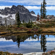
A few photos from Quartz Ridge yesterday - my first time up this trail. The views were pretty spectacular and it was cool to see some familiar peaks from a totally different vantage point. Garfield was quite impressive from this angle. I also enjoyed the view up Taylor River Valley, past Dream Lake to Malachite Peak - that was a surprising alignment! Up the Middle Fork direction, Chikamin looked like a totally different peak since it's hard to make out the normally obvious summit block.
We ran into snow at about 2500', a bit below the sign for the vista. The views at the vista were underwhelming - too many big trees in the way. With the steep slopes around there and the snow, we didn't want to get too close to the edge. Perhaps without the snow, there is a better spot. Our high point was the big flat area just below 3400' - well worth the climb! The snow was maybe 3' deep at our high point, and very soft in the afternoon sun. Snowshoes would have helped for sure, I was postholing up to my knees pretty regularly, or to my waist when I hit a hole next to a log.
I was amazed at how well constructed this trail is. Does anyone know the history of the trail and who built it? I imagine the lower part to the old lookout site was officially built, not sure about the upper part. I had thought it was a clandestine trail, but those usually forego the niceties like switchbacks. 
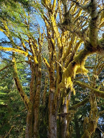 Big leaf maples near the Middle Fork CG 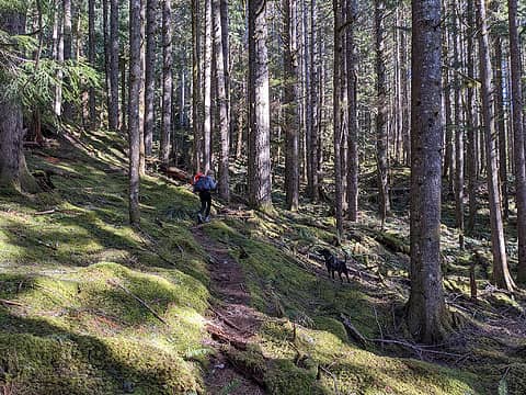 Quartz Ridge Trail below snow line 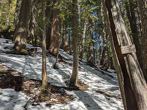 Vista junction 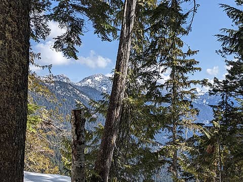 About the best view I could coax out of the vista - looking toward Morpheus 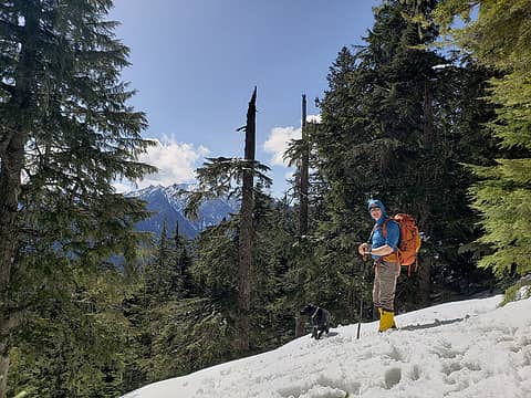 Stopping for a snack break - a bit above the vista 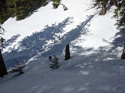 Through the first saddle 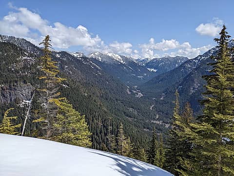 Taylor River wide shot 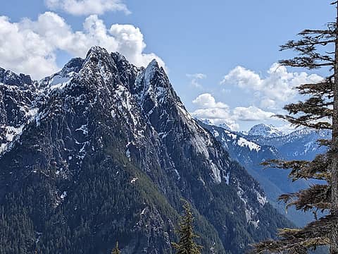 Garfield plus Lemahs and Chikamin 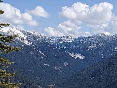 Taylor River / Dream Lake zoom - Cascade Mountain and Malachite Peak in the back 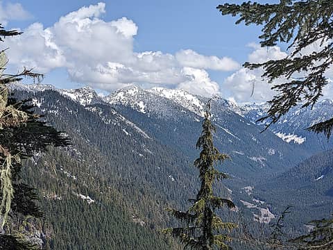 Morpheus (center), Taylor River 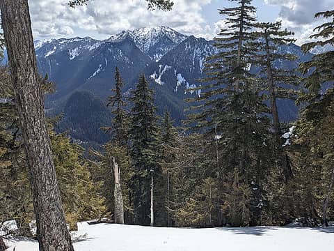 Nice overview of Preacher, Pulpit, Stegosaurus 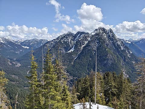 Treen and Garfield 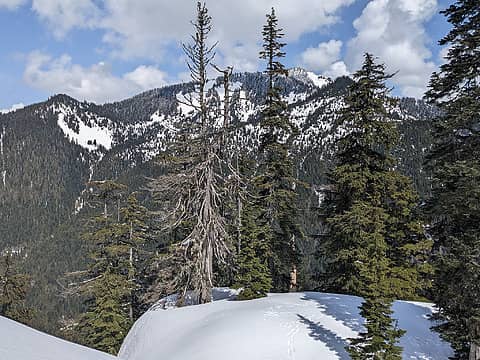 Rooster (The Ark) 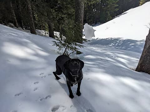 Action shot 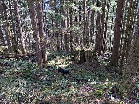 Huge stump below the Nordrum Lookout
 Anne Elk, zimmertr, zeldathewelder, The Ghost of Bear 380, yukon222, awilsondc, jaysway, Tom, Fedor, puzzlr, Now I Fly Anne Elk, zimmertr, zeldathewelder, The Ghost of Bear 380, yukon222, awilsondc, jaysway, Tom, Fedor, puzzlr, Now I Fly
Anne Elk, zimmertr, zeldathewelder, The Ghost of Bear 380, yukon222, awilsondc, jaysway, Tom, Fedor, puzzlr, Now I Fly |
| Back to top |
  
|
|
puzzlr
Mid Fork Rocks

Joined: 13 Feb 2007
Posts: 7220 | TRs | Pics
Location: Stuck in the middle |
|
puzzlr
Mid Fork Rocks
|
Sat Apr 15, 2023 2:22 pm |
|
|
I first heard about this trail in November 2019 but didn't check it out until October, 2020. We ran into snow as well but made it to a minor summit at 3900'. I hope someday to follow either the ridge or just to the east all the way to the Quartz summit. I know the creator doesn't live in Washington anymore so they won't be doing more work on it.
|
| Back to top |
|
|
ALW Hiker
lakebagger
Joined: 27 Jul 2021
Posts: 120 | TRs | Pics
Location: Redmond, WA |
|
ALW Hiker
lakebagger
|
Sat Apr 15, 2023 3:30 pm |
|
|
Thanks puzzlr! We were debating whether one person could have built such an extensive trail - pretty impressive if so. I mean, it's not up to PCT standards or anything, but it's quite a bit better than most of the other unofficial trails in the area - Stegosaurus, Marten Lake, Rainy Lake, Old Mailbox, etc. I suppose the relative dryness of that hillside and openness of the (previously logged) forest helped with construction - it only crosses over a couple creeks, one of which is entirely dry.
Looks to me like pretty much everyone who summits Quartz does it via the Bessequartz south ridge. That way looks shorter and easier, for sure. I suspect there may be some gnarly impassable stuff on that ridge east of Quartz - East.
|
| Back to top |
|
|
Fedor
Member
Joined: 06 May 2009
Posts: 126 | TRs | Pics
|
|
Fedor
Member
|
Sat Apr 15, 2023 4:37 pm |
|
|
I suspect the same person or people who worked on some of the exit 38 trails (zig-zag, hall Creek, etc) was involved. Maybe whitebark who used to post here had something to do with it.
ALW Hiker
ALW Hiker |
| Back to top |
|
|
fourteen410
Member

Joined: 23 May 2008
Posts: 2629 | TRs | Pics
|
I always figured it was Whitebark.
There's an open rocky ledge below the vista that I've been meaning to check out. I got close to it a month or so ago but got turned back by tree bombs.
|
| Back to top |
|
|
lopper
off-route

Joined: 22 Jan 2002
Posts: 845 | TRs | Pics
|
|
lopper
off-route
|
Sat Apr 29, 2023 6:55 am |
|
|
Thanks for the report and pics. Glad to learn of another height-gaining trail in the MFK slot.
BTW- Rainy Lake trail was a USFS numbered trail. Shows up on older agency maps. There was even a cable bridge to start... At Camp Brown. Not to be confused with the one at the Pratt confluence.
ALW Hiker
ALW Hiker |
| Back to top |
|
|
ALW Hiker
lakebagger
Joined: 27 Jul 2021
Posts: 120 | TRs | Pics
Location: Redmond, WA |
|
ALW Hiker
lakebagger
|
Sun Apr 30, 2023 10:44 am |
|
|
Thanks for the clarification on the Rainy Lake Trail, it has had an interesting history. I always figured it was just a fisherman's trail given the lack of "polish" through some of the tougher sections, but all the massive cut logs hint at a more official status in the past. Also, in Beckey's information about Preacher Mountain he says the trail to Rainy Lake "cannot be found", but that may have been written before the Gateway Bridge went in, and certainly before all the work on the Pratt Connector (aka Pratt River Trail).
The Forest Service has recently been paying some attention to Rainy Lake, as there were some WTA work parties there last year. Hopefully that trend will continue. It still doesn't have an official entry on the USFS web site, but as you pointed out, is is on their maps as "Rainy Lake Trail 1252". Same deal with the Pratt River Trail #1035 - WTA has another long work party on that one this year, starting from the Pratt Lake side.
|
| Back to top |
|
|
|
|
You cannot post new topics in this forum
You cannot reply to topics in this forum
You cannot edit your posts in this forum
You cannot delete your posts in this forum
You cannot vote in polls in this forum
|
Disclosure: As an Amazon Associate NWHikers.net earns from qualifying purchases when you use our link(s). |


