| Previous :: Next Topic |
| Author |
Message |
peter707
Member

Joined: 16 Jun 2022
Posts: 138 | TRs | Pics
Location: Seattle, WA |
|
peter707
Member
|
 Mon Jun 05, 2023 10:23 pm |
|
|
The WA ski season is on it's last legs. The 88F heat wave melted the snow between 3,000'-5,000', so many of the normal ski areas are hikes rather than skis. However, the taller volcanoes are still in for great skiing above 6,000', so off we went from Seattle at 5am! Each year, there's a timeframe for skiing big Washington volcano routes, usually around 1-3 weeks long[1]. Therefore, Chris said this week is one-of-a-kind and we should drop everything and ski all week. We can't ski all week (physical exhaustion, work responsibilities), but we got pretty darn close[10].
Cast of characters:
Chris: Sub-elite mountain athlete, strong ultra runner, experienced in basic mountaineering and intermediate ski touring. Advanced Expert downhill skier. Joined for days 1-3.
Harrison: Locally competitive athlete. Solid Expert resort skier. Less mountain experience. Lives in NYC, and is on a weeklong ski vacation.
Peter: Middle-pack runner, some ultra experience. Experienced in basic mountaineering and basic ski touring. Intermediate downhill skier.
Thomas: Highly experienced in long mountain days. Advanced backcountry skier from France w/ dual residency in France. New to Washington and wants to ski all the good lines. Joined for days 1-3.
Ian: Professional Mountain Guide, hired for Mt. Baker by Harrison and Peter. Just got back from Denali. [in group for 06/02/2023 only]
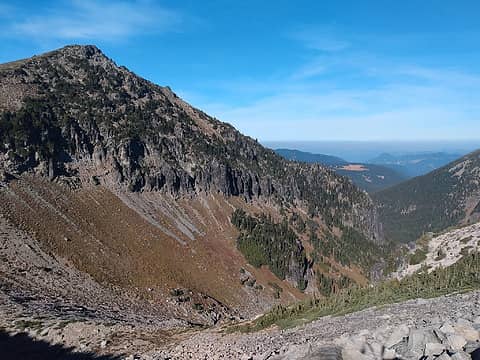
05/28/2023: Glacier Basin Trailhead (4,200') to Inter Glacier to Steamboat Prow ( 9,600')
Mount Rainier National Park
Inter Glacier was recommended to me by williswall and Randito, in the 'WA ski touring ideas' thread. At this time of the year it's snow-covered and great for skiing. The road just opened for the summer, so we started at the Glacier Basin Trailhead at 4200'.
The first step is to hike up the trail to the snow at 6,000'. We attached skis to the backpacks.
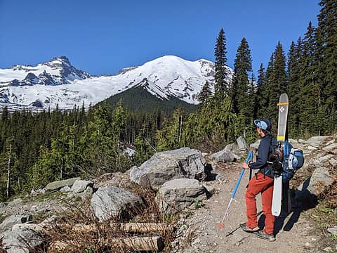 Chris hikes up 1600' of dirt prior to the snow. 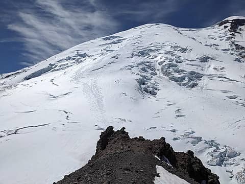 Steamboat Prow, looking at Emmons Glacier on Mt. Rainier. 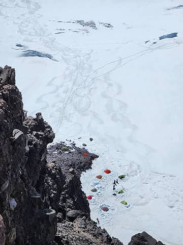 Camp Schurman from the Prow 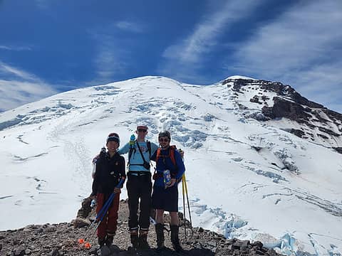 Group Photo 1 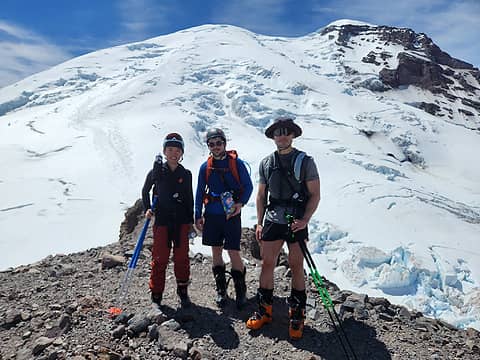 Group Photo 2 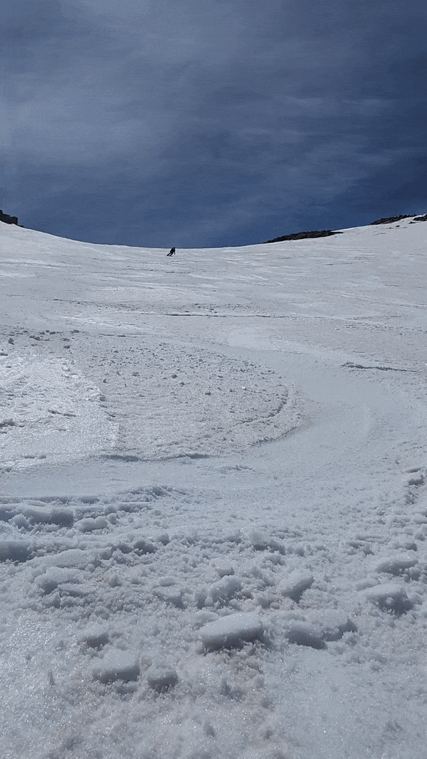 Chris zooms down Inter Glacier 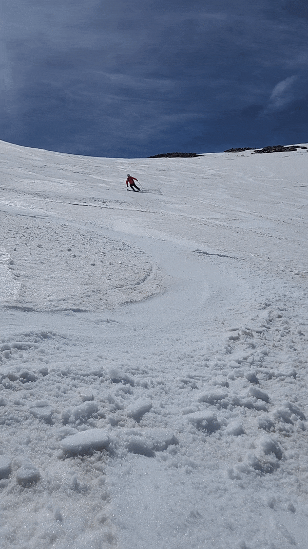 Harrison ski's down Inter Glacier and sprays me (this is why you don't wear shorts skiing!) 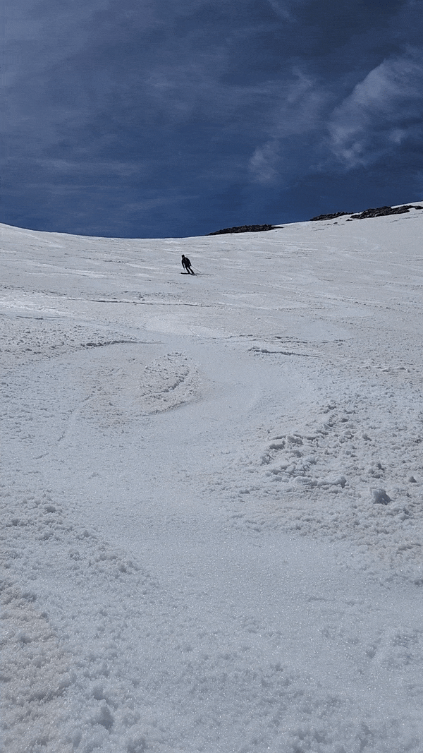 Thomas ski's down Inter Glacier 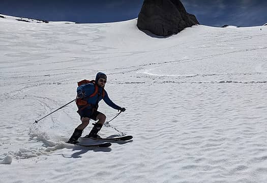 Peter ski's down Inter Glacier  Skiing down Glacier Basin Trail 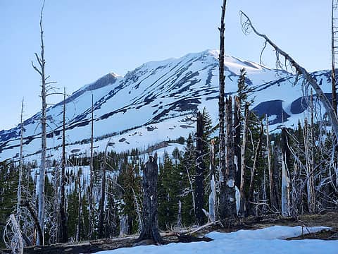 Mt. Adams looms large in the morning 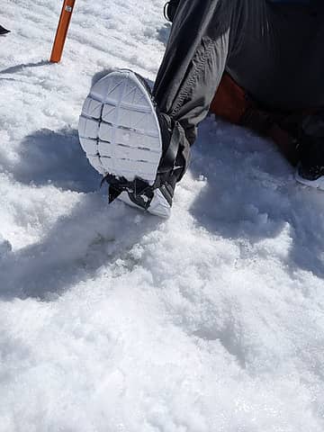 Odd footwear choice but worked very well. 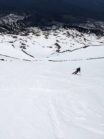 Chris skiing down SW Chutes 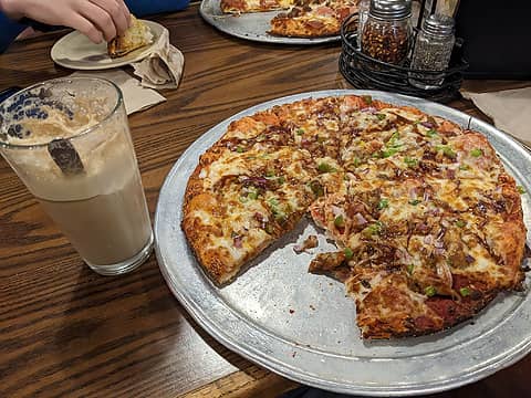 pizza 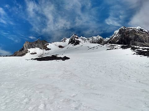 Mt. Hood 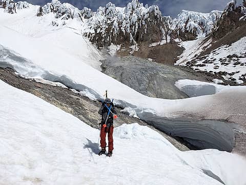 Chris at the crater 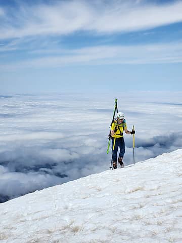 Harrison getting a workout w/ Chris 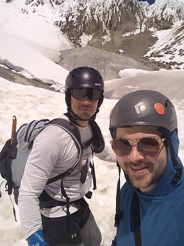 Thomas and I up at the crater 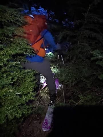 Squak glacier approach is a bushwhack at times 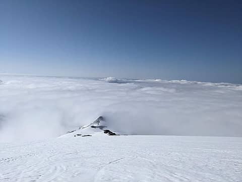 clouds from above 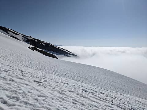 clouds from above 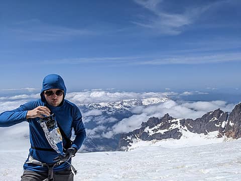 Learned from Mt. Adams. No bonking this time! 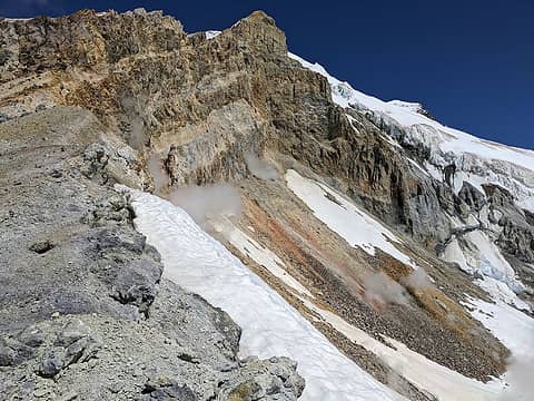 Crater 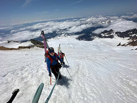 Short-roped up the headwall 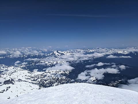 Great views from summit! 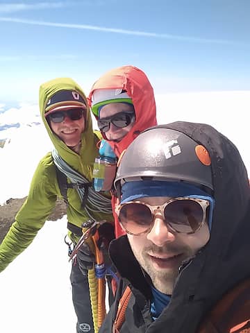 Ian, Harrison, and myself 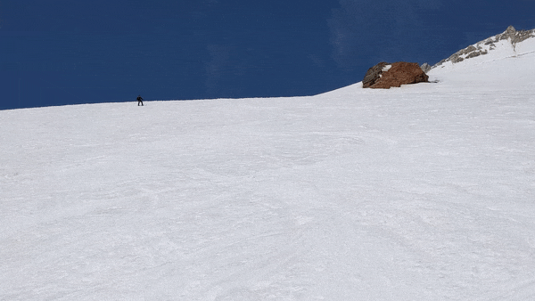 Skiing down the Squak Glacier
 fourteen410, KascadeFlat, zimmertr fourteen410, KascadeFlat, zimmertr  vk vk
fourteen410, KascadeFlat, zimmertr vk |
| Back to top |
  
|
|
KascadeFlat
Member
Joined: 06 Jul 2020
Posts: 320 | TRs | Pics
Location: Eating peanut M&Ms under my blue tarp |
Wow! What a week! Glad you were able to capitalize on the window and get all that skiing done.
There is something about Mt. Adams and footwear. When we climbed it we all decided to wear trail runners and leave the crampons + boots in the car. We made it but there was one section where we had to cut steps up an icy spot while watched everyone motor by with their crampons. I think it must be some kind of NW right of passage.
For a good time call: 1-800-SLD-ALDR.
peter707
For a good time call: 1-800-SLD-ALDR.
peter707
|
| Back to top |
|
|
|
|
You cannot post new topics in this forum
You cannot reply to topics in this forum
You cannot edit your posts in this forum
You cannot delete your posts in this forum
You cannot vote in polls in this forum
|
Disclosure: As an Amazon Associate NWHikers.net earns from qualifying purchases when you use our link(s). |


