| Previous :: Next Topic |
| Author |
Message |
Gimpilator
infinity/21M


Joined: 12 Oct 2006
Posts: 1684 | TRs | Pics
Location: Edmonds, WA |
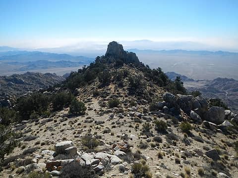
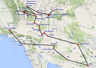 Overview Map 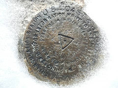 Pinos 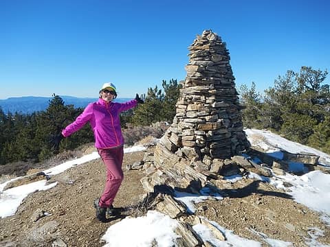 Sawmill 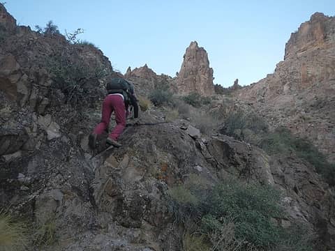 class 3 step 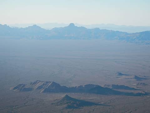 Castle Dome seen from Signal 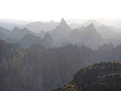 craggy peaks: Squaw and Old Smokey 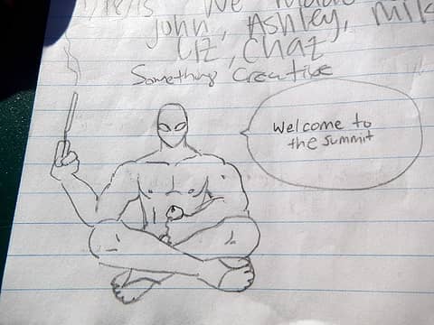 strange summit log entry 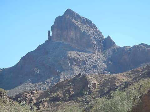 Castle Dome 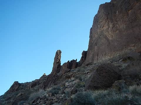 the notch 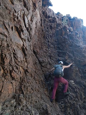 the chute 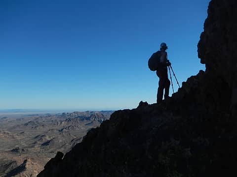 ledges 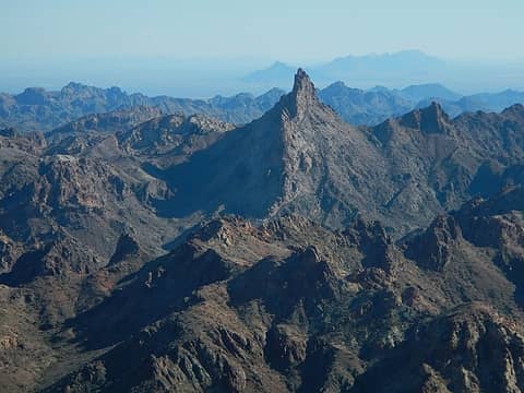 Point 3356 "The Blade" 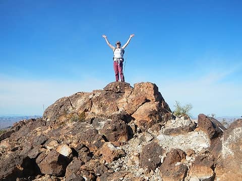 Castle Dome summit 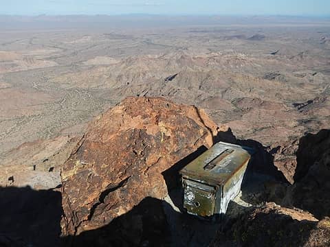 register box 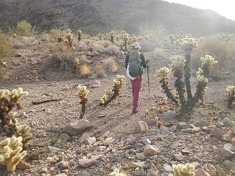 cholla 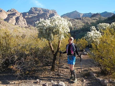 big cholla 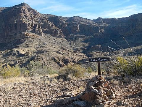 Bull Pasture 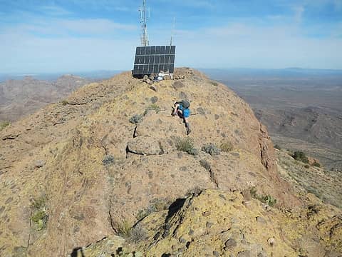 summit rocks 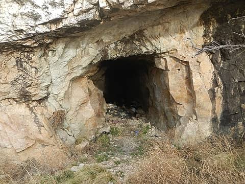 mine adit 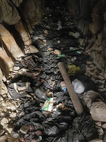 trash from illegal immigrants 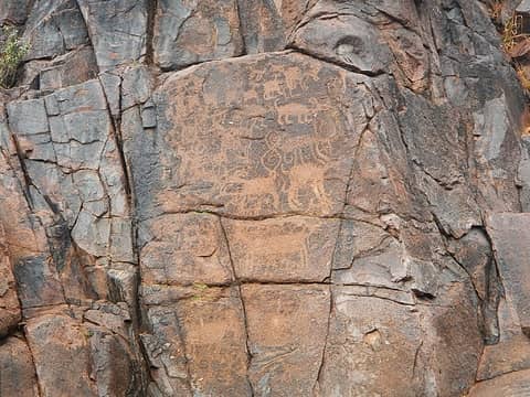 petroglyphs 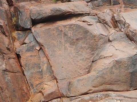 petroglyphs 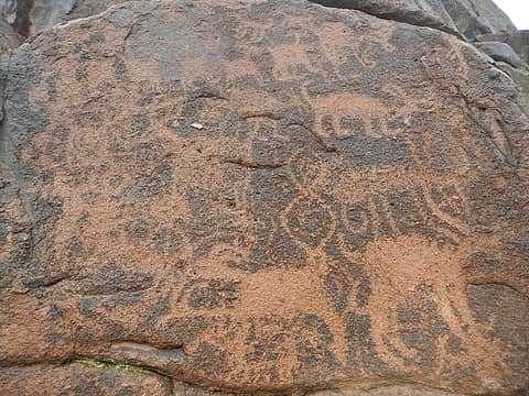 petroglyphs 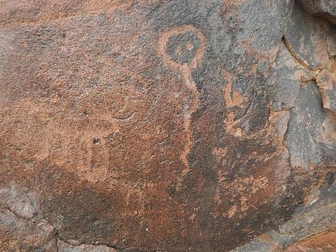 petroglyphs 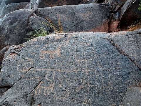 petroglyphs 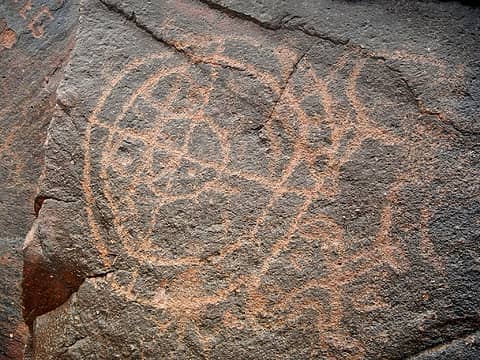 petroglyphs 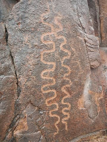 petroglyphs 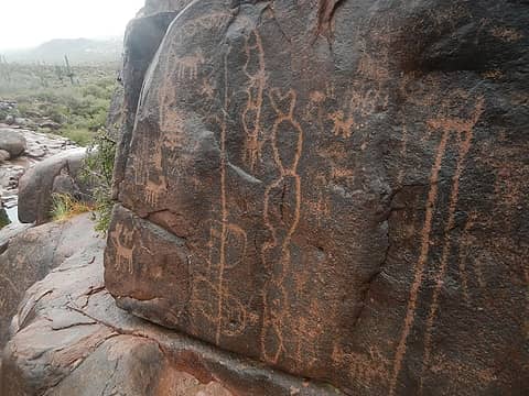 petroglyphs 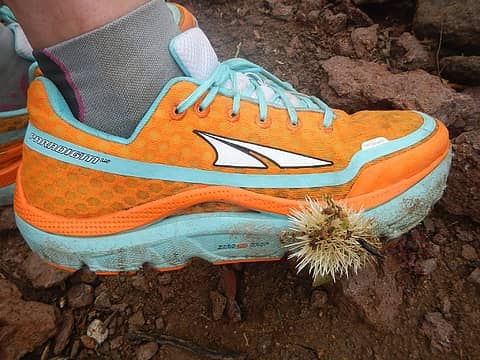 Oya! Cholla 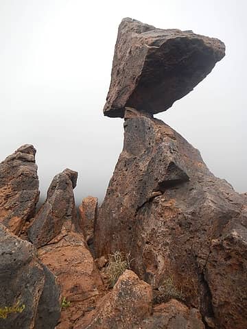 balanced rock route feature 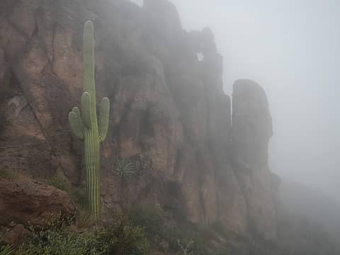 poor visibility 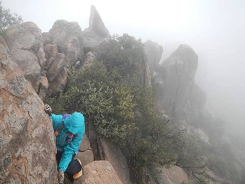 near the summit 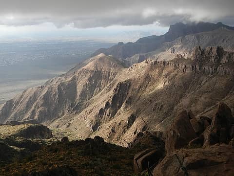 clearing views 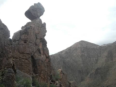 balanced rock again 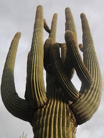 saguaros grow big in the Superstitions 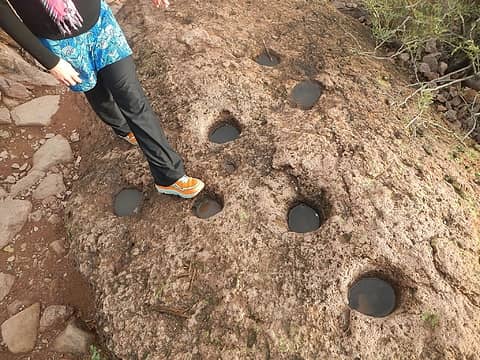 natives used to grind their grain here 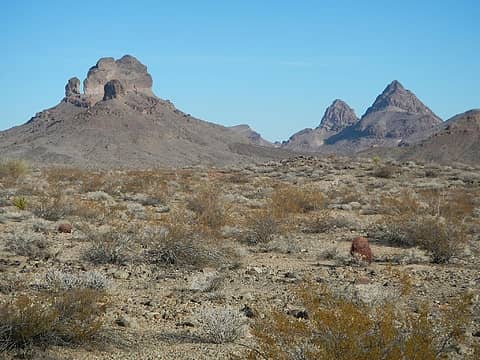 Castle Rock (left) 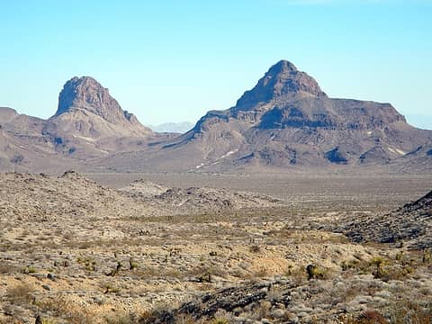 Mopah and Umpah 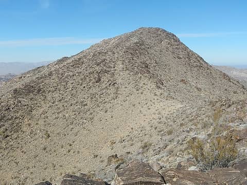 summit ahead 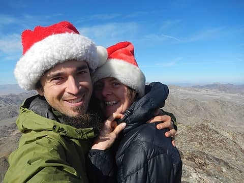 Christmas Eve 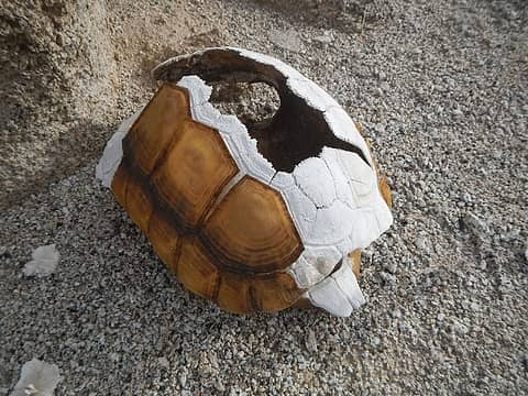 tortoise shell 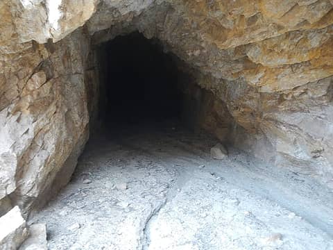 mine adit 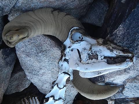 sheep skeleton 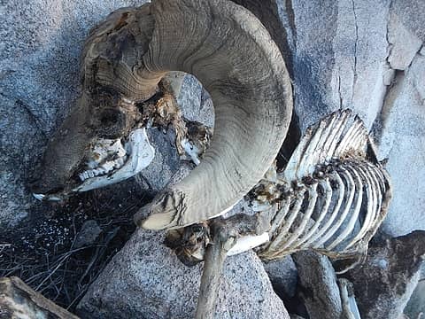 sheep skeleton 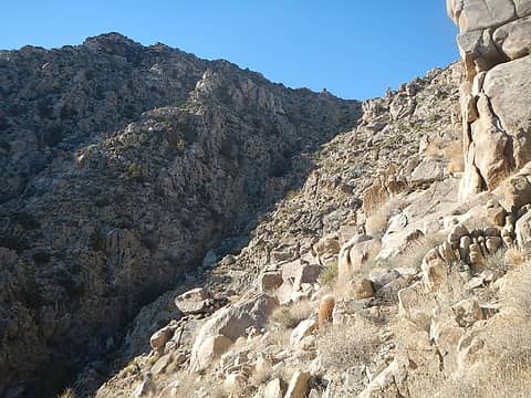 second gully 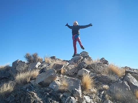 summit leap 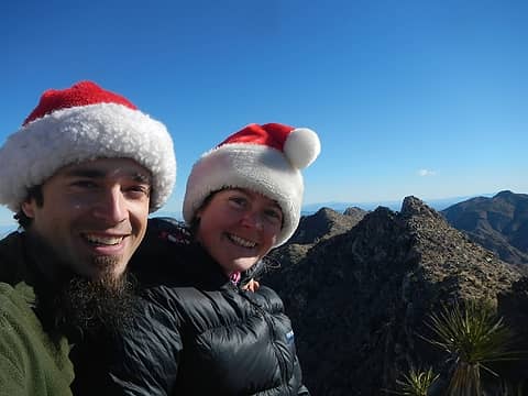 Merry Christmas! 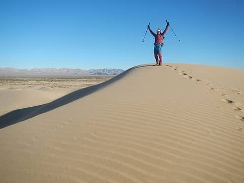 Cadiz Dunes HP
|
| Back to top |
  
|
|
Gimpilator
infinity/21M
Joined: 12 Oct 2006
Posts: 1684 | TRs | Pics
Location: Edmonds, WA |
12/26 - Granite Mountain (P2k), Mojave Lava Tube, Cinder Cone 3894' peaklet
Granite Mountain has a number of monzogranitic formations reminiscent of Joshua Tree. It's rugged terrain and it seemed to take forever before we came to the summit plateau. It was windy and cold again so we didn't linger. I briefly explored the slightly lower south spire and concluded it was class 4 and turned around. I have heard there is a register up there as well.
 south pinacle 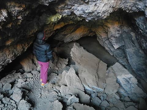 entering the lava tube 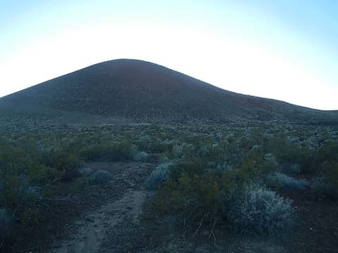 Cinder Cone 3894' 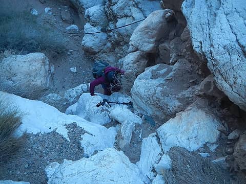 a dryfall  second spring in the narrows 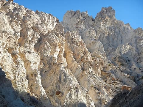 steep mud 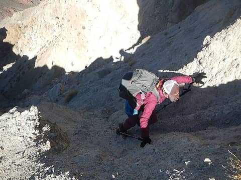 not the best exit spot 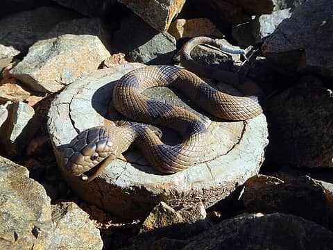 summit snake 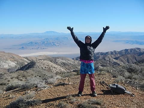 Avawatz summit 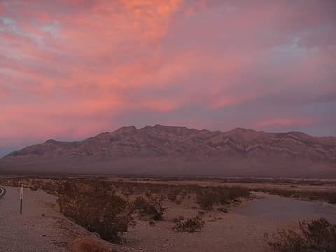 sunset colors over Pahrump Point 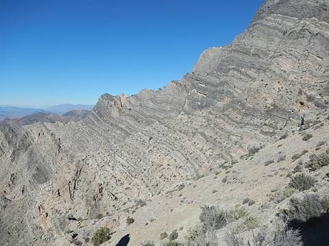 nice strata 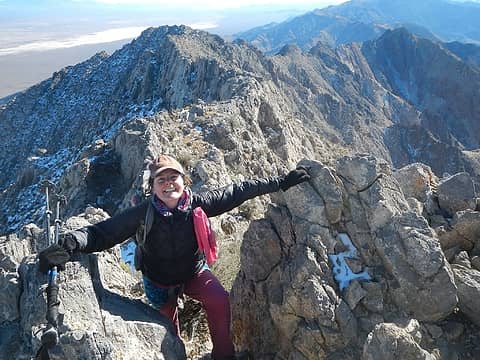 final ridge 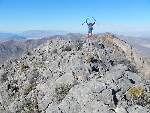 Pahrump Point summit 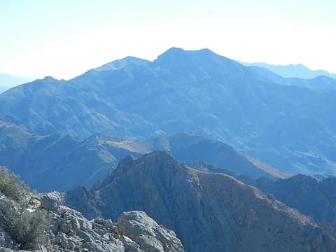 The Nopahs to the south 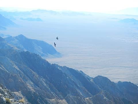 ravens circled us 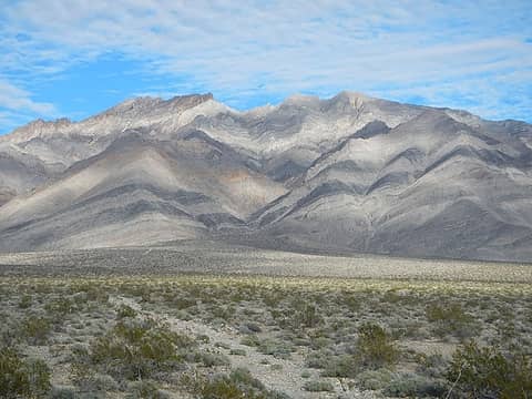 Pahrump Point (furthest right) 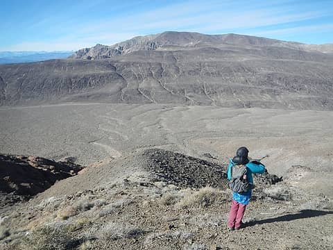 Towne accross the way 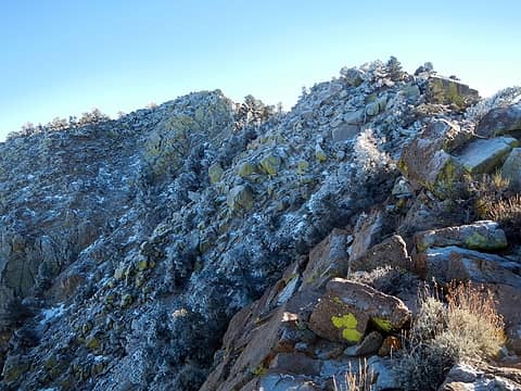 false summit of Nelson 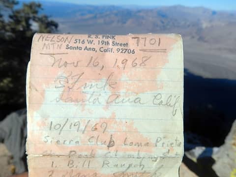 1968 register 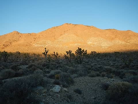 alpenglow on Nelson 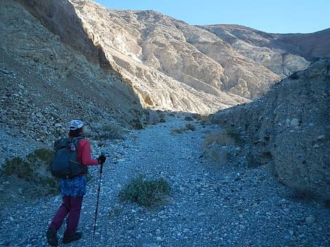 entering the canyon 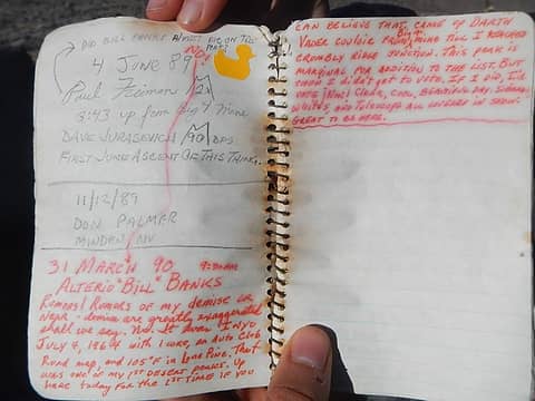 Darth Vader Couloir entry 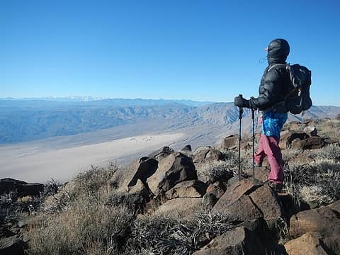 Panamint Valley below 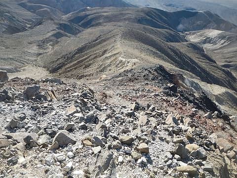 looking back down the narrow loose ridge 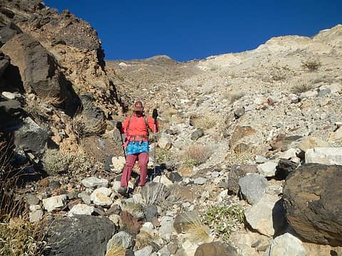 below Darth Vader Couloir 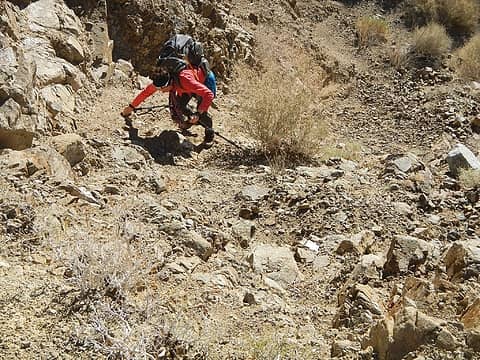 the crux of Canyon Point is the very start 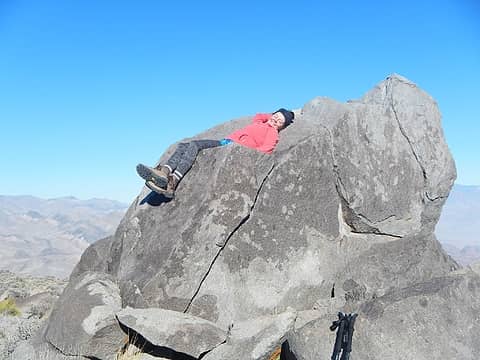 Canyon Point summit boulder, 4000 miles! 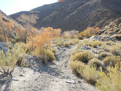 Cottonwood Spring 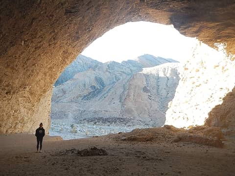 cave 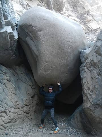 goofball  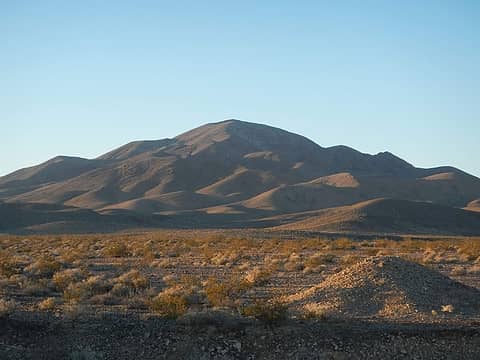 Shadow in first light 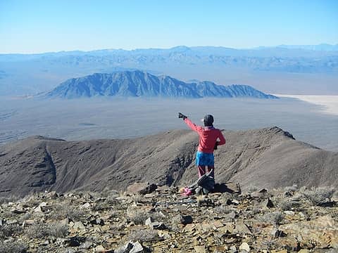 we were up there exactly one year ago 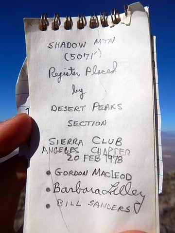 1978 register 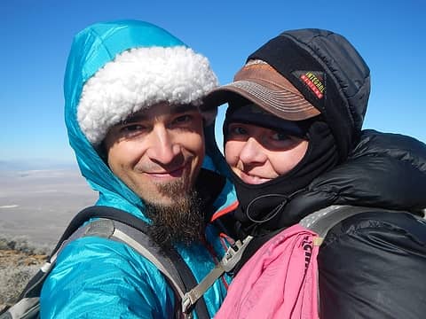 this coat 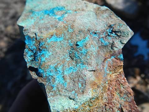 matches this ore
|
| Back to top |
|
|
Gimpilator
infinity/21M
Joined: 12 Oct 2006
Posts: 1684 | TRs | Pics
Location: Edmonds, WA |
1/2 Grapevine Peak (P4k) and Wahguyhe Peak
We drove over to the east side of the Grapevines and got lost on the dirt approach roads (my fault). There was a small group of wild asses staring at us like WTF are you doing here and we stared back at them like WTF are you doing here. Heather figured out where we were and found an old connector road to put us back on track. The correct road was in much better shape.
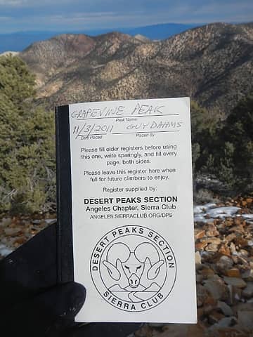 Grapevine register 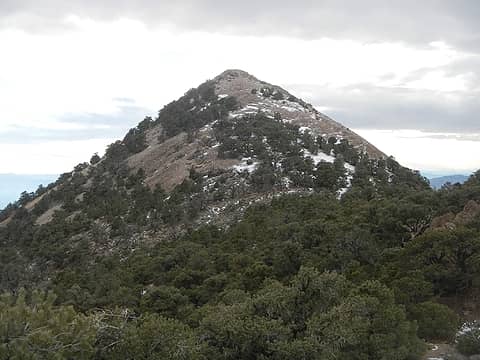 Wahguyhe 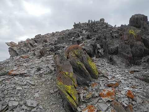 summit rocks 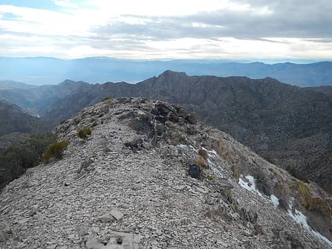 looking down at Palmer from Wahguyhe 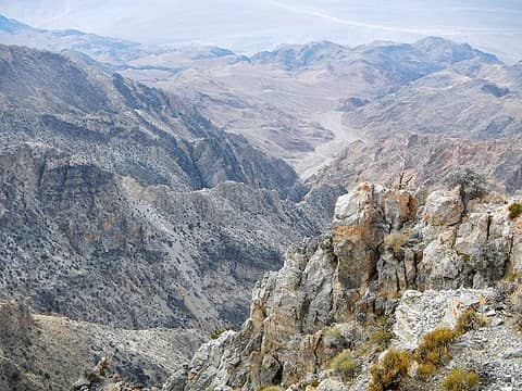 Redwall Canyon below 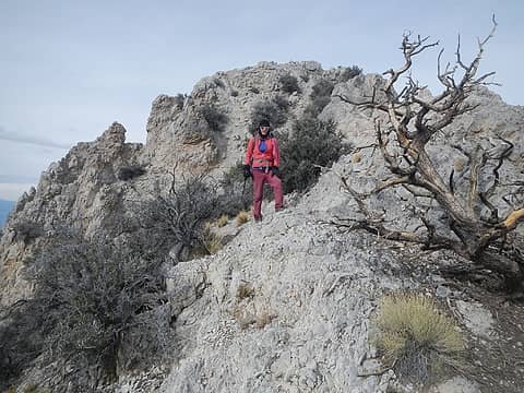 dolomite ridge 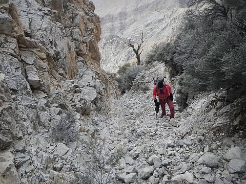 navigating through cliffs 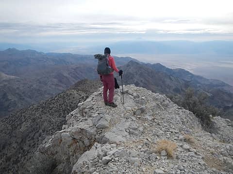 Palmer summit 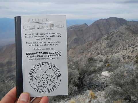 Palmer register 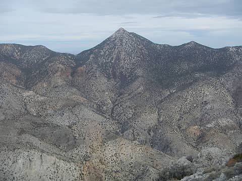 Wahguyhe 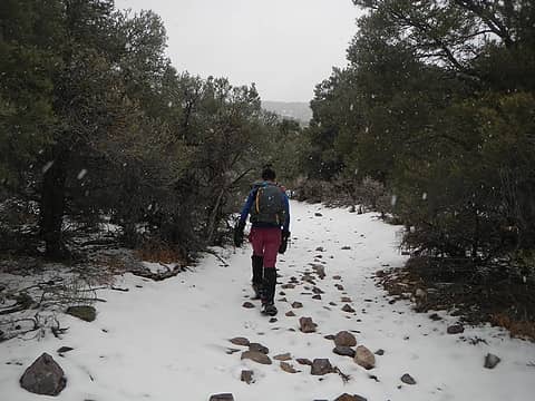 snowing hard 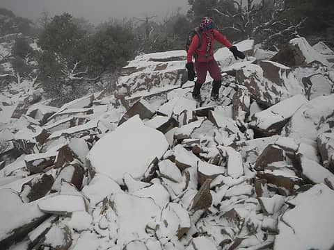 slippery rocks 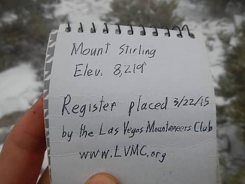 Stirling register 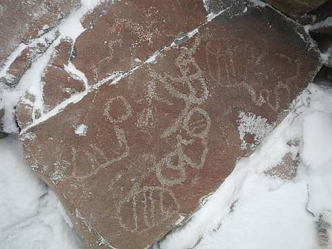 petroglyphs 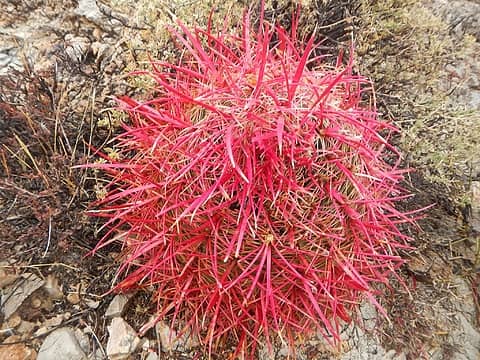 bright cactus 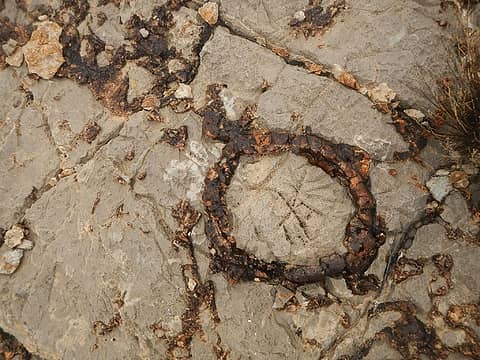 fossils 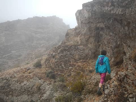 fog 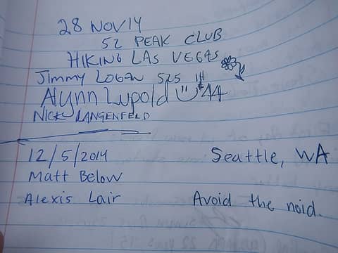 Matt Below entry 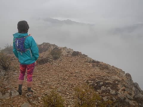 momentary summit view 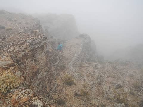 more fog 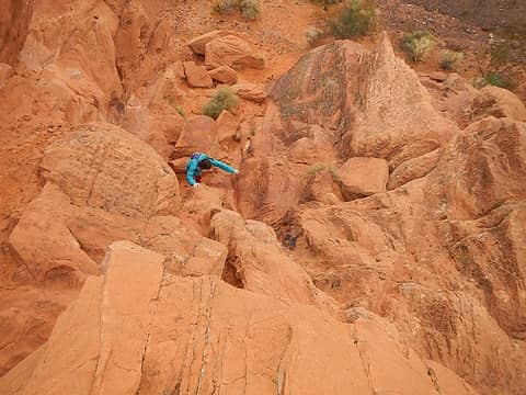 red rocks 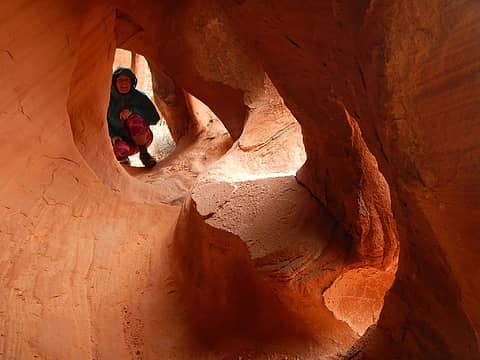 tunnel 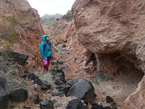 Black Mesa approach wash 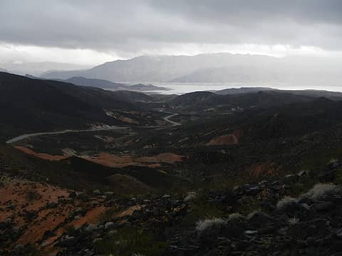 Lake Meade seen from Black Mesa summit 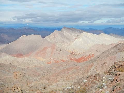 mysterious white peak 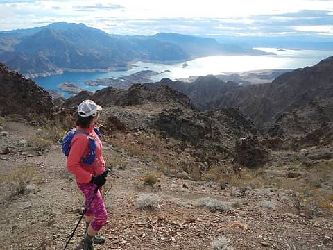 Lake Meade below 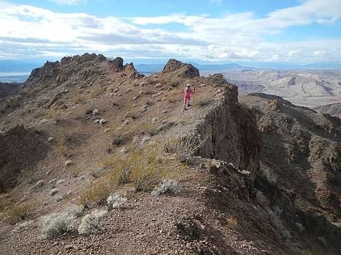 Hamblin summit 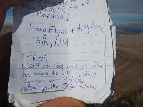 Hamblin register 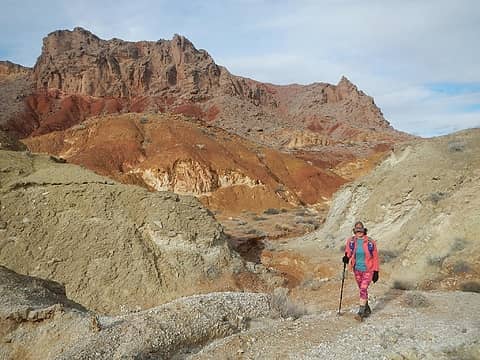 nearing Pinto Valley area 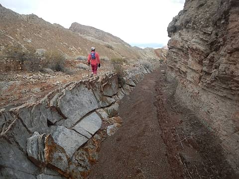 entering Pinto valley area 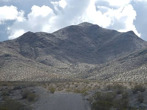 Little Virgin 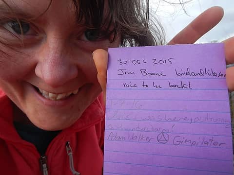 Little Virgin register 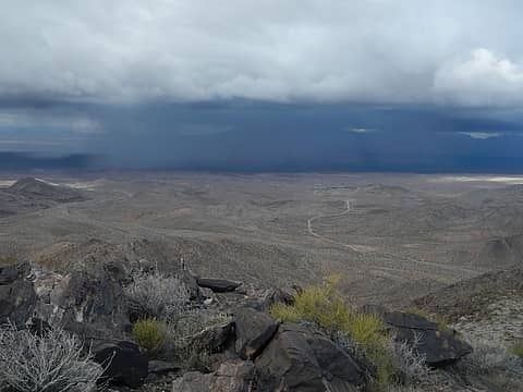 impending storm 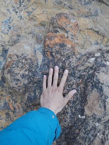 dinosaur track 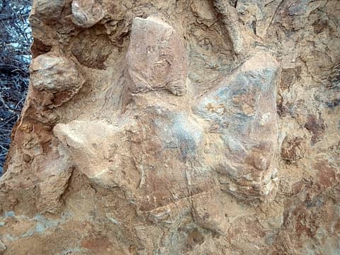 dinosaur track 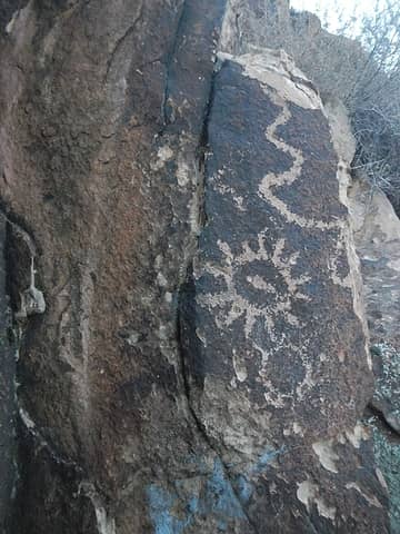 petroglyphs 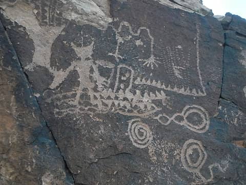 petroglyphs 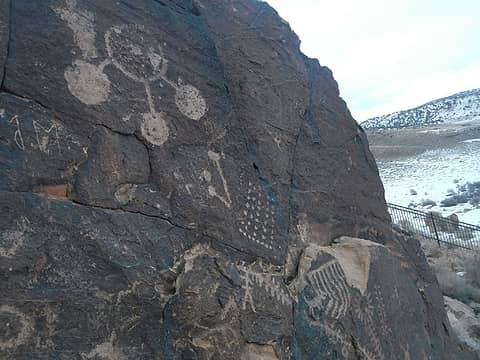 petroglyphs 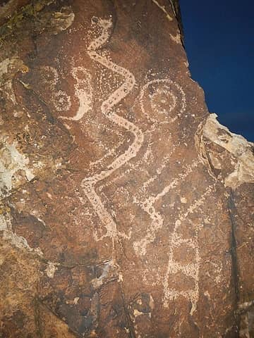 petroglyphs 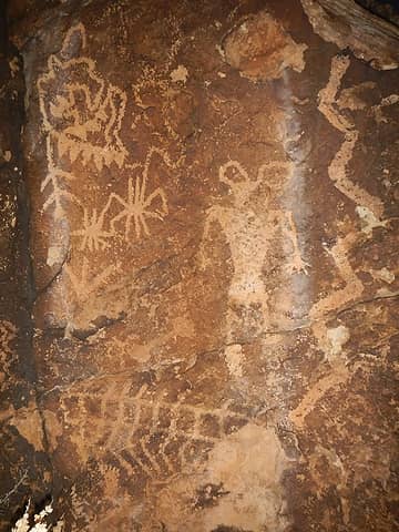 petroglyphs
|
| Back to top |
|
|
Anish
Member

Joined: 07 Sep 2014
Posts: 79 | TRs | Pics
|
|
Anish
Member
|
 Thu Jan 14, 2016 4:32 pm |
|
|
I <3 you even if you do try to climb the same mountain twice  Thanks for such a great recap of a great 3 weeks!
"Our way is not soft grass. It's a mountain path with lots of rocks. But it goes upwards, forward, toward the sun." -Ruth Westheimer
"Our way is not soft grass. It's a mountain path with lots of rocks. But it goes upwards, forward, toward the sun." -Ruth Westheimer
|
| Back to top |
|
|
Brushbuffalo
Member

Joined: 17 Sep 2015
Posts: 1887 | TRs | Pics
Location: there earlier, here now, somewhere later... Bellingham in between |
| Gimpilator wrote: | The summit rocks are like nothing I have ever seen before. 
summit rocks |
Adam, those rocks appear to be volcanic breccia.(side note: the array of photoelectric cells is much larger than what I've seen for repeaters in the NC....interesting, considering all the sunlight down there.....must be quite different equipment being powered).
Heather, congrats. on 4k in '15! Plus lots of summits.  I like the precarious boulder pix! Rocks such as these can be used as indicators from the time of a previous earthquake of a specific intensity in an area ( involved theory).
Passing rocks and trees like they were standing still
Passing rocks and trees like they were standing still
|
| Back to top |
|
|
puzzlr
Mid Fork Rocks

Joined: 13 Feb 2007
Posts: 7220 | TRs | Pics
Location: Stuck in the middle |
|
puzzlr
Mid Fork Rocks
|
Fri Jan 15, 2016 12:23 am |
|
|
Looks like you're having a lot of fun together. Great looking mountains, they remind me just a little of Superstitions.
|
| Back to top |
|
|
contour5
Member

Joined: 16 Jul 2003
Posts: 2963 | TRs | Pics
|
|
contour5
Member
|
Fri Jan 15, 2016 12:31 am |
|
|
That is quite an extravaganza!
The weather looks pretty nice from here.
The dunes, the bones, the petroglyphs, and coprolites too! I'm missing the desert...thanks for the post.
|
| Back to top |
|
|
tmatlack
Member
Joined: 21 Aug 2007
Posts: 2854 | TRs | Pics
|
|
tmatlack
Member
|
Fri Jan 15, 2016 3:58 am |
|
|
Thanks for the tour. Christmas weather in Tucson was cold nights, cool days(for AZ) but lots of 'shine and blue skies...and yes, we had cholla buttons on our shoes too.  Tom
Tom
|
| Back to top |
|
|
John Morrow
Member

Joined: 03 Apr 2007
Posts: 1526 | TRs | Pics
Location: Roslyn |
Holy moly, wow, wow, WOW!
Fantastic effort you two. Did your Subaru get you to all those respective THs?
Maybe we should meet down there sometime for Mopah and Umpah now that they beckoned you. Somehow I missed seeing Matt Below in that register. Or maybe I wasn't on that summit???
| Gimpilator wrote: | | We decided on this hike to move to Las Vegas in future winters, possibly as soon as next year. It's not that we like Las Vegas culture, but the city is centrally located between Death Valley, the High Sierra, and canyon country. Everything we love about the desert is within manageable driving distance. |
Isn't that the strange truth. Worth consideration for sure.
Thanks for the awesome TR.
John
Tell me, what is it you plan to do with your one wild and precious life?-Mary Oliver
A nation that continues year after year to spend more money on military defense than on programs of social uplift is approaching spiritual doom.
― MLK Jr.
Tell me, what is it you plan to do with your one wild and precious life?-Mary Oliver
A nation that continues year after year to spend more money on military defense than on programs of social uplift is approaching spiritual doom.
― MLK Jr.
|
| Back to top |
|
|
Distel32
Member
Joined: 03 Jun 2014
Posts: 961 | TRs | Pics
Location: Edmonds, WA |
|
Distel32
Member
|
Fri Jan 15, 2016 7:38 am |
|
|
Busy trip
|
| Back to top |
|
|
neek
Member

Joined: 12 Sep 2011
Posts: 2338 | TRs | Pics
Location: Seattle, WA |
|
neek
Member
|
Fri Jan 15, 2016 8:14 am |
|
|
Fascinating report! Bookmarked for future reference. I was in the Mojave Desert on 1/6 and yeah wow, that rain - very welcome down there of course.
|
| Back to top |
|
|
Fletcher
Member

Joined: 29 Jul 2009
Posts: 1870 | TRs | Pics
Location: kirkland |
|
Fletcher
Member
|
Fri Jan 15, 2016 6:44 pm |
|
|
I need to be honest, this report is a little long-winded for my attention span at the moment... But I read bits and pieces and your pictures are awesome! Seriously, some great images in there. So jealous, although the powder turns at home have been pretty damn good lately
|
| Back to top |
|
|
Jaberwock
Member
Joined: 30 Jan 2013
Posts: 722 | TRs | Pics
Location: Bellingham |
Excellent! Thanks!
|
| Back to top |
|
|
Magellan
Brutally Handsome

Joined: 26 Jul 2006
Posts: 13117 | TRs | Pics
Location: Inexorable descent |
|
Magellan
Brutally Handsome
|
Fri Jan 15, 2016 6:52 pm |
|
|
Worn out just reading it. Thanks for the photos, and I'm glad you didn't do a repeat.
|
| Back to top |
|
|
Gimpilator
infinity/21M
Joined: 12 Oct 2006
Posts: 1684 | TRs | Pics
Location: Edmonds, WA |
|
| Back to top |
|
|
|
|
You cannot post new topics in this forum
You cannot reply to topics in this forum
You cannot edit your posts in this forum
You cannot delete your posts in this forum
You cannot vote in polls in this forum
|
Disclosure: As an Amazon Associate NWHikers.net earns from qualifying purchases when you use our link(s). |


