| Previous :: Next Topic |
| Author |
Message |
RichP
Member


Joined: 13 Jul 2006
Posts: 5634 | TRs | Pics
Location: here |
|
RichP
Member
|
 Thu Nov 03, 2016 9:52 pm |
|
|
Puzzlr, Snowdog, Izzy and I had a great day in the eastern Teanaway checking out a section of trail none of us had ever hiked on. All of us had been to some if not all of these peaks on other occasions but decided that with the great weather the area was worth a revisit.
Instead of starting at the Iron Bear Trailhead, we took FR 113 off of the Iron Ck Rd and drove to the trailhead of The County Line Trail at 4300.'
These are better directions to get there from The Old Blewett Pass Highway which we used on the way out.
http://www.fs.usda.gov/recarea/okawen/recarea/?recid=57451
You will most definitely need a high clearance vehicle to get to this trailhead as it's badly rutted in places. Snowdog drove expertly and got us there without issues.
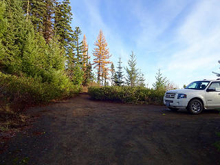 We parked a few hundred yards from the actual trailhead due to encroaching brush on the final part of the road. 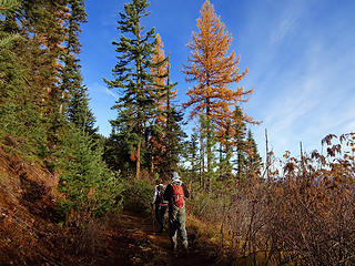 Hiking the few hundred yards to the trailhead along overgrown road. 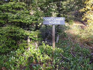 Trailhead. 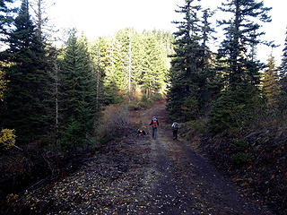 The trail drops to a logging road for a short distance. 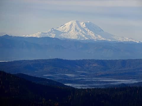 Views from County Line Trail. 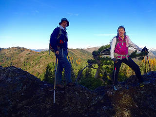 On Joker 5420.' 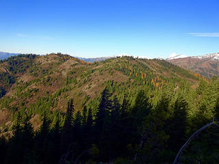 Iron Bear and Jester. 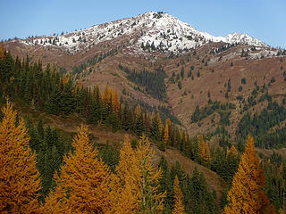 Miller. Most of the snow was gone by the time we hiked out. 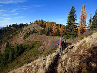 Approaching junction of Teanaway Ridge and County Line Trails. 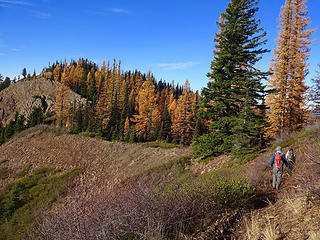 Junction of Teanaway Ridge and County Line Trails. 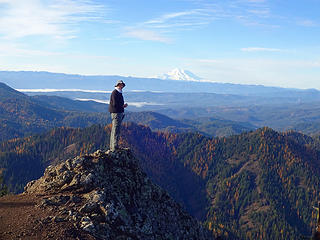 Puzzlr on Iron bear 5489.' 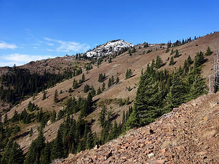 On the way to Miller Peak. 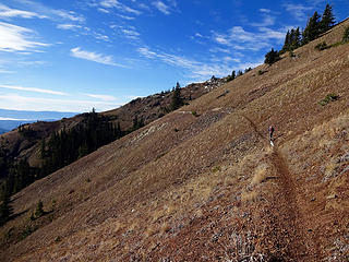 Traversing slopes below Miller. 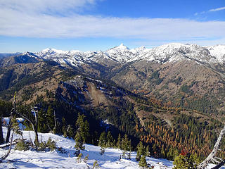 Miller summit view 6402.' 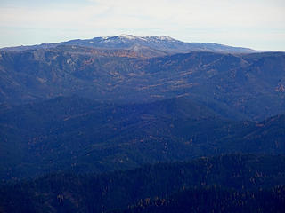 Mission Ridge in the distance. 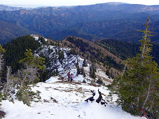 Instead of taking the trail we dropped off the east ridge. 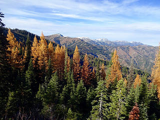 Back on the County Line Trail. 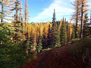 Headed to Jester. 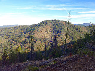 Roughhouse Mtn.  A short hike leads to the summit 4760.'
|
| Back to top |
  
|
|
fourteen410
Member

Joined: 23 May 2008
Posts: 2630 | TRs | Pics
|
Those larches are still hanging on 
|
| Back to top |
|
|
neek
Member

Joined: 12 Sep 2011
Posts: 2338 | TRs | Pics
Location: Seattle, WA |
|
neek
Member
|
Fri Nov 04, 2016 8:06 am |
|
|
bummed I couldn't make it, looks like a fantastic fall hike
|
| Back to top |
|
|
mbravenboer
Member

Joined: 20 Oct 2013
Posts: 1422 | TRs | Pics
Location: Seattle |
|
| Back to top |
|
|
RichP
Member
Joined: 13 Jul 2006
Posts: 5634 | TRs | Pics
Location: here |
|
RichP
Member
|
Fri Nov 04, 2016 1:28 pm |
|
|
| mbravenboer wrote: | | I don't see a whole lot of snow in trip reports though ... |
Most of it melted below 6000.' I think there is an inversion going on.
We were envious of a solo hiker we saw in shorts and tee shirt as it was so warm in the sunshine and we were dressed for chilly temps.
|
| Back to top |
|
|
capbiker
Member
Joined: 23 Sep 2015
Posts: 46 | TRs | Pics
|
|
capbiker
Member
|
Fri Nov 04, 2016 2:37 pm |
|
|
Nice trip and photos. Have often wondered about the condition of FR 113 but never wandered up there. Now I know I need to!
|
| Back to top |
|
|
Get Out and Go
Member

Joined: 13 Nov 2004
Posts: 2130 | TRs | Pics
Location: Leavenworth |
It's been too long since I've been up in there.  Looks really nice with Fall colors and light. Looks really nice with Fall colors and light. 
"These are the places you will find me hiding'...These are the places I will always go."
(Down in the Valley by The Head and The Heart)
"Sometimes you're happy. Sometimes you cry.
Half of me is ocean. Half of me is sky."
(Thanks, Tom Petty)
"These are the places you will find me hiding'...These are the places I will always go."
(Down in the Valley by The Head and The Heart)
"Sometimes you're happy. Sometimes you cry.
Half of me is ocean. Half of me is sky."
(Thanks, Tom Petty)
|
| Back to top |
|
|
Snowdog
Member

Joined: 21 Jul 2006
Posts: 1028 | TRs | Pics
Location: on (& off) the beaten path |
|
Snowdog
Member
|
Sun Nov 06, 2016 8:47 am |
|
|
The drive to the TH was the *crux* of the trip. The road/dirt was wet in spots and therefore slicker than it could have been. The Expedition has new, good tires though, so we felt secure.
Accessing this TH form the Old Blewett Hwy would be better.
'we don't have time for a shortcut'
'we don't have time for a shortcut'
|
| Back to top |
|
|
Snowday
Member

Joined: 13 Aug 2010
Posts: 120 | TRs | Pics
Location: Ellensburg, Park City, Bend, etc. |
|
Snowday
Member
|
Sun Nov 06, 2016 11:52 am |
|
|
I tried for the County Line Trail week before last and was not so successful as RichP and company (due to lack of time and physical fitness).
I drove in from the south up the twisty paved Old Blewett Highway and parked at the pass. This is a great drive if you have someone who can not go hiking. Larches were out. I wish I had taken my Mom up here before she passed (she remembered when this was the Highway 97 back in the early 1950s).
Road 200 from the pass is a bit too much for my Subaru Impreza. The first steep part has deep ruts -- high clearance advised. So I parked, and rode (sometimes walked) my mountain bike into the trail head. There is a sign at the junction with Road 113.
| Quote: | | Have often wondered about the condition of FR 113 but never wandered up there. |
113 is far beyond the ability of an Impreza. It's steep, narrow, and rough in places. I wouldn't do it in anything less than an old jeep that I didn't mine getting scratched up. Hats off to Snowdog for getting in there. It's fine on a bicycle, but again pretty steep -- I was able to coast out, but walked the bike most of the way in.
My aim was to see if I could roll in on the bike a good way to find a way in to Miller Peak that was shorter with less elevation gain than from the Iron/Bear TH or the Stafford Creek side. I ended up parking at the TH and walking from there. A sign at the TH says "Miller Peak 6." My conclusion is that Iron/Bear is the better way for me.
The trail itself is in good shape and a fit and skilled mountain biker could ride it (seems like the main use is for motorcycles). I was just starting to have fun when I ran into a new and unmapped logging road. Unfortunately I walked by the trail on the other side, but I did mark it with a little pile of rocks. Regaining the trail, I made it as far pt. 5459. Nice views both to the south, west, and north along the trail. Gotta get in better shape next year so I can go farther.
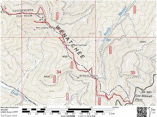 Begining of County Line Trail GPS Track
|
| Back to top |
|
|
|
|


