| Previous :: Next Topic |
| Author |
Message |
DaveBnd
Member


Joined: 14 Mar 2018
Posts: 2 | TRs | Pics
|
|
DaveBnd
Member
|
 Wed Mar 14, 2018 8:27 pm |
|
|
Every year, my wife and I like to do a peak for our anniversary in Aug/Sept.
In the past we've done fun adventurous 5th class stuff in the Rockies, but after an almost-life-altering climbing accident in 2016 we've been keeping it a bit more mellow. Regardless, we still want an adventure, great scenery, and are hoping for some suggestions.
Priorities (in order)
1. North Cascades with awesome views
2. 3-4 day trip (20-30 miles rt) with limited/no schwacking or exposure, no roped glacier travel, and a summit that is class 2 or easier.
3. Not a crowded sh##-show
4. Accessible from east side, since we'll be driving from Boise (perhaps negotiable)
Glacier Peak was my first thought, but east side access seems to necessitate glacier travel (???) and the 10h one way drive through SEA to Darrington for west side access sounds like a sad trombone to me.
I know that's a lot of parameters, but I'm hoping that you kind folk may be able to point me in a good direction or offer some suggestions. Many thanks in advance!
|
| Back to top |
  
|
|
Just_Some_Hiker
Member

Joined: 02 Jan 2013
Posts: 691 | TRs | Pics
Location: Snoqualmie, WA |
| DaveBnd wrote: | | Glacier Peak was my first thought, but east side access seems to necessitate glacier travel (???) |
Yes, Glacier Peak will involve glacier travel or 4th class scrambling.
|
| Back to top |
|
|
MangyMarmot
Member

Joined: 06 Apr 2012
Posts: 474 | TRs | Pics
|
How about the Pasayten? Remmel and Amphitheater. Cathedral is also there. It's easy scrambling except for one jump. The jump is near the summit, so if you decide not to do it, you still get great views. Cathedral Lake is a really nice camp. Not sure if the Diamond Creek fire got that far. You may want to call the ranger station to see if it burned.
Lots of scramble peaks around Twisp River Road also.
|
| Back to top |
|
|
Just_Some_Hiker
Member
Joined: 02 Jan 2013
Posts: 691 | TRs | Pics
Location: Snoqualmie, WA |
| Jeff wrote: | | Mt Daniel would work. There is a short somewhat exposed dirt traverse that really isn't bad, but might scare some.. |
The SE ridge is also exposed...at least in the sense that on some parts of the trail a slip equals death. The Hyas Creek Basin route involves steep snow travel, and sometimes scrambling on polished slabs. Also, getting to the true summit involves a VERY unpleasant traverse across steep scree. Nothing mellow about it.
I'd recommend the Leroy Creek and Buck Creek areas down Chiwawa River Road (30 minutes out of Leavenworth). There are class 2 bulgers out there like Maude and Seven Fingered Jack and you can definitely find enough things to do for 2-3 days. The scenery is second to none and it doesn't get nearly as crowded as some other areas in the summer. Leroy Creek Basin is an awesome place to setup camp.
https://www.summitpost.org/mount-maude/150386
https://www.summitpost.org/seven-fingered-jack/150428
https://www.wta.org/go-hiking/hikes/leroy-creek-high-route
https://www.summitpost.org/chiwawa-mountain/622101
|
| Back to top |
|
|
Matt
Tea, Earl Grey, Hot

Joined: 30 Jan 2007
Posts: 4308 | TRs | Pics
Location: Shoreline |
|
Matt
Tea, Earl Grey, Hot
|
Wed Mar 14, 2018 9:10 pm |
|
|
You want the Pasayten or Twisp River areas. Lots of class 2/3 peaks out there, and few crowds.
As beacons mountains burned at evening. J.R.R. Tolkien
As beacons mountains burned at evening. J.R.R. Tolkien
|
| Back to top |
|
|
jared_j
Member
Joined: 16 Aug 2007
Posts: 298 | TRs | Pics
|
|
jared_j
Member
|
Thu Mar 15, 2018 5:52 am |
|
|
This doesnt culminate in a summit, but Copper Ridge is a popular one that could fit your needs.
I think the Leroy basin suggestion is a good one. I think mt Maude may be a bit much for OP with how the snow usually is on the regular route (crampons and axe are use by most parties in summer from the time I was up there), but seven finger jack is indeed a mellow scramble and the views are pretty dang good.
A bonus of the chiwawa / Leroy basin area idea is that it is close to Leavenworth. OP could try their hand at a walk-up enchantments permit, and if he strikes out it isnt too far a drive away.
|
| Back to top |
|
|
Secret Agent Man
Member
Joined: 24 Dec 2015
Posts: 164 | TRs | Pics
Location: Seattle |
I doubt ice ax and crampons would be necessary for Maude in the Aug/September window that OP outlines. There will be snow patches but by the end of August it shouldn't be too tough to avoid them and stay on dirt or talus.
I agree Maude/7FJ is a great suggestion. Going up Carne to start, hitting Maude, camping at Ice Lakes or Leroy Basin, hitting 7FJ and taking Phelps Creek out makes it a good loop.
It does sound like OP could be coming from out of town and renting a car, if so it's a rough road and they'll want something that can confidently make it.
|
| Back to top |
|
|
DIYSteve
seeking hygge

Joined: 06 Mar 2007
Posts: 12654 | TRs | Pics
Location: here now |
|
DIYSteve
seeking hygge
|
Thu Mar 15, 2018 5:51 pm |
|
|
| Matt wrote: | | You want the Pasayten or Twisp River areas. Lots of class 2/3 peaks out there, and few crowds. |
 e.g., Star/Courtney/Oval -- checks all your boxes, easy trail access, class 2 max, nice camps
Leroy Basin is okay, but expect crowds, better to go in via Carne High Route (old sheepherder's trail) and out Leroy Creek. 3-4 days is just right for that loop with a side trip to Ice Lakes camp. e.g., Star/Courtney/Oval -- checks all your boxes, easy trail access, class 2 max, nice camps
Leroy Basin is okay, but expect crowds, better to go in via Carne High Route (old sheepherder's trail) and out Leroy Creek. 3-4 days is just right for that loop with a side trip to Ice Lakes camp.
|
| Back to top |
|
|
DaveBnd
Member
Joined: 14 Mar 2018
Posts: 2 | TRs | Pics
|
|
DaveBnd
Member
|
Fri Mar 16, 2018 7:17 am |
|
|
Thanks for all of the suggestions.
Looks like a lot of suggestions for the Twisp/Pasayten area, and Cathedral looks to nail all of the parameters I outlined. Mt Maude also looks awesome, and bit shorter of a drive, I like the prospect of having glaciers (and Glacier Peak) being a larger component of the views too. I think including it as part of the Leroy Creek high route may be a winner.
I'll also add that we'll actually be driving from Boise and will have high clearance and 4x4 so road quality isn't too much of a concern.
On another note, and for future reference:
| Quote: | | Yes, Glacier Peak will involve glacier travel or 4th class scrambling. |
The Gerdine/Cool glacier bypass of the 4th class is relatively mellow, no? I.e. 30ish degrees and few/no crevasses? We're both pretty comfy on moderate snow, so this had always seemed like a potentially doable route, but I imagine things can start getting pretty firm in Aug/Sept?
|
| Back to top |
|
|
DIYSteve
seeking hygge
Joined: 06 Mar 2007
Posts: 12654 | TRs | Pics
Location: here now |
|
DIYSteve
seeking hygge
|
Fri Mar 16, 2018 7:52 am |
|
|
| DaveBnd wrote: | | The Gerdine/Cool glacier bypass of the 4th class is relatively mellow, no? I.e. 30ish degrees and few/no crevasses? |
The Gerdine/Cool route is indeed relatively mellow for stratovolcano routes, but there are crevasses, most notably at the S margin of the Cool Glacier @ c. 9100' where the Gerdine tops out, and they will likely be an issue (albeit likely a minor one) in August. It's not bad, close to flat, but you should rope up. We put in a picket at that spot. As with all glacier travel, it changes as the season progresses and from year to year. I would not hesitate to do the route as a 2-rope team with my wife (although next time we do it, it'll likely be earlier in the season on skis).
Gerdine/Cool is a great basic mountaineering route, IMO the best standard stratovolcano route in the Cascades. (It became the standard after access to the Sitkum Glacier route was washed out.) Contrast the direct Disappointment Cleaver route, which is miserable loose POS.
|
| Back to top |
|
|
woodchips
Member
Joined: 08 Sep 2013
Posts: 65 | TRs | Pics
Location: Bellingham |
Cathedral is one of my favorite trips ever (the hike in, the camps below, and the peak.) However, its definitely not class 2 - my recollection is third class with one 4th class jump right before the summit.
While we didnt climb any of the other peaks in the area, i believe theres some class 2 stuff close by.
|
| Back to top |
|
|
Brushbuffalo
Member

Joined: 17 Sep 2015
Posts: 1887 | TRs | Pics
Location: there earlier, here now, somewhere later... Bellingham in between |
| DIYSteve wrote: | | Star/Courtney/Oval -- checks all your boxes, easy trail access, class 2 max, nice camps |
Ditto that too! Splendid area.
Passing rocks and trees like they were standing still
Passing rocks and trees like they were standing still
|
| Back to top |
|
|
Hiking_Husky
Member

Joined: 07 Nov 2012
Posts: 79 | TRs | Pics
|
Lots of great suggestions here! Have done a few in some of the aforementioned locations (Star/Courtney/Oval, Pasayten, Entiats, etc.), and all worth your while. One I may add for the Pasayten would be anything from Hart's Pass. I looped the Middle Fork Pasayten trail with Buckskin Ridge (with a side trip up Shellrock Pass trail to get Osceola, Carru, and Lago), and was quite impressed.
I will add, if you want to explore the Glacier Peak Wilderness without glacier travel, Pilot Ridge loop with the PCT is excellent, plus plenty of opportunity for some peakbagging (Johnson, Kodak, White, Indian Head, and Portal come to mind). Excellent views of Glacier, Sloan, and many others along the way.
Another I loved was Lake Byrne via Lost Creek Ridge. One of the most beautiful backcountry lakes I have visited, not many folks, and one of the best views of Glacier I have seen. I just did an out and back, but you could probably get creative with a loop if you study some maps and are willing to 'shwack a bit (some of the trails around there are abandoned).
Anyhow, happy picking, and happy hiking!
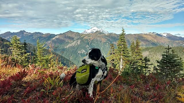 Pilot Ridge 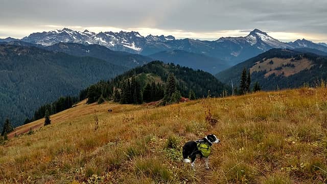 Pilot Ridge 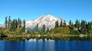 Lake Byrne 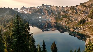 Lake Byrne
|
| Back to top |
|
|
olderthanIusedtobe
Member
Joined: 05 Sep 2011
Posts: 7725 | TRs | Pics
Location: Shoreline |
Excellent suggestions Hiking Husky. The entire Glacier Peak Wilderness is fantastic. If the logs spanning the river are still in place like they were a couple years ago, you can make a great loop out of Lost Creek Ridge/Lake Byrne. I would never ever suggest fording the White Chuck, but if you can cross on logs right by the confluence w/ Kennedy Creek, you can sniff out a connector trail that fairly quickly leads you to the PCT. From there you can go south and either come out on NF Sauk or extend it a little further and take in Blue Lake and Pilot Ridge. This loop would include about 4 miles of road walking between the trailheads.
|
| Back to top |
|
|
Hiking_Husky
Member
Joined: 07 Nov 2012
Posts: 79 | TRs | Pics
|
| olderthanIusedtobe wrote: | | I would never ever suggest fording the White Chuck, but if you can cross on logs right by the confluence w/ Kennedy Creek, you can sniff out a connector trail that fairly quickly leads you to the PCT. From there you can go south and either come out on NF Sauk or extend it a little further and take in Blue Lake and Pilot Ridge. This loop would include about 4 miles of road walking between the trailheads. |
You know, I've looked at a loop involving going down from Byrne towards Kennedy, but kinda been scared off by some reports that the trail is pretty overgrown. A Byrne/PCT/Pilot Ridge loop would make for a fantastic multi-day backpack with a car/bike shuttle from NF Sauk trailhead to Lost Creek trailhead. May have to check it out someday, but having to hope for a log crossing can be a bit unnerving!
|
| Back to top |
|
|
|
|
You cannot post new topics in this forum
You cannot reply to topics in this forum
You cannot edit your posts in this forum
You cannot delete your posts in this forum
You cannot vote in polls in this forum
|
Disclosure: As an Amazon Associate NWHikers.net earns from qualifying purchases when you use our link(s). |


