| Previous :: Next Topic |
| Author |
Message |
neek
Member


Joined: 12 Sep 2011
Posts: 2338 | TRs | Pics
Location: Seattle, WA |
|
neek
Member
|
 Fri Jul 20, 2018 5:40 pm |
|
|
I went to Slate Pass for the first time and did a 3-day loop that involved a camp site with a decent view
a colorful sunrise
pretty flowers
some peaceful lakes
prickly wildlife
and some mountains too
My loop, not quite as ambitious as some of the recent reports for this area, looked something like this:
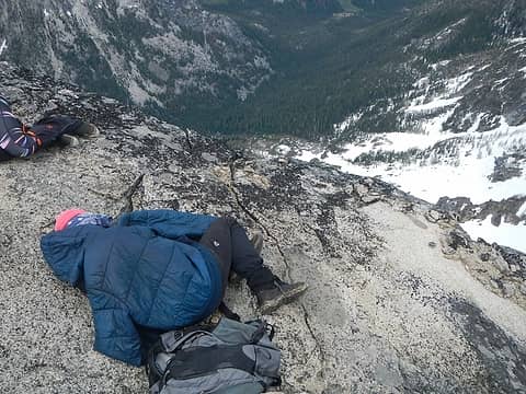
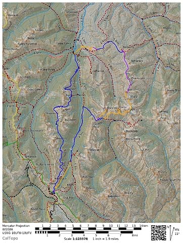 Blue = trails from OpenStreetMap (often not very accurate in this region), orange = GPS, purple = hand-drawn 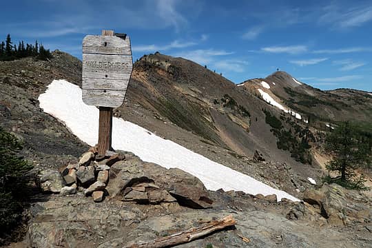 Cresting Slate Pass a couple minutes after leaving the car 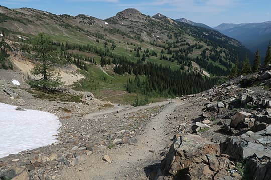 Looking down from Slate Pass 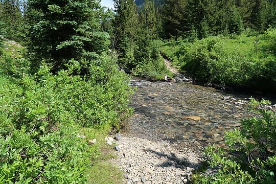 Middle Fork Pasayten crossing. I had tennis shoes on so just walked across 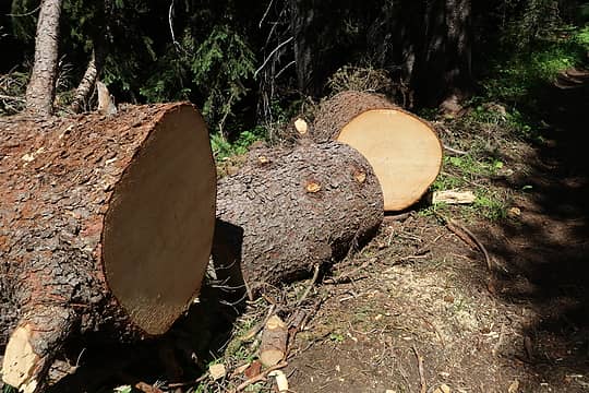 The entire MFP trail had just been cleared by a Forest Service team 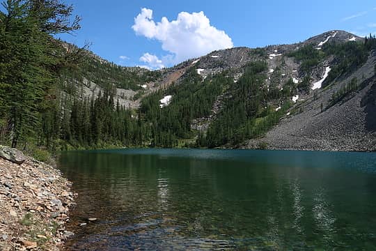 Freds Lake 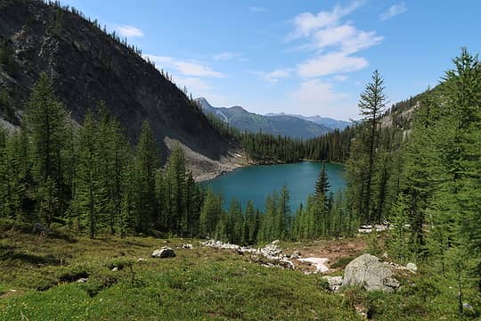 Freds Lake 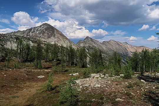 Three of the objectives coming into view: Osceola, Carru, Lago 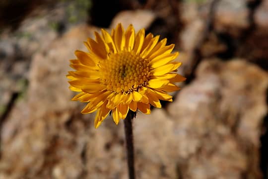 LYF 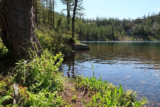 Lake Doris 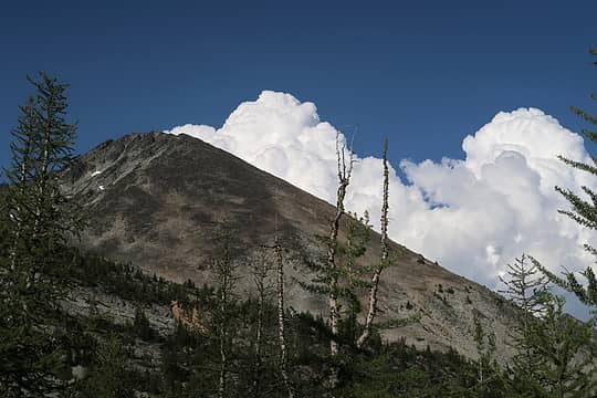 Hmmm 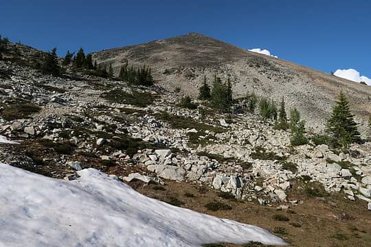 Heading up 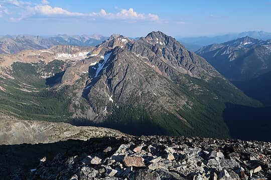 Blackcap, Monument 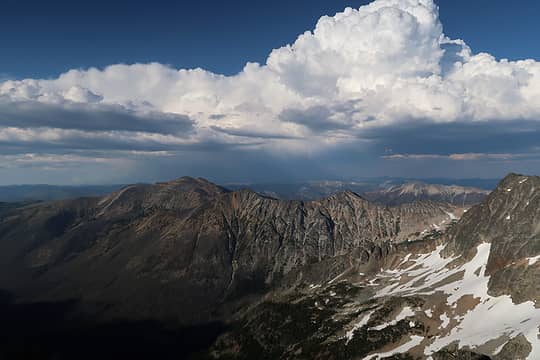 Storm to the NE 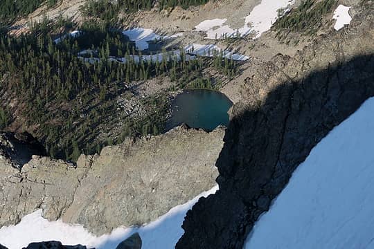 Lake 6765 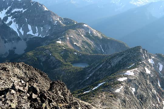 Looking back at Doris Lake 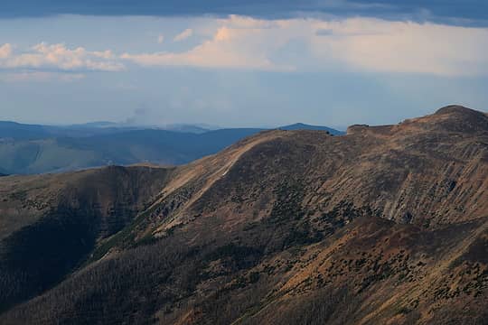 What looks like a couple small fires 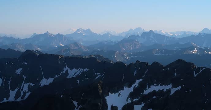 View SW 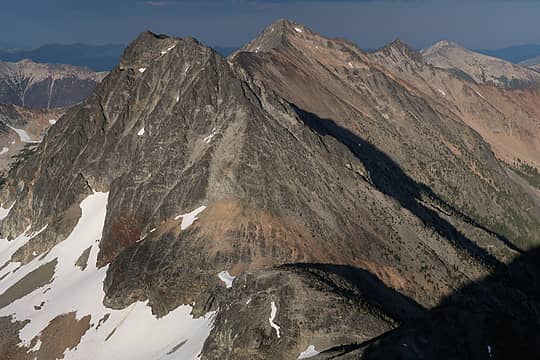 Carru and Lago 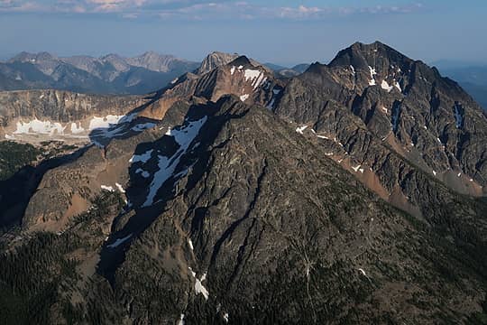 Blackcap and Monument 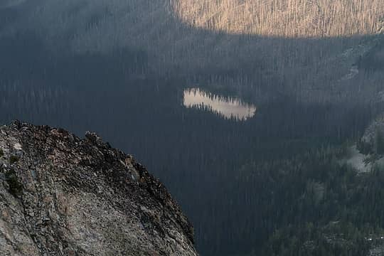 Lease Lake 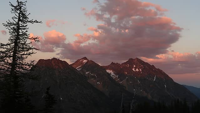 Back at camp 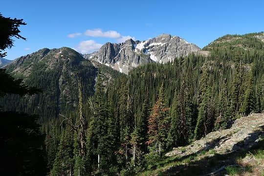 Rolo 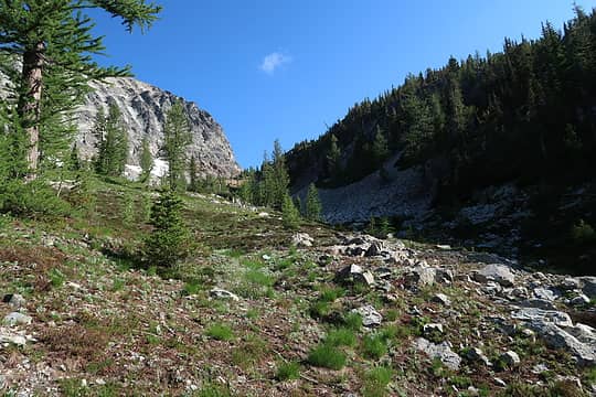 Good so far 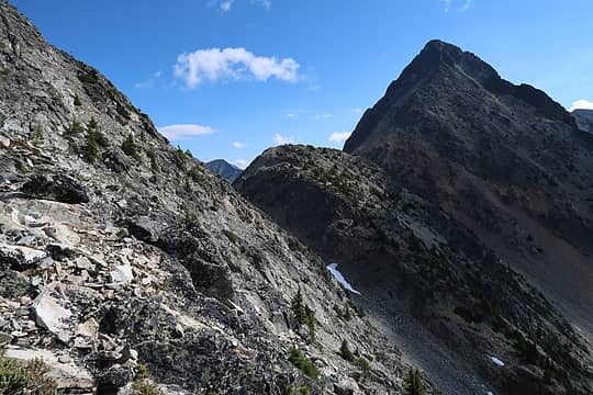 Not good 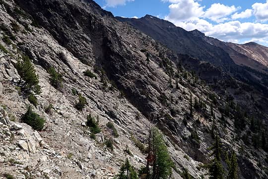 Ugh 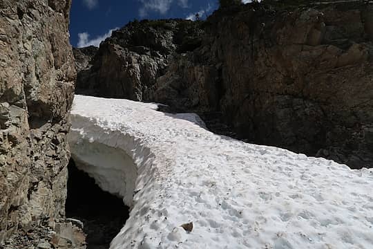 Crossing a gully 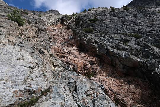 Nice solid class 2 believe it or not 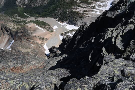 Serious drop on the north side of Carru 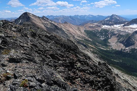 Lago from the summit of Carru 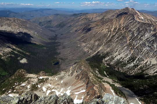 Burnt Lease Creek valley 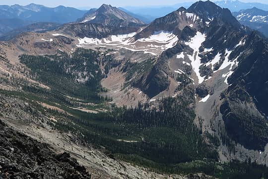 Eureka Creek valley 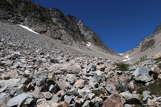 At 7200 ft between Carru and Lago. Don't see any weaknesses further up that wall so I think it's necessary to drop this far 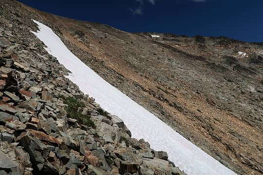 Heading up Lago 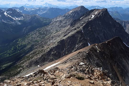 Lago summit, looking back at Osceola and Carru  Familiar names 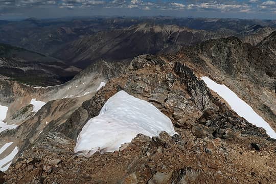 View to the east 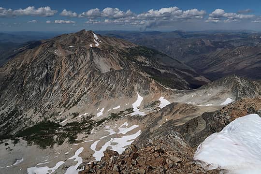 View from the summit of Lago showing my entire ridge route for the rest of the day. Smoke in the background 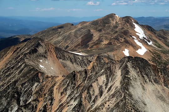 Pt. 8165 (right), Dot (left), Ptarmigan (back) 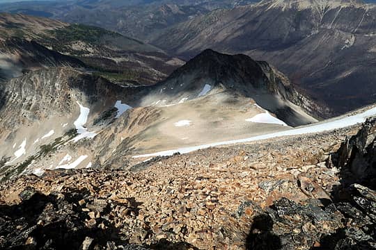 Easy descent down the north side of Lago 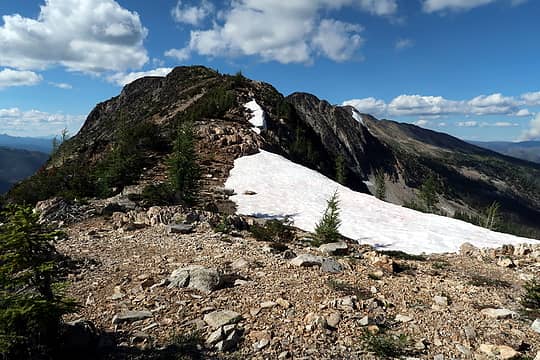 Along the ridge 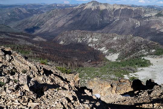 Burn 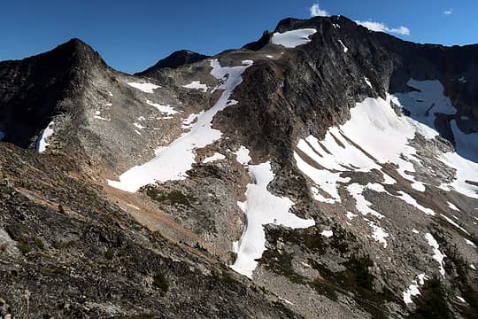 Looking back 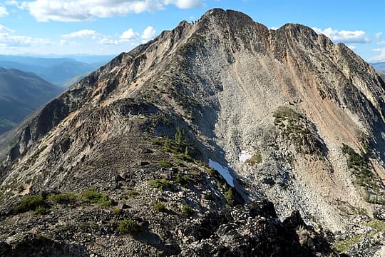 Heading up pt. 8165 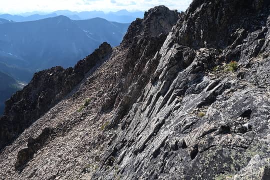 Slightly tricky 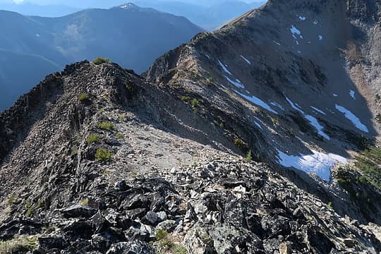 Ridge magically opens back up 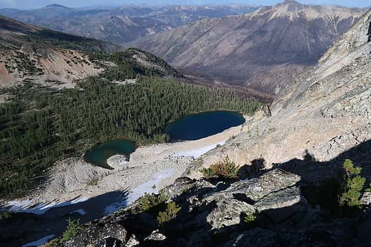 Dot Lakes 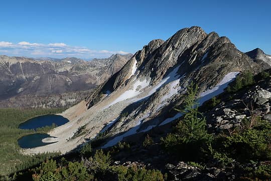 Dot Lakes and Peak 8165 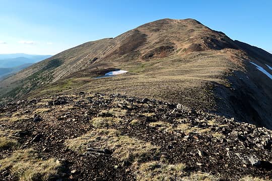 Ptarmigan Peak 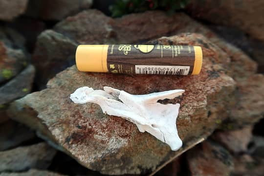 Part of a skull 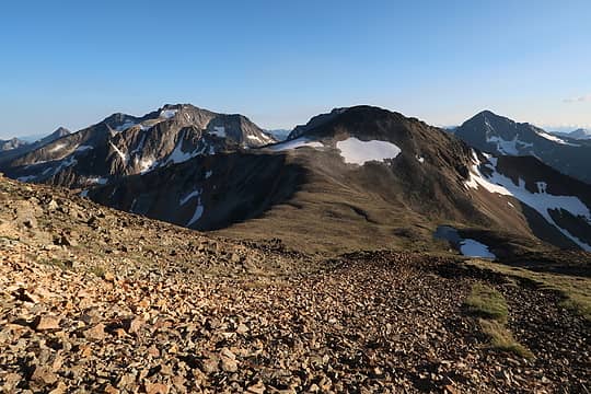 Looking back at Dot 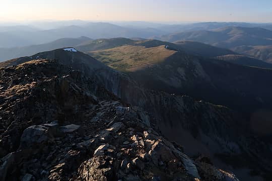 View north from Ptarmigan 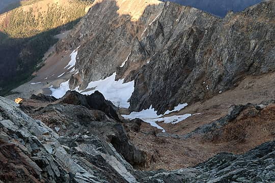 Despite the gentle south slopes, the NE side of Ptarmigan is very rugged 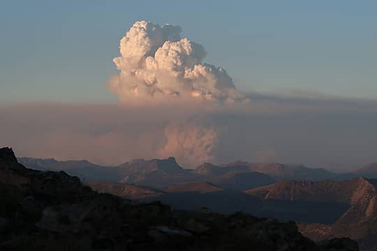 Fire blowing up in Canada 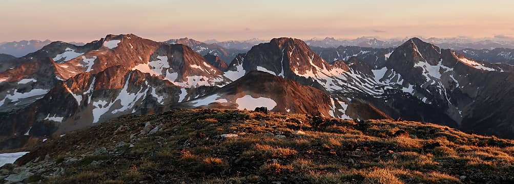 Fading light 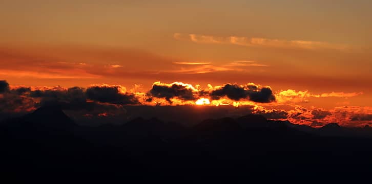 Sunset 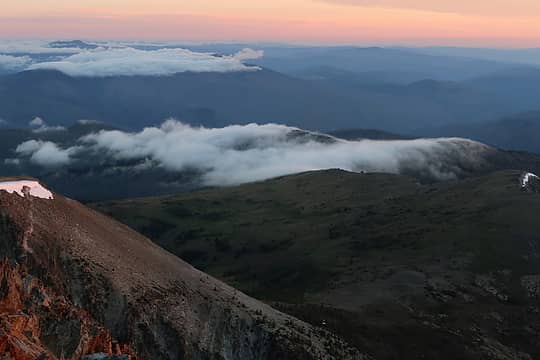 Clouds rolling over Tatoosh Buttes 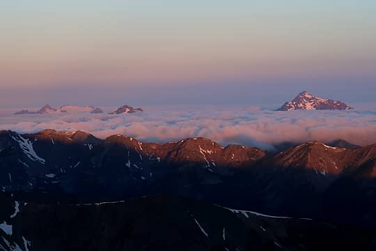 Jack 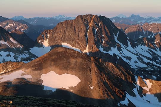 Carru 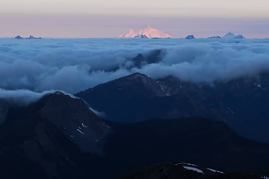 Baker 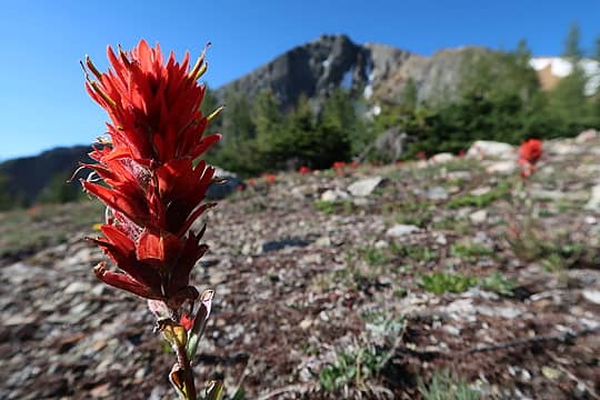 Paintbrush 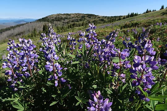 Lupine 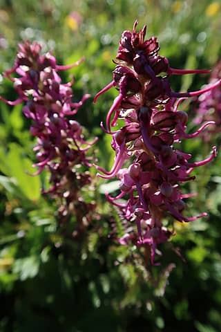 Elephant head 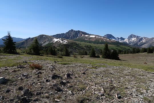 View from Tatoosh Buttes 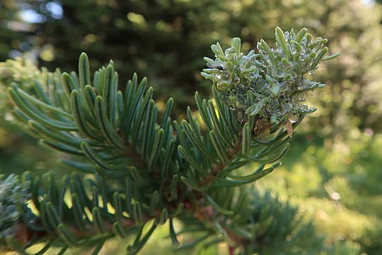 I am not sure whom these trees were offering sap to, but I helped myself to a bit 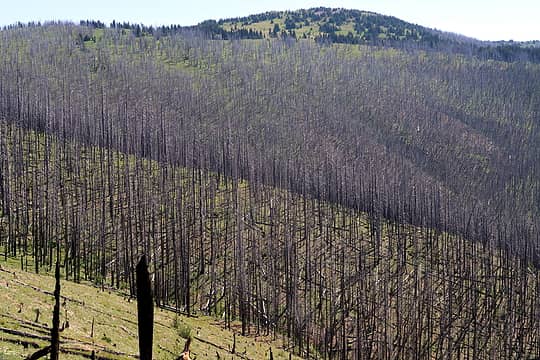 Devastation 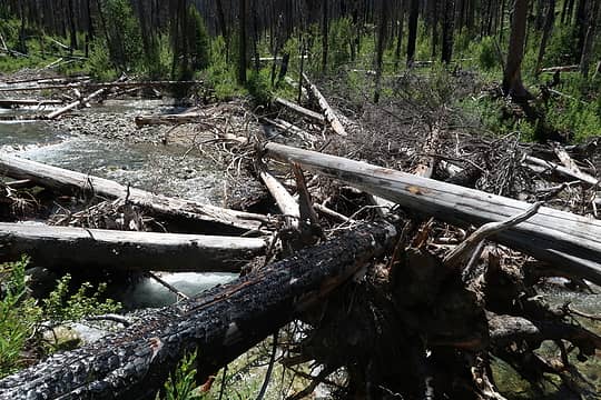 Lease Creek crossing 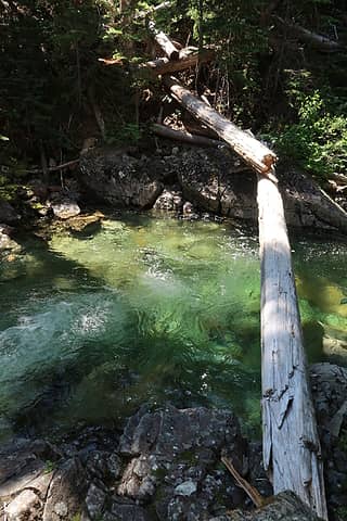 Pasayten crossing 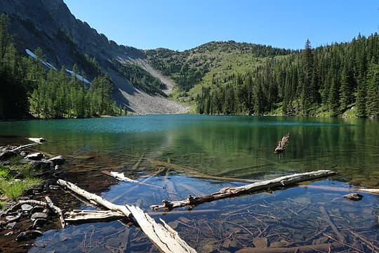 Lake 6326  What is this thing? It's HUGE 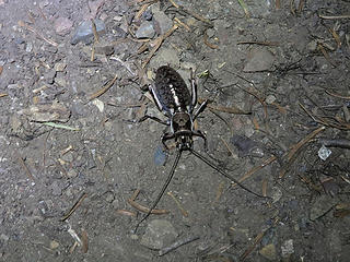 They were all over the trail at night 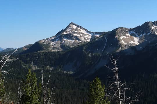 Pasayten Peak (I think)
|
| Back to top |
  
|
|
Michael Lewis
Taking a nap
Joined: 27 Apr 2009
Posts: 629 | TRs | Pics
Location: Lynnwood, WA (for now) |
Crushed it! 
|
| Back to top |
|
|
Bernardo
Member

Joined: 08 Feb 2010
Posts: 2174 | TRs | Pics
Location: out and about in the world |
|
Bernardo
Member
|
Fri Jul 20, 2018 6:01 pm |
|
|
Wow. Just wow. What great photo! I am reslly enjoyinh all the amazing trip reports coming in at this time of the year!
|
| Back to top |
|
|
Jake Robinson
Member

Joined: 02 Aug 2016
Posts: 521 | TRs | Pics
|
Really impressive solo trip. Lots of rough ground you covered!
|
| Back to top |
|
|
Opus
Wannabe

Joined: 04 Mar 2006
Posts: 3700 | TRs | Pics
Location: The big rock candy mountain |
|
Opus
Wannabe
|
Fri Jul 20, 2018 6:14 pm |
|
|
Glad to see that area more or less escaped the fire! I did a similar loop two years ago, but didn't end up doing Osceola, Carru, or Lago. It's also possible to go down to Dot Lakes from Dot Peak and traverse around Lago and back up to Shellrock Pass. Mostly easy terrain, minus one steep bit about halfway between the lakes and pass.
|
| Back to top |
|
|
Jake Robinson
Member
Joined: 02 Aug 2016
Posts: 521 | TRs | Pics
|
| Opus wrote: | | Glad to see that area more or less escaped the fire! I did a similar loop two years ago, but didn't end up doing Osceola, Carru, or Lago. It's also possible to go down to Dot Lakes from Dot Peak and traverse around Lago and back up to Shellrock Pass. Mostly easy terrain, minus one steep bit about halfway between the lakes and pass. |
True. Traverse south at treeline from Dot Lakes across a burned out basin. Cross over into another basin, drop an ugly gully into another burn zone, then climb boulders and easy open terrain to Butte Pass. Butte Pass to Shellrock is mostly burned now but easy travel.
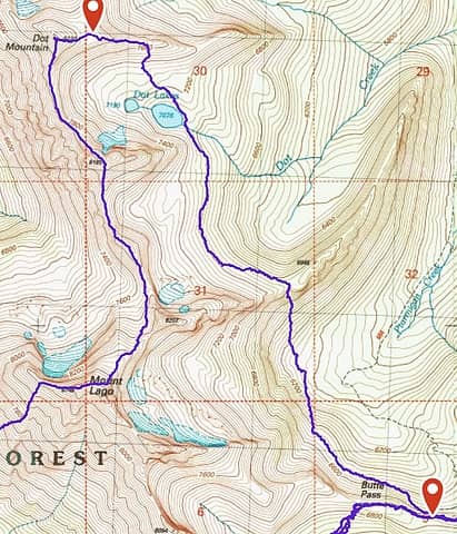 Dot Lakes to Butte Pass
|
| Back to top |
|
|
awilsondc
Member

Joined: 03 Apr 2016
Posts: 1324 | TRs | Pics
|
|
| Back to top |
|
|
Fletcher
Member

Joined: 29 Jul 2009
Posts: 1870 | TRs | Pics
Location: kirkland |
|
Fletcher
Member
|
Fri Jul 20, 2018 11:34 pm |
|
|
Wow, awesome photos Nick! One of my favorite corners of the Cascades.
|
| Back to top |
|
|
RichP
Member

Joined: 13 Jul 2006
Posts: 5634 | TRs | Pics
Location: here |
|
RichP
Member
|
Sat Jul 21, 2018 5:51 am |
|
|
Cool report and photos. It really brought back memories from a trip I did in 2008. That traverse between Oceola and Carru? Yeah, it was quite a lot of work with gully after gully after gully...
https://www.nwhikers.net/forums/viewtopic.php?t=7969247
The traverse on the Lease Ck Divide is pretty well outlined in the 100 Summits book and I found it fairly straightforward from the Lago/Carru Col.
Dot lakes are looking as good as ever but Ptarmigan Ck is toast.
|
| Back to top |
|
|
Bootpathguy
Member
Joined: 18 Jun 2015
Posts: 1791 | TRs | Pics
Location: United States |
Experience is what'cha get, when you get what'cha don't want
|
| Back to top |
|
|
OutOfOffice
Member

Joined: 02 Jun 2015
Posts: 91 | TRs | Pics
Location: Seattle |
Nice photos Neek 
|
| Back to top |
|
|
Distel32
Member
Joined: 03 Jun 2014
Posts: 961 | TRs | Pics
Location: Edmonds, WA |
|
Distel32
Member
|
Mon Jul 23, 2018 7:16 pm |
|
|
|
| Back to top |
|
|
User-Name
Member

Joined: 10 Aug 2010
Posts: 312 | TRs | Pics
Location: bellevue |
Dang, Nickel! That's a nice bit o' 'splorin' you done there. Next time you're planning a wander over new ground, lmk.  Looking forward to some mini-epics in the Fall. Legs are toast from Sunday, btw. hahaha Looking forward to some mini-epics in the Fall. Legs are toast from Sunday, btw. hahaha 
|
| Back to top |
|
|
Strider518
Member
Joined: 04 Sep 2019
Posts: 19 | TRs | Pics
Location: Bellingham, WA |
I enjoyed immensely your trip report and pictures. I've been thinking about doing the same loop, except 'clockwise'. From your report it seems that climbing up and over Lago does not involve any technical rock climbing, as long as one is careful to look ahead and not get stuck somewhere. I'd appreciate any private comments you may have, if you like. Thanks.
|
| Back to top |
|
|
gb
Member
Joined: 01 Jul 2010
Posts: 6311 | TRs | Pics
|
|
gb
Member
|
Thu Sep 05, 2019 8:51 am |
|
|
A really great trip report! I've considered that route as well, although I'd likely forego Osceola and Carru. Good information about finding the trails and the state of the route regarding fires and blowdown. Interested in hearing you say that views of the Buckskin Ridge trail were not all that great. That surprised me.
|
| Back to top |
|
|
|
|
You cannot post new topics in this forum
You cannot reply to topics in this forum
You cannot edit your posts in this forum
You cannot delete your posts in this forum
You cannot vote in polls in this forum
|
Disclosure: As an Amazon Associate NWHikers.net earns from qualifying purchases when you use our link(s). |


