| Previous :: Next Topic |
| Author |
Message |
Eric Gilbertson
Member


Joined: 04 Jul 2018
Posts: 188 | TRs | Pics
Location: Seattle |
October 20, 2018: 12:30am-4:59pm
New fastest known time: 16 hours 29 minutes car to car
48 miles, 12,200ft gain
I had recently finished climbing the Bulgers, and figured I might as well climb the extra seven mountains that would be on a stricter definition of the Washington top 100. Luna is one of those seven mountains. I was available for one day over the weekend, so I thought Id try to squeeze Luna peak into that one day. Amazingly it hadnt snowed for the past 10 days, and most of the upper route on Luna Peak is on south facing aspects. This meant I had a good chance of getting a snow-free ascent of Luna, which is pretty surprising for late October.
My time constraint was that I needed to be back in Seattle at a reasonable hour Saturday night to get ready for a hiking/packrafting trip Sunday to Blanca Lake. I estimated based on my previous long day trips that I would average about 2.5 miles per hour, which would put the trip around 20 hours. So I would have to start very early to get back at a reasonable hour Saturday night.
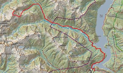 The route 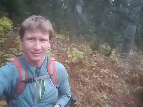 Finally some open bushwhacking on the north side of Access Creek 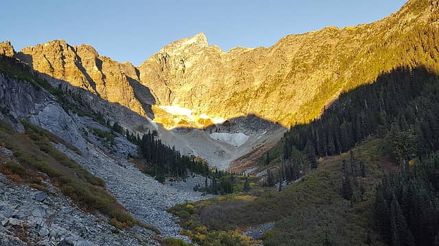 The cirque on the east side of Luna 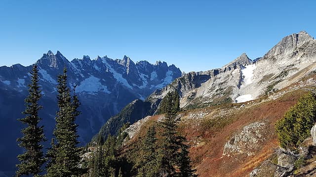 My first view of the southern pickets 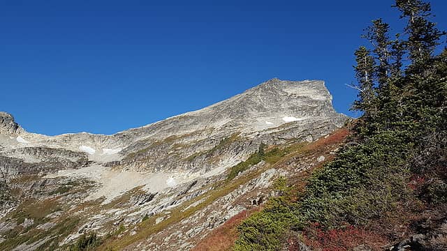 The southeast slopes of Luna 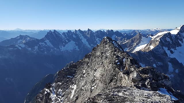 Looking back at the false summit along the summit ridge 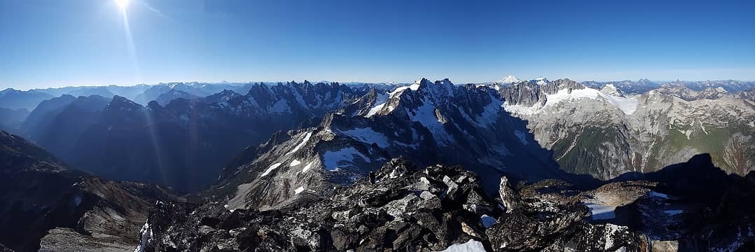 Panorama from back on the false summit 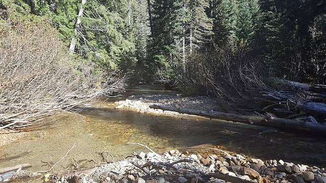 The Big Beaver Creek crossing
|
| Back to top |
  
|
|
awilsondc
Member

Joined: 03 Apr 2016
Posts: 1324 | TRs | Pics
|
|
| Back to top |
|
|
rbuzby
Attention Surplus
Joined: 24 Feb 2009
Posts: 1012 | TRs | Pics
|
|
rbuzby
Attention Surplus
|
 Tue Oct 23, 2018 6:48 am |
|
|
Would this be a good hike for my Corgi?
I took the same amount of time to climb Mt Stuart in the Spring once. But I didn't walk around my neighborhood for 2.5 miles after I got home.
Nice pics.
|
| Back to top |
|
|
Brushbuffalo
Member

Joined: 17 Sep 2015
Posts: 1887 | TRs | Pics
Location: there earlier, here now, somewhere later... Bellingham in between |
Wow!  Nice warmup for your rigorous trek to Blanca Lake the next day.
Passing rocks and trees like they were standing still
Passing rocks and trees like they were standing still
|
| Back to top |
|
|
Matt Lemke
High on the Outdoors

Joined: 15 Jul 2010
Posts: 2052 | TRs | Pics
Location: Grand Junction |
|
Matt Lemke
High on the Outdoors
|
Fri Oct 26, 2018 7:05 pm |
|
|
The next time all my friends tell me I am fast, I will point them your way! Its not the elevation gain that gets me, but the hours of monotonous trail miles I simply cannot handle.
Nice work!
|
| Back to top |
|
|
puzzlr
Mid Fork Rocks

Joined: 13 Feb 2007
Posts: 7220 | TRs | Pics
Location: Stuck in the middle |
|
puzzlr
Mid Fork Rocks
|
Fri Oct 26, 2018 7:27 pm |
|
|
Very impressive. I didn't know FKTs were tracked for destinations like this.
|
| Back to top |
|
|
Brushbuffalo
Member
Joined: 17 Sep 2015
Posts: 1887 | TRs | Pics
Location: there earlier, here now, somewhere later... Bellingham in between |
Passing rocks and trees like they were standing still
|
| Back to top |
|
|
iron
Member

Joined: 10 Aug 2008
Posts: 6392 | TRs | Pics
Location: southeast kootenays |
|
iron
Member
|
Fri Oct 26, 2018 9:59 pm |
|
|
pretty badass. sad looking state for those pickets glaciers. they're goners in 10 years.
|
| Back to top |
|
|
Matt Lemke
High on the Outdoors
Joined: 15 Jul 2010
Posts: 2052 | TRs | Pics
Location: Grand Junction |
|
Matt Lemke
High on the Outdoors
|
Sat Oct 27, 2018 1:38 am |
|
|
| iron wrote: | | pretty badass. sad looking state for those pickets glaciers. they're goners in 10 years. |
Yeah it honestly looks like the one dropping off east fury is the only one that'll last until I get older... If even that. So sad
|
| Back to top |
|
|
trent
Suffering fool

Joined: 02 Oct 2006
Posts: 65 | TRs | Pics
Location: Stanwood |
|
trent
Suffering fool
|
Tue Oct 30, 2018 10:27 am |
|
|
As if climbing Luna in a day wasn't enough! Walking around the block to get some extra exercise; that's pretty inconceivable to me!
Thanks for the TR!
It's all downhill from here!
It's all downhill from here!
|
| Back to top |
|
|
mike
Member
Joined: 09 Jul 2004
Posts: 6401 | TRs | Pics
Location: SJIsl |
|
mike
Member
|
Tue Oct 30, 2018 2:00 pm |
|
|
| iron wrote: | | sad looking state for those pickets glaciers. |
Here's comparison shots taken near the same location as the pano above. I took the one on the right on a climb in the '70's. The one on the left poached from a TR on this site at least 5 years ago. (previously posted)
|
| Back to top |
|
|
puzzlr
Mid Fork Rocks
Joined: 13 Feb 2007
Posts: 7220 | TRs | Pics
Location: Stuck in the middle |
|
puzzlr
Mid Fork Rocks
|
Tue Oct 30, 2018 8:42 pm |
|
|
Nice comparison shot. The conditions are really similar so it's easy to see the difference.
|
| Back to top |
|
|
iron
Member
Joined: 10 Aug 2008
Posts: 6392 | TRs | Pics
Location: southeast kootenays |
|
iron
Member
|
Wed Oct 31, 2018 1:35 pm |
|
|
maybe a 1000ft retreat for the icefall below swiss peak?
|
| Back to top |
|
|
PorcupinePhobia
Murse
Joined: 04 Mar 2012
Posts: 1002 | TRs | Pics
Location: Hwy20 |
I seem to remember a conversation about a pretty stout car-to-car time on Glacier Peak...
|
| Back to top |
|
|
|
|


 ).
).