| Previous :: Next Topic |
| Author |
Message |
RichP
Member


Joined: 13 Jul 2006
Posts: 5634 | TRs | Pics
Location: here |
|
RichP
Member
|
 Fri Sep 06, 2019 10:30 am |
|
|
Tonga Ridge/Mt Sawyer 9-5-2019. Berries, berries berries..
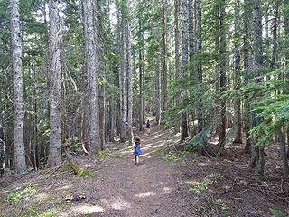 Tonga Ridge Trail. 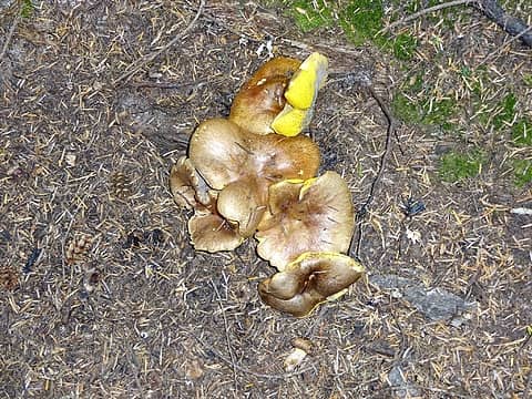 Fungi. 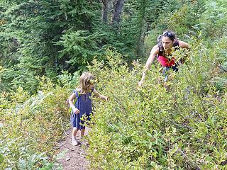 Huckleberry heaven. 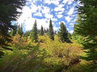 Nearing the summit. 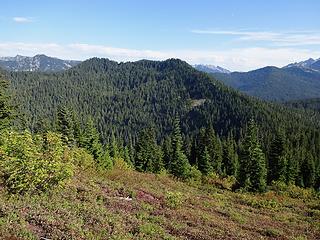 Tonga Ridge highpoint to the east. 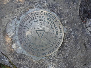 Benchmark on Sawyer. 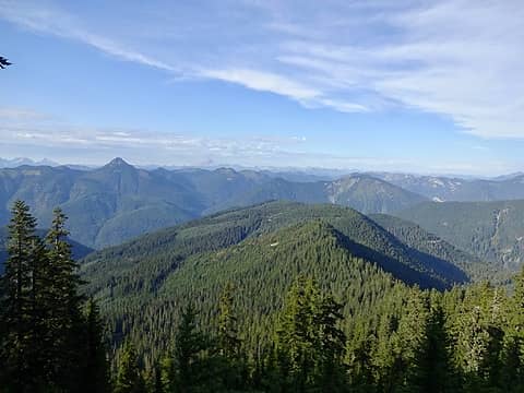 Northeast views from the summit.  Mt Daniel at just under 8000' is the King County highpoint. 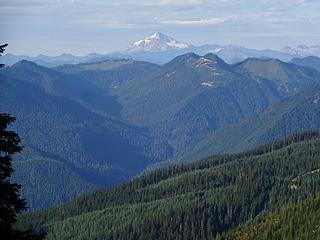 Glacier Peak. Captain Point has the logging road nearly to its summit.
|
| Back to top |
  
|
|
Nancyann
Member

Joined: 28 Jul 2013
Posts: 2322 | TRs | Pics
Location: Sultan Basin |
|
Nancyann
Member
|
Fri Sep 06, 2019 12:28 pm |
|
|
Its nice to see the little one enjoying those berries. Was that her first summit?
|
| Back to top |
|
|
RichP
Member
Joined: 13 Jul 2006
Posts: 5634 | TRs | Pics
Location: here |
|
RichP
Member
|
Fri Sep 06, 2019 1:39 pm |
|
|
| Nancyann wrote: | | Its nice to see the little one enjoying those berries. Was that her first summit? |
She's done quite a few, actually. I should start a peakbagger page for her.
|
| Back to top |
|
|
mosey
Member

Joined: 18 Dec 2018
Posts: 163 | TRs | Pics
|
|
mosey
Member
|
Sat Sep 07, 2019 5:46 pm |
|
|
Visited a half million cubic meter landslide that exposed a lot of bedrock and fossils on Slide Mountain near Bellingham. Some pics from 2009 showed this large slope as an exposed scarp of rock 75-90' tall, but sediment has mostly covered it up and some trees are sprouting. Lots of cool destruction, and a singletrack trail is well established now.
Directions: drive 4.1 miles on North Saul River. Turn right at junction, drive 1 mile, park at blockaded road to left. Follow abandoned road for 1 mile, on map it shows a few formerly driveable logging roads that were decommissioned after the slide. Slide alder has covered all of the other paths here, follow it up. Eventually The road switchbacks up but is totally obscured, going straight the trail becomes a bootpath, follow for 1/4 mile before a flagged fork, heading right, up the ridge for 1/4 mile (steep dirt).
Scarp pano
Closeup of chuckanut bedrock layers
View from 1800' (just below scarp area)
|
| Back to top |
|
|
geyer
Member

Joined: 23 May 2017
Posts: 463 | TRs | Pics
Location: Seattle |
|
geyer
Member
|
Mon Sep 09, 2019 12:29 pm |
|
|
Wrangell-St. Elias National Park 8/31 - 9/2
It wasn't quite the wilderness I expected it to be (though it would be if you just hiked a few miles away from the towns of Kennecott and McCarthy). Still an interesting place. We went with St Elias guides for the 1/2 day hike on the Root Glacier and the guide told us some interesting "facts" like how the Stairway icefall was the second biggest ice fall in the world behind the Khumbu.
Interesting article here.
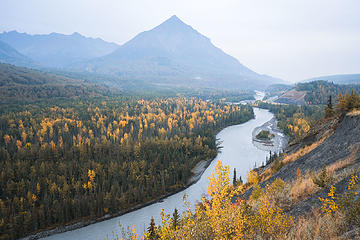 Matanuska River 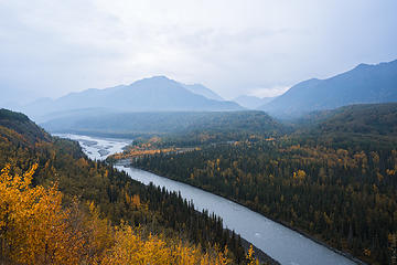 Matanuska River 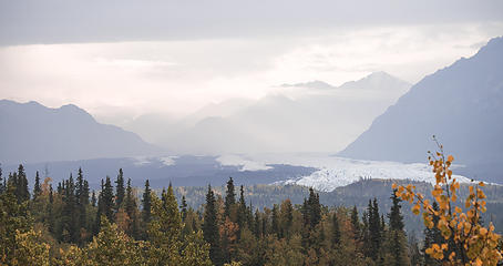 Matanuska Glacier light show 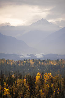 Matanuska Glacier light show 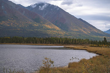 Crystalline Hils with Ruth Lake in foreground 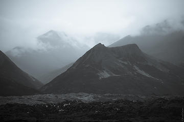 Selenium B&W 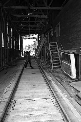 In the mill 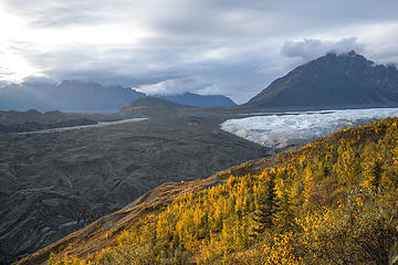 Note the tent in foreground 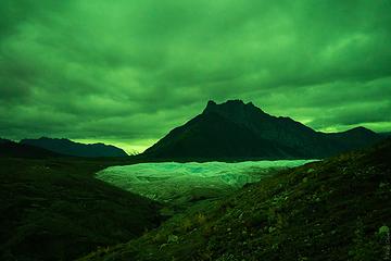 Aurora but too cloudy to see! 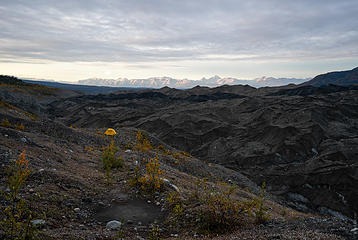 Looking back toward SE Chugach Mtns 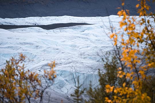 Root Glacier 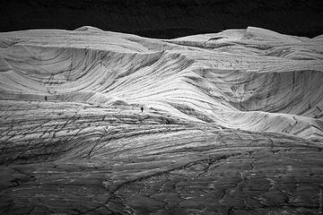 Small Human, big glacier 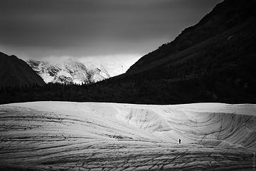 Small Human, big glacier 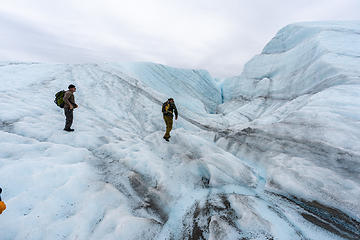 walking the glacier 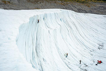 Ice climber 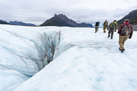 walking past a moulin 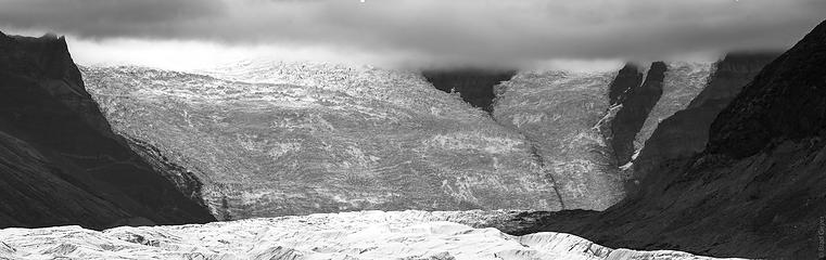 BW Icefall
|
| Back to top |
|
|
mosey
Member
Joined: 18 Dec 2018
Posts: 163 | TRs | Pics
|
|
mosey
Member
|
Thu Sep 12, 2019 9:21 pm |
|
|
Moolock, the road completely covered in pearly everlastings and slide alder.
Some nice buttes
Hansen forest lakes
|
| Back to top |
|
|
Downhill
Member
Joined: 30 Jul 2018
Posts: 345 | TRs | Pics
Location: Leavenworth |
|
Downhill
Member
|
Sun Sep 15, 2019 2:54 pm |
|
|
9-13-19 Lakes Minotaur and Theseus. Saw several other day hikers, all chased away by the rain showers. Good fishing in Theseus, no fish in Minotaur. 3 underground yellowjacket nests along the trail to Minotaur, I was wearing shorts and got stung in the back of my calf going up. I wore long pants on the descent.
9-14-19 Alice Lake via Chatter Creek trail. Good fishing. A few rain showers throughout the day. The Index Creek fire is still smoldering in the valley below to the east.
|
| Back to top |
|
|
RichP
Member
Joined: 13 Jul 2006
Posts: 5634 | TRs | Pics
Location: here |
|
RichP
Member
|
Tue Sep 17, 2019 7:51 am |
|
|
Green Gulch in Chief Joseph Wildlife Area in the southeast corner of the state. Got to see a bull elk fend off a potential suitor of his herd of 13 cows and calves. They never locked horns but lots of snorting, bugling and posturing.
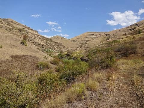 Lower down where the creek runs. 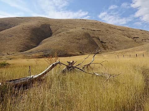 This hill has a great view of the area. 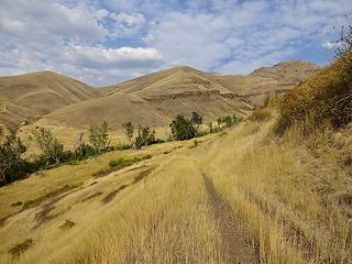 Upper Green Gulch. 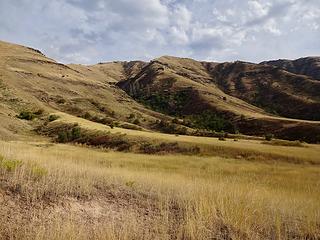 Mt Wilson which I hiked up in spring. 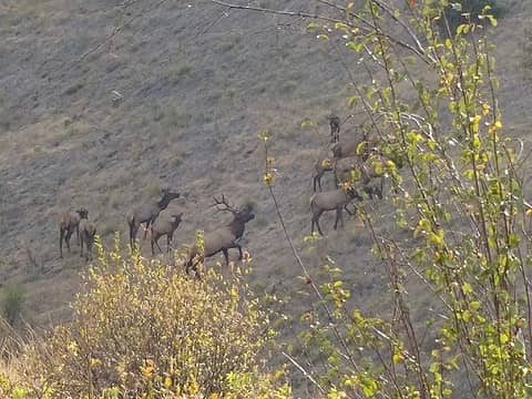 We got to witness this big bull chase off another male who tried to mosey in on his herd. 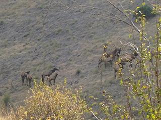 Herd of Elk. Lots of bugling going on. 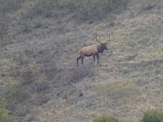 The big bull now checking us out after dealing with his competition. 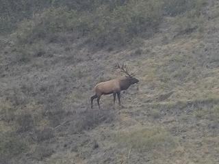 Snorting at another potential suitor. 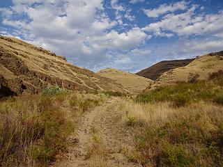 Lower Green Gulch.
|
| Back to top |
|
|
Abert
Member
Joined: 02 Sep 2010
Posts: 588 | TRs | Pics
Location: Sequim |
|
Abert
Member
|
Fri Sep 20, 2019 5:02 pm |
|
|
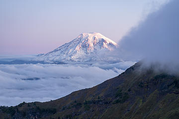
I walked up to Big Chiwaukum yesterday. White Pine Road is rocky in spots. Trails are clear of any blowdown. A little mud at some of the stream crossings and just enough wet brush to have me soaked from mid-thigh down. Not surprisingly, with everything so wet from the recent rains, the ridges were mostly buried in the mist, with just brief breaks of clearing. Route finding was very localized.
Little left up high of whatever snow fell this week. The basin above the Wildhorse Trail below Big Chiwaukum was full of huckleberries but I didn't see any sign of bears. Photos
 094  051 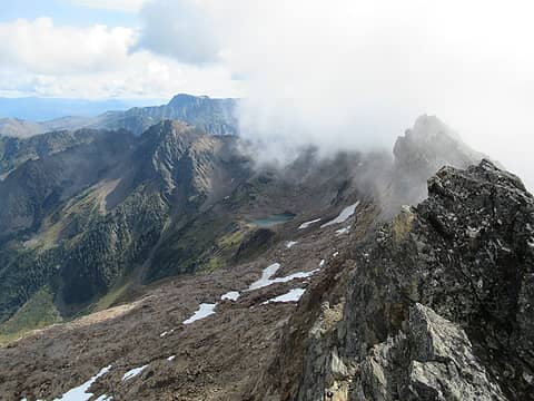 053 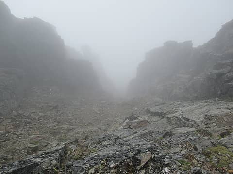 067 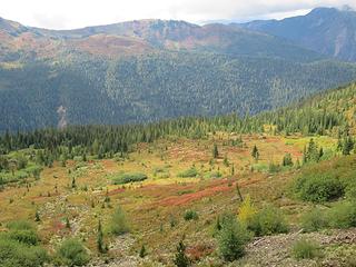 088 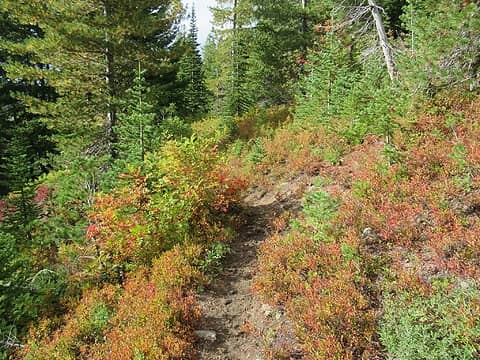 Wildhorse Trail
|
| Back to top |
|
|
awilsondc
Member

Joined: 03 Apr 2016
Posts: 1324 | TRs | Pics
|
Hawkeye Point and Old Snowy in the Goat Rocks. 9-19-19 ~17.5 miles 5100k gain
 A-07486 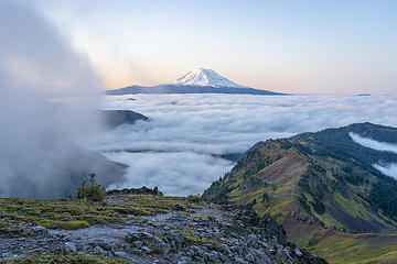 A-07498 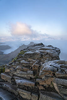 A-07503 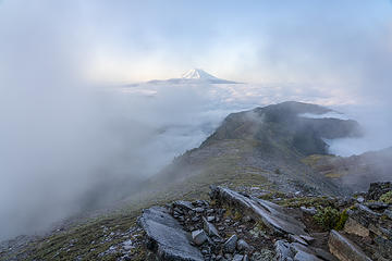 A-07507 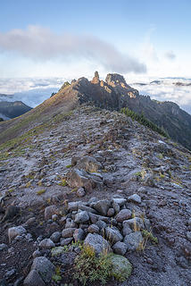 A-07525 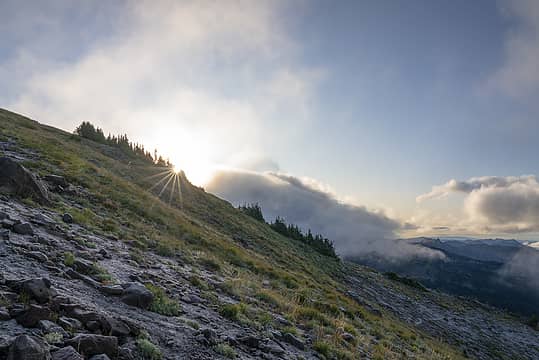 A-07528 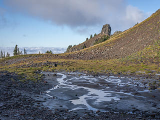 A-07551 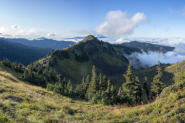 A-07568 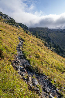 A-07574 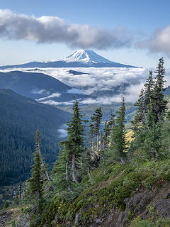 A-07588 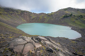 A-07592 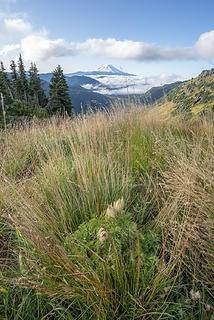 A-07602 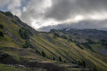 A-07605 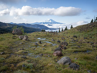 A-07612 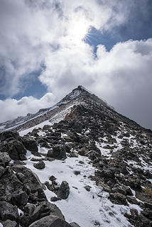 A-07632 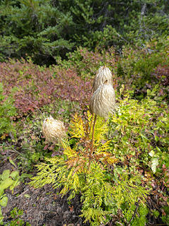 A-07643 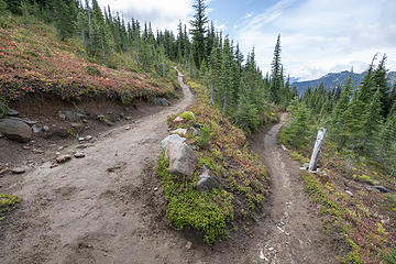 A-07647
|
| Back to top |
|
|
rubywrangler
Member

Joined: 04 Aug 2015
Posts: 511 | TRs | Pics
|
cashmere mountain 9.21.19
We got one of the last spots in the eightmile parking lot when we arrived at 6am. Most folks were walking up the road to Colchuck, and the rest were planning to take the Eightmile trail because they thought it would get them to Colchuck.  We went up the SE slope route described by Aaron and Jake and down the trail. The annoying brushy slope above the old road stole my iphone
  and new snow made the descent from the summit ridge a little more exciting than anticipated, but overall it was a great day! Gloriously clear, a fun crew and excellent views. All larches in the vicinity are still green. and new snow made the descent from the summit ridge a little more exciting than anticipated, but overall it was a great day! Gloriously clear, a fun crew and excellent views. All larches in the vicinity are still green.
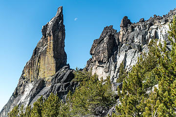 dagger and moon 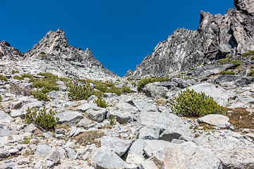 choose your own adventure gully 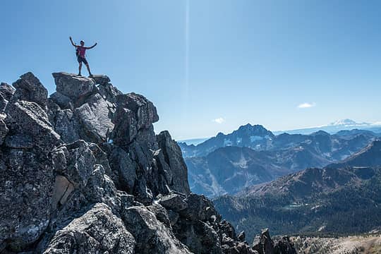 victory 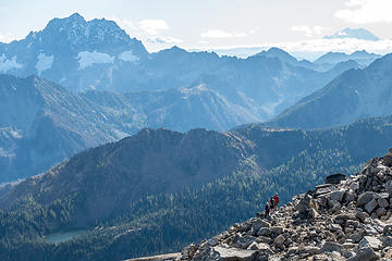 scoping out the valley below 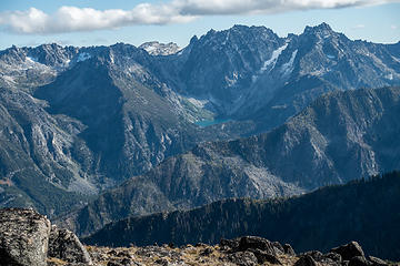 colchuck 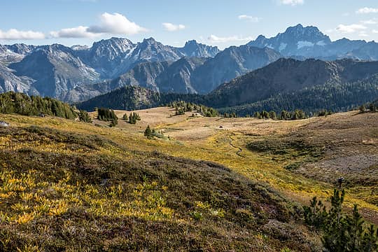 meadows & mountains 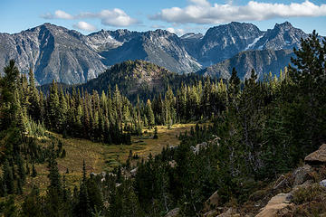 pretty light on meadows and enchantment range 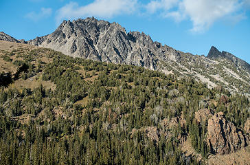 cashmere 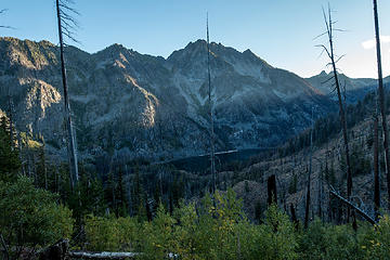 early evening light at eightmile lake
|
| Back to top |
|
|
thename
Member
Joined: 26 Jul 2015
Posts: 33 | TRs | Pics
|
|
thename
Member
|
Mon Sep 23, 2019 11:28 pm |
|
|
Headed up Chatter Creek 9/21/19 and looped from Ida via Icicle Ridge Trail. Managed to lose Icicle Ridge in the brush for a good long while after descending from Carter Lake. Better eyes than mine required, I guess and our descent from the pass at Grindstone was via headlamp (and iPhone LED). Still a wonderful day of hiking and the larch'll drag me back in the next week or two.
|
| Back to top |
|
|
Downhill
Member
Joined: 30 Jul 2018
Posts: 345 | TRs | Pics
Location: Leavenworth |
|
Downhill
Member
|
Wed Sep 25, 2019 4:53 pm |
|
|
| thename wrote: | | Managed to lose Icicle Ridge in the brush for a good long while after descending from Carter Lake. Better eyes than mine required |
I've heard from others who have been there in the past 2 years that the trail there is overgrown to the point of being non-existant, so it probably wasn't just your eyes.
|
| Back to top |
|
|
thename
Member
Joined: 26 Jul 2015
Posts: 33 | TRs | Pics
|
|
thename
Member
|
Wed Sep 25, 2019 5:30 pm |
|
|
| Downhill wrote: | | I've heard from others who have been there in the past 2 years that the trail there is overgrown to the point of being non-existant, so it probably wasn't just your eyes. |
Good to know I'm not alone. We floundered more than we should've searching for the track (switchbacks down into the basin were quite well maintained, though) so can confirm there was largely no sign until crossing Index Creek.
|
| Back to top |
|
|
Tom
Admin
Joined: 15 Dec 2001
Posts: 17857 | TRs | Pics
|
|
Tom
Admin
|
Tue Oct 01, 2019 9:36 pm |
|
|
Quick trip to Barbie's Boyfriend Lakes today. Feet got a little soggy but great day to be out.
 Just me today 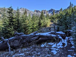 Snowy log on road 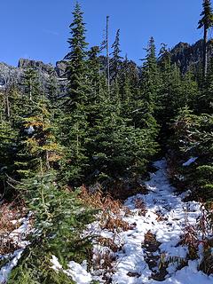 A few inches on the trail 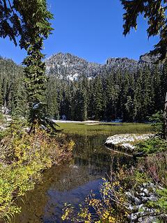 Lower Ken Doll 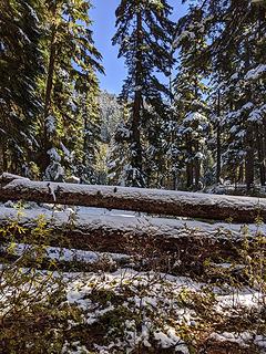 Logs 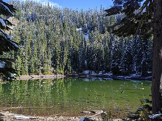 Middle 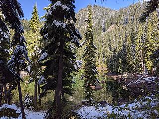 Leaving middle 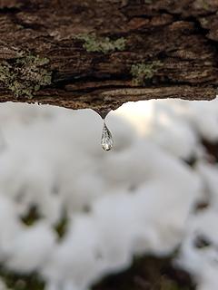 Frozen drop 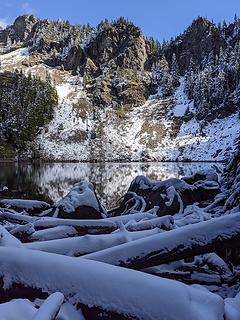 Arriving at upper 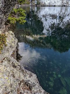 Melting snow drop ripples 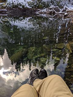 Shoe shot 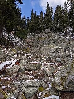 Upper inlet 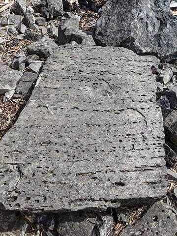 Paging Brushbuffalo 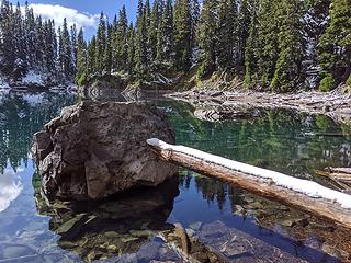 Snow plank 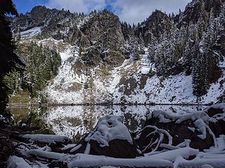 Leaving upper 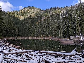 Middle from outlet 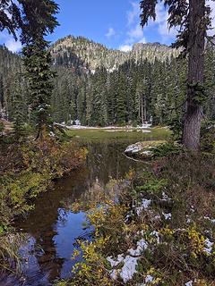 Leaving lower  Chikamin peek-a-boo
|
| Back to top |
|
|
|
|


