| Previous :: Next Topic |
| Author |
Message |
RichP
Member


Joined: 13 Jul 2006
Posts: 5634 | TRs | Pics
Location: here |
|
RichP
Member
|
 Sun Sep 03, 2017 8:37 pm |
|
|
| SingleShot wrote: | | Did you see the plane wreck south of Boner? |
Yes, we did.
|
| Back to top |
  
|
|
rustdogbrown
Member

Joined: 18 Aug 2009
Posts: 10 | TRs | Pics
|
What route did you use for your third attempt? And do you have pictures of the BT-13?
|
| Back to top |
|
|
puzzlr
Mid Fork Rocks

Joined: 13 Feb 2007
Posts: 7220 | TRs | Pics
Location: Stuck in the middle |
|
puzzlr
Mid Fork Rocks
|
Tue Oct 09, 2018 10:48 pm |
|
|
There's a pretty detailed map of the route on the upper mountain at my flickr page
I prefer not to post photos of the airplane or describe where it is. There are too many artifact hunters. 
|
| Back to top |
|
|
rustdogbrown
Member
Joined: 18 Aug 2009
Posts: 10 | TRs | Pics
|
How long did it take to get to cement lake from Money Creek Road?
|
| Back to top |
|
|
RichP
Member
Joined: 13 Jul 2006
Posts: 5634 | TRs | Pics
Location: here |
|
RichP
Member
|
Sat Oct 13, 2018 2:38 pm |
|
|
I'd plan on at least 4-5 hours.
|
| Back to top |
|
|
Chief Joseph
Member

Joined: 10 Nov 2007
Posts: 7710 | TRs | Pics
Location: Verlot-Priest Lake |
| RichP wrote: | | Puzzlr and I returned to Crosby Mtn for our third try and finally made it this time. Our first attempt was stopped short due to an unstable gully and the second was stymied by the shortness of a late Oct day and a route finding error. |
Tried this one yesterday with Waterman, I think we also ended up in the "unstable gully". Near mile marker 3 along money creek someone has purchased the property on the old road that previously led to the correct route and there are posted signs quite a ways prior to the road. So we drove past a ways, parked at a turnout and headed into the bush and by the time we had climbed about 2k' and had an opening near the cliff bands, we realized that we needed to be across the deep gully-stream bed to the east. Given time constrains, being nearly exhausted, and out of water, we bailed. Not sure about the route now due to the private property signs. Maybe another day.
Go placidly amid the noise and waste, and remember what comfort there may be in owning a piece thereof.
Go placidly amid the noise and waste, and remember what comfort there may be in owning a piece thereof.
|
| Back to top |
|
|
Sky Hiker
Member
Joined: 03 Feb 2007
Posts: 1469 | TRs | Pics
Location: outside |
Replied To Watermans PM, It was purchased by a lady in CA. Believe with the intention of a group club mining in Money creek as it was for sale on Ebay a few years back.
|
| Back to top |
|
|
yeoldehipster
Member
Joined: 22 Sep 2011
Posts: 3 | TRs | Pics
|
Has anyone gotten a good look at the north aspect of Crosby? It looks spectacular from the road, like a ship's prow sailing through a sea of peaks!
|
| Back to top |
|
|
zimmertr
TJ Zimmerman
Joined: 24 Jun 2018
Posts: 1228 | TRs | Pics
Location: Issaquah |
|
zimmertr
TJ Zimmerman
|
Thu Jan 27, 2022 4:59 pm |
|
|
Out of curiosity, why approach from the Money Creek side instead of the Lowe Creek side? Looks like the spur road on that side could get you to ~2,900' instead of 1,500'. I'm not sure how to label photos, but the pin drop represents the end of the mapped spur road on Caltopo.
Looks like there are also some curious switchback-esque formations in the talus on that side of Bing too. Perhaps an old & unmapped continuation of the road?
|
| Back to top |
|
|
RichP
Member
Joined: 13 Jul 2006
Posts: 5634 | TRs | Pics
Location: here |
|
RichP
Member
|
Thu Jan 27, 2022 6:29 pm |
|
|
We had attempted this way earlier and so knew the route even though we ran out of daylight on the first try. There is a quarry high up there and that might be what you are seeing in the photo. From my understanding it was accessed by aerial cables from the valley below. There is a discussion on the history section of the forum regarding the subject.
I seem to recall hearing that Lowe Ck is pretty overgrown but can't confirm that.
 zimmertr zimmertr
zimmertr |
| Back to top |
|
|
timberghost
Member
Joined: 06 Dec 2011
Posts: 1333 | TRs | Pics
|
i can confirm that it is vine maple infested with steep creek draws valley. I turned back after 3 hours and the next weekend went up from Money creek much easier.
zimmertr
zimmertr |
| Back to top |
|
|
MangyMarmot
Member

Joined: 06 Apr 2012
Posts: 474 | TRs | Pics
|
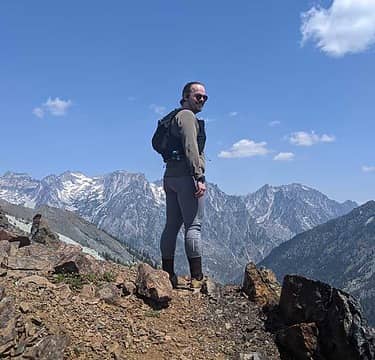
I went up to Crosby in May from the Money Creek side. I also found the no trespassing signs. I headed up the hill just after the no trespassing signs ended. I ended up near Bing Peak. Then went down the ridge to Crosby. There was one place where I had to do a steep somewhat sketchy downclimb, which I had to reverse on the way back. There was also some steep snow near the summit block but not too bad. The Money Creek approach works. It's a pretty good day though. It took me longer than expected.
|
| Back to top |
|
|
Sky Hiker
Member
Joined: 03 Feb 2007
Posts: 1469 | TRs | Pics
Location: outside |
 Only way to go Only way to go
|
| Back to top |
|
|
|
|


