| Previous :: Next Topic |
| Author |
Message |
rubywrangler
Member


Joined: 04 Aug 2015
Posts: 511 | TRs | Pics
|
One of the classic nwhikers TRs that has been on my list for a long time is "the Italian traverse". And a few years ago Kyle McCrohan described a route on his blog that he called the "Alpine lakes crest traverse", from Snoqualmie pass to Cathedral pass trailhead. I had devised a loop that would combine parts of these two routes I hadn't been to yet, along with some other lakes still on my to-visit list. Then Julia decided to join so we revised the plan back to a traverse, including some places that were repeats  for me, but she hadn't been to yet. There was A LOT of talus hopping on this route and pretty much every day except for the first one was long. We could have used at least one more day, maybe two if we wanted to add a couple more summits (burntboot, dip top, lynch would be good options). But wow, what an incredible route and place!! I have already started trying to forget the Type 2 parts so I can convince myself to do some of this route again in the future.
Day 1 Mineral creek to Chikamin lake
After dropping my car at cathedral TH, we started hiking from mineral creek around 11:30. Both parking lots were already full at 11am on Friday. The mineral creek trail has been majorly brushed out since I was there last and was unrecognizable (in a good way). But it was hot. As we got near/above treeline, we experienced significant huckleberry and blueberry delays. It was smoky/hazy but glacier lake and beyond were still stunning even with a weird orange tint. We had passed a few groups en route but had chikamin lake to ourselves until another group rolled in at dusk. for me, but she hadn't been to yet. There was A LOT of talus hopping on this route and pretty much every day except for the first one was long. We could have used at least one more day, maybe two if we wanted to add a couple more summits (burntboot, dip top, lynch would be good options). But wow, what an incredible route and place!! I have already started trying to forget the Type 2 parts so I can convince myself to do some of this route again in the future.
Day 1 Mineral creek to Chikamin lake
After dropping my car at cathedral TH, we started hiking from mineral creek around 11:30. Both parking lots were already full at 11am on Friday. The mineral creek trail has been majorly brushed out since I was there last and was unrecognizable (in a good way). But it was hot. As we got near/above treeline, we experienced significant huckleberry and blueberry delays. It was smoky/hazy but glacier lake and beyond were still stunning even with a weird orange tint. We had passed a few groups en route but had chikamin lake to ourselves until another group rolled in at dusk.
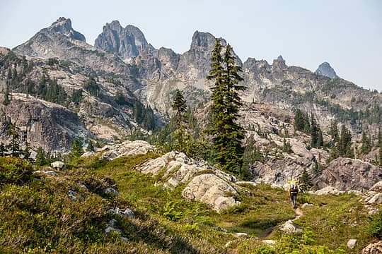 approaching glacier lake in a smoky haze 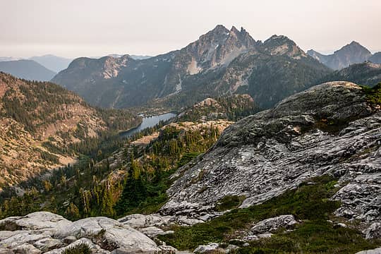 spectacle + 3 queens 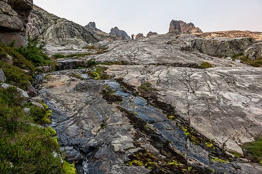 climbing to chikamin lake 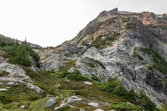 approaching chikamin tarns 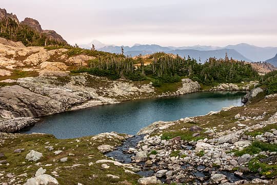 chikamin tarn 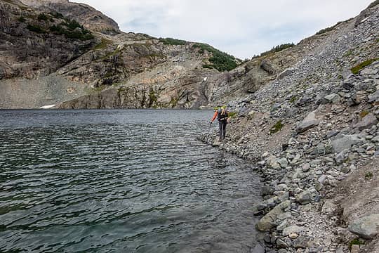 around the lake 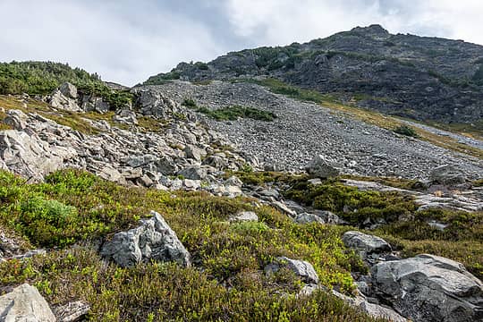 up the ridge to lemah 1 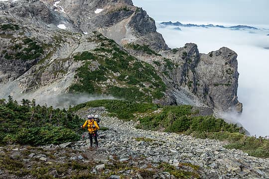 marine layer moving in 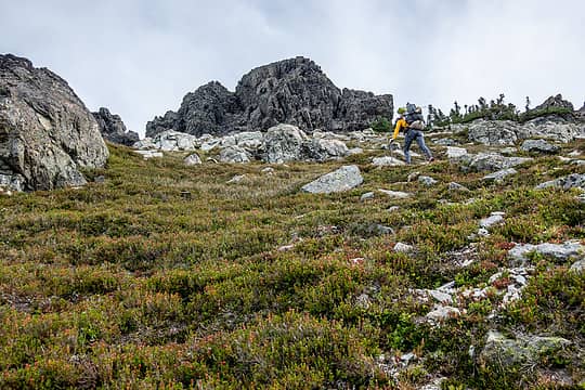 approaching the summit block 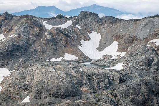 chikamin tarn 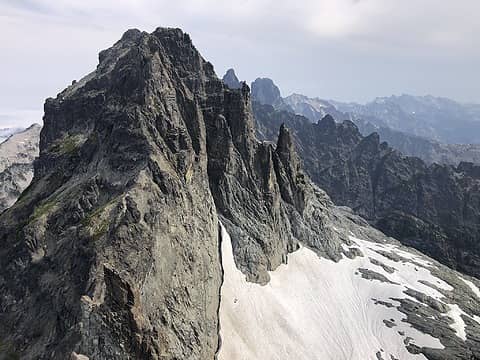 lemah 2, 3 and beyond from lemah 1 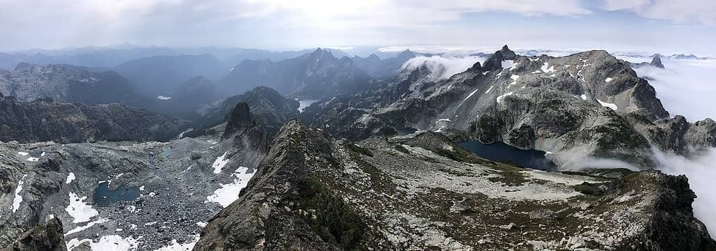 lemah 1 pano 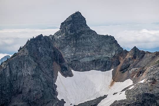 chikamin summiteers 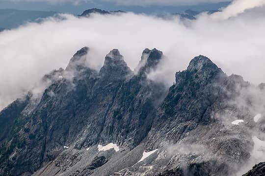 4 bros in the mist 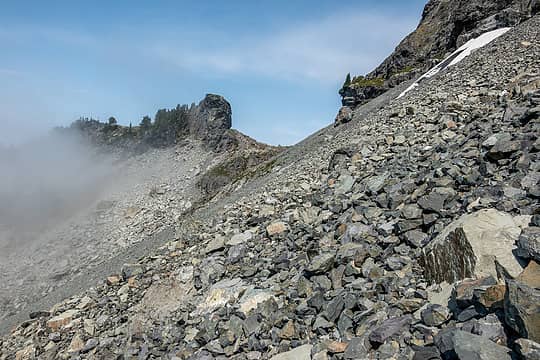 notch to grebeci, brief moment of visibility 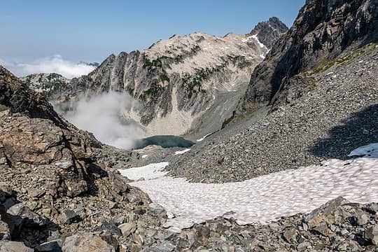 grebeci 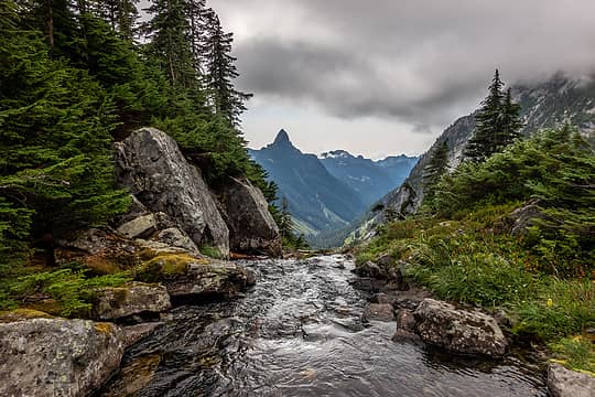 thomson 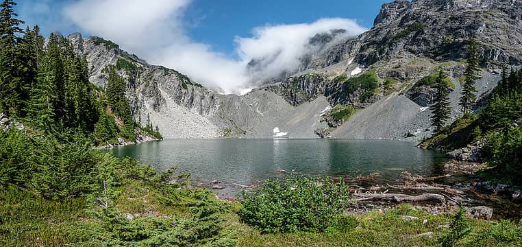 clearing  It cleared (again) as we climbed up to the tarny bench above the lake, but it was dusk by the time we arrived so views were minimal. We camped in a dry tarn. 11 hr day. It cleared (again) as we climbed up to the tarny bench above the lake, but it was dusk by the time we arrived so views were minimal. We camped in a dry tarn. 11 hr day.
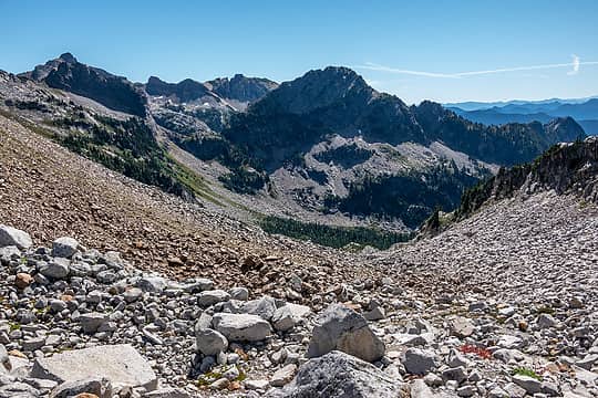
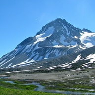
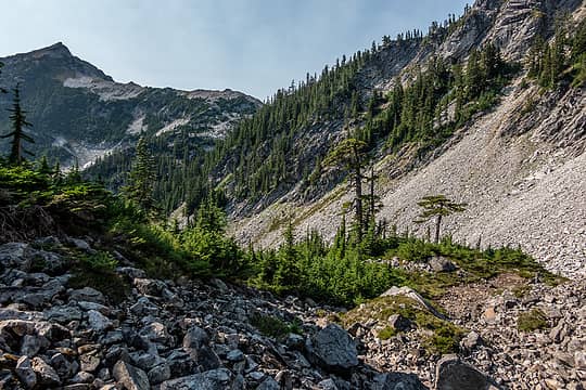 more talus 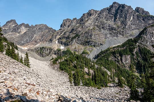 looking back, lemah + chimney rock 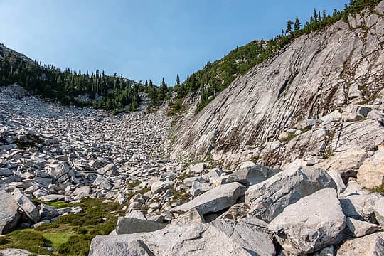 missed a turn here 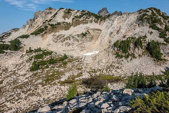 on top of 5781' 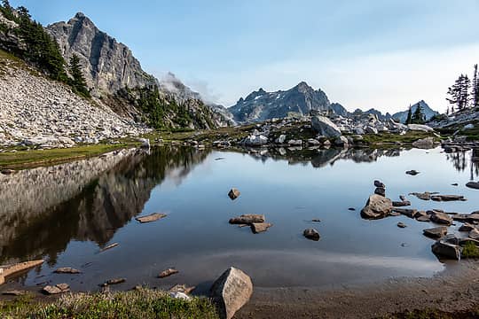 bench tarn 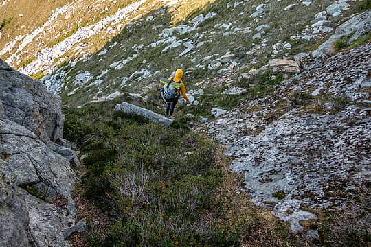 through a break in the ridge 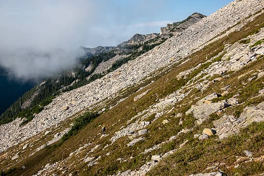 more steep talus ahead 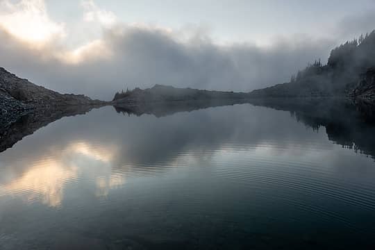 taocrevo 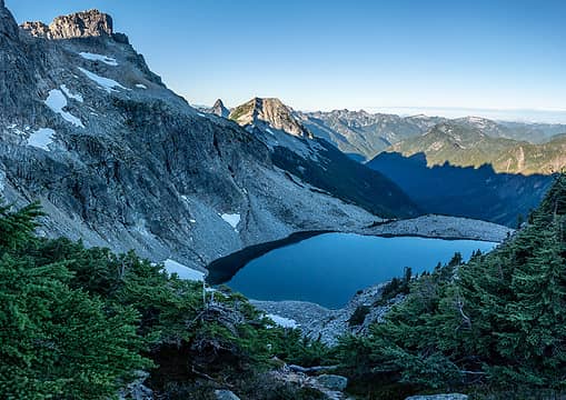 taocrevo from tarn bench 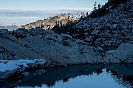 big snow 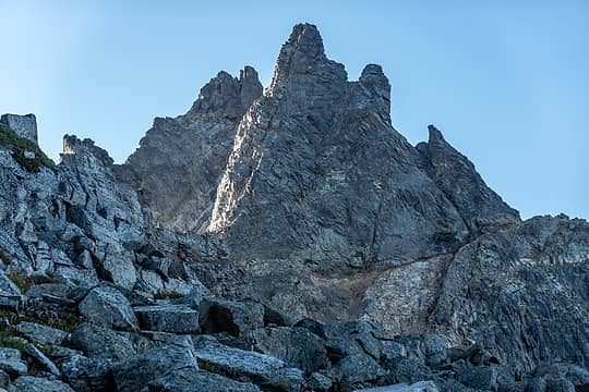 chimney rock + overcoat 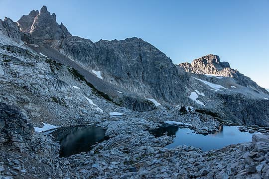 leaving the bench 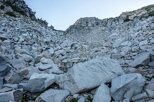 yet another talus slope 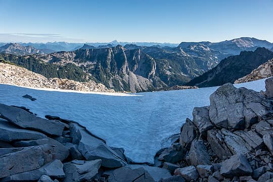 crossing over the saddle 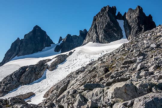 approaching overcoat glacier 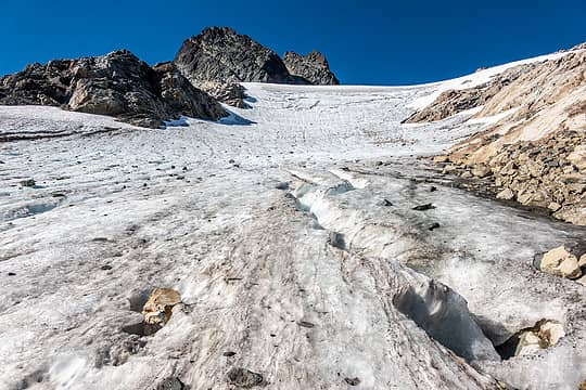 overcoat glacier 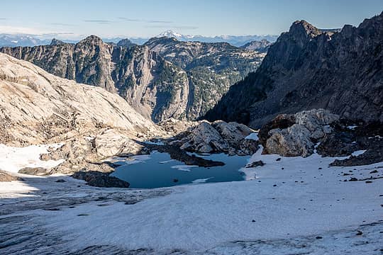 overcoat glacier terminal lake 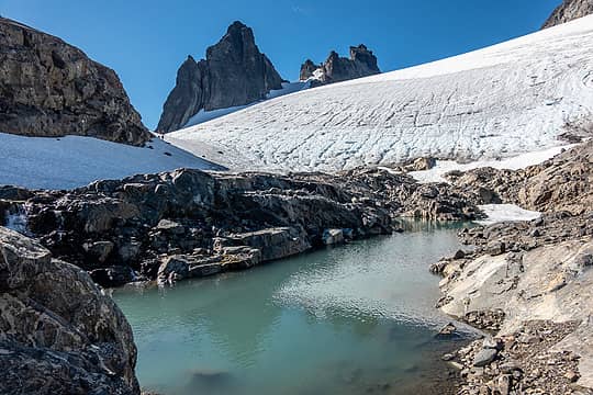 overcoat tarn 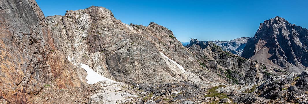 "crux traverse" to obvious ledge left and above summit chief pass 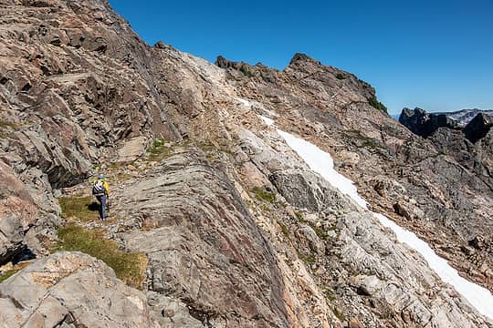 traversing (better route is below us here) 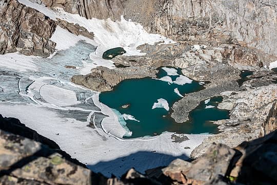 looking over the ridge to overcoat glacier terminal lake  mossy interlude 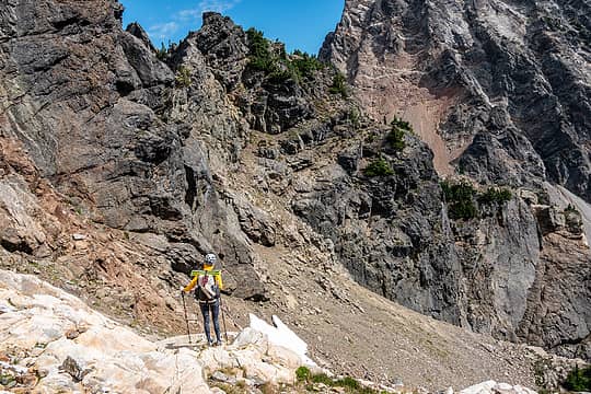 still traversing 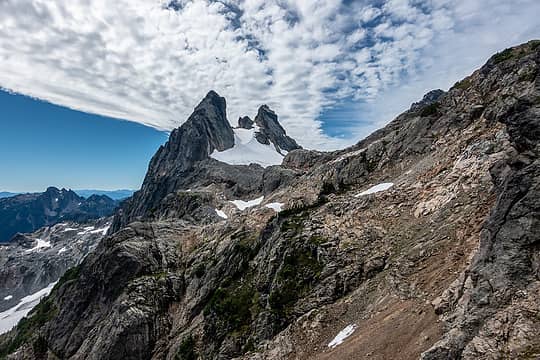 for real. 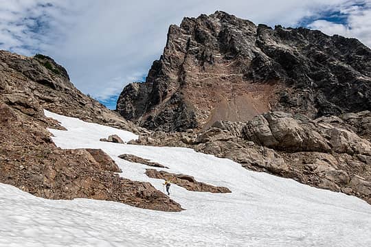 almost to summit chief pass 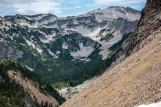 view across the middle fork valley at summit chief pass 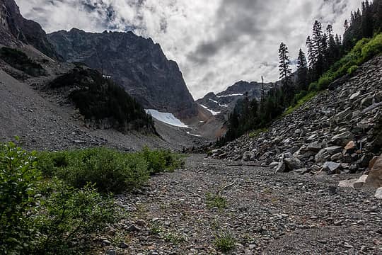 valley of the chief 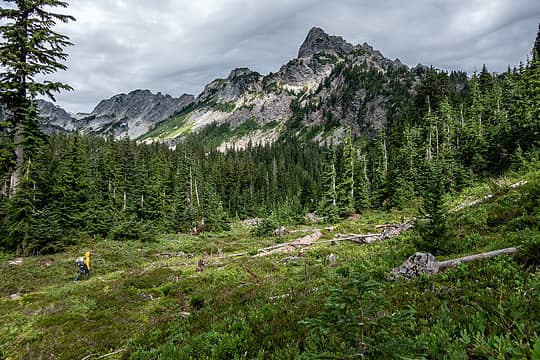 almost to the trail 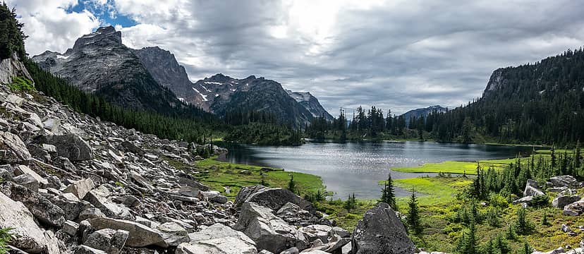 williams 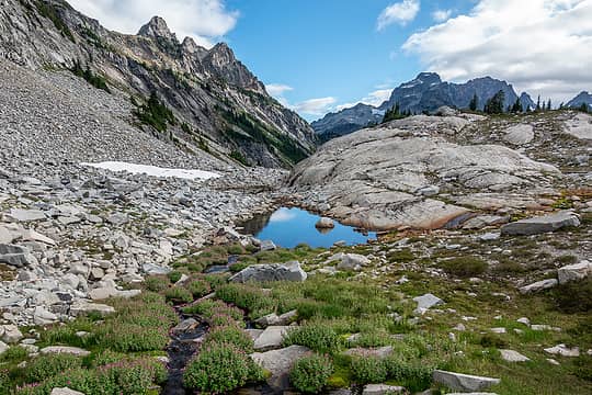 chain lakes 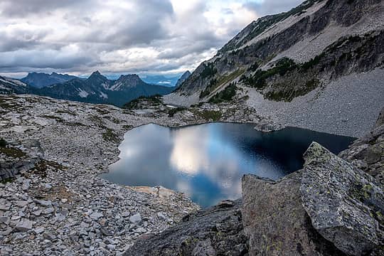 la bohn 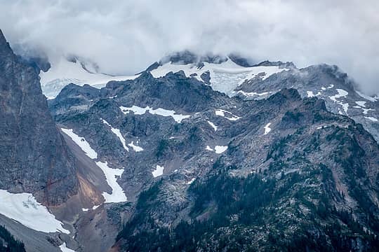 long snow finger is the route down from summit chief pass 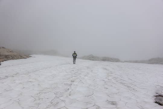 typical visibility on hinman 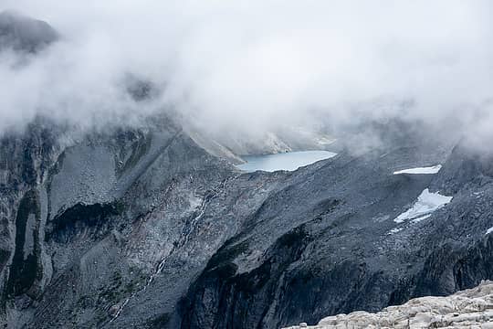 psl 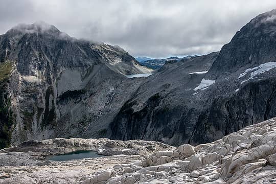 descending to daniel-hinman saddle 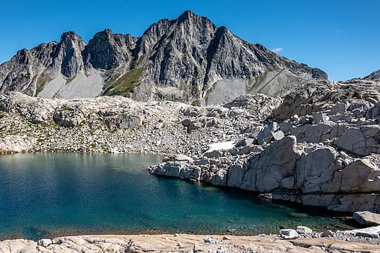 dip top 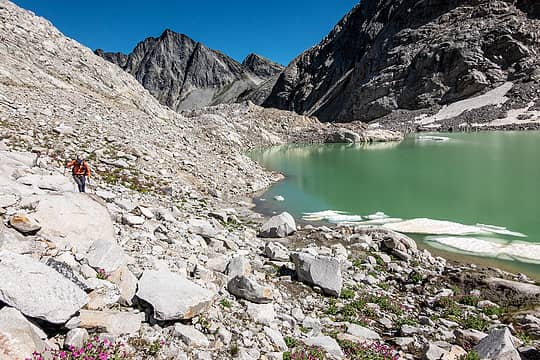 rounding a new psl en route to the saddle 
 more talus ahead, shocking 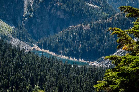 shovel 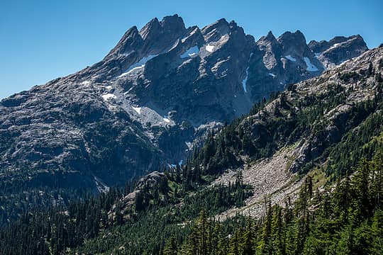 bears breast 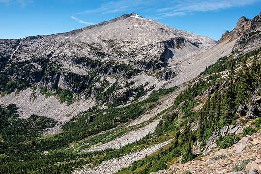 hinman and our route 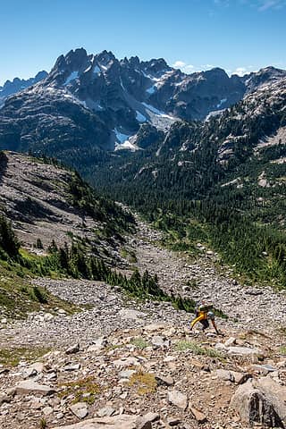 taking the hard way up to saddle w of venus 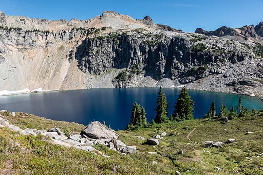 i love venus  spade and where we came from 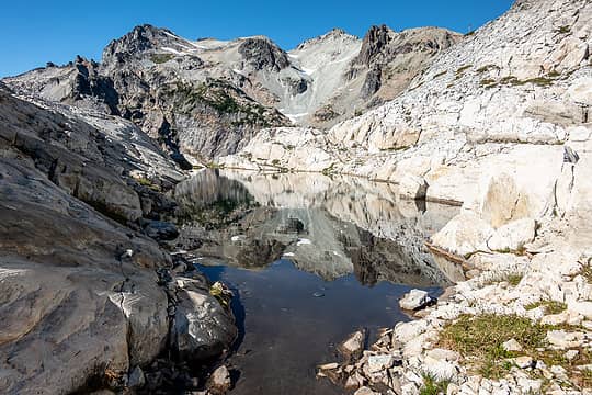 the best tarn 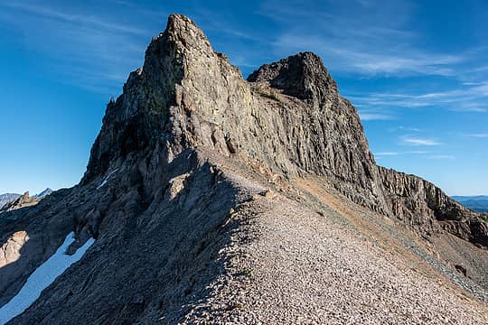 citadel from the pass 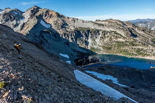 starting the descent to circle 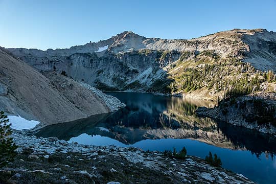 circle
 ALW Hiker, abkoch3, Kenji, neek, Now I Fly, Tom, Prosit, raising3hikers, fffej50, Gimpilator, Bowregard, Kascadia, Carbonj, GeoTom, jaysway, contour5, Bramble_Scramble, Slim, philfort, Gabep, meck, RichP, Waterman, hikerbiker, reststep, puzzlr, Lightning_bug, mosey ALW Hiker, abkoch3, Kenji, neek, Now I Fly, Tom, Prosit, raising3hikers, fffej50, Gimpilator, Bowregard, Kascadia, Carbonj, GeoTom, jaysway, contour5, Bramble_Scramble, Slim, philfort, Gabep, meck, RichP, Waterman, hikerbiker, reststep, puzzlr, Lightning_bug, mosey  Alden Ryno, GaliWalker, zimmertr, fourteen410 Alden Ryno, GaliWalker, zimmertr, fourteen410  geyer, awilsondc geyer, awilsondc
ALW Hiker, abkoch3, Kenji, neek, Now I Fly, Tom, Prosit, raising3hikers, fffej50, Gimpilator, Bowregard, Kascadia, Carbonj, GeoTom, jaysway, contour5, Bramble_Scramble, Slim, philfort, Gabep, meck, RichP, Waterman, hikerbiker, reststep, puzzlr, Lightning_bug, mosey Alden Ryno, GaliWalker, zimmertr, fourteen410 geyer, awilsondc |
| Back to top |
  
|
|
awilsondc
Member

Joined: 03 Apr 2016
Posts: 1324 | TRs | Pics
|
rubywrangler |
| Back to top |
|
|
HitTheTrail
Member

Joined: 30 Oct 2007
Posts: 5462 | TRs | Pics
Location: 509 |
Roly Poly rubywrangler |
| Back to top |
|
|
zephyr
aka friendly hiker

Joined: 21 Jun 2009
Posts: 3370 | TRs | Pics
Location: West Seattle |
|
zephyr
aka friendly hiker
|
 Fri Sep 09, 2022 11:06 am |
|
|
| rubywrangler wrote: | lemah 1 pano |
So many stunning photos. I love seeing this wall of peaks holding back the marine layer. How exciting it must have been to experience this and more. ~z
zimmertr rubywrangler
zimmertr rubywrangler |
| Back to top |
|
|
rubywrangler
Member
Joined: 04 Aug 2015
Posts: 511 | TRs | Pics
|
| HitTheTrail wrote: | | Why would anyone fight the crowds in the Enchantments? |
Agreed!
| Zephyr wrote: | | How exciting it must have been to experience this |
It was! I'm a fair-weather hiker so in all my trips in the cascades and olympics, I've only been above a marine layer a handful of times. It is so cool!
Forgot to say a big thanks to Tom, dayhike mike and Kyle for putting these routes out there for the rest of us to riff on 
awilsondc
awilsondc |
| Back to top |
|
|
GaliWalker
Have camera will use

Joined: 10 Dec 2007
Posts: 4931 | TRs | Pics
Location: Pittsburgh |
|
GaliWalker
Have camera will use
|
Fri Sep 09, 2022 2:12 pm |
|
|
Your photos are great and have nice exposure control. e.g. I was particularly impressed with your second photo: mine (from the same spot) has a totally blown out sky (although I think you 'lucked out' with the smoky sky).
|
| Back to top |
|
|
RichP
Member

Joined: 13 Jul 2006
Posts: 5634 | TRs | Pics
Location: here |
|
RichP
Member
|
Fri Sep 09, 2022 4:07 pm |
|
|
Gorgeous traverse. 
rubywrangler
rubywrangler |
| Back to top |
|
|
rubywrangler
Member
Joined: 04 Aug 2015
Posts: 511 | TRs | Pics
|
| GaliWalker wrote: | | I think you 'lucked out' with the smoky sky |
Thanks, Gali. Yes mostly luck on the second photo. I also took the same shot 6 years ago (sans smoke). Should have waited for the cloud shadows to move off the lake!
awilsondc
awilsondc |
| Back to top |
|
|
puzzlr
Mid Fork Rocks

Joined: 13 Feb 2007
Posts: 7220 | TRs | Pics
Location: Stuck in the middle |
|
puzzlr
Mid Fork Rocks
|
Sat Sep 10, 2022 1:43 am |
|
|
|
| Back to top |
|
|
Now I Fly
Member
Joined: 07 Jun 2018
Posts: 472 | TRs | Pics
|
What a fantastic trip! Well done!
I have two questions,
Are "Grebeci" and "Iceburg" the same lake? Looks that way to me.
Also, is there any chance you spotted any wildlife you thought may have been a wolverine. I'm confident I saw one above Chikamin Lake, and maybe near Iceburg too.
Thanks again for a great report!
rubywrangler
rubywrangler |
| Back to top |
|
|
GaliWalker
Have camera will use
Joined: 10 Dec 2007
Posts: 4931 | TRs | Pics
Location: Pittsburgh |
|
GaliWalker
Have camera will use
|
Sat Sep 10, 2022 9:58 am |
|
|
| Now I Fly wrote: | | Are "Grebeci" and "Iceburg" the same lake? Looks that way to me. |
It's like they are mirror images of each other.
'Gali'Walker => 'Mountain-pass' walker
bobbi: "...don't you ever forget your camera!"
Photography: flickr.com/photos/shahiddurrani
Now I Fly, RichP  rubywrangler rubywrangler
'Gali'Walker => 'Mountain-pass' walker
bobbi: "...don't you ever forget your camera!"
Photography: flickr.com/photos/shahiddurrani
Now I Fly, RichP rubywrangler
|
| Back to top |
|
|
Now I Fly
Member
Joined: 07 Jun 2018
Posts: 472 | TRs | Pics
|
I'm such a dork! 
Slim
Slim |
| Back to top |
|
|
rubywrangler
Member
Joined: 04 Aug 2015
Posts: 511 | TRs | Pics
|
Monty, thanks for sharing your photos - beautiful! I'm sorry to have missed that view from Burntboot and will definitely go earlier in the season next time. All that talus must certainly be a lot quicker and less tedious when it's filled in.
Now I Fly, no interesting wildlife sightings unfortunately.
|
| Back to top |
|
|
BeardoMcGrath
Member
Joined: 16 Jan 2018
Posts: 143 | TRs | Pics
Location: Snohomish |
Great trip! I intended to stay at Chikamin Lake 2 nights over the long weekend and dayhike over to Grebeci. But when I got to the outcropping I went down and got pulled into a gully that was too steep and loose for my liking, so I bailed and went up the W summit of Chikamin instead. So maybe staying high is best.
You were at Chikamin Lake at the right time; there were 4 other parties there Sat night of the long weekend!
|
| Back to top |
|
|
Justus S.
Member

Joined: 17 Nov 2004
Posts: 1298 | TRs | Pics
Location: WA |
Beautiful tour through the ALW. Thanks 
|
| Back to top |
|
|
|
|
You cannot post new topics in this forum
You cannot reply to topics in this forum
You cannot edit your posts in this forum
You cannot delete your posts in this forum
You cannot vote in polls in this forum
|
Disclosure: As an Amazon Associate NWHikers.net earns from qualifying purchases when you use our link(s). |


