| Previous :: Next Topic |
| Author |
Message |
Get Out and Go
Member


Joined: 13 Nov 2004
Posts: 2129 | TRs | Pics
Location: Leavenworth |
Did our annual early season hike up 4th of July Trail to the top of Icicle Ridge and down on the Ridge Trail to the second vehicle. Snow conditions were not optimal as we endured sporadic postholing until we had descended enough. The late snow we had this year never really adhered to the old snow and we heard all kinds of weird noises underneath as we loosened up the mess. After a few ups and downs we came to the Power Creek Basin. This time instead of dropping into the basin and up and out the other side we stayed high on the ridge circling around offering some awesome views down fire ravaged gullies into the Icicle Valley. We soon intersected the trail and the true knee-banging descent began in earnest. Even though we were out of snow, the trail itself is hard to follow in the silver forest aftermath of the '94 fire with lots of deadfall across the route. Fortunately, we knew where we were going: down, down, down. We found beautiful peach Lewisia flowers growing out of the rocks, between 3 and 4 miles from the trail's end. Finally, the car, after 10 hours, 15 miles and over 5000 ft of elevation gain with the ups and downs on the ridge trail. This is a stark area with little use, even with its proximity to Leavenworth.
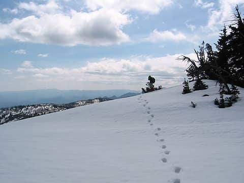 Top of Icicle Ridge 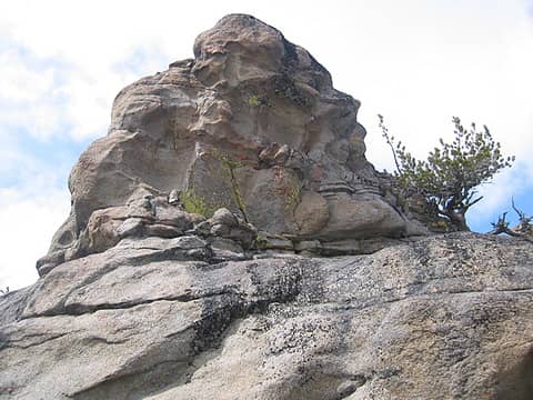 Lichen-covered rock
"These are the places you will find me hiding'...These are the places I will always go."
(Down in the Valley by The Head and The Heart)
"Sometimes you're happy. Sometimes you cry.
Half of me is ocean. Half of me is sky."
(Thanks, Tom Petty)
"These are the places you will find me hiding'...These are the places I will always go."
(Down in the Valley by The Head and The Heart)
"Sometimes you're happy. Sometimes you cry.
Half of me is ocean. Half of me is sky."
(Thanks, Tom Petty)
|
| Back to top |
  
|
|
wildernessed
viewbagger

Joined: 31 Oct 2004
Posts: 9275 | TRs | Pics
Location: Wenatchee |
Wheres the snow level on 4th of July begin and what was the approx. average depth up and along Icicle Ridge. Thanks.
wildernessed
Living in the Anthropocene
Living in the Anthropocene
|
| Back to top |
|
|
Get Out and Go
Member
Joined: 13 Nov 2004
Posts: 2129 | TRs | Pics
Location: Leavenworth |
There is absolutely no snow on the south slope 4th of July Trail until the last quarter mile before attaining the 6800 foot ridge. Once on top there are bare patches, tree wells that show 8 feet of snow, as well as mounds of snow that the winter winds played havoc with, leaving easily 10- 15 feet of snow!!! We usually like to hit this trail late May or June when the snow is consolidated, making for easy gliding. This time we only experienced maybe a half-hour of not-fun postholing. After that it was easy to pick out a route that avoided deep snow.
"These are the places you will find me hiding'...These are the places I will always go."
(Down in the Valley by The Head and The Heart)
"Sometimes you're happy. Sometimes you cry.
Half of me is ocean. Half of me is sky."
(Thanks, Tom Petty)
"These are the places you will find me hiding'...These are the places I will always go."
(Down in the Valley by The Head and The Heart)
"Sometimes you're happy. Sometimes you cry.
Half of me is ocean. Half of me is sky."
(Thanks, Tom Petty)
|
| Back to top |
|
|
|
|
You cannot post new topics in this forum
You cannot reply to topics in this forum
You cannot edit your posts in this forum
You cannot delete your posts in this forum
You cannot vote in polls in this forum
|
Disclosure: As an Amazon Associate NWHikers.net earns from qualifying purchases when you use our link(s). |


