| Previous :: Next Topic |
| Author |
Message |
Eric Gilbertson
Member


Joined: 04 Jul 2018
Posts: 188 | TRs | Pics
Location: Seattle |
He Devil She Devil Peak Survey
Sept 16, 2023
Summary of Results: She Devil is true summit, 3.1 in taller than He Devil.
She Devil 9385.89ft +/-0.098ft, He Devil 9385.63ft +/-0.098ft (NGVD29 datum, same as quad uses, 95% confidence interval errors)
He Devil and She Devil are two 9000ft peaks in Western Idaho near the Oregon and Washington borders. They are well known because whichever is higher is an ultraprominent peak, with over 5,000ft of prominence, but until now it was not known for sure which is higher. They are almost exactly the same height. There are 57 Ultras in the contiguous United States, and until now this was the only one I'd heard of whose true summit location was not known with certainty. Whichever peak He Devil or She Devil is higher, even by an inch, is the true summit of the massif and is the Ultra. The shorter of the two is then not an Ultra.
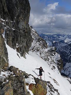
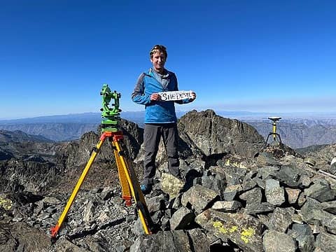 On the summit of She Devil looking towards He Devil (photo by Mike) 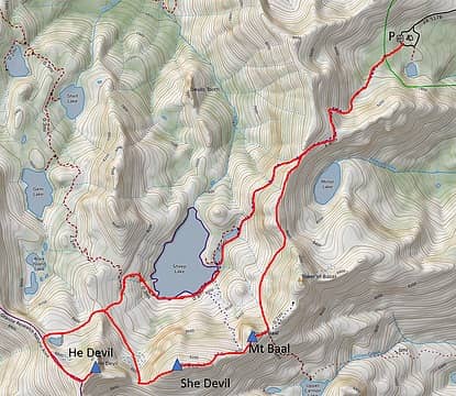 The route 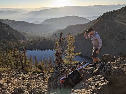 Hiking above Mirror Lake 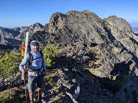 Hiking from Mt Baal towards She Devil 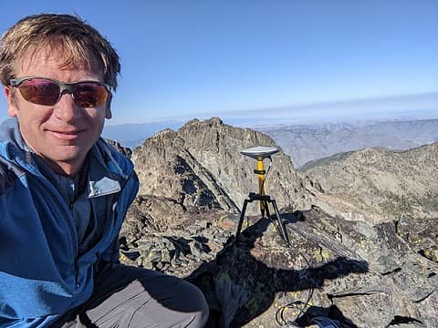 The differential GPS unit mounted on She Devil 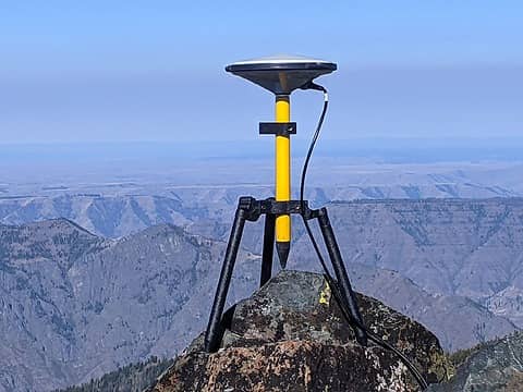 Differential GPS on She Devil 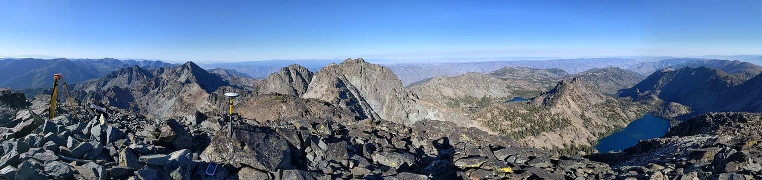 Panorama from She Devil 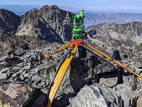 Theodolite on the summit 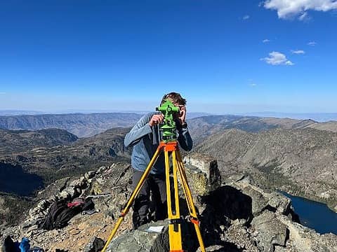 Taking theodolite measurements from He Devil (photo by Mike) 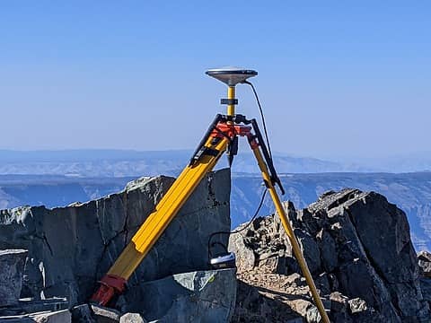 The GPS on He Devil  On He Devil 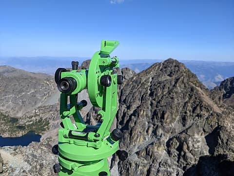 Looking across to She Devil  On He Devil 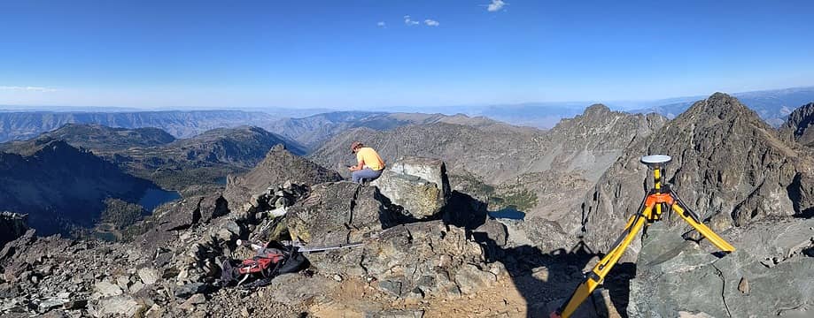 Summit panorama 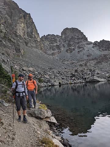 Hiking back around Sheep Lake 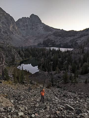 Hiking out 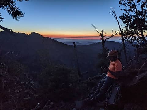 Sunset hiking out
 Michael Lewis, geyer, Nancyann, Seventy2002, zimmertr, jaysway, pjhorst, Josh Journey, Now I Fly, jstern, John Mac, Scramblin Rover, IanB, rstoddard24, awilsondc Michael Lewis, geyer, Nancyann, Seventy2002, zimmertr, jaysway, pjhorst, Josh Journey, Now I Fly, jstern, John Mac, Scramblin Rover, IanB, rstoddard24, awilsondc  RichP RichP
Michael Lewis, geyer, Nancyann, Seventy2002, zimmertr, jaysway, pjhorst, Josh Journey, Now I Fly, jstern, John Mac, Scramblin Rover, IanB, rstoddard24, awilsondc RichP |
| Back to top |
  
|
|
RichP
Member

Joined: 13 Jul 2006
Posts: 5634 | TRs | Pics
Location: here |
|
RichP
Member
|
 Thu Oct 26, 2023 5:53 am |
|
|
Well, that settles that. Thanks for another great survey. He Devil is still a fine peak even though folks won't feel the same pressure to climb it as before with the "just in case' removed.
|
| Back to top |
|
|
Josh Journey
a.k.a Josh Lewis
Joined: 01 Nov 2007
Posts: 4836 | TRs | Pics
|
Glad I did both. Amazing how close they are in height. Normally it's safe to use integers, but maybe you've seen enough less than a foot scenarios. Dare I say the Devil is in the details.
Eric Gilbertson  geyer geyer
Eric Gilbertson geyer |
| Back to top |
|
|
jaysway
Member

Joined: 16 Jul 2020
Posts: 348 | TRs | Pics
|
|
jaysway
Member
|
Thu Oct 26, 2023 8:54 am |
|
|
Great survey as always. I love the views of Hells Canyon and the Wallowas from these peaks.
|
| Back to top |
|
|
Gimpilator
infinity/21M

Joined: 12 Oct 2006
Posts: 1684 | TRs | Pics
Location: Edmonds, WA |
She's got an extra 3 inches?  This is one I've wondered about for many years. Thanks for finding the answer. Glad we did both.
|
| Back to top |
|
|
|
|
You cannot post new topics in this forum
You cannot reply to topics in this forum
You cannot edit your posts in this forum
You cannot delete your posts in this forum
You cannot vote in polls in this forum
|
Disclosure: As an Amazon Associate NWHikers.net earns from qualifying purchases when you use our link(s). |


