mbravenboer
Member


Joined: 20 Oct 2013
Posts: 1422 | TRs | Pics
Location: Seattle |
October 21st, I was trying to figure out what the top of the cloud deck would be in the forecast for the next day, but with little clarity on that I hesitantly headed to Mt Rainier to hike up Spray Park from the Carbon River road. During the drive, I ran into some presumably drunk people in the middle of the night with an all-terrain vehicle doing donuts, but otherwise it was very quiet at the Carbon River.
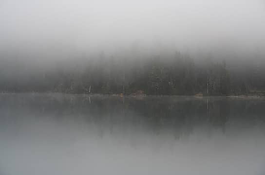
I started hiking at 3:45am thinking that maybe I could hit the sunrise at Tolmie Peak, but I was a little too slow and later it turned out the peak was in the clouds anyway. I hit Mowich Lake a little past sunrise and met a person there who camped in the relative solitude. Later I saw a person going up the Flett Glacier but somehow we never met. No idea where the person went.
Spray Falls was pretty cool. Spray Park was quiet and this is where I finally broke through the clouds. Bears appeared to be asleep already. I headed up towards Observation Rock. Flett Glacier was pretty icy, but low angle and I managed to avoid the steeper part by going over a rock island in the middle. This is quickly splitting the glacier into just a few remnants. Though it appears mostly dead, there are definitely still some crevasses that could cause trouble, but this late in the season it was all easy to see and avoid.
I wanted to see the larger glaciers up close, so I continued up to the highest point that is easily accessible on the Ptarmigan Ridge. There was a big established campsite there. The views of North Mowich Glacier and the waterfalls were pretty stunning. I had only a day though, so I had to go back down. It was a loooong walk out back, completing the loop via the Carbon River suspension bridge. The trail down to the Carbon River from Spray Park is quite a bit worse than the trail to Ipsut Pass.
Seeing all the damage along the Carbon River was pretty interesting. The river really does whatever it wants.
GPS is a little unreliable in the deep valleys, but I think it was about 35-40 miles, and around 7000-8000ft gain.
All photos: https://www.flickr.com/photos/bravenboer/albums/72177720312392871
 Mowich Lake 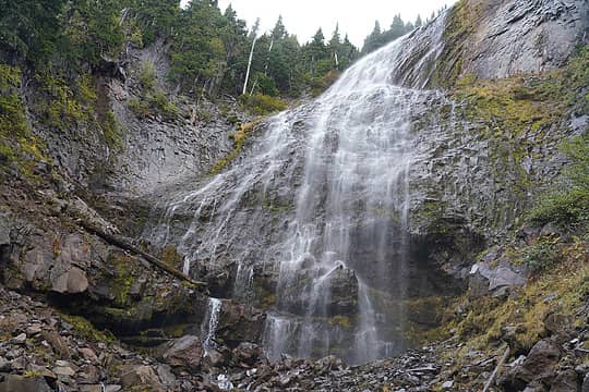 Spray Falls 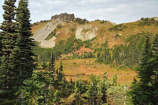 Hessong Rock 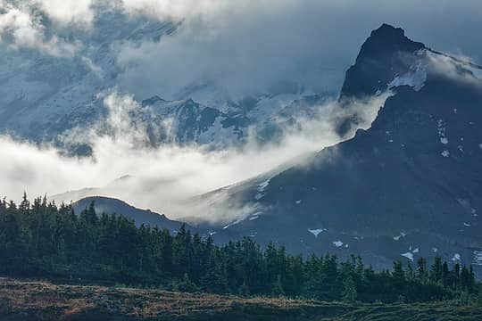 Moody Observation Rock from Spray Park 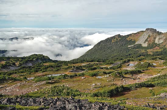 Spray Park above the clouds 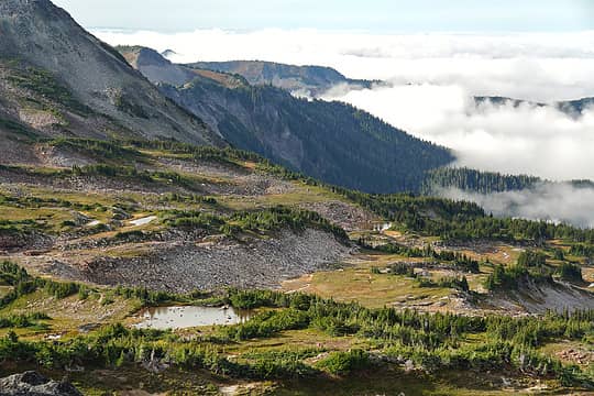 Spray Park above the clouds 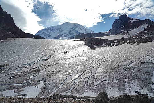 Flett Glacier 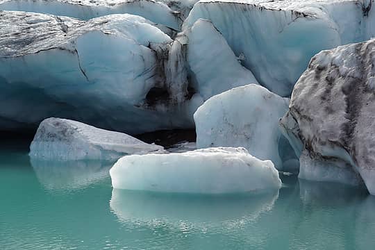 Flett Glacier 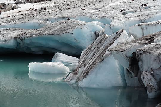 Flett Glacier  Echo Rock and Flett Glacier 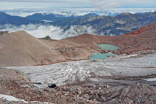 Flett Glacier Terminus 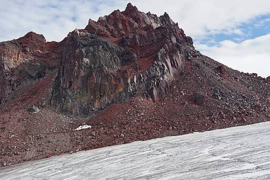 Echo Rock 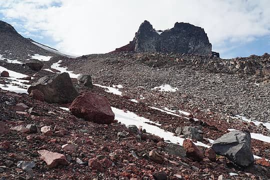 Approaching Observation Rock 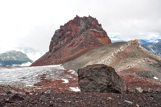 Echo Rock 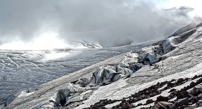 Russell Glacier 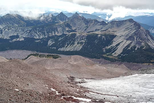 Russell Glacier, Carbon Glacier, Moraine Park 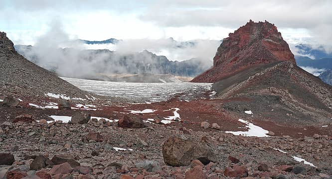 Echo Rock 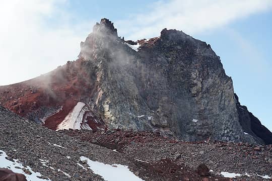 Observation Rock 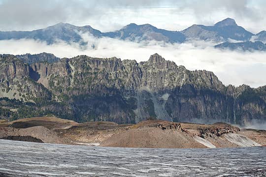 Morther Mountain 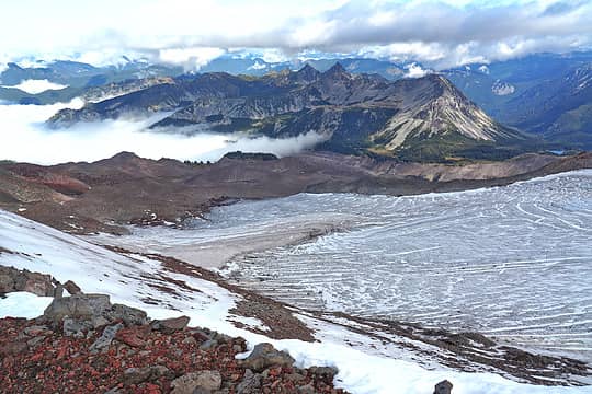 Russell Glacier and Moraine Park 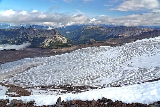 Russell Glacier and views for the Northern Loop 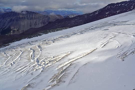 Russell Glacier 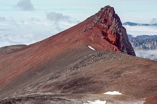 Observation Rock 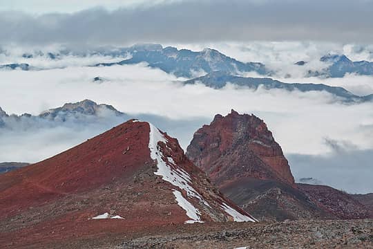 Echo Rock 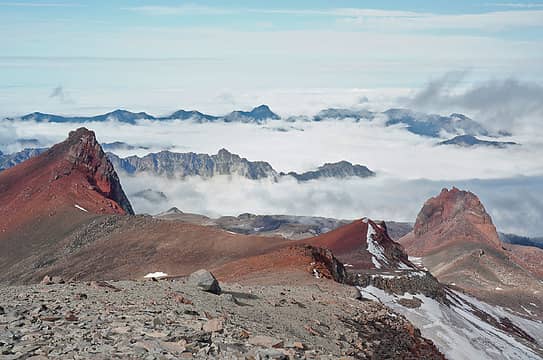 Observation and Echo Rock 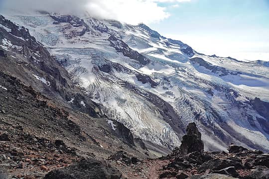 North Mowich Glacier 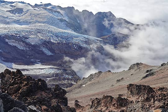 North Mowich Glacier 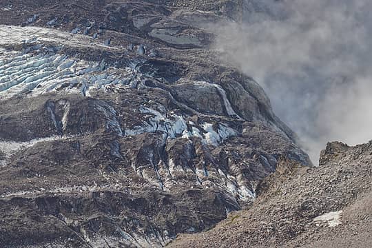 North Mowich Glacier 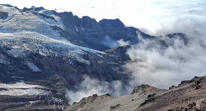 North Mowich Glacier 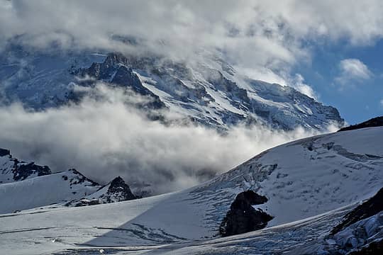 Mt Rainier from Ptarmigan Ridge 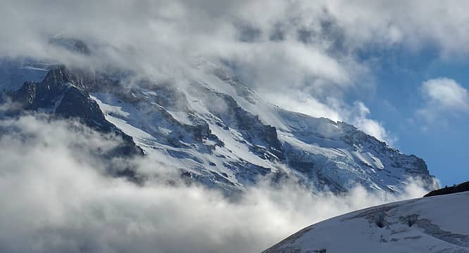 Mt Rainier from Ptarmigan Ridge 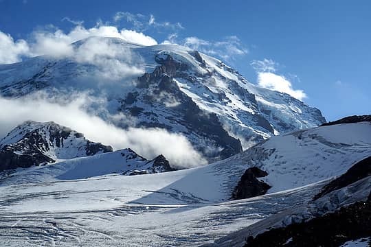 Mt Rainier from Ptarmigan Ridge 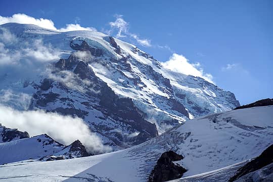 Mt Rainier from Ptarmigan Ridge 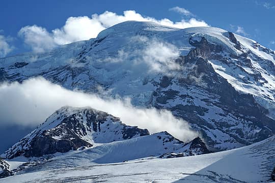 Mt Rainier from Ptarmigan Ridge  Upper Carbon River crossing 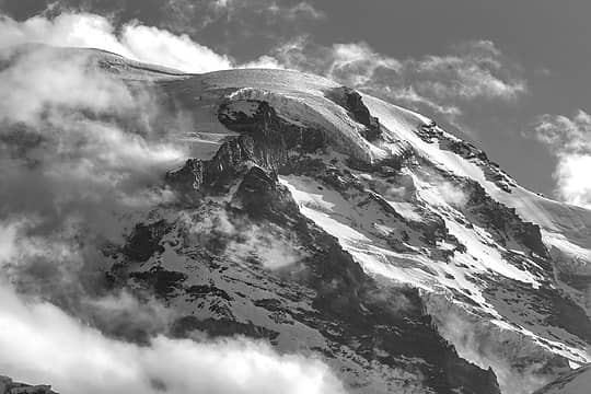 Mt Rainier from Ptarmigan Ridge 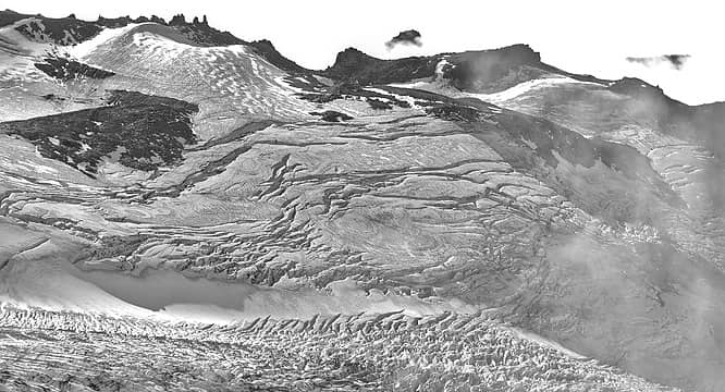 North Mowich Glacier
 Slugman, Popcorn, day_hike_mike, RAW-dad, John Mac, Nancyann, Route Loser, jaysway, Dustin R, geyer, Tom, Now I Fly, MangyMarmot, williswall, Kascadia, zimmertr, jstern Slugman, Popcorn, day_hike_mike, RAW-dad, John Mac, Nancyann, Route Loser, jaysway, Dustin R, geyer, Tom, Now I Fly, MangyMarmot, williswall, Kascadia, zimmertr, jstern  silence, awilsondc, RichP silence, awilsondc, RichP
Slugman, Popcorn, day_hike_mike, RAW-dad, John Mac, Nancyann, Route Loser, jaysway, Dustin R, geyer, Tom, Now I Fly, MangyMarmot, williswall, Kascadia, zimmertr, jstern silence, awilsondc, RichP |


