| Previous :: Next Topic |
| Author |
Message |
rubywrangler
Member


Joined: 04 Aug 2015
Posts: 511 | TRs | Pics
|
The first weekend I was in Bishop it was too cold for backpacking so I did a dayhike to Cloudripper (13,525) and Vagabond (13,374) peaks via Green lake, from the South lake trailhead. I had read that Cloudripper has great views and had considered climbing it from Chocolate lakes a couple years ago, but was scared off by the long class 4 gully on that side. The Green lake route is mostly a walk-up with some easy scrambling near the summit. The temperature barely got above freezing all day but it wasn't THAT painful as long as I stayed in the sun, except for a very windy section of the route above Green lake. I took the pipeline shortcut from the trailhead which literally means you walk on an old cast iron pipe for about a mile before joining up with the trail. After passing golden meadows and Brown lake and Green lake, the trail climbs up to a huge plateau and then drops down the other side into the Big Pine lakes drainage. I left the trail near its highest point and climbed up the ridge and over Vagabond to Cloudripper. On the way I accidentally disturbed a cute little burrowing owl, the highlight of my day.  Cloudripper does have excellent views as advertised! It was calm and sunny on top so I stayed for awhile. Eventually my hands started to get cold so I went back over Vagabond and then dropped straight down a steep, sandy talus slope to a swampy meadow south of Green lake, trying to avoid the wind. I have a pretty strong internal furnace but by now my descent route was in shade and it was steep enough that I couldn't move fast enough to stay warm, it was kind of miserable. Probably should have stuck with the normal route which was still in the sun. My hydration hose froze and cracked, first time ever! I was chilled to the bone by the time I got back to the car and was very happy to be staying in town instead of camping that night. Took the longest hot shower I've had in awhile! Cloudripper does have excellent views as advertised! It was calm and sunny on top so I stayed for awhile. Eventually my hands started to get cold so I went back over Vagabond and then dropped straight down a steep, sandy talus slope to a swampy meadow south of Green lake, trying to avoid the wind. I have a pretty strong internal furnace but by now my descent route was in shade and it was steep enough that I couldn't move fast enough to stay warm, it was kind of miserable. Probably should have stuck with the normal route which was still in the sun. My hydration hose froze and cracked, first time ever! I was chilled to the bone by the time I got back to the car and was very happy to be staying in town instead of camping that night. Took the longest hot shower I've had in awhile!
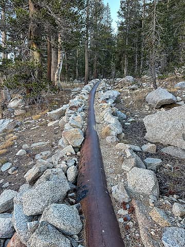 pipeline 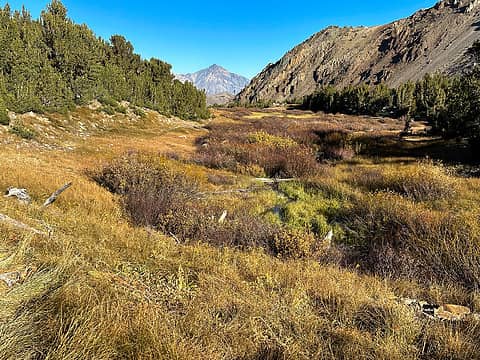 autumn meadow color 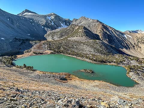 green lake 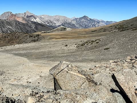 huge plateau 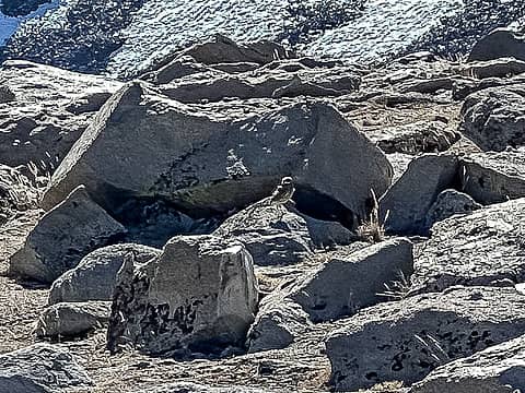 burrowing owl 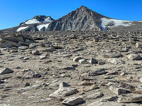 vagabond and cloudripper 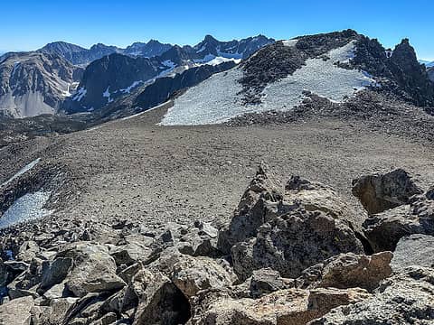 cloudripper from vagabond 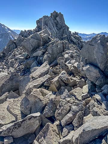 cloudripper summit 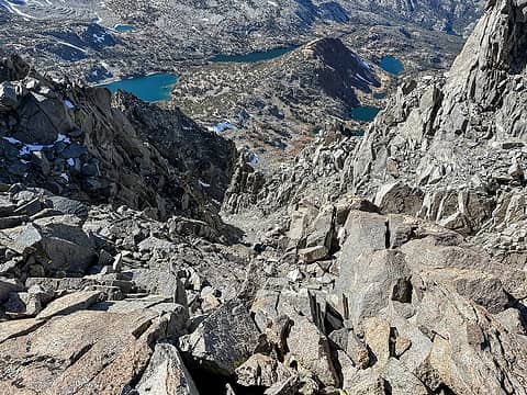 maybe the class 4 gully? 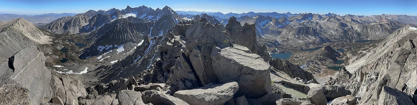 summit pano 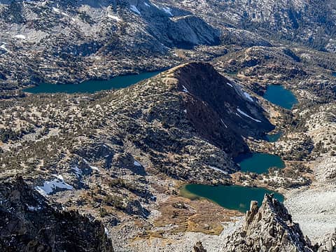 chocolate peak environs  Luckily one of the other options started right up the road, because I was already getting a late start due to morning meetings that ran long.
It was almost 1pm when I left my car at the Hilton lakes trailhead and headed up the road about a mile to Mosquito Flat. I love the way these roads fling you into the alpine. Views are great even before you leave the parking lot. After ~1/2 mile the trail splits; I took the right fork up to Mono pass. The weather was gloriously warm and sunny and this trail has really spectacular views all the way to the pass: Little lakes valley, the surrounding peaks, Ruby lake. Mono pass itself is very big and barren. It took longer than expected to get across and it was super windy and cold. I passed a couple more lakes on the descent and then took the side trail to Fourth Recess lake, where I camped. Another super pretty spot, although it was already in shadow when I arrived. I figured the temperature would drop quickly after sunset so I suited up in my stay-puff marshmallow man costume (puffy jacket, pants, booties), ate dinner, and snuggled in for a long night of reading and sleeping. The forecasted lows were mid-30s, but I don't know if the temp ever got below 45 on the whole trip. I woke up sweaty and had to de-puffy both nights! And friday morning was warm enough for shorts Luckily one of the other options started right up the road, because I was already getting a late start due to morning meetings that ran long.
It was almost 1pm when I left my car at the Hilton lakes trailhead and headed up the road about a mile to Mosquito Flat. I love the way these roads fling you into the alpine. Views are great even before you leave the parking lot. After ~1/2 mile the trail splits; I took the right fork up to Mono pass. The weather was gloriously warm and sunny and this trail has really spectacular views all the way to the pass: Little lakes valley, the surrounding peaks, Ruby lake. Mono pass itself is very big and barren. It took longer than expected to get across and it was super windy and cold. I passed a couple more lakes on the descent and then took the side trail to Fourth Recess lake, where I camped. Another super pretty spot, although it was already in shadow when I arrived. I figured the temperature would drop quickly after sunset so I suited up in my stay-puff marshmallow man costume (puffy jacket, pants, booties), ate dinner, and snuggled in for a long night of reading and sleeping. The forecasted lows were mid-30s, but I don't know if the temp ever got below 45 on the whole trip. I woke up sweaty and had to de-puffy both nights! And friday morning was warm enough for shorts
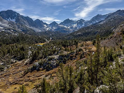 little lakes valley 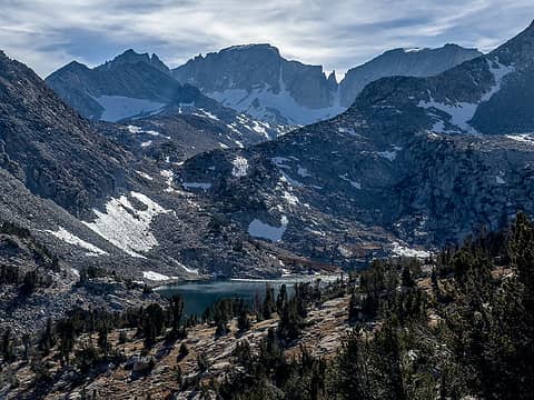 ruby lake 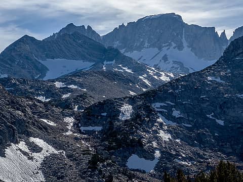 stripes 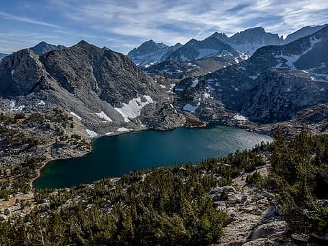 ruby lake 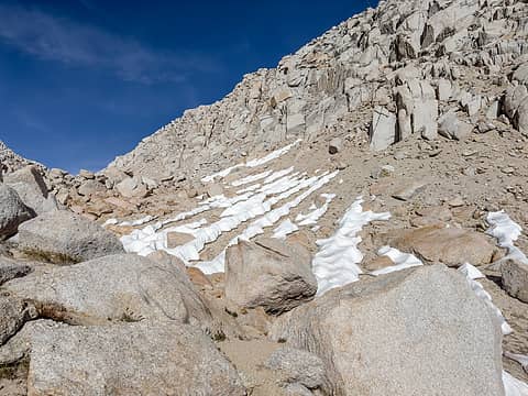 mono pass area 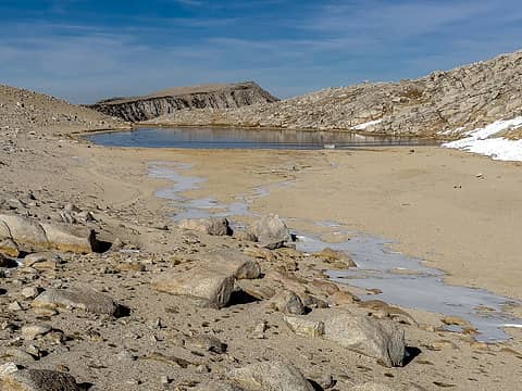 summit lake 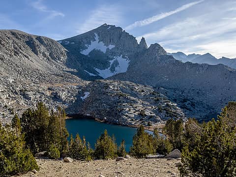 one of the trail lakes 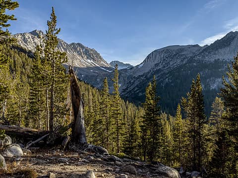 4th recess 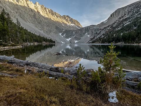 4th recess lake 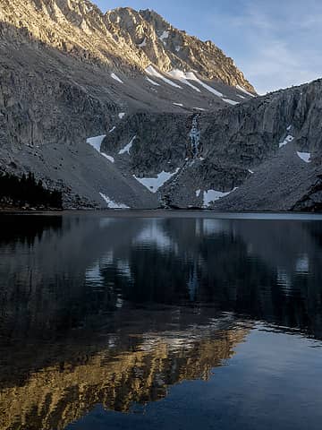 4th recess lake 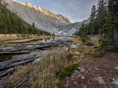 4th recess lake 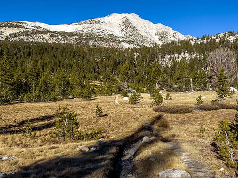 approaching pioneer basin 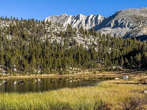 approaching pioneer basin 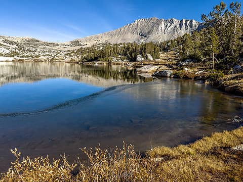 pioneer basin 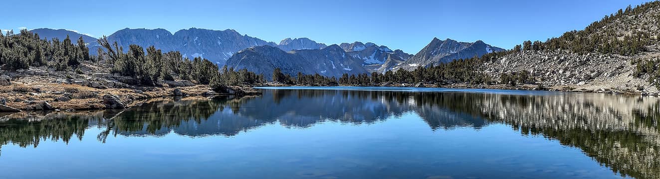 pioneer basin 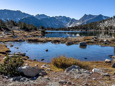 pioneer basin 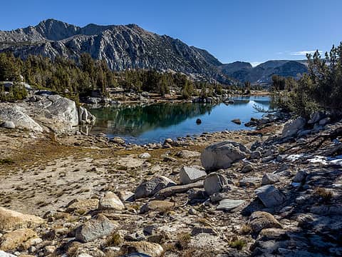 pioneer basin 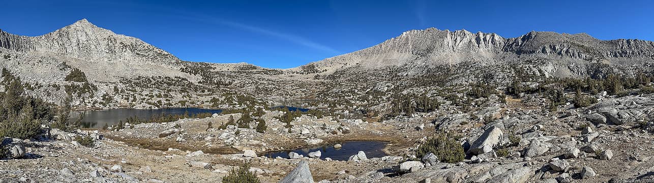 pioneer basin 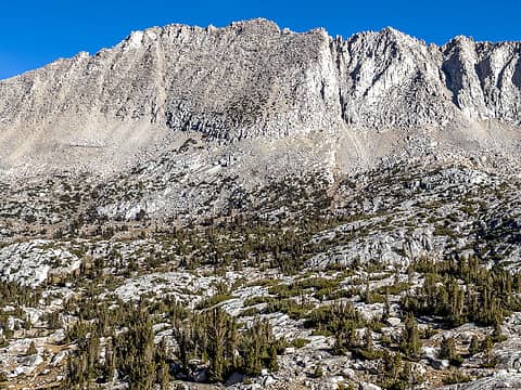 mt stanford 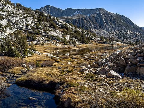 pioneer basin 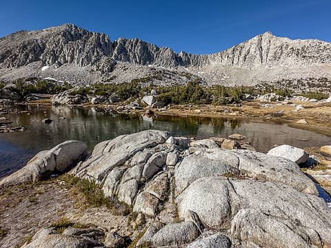 pioneer basin 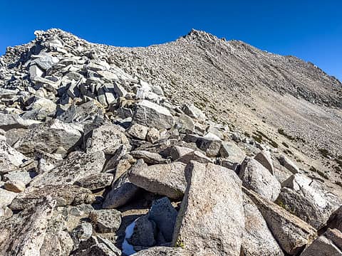 west ridge 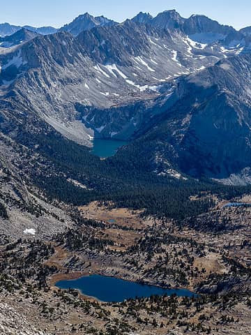 4th recess 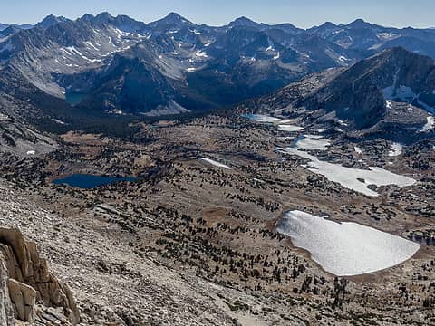 pioneer basin 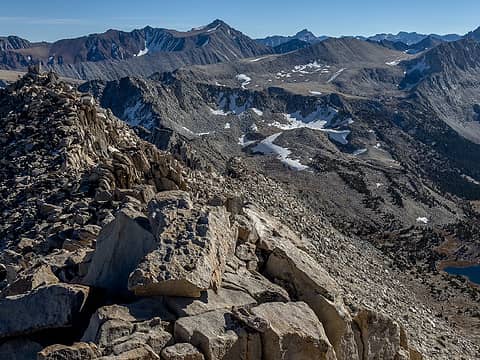 toward mono pass 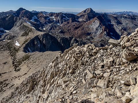 back down the west ridge 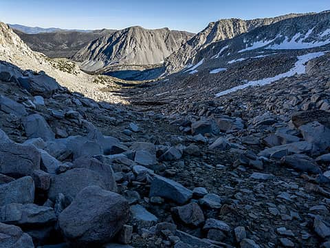 descent route 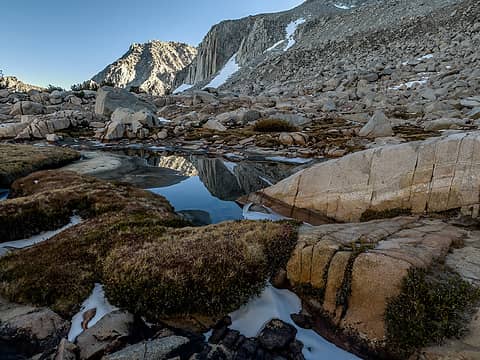 tarn 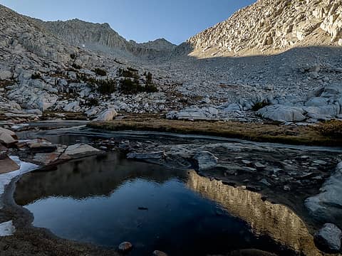 tarn 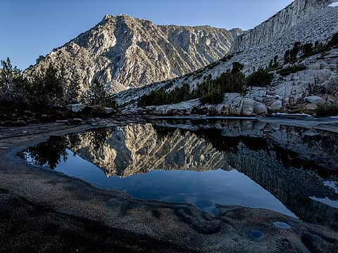 tarn 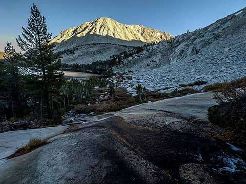 lake 10353 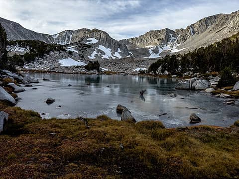 lk 10720 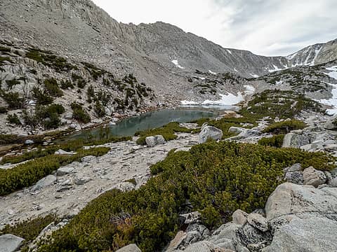 lk 10800+ 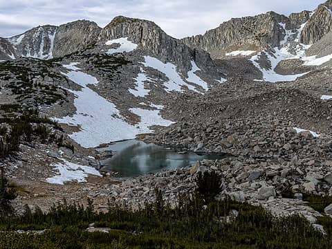 lk 10800 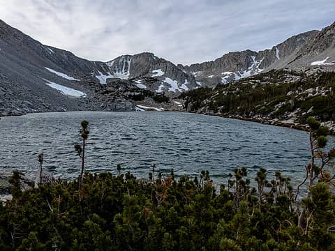 lk 10650
 neek, Eric Gilbertson, shelby147, contour5, IanB, Prosit, RAW-dad, RichP, raising3hikers, NWtrax, HitTheTrail, zimmertr, olderthanIusedtobe, jstern, John Mac, Waterman, Kascadia, Sculpin, JimK neek, Eric Gilbertson, shelby147, contour5, IanB, Prosit, RAW-dad, RichP, raising3hikers, NWtrax, HitTheTrail, zimmertr, olderthanIusedtobe, jstern, John Mac, Waterman, Kascadia, Sculpin, JimK  Gimpilator, awilsondc, Now I Fly, silence Gimpilator, awilsondc, Now I Fly, silence  geyer geyer
neek, Eric Gilbertson, shelby147, contour5, IanB, Prosit, RAW-dad, RichP, raising3hikers, NWtrax, HitTheTrail, zimmertr, olderthanIusedtobe, jstern, John Mac, Waterman, Kascadia, Sculpin, JimK Gimpilator, awilsondc, Now I Fly, silence geyer |
| Back to top |
  
|
|
olderthanIusedtobe
Member

Joined: 05 Sep 2011
Posts: 7722 | TRs | Pics
Location: Shoreline |
Wandering around the Sierras never gets old. 
rubywrangler
rubywrangler |
| Back to top |
|
|
Bargainhunter
Member
Joined: 28 Sep 2021
Posts: 44 | TRs | Pics
|
Gorgeous photos of some very cool areas. The East Side cold is no joke. "Denali level temps" at times isn't much of an exaggeration. When Galen Rowell did his winter route on Lone Pine Peak it was minus 10F overnight (the coldest I recorded during my trip on Denali was ~ -25F). Sounds like you were prepared for it. Hiking this time of year avoids some of the crowds otherwise at Bishop Pass, etc. and the other popular trailheads. For a chilly winter walkup, try White Mountain. Brrrrr.... Still, fall hikes on the Sierra East Side beat the summer Sierra heat which can be unrelenting (I'm looking at you Mt. Tom). Your pano shot of the Palisades was so crisp! I need to get back down there!
rubywrangler
rubywrangler |
| Back to top |
|
|
Stefan
Member

Joined: 17 Dec 2001
Posts: 5093 | TRs | Pics
|
|
Stefan
Member
|
 Fri Nov 17, 2023 2:45 pm |
|
|
You definitely motivate me to return to the Sierras!
Art is an adventure.
rubywrangler
Art is an adventure.
rubywrangler
|
| Back to top |
|
|
Matt
Tea, Earl Grey, Hot

Joined: 30 Jan 2007
Posts: 4308 | TRs | Pics
Location: Shoreline |
|
Matt
Tea, Earl Grey, Hot
|
Sun Nov 19, 2023 1:35 pm |
|
|
| Stefan wrote: | | You definitely motivate me to return to the Sierras! |
Me too.
As beacons mountains burned at evening. J.R.R. Tolkien
As beacons mountains burned at evening. J.R.R. Tolkien
|
| Back to top |
|
|
|
|
You cannot post new topics in this forum
You cannot reply to topics in this forum
You cannot edit your posts in this forum
You cannot delete your posts in this forum
You cannot vote in polls in this forum
|
Disclosure: As an Amazon Associate NWHikers.net earns from qualifying purchases when you use our link(s). |


