| Previous :: Next Topic |
| Author |
Message |
rubywrangler
Member


Joined: 04 Aug 2015
Posts: 511 | TRs | Pics
|
This is such a cool place. I hiked most of the trails on my last trip, so this visit was mainly off-trail adventures. And it is a little nerve-racking to wander off the beaten path solo in this neighborhood! But I had no issues. A smart person would be sure to have their passport so they could drive 5 minutes south to Mexico and get tacos. Unfortunately I had to send mine in for renewal recently so no tacos for me.  Peak 4180 & Peak 4220 - 2.3.24
10 mi, ~3000'
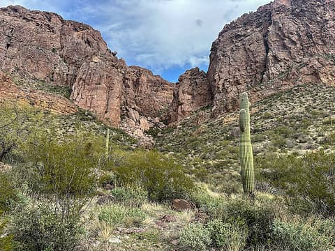
This is a very fun and very scenic loop out of Alamo Canyon campground with side trips to two peaks in the Ajo Range. An excellent and detailed description of the route with lots of geology info is posted on Debra Van Winegarden's Earthline blog.
Summary: follow the Alamo canyon trail to the corral. Turn left and stroll/hop up the gravel/boulders/solid rock of the north fork. After the canyon makes a hard turn to the east, hike NNW up a side drainage to a small saddle east of Peak 4180. About halfway up the side drainage the terrain becomes mostly solid rock and gets really fun. From the saddle, hike west to a broad plateau south of the summit, then north to the summit on a fun ridge. Retrace your steps to the saddle, descend to Grass Pass, and hike northeast up a steep slope to cross a yellow breccia plateau. Scramble ~20' to the summit ridge of 4220. Descend to Grass canyon by crossing a gap at ~3600' in the ridge that runs north from Grass Pass, or go back to Grass Pass and descend from there. Enjoy ~30 minutes of fun scrambling descent, then a short walk to exit the canyon to the bajada. Turn south and walk a couple miles through open desert and across many washes back to the campground.
The only unpleasant section of the route was from the 3600' gap to Grass Canyon - loose rock and overgrown vegetation. I also made a slight routefinding error trying to make a loop down from Peak 4220 and ended up having to do some Spiderman-type shenaningans across a little cliff band instead of traversing below it like I intended. Otherwise navigation was straightforward. I wasn't exactly sure where to leave Grass Canyon but I randomly picked an exit route that seemed not too brushy and it worked fine. The bajada is grassy and green now, but I bet it will be glorious when it blooms this year.
Just before leaving Grass Canyon, I passed by a big chuparosa bush about 25' long, occupied by a flock? family? charm of hummingbirds. I stopped to watch them, and then a few of them stopped to watch me, and then suddenly they swarmed and flew circles around me! It was so neat!!
There were two registers on Peak 4180 but one appeared to be burnt and crumbled to the touch. I couldn't open the other one. Both were last signed in 1998, but I found several cairns so the route seems to be used. No register on peak 4220. Many trash piles and hiding places around the summit though. I hadn't seen any obvious signs of migration on the route until I got to the 4220 summit ridge, though I heard strange noises after turning east in north fork Alamo canyon and nearly bailed. Sounded like rocks dropping, slowly, one at a time. Eventually I decided whatever it was was far enough away, but definitely freaked me out a bit.
Peak 4180 & Peak 4220 - 2.3.24
10 mi, ~3000'
This is a very fun and very scenic loop out of Alamo Canyon campground with side trips to two peaks in the Ajo Range. An excellent and detailed description of the route with lots of geology info is posted on Debra Van Winegarden's Earthline blog.
Summary: follow the Alamo canyon trail to the corral. Turn left and stroll/hop up the gravel/boulders/solid rock of the north fork. After the canyon makes a hard turn to the east, hike NNW up a side drainage to a small saddle east of Peak 4180. About halfway up the side drainage the terrain becomes mostly solid rock and gets really fun. From the saddle, hike west to a broad plateau south of the summit, then north to the summit on a fun ridge. Retrace your steps to the saddle, descend to Grass Pass, and hike northeast up a steep slope to cross a yellow breccia plateau. Scramble ~20' to the summit ridge of 4220. Descend to Grass canyon by crossing a gap at ~3600' in the ridge that runs north from Grass Pass, or go back to Grass Pass and descend from there. Enjoy ~30 minutes of fun scrambling descent, then a short walk to exit the canyon to the bajada. Turn south and walk a couple miles through open desert and across many washes back to the campground.
The only unpleasant section of the route was from the 3600' gap to Grass Canyon - loose rock and overgrown vegetation. I also made a slight routefinding error trying to make a loop down from Peak 4220 and ended up having to do some Spiderman-type shenaningans across a little cliff band instead of traversing below it like I intended. Otherwise navigation was straightforward. I wasn't exactly sure where to leave Grass Canyon but I randomly picked an exit route that seemed not too brushy and it worked fine. The bajada is grassy and green now, but I bet it will be glorious when it blooms this year.
Just before leaving Grass Canyon, I passed by a big chuparosa bush about 25' long, occupied by a flock? family? charm of hummingbirds. I stopped to watch them, and then a few of them stopped to watch me, and then suddenly they swarmed and flew circles around me! It was so neat!!
There were two registers on Peak 4180 but one appeared to be burnt and crumbled to the touch. I couldn't open the other one. Both were last signed in 1998, but I found several cairns so the route seems to be used. No register on peak 4220. Many trash piles and hiding places around the summit though. I hadn't seen any obvious signs of migration on the route until I got to the 4220 summit ridge, though I heard strange noises after turning east in north fork Alamo canyon and nearly bailed. Sounded like rocks dropping, slowly, one at a time. Eventually I decided whatever it was was far enough away, but definitely freaked me out a bit.
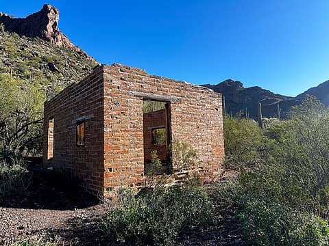 Alamo canyon ranch house 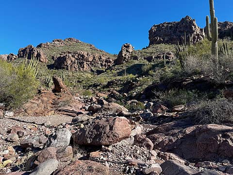 Starting up the north fork 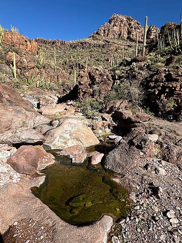 North fork alamo 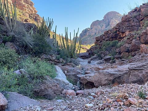 North fork alamo 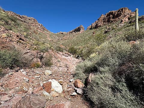 Starting up the side drainage, target saddle left of center 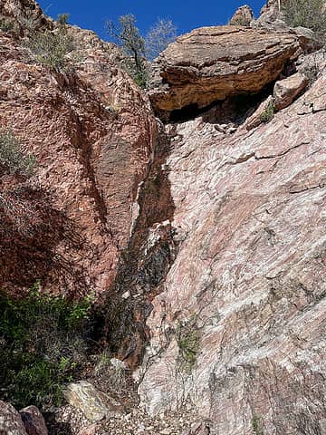 Fun scrambling 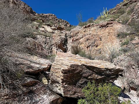 More fun scrambling 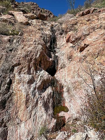 More fun scrambling 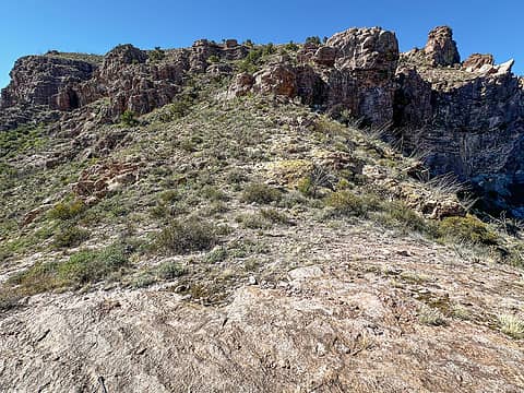 Looking west from the saddle. 4180 summit at far right 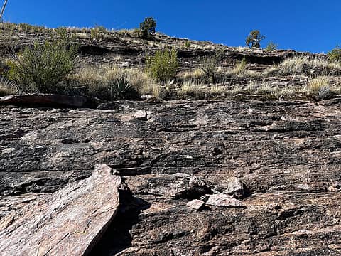 Easy peasy 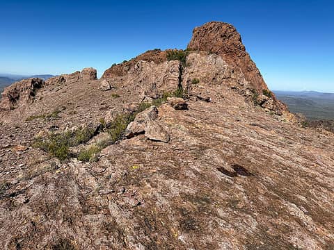 On the ridge (summit not really visible here) 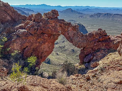 Arch en route 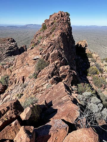 Summit ridge 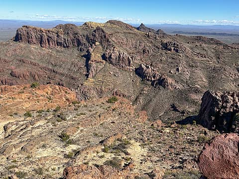 4220 from 4180 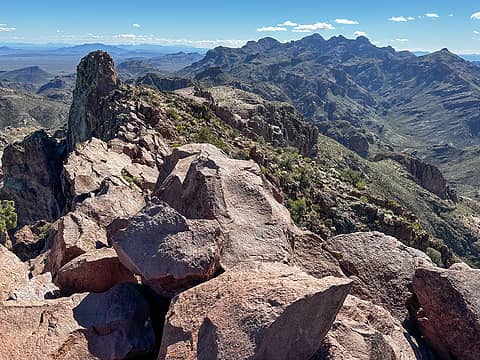 Looking back down the ridge 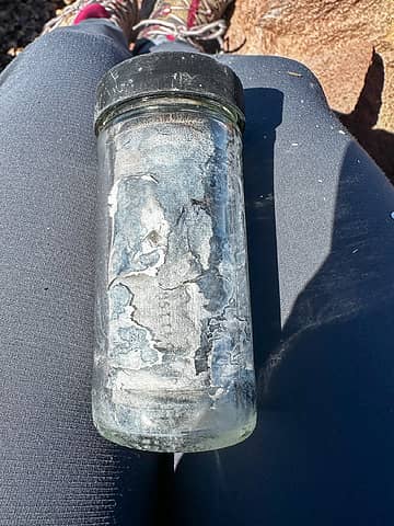 reg 1  reg 2 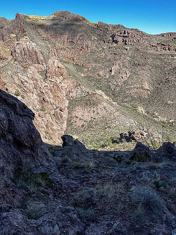 Descending to grass pass 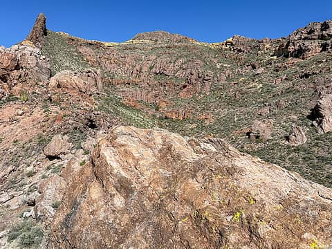 Route from pass to summit 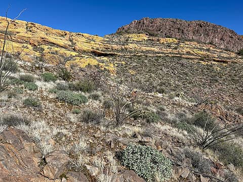 Approaching the yellow plateau 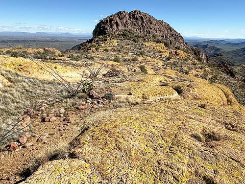 On the yellow plateau 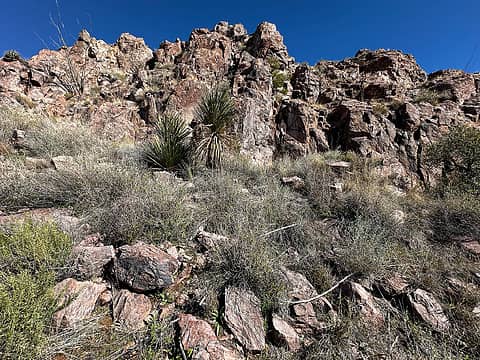 Final scramble 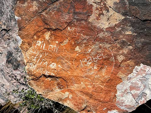 Summit graffiti 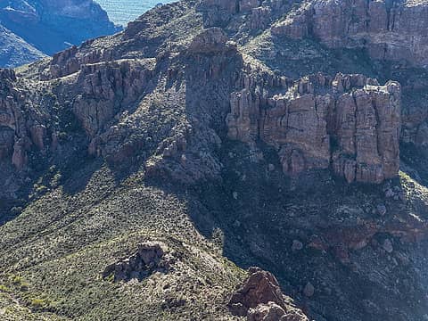 zoom of descent route from the saddle to grass pass, and cool pinnacles 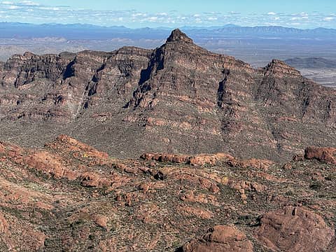 Montezuma's head 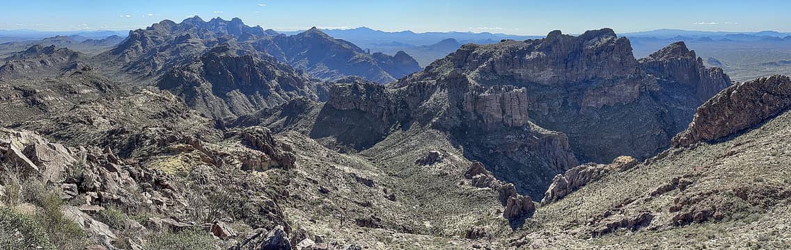 Southern highpoints of the Ajo range and 4180 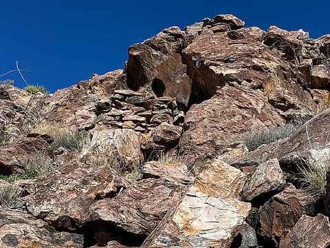 hidey hole below the summit 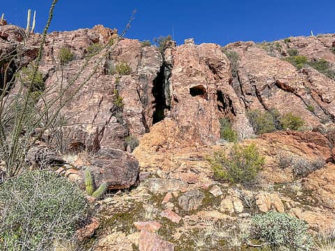 Spiderman cliffs 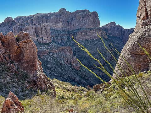 3600' gap 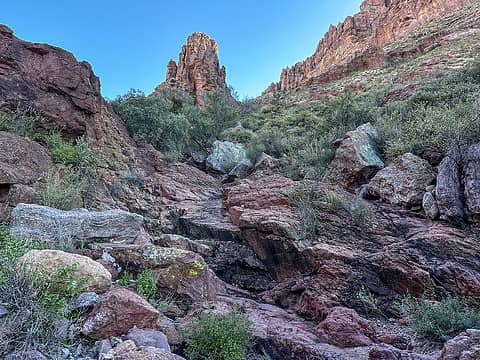 Looking up grass canyon 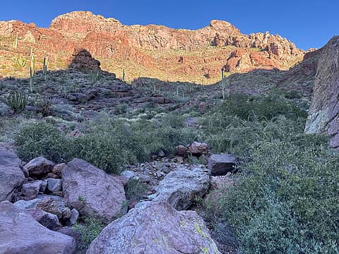 Grass canyon 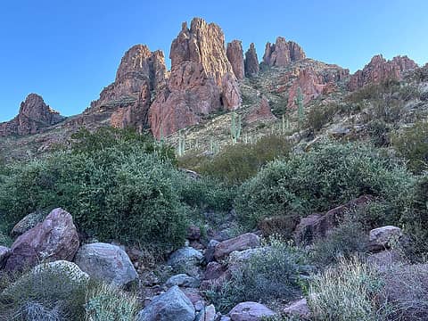 4180 from grass canyon 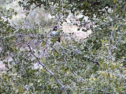 costa's 1 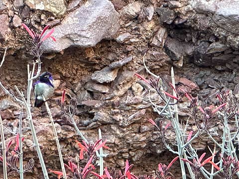 costa's 2 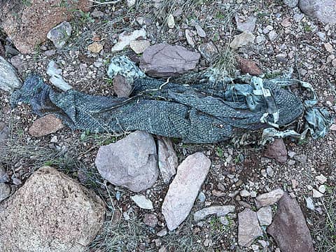 first of many pants, why?? 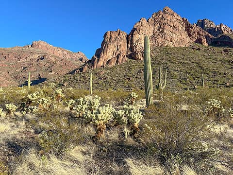 Looking back from the bajada 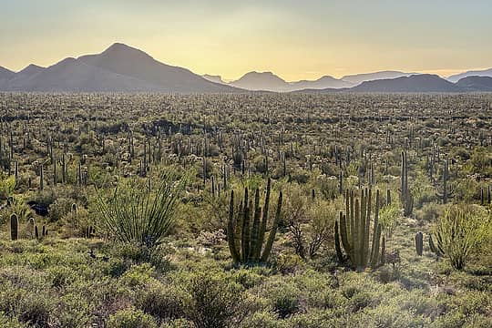 Very green desert 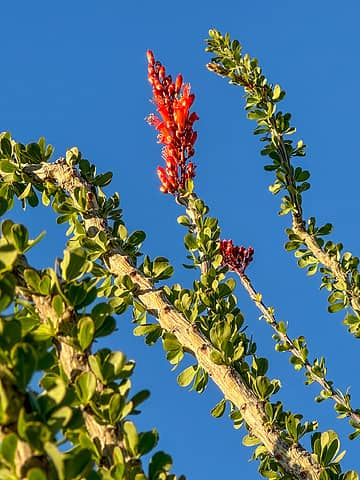 Blooming already! 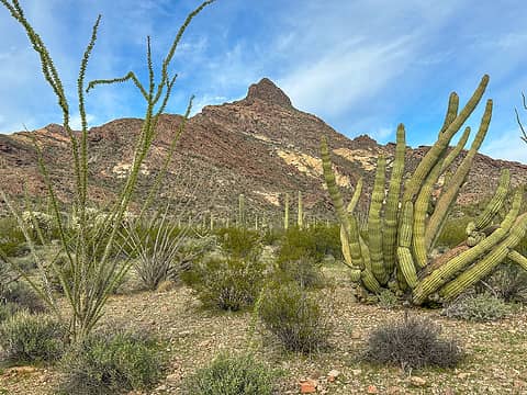 Approaching pinkley 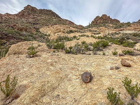 This is nice 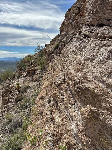 Ledges 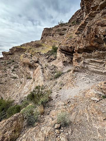 More ledges 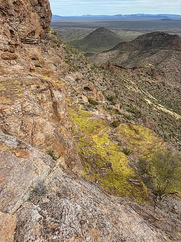 Looking back down the green ramp 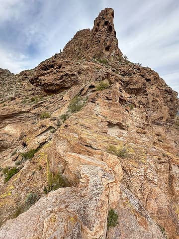 Up the southeast ridge a little ways 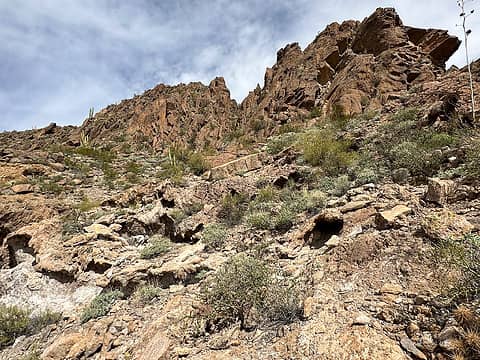 Summit block from south side 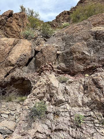 I scrambled up this weakness but also possible to traverse 2 min further and just walk uphill 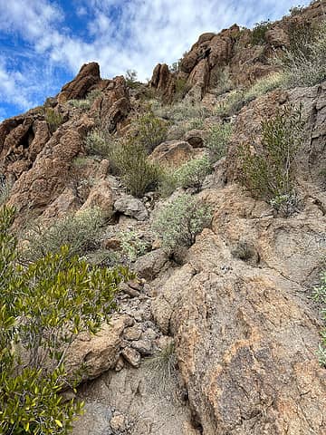 Near the summit ridge 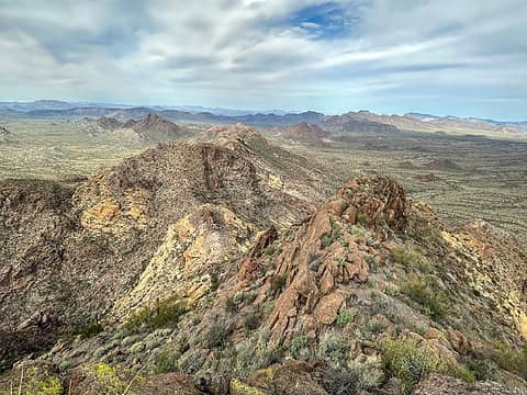 Summit views 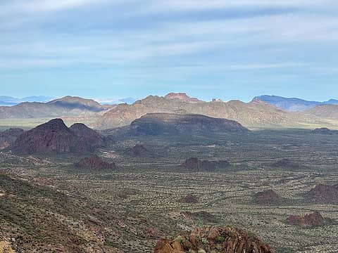 Summit views 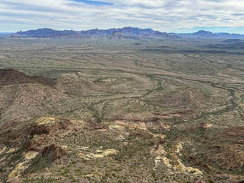 Summit views 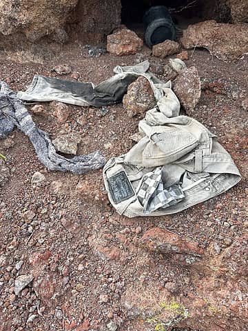 Summit trash 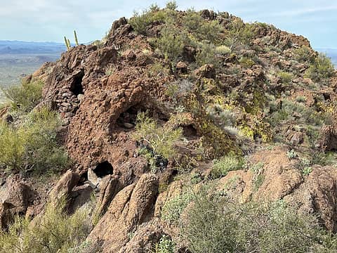 So many crevices, each filled with trash  However, the lower canyon is not difficult - just requires picking a route though huge boulders at the entrance. Then there is some fun scrambling on solid rock. It seems best to approach the canyon from the northwest to avoid the worst brush (I didn't). Don't skip the side trip to 3760' though. Both the north and south ends of the platform have excellent views. I descended the Arch trail but skipped the Arch since I'd been there before. The trail has a ridiculous number of cairns! However, the lower canyon is not difficult - just requires picking a route though huge boulders at the entrance. Then there is some fun scrambling on solid rock. It seems best to approach the canyon from the northwest to avoid the worst brush (I didn't). Don't skip the side trip to 3760' though. Both the north and south ends of the platform have excellent views. I descended the Arch trail but skipped the Arch since I'd been there before. The trail has a ridiculous number of cairns!
 Boulder canyon 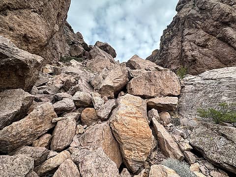 Fitting 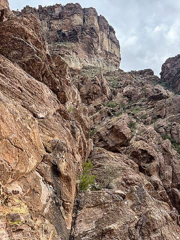 Fun scrambling beyond the boulders 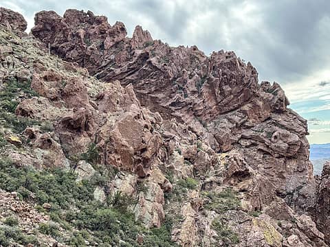 Really cool rock formations 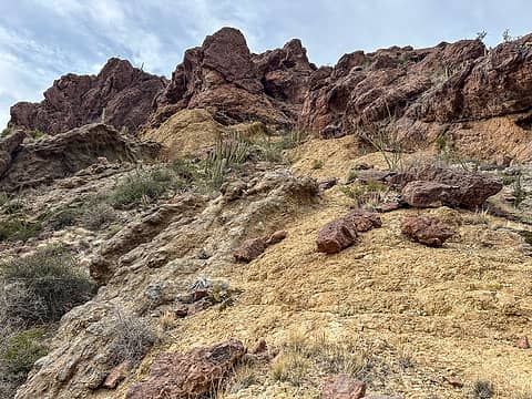 Nearing the saddle 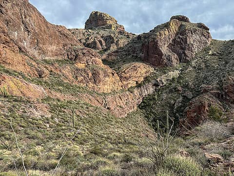 I turned around on level 4 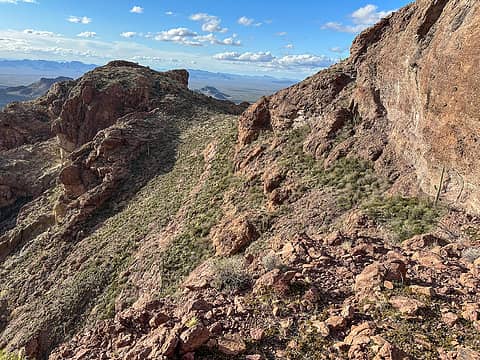 Looking back to the saddle 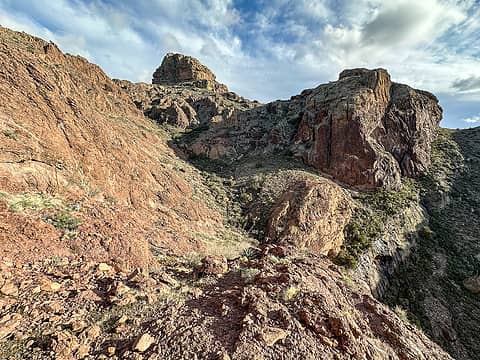 View from turnaround point 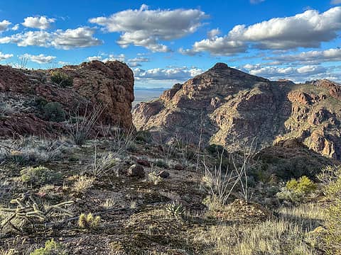 Platform 3760 and Peak 4158 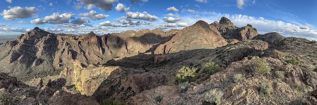 Platform 3760 view 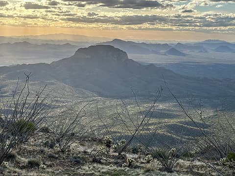 Tillotson 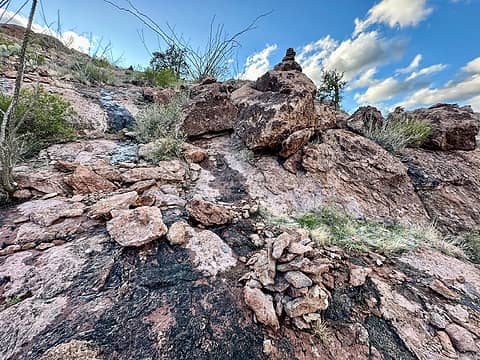 SO MANY CAIRNS 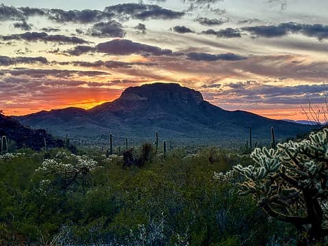 Tillotson sunset 
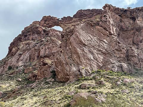 Little arch, big arch 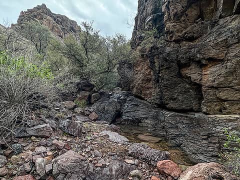 Lots of water 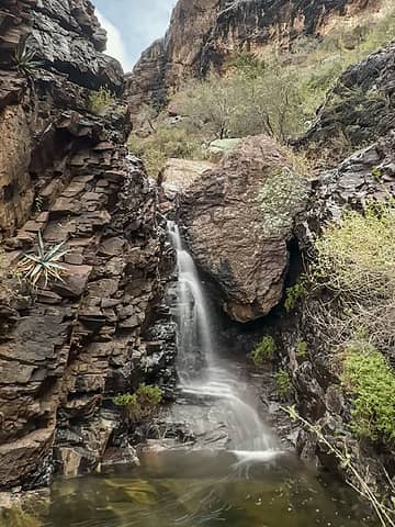 Chockstone obstacle 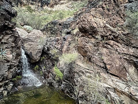 ledge bypass route on right 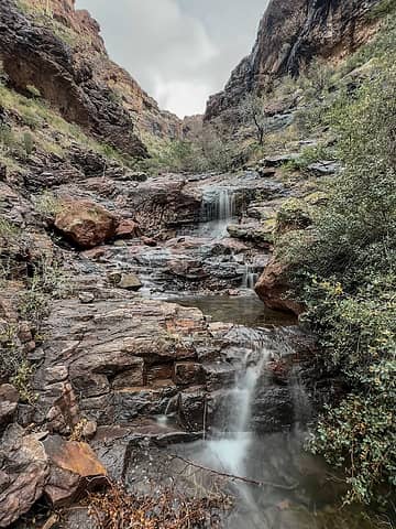 Beyond the ledges 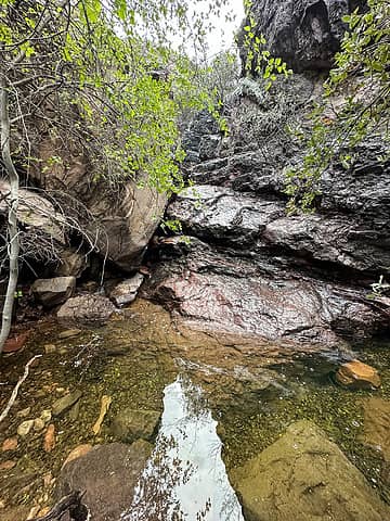 Scrambled through a hole between boulder on the left to pass this 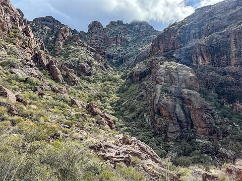 Looking south at the last big turn 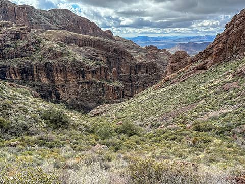 Arch from the side drainage 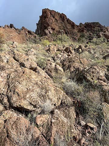 Stay south of the pinnacle at center (obscured here) and hug the north wall of the rock outcrop 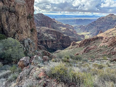 Looking down canyon from the ridge 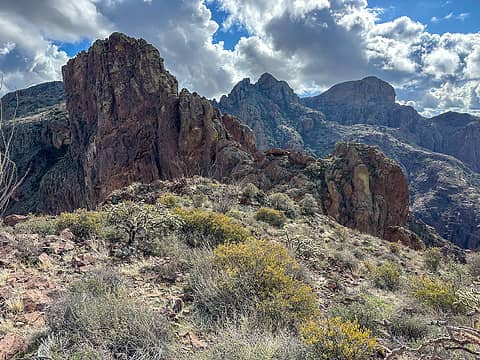 Looking south on the ridge 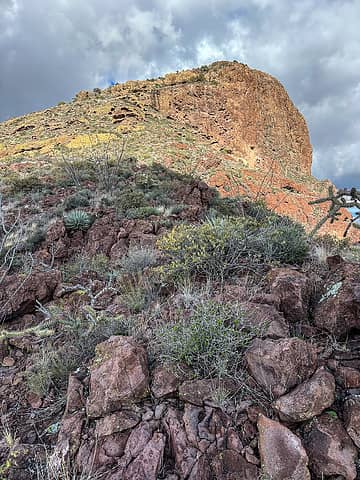 Summit ahead 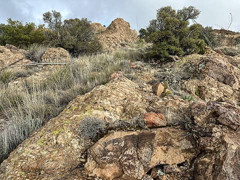 Strolling the summit ridge 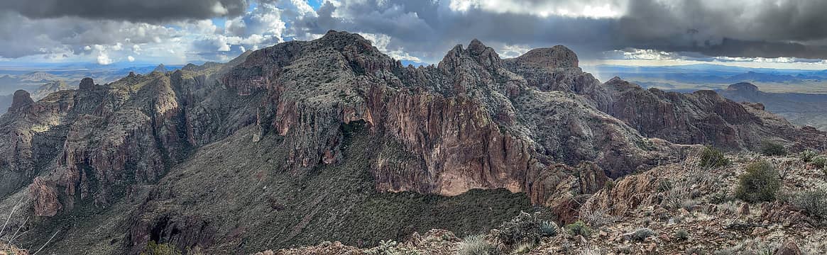 summit pano 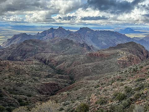 4180 and 4220 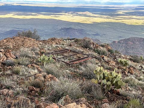 Hmm. 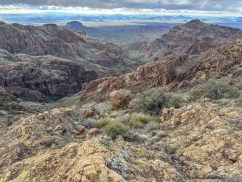 Arch canyon
 RAW-dad, Prosit, Nancyann, Route Loser, meck, Now I Fly, fffej50, Gimpilator, John Mac, jstern RAW-dad, Prosit, Nancyann, Route Loser, meck, Now I Fly, fffej50, Gimpilator, John Mac, jstern  Anne Elk, awilsondc Anne Elk, awilsondc  fourteen410 fourteen410
RAW-dad, Prosit, Nancyann, Route Loser, meck, Now I Fly, fffej50, Gimpilator, John Mac, jstern Anne Elk, awilsondc fourteen410 |
| Back to top |
  
|
|
Eric Hansen
Member

Joined: 23 Mar 2015
Posts: 866 | TRs | Pics
Location: Wisconsin |
Yep! I'm getting faint memories of a trip there 20 or 25 years ago. Glorious land. We were camping at Alamo and had a route description that we followed hiking north, then east up and over a "pass", descending to a drainage that we followed back to Alamo. Don't have a map here so can't be more precise but I would gladly return.
Thanks for the great report, pictures.
Off trail rambler
rubywrangler
Off trail rambler
rubywrangler
|
| Back to top |
|
|
Gimpilator
infinity/21M

Joined: 12 Oct 2006
Posts: 1684 | TRs | Pics
Location: Edmonds, WA |
Great report and photos. You've given me some ideas for peaks I have not done. Pinkley is fun, but intricate. Ended up descending a different way by mistake, which was interesting.
|
| Back to top |
|
|
Dick B
Member
Joined: 06 Jun 2013
Posts: 345 | TRs | Pics
Location: Redmond, Or |
|
Dick B
Member
|
 Fri Feb 16, 2024 1:22 pm |
|
|
My wife and I were there in 05. We had just spent several days enjoying the wildflowers at Borrego Springs SP. We headed east on I 8 then crossed into Mexico at Yumà and continued east exiting at Sonoyta. Wouldn't do that today.
We were towing a small camp trailer and were greeted by a large rattler crossing our camp site. On our first hike we encountered another one on the trail. We could have walked right over it, had not another hiker warned us. My wife hates snakes in all forms.
We did have a good time tho and is a beautiful spot.
rubywrangler
rubywrangler |
| Back to top |
|
|
rubywrangler
Member
Joined: 04 Aug 2015
Posts: 511 | TRs | Pics
|
Thanks Eric, sounds like you did a similar loop through grass canyon going the other direction.
Adam, yeah I was surprised that you hadn't logged ascents of these Ajo range peaks already! I should have reached out to see if you were free but didn't think about it until too late. All three are worth going back for IMO, and I will definitely be back for 4740. The NPS volunteers said Tillotson is also fun.
|
| Back to top |
|
|
TrumOnTop
Scenic Pisser
Joined: 02 Feb 2024
Posts: 4 | TRs | Pics
Location: SLC |
|
TrumOnTop
Scenic Pisser
|
Fri Feb 16, 2024 9:48 pm |
|
|
I really enjoyed your report and photos 
Beep borp
rubywrangler
Beep borp
rubywrangler
|
| Back to top |
|
|
Zloi
Member

Joined: 30 Sep 2009
Posts: 129 | TRs | Pics
Location: Burien, haven for the helpless & homeless |
|
Zloi
Member
|
Sun Mar 24, 2024 5:05 pm |
|
|
Thank you for these detailed trip reports. I am planning to be in Organ Pipe in a couple weeks as part of a road trip after hitting Joshua Tree and was ruminating on how to occupy myself there. Will spend only a couple days there as I'm pushing on to Texas to get into the eclipse zone, and I assume it will be hotter than when you were there, so I'm not sure how strenuous a hike I'll be up for. But always better to have more info than not enough, and in my experience, hitting up the park rangers in such places isn't very fruitful. They will steer you to 'safe' routes where they hope not to have to make a rescue. I'm not surprised, I guess, at the amount of trash you encountered, but it is a sad commentary. It sounds like you didn't make it up Mt Ajo, although my Gaia topo shows at least a rudimentary route there from Bull Pasture.
|
| Back to top |
|
|
rubywrangler
Member
Joined: 04 Aug 2015
Posts: 511 | TRs | Pics
|
I hiked up Mt. Ajo on a previous trip a few years ago and there's a good trail the whole way. Enjoy!
|
| Back to top |
|
|
|
|
You cannot post new topics in this forum
You cannot reply to topics in this forum
You cannot edit your posts in this forum
You cannot delete your posts in this forum
You cannot vote in polls in this forum
|
Disclosure: As an Amazon Associate NWHikers.net earns from qualifying purchases when you use our link(s). |


