captain jack
Serving suggestion


Joined: 25 May 2004
Posts: 3389 | TRs | Pics
Location: Upper Fidalgo |
Pyramid mountain is located on the north side of Lake Crescent, which flanks the northern border of Olympic National Park. Lake Crescent is about 30 miles west of Port Angeles, Wa. if you are googling maps.
I hiked this trail last year solo, encountering a dangerous landslide that had obliterated the trail at about 1800' up on the side of a steep slope about two miles from the trailhead. Crossing this landslide was extremely risky. The path across was a section of boot cuts, followed by a section of slide sand and gravel with minor indentations, then a 6 foot uphill scramble on gravel, then a final boot cut section to regain the trail on the other side. So I took a deep breath, made sure my laces were short, and walked across. Sometimes I'm glad I have no kids, or responsibilities to anyone, because this was a life questioning moment.
I chose not to write a report about the trail so as not to encourage anyone to go, I would be destroyed if I knew anyone was put at risk because of what I wrote. Hiking is fun, nobody should ever die.
I was hoping the park rangers would fix this trail, it does offer great views, and lies within easy reach of many local campgrounds. I found this trail report posted in April , this year that said:
| Quote: | | The slide area near the ridgeline has been graded by the trail crew and is passable but may be scary for some. The slide area is still unstable and may continue to slide and erode the trail tread. Use Caution! Not passable to stock. |
So I thought, great, they fixed the trail, now I can take Spindy up, she loves this area, so we went on Saturday.
Weather was perfect , sunny , about 70 degrees, we arrived at the Northshore Picnic area around 1pm. The trail starts out across the road from the parking area, and after about 50', crosses the Spruce
Railroad Trail. The trail follows a gentle traverse up the southern flank of the ridge, with peekaboo views to the lake below. At about two miles we come to the landslide, which I am now convinced will be an easy cross.
WRONG
Trail report is WRONG
Park service didnt fix anything
There is no difference from last year
NONE
Spindy froze halfway across, she hates cliffs, she doesnt trust her knees not to buckle. She was clinging to the sand and gravel like a cat with no grip, bawling. She insisted she couldnt go on. I knew we couldnt turn around, so I encouraged her forward, congratulating her for every step she made, I held her beltloop, and told her I wouldnt let her die.
We made it to the uphill side, she was shaking, we had to sit for a few minutes so she could calm down. She said she would not be able to go back that way, so I assured her I would find a route, either up or down, around the landslide, on the way back down. The rest of the trail tp the lookout was relaxing and uneventful. The trail gains the ridgeline at about 3 miles and 3000'. From here there are views alternating between the lake on your right side, and the Straight of Juan De Fuca on your left, with Vancouver Island, the San Juans, and Mt. Baker far off in the distance. the last part of the trail switchbacks steeply to the pinnacle of the mountain, and the lookout. We made the top in about 2 hours, and sat on the rocks just to the south of the lookout. The bugs were fierce in the heat of the afternoon, even with the breeze on top of the mountain. We set off back down at about 4pm, me pondering whether or not I should try to go up first, at the landslide, then down the other side, or go down first, hopefully finding more level ground to walk across near the base of the slide. It didnt take us long to get back to the crossing, I left Spindy on the uphill side, and seeing what I thought was a boot trail going down, I set off. First 50' down was fine, sliding on the junky soft soil, swinging between trees, then there was a steep part, so I went ass first in a tuck, using my feet for brakes. I grabbed for a branch to slow me down, and it embedded a piece of wood a 1/4" into my palm. When I unstuck my hand, it gushed a bit, and I swore. It wouldnt be the last time I bled, or swore. I descended more on the same slidy junk, crossing , and emerging onto the slide about halfway down, maybe 150' below the trail. I saw the same slope here as above, only with no tread at all, so this wasnt an option. I followed a runoff gully down to the base of the slide, falling and sliding on sharp rocks, getting shredded all the way down. I landed about 50' from the bottom of the slide, both wrists bleeding bad, both legs lacerated from ankles on up, sweat stinging my eyes, and bugs atacking me in droves. I was getting really angry now, I thought this was way worse than trying to coax her back across the trail, I was badly damaged, and I still had to go back up. I rested at the bottom, trying to think what to say to Spindy. I finally got sick of the bugs and went back up.
I started going up the edge of the slide, but had no footing, everything was loose, one step forward, two steps back kinda thing. I found a deadfall that was alomst vertical to the slide, and climbed it , then crossed to the steep slope on the west side of the slide. More soft, crumbling mosslike junk, then large trees going 50-75' in either direction across the slope, so sidehilling and sliding on more junk. It took me 45 minutes to go down and up the other side, by the time I got back up to the trail, I was beat, I had to rest. I spit out some dust and bugs, used my doo rag and fresh water to clean my wounds as good as I could stand, then walked across the slide to Spindy. I told her the route I took was far more risky than going back the way we came, she took one look at my bloody arms and agreed . We took our time, she faced into the wall and sidestepped the whole thing, I told her over and over I wasnt gonna let her die, it wasnt her time and all that, and we made it safely back across. The rest of the walk back was a solemn affair, she was still in shock, I was in pain. I walked right down to the dock at Northshore, peeled off my shoes and socks , and waded painfully in to wash my wounds. My left hand was useless until today, I have many many things to include in the "things you cant do with one hand" thread, like can opener, bottle opener, even twisting off the soda bottle cap required teeth. And try nose picking or bottom wiping with the other hand, its just weird.
Moral of this story is, dont trust all trail reports.
If you go here's the particulars
3.5 miles one way
Trailhead elev. 700'
Lookout 3000'
Green Trails #101 Lake Crescent
I dont recommend anybody with any fear of heights on this trail. Little dogs may have trouble, and you dont want to carry them across here. Do not carry a large pack, dont bother with poles, and dont bother with ropes, there is no holds for anchors anywhere. While we were crossing in both directions, rock and debris was constantly falling from above, I prayed nothing large would come down while we were exposed.
I really hope the park closes this trail permanently until it can be rerouted, its gonna cost them dearly if they dont.
Pics.
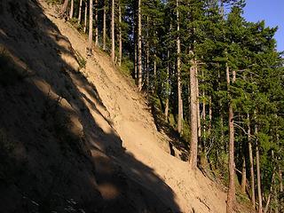 trail level looking east at trail across landslide 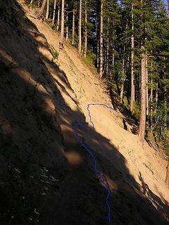 trail level with route 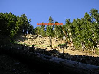 landslide from below with lines 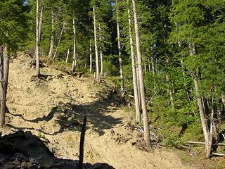 trail zoom from below 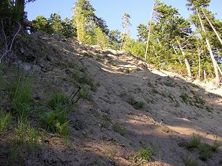 this is whats above the trail 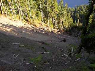 looking down at the bottom 
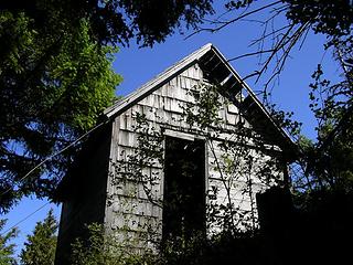 lookout from trail 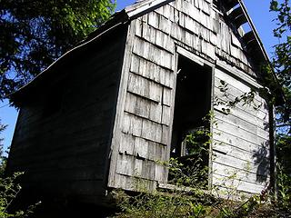 lookout three 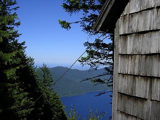 lookout two 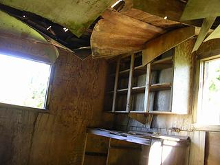 inside one 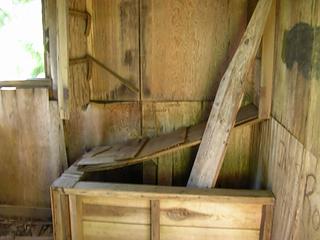 inside three 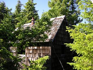 lookout four 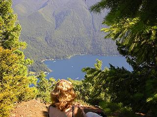 looking down on the lodge
|


