| Previous :: Next Topic |
| Author |
Message |
silly_traveler
~ roaming ~


Joined: 04 Jun 2006
Posts: 1525 | TRs | Pics
Location: Bellevue |
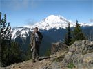
What a nice day to be out in the woods  Dacker joined me on this walk to Ashland Lakes. The road to the TH is in decent shape, you can now drive all the way to the TH parking area
  The trail is in decent shape, only a few snow patches. We visited Beaver Lake, then Upper Ashland and then Lower Ashland Lake.
It's about 5 miles RT to Lower Ashland Lake. Not sure about the elevation gain The trail is in decent shape, only a few snow patches. We visited Beaver Lake, then Upper Ashland and then Lower Ashland Lake.
It's about 5 miles RT to Lower Ashland Lake. Not sure about the elevation gain 
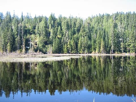 Beaver Lake 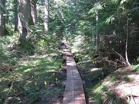 the trail to Upper Ashland Lake 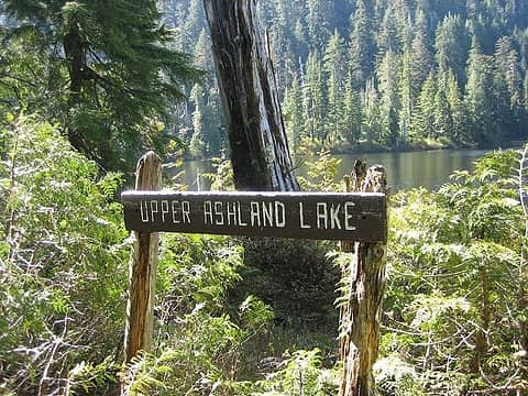 sign! 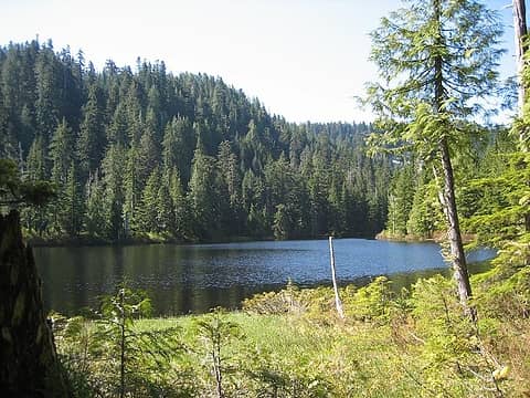 Upper Ashland Lake 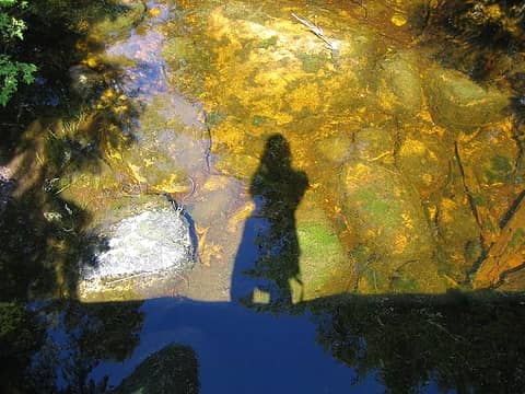 shadow in the water 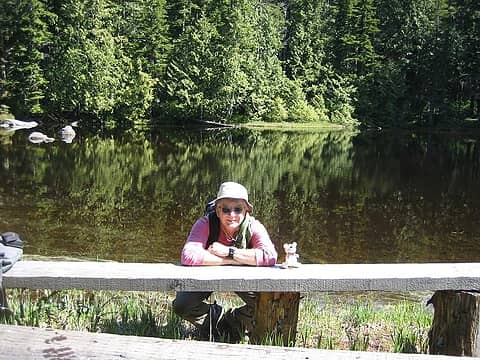 Dacker and Jake 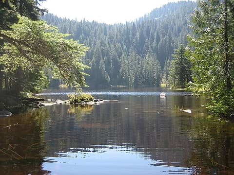 Lower Ashland Lake
♫ You have brains in your head. You have feet in your shoes. You can steer yourself any direction you choose. And you're the one who will decide where you'll go. Oh the places you'll go. - Dr. Seuss
♫ You have brains in your head. You have feet in your shoes. You can steer yourself any direction you choose. And you're the one who will decide where you'll go. Oh the places you'll go. - Dr. Seuss
|
| Back to top |
  
|
|
GeoTom
Member

Joined: 19 May 2005
Posts: 3216 | TRs | Pics
Location: Earth |
|
GeoTom
Member
|
 Thu May 24, 2007 2:06 pm |
|
|
|
| Back to top |
|
|
Scrooge
Famous Grouse

Joined: 16 Dec 2001
Posts: 6966 | TRs | Pics
Location: wishful thinking |
|
Scrooge
Famous Grouse
|
Thu May 24, 2007 2:59 pm |
|
|
Good thing you took all those nice pictures, ST, otherwise we might be tempted to think you were fabricating ........ since WTA's brand new "Storm Damage" report says the Ashland Lakes Trail is inaccessible. 
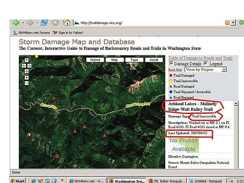 Status of the Ashland Lakes Trail as shown on WTA's "Storm Damage" report, 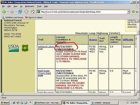 Current MBSNF trail report for the Ashland Lakes Trail.  Pretty Silly, going up to hike on a trail you couldn't even get to.
By the way, that "shadow on the water" is a neat shot. Pretty Silly, going up to hike on a trail you couldn't even get to.
By the way, that "shadow on the water" is a neat shot.  edit - Oh. Just in case you're going to plan a trip to the Ashland Lakes, anyway, the damaged roads involved are either FS 4020, 4021 or FS 4030, 4032 ......... depending on which report you look at.
  Good luck.
Something lost behind the ranges. Lost and waiting for you....... Go and find it. Go!
Something lost behind the ranges. Lost and waiting for you....... Go and find it. Go!
|
| Back to top |
|
|
Hiker Mama
Member

Joined: 25 Jun 2006
Posts: 3451 | TRs | Pics
Location: Lynnwood |
ST, thanks for bringing back good memories. I took Gabriel on that hike with a friend a few years back. It was beautiful. It's nice to know you can get there. I'm glad you had a day in the woods so I can vicariously have one too!
|
| Back to top |
|
|
Joe
Member
Joined: 29 Jun 2002
Posts: 819 | TRs | Pics
Location: Kent |
|
Joe
Member
|
Thu May 24, 2007 7:14 pm |
|
|
Nice photos and great hiking weather. Meanwhile, I was stuck in the office and could only dream about being outdoors.
|
| Back to top |
|
|
silly_traveler
~ roaming ~
Joined: 04 Jun 2006
Posts: 1525 | TRs | Pics
Location: Bellevue |
♫ You have brains in your head. You have feet in your shoes. You can steer yourself any direction you choose. And you're the one who will decide where you'll go. Oh the places you'll go. - Dr. Seuss
|
| Back to top |
|
|
captain jack
Serving suggestion

Joined: 25 May 2004
Posts: 3389 | TRs | Pics
Location: Upper Fidalgo |
| silly_traveler wrote: | | It's about 5 miles RT to Lower Ashland Lake. Not sure about the elevation gain |
Trailhead elevation is 2500'
High point is Beaver Plant lake at 3000', then you loose a couple hundy feet to Lower Ashland.
|
| Back to top |
|
|
Sabahsboy
Member

Joined: 18 Jul 2006
Posts: 2484 | TRs | Pics
Location: SW Sno County |
Good to learn these are accessible. Digging through previously undeveloped film, now processed and on CD, I found myself viewing 2 year old photos of Ashland Lakes. It was a wet and foggy day up there, though after snow melt (late June). I recall the discomfort, esp. when doing a 'round the lake walk that led into sopping brush and setting feet into soggy and deep soil that was more jello than terra firma. So, there! It WAS worth the effort! The photos are remarkably beautiful and moody!
I may try to place a few in this thread after this weekend. I get to be "b'day boy" and will hit the trail rather than the desk, tomorrow and do a "mini-vacation". I will keep Ashland Lakes on the "back burner".
|
| Back to top |
|
|
Slugman
Its a Slugfest!

Joined: 27 Mar 2003
Posts: 16874 | TRs | Pics
|
|
Slugman
Its a Slugfest!
|
Thu May 24, 2007 10:28 pm |
|
|
Scrooge, the WTA mistakes are really hard to understand. Trip reports posted there dating back to late last year clearly state that the road is undamaged to Ashland TH. Here are three: Dec 29th, 2006, May 11th, 2007, and May 20th, 2007.
The road to Boardman is damaged after the Ashland/Bear turnoff, and the Bear/Pinnacle road is damaged after the Ashland turnoff. But Ashland has always been accessible except for snow.
PS: I emailed andrew e at WTA about the error, per the instructions in the storm damage database at WTA.
|
| Back to top |
|
|
dacker
little black dots

Joined: 27 Sep 2006
Posts: 738 | TRs | Pics
Location: the end of my rope |
|
dacker
little black dots
|
Fri May 25, 2007 10:20 am |
|
|
Here's a few more photos:
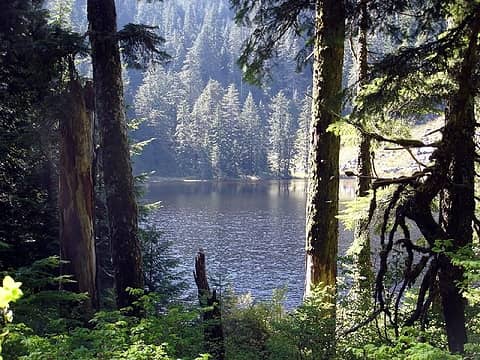 Upper Lake 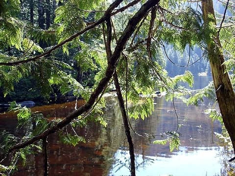 Backlit branches 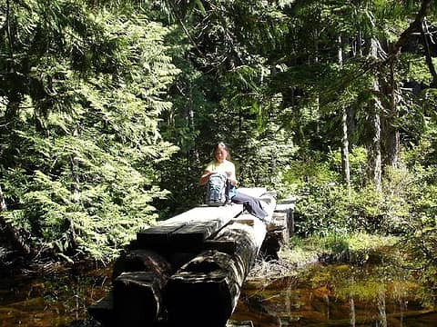 ST soaking up the sun 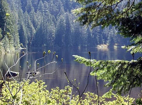 Lower Lake
We don't stop hiking because we grow old; we grow old because we stop hiking. --Finis Mitchell
We don't stop hiking because we grow old; we grow old because we stop hiking. --Finis Mitchell
|
| Back to top |
|
|
andrew e
Member

Joined: 13 Feb 2006
Posts: 147 | TRs | Pics
Location: Seattle |
|
andrew e
Member
|
Fri May 25, 2007 10:34 am |
|
|
Slugman: thanks for the heads-up, we fixed it.
Scrooge: it's a work in progress, if you all find mistakes, we will do our best to correct and update them.
USFS is doing the best it can to keep its conditions report current with the limited staff they have. In my opinion, they do a fantastic job considering how few staff they have.
If you folks at nwhikers find our storm damage website useful, I'd encourage you to become members of WTA and support all the work that we do. It doesn't come free, that's for sure. Kudos to REI, WTA members and the Stusser Endowment for making the storm damage map project possible.
Respectfully
Andrew E
|
| Back to top |
|
|
scm007
Member
Joined: 19 Jul 2006
Posts: 261 | TRs | Pics
|
|
scm007
Member
|
Fri May 25, 2007 11:06 am |
|
|
Anybody know if there are any fish in those lakes?
|
| Back to top |
|
|
Scrooge
Famous Grouse
Joined: 16 Dec 2001
Posts: 6966 | TRs | Pics
Location: wishful thinking |
|
Scrooge
Famous Grouse
|
Fri May 25, 2007 1:43 pm |
|
|
About WTA's new Storm Damage website, andrew e said | Quote: | | Scrooge: it's a work in progress, if you all find mistakes, we will do our best to correct and update them. |
I thought that's what you intended, which is why I was disturbed to find that the very first place I checked, at just about the first moment the site was up, should prove to have the wrong information.
andrew e also said | Quote: | | If you folks at nwhikers find our storm damage website useful, I'd encourage you to become members of WTA and support all the work that we do. |
The WTA does some good stuff (notably its trail maintenance program). Unfortunately, it's apparently driven by its advocacy program. That is necessarily hiker-elitist and, as such, is usually diametrically opposed to my own beliefs. Because of that, I won't support WTA, any more than I support other organizations like the Sierra Club ...... or even the Pacific Audubon Society ....... that do some good things, but also work actively to twist the law in opposition to my interests.
Something lost behind the ranges. Lost and waiting for you....... Go and find it. Go!
Something lost behind the ranges. Lost and waiting for you....... Go and find it. Go!
|
| Back to top |
|
|
|
|


 Glad you guys had a nice hike.


 Scrooge-
  Thanks, I like the shadow picture also


