| Previous :: Next Topic |
| Author |
Message |
Randy
Cube Rat


Joined: 18 Dec 2001
Posts: 2910 | TRs | Pics
Location: Near the Siamangs |
|
Randy
Cube Rat
|
 Wed Aug 27, 2008 11:57 pm |
|
|
Don Brooks and I arrived at the White River TH with a half-assed plan to climb these three peaks over three days. We knew sort of what we wanted to do, but there are about 2000 ways to combine the three peaks, so we just went for it with the intent of staying flexible and deciding routes and all that as we went. An enjoyable way to implement a trip, but staying flexible meant carrying heavier climbing gear. Perhaps this defied logic with the long approach and all the trail miles, then again, Top 100 peakbagging has been known to defy logic at times.
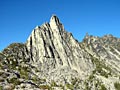
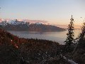
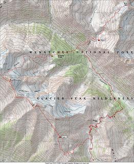 Clark 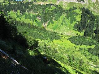 Don works out of basin 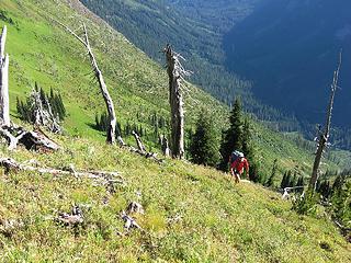 Booting higher. White River below. 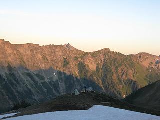 Don and first night camp 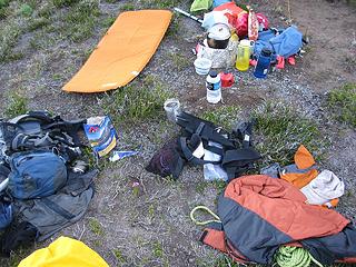 Crap 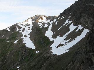 First views of Clark 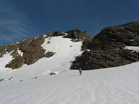 Clark gets closer 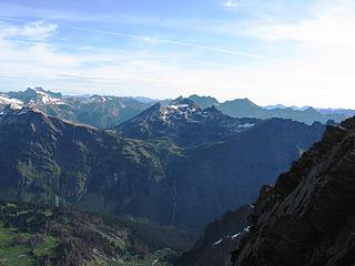 Buck from Clark 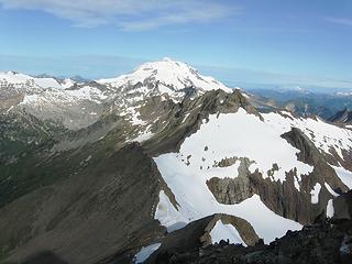 Luahna, Glacier from Clark 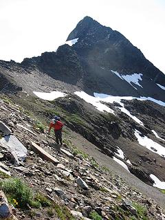 Working to Luahna 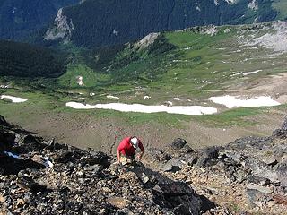 Don grabs for Luahna 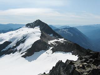 Clark from Luahna 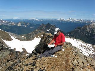 The scene on Luahna 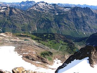 Butterfly Butte, Buck Mountain from Luahna 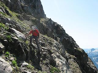 The Ledge above and to the right of Don 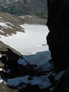 Looking down the Pilz Glacier 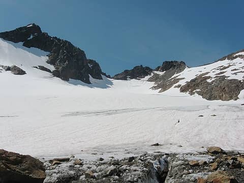 Looking up the Pilz Glacier. Luahna at left. 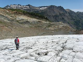 Descending the toe of the Pilz 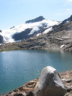 Tarn and Clark 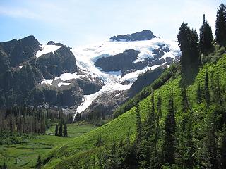 Clark from Butterfly Butte 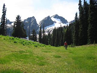 Luahna Peak from Butterfly Butte 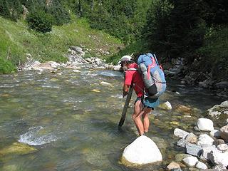 Crossing the Napeequa, Day 2 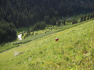 Ascending the fern slope 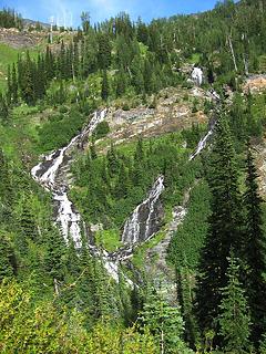 Upper Louis Creek Cascade 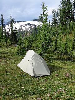 Second night camp 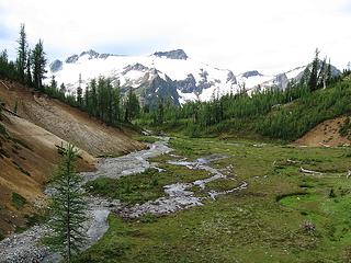 Basin views of Clark 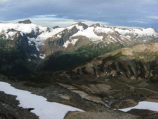 Clark, Luahna, Pilz Galcier, and Butterfly Butte 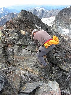 Wrestling Buck 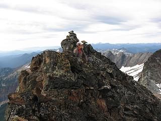 Surveying the scene from Buck's summit 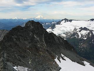 Rainier from Buck 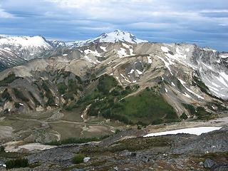 Glacier Peak from ascent of Buck 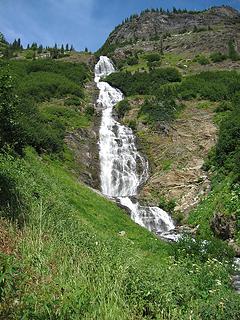 Louis Creek Falls 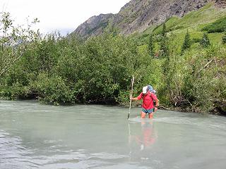 Crossing the Napeequa, Day 3 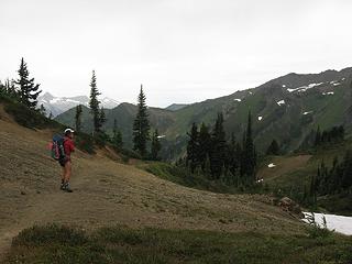 Don at Boulder Pass
|
| Back to top |
  
|
|
Dayhike Mike
Bad MFKer
Joined: 02 Mar 2003
Posts: 10955 | TRs | Pics
Location: Going to Tukwila |
OMG! Overnight, Randy!?  Strong work... Beautiful area and a nice combination of summits....
"There is only one basic human right, the right to do as you damn well please. And with it comes the only basic human duty, the duty to take the consequences." -P.J. O'Rourke
"Ignorance is natural. Stupidity takes commitment." -Solomon Short
"There is only one basic human right, the right to do as you damn well please. And with it comes the only basic human duty, the duty to take the consequences." -P.J. O'Rourke
"Ignorance is natural. Stupidity takes commitment." -Solomon Short
|
| Back to top |
|
|
peltoms
Member

Joined: 13 Jul 2006
Posts: 1760 | TRs | Pics
Location: Worcester MA |
|
peltoms
Member
|
Thu Aug 28, 2008 4:21 am |
|
|
Great shots from Buck Pass gorgeous country across the upper Napequa. The Napequa crossing looks like half and half.
|
| Back to top |
|
|
kleet
meat tornado

Joined: 06 Feb 2002
Posts: 5303 | TRs | Pics
Location: O no they dih ent |
|
kleet
meat tornado
|
Thu Aug 28, 2008 7:22 am |
|
|
Pffft. A real man would have knocked off those three in one day.
 Nice work, guys. Some beautiful shots.
A fuxk, why do I not give one?
A fuxk, why do I not give one?
|
| Back to top |
|
|
David¹
Token Canadian

Joined: 25 Jul 2002
Posts: 3040 | TRs | Pics
Location: The Great White North |
|
David¹
Token Canadian
|
Thu Aug 28, 2008 7:34 am |
|
|
| peltoms wrote: | | The Napequa crossing looks like half and half. |
I suspect it feels more like an iced cappuccino. Butterfly Butte looks magical. I can't understand how you could actually leave such a wonderful spot to go play in the rocks.
|
| Back to top |
|
|
wildernessed
viewbagger

Joined: 31 Oct 2004
Posts: 9275 | TRs | Pics
Location: Wenatchee |
 Awesome TR and Pics ! Awesome TR and Pics !
Living in the Anthropocene
Living in the Anthropocene
|
| Back to top |
|
|
Movenhike
\m/..mmmmetal\m/
Joined: 16 Apr 2007
Posts: 642 | TRs | Pics
Location: Leavenworth, WA |
|
Movenhike
\m/..mmmmetal\m/
|
Thu Aug 28, 2008 8:23 am |
|
|
Spectacular! way to nail it.
Now you got the marbles in my head rolling.
"Make it your Friend" -John Bull
"Make it your Friend" -John Bull
|
| Back to top |
|
|
don b
Member

Joined: 22 Feb 2006
Posts: 369 | TRs | Pics
|
|
don b
Member
|
Thu Aug 28, 2008 8:39 am |
|
|
Great trip and TR. I fully second Randy's comments about the Louis Creek basin. We looked down on the upper basin from above and thought we should be seeing Grizzlys and Caribou as it looked more like Alaska than Washington.
Another highlight of the trip was walking on the old sheep trail below Boulder Pass and seeing the remnants of dozens of cross trails throughout the basin. Those old trails will take a century to totally disappear after grazing.
Perhaps the final entertainment was watching Randy trying to empty water out of his boots. One lace was shot so he was afraid to take it off. The solution was to lay on his back with his leg straight up in the hopes that water would drain out. Didn't work so well.
|
| Back to top |
|
|
yukon222
Member

Joined: 12 Mar 2007
Posts: 1894 | TRs | Pics
|
|
yukon222
Member
|
Thu Aug 28, 2008 8:44 am |
|
|
Extremely enticing area. Love your pic selections. I hope to see the area in person - it just looks amazing!
|
| Back to top |
|
|
Stefan
Member

Joined: 17 Dec 2001
Posts: 5093 | TRs | Pics
|
|
Stefan
Member
|
Thu Aug 28, 2008 9:09 am |
|
|
Louis Creek Basin is awesome. Really. Thanks for the trip report!
|
| Back to top |
|
|
RichP
Member

Joined: 13 Jul 2006
Posts: 5634 | TRs | Pics
Location: here |
|
RichP
Member
|
Thu Aug 28, 2008 9:41 am |
|
|
I like the combination of peaks. I think I'll copy your route if we get a good weather window. Perhaps next season?
|
| Back to top |
|
|
Roald
Member

Joined: 06 Aug 2007
Posts: 367 | TRs | Pics
Location: Seattle |
|
Roald
Member
|
Thu Aug 28, 2008 2:21 pm |
|
|
Wow, great TR and route! You guys are tearing it up out there.
|
| Back to top |
|
|
Sore Feet
Member

Joined: 16 Dec 2001
Posts: 6303 | TRs | Pics
Location: Out There, Somewhere |
Butterfly Butte just went WAAAY higher up on my list.
|
| Back to top |
|
|
Don
Member

Joined: 25 Apr 2005
Posts: 2013 | TRs | Pics
Location: Fairwood, WA |
|
Don
Member
|
Thu Aug 28, 2008 4:01 pm |
|
|
|
| Back to top |
|
|
raising3hikers
Member
Joined: 21 Sep 2007
Posts: 2344 | TRs | Pics
Location: Edmonds, Wa |
Very nice TR I've been thinking about Clark Mtn. lately and now I definitely want to do it.
|
| Back to top |
|
|
|
|


 Excellent images Randy! Clark above that hanging basin is sweet.