| Previous :: Next Topic |
| Author |
Message |
jimmymac
Zip Lock Bagger


Joined: 14 Nov 2003
Posts: 3704 | TRs | Pics
Location: Lake Wittenmyer, WA |
|
jimmymac
Zip Lock Bagger
|
 Tue Jul 06, 2004 11:16 am |
|
|
Fairly late into the weekend, I decided to opt in to getting out. With the weather forecasted to peak on Monday, it seemed like a quick mountain top visit was in order. Previous reports by EDD and Dicey suggested that there was enough remaining snow to give the Mt Pugh scramble a little spice.
WTA trip reports (specifically from fall of 2003) with photo links, already document the route exceptionally well. I would offer the following update:
Contrary to some reports, the trail is not washing away at any point. While there is some benign (hemlock, huckleberry) vegetation intrusion, the trail is not extremely brushy. All the blowdowns have been logged out.
Once you attain Stujack Pass, you switchback up to a south-trending ridge. This narrow ridge leads to the final ascent to Mt Pugh. To the west (right) of the ridge are the brushy rocks of the avalanche slope you crossed on your way up to Stujack Pass. To the east (left), is a broad gully, whose permanent snow gives a hint of the narrow glacier that once filled the space.
The trail that switchbacks up from Stujack to the ridge crest has a couple of snow patches that run out to heather and small trees. Not a big deal and its almost gone. More significant, is the disappearance of any real snow on the ridge trail as it passes above the steep snow of the east gully. Crossing snow along this steep stretch might be more than a casual hiker would want to deal with. But as of 7/5/04 the trail is clear of snow, except for a patch or two, whose tips actually slope inward.
Much of the ridge trail is actually just west of the crest where snow is long gone. But a couple trail segments on the west side deserve a little caution particularly on the way down because of loose soil. The slope is just at the point where loss of traction doesnt seem like it would be an issue.
At its south end, the narrow ridge hooks left and ends with a small saddle that connects the ridge to the larger block holding Pugh and a couple of false summits. This notch forms the head of the permanent snow gully. Immediately after crossing the notch the route climbs up though a little niche blasted out of the rock face. This niche at the notch is not a big deal, though it looks a little intimidating when viewed from the ridge top. Its not all that steep. And since it's inserted into the rock face, the route had an almost sheltered feel to it. The niche has been covered by other hikers in previous reports; I mention it here because I have far less experience than some of the previous reporters. And I found this and the other scramble portions to be fairly tame.
From the niche to the summit, there remains one, 40-foot snow patch covering the trail. A slide here would be unacceptable. An ice axe is really in order. Or, fully retracted, fully inserted poles would probably provide adequate self-belay for the crossing. In fact, self-belay is probably the best application of an ice axe here as well. IMO, a person would be into the rocks before he or she could make an arrest. A simple workaround for those wary of steep snow would be to bypass the patch altogether on the rocks above.
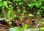
Wildflowers were striking, but not numerous. Bugs were evident but not remarkable. Heather near the top was blooming, creating broad carpets of green with lemon yellow and white speckles.
The summit has a fair amount of area and the view is 360. I could see from Baker to Stuart between scattered cumulus clouds. A broken canopy of very thin high clouds extended south to about Stevens Pass. The cloud activity was pretty dynamic. Overall visibility got slightly better by the time I was ready to shove off, but watching the constant change in cloud cover was kind of entertaining. Glacier Peak was doing the dance of the seven veils, but it never cleared off entirely. At least the Class B weather and visibility was visited upon a quick day trip and not an overnight stay.
Like most lookout sites, the summit of Mt Pugh has adequate space for a sleeping bag or two. I have been known to enjoy the sunset/moonshine/sunrise experience. I could see where Pugh wouldnt be a bad place to take in a meteor shower. A second, less rocky camp spot is located along the ridge trail.
Since I was determined to get the most out of my gasoline investment, I hung out at the summit until my food started running low. Unless I wanted my next meal to be dependent on successful foraging in Darrington at 9 pm, I knew I had better load up and head down. I banked on the assumption that the lower trail would easily accommodate an evening descent, but I actually arrived at the car well before sunset.
As a consequence of delaying my departure, I had the opportunity to walk the forest below Lake Metan with the sun at a very low angle. The large trees provided a mostly dark ceiling. Warm light spilled in as it wrapped around 36-inch trunks. The young hemlocks of the under story caught the light and bounced it upslope. It made for a post card scene. Which probably explains why my camera batteries expired at that point.
If you're not a serious mountaineer, but would like to taste a little mountain goat action, Mt Pugh isn't a bad place to get a sample.
"Profound serenity is the product of unfaltering Trust and heightened vulnerability."
"Profound serenity is the product of unfaltering Trust and heightened vulnerability."
|
| Back to top |
  
|
|
bonobo
Owl Juggler for rent
Joined: 23 Jun 2004
Posts: 818 | TRs | Pics
|
|
bonobo
Owl Juggler for rent
|
Tue Jul 06, 2004 12:45 pm |
|
|
Sounds like an interesting trip. Weather-watching is always interesting, at least in my book!
|
| Back to top |
|
|
Edd
Member

Joined: 23 Jun 2003
Posts: 296 | TRs | Pics
|
|
Edd
Member
|
Tue Jul 06, 2004 2:35 pm mt pugh 05july2004
|
|
|
Great trip report, nice details. I also thought because of the space on top that it would be a great place to spend the evening looking at the stars and views, (other than during a thunderstorm). Sounds like the snow covering the switchbacks from the pass to the ridge were almost gone. When I went up you only got a glimpse of the end of a switchback a couple of times. I agree that, it is a good hike for someone with not alot of scrambling or climbing experinence (like myself), to get a feel what it is like without alot of risk. The amount of snow though can make all the difference in the world.
|
| Back to top |
|
|
jimmymac
Zip Lock Bagger
Joined: 14 Nov 2003
Posts: 3704 | TRs | Pics
Location: Lake Wittenmyer, WA |
|
jimmymac
Zip Lock Bagger
|
Tue Jul 06, 2004 3:33 pm |
|
|
| EDD wrote: | | ...The amount of snow though can make all the difference in the world. |
Agreed. I was half-hoping for a little more snow, but I can see where snow on the east face of that ridge could take a person damn near to Stujack Creek with only a couple of bounces in between.  So it all worked out okay. I approached the hike, figuring I could always pull out your moat technique if worse came to worst. So it all worked out okay. I approached the hike, figuring I could always pull out your moat technique if worse came to worst.
"Profound serenity is the product of unfaltering Trust and heightened vulnerability."
"Profound serenity is the product of unfaltering Trust and heightened vulnerability."
|
| Back to top |
|
|
Spotly
Member

Joined: 06 Jan 2004
Posts: 3723 | TRs | Pics
Location: Spokane Valley |
|
Spotly
Member
|
Tue Jul 06, 2004 3:46 pm |
|
|
Nice report. Sounds like something I'd like to try if I ever get over that way. How much time should it take up and back for the average Joe (or Jill)?
|
| Back to top |
|
|
jimmymac
Zip Lock Bagger
Joined: 14 Nov 2003
Posts: 3704 | TRs | Pics
Location: Lake Wittenmyer, WA |
|
jimmymac
Zip Lock Bagger
|
Tue Jul 06, 2004 5:19 pm |
|
|
Well that all depends. The EG is 5,300' over 4.7 miles.
The lower 2.8 miles involve a well engineered grade, good tread, and shade; it covers 3000 feet. The last water is at 1.5 miles and 3,200'.
The upper 1.9 miles is all in the open, more direct, and more rugged; it covers the remaining 2,300 feet. Other than rapidly melting snow it's dry.
"Profound serenity is the product of unfaltering Trust and heightened vulnerability."
"Profound serenity is the product of unfaltering Trust and heightened vulnerability."
|
| Back to top |
|
|
Yana
Hater

Joined: 04 Jun 2004
Posts: 4212 | TRs | Pics
Location: Out Hating |
|
Yana
Hater
|
Tue Jul 06, 2004 11:29 pm |
|
|
Great detailed TR. The early part of the day (well, after the morning clouds dissipated around 10) was actually pretty cloudless, at least from what I could see from Green Mountain, but I guess with a much longer trip like Pugh it'd be hard to get up there in the morning.
PLAY SAFE! SKI ONLY IN CLOCKWISE DIRECTION! LET'S ALL HAVE FUN TOGETHER!
PLAY SAFE! SKI ONLY IN CLOCKWISE DIRECTION! LET'S ALL HAVE FUN TOGETHER!
|
| Back to top |
|
|
jimmymac
Zip Lock Bagger
Joined: 14 Nov 2003
Posts: 3704 | TRs | Pics
Location: Lake Wittenmyer, WA |
|
jimmymac
Zip Lock Bagger
|
Wed Jul 07, 2004 7:41 am |
|
|
| Yana wrote: | | Great detailed TR. The early part of the day (well, after the morning clouds dissipated around 10) was actually pretty cloudless, at least from what I could see from Green Mountain, but I guess with a much longer trip like Pugh it'd be hard to get up there in the morning. |
When we get 10 hours of clearing in between weather systems, Mrs jimmymac will sometimes comment about the "nice weather." More than once, I've gotten slugged in the arm for pointing out that in fact, it's only imitation nice weather.  You're right; most of the morning clouds were burning off by 9:00. I guess I'd have to admit that it was basically a beautiful, sunny day. My standards for visibility are probably a tad unreasonable. But Glacier Peak had clouds persistently clinging to its top, and scattered clouds kept blowing by like so many fast food wrappers. So the "Class B" label I gave the weather was being generous in my book.
  I hope you enjoyed Green Mountain.
"Profound serenity is the product of unfaltering Trust and heightened vulnerability."
"Profound serenity is the product of unfaltering Trust and heightened vulnerability."
|
| Back to top |
|
|
Yana
Hater
Joined: 04 Jun 2004
Posts: 4212 | TRs | Pics
Location: Out Hating |
|
Yana
Hater
|
Wed Jul 07, 2004 7:57 am |
|
|
I did enjoy Green Mountain. We went early, and played tag with a party of two up to the summit, where we met two more people who had camped at the tarns. I thought this was very odd for a holiday Monday for supposedly such a popular trail, but on the way down (mostly through the forest and that initial meadow slope you switchback up) we met FORTY (I counted) people. I'm so glad we went early.
I even made up the "gee the weather's not perfect, I'm glad I didn't end up doing Pugh" to make myself feel better, but it only partly worked. ;o)
PLAY SAFE! SKI ONLY IN CLOCKWISE DIRECTION! LET'S ALL HAVE FUN TOGETHER!
PLAY SAFE! SKI ONLY IN CLOCKWISE DIRECTION! LET'S ALL HAVE FUN TOGETHER!
|
| Back to top |
|
|
|
|
You cannot post new topics in this forum
You cannot reply to topics in this forum
You cannot edit your posts in this forum
You cannot delete your posts in this forum
You cannot vote in polls in this forum
|
Disclosure: As an Amazon Associate NWHikers.net earns from qualifying purchases when you use our link(s). |


