| Previous :: Next Topic |
| Author |
Message |
Stefan
Member


Joined: 17 Dec 2001
Posts: 5093 | TRs | Pics
|
|
Stefan
Member
|
 Mon Apr 16, 2012 9:27 am |
|
|
I have no idea where the name Blister came up for this peak. This peak is between Crystal Creek, Pass Creek and the Baker River. It offers wonderful views somewhat similar in scope to Icy Peak...when you have completely clear skies.
Tom, iron, r3h, Martin, Mike, Dave, and Matt all started at 7:30 from the Baker River trailhead. I was skeptical about crossing Sulphide Creek, but a recent report from a fellow nwhiker.net person calmed my fears. I had even brought rope for the potentially hazardous crossing. Well the forecast I saw was for beautiful blue skies....actually it was raining on the drive in! Now that ticked me off. We hiked to Sulphide Creek and it was quite benign, even so that we could cross on numerous logs without getting wet--but you had to find them. The abandoned trail on the other side is more or less directly across from the maintained trail....look for flagging. The abandoned trail ends at where the braiding of the river starts across from a large gully coming off of the nw arm of Mt. Blum. From here we mainly stayed inland working on snow over to Crystal Creek. 2.5 hours to here. We crossed Crystal Creek and followed the obvious animal path up and up until we came across wet mossy cliffs and then just went up and left. No problems whatsoever. We never even weaved through cliff bands we just stayed left and up. Somewhere around 1:00 we reached the top and somewhat views. As time progressed the views improved....and then the sun came out. Awesome! And then we reversed....I am sure other pictures from the other dudes will be mucho bettero than mine...My battery went out!
|
| Back to top |
  
|
|
Matt
Tea, Earl Grey, Hot

Joined: 30 Jan 2007
Posts: 4308 | TRs | Pics
Location: Shoreline |
|
Matt
Tea, Earl Grey, Hot
|
Mon Apr 16, 2012 10:49 am |
|
|
Thank you to Stefan for organizing this trip, and to the many others who broke trail.
Blister turned out to be quite a wild viewpoint, looking across Pass Creek to the cliffs on Mineral Mountain and way up Picket Creek to Phantom Arm. Even though the clouds were reluctant to pull aside, most of the peaks made at least a brief appearance. The view straight across Crystal Creek to the rocky spine of Seahpo was especially good.
Hiking in along Baker River past Lake, Sulphide & Crystal Creeks:
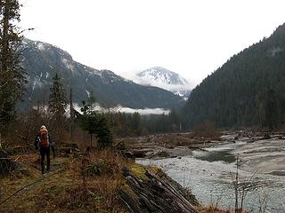 Blister in the distance up the Baker River 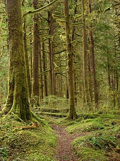 Mossy forest between Lake & Sulphide Creeks 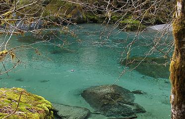 Bird swimming in Baker River 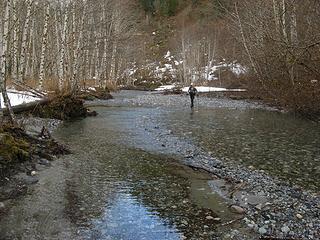 Walking in a side channel of the river 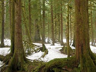 Mist rising off the snow under the trees 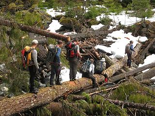 Conga line crossing Crystal Creek 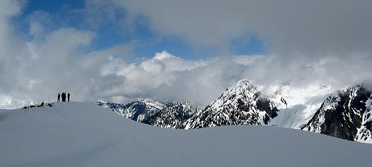 Waiting for clouds to clear at Blister summit (Mineral Mountain on right) 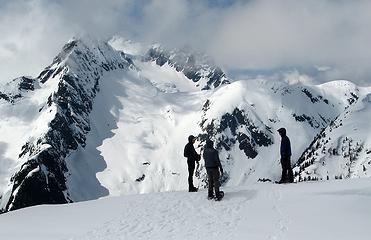 Seahpo and Jagged Ridge starting to emerge 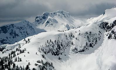 Holy Cornices, Batman 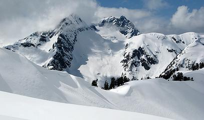 Seapho & Nooksack Tower 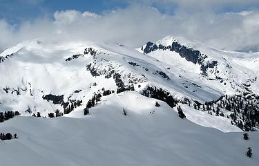 Icy (barely visible) and Ruth 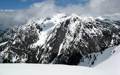 Mineral Mountain 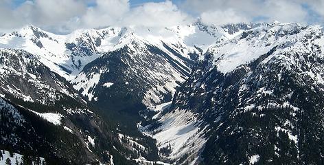 Looking up Baker River to Perfect Pass and up Picket Creek to Phantom Arm 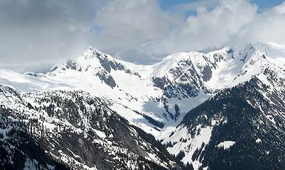 Whatcom & Perfect Pass 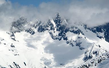 Crooking Thumb & Phantom 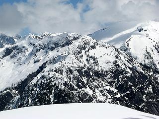 Pioneer Ridge 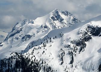 Despair 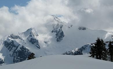 Blum emerges 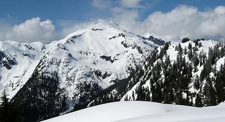 Icy & Ruth 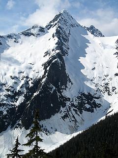 The spine of Seahpo
As beacons mountains burned at evening. J.R.R. Tolkien
As beacons mountains burned at evening. J.R.R. Tolkien
|
| Back to top |
|
|
twodogdad
Member

Joined: 21 Nov 2006
Posts: 846 | TRs | Pics
Location: seattle |
I'd never go to a peak named "Blister"  Come to think of it, there are quite a few names that promise bad things-- Fury, Terror, Damnation, Devil's That or That, etc.--but "Blister" is just too close to home, right where the famous boot pinches.
tdd
Come to think of it, there are quite a few names that promise bad things-- Fury, Terror, Damnation, Devil's That or That, etc.--but "Blister" is just too close to home, right where the famous boot pinches.
tdd
|
| Back to top |
|
|
raising3hikers
Member
Joined: 21 Sep 2007
Posts: 2344 | TRs | Pics
Location: Edmonds, Wa |
Another great choice for a peak, Stefan. That whole area is just a great place to be in, from the big old growth cedars and mossy forest down in the valley to the views up on the mountain. The clouds moved around just enough to give us views that were worth the extra effort to get there.
 the mossy rainforest 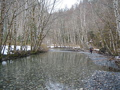 part of the Baker River  at the Crystal Creek log crossing  almost at the Blister summit  the spine leading to Seahpo Peak and to the right is Nooksack Tower 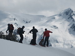 getting ready to leave the summit 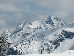 a view to the North side of Despair  Seahpo Pk
|
| Back to top |
|
|
Tom_Sjolseth
Born Yesterday

Joined: 30 May 2007
Posts: 2652 | TRs | Pics
Location: Right here. |
It was great to get back into this neck of the woods again. Fun group, fun time, and no blisters - well, just one.
|
| Back to top |
|
|
iron
Member

Joined: 10 Aug 2008
Posts: 6392 | TRs | Pics
Location: southeast kootenays |
|
iron
Member
|
Tue Apr 17, 2012 2:04 pm |
|
|
i just love green, mossy areas, and not many places compare to the baker lake area.
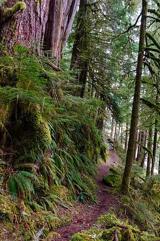 fern-lined baker lake trail 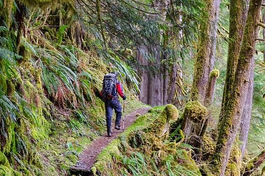 trekking along 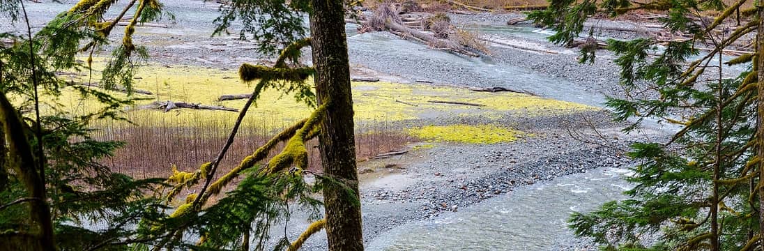 great colors in the river 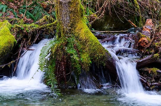 i think there's enough water for this tree 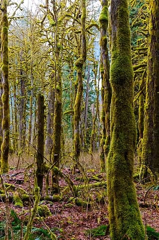 wet much? 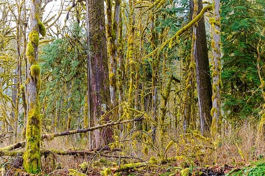 yep 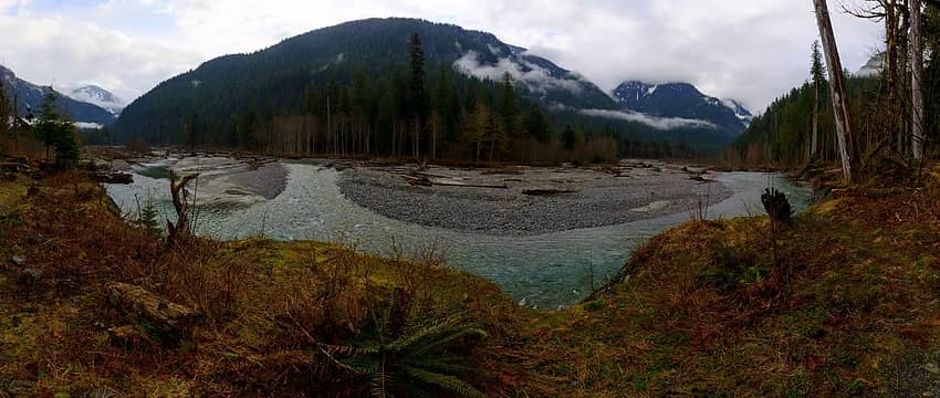 a braided bend 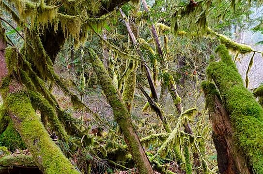 green chaos  really green! 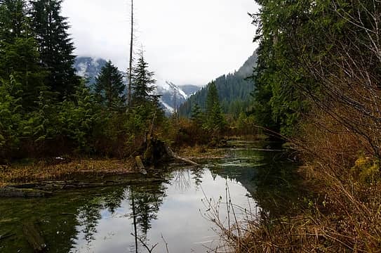 peaceful pond 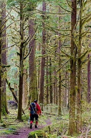 truckin' 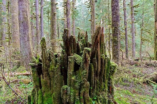 splintered 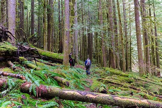 more green 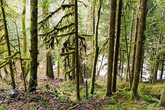 more moss 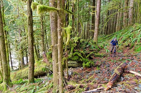 more truckin' 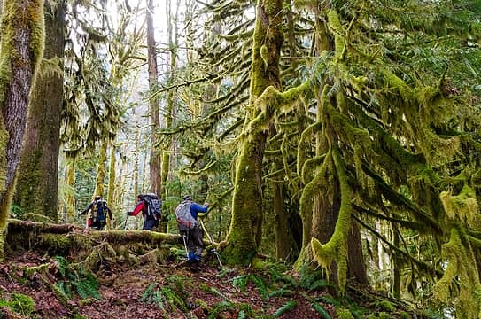 and some more 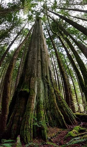 a big one 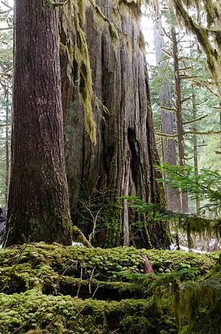 another monster tree 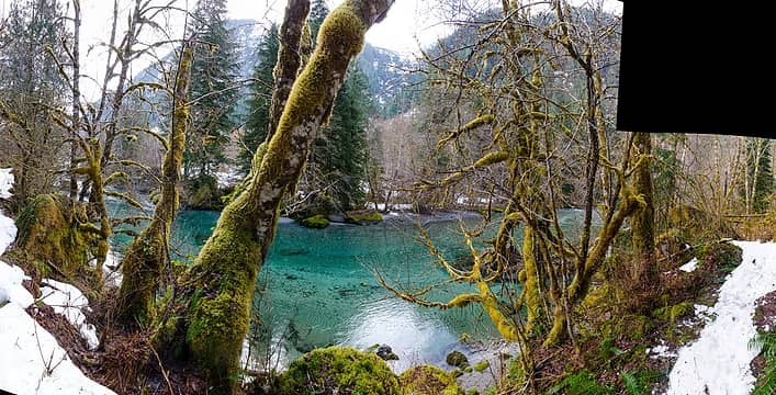 missed a spot 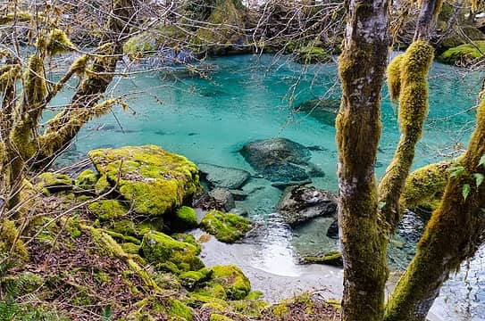 a fine spot for a beer on a hot day 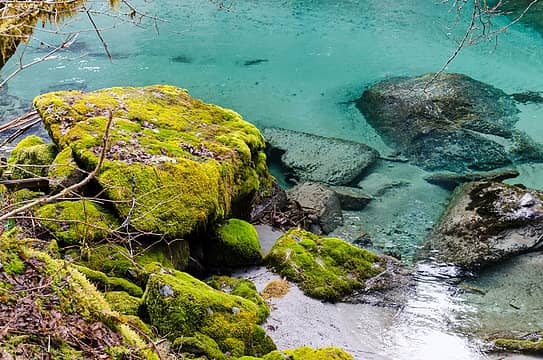 or just dangling your feet in the water 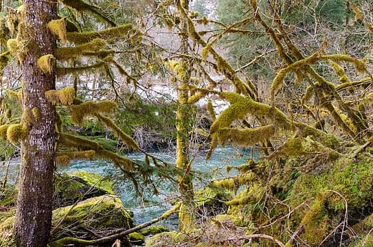 hard to hike with these sights 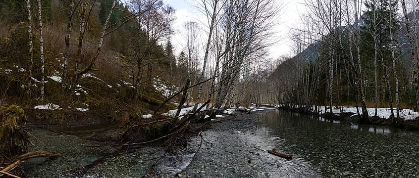 walking in the braided river instead of the brushy hillside 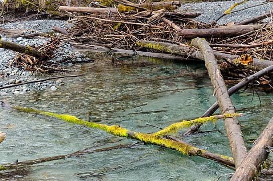 moss on water 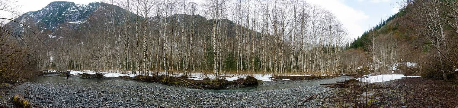 the trees take a stand in the river 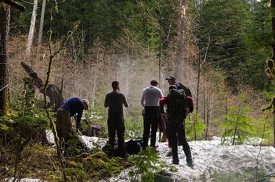 nothing like a bunch of steamy dudes 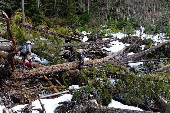 crossing crystal creek 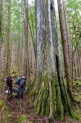 getting ready for the steep 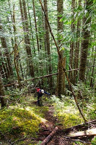 up we go via a game trail 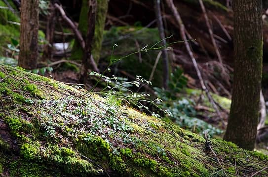 a gap of light 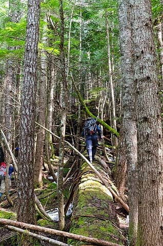 r3h takes the high road 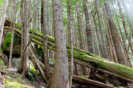 did the boulder take out the tree? 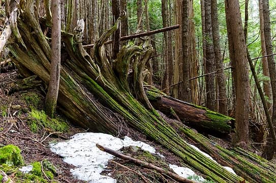 being slowly absorbed 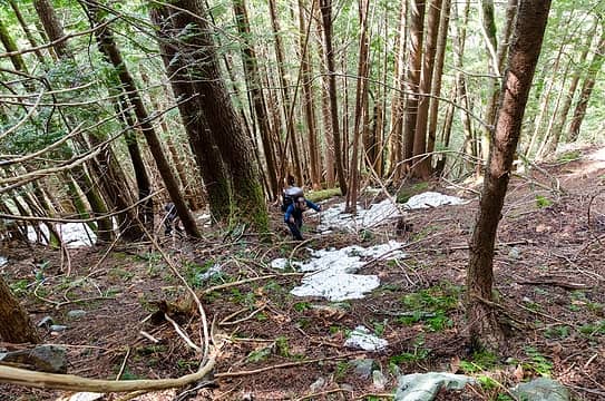 steep 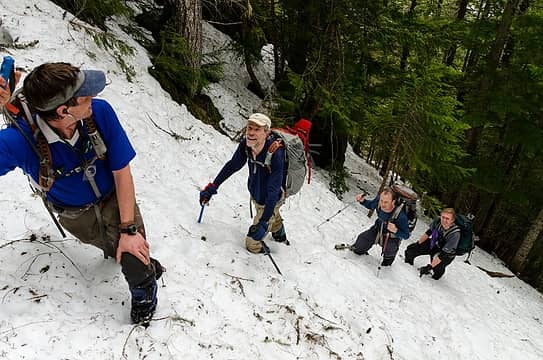 more steep, now in snow 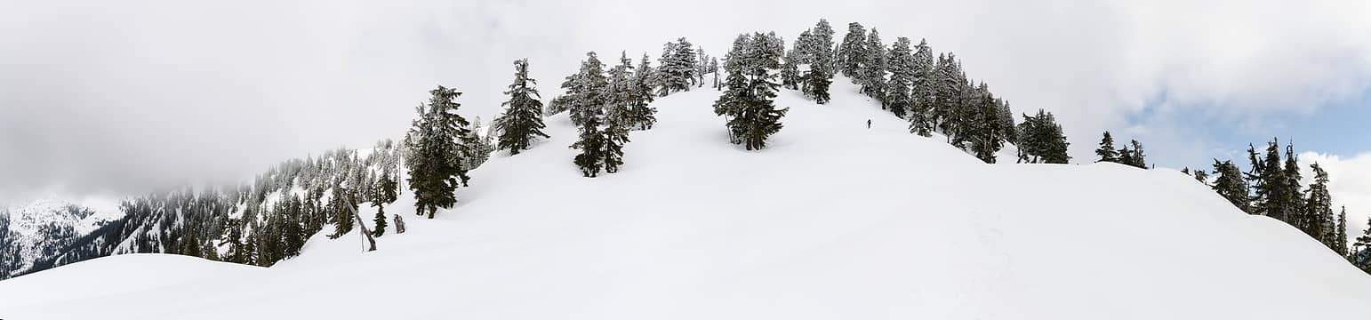 now, up in the firm, flatter snow 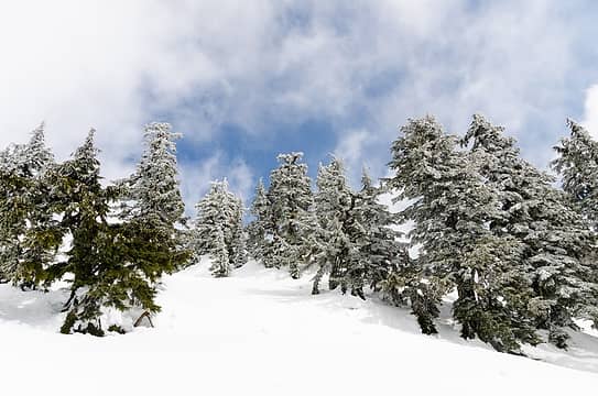 and a touch of frosty trees 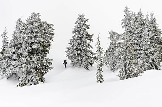 r3h on final approach 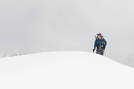 touchdown!  ghostly figure emerges 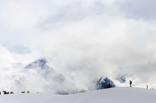 clouds burning off 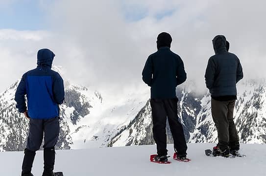 gazing 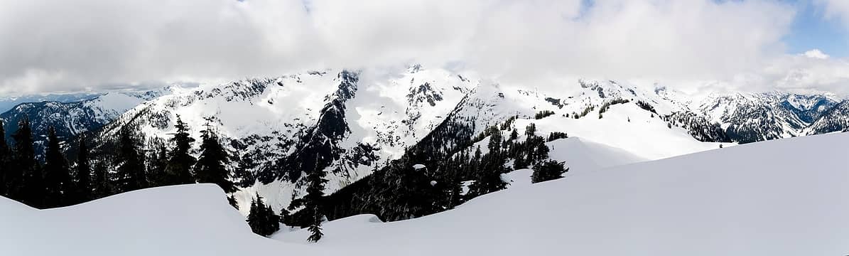 seahpo, shuksan, and icy area 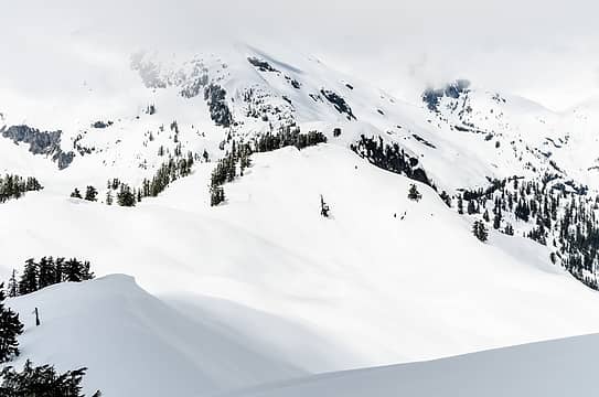 blister's NW ridge towards phantom pass and icy 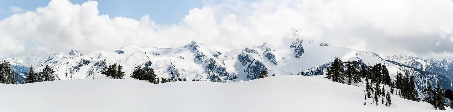 despair through blum 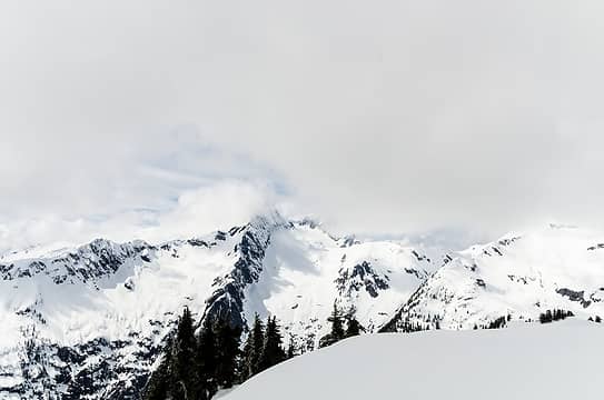 seahpo 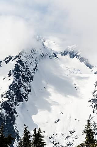 more seahpo 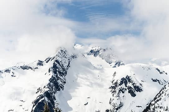 nooksack tower peaks out 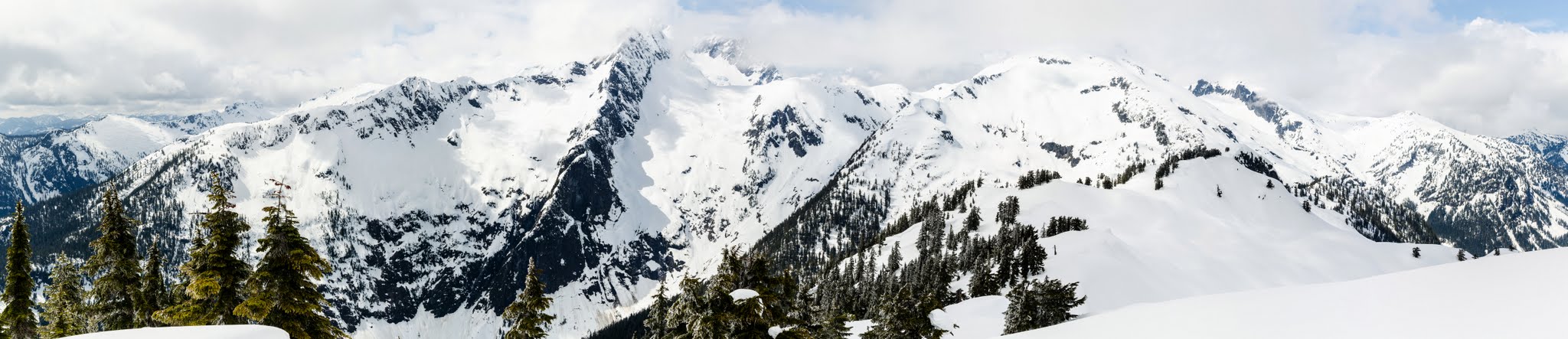 clouds parting a bit more 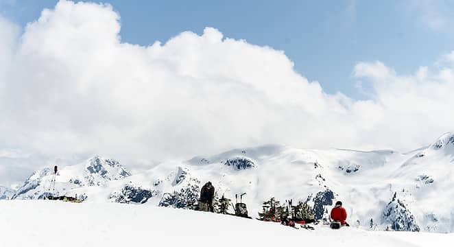 soaking it in  shadows  stefan calls for the sun 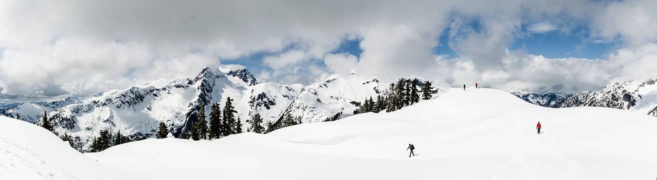 summit scattering 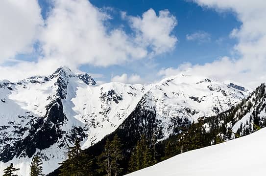 final look as the clouds really part 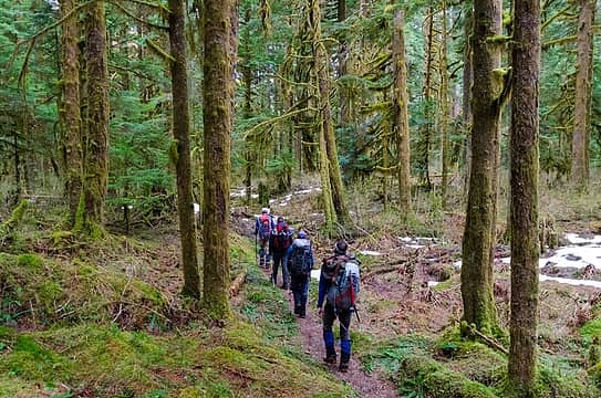 how long is this trail?
|
| Back to top |
|
|
Matt
Tea, Earl Grey, Hot
Joined: 30 Jan 2007
Posts: 4308 | TRs | Pics
Location: Shoreline |
|
Matt
Tea, Earl Grey, Hot
|
Tue Apr 17, 2012 3:33 pm |
|
|
John Roper provides the following info about Blister Mountain:
The Blister Mountain name came about from its shape, in honor of what as climbers we have all experienced by foot. Dick Kegel, Bruce Gibbs, and jr climbed this (FA?/first descent? 6/21/92) the day after we climbed Cloudcap and Icy (over Ruth) about 20 years ago, exiting that ridge you guys came up.
More info here, including John's photos of Blister from Icy:
http://listsofjohn.com/PeakStats/Climbers.php?Id=51097
I had wondered whether that traverse was workable across Phantom Pass from the east ridge of Icy to the north ridge of Blister. It sounds like an interesting way to exit from Seahpo (aka Cloudcap) without having to retrace the route back over Icy & Ruth.
As beacons mountains burned at evening. J.R.R. Tolkien
As beacons mountains burned at evening. J.R.R. Tolkien
|
| Back to top |
|
|
kite
Member

Joined: 28 Sep 2009
Posts: 1416 | TRs | Pics
Location: Olympia |
|
kite
Member
|
Tue Apr 17, 2012 4:05 pm |
|
|
Wow the color in the Baker river photos is amazing!
|
| Back to top |
|
|
raising3hikers
Member
Joined: 21 Sep 2007
Posts: 2344 | TRs | Pics
Location: Edmonds, Wa |
Matt, your patience paid off to get the best look at Icy Peak. Nice job  I guess the rest of us left just a little too soon. I guess the rest of us left just a little too soon.
|
| Back to top |
|
|
Matt
Tea, Earl Grey, Hot
Joined: 30 Jan 2007
Posts: 4308 | TRs | Pics
Location: Shoreline |
|
Matt
Tea, Earl Grey, Hot
|
Tue Apr 17, 2012 11:25 pm |
|
|
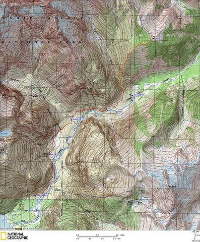 Blister GPS Track
As beacons mountains burned at evening. J.R.R. Tolkien
As beacons mountains burned at evening. J.R.R. Tolkien
|
| Back to top |
|
|
Matt
Tea, Earl Grey, Hot
Joined: 30 Jan 2007
Posts: 4308 | TRs | Pics
Location: Shoreline |
|
Matt
Tea, Earl Grey, Hot
|
Tue Apr 17, 2012 11:32 pm |
|
|
And finally, here is a stitched panorama of the view from Blister's summit. I took these from the northern lobe of the summit. Because it's such a wide summit, one has to walk several hundred feet to look off different sides, so it's not possible to put together a single pan that looks down into the drainages on the sides and end at the same time.
It was interesting tracing out the valleys. I had forgotten that the Baker River has its headwaters at Perfect Pass (nowhere near Mt. Baker) and that Picket Creek is one of it's tributaries. And it was sort of a surprise to find that one could see so far up the valleys to Chillwack and Jasper passes. It's also amazing that Sjolseth crossed much of this terrain in a single solo trip.
I think Mineral Mountain is going up high on my wish list for early summer.
As beacons mountains burned at evening. J.R.R. Tolkien
As beacons mountains burned at evening. J.R.R. Tolkien
|
| Back to top |
|
|
Matt Lemke
High on the Outdoors

Joined: 15 Jul 2010
Posts: 2052 | TRs | Pics
Location: Grand Junction |
|
Matt Lemke
High on the Outdoors
|
Tue Apr 17, 2012 11:40 pm |
|
|
Very Very nice pano Matt
I can't wait to get up in the Picketts this summer....it is about time!
|
| Back to top |
|
|
markod72
Member
Joined: 28 Jul 2011
Posts: 33 | TRs | Pics
Location: Surveillance Van #5 |
|
markod72
Member
|
Tue Jun 18, 2013 6:31 pm |
|
|
| iron wrote: | more steep, now in snow |
All smiles...love it.
Looks like a good day out.
|
| Back to top |
|
|
|
|


