Motivated by Jim Ks 4-2-2006 trip report on Guye Peak, rodman and I decided to give it a try since neither of us had ever done Guye Peak via the Commonwealth Basin route we also liked the idea of the hard-packed super highway leading to Guyes false summit this meant that we wouldnt have to bother with the snow shoes.
Jims report gives excellent details on this trip so Ill pick up from where we crossed the creek after reaching the basin immediately after the creek crossing the trail splits... one trail heads in the direction of the saddle between Guye and Cave Ridge and the other trail heads on up Commonwealth Basin we had heard a rumor that most people make the mistake of heading towards the Guye/Cave saddle too early and that the easiest way to reach the saddle is to continue up the basin for awhile taking this suggestion to heart, we continued on up the basin on well-packed trail a mile or so later we knew that we had taken the wrong route however, since the trail continued to be easy, we continued for another half mile to the end of Commonwealth Basin.
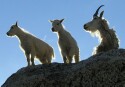
After discussing our options we decided to posthole (uh where were the snow shoes) our way up to Cave Ridge it took us an hour to reach the ridge with the last 200 feet of elevation gain being relatively steep we were rewarded with nice views of Guye Peak, Silver Peak in the foreground of Mt. Rainier, and a look across Red Pass to Mt. Thompson after a short rest we dropped off of Cave Ridge and found the super highway leading over to Guye Peak with high clouds starting to move in we made a quick trip up to the false summit of Guye.
We returned to the car via the route in Jim Ks trip report you know, the route we should have used on the way in according to rodmans GPS we covered 6.75 miles (seemed like more, probably because of the post-holing) and gained 2995 feet of elevation.
rodman's GPS route and pictures.
..
"Teanaway 70" Peaks List... a guide to hiking and scrambling in the Teanaway Area.
----------------
0
"Teanaway 70" Peaks List... a guide to hiking and scrambling in the Teanaway Area.
----------------
You guys definitely had the grand tour of Commonwealth Basin. You also had much better views than we did. We could not even see over to the real summit of Guye.
What fun is it just following in a trench? Of course, cutting new trail is easier with snowshoes. All in all, it looks like you had a good time.
Ah yes, ya'll took the scenic loop route .
At least you had some views. We just had the work out...and that bit of exhilaration of standing on the summit. But it was still a fun hike.
Nice photos!
This thing called work is interfering with my play
0
This thing called work is interfering with my play
Guye Peak caps out at 5168 feet. How did you manage to gain 2995 feet? Starting at 2173 feet would put your jumpoff a mile before the Denny Creek turnoff from I-90. That figure is the elevation gain for climbing Red Mtn which comes in at 5890 feet with a Commonwealth Creek jumpoff. Maybe your GPS is sensitive and factors in the elevation lost by the postholing. The numbers created by the box don't jibe with the known elevations of the map.
Mike,
It would not have been possible if they climbed up to the saddle then on to the summit. Instead, they took the grand tour topping out on Cave Ridge before dropping down and then climbing up to the summit. The GPS track in their pictures shows them getting just above the summit of Guye (5200') before dropping down and then climbing up Guye.
You cannot post new topics in this forum You cannot reply to topics in this forum You cannot edit your posts in this forum You cannot delete your posts in this forum You cannot vote in polls in this forum
Disclosure: As an Amazon Associate NWHikers.net earns from qualifying purchases when you use our link(s).


 .
At least you had some views. We just had the work out...and that bit of exhilaration of standing on the summit. But it was still a fun hike.
.
At least you had some views. We just had the work out...and that bit of exhilaration of standing on the summit. But it was still a fun hike.  Nice photos!