| Previous :: Next Topic |
| Author |
Message |
Sadie's Driver
Sadie's Driver


Joined: 24 Apr 2006
Posts: 1763 | TRs | Pics
Location: Welcome Pass |
Sadie has friends visiting. Arrived on Wednesday from Austin, TX - kid home from college (UT). They wanted to go on a hike - see the mountains and find a lake. Sadie had the perfect hike - one of her favorites - Tonga Ridge: Fisher Lake and Mt. Sawyer. Reports said that the snow was melting fast. Hiker Jim said that he wanted to tag along - he'd never done(!) Sawyer or Fisher. Imagine that. A first for HJ. So, we headed out a little after 7:00 a.m. - wanted an early start because it was supposed to be warm today. Got to the trailhead about 9:00 a.m. - about 4 other cars there, likely overnight folks. The kid was excited about joining the driver and Sadie.
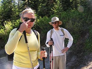 The kid enjoying a hike with mom and Sadie. Tony along for the jaunt. 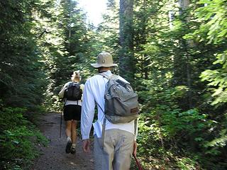 Heading up the trail and into the forest. 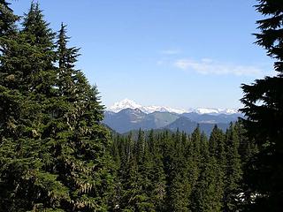 Glacier Peak from the viewpoint 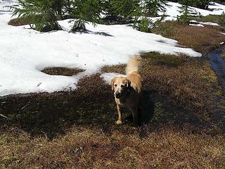 Sadie gets a first dip in a pond near Sawyer Pass. 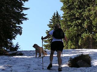 Kid and Sadie heading up the slope on bump #3 heading south towards Fisher. 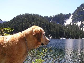 Sadie at Fisher Lake 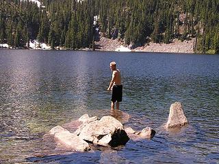 Texas Tony contemplating the refreshing waters of an alpine lake 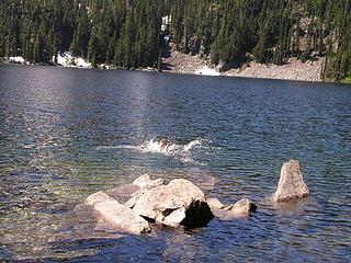 He actually did it! 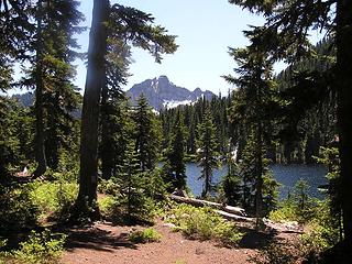 View from Fisher to the East/Southeast 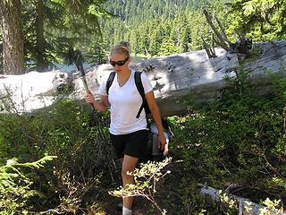 "Little Log" over the trail kid crawled under 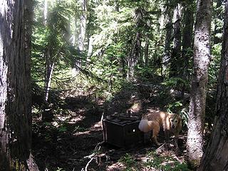 Sadie checking out the trail facilities 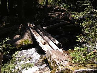 Bridge across Sawyer outlet stream 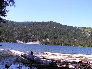 View west at the east end of Fisher 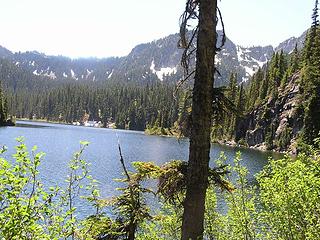 Ptarmigan Lake 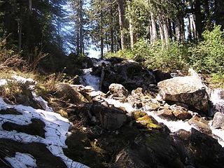 Outlet Stream from Fisher 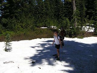 Snowball fight 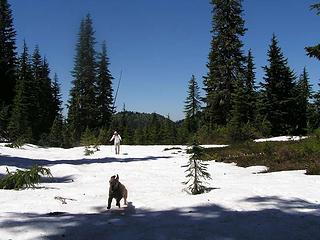 Sadie enjoys a good snowball fight, too. 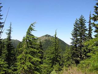 Mt. Sawyer from Fisher Lake Trail 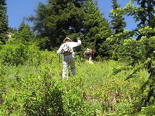 Tony, Jim and Sadie bushwhacking up to Sawyer 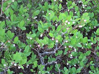 Hiker Jim, Sadie and the Driver will be back in August 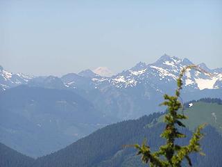 Mt. Rainier peeking out 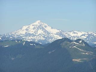 Glacier Peak spectacular from Sawyer 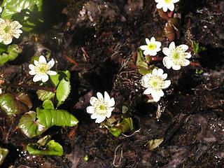 Marsh Marigolds 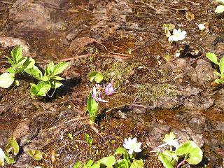 Shooting Star
Four-paw buddy lets me tag along!
Four-paw buddy lets me tag along!
|
| Back to top |
  
|
|
Backpacker Joe
Blind Hiker

Joined: 16 Dec 2001
Posts: 23956 | TRs | Pics
Location: Cle Elum |
Nice report and pics. It's been a while since Ive been there. Looks good.
"If destruction be our lot we must ourselves be its author and finisher. As a nation of freemen we must live through all time or die by suicide."
Abraham Lincoln
"If destruction be our lot we must ourselves be its author and finisher. As a nation of freemen we must live through all time or die by suicide."
Abraham Lincoln
|
| Back to top |
|
|
Larry
Member

Joined: 22 Feb 2003
Posts: 1084 | TRs | Pics
Location: Kitsap |
|
Larry
Member
|
 Sun Jul 02, 2006 4:20 am |
|
|
NICE report. Nice pix. Thanks for sharing this sunny day!
|
| Back to top |
|
|
MtnGoat
Member

Joined: 17 Dec 2001
Posts: 11992 | TRs | Pics
Location: Lyle, WA |
|
MtnGoat
Member
|
Sun Jul 02, 2006 8:07 am |
|
|
Looks like a great hike for some texas visitors on a great day, glad someone went swimming, that's a vital part of lake visitation!
Diplomacy is the art of saying 'Nice doggie' until you can find a rock. - Will Rogers
Diplomacy is the art of saying 'Nice doggie' until you can find a rock. - Will Rogers
|
| Back to top |
|
|
ActionBetty
Im a dirty hippie!

Joined: 06 Jul 2003
Posts: 4807 | TRs | Pics
Location: kennewick, wa |
|
ActionBetty
Im a dirty hippie!
|
Sun Jul 02, 2006 9:44 am |
|
|
Austin has this natural limestone pool that is open all year round..its called "barton springs"...it's as cold as the alpine lakes in the summer.
Nice to see some Austinites enjoying the snow covered trails 
"If you're not living good, you gotta travel wide"...Bob Marley
"If you're not living good, you gotta travel wide"...Bob Marley
|
| Back to top |
|
|
Sadie's Driver
Sadie's Driver
Joined: 24 Apr 2006
Posts: 1763 | TRs | Pics
Location: Welcome Pass |
| Quote: | | Austin has this natural limestone pool that is open all year round..its called "barton springs"...it's as cold as the alpine lakes in the summer. |
Kid says that Fisher Lake was a LOT colder than Barton! They loved it.
This is a great hike - tricky part is finding the first part of the trail - helps keep the crowds down! Adviso - bear frequently spotted on the route near the lake - be aware of you're planning an overnight. s.d.
Four-paw buddy lets me tag along!
Four-paw buddy lets me tag along!
|
| Back to top |
|
|
|
|
You cannot post new topics in this forum
You cannot reply to topics in this forum
You cannot edit your posts in this forum
You cannot delete your posts in this forum
You cannot vote in polls in this forum
|
Disclosure: As an Amazon Associate NWHikers.net earns from qualifying purchases when you use our link(s). |


