| Previous :: Next Topic |
| Author |
Message |
Ancient Ambler
Member


Joined: 15 May 2007
Posts: 1092 | TRs | Pics
Location: Bainbridge Island |
Attempting to tune up for a longer hike later this week, took off for the Upper Dungeness TH and a trip into Deception Basin cross-country from the Heather Creek Trail. Reached the TH mid afternoon Friday. The first minor challenge is the lashed-together fix to the collapsed log bridge about 1/2 mile downstream from Camp Handy. Shouldn't be a problem for most, but if you're loaded up like Lawnchair Al, specialist in ultra-heavy hiking, you can snag whatever you've got tied to the top of your pack on the hand ropes that cross the bridge diagonally at a dicey location.
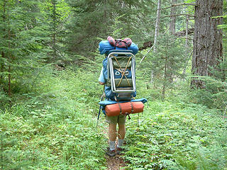 Lawnchair Al, ultra heavy specialist 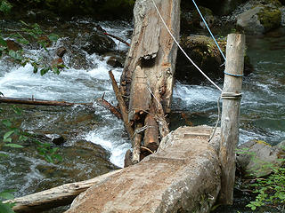 Dungeness River crossing 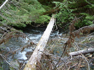 Tight-rope crossing 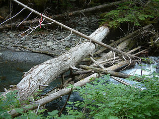 A better choice 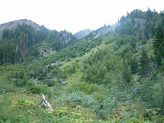 Heather Creek Basin route start 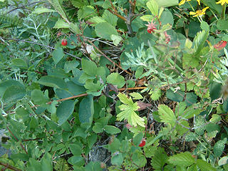 Mountain strawberries north of Heather Creek basin 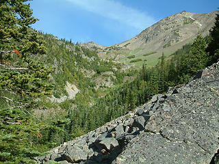 Middle portion of route 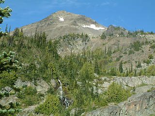 Fricaba basin waterfall, Hal Foss Peak 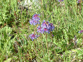 On route to Fricaba Pass 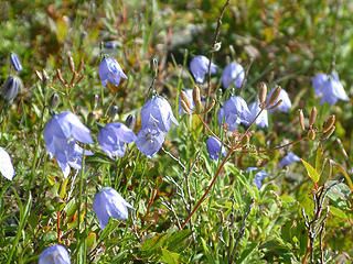 Harebells on route to Fricaba Pass 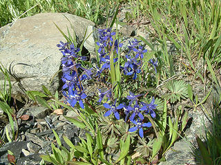 On route to Fricaba Pass 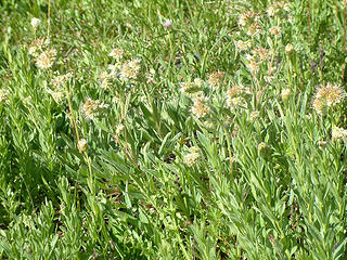 On route to Fricaba Pass 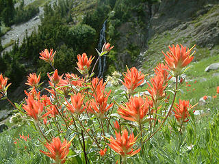 Paintbrush and waterfall, Fricaba Basin 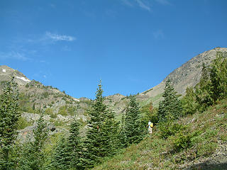 Hal Foss Pk, Fricaba Pass, Fricaba 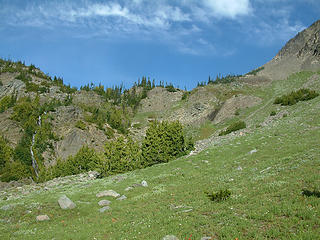 Fricaba Basin 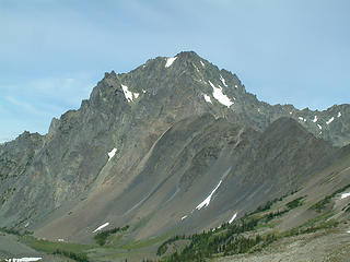 Mt. Deception from Fricaba Pass 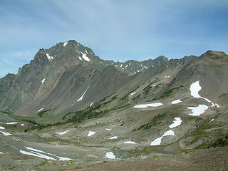 Upper Deception Basin from Fricaba Pass 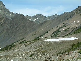 1 label Deception Pass from Deception Basin 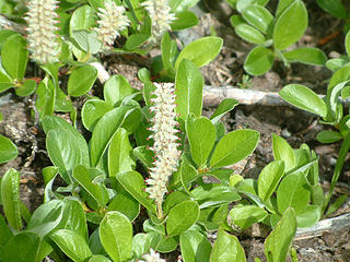 Deception Basin 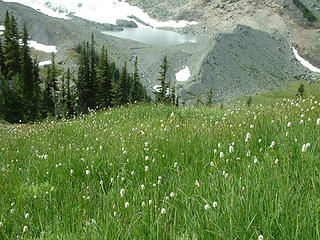 Tow-headed babies, Deception Basin 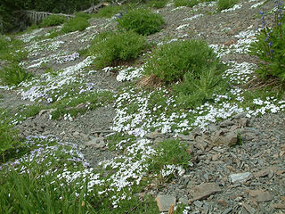 Phlox, Deception Basin 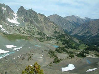 Upper and Lower Royal Basin from Deception Pass 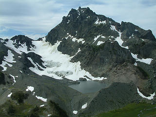 Mt. Mystery and Lake Mystery from Deception Pass 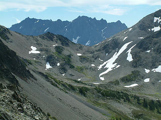 Constance, Inner Constance, Fricaba Pass from Deception Pass 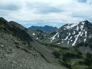 Upper Deception Basin from Deception Pass 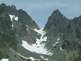 Surprise Basin from Deception Pass 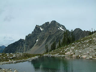 Mt. Deception from tarn, upper Deception Pass 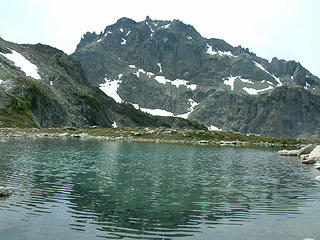 Mt. Mystery from tarn, upper Deception Basin 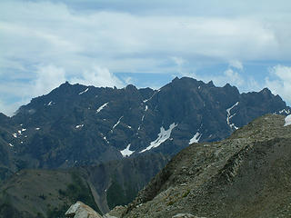 Constance, Inner Constance from Fricaba Pass 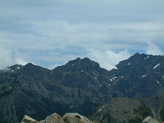 Cloudy Peak, Warrior, Constance from Fricaba Pass
|
| Back to top |
  
|
|
reststep
Member

Joined: 17 Dec 2001
Posts: 4757 | TRs | Pics
|
|
reststep
Member
|
 Mon Aug 13, 2007 6:19 pm |
|
|
Beautiful country.
Thanks for the report and pictures.
That is an interesting route to Deception Basin. I like it.
I tried to get there once by following Deception Creek up but did not make it. I made it to the spot below below Gunsight Pass where 2 branches of Deception Creek come together.
"The mountains are calling and I must go." - John Muir
"The mountains are calling and I must go." - John Muir
|
| Back to top |
|
|
ScottM
Member

Joined: 18 Apr 2007
Posts: 363 | TRs | Pics
Location: The Olympics |
|
ScottM
Member
|
Mon Aug 13, 2007 7:42 pm |
|
|
Very nice. I always like your trip reports because you like to do the kind of trips I like to do (or is it, I like to do the kind of trips you like to do). It looks like a return trip down the Royal Basin trail would make a pretty nice loop trip.
|
| Back to top |
|
|
Magellan
Brutally Handsome

Joined: 26 Jul 2006
Posts: 13116 | TRs | Pics
Location: Inexorable descent |
|
Magellan
Brutally Handsome
|
Mon Aug 13, 2007 9:24 pm |
|
|
Abandoned, remote, lonely. I like. 
|
| Back to top |
|
|
silence
Member

Joined: 25 Apr 2005
Posts: 4420 | TRs | Pics
|
|
silence
Member
|
Tue Aug 14, 2007 8:19 am |
|
|
EXCELLENT!! Awesome views of some rarely seen backcountry. Thanks for the great TR and pix.
PHOTOS
FILMS
Keep a good head and always carry a light bulb. Bob Dylan
PHOTOS
FILMS
Keep a good head and always carry a light bulb. Bob Dylan
|
| Back to top |
|
|
Phil
Member

Joined: 02 Jul 2003
Posts: 2025 | TRs | Pics
Location: Shoreline, WA |
|
Phil
Member
|
Sun Sep 09, 2007 4:26 pm |
|
|
Sorry for the late reply to this one ...dunno how I missed it. But anyway wow what a hike! AA we think alike, it seems. I'm pooring over maps for dayhike ideas and jotted down the route up Heather and then over Del Monte ridge to Constance pass and back down Dungeness. Then check this site and behold here's your report on the critical first part of that route.
How long did it take you to go from your campsite to the open terrain of Fricaba pass? From reading your report seemed like just 2-3 hours.
|
| Back to top |
|
|
Ancient Ambler
Member
Joined: 15 May 2007
Posts: 1092 | TRs | Pics
Location: Bainbridge Island |
Phil:
We took our time, with a number of photo breaks, so it was a little over 2 hours from our camp at the end of the Heather Creek trail to get to Fricaba Pass. Are you thinking of entering Deception Basin via Heather Creek/Fricaba Pass, descending Deception Creek a bit and then heading up to Gunsight Pass, and then exiting via Del Monte and Constance Pass back to the Dungeness TH, all in one day? That's what I'd call a long day. As for the Heather Creek to Deception Basin route, I'd been considering it for a few years, looking at the route from other mountains in the area. Then earlier this summer in a post here EThorson mentioned it as something he was thinking of doing, so that got me off the dime. He mentioned a couple of other places he was considering going that I have also been thinking about-- nwhikers.net definitely appeals to like-minded hikers.
|
| Back to top |
|
|
Phil
Member
Joined: 02 Jul 2003
Posts: 2025 | TRs | Pics
Location: Shoreline, WA |
|
Phil
Member
|
Mon Sep 10, 2007 8:34 am |
|
|
| Ancient Ambler wrote: | | Are you thinking of entering Deception Basin via Heather Creek/Fricaba Pass, descending Deception Creek a bit and then heading up to Gunsight Pass, and then exiting via Del Monte and Constance Pass back to the Dungeness TH, all in one day? That's what I'd call a long day. |
Gunsight pass is between Mystery and Hal Foss? If so, then yes that is the route I was thinking of as an armchair navigator. I would welcome any tips. E.G., dropping into Deception basin is necessary, versus up and over Hal Foss from Fricaba pass?
Alternatively, looping down Royal Basin would be cool and maybe more straight-forward, even back over the ridge to take in Goat lake on the way out.
|
| Back to top |
|
|
|
|
You cannot post new topics in this forum
You cannot reply to topics in this forum
You cannot edit your posts in this forum
You cannot delete your posts in this forum
You cannot vote in polls in this forum
|
Disclosure: As an Amazon Associate NWHikers.net earns from qualifying purchases when you use our link(s). |


