| Previous :: Next Topic |
| Author |
Message |
markh752
Snoozing on a rock!


Joined: 03 Dec 2011
Posts: 866 | TRs | Pics
|
|
markh752
Snoozing on a rock!
|
 Sun Jul 01, 2012 12:04 am |
|
|
Since my BP trip went bust this weekend, I thought I would post a TH report.
FR 21 is open all the way. I started at Walupt Lake(Hoodoo is charging) early in the am. After cresting the hill and seeing others going the opposite way, I assumed the entire road was open.
FR 2150 aka Snowgrass TH: the snow start 1/2 mile before the TH, just before the junction with Chambers Lake.
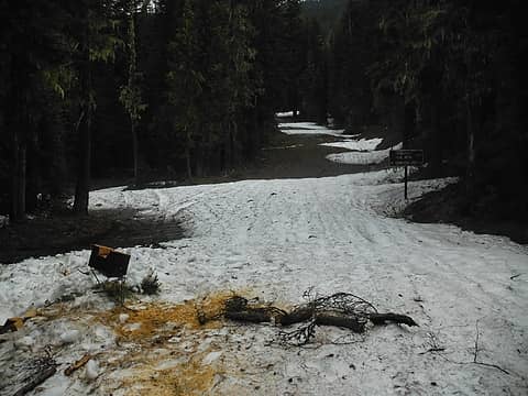 1/2mile from Snowgrass Flatts TH 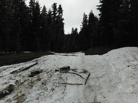 1/2 mile from Snowgrass Flatts TH 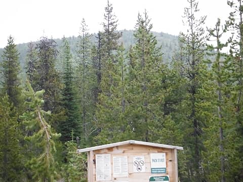 PCT sign on south side of Potato Hill 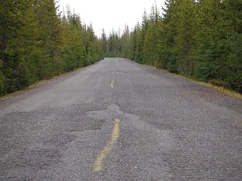 Who did this on the 5601? 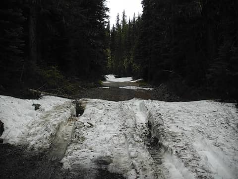 FR 2329 1 mile north of Killen Creek TH 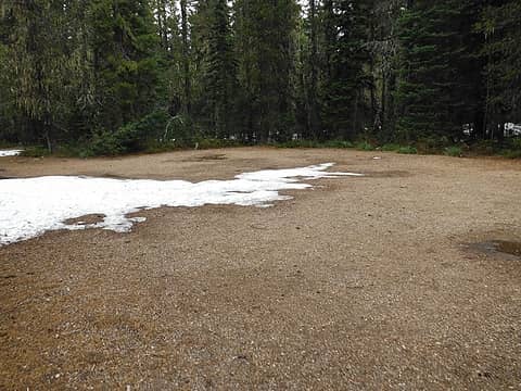 Killen Creek TH parking lot 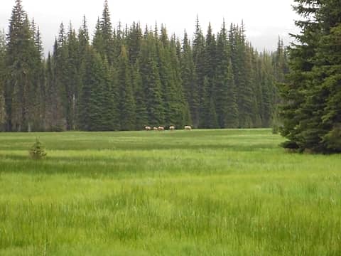 Muddy Meadows TH 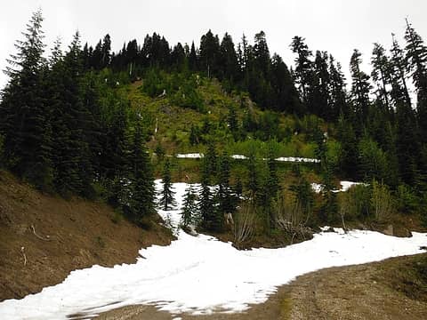 Sunrise Peak TH 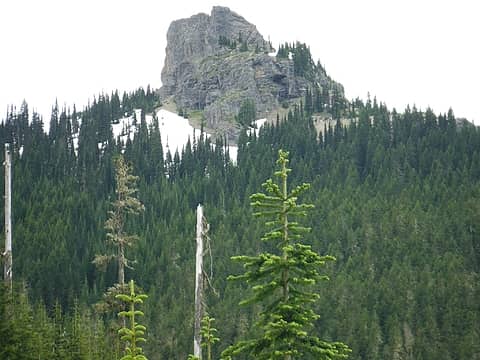 Sunrise Peak 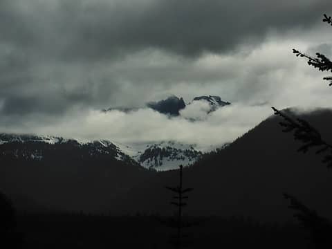 Cispus Pass?
|
| Back to top |
  
|
|
salpine
Member
Joined: 19 Jan 2009
Posts: 12 | TRs | Pics
Location: Oly |
|
salpine
Member
|
Sun Jul 01, 2012 10:24 am |
|
|
Thanks for the update... Good to see access is improving in that area.
|
| Back to top |
|
|
treeswarper
Alleged Sockpuppet!
Joined: 25 Dec 2006
Posts: 11279 | TRs | Pics
Location: Don't move here |
|
treeswarper
Alleged Sockpuppet!
|
Thu Jul 05, 2012 4:36 pm |
|
|
The Used Dog and I went up the 5508-024 (don't go there unless you have a high clearance on your car/truck) and hiked in on the seldom used Klickitat trail.
We hit snow and didn't try hard to find the trail under the snow, at 4500 feet on a north facing slope. I don't think there have been many feet on the trail as The Used Dog seemed unwilling to find the trail by using his nose. He has that power. I would say the snow depth averaged 3 feet.
The road has some nasty semi-washed out parts. I never tried it in my Subaru. I think it would have scraped. The Tomato Ranger crept through it all quite well.
Maybe I'll do a trail report.
What's especially fun about sock puppets is that you can make each one unique and individual, so that they each have special characters. And they don't have to be humananimals and aliens are great possibilities
What's especially fun about sock puppets is that you can make each one unique and individual, so that they each have special characters. And they don't have to be humananimals and aliens are great possibilities
|
| Back to top |
|
|
wildsky
Member
Joined: 08 Jul 2012
Posts: 1 | TRs | Pics
|
|
wildsky
Member
|
Sun Jul 08, 2012 4:46 pm |
|
|
I am bringing a group of scouts up this way next week. Does anybody have info or opinions on snow and trail/road conditions on the following route
Start Pompey trailhead from road 2301 taking trail 128/7 to walupt lake
continuing south on trail 7a and 115/116 to council bluff
and then west on trail 1 boundry trail to elk pass.
I need to know if the snow level later this week and next will proclude this trip.
Thanks
|
| Back to top |
|
|
markh752
Snoozing on a rock!
Joined: 03 Dec 2011
Posts: 866 | TRs | Pics
|
|
markh752
Snoozing on a rock!
|
Sun Jul 08, 2012 10:32 pm |
|
|
Wildsky, first I want to give you a  for taking your scouts on a nearly 100 mile trip. I know that I couldn't do a trip like that.
Unfortunately, what I observed is no longer valid due to the recent and continuing warm temps. If no one else chimes in, the best thing to do is go look for yourself. You can also call the Ranger Station in Randle or check the GPNF recreation conditions report.
http://www.fs.usda.gov/recmain/giffordpinchot/recreation#cond
Last year(maybe the year before) I saw a posting for the 116 at Chain of Lakes stating that a bridge was out over Adams Creek. I'm not sure if that ever got replaced. A call to the Ranger Station in Randle should answer this. for taking your scouts on a nearly 100 mile trip. I know that I couldn't do a trip like that.
Unfortunately, what I observed is no longer valid due to the recent and continuing warm temps. If no one else chimes in, the best thing to do is go look for yourself. You can also call the Ranger Station in Randle or check the GPNF recreation conditions report.
http://www.fs.usda.gov/recmain/giffordpinchot/recreation#cond
Last year(maybe the year before) I saw a posting for the 116 at Chain of Lakes stating that a bridge was out over Adams Creek. I'm not sure if that ever got replaced. A call to the Ranger Station in Randle should answer this.
|
| Back to top |
|
|
treeswarper
Alleged Sockpuppet!
Joined: 25 Dec 2006
Posts: 11279 | TRs | Pics
Location: Don't move here |
|
treeswarper
Alleged Sockpuppet!
|
Sun Jul 08, 2012 10:51 pm |
|
|
| wildsky wrote: | | I am bringing a group of scouts up this way next week. Does anybody have info or opinions on snow and trail/road conditions on the following route
Start Pompey trailhead from road 2301 taking trail 128/7 to walupt lake
continuing south on trail 7a and 115/116 to council bluff
and then west on trail 1 boundry trail to elk pass.
I need to know if the snow level later this week and next will proclude this trip.
Thanks |
That was the area I made it in two miles into. I believe I was at, or close to the junction of the Pompey trail and the Klickitat trail when I hit snow. However, it has been HOT here. It is still quite warm tonight and we are having quite the light show. That's why I'm still up.
I do not know of a 2301 road. The 2304 road, which accessed the Pompey trail washed out at Killborn Cr, in 2006 or 7, and there are no plans to repair it ever.
That's why I went in the way I did. I do not know how it would be to hike through the washout. It would be best for you to call the Cowlitz Valley R.D. in Randle.
This report is from July 5th last week.
https://www.nwhikers.net/forums/viewtopic.php?t=7999425
What's especially fun about sock puppets is that you can make each one unique and individual, so that they each have special characters. And they don't have to be humananimals and aliens are great possibilities
What's especially fun about sock puppets is that you can make each one unique and individual, so that they each have special characters. And they don't have to be humananimals and aliens are great possibilities
|
| Back to top |
|
|
|
|


