| Previous :: Next Topic |
| Author |
Message |
puzzlr
Mid Fork Rocks


Joined: 13 Feb 2007
Posts: 7223 | TRs | Pics
Location: Stuck in the middle |
|
puzzlr
Mid Fork Rocks
|
 Mon Nov 12, 2012 1:32 am |
|
|
This Frozen Mountain report is a November version of the excellent report by Martin S from Sep 2010 before the snow season. I think it's cheating to climb this peak when the temperature is above 32 degrees, but to each his own. Franklin and Yana climbed it from the other direction in seasonally correct January.
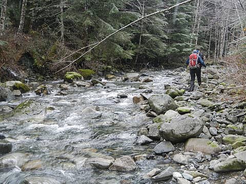
Paul, Adam and I took advantage of our Hancock permits before they expire and drove the long and winding roads to within half a mile of the North Fork Tolt river crossing where this climb starts heading uphill (another form of cheating?). The short cross-country section between the road and the river is surprisingly open forest. As Martin mentioned, there is another old logging road on the North side of the river, but Fay reported that it's brushy and that's confirmed by the short section we walked on our way out. Assuming the river crossing is reasonable, the south side roads are a better approach. We could have easily forded the the river today, but found a cluster of fallen alders to cross on.
 Annotated route 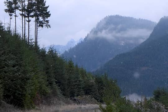 First view of Frozen Mountain on the drive up the North Fork Tolt river valley 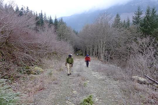 First half mile on an old logging road 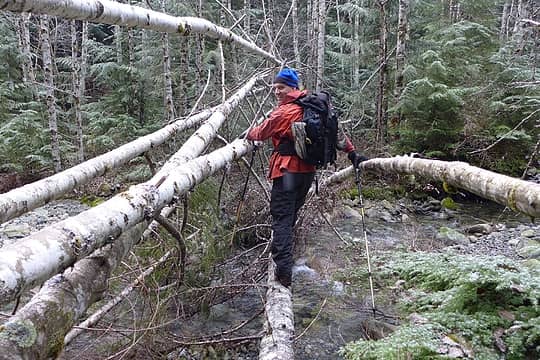 Crossing the North Fork Tolt 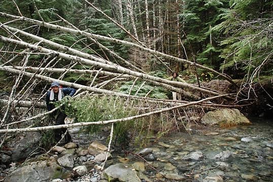 Crossing the North Fork Tolt 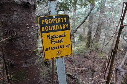 Old National Forest boundary sign beyond the creek 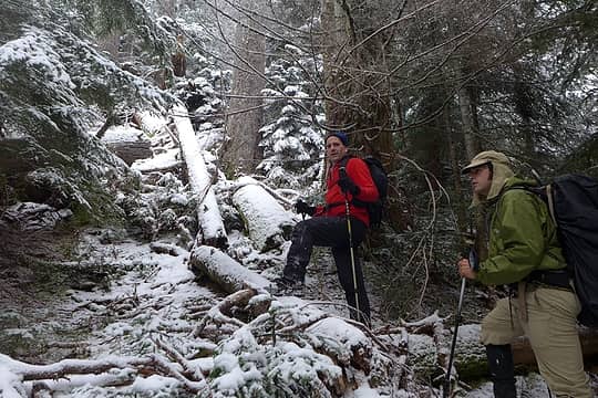 Negotiating blow downs and brush in the clearings 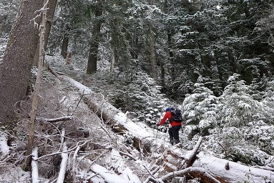 Taking advantage of log highways through the snowy brush 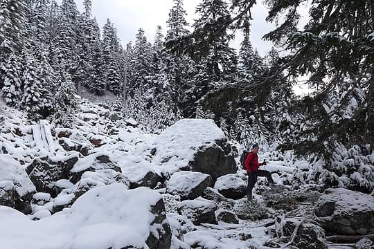 Snow talus provides a welcome break from the blueberry and alder bushwhacking 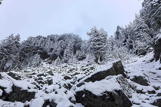 Looking up the final talus slope to the col. The summit is out of view to the right. 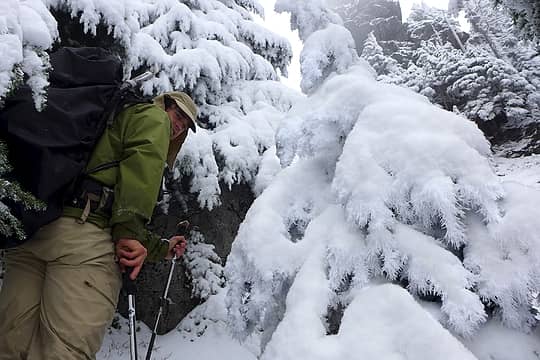 Hoarfrost on the trees near the col 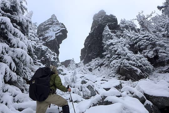 Two towers guard the col 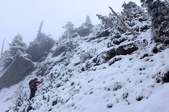 1 label Paul on snow covered slabs just below the summit 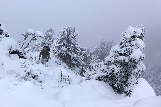 Final steps 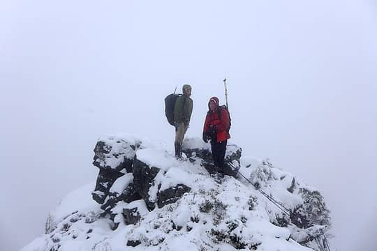 Blue skies everywhere except on the summit of Frozen. We saw nothing. 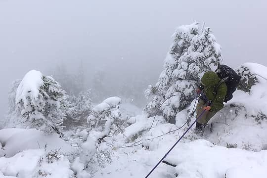 Adam rapping down the summit block to avoid a potentially dangerous slip 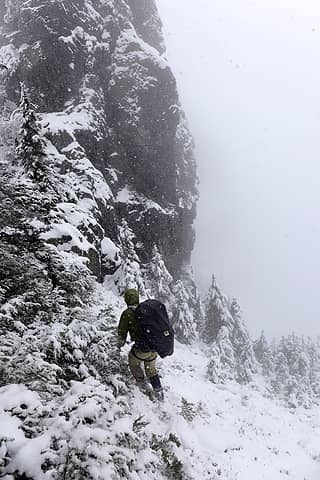 Traversing below the upper tower 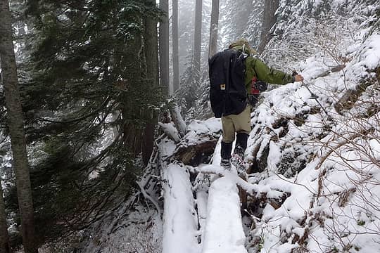 A fallen log provides convenient passage past a small cliff 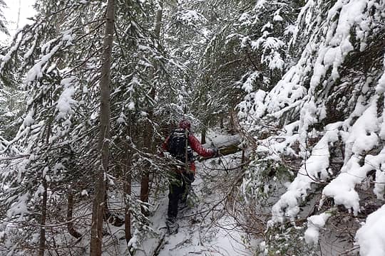 Bushwhacking through annoying small trees on the ridge at 4100'  One of many large old growth trees, probably 7' in diameter 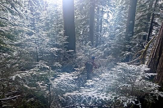 Frozen bushes (and fog on the lens) 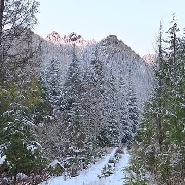 The mountain teases us by emerging just as we leave 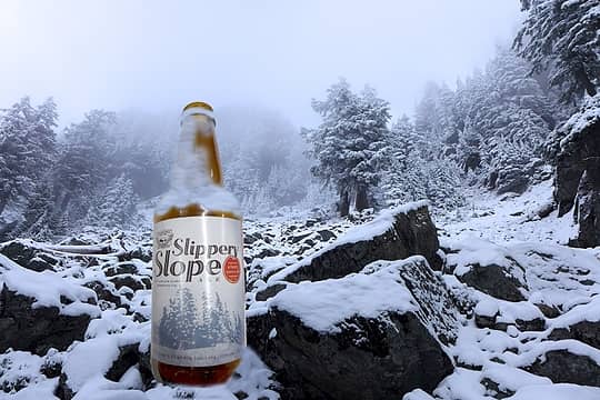 This climb sponsored by Slippery Slope Ale
|
| Back to top |
  
|
|
Magellan
Brutally Handsome

Joined: 26 Jul 2006
Posts: 13116 | TRs | Pics
Location: Inexorable descent |
|
Magellan
Brutally Handsome
|
Mon Nov 12, 2012 7:24 am |
|
|
Looks tough.  Glad you fellas enjoyed it. Glad you fellas enjoyed it.
|
| Back to top |
|
|
Bedivere
Why Do Witches Burn?

Joined: 25 Jul 2008
Posts: 7464 | TRs | Pics
Location: The Hermitage |
|
Bedivere
Why Do Witches Burn?
|
Mon Nov 12, 2012 7:33 am |
|
|
How do you guys walk on those snow covered logs? Microspikes? Crampons?
|
| Back to top |
|
|
LadyÆsa
Surefooted Spitfire

Joined: 16 Oct 2012
Posts: 671 | TRs | Pics
Location: Custer, Whatcom County, WA |
|
LadyÆsa
Surefooted Spitfire
|
Mon Nov 12, 2012 9:50 am |
|
|
Awesome trip.... Pretty pics.
Woo-Hoo! Ale! 
"We have one chance, one chance, to get everything right. We have one chance, one chance, and if we're lucky we might." One Chance, Modest Mouse
"We have one chance, one chance, to get everything right. We have one chance, one chance, and if we're lucky we might." One Chance, Modest Mouse
|
| Back to top |
|
|
n16ht5
Member
Joined: 21 Jun 2010
Posts: 592 | TRs | Pics
|
|
n16ht5
Member
|
Mon Nov 12, 2012 10:17 am |
|
|
|
| Back to top |
|
|
iron
Member

Joined: 10 Aug 2008
Posts: 6392 | TRs | Pics
Location: southeast kootenays |
|
iron
Member
|
Mon Nov 12, 2012 10:51 am |
|
|
great quote:
| Quote: | | Blue skies everywhere except on the summit of Frozen. We saw nothing. |
|
| Back to top |
|
|
Gimpilator
infinity/21M

Joined: 12 Oct 2006
Posts: 1688 | TRs | Pics
Location: Edmonds, WA |
A great day in the mountains. Glad I could be a part of it.
 North Fork Tolt 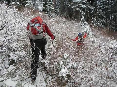 Brushwhacking 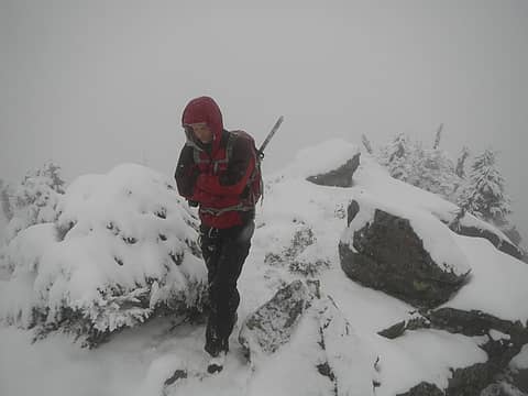 Monty On The Summit 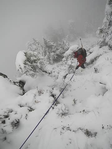 Paul Rappelling From Summit 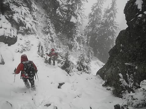 Descending From The Col 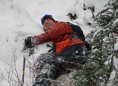 Paul Takes A Tumble
|
| Back to top |
|
|
Cyclopath
Faster than light

Joined: 20 Mar 2012
Posts: 7789 | TRs | Pics
Location: Seattle |
|
Cyclopath
Faster than light
|
Mon Nov 12, 2012 12:25 pm |
|
|
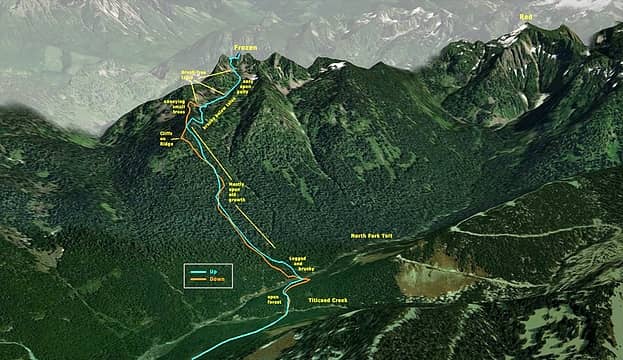
Looks like a great trip. How did you make that map?
|
| Back to top |
|
|
puzzlr
Mid Fork Rocks
Joined: 13 Feb 2007
Posts: 7223 | TRs | Pics
Location: Stuck in the middle |
|
puzzlr
Mid Fork Rocks
|
Mon Nov 12, 2012 6:15 pm |
|
|
re: How did you make that map?
1) GPS track to Basecamp (where I archive my GPS tracks)
2) Basecamp "view in Google Earth" to get track as GE path
3) Draw simplified up and down path in Google Earth using GPS track as guide
4) Add 50% transparent GE polygon to block distracting background
5) Save GE screen image as jpg
6) Add annotation in Photoshop (or other image editor)
|
| Back to top |
|
|
Matt
Tea, Earl Grey, Hot

Joined: 30 Jan 2007
Posts: 4308 | TRs | Pics
Location: Shoreline |
|
Matt
Tea, Earl Grey, Hot
|
Mon Nov 12, 2012 6:42 pm |
|
|
Looks cold.
Nice job on the map. Thanks for the info on how you made it.
As beacons mountains burned at evening. J.R.R. Tolkien
As beacons mountains burned at evening. J.R.R. Tolkien
|
| Back to top |
|
|
|
|


