| Previous :: Next Topic |
| Author |
Message |
Redwic
Unlisted Free Agent


Joined: 23 Feb 2009
Posts: 3292 | TRs | Pics
Location: Going to the Prom(inence) |
|
Redwic
Unlisted Free Agent
|
 Tue Jun 10, 2014 6:05 pm |
|
|
With Paul and I each having very busy non-peakbagging schedules for nearly the remainder of June, Paul thought this past weekend would be a good time to visit together the remaining fire lookouts in NE Washington that we had not yet seen. I wanted to add some lookout-related nuggets to the trip, as well. Adam wanted to get out during the weekend, too, but only wanted low-key stuff
for which potentially short road hikes fit the bill. It also marked the first official trip together for Paul and Adam.
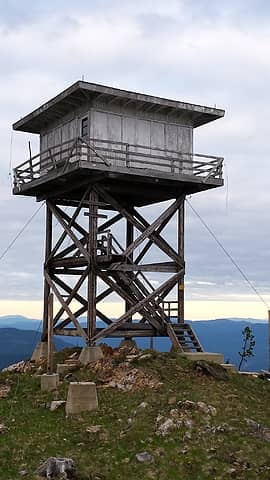
We left western Washington on Friday afternoon, arriving at the Sullivan Mountain Road in the middle of the night. The Sullivan Mountain Road is rough in various places, with snowbanks, a dirtslide crossing, and downed trees making this otherwise summit drive become a multi-mile road hike. Sometimes this stuff happens. We car-camped alongside the road and began hiking only three hours later to take advantage of first daylight. This might sound similar to a typical solo Redwic road/hiking trip but in reality we each had wanted a lot more sleep and were exhausted from the long drive the previous night. We soon arrived at the Sullivan Mountain Lookout. Great views of Abercrombie, Hooknose, Crowell Ridge, and Gypsy Ridge. When we got back to the vehicle, I had three ticks on my pants legs. Dang it. During the drive down the mountain, we were temporarily delayed by a skunk which refused to leave the roadway as he trotted down it. It was almost as if Gandalf the Skunk was saying, You shall not pass.
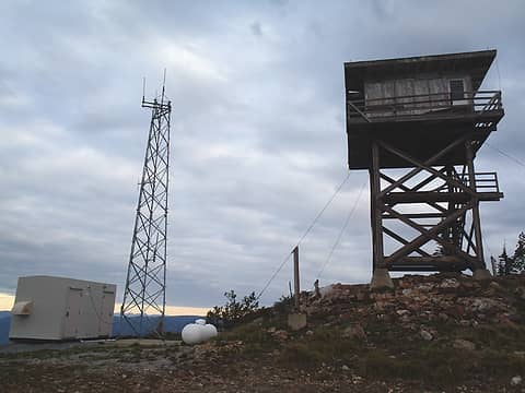 Sullivan Mountain LO 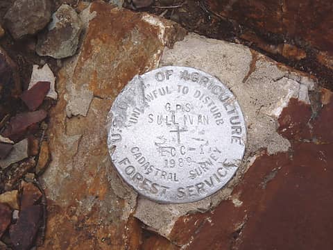 Sullivan Mtn Summit BM 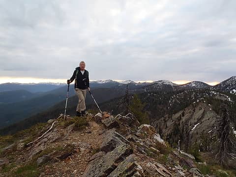 Paul, With Crowell Ridge 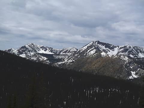 Peak 7177 & Gypsy Peak 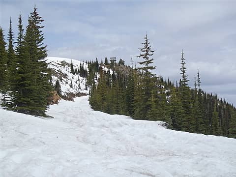 Looking To True Summit... 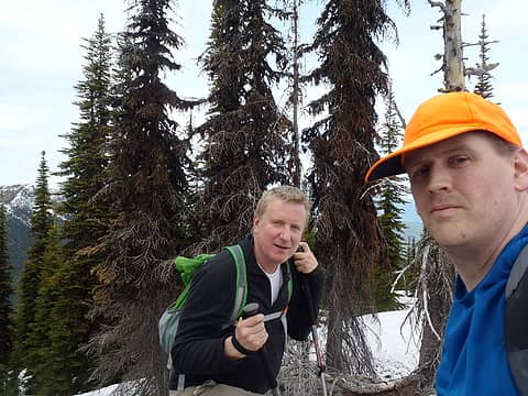 At True Summit Area Of Salmo 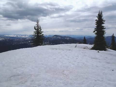 North (True) Summit Of Salmo 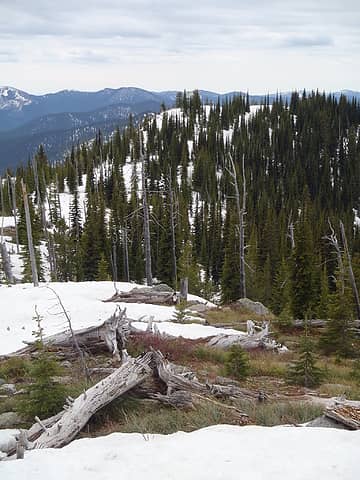 South Hill From True Summit 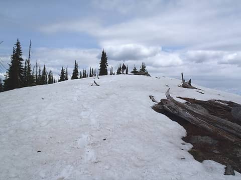 Paul Descends True Summit 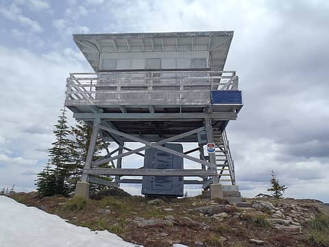 Salmo Mountain LO Tower 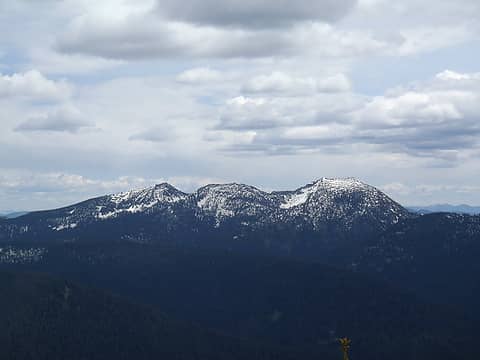 Nice Peaks! 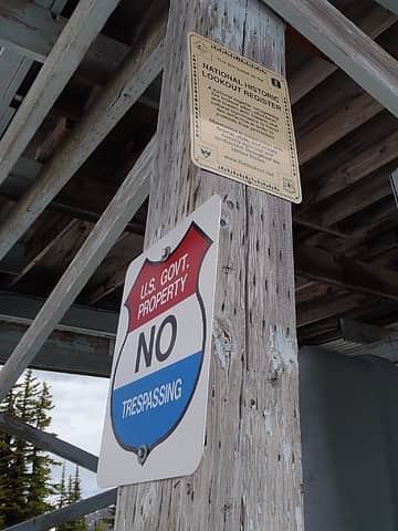 Don't Cross The Border Patrol 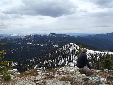 So Many Mountains, So Little Time 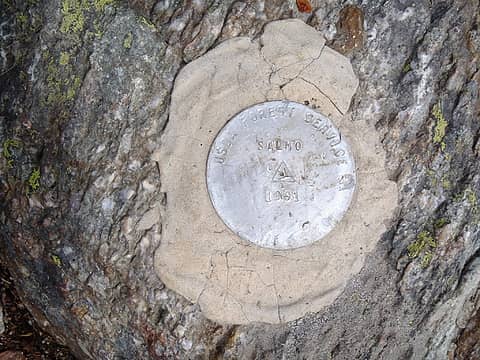 Salmo South Summit BM 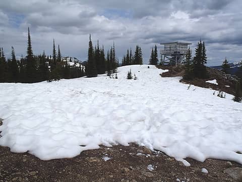 Salmo LO From Nearby Hill 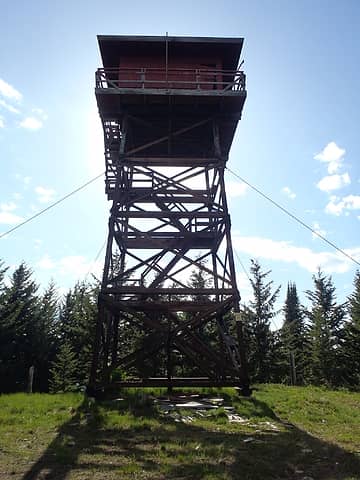 Timber Mountain LO Tower 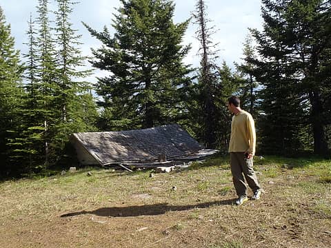 A Cabin No More 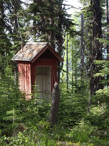 Timber Outhouse 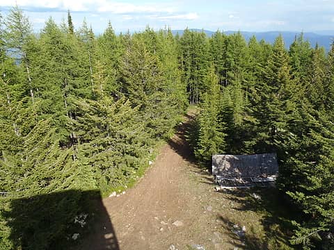 Nice Ridge View 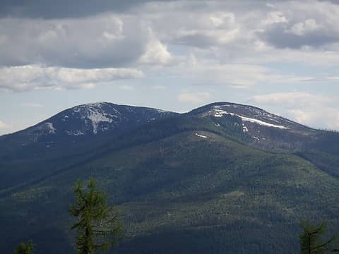 Good View Of Calispell Peak 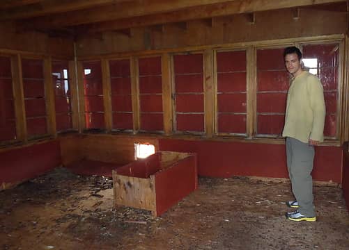 Looks Like Rat Heaven In Here 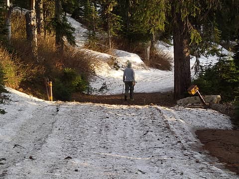 Yay! The Gate Is Open! 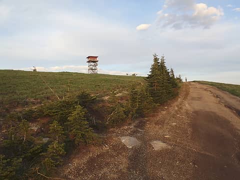 Approaching South Baldy LO... 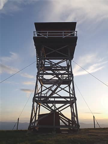 South Baldy LO Tower 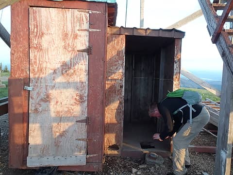 Paul Finds Tower BM 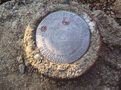 South Baldy Tower BM  Nice Way To End The Day 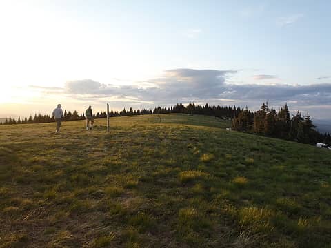 The "Bald" Of South Baldy 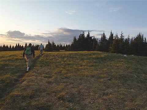 Following Summit Trail 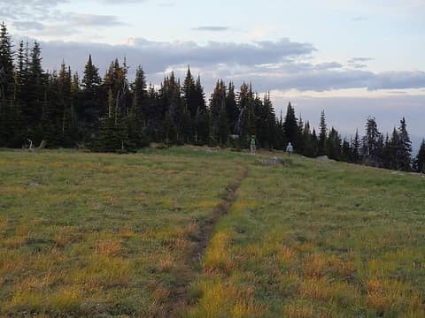 Nearing The True Summit 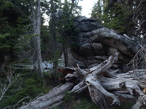 South Baldy Summit Outcrop 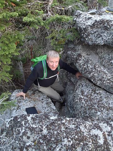 Paul Climbs South Baldy Summit 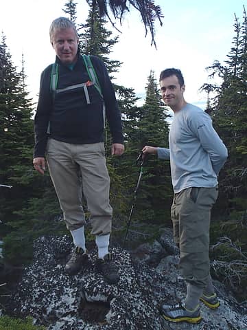 Paul & Adam Atop True Summit 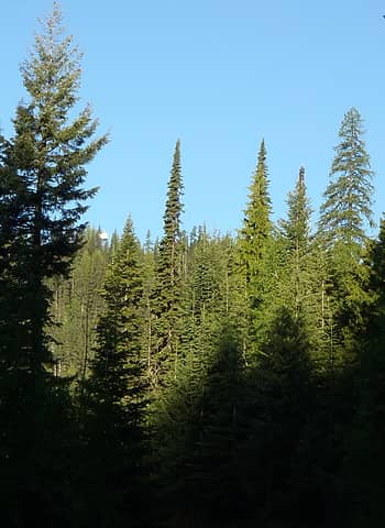 First View Of Tower From Road 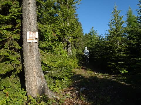 Indian Mountain Summit Trail 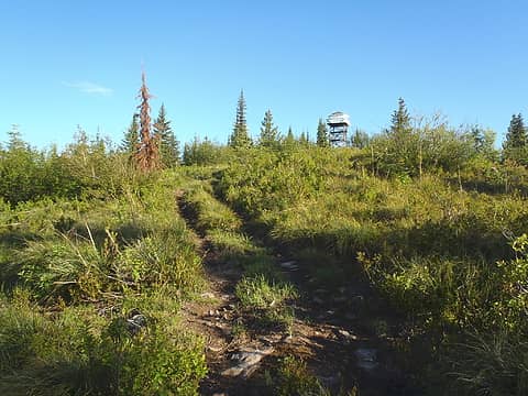 Nearing The Summit... 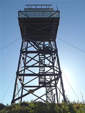 Indian Mountain LO Tower 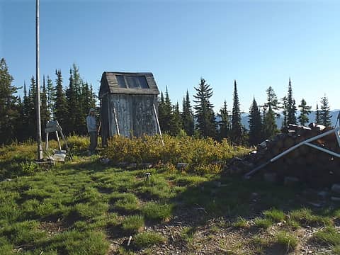 Adam Looks At Flagpole & Shed 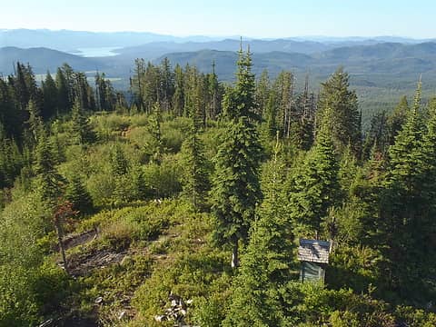 Ridge View From Indian Mtn Tower  Indian Mountain Summit BM 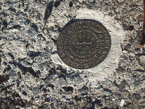 Another Indian Mountain BM 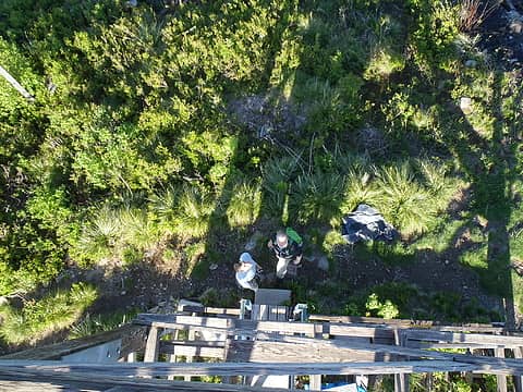 A Long Way Down 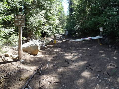 Diamond Peak Access Road 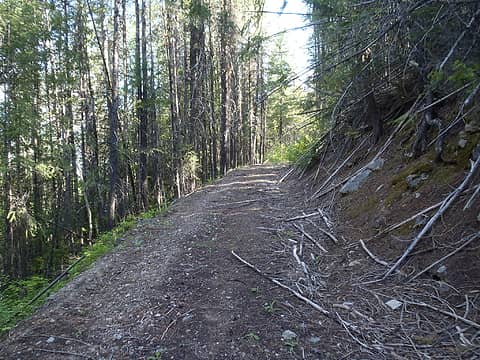 Yet Another Road Walk 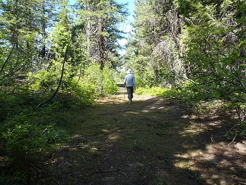 A Better Section Of Road 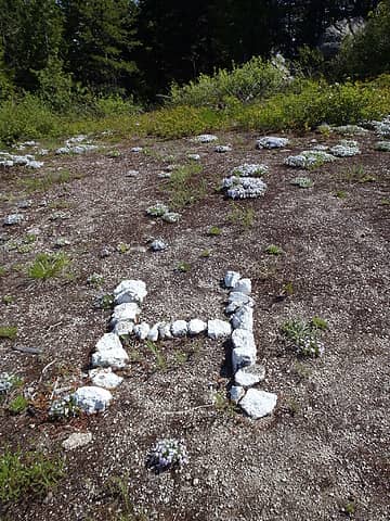 Heliport Marker 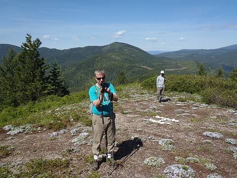 No Helicopters To Be Found! 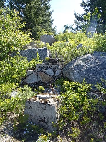 Old Staircase To Summit Tower 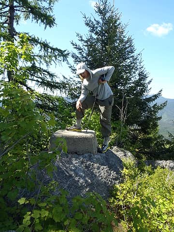 Adam Inspects Old Footings 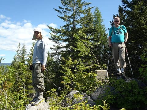 Atop Diamond Peak 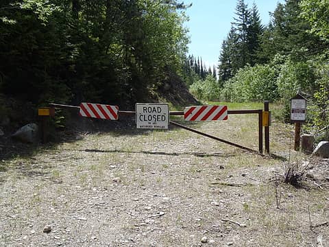 Sigh. Get Ready For A Long Hike 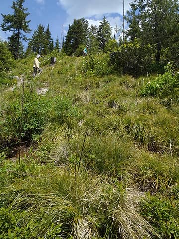 Heading Uphill... 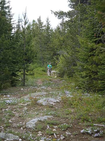 Following Old Trail 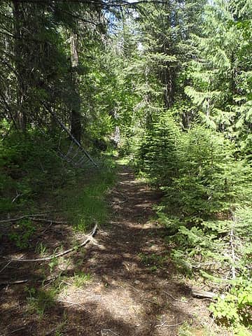 Kalispell Rock Trail 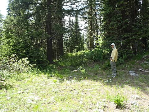 Important Junction 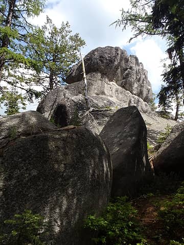 Kalispell Rock Summit Outcrop 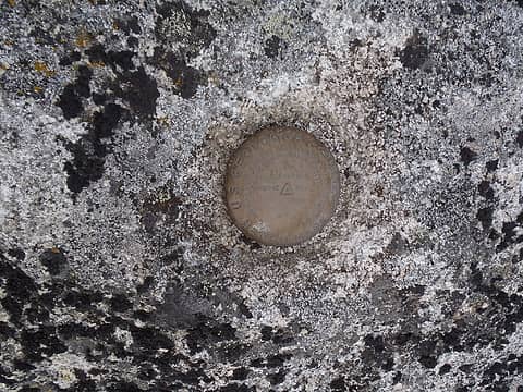 Kalispell Rock Summit BM 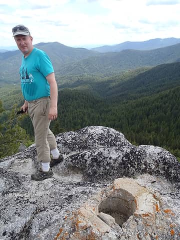 Paul Near Firefinder Posthole 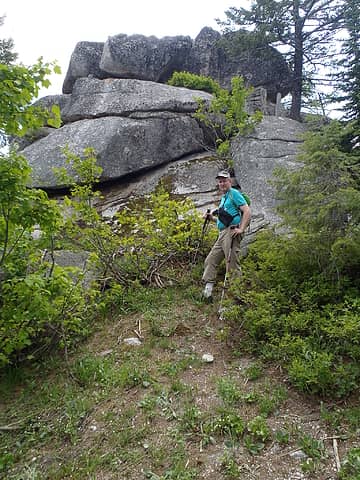 Descending From Summit Boulders 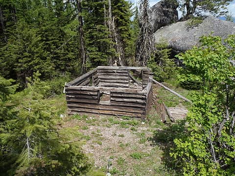 USFS Living Quarters Circa 1927-1934 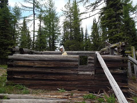 Adam In Log Cabin 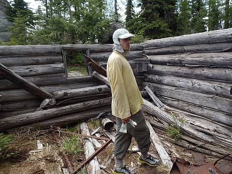 Quarters Not Very Livable 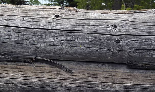 Pete Van Gelder: Start 1948... 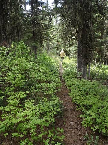 Adam On Old Ridge Trail 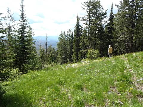 Nice Area Of Kalispell Rock 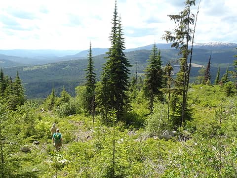 Descending Kalispell Rock 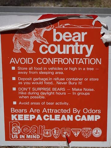 Strength In Numbers Not Odors
60 pounds lighter but not 60 points brighter.
60 pounds lighter but not 60 points brighter.
|
| Back to top |
  
|
|
Paul M
Member

Joined: 15 Jul 2008
Posts: 371 | TRs | Pics
|
|
Paul M
Member
|
Tue Jun 10, 2014 6:07 pm |
|
|
Thanks guys for the company on a great trip this past weekend. We were very productive in getting all of our objectives on two very long days. I figure we hiked about 30 miles with 7k feet total elevation gain, all while driving almost 1000 miles in the process. In that time we visited all 7 target peaks (with the exception of Adam skipping Salmo). I was surprised at the lack of wildlife seen on this trip after the bear fest we experienced just a few weeks ago. It was also somewhat bitter sweet for me, closing out the P2K and Lookout peaks in the region. It is a very pretty area although I won't miss the horrible logging roads one bit. Still I have some reason to go back as there are a number of T200 prom peaks and one P2k error range peak for me yet to visit.
Here are some of my pics from the trip:
 Sullivan LO  Sullivan telephone line 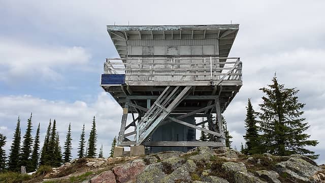 Salmo Mountain Lookout 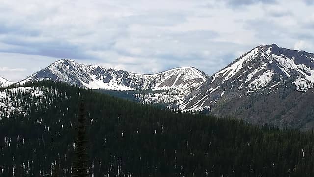 Gypsy Peak from Salmo Mountain 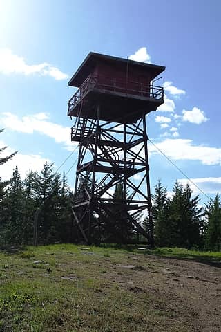 Timber Mountain Lookout 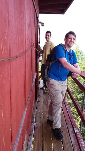 Adam and Craig at Timber Lookout 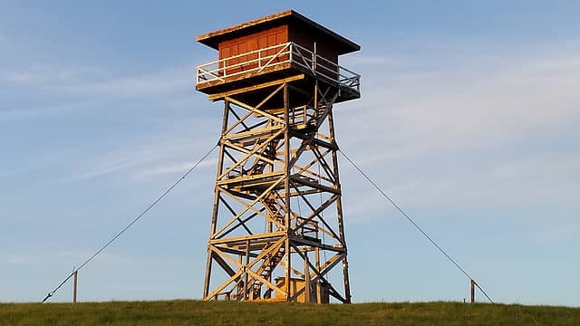 South Baldy LO 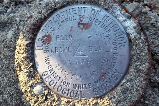 South Baldy BM 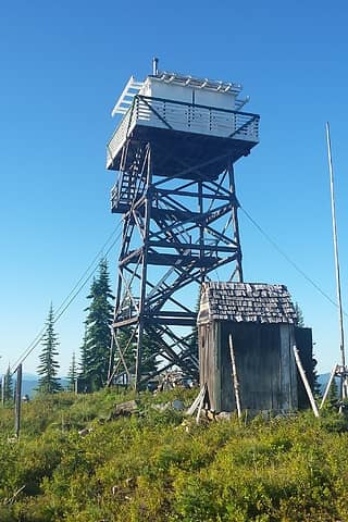 Indian Mountain Lookout 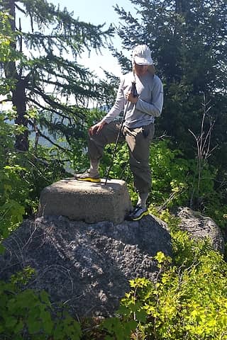 Adam at Diamond Peak summit 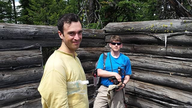 Adam and Craig at old Kalispell LO cabin 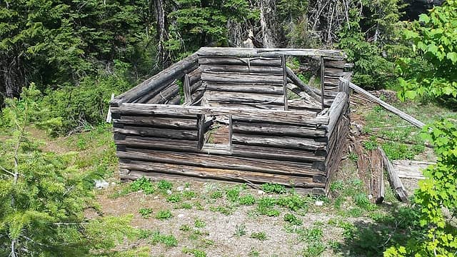 Kalispell LO cabin 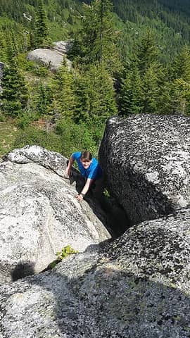 Craig at Kalispell Rock summit scramble 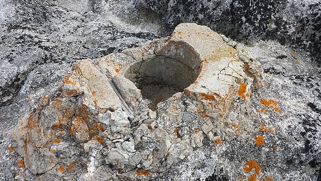 Fire Finder base on summit of Kalispell Rock  Sign
|
| Back to top |
|
|
Gimpilator
infinity/21M

Joined: 12 Oct 2006
Posts: 1684 | TRs | Pics
Location: Edmonds, WA |
| Redwic wrote: | | Adam wanted to get out during the weekend, too, but only wanted low-key stuff
|
In case anyone was wondering about this or why I did not do the 14 mile hike up Salmo, the reason is that I crashed my motorcycle a week ago, injuring my shoulder and knee.
Thanks Paul and Craig for an awesome weekend. It's great to spend time with some experienced peakbaggers after having been in more of the leadership role recently. You guys did great research to put the trip together and I appreciate it.
|
| Back to top |
|
|
iron
Member

Joined: 10 Aug 2008
Posts: 6392 | TRs | Pics
Location: southeast kootenays |
|
iron
Member
|
Tue Jun 10, 2014 6:46 pm |
|
|
i don't know if you guys got enough pics of the summit benchmarks
|
| Back to top |
|
|
fourteen410
Member

Joined: 23 May 2008
Posts: 2630 | TRs | Pics
|
nice work! I plan on visiting some of those LOs later this summer, so good beta 
|
| Back to top |
|
|
Ski
><((((°>

Joined: 28 May 2005
Posts: 12840 | TRs | Pics
Location: tacoma |
|
Ski
><((((°>
|
Tue Jun 10, 2014 8:41 pm |
|
|
excellent.
must be hell to maintain roads over there. crowell ridge road was probably one of the worst I've ever driven.
"I shall wear white flannel trousers, and walk upon the beach.
I have heard the mermaids singing, each to each."
"I shall wear white flannel trousers, and walk upon the beach.
I have heard the mermaids singing, each to each."
|
| Back to top |
|
|
Redwic
Unlisted Free Agent
Joined: 23 Feb 2009
Posts: 3292 | TRs | Pics
Location: Going to the Prom(inence) |
|
Redwic
Unlisted Free Agent
|
Tue Jun 10, 2014 8:49 pm |
|
|
| iron wrote: | | i don't know if you guys got enough pics of the summit benchmarks |
| Ski wrote: | | must be hell to maintain roads over there. crowell ridge road was probably one of the worst I've ever driven. |
What really shocked us was the road leading from Indian Mountain to Petit Lake. It was one of the best gravel roads any of us had ever driven on in Washington. And it was seemingly made great so that people from Idaho could access it. Go figure.
60 pounds lighter but not 60 points brighter.
60 pounds lighter but not 60 points brighter.
|
| Back to top |
|
|
Magellan
Brutally Handsome

Joined: 26 Jul 2006
Posts: 13116 | TRs | Pics
Location: Inexorable descent |
|
Magellan
Brutally Handsome
|
Tue Jun 10, 2014 9:46 pm |
|
|
Lookouts!
|
| Back to top |
|
|
lookout bob
WTA proponent.....

Joined: 12 Apr 2005
Posts: 3048 | TRs | Pics
Location: wta work while in between lookouts |
|
lookout bob
WTA proponent.....
|
Wed Jun 11, 2014 6:37 am |
|
|
"Altitude is its own reward"
John Jerome ( from "On Mountains")
|
| Back to top |
|
|
Redwic
Unlisted Free Agent
Joined: 23 Feb 2009
Posts: 3292 | TRs | Pics
Location: Going to the Prom(inence) |
|
Redwic
Unlisted Free Agent
|
Wed Jun 11, 2014 8:10 am |
|
|
| lookout bob wrote: | | were the lower stairs still missing from Sullivan??? |
Any efforts to reach the top cab would require Class 4 type of effort and exposure. 
60 pounds lighter but not 60 points brighter.
60 pounds lighter but not 60 points brighter.
|
| Back to top |
|
|
Kim Brown
Member

Joined: 13 Jul 2009
Posts: 6900 | TRs | Pics
|
Favorite trip report of the year so far!
The road to Salmo Lookout is scary as sh## -- if you meet another vehicle coming down at that one place where theres a sheer drop. But what are the chances of that happening?  I enjoyed reading about the cabin, too.
"..living on the east side of the Sierra world be ideal - except for harsher winters and the chance of apocalyptic fires burning the whole area."
Bosterson, NWHiker's marketing expert
"..living on the east side of the Sierra world be ideal - except for harsher winters and the chance of apocalyptic fires burning the whole area."
Bosterson, NWHiker's marketing expert
|
| Back to top |
|
|
ree
Member

Joined: 29 Jun 2004
Posts: 4399 | TRs | Pics
|
|
ree
Member
|
Wed Jun 11, 2014 8:53 am |
|
|
What a great trip report! I'm glad you posted it - we were checking you out from Abercrombie and Sherlock across the way.
Kind of creepy about the vehicle from Tennessee. And the inquisition from the USBP... so with wacky tobaccy being legal, I wonder what they would have done if they found a recreational amount on you guys?
So glad to see the pictures of the lookouts. We saw only sites on our EaWa weekend... it'd be nice to get to see a building intact.
I really enjoyed the area. Yeah those roads are something else! I definitely want a return trip.
|
| Back to top |
|
|
Redwic
Unlisted Free Agent
Joined: 23 Feb 2009
Posts: 3292 | TRs | Pics
Location: Going to the Prom(inence) |
|
Redwic
Unlisted Free Agent
|
Wed Jun 11, 2014 12:53 pm |
|
|
60 pounds lighter but not 60 points brighter.
|
| Back to top |
|
|
D. Inscho
Not bored yet...

Joined: 28 Feb 2010
Posts: 973 | TRs | Pics
Location: Bellingham,WA |
|
D. Inscho
Not bored yet...
|
Thu Jun 12, 2014 6:56 am |
|
|
Great effort. Thanks for the intro to more WA lookouts. So much potential in these structures. I hope Timber can be saved: fit retirees; the industrious homeless?
http://david-inscho.smugmug.com/
The key to a successful trip is to do the planning during work hours. -- John Muir
My most memorable hikes can be classified as 'Shortcuts that Backfired'. --Ed Abbey
http://david-inscho.smugmug.com/
The key to a successful trip is to do the planning during work hours. -- John Muir
My most memorable hikes can be classified as 'Shortcuts that Backfired'. --Ed Abbey
|
| Back to top |
|
|
|
|
You cannot post new topics in this forum
You cannot reply to topics in this forum
You cannot edit your posts in this forum
You cannot delete your posts in this forum
You cannot vote in polls in this forum
|
Disclosure: As an Amazon Associate NWHikers.net earns from qualifying purchases when you use our link(s). |


