| Previous :: Next Topic |
| Author |
Message |
Gimpilator
infinity/21M


Joined: 12 Oct 2006
Posts: 1684 | TRs | Pics
Location: Edmonds, WA |
January 1
When I pulled up to the west side of Eagle Peak after driving for 4 hours through the dark, Heather looked at the peak and said, "Is that technical?". I had to admit, it looked pretty steep. Our car was packed for 6 days worth of peaks, dunes, and canyon exploration. We had a list of objectives far longer than we could possibly finish. But we would do as much as we could.
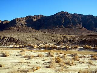 Eagle Peak 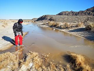 the Amargosa River frozen 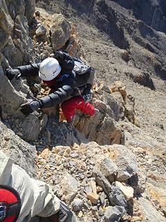 exposed crux 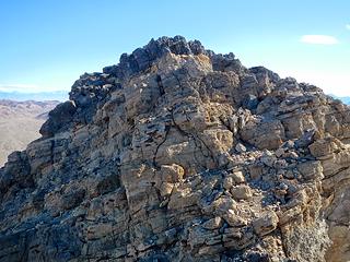 Eagle summit block 
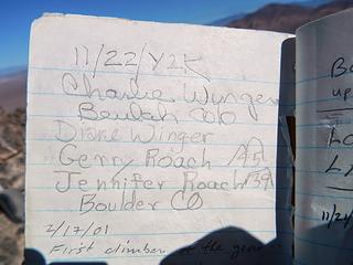 some famous peakbaggers 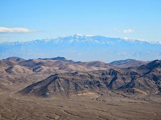 Charleston visible 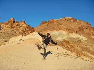 excited for Beatty 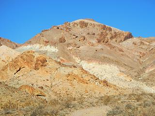 colored rocks on Beatty 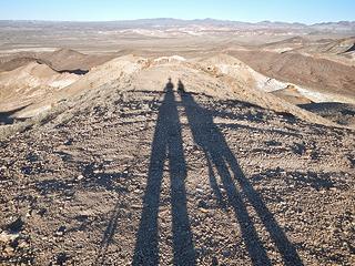 Beatty summit shadows 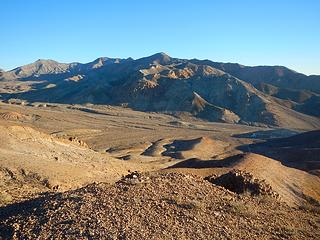 Bare Mountain Peak 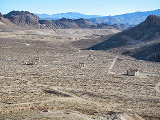 Rhyolite structures 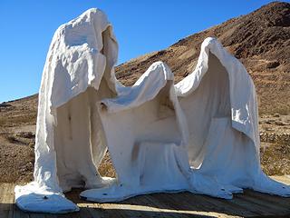 the ghosts of Rhyolite 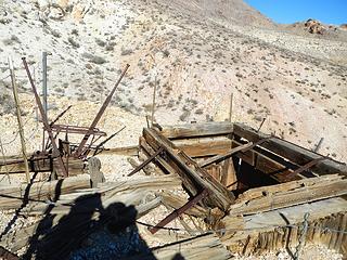 pit mine 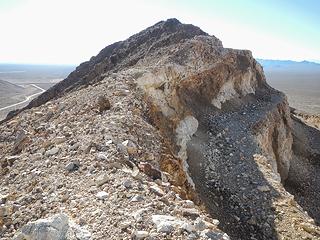 Bonanza 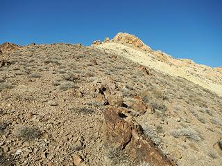 Rainbow 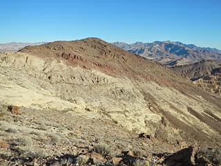 Black 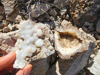 chalcedony geodes and crystals 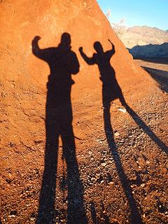 Red Pass shadows 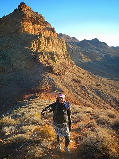 above Red Pass 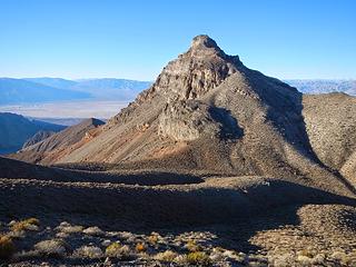 Thimble Peak 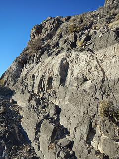 Thimble northeast ridge 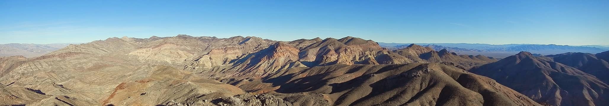 Thimble summit pano 1 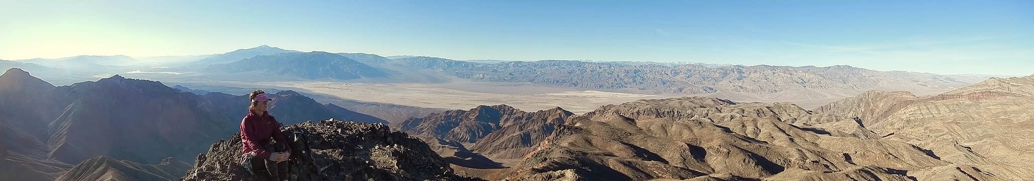 Thimble summit pano 2 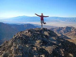 Thimble summit  Mount Whitney visible 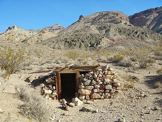 Leadfield ruins 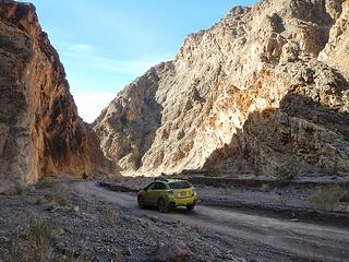 Titus Canyon 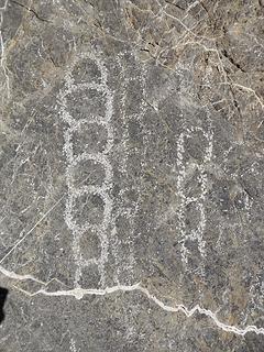 petroglyphs 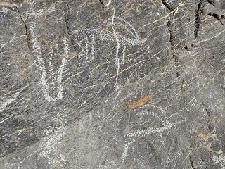 bighorn sheep 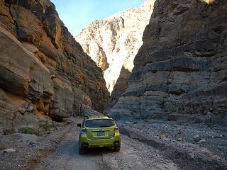 entering the narrows 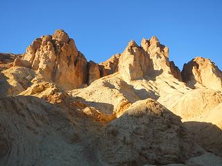 Golden Canyon formations 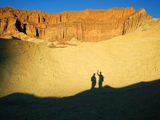 shadows below Red Cathedral 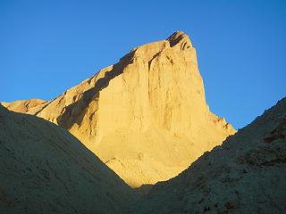 Manly Beacon 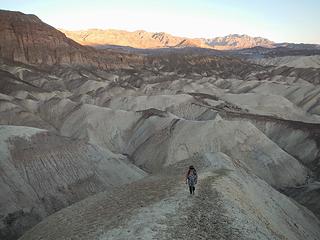 ascending Manly Beacon 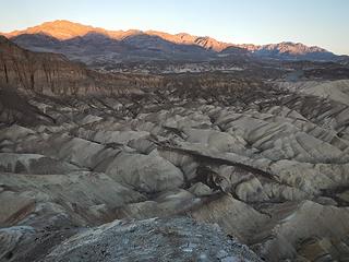 Winters Peak alpenglow 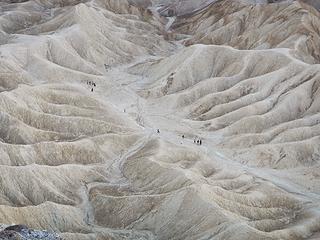 hikers in Golden Canyon seen from Manly Beacon summit 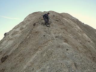 descending crux mud scramble 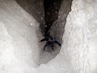 ascending "Golden Canyon Peak" in the dark 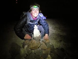 "Golden Canyon Peak" summit cairn 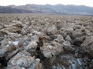 salt flats 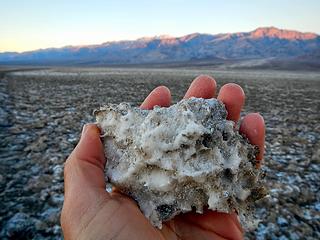 sodium chloride 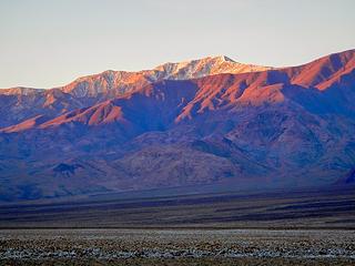 Telescope Peak alpenglow 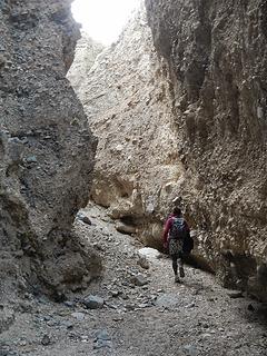 Sidewinder Canyon 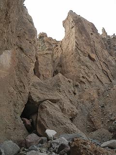 entrance to the first narrows 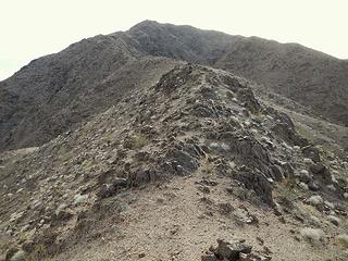 Jubilee north ridge 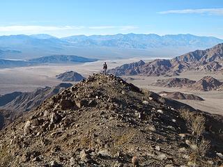 Jubilee summit 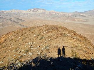 shadows near the summit of Jubilee 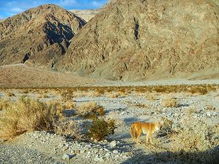 coyote 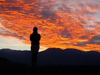 sunset at Artists Drive 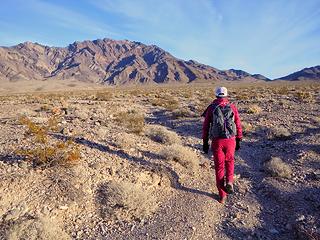 4 mile approach to Pyramid 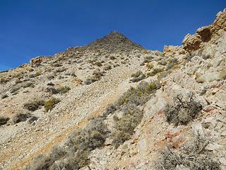 Pyramid false summit 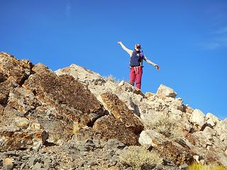 Pyramid summit 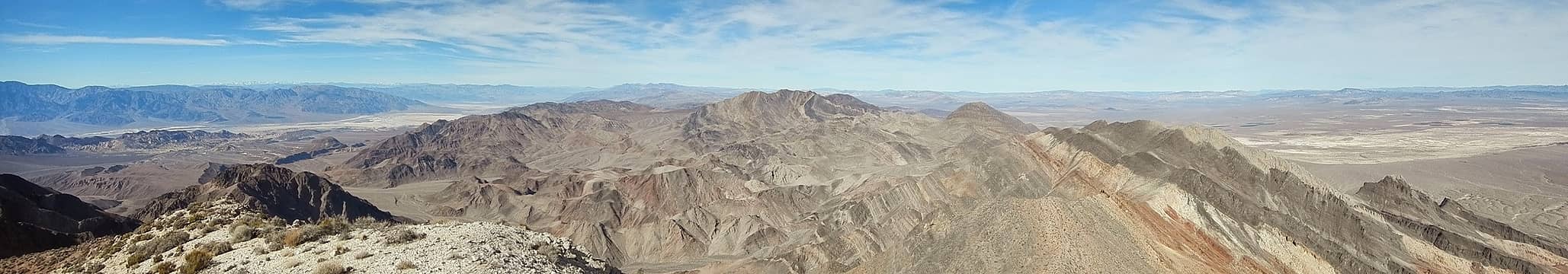 Pyramid summit views 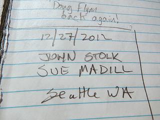 John Stolk entry 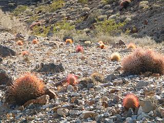 cactus gardens  dino dukey 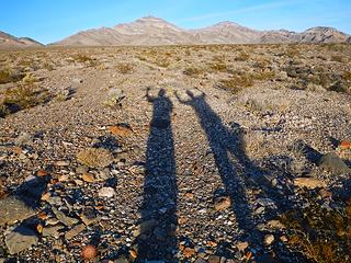 some more shadows 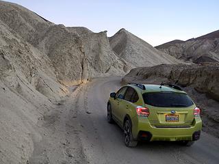 Twenty Mule Canyon 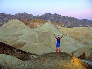 Pyramid seen from 20 Mule Canyon 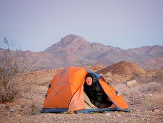 Camping below Corkscrew Peak 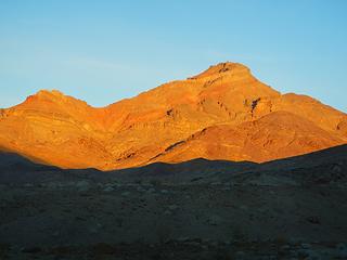 Corkscrew alpenglow 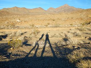 creeping shadows 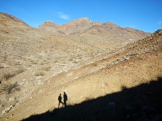 shadows below Corkscrew 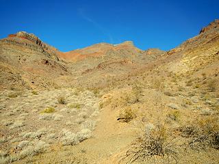 entering the wash 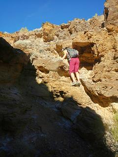 scrambling minor dry falls 
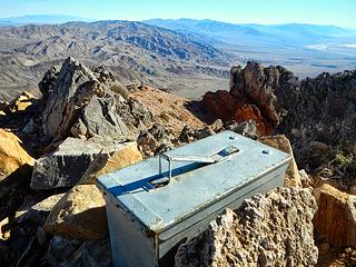 Corkscrew summit box 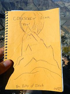 The Valley of Death 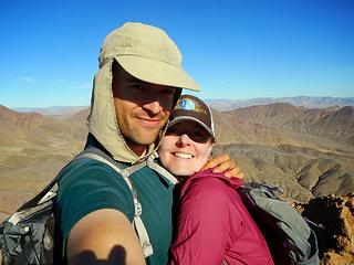 Corkscrew summit 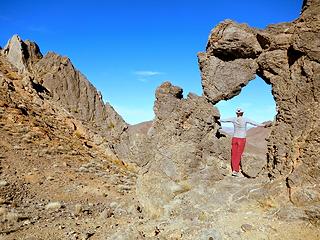 arch near corkscrew summit 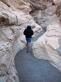 Mosaic canyon narrows 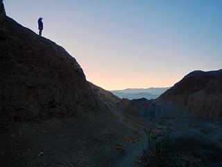 dusk in Mosaic Canyon 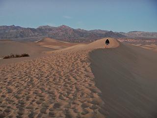 Mesquite Dunes 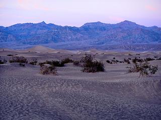 Thimble and Corkscrew visible 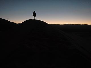 on the dunes 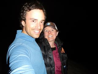 Mesquite Dunes highpoint
|
| Back to top |
  
|
|
Anish
Member

Joined: 07 Sep 2014
Posts: 79 | TRs | Pics
|
|
Anish
Member
|
 Thu Jan 08, 2015 10:34 pm |
|
|
Here are some of my shots.
Couldn't ask for a better adventure partner! xo
"Our way is not soft grass. It's a mountain path with lots of rocks. But it goes upwards, forward, toward the sun." -Ruth Westheimer
"Our way is not soft grass. It's a mountain path with lots of rocks. But it goes upwards, forward, toward the sun." -Ruth Westheimer
|
| Back to top |
|
|
Fletcher
Member

Joined: 29 Jul 2009
Posts: 1870 | TRs | Pics
Location: kirkland |
|
Fletcher
Member
|
Thu Jan 08, 2015 10:46 pm |
|
|
Really awesome guys! Looks like you guys are having fun!
|
| Back to top |
|
|
puzzlr
Mid Fork Rocks

Joined: 13 Feb 2007
Posts: 7220 | TRs | Pics
Location: Stuck in the middle |
|
puzzlr
Mid Fork Rocks
|
Fri Jan 09, 2015 1:46 am |
|
|
That's a lot of desert tramping! Good time of year for those parts.
|
| Back to top |
|
|
Bryan K
Shameless Peakbagger

Joined: 29 Sep 2005
Posts: 5129 | TRs | Pics
Location: Alaska |
|
Bryan K
Shameless Peakbagger
|
Fri Jan 09, 2015 5:25 am |
|
|
Nice 'stache you've got going on in that last photo.
Looks like a fun trip with lots to offer! Very well done you two!!
|
| Back to top |
|
|
Jeb
Summit Driven

Joined: 21 Jul 2012
Posts: 251 | TRs | Pics
Location: Seattle |
|
Jeb
Summit Driven
|
Fri Jan 09, 2015 7:52 am |
|
|
It looks gorgeous there.
Way to make the most of it!
|
| Back to top |
|
|
ree
Member

Joined: 29 Jun 2004
Posts: 4399 | TRs | Pics
|
|
ree
Member
|
Fri Jan 09, 2015 8:53 am |
|
|
Thank you for posting such an AMAZING trip report! I love Death Valley to pieces too, in fact, we were there same time you were. We were exploring the north end, in Racetrack Valley.
Looks like you went all around! That full moon was awesome, and I can imagine Golden Canyon/Badlands being all lit up. It was super cold out there at night!!
Did you drive from Wa? Or did you fly in and rent a car in Vegas?
Where did you get your peak bagging beta for DV?
I found death-valley.net forum for road stuff helpful. I considered a long route back to Vegas via Oriental Wash or Tule Canyon to get to Goldfield, but bagged it because it was too long, and I was nervous about the route and time.
I have driven Titus Canyon a few times. Just as you get over the pass, and drop into the big canyon with Leadfield, the road hugs the shady side of a steep drop, which can get icy/hairy. Once I saw a guy in a pickup driving a 5th-wheel down Titus Canyon, before the narrows.  I couldn't believe it. Thank god he let us pass him, because it would have been a nightmare to be stuck behind him. Freakin' touron.
That is cool you explored around Beatty. Love Rhyolite too, and the outdoor sculpture garden. I couldn't believe it. Thank god he let us pass him, because it would have been a nightmare to be stuck behind him. Freakin' touron.
That is cool you explored around Beatty. Love Rhyolite too, and the outdoor sculpture garden.  Your pics are a treat.
|
| Back to top |
|
|
cefire
Member

Joined: 03 Feb 2010
Posts: 523 | TRs | Pics
|
|
cefire
Member
|
Fri Jan 09, 2015 10:44 am |
|
|
Awesome TR, really makes me want to get down there this winter!!
I remember some pretty aggravating navigation in those washes too! 
|
| Back to top |
|
|
Redwic
Unlisted Free Agent

Joined: 23 Feb 2009
Posts: 3292 | TRs | Pics
Location: Going to the Prom(inence) |
|
Redwic
Unlisted Free Agent
|
Fri Jan 09, 2015 1:48 pm |
|
|
60 pounds lighter but not 60 points brighter.
|
| Back to top |
|
|
wolffie
Member

Joined: 14 Jul 2008
Posts: 2693 | TRs | Pics
Location: Seattle |
|
wolffie
Member
|
Fri Jan 09, 2015 2:59 pm |
|
|
Yea, though I walk through the shadows of the Valley of Death, yet I shall fear no evil, for verily I am the meanest son-of-a-bitch in the valley.
Some people have better things to do with their lives than walking the dog. Some don't.
Some people have better things to do with their lives than walking the dog. Some don't.
|
| Back to top |
|
|
Gimpilator
infinity/21M
Joined: 12 Oct 2006
Posts: 1684 | TRs | Pics
Location: Edmonds, WA |
Thanks everyone. Glad you like our photos and whatnot.
Ree - That's pretty neat that we were there at the same time. We even discussed going to Racetrack Valley. We're living in Laguna Beach until March and then returning to WA. So Anza Borrego, the High Sierra, Joshua Tree, and Death Valley are all within reach which is really nice.
This trip actually wasn't planned out very well. I suggested it on New Years Eve and then we spent that whole day researching online, shopping and then packing the car. Most of our peak beta was obtained from SummitPost but some of the Canyon stuff was gathered from NPS sites and Google searches.
I haven't seen death-valley.net, but I'll be sure to check it out. We might make one more trip there before returning to WA.
|
| Back to top |
|
|
GaliWalker
Have camera will use

Joined: 10 Dec 2007
Posts: 4930 | TRs | Pics
Location: Pittsburgh |
|
GaliWalker
Have camera will use
|
Fri Jan 09, 2015 5:29 pm |
|
|
Thanks! Man, you covered a lot of ground.
I want to make a return trip to Death Valley...now.
|
| Back to top |
|
|
mehitabel
archyologist

Joined: 23 Mar 2009
Posts: 519 | TRs | Pics
Location: the Emerald City |
|
mehitabel
archyologist
|
Sat Jan 17, 2015 10:56 am |
|
|
wow those might be the best photos of Death Valley i ever saw.
toujours gai toujours gai
toujours gai toujours gai
|
| Back to top |
|
|
John Morrow
Member

Joined: 03 Apr 2007
Posts: 1526 | TRs | Pics
Location: Roslyn |
| Gimpilator wrote: | | For anyone who has yet to visit Death Valley but wants to go, I would like to encourage you to go for it. As you can see there is a lot to do there and we really only scratched the surface with this trip. |
OK, I am convinced! If I get there I'll probably look like a copy-cat, Gimp, but your reports are too good!
Tell me, what is it you plan to do with your one wild and precious life?-Mary Oliver
A nation that continues year after year to spend more money on military defense than on programs of social uplift is approaching spiritual doom.
― MLK Jr.
Tell me, what is it you plan to do with your one wild and precious life?-Mary Oliver
A nation that continues year after year to spend more money on military defense than on programs of social uplift is approaching spiritual doom.
― MLK Jr.
|
| Back to top |
|
|
Mtn Dog
Technohiker

Joined: 01 Aug 2004
Posts: 3336 | TRs | Pics
Location: Bellevue, WA |
|
Mtn Dog
Technohiker
|
Thu Jan 29, 2015 10:31 pm |
|
|
I like your car. I just bought a Red XV Crosstrek in December. It'll be in the mountains soon too.
Footprints on the sands of time will never be made sitting down.
Footprints on the sands of time will never be made sitting down.
|
| Back to top |
|
|
|
|
You cannot post new topics in this forum
You cannot reply to topics in this forum
You cannot edit your posts in this forum
You cannot delete your posts in this forum
You cannot vote in polls in this forum
|
Disclosure: As an Amazon Associate NWHikers.net earns from qualifying purchases when you use our link(s). |


