| Previous :: Next Topic |
| Author |
Message |
Gimpilator
infinity/21M


Joined: 12 Oct 2006
Posts: 1684 | TRs | Pics
Location: Edmonds, WA |
After 3 weeks of unstable Juneuary weather and lots of stymied trip plans, I pitched a travel idea to Heather and she quickly agreed. We spent the next 3 hours researching peaks, printing driving maps, hiking maps and route descriptions. In 3 short hours we had created a thick stack of information in paper form and a tick list of mountains. I was even able to find GPX track logs for a number of the peaks, just in case we developed navigational trouble. It would be enough to keep us busy for weeks. It was time to leave the crappy Washington weather behind. We spent half of the next day packing the car and then we promptly hit the road.
Here is the list of what we did, in case you only have an interest in certain parts of our journey and want to skip ahead. We climbed 37 peaks in 19 days. Timpanogos was our favorite peak while Flat Top was the most unpleasant.
Mount Thielsen 9182 OR
Mount McLoughlin 9495 OR
Mount Eddy 9025 CA
Lassen Peak 10,457 CA
Lassen Volcanic WHP - 10,400 CA
Eagle Peak 9222 CA
Eagle Peak 9892 CA
Duffer Peak 9428 NV
Duffer North Peak 9400 NV
Jackson Mountains HP 9095 NV
Granite Peak 9732 NV
Star Peak 9836 NV
Mount Tobin 9775 NV
Mount Lewis 9680 NV
McAfee Peak 10,438 NV
Ruby Dome 11,387 NV
Ruby Pyramid 11,360 NV
Hole in the Mountain 11,306 NV
Pilot Peak 10,716 NV
Deseret Peak 11,031 UT
Flat Top Mountain 10,620 UT
Lewiston Peak 10,411 UT
Mount Timpanogos 11,749 UT
Oxford Ridge 8735 ID
Oxford Peak 9282 ID
Black Pine Mountains HP 9395 ID
Black Pine Peak 9386 ID
Cache Peak 10,339 ID
Matterhorn 10,838 NV
Square Top 10,694 NV
Jumbo Peak 10,635 NV
Jarbidge Peak 10,793 NV
Steens Mountain 9733 OR
Steens Point 9686 9686 OR
Steens Point 9730 9730 OR
Strawberry Mountain 9040 OR
Rock Creek Butte 9106 OR
June 20, Mount Thielsen
Heather and I had both wanted this peak for a long time, so it was our first stop on the way south. The approach through the forest was not very interesting, but once we caught our first view of the mountain it was pretty exciting. Ive heard it called the lightning rod of the Cascades and several friends told me it was their favorite hike in Oregon. The trail sort of ended at the base of some scramble terrain above which we found it again leading to the base of the summit pinnacle.
The rock consisted of huge blocks. We scrambled up from block to block and it was not challenging to pick out the easiest way up. We encountered 2 crux moves along the way. The first was a squeeze up through a chimney and the second was some class 4 moves below an overhang. A lot of the hands and feet holds were down-sloping and semi-polished. Heather was extremely stoked to get this peak which she had seen from her PCT hikes and wanted to climb, but didnt know how. On the summit rocks we found many holes melted in the rocks from lightning strikes, so I guess the peak lives up to its name.
June 21, Mount McLoughlin, Mount Eddy
Since Heather had already climbed McLoughlin previously, I got up super early and headed up the trail solo. I encountered some snow on the route which was icy in the trees and required micro-spikes. I didnt spend long on the summit because we had plans to do Mount Eddy later in the day.
The previous spring Heather and I had tried to drive to the Mount Eddy trailhead, but a blizzard prevented us from getting up the road. This time, the road had melted out just days before we got there. We took the lower trail below the PCT through some marshy meadows. Next to a creek, I saw a strange rock sticking out of the dirt. When I bent over to examine it, I discovered it was an obsidian spear point. This is only the second time Ive ever found anything like this. I was pretty excited to see this bit of history.
Further up the trail we passed some very scenic lakes and I was tempted to take a dip in one to cool down, but didnt take the time. The trail went up to a pass and then we followed switchbacks up the peak. There was a stunning view of Mount Shasta from the top. Heather accidentally set her poles down in a patch of flowers thick with bees and I had to retrieve them for her. Then she pointed out that I had a ladybug on my shoulder, the largest I have ever seen.
June 22, Lassen Peak, Lassen Volcanic Wilderness High Point, Eagle Peak
The trail up Lassen Peak is finally open! I have been waiting for this for years. Apparently an old rock retaining wall collapsed on the old trail killing a small boy and the repair work had the trail closed for several years except for a few specific dates each summer. The trail was short and easy and was still partially covered with large snowfields. After we took a break on the summit we ventured over to the far side of the crater rim to explore the wilderness high point. This afforded us unique views inside the crater.
Being such a short hike, we decided to climb nearby Eagle Peak. From part way down the trail, we traversed directly toward the Eagle/Lassen saddle and then ascended the snow and rock ridge to the summit. The northeast face had a steep snow slope and this made for an excellent 200+ foot glissade.
Later that day we stopped at Subway Cave lava tube and I found some other caves to explore besides the standard one which everyone else visits. The cold air inside the cave was refreshing compared to the heat outside.
June 23, Eagle Peak
Around this point in the trip I developed a sore throat which turned into a full-blown head cold. It plagued me for well over a week and then I passed it on to Heather, but we didnt let it ruin our plans.
Another Eagle Peak, this one much larger. It was a long hike which started in the forest, went past a lake and then trhough meadows to reach an upper ridge. We encountered a fair amount of snow at the end. Heather said the meadows reminded her of the CDT. As with many of the peaks on this trip we saw a lot of familiar names in the registers as well as a few good friends. One entry was very strange
June 24, Duffer Peak, Duffer North Peak
During the drive to this peak we made a terrible discovery. All the mice that had chewed their way into my car at Washington trailheads had somehow damaged something under the dashboard of my car. No matter what setting the vent was set to, copious clouds of dust poured into the car from the dirt road. I tied a bandana around my face and Heather laughed at me. Nevada peakbagging, yeah! Im a f**king mountain bandit. Wahoo! Opening the windows seemed to make the problem worse and more dust came in from under the steering wheel and behind the glove box. Furthermore the road to the trailhead proved to be by far the worst of the entire trip. Driving my Subaru straddling bad washout channels made me feel like I had brought a knife to a gun fight. Really you need a truck or a jeep for this road.
There are two approaches for this peak and I chose the one which appeared to have a better road, turning left at the final road fork. So we would be starting near Blue Lake instead of the standard route from Little Onion Reservoir. This might have been a mistake because the brush and tightly packed trees beyond Blue Lake were terrible. Once we reached the pass northeast of Outlaw Meadow it opened up. We continued around the peak to Bare Pass where there were a lot of flakes of obsidian and broken arrowheads strewn about. There was some minor scrambling before we reached the peak. Signatures in the register indicated an old controversy over whether this peak or the north peak was higher, so we made sure to scramble over to the north peak before descending.
|
| Back to top |
  
|
|
Gimpilator
infinity/21M
Joined: 12 Oct 2006
Posts: 1684 | TRs | Pics
Location: Edmonds, WA |
June 25, Jackson Mountains High Point, Granite Peak
We were able to drive most of the way up Jackson Mountains High Point which left only a few miles of road walking and off trail hiking. There was a bit of loose talus near the top. With extra daylight we drove over to Granite Peak above the town of Paradise Valley. The Santa Rosa Range is exquisite and I wished we could spend more time there, perhaps to climb Santa Rosa Peak which is only slightly lower than Granite. Once again we drove very high on the mountain but not quite to the end of the road. Thick aspens put some new scratches on the sides of my car.
The hike up Granite was pleasant and scenic. When we hiked through a small marsh near the roads end, Heather found her first obsidian arrowhead. Near the summit we came to some minor scrambling along the ridge crest. From this vantage we could see several peaks we had already done on the trip and many more we were planning to do.
June 26, Star Peak, Mount Tobin
We parked at the mining ruins and started long road hike. It was already hot early in the morning, but brush and small trees along the way offered some shelter from the sun. The road hiking was a bit dull and I couldnt help but think that if I had a truck, I could have drive the steeper parts of this road. Heather pointed out some bitterroot flowers growing in the road. When we reached the the saddle, once again we noticed numerous flakes of obsidian and it made me wonder if natives had previously napped the rock here and hunted deer coming up from the washes on either side. To our surprise, ATV tracks led all the way to the summit. Some of the rocks on the ground had etchings which predated the paper register. The oldest I found was from 1885.
After Star we drove to nearby Mount Tobin. We had planned to camp there since it was evening, however there were zero options for camping. To make matters worse, I got my car stuck in deep ruts when I tried to turn around on the road. Thankfully I was able to push it out while Heather floored it in reverse. We then filled in the ruts with rocks and were finally able to turn it around.
Knowing that we couldnt camp meant we had to do the peak immediately. It was a long hike and we would be coming out in the dark, but I just hoped we could make it to the summit before sunset. We quickly packed more food and water and started up the steep rough road. Once it road above cattle country, the road ran along the spine of the main ridge up and over several large humps. It was extremely hot that evening, but I pushed to move as fast as possible. Heat does not faze Heather. At one point a rattlesnake crossed my path and turned directly toward me in an attempt to avoid Heather. I jumped back in surprise and so did the snake.
We came to the last deep saddle along the ridge and Mount Tobin stood before us. The road traversed beyond the saddle but did not aim for the summit. It was thickly overgrown with flowers and thistles. We followed it for a time and then cut directly up-slope toward the summit. We got there literally minutes before sunset. It felt like a great victory to get this peak under challenging circumstances. We hiked out and drove out in the dark. Near the car I accidentally kicked a rock and damaged my big toe. After that we referred to Tobin as toe-bend.
June 27, Mount Lewis
This was primarily a long driving day, however we did take time to drive up Mount Lewis. The summit block has access ladders for servicing the towers and electrical equipment, however we found that the surrounding rock had class 2+ options so we didnt even use the ladders.
June 28, McAfee Peak
We found a lovely spot to camp next to a creek, just before the official campground. McAfee is a lush green and flowered peak amidst the surrounding dry range land. Even though the first half of the hike was on a forest service road, we really enjoyed this area. I spotted a horny toad. The views were good right away and the upper ridge-run was fun. When I opened the register I was surprised to see that the last one to sign in was our very own Grant Meyers. It was his last Nevada P4k. Congratulations Grant!
June 29, Ruby Dome, Ruby Pyramid
Ruby Dome has been on my list for awhile since its on the DPS list. It would be my 40th DPS peak. Visible snow from the valley bottom had us wondering if the route was in yet, but we were determined to give it our best shot. I was also determined not to pay for camping or special access to the peak as many do. If you want to know how to do it, PM me. We followed the trail up through sage land and then aspen forest to reach the canyon adjacent the northwest ridge. We hiked atop numerous rock slabs and had to climb or avoid a few snowfields before we came to Griswold Lake.
The lake was hemmed in by a cliff cirque and it wasnt immediately apparent where we should ascend. Some snow fields seemed to block some of the ledges out of the cirque. At one point we ended up scrambling to a ledge with an overhanging ceiling but eventually we made it to the pass southeast of the lake. At the pass, Ruby Dome and Ruby Pyramid stood tall above us. We traversed toward the pass between them and climbed an easy snow gully along the way. At the pass we turned right and climbed the razors edge to reach the summit of Ruby Dome. Its not as scary as it sounds, but it is exposed.
After the main peak we went back to the saddle and climbed the east peak known as Ruby Pyramid, which we both agreed has better view of the Ruby Range.
June 30, Hole in the Mountain Peak
This peak was much harder than we expected. Its named for a large cannon type hole in the upper crest of the range which is visible from the road. The mileage is short, but its somewhat slow going. Also, the route map we had was mislabeled and would have taken us up the wrong gully, but thankfully we figured that out without any mistakes. From the parking area we could see the steep snow couloir high above and this prompted us to carry axes and crampons instead of just micro-spikes.
At the end of the road we pushed through knee and waist high brush, trying to follow the old overgrown path up the ridge. We then descended to the Lizzies Basin above a remnant lake which is now more of a marsh. From there we went cross country aiming for the base of the long steep snow couloir. We climbed to the top of that and then turned left, crossing over large talus. The summit looked close but it was another 1000 vertical feet to go.
On an upper snow slope we startled several pregnant goats as well as one new nanny goat and kid. We were later told that it is extremely rare to encounter mountain goats in Nevada. Beyond the goats the ridge narrowed and we had some fun ledge scrambling up to the summit. But we didnt linger long because a large storm cloud was forming right above our heads. Climbing down the couloir was more challenging than climbing up it.
July 1, Pilot Peak
We had heard that this peak was a one-timer and so we were mentally prepared for lots of rock hopping. We certainly experienced talus-fatigue by the end of the day. While Heather was still asleep in the tent one couple passed by and I figured we might pass them somewhere along the route. Sure enough, half way up they came to their turn around point when the woman got sketched out on a short scramble step.
Near the top our directions suggested leaving the crest and ascending a talus and scree slope, but we didnt want to do that so we stayed on the crest and did a short 4th class downclimb, which must have been what the standard route was trying to avoid. We spent about an hour on the summit and read many of the entries from an old register. One entry described exactly where to look to see that original wagon tracks across the salt flats which were left by the Donner Party. Whoa! What a mind-blower to think that we were viewing marks left on the earth by that unfortunate party. This bogging down in the mud was partly responsible for their nightmarish fate.
During the descent we encountered the same couple who seemed somewhat demoralized by the terrain. The woman seemed slightly hysterical and I felt bad for them. Then when we got to the car and drove off a thunderstorm began immediately with lightning and heavy rain. Then I felt really bad for them. They had parked further down the road and must be getting soaked.
|
| Back to top |
|
|
Gimpilator
infinity/21M
Joined: 12 Oct 2006
Posts: 1684 | TRs | Pics
Location: Edmonds, WA |
July 2, Deseret Peak, Flat Top Mountain, Lewiston Peak
This time I couldnt dodge The Man and I had to pay cash for a good camp spot. The hike itself was really nice. Alpine meadows and new flowers we had never seen before. Could all the peaks in Utah be this good? I had no idea they had such nice peaks. You would never know it from their appearance while driving on the highway. There were terraced cliffs and wildflowers everywhere on the upper slopes.
I really wanted to traverse over to Peak 10,685 as well as North Medina, but that would take up the rest of the day and Heather reminded me that this trip was already eating up more days than we had scheduled. She was right. So we descended back to the car and drove across the valley to Flat Top Mountain. We had to park near the town of Ophir where we got some bad vibes. There were lots of no trespassing signs all over the town and barbed wire and whatnot. I tried to buy jugs of water in a store but all they would sell me were tiny overpriced single serve bottles.
We parked in the designated lot and then hiked up the trail which was actually an ATV road full of cattle, cow pies and biting flies. The biting flies were fierce enough to make me wear my French Foreign Legion style hat and full length pants despite the heat. Heather was in a dress and suffered many bites. Above the road we followed a boot path but lost it in the brush until we saw another party coming down the path. We corrected ourselves and continued up to a junction with the old and new routes which go along the left and right side of the ridge.
Our directions indicated the new better trail went left while the old way went to the right and eventually petered out. We went left and passed several No Trespassing and no excuses signs near where the two routes come back together. From there we followed near the crest of the ridge passing Lewiston Peak along the way. It was still a mile further to Flat Top. What lame peak, especially after our nice morning on Deseret. We tagged the summit of Lewiston on the way back.
 someone else didn't like this peak either
|
| Back to top |
|
|
Anish
Member

Joined: 07 Sep 2014
Posts: 79 | TRs | Pics
|
|
Anish
Member
|
 Wed Jul 13, 2016 12:25 am |
|
|
A few of my favorite pics from this uber fun trip. Glad you put up with my listbagging compulsions!!
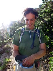 So much stoke for snow in the hat 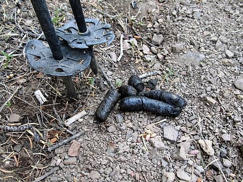 dookie 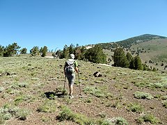 on the way up Eagle Peak 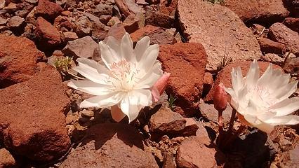 bitterroot 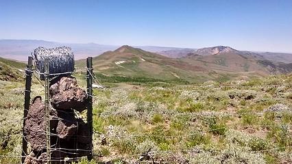 views from Granite Peak 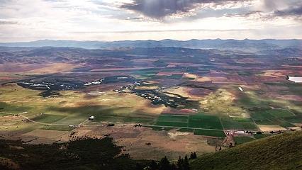 Idaho morning from Oxford Ridge 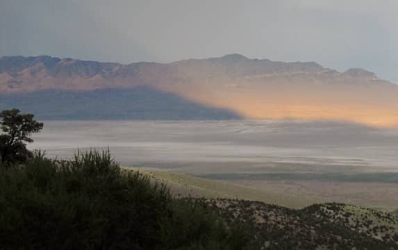 Pilot Peak casts its shadow on the salt flats below 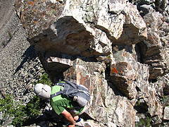 scramble fun 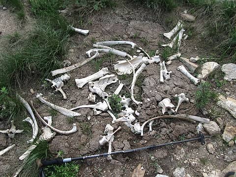 trekking pole for scale  every scrap of clothing needed to stop the bugs 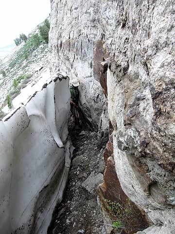 moat squeeze  alternate ledge route 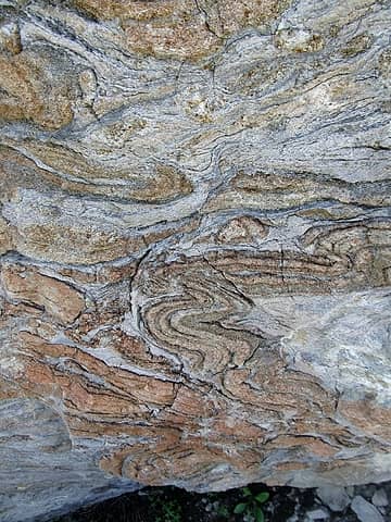 interesting rock formations...here's looking to you Brushbuffalo...
"Our way is not soft grass. It's a mountain path with lots of rocks. But it goes upwards, forward, toward the sun." -Ruth Westheimer
"Our way is not soft grass. It's a mountain path with lots of rocks. But it goes upwards, forward, toward the sun." -Ruth Westheimer
|
| Back to top |
|
|
neek
Member

Joined: 12 Sep 2011
Posts: 2338 | TRs | Pics
Location: Seattle, WA |
|
neek
Member
|
Wed Jul 13, 2016 5:49 am |
|
|
 times 37 times 37
|
| Back to top |
|
|
Redwic
Unlisted Free Agent

Joined: 23 Feb 2009
Posts: 3292 | TRs | Pics
Location: Going to the Prom(inence) |
|
Redwic
Unlisted Free Agent
|
Wed Jul 13, 2016 5:56 am |
|
|
Quite the adventure.
60 pounds lighter but not 60 points brighter.
60 pounds lighter but not 60 points brighter.
|
| Back to top |
|
|
Bryan K
Shameless Peakbagger

Joined: 29 Sep 2005
Posts: 5129 | TRs | Pics
Location: Alaska |
|
Bryan K
Shameless Peakbagger
|
Wed Jul 13, 2016 6:17 am |
|
|
That's an awesome trip!!!! Before you know it you'll be over here in Ohio bagging hills since you'll run out of stuff in the west 
|
| Back to top |
|
|
awilsondc
Member

Joined: 03 Apr 2016
Posts: 1324 | TRs | Pics
|
That's crazy you guys! That's a seriously awesome trip, and with a head cold much of the time?!  Hats off to the two of you. Only a handful of people could have put together a trip like that.
That's crazy about the ultra runners on Timp. I wish I enjoyed running, it would be fun to be that fast! Hats off to the two of you. Only a handful of people could have put together a trip like that.
That's crazy about the ultra runners on Timp. I wish I enjoyed running, it would be fun to be that fast!
|
| Back to top |
|
|
Distel32
Member
Joined: 03 Jun 2014
Posts: 961 | TRs | Pics
Location: Edmonds, WA |
|
Distel32
Member
|
Wed Jul 13, 2016 7:07 am |
|
|
|
| Back to top |
|
|
Brushbuffalo
Member

Joined: 17 Sep 2015
Posts: 1887 | TRs | Pics
Location: there earlier, here now, somewhere later... Bellingham in between |
So that's where you've been!
The overused word "epic" applies to this peak-bagging trip.
Time for a mountain truck or SUV, Adam? 
Passing rocks and trees like they were standing still
Passing rocks and trees like they were standing still
|
| Back to top |
|
|
Stefan
Member

Joined: 17 Dec 2001
Posts: 5093 | TRs | Pics
|
|
Stefan
Member
|
Wed Jul 13, 2016 3:20 pm |
|
|
Have a dream. Commit to the dream. Do it. Great!!!
|
| Back to top |
|
|
bobbi
stillaGUAMish

Joined: 13 Jul 2006
Posts: 8012 | TRs | Pics
Location: olympics! |
|
bobbi
stillaGUAMish
|
Wed Jul 13, 2016 6:20 pm |
|
|
beyond epic...most excellent
bobbi ૐ
"Today is your day! Your mountain is waiting. So
get on your way!" - Oh, the Places Youll Go! By Dr. Seuss
bobbi ૐ
"Today is your day! Your mountain is waiting. So
get on your way!" - Oh, the Places Youll Go! By Dr. Seuss
|
| Back to top |
|
|
Magellan
Brutally Handsome

Joined: 26 Jul 2006
Posts: 13117 | TRs | Pics
Location: Inexorable descent |
|
Magellan
Brutally Handsome
|
Wed Jul 13, 2016 8:52 pm |
|
|
I might get to 37 summits this year if I count Tiger hikes.
|
| Back to top |
|
|
puzzlr
Mid Fork Rocks

Joined: 13 Feb 2007
Posts: 7220 | TRs | Pics
Location: Stuck in the middle |
|
puzzlr
Mid Fork Rocks
|
Wed Jul 13, 2016 10:43 pm |
|
|
Thanks for taking the time to post all that here. It's really fun to follow along on your adventures. You both look like you're having the time of your lives.
|
| Back to top |
|
|
smmslt
Prominencian
Joined: 14 Jan 2003
Posts: 89 | TRs | Pics
Location: Vancouver, WA |
|
smmslt
Prominencian
|
Wed Jul 13, 2016 11:04 pm |
|
|
Great report and photos of a bunch of familiar places. Thanks for posting as always -- much enjoyed!
|
| Back to top |
|
|
|
|
You cannot post new topics in this forum
You cannot reply to topics in this forum
You cannot edit your posts in this forum
You cannot delete your posts in this forum
You cannot vote in polls in this forum
|
Disclosure: As an Amazon Associate NWHikers.net earns from qualifying purchases when you use our link(s). |


