| Previous :: Next Topic |
| Author |
Message |
RichP
Member


Joined: 13 Jul 2006
Posts: 5637 | TRs | Pics
Location: here |
|
RichP
Member
|
 Thu May 04, 2017 6:20 am |
|
|
Awoke at 4am to the pitter patter of rain in Seattle and decided to take advantage of the warm forecast for the day. By 8am I was hiking through the wildlife gate at Waterworks Canyon just east of of Naches where I planned to make a loop by walking up the west rim of the canyon to the top and drop down via the east rim of Meystre Canyon. I would complete the loop by walking back to my car on the road after exiting through the winter wildlife feeding station at the base of Cleman.
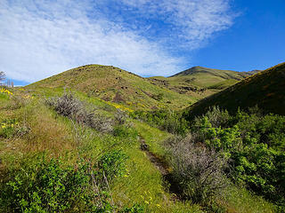 The ridge I will ascend. 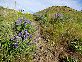 Many flowers at the trailhead for Waterworks Canyon. 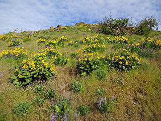 Balsamroot. 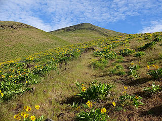 I left the canyon and am walking the west rim of Waterworks. 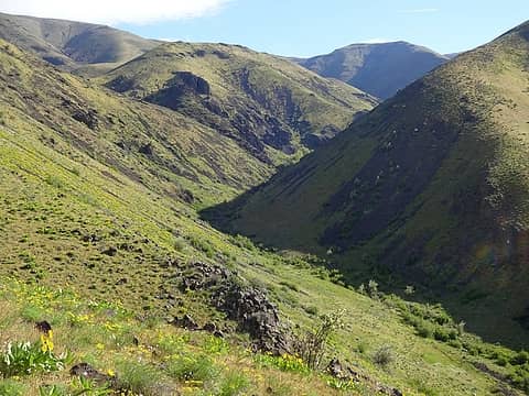 Waterworks Canyon 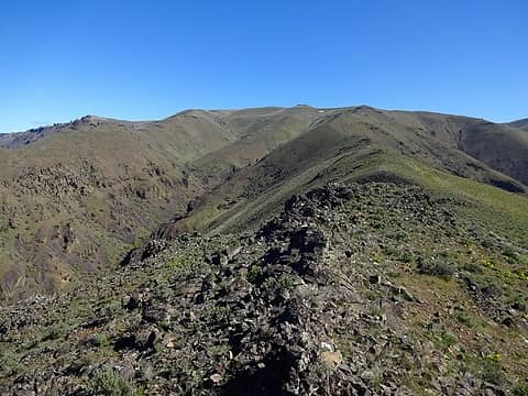 Easy and scenic walking. 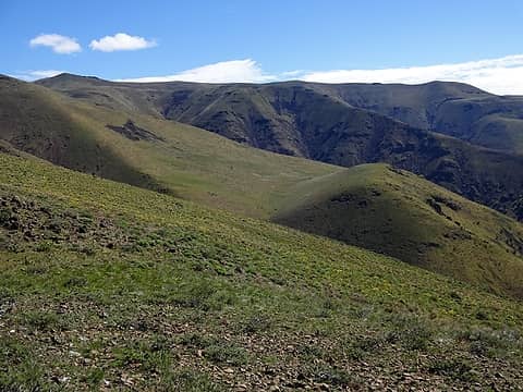 My return ridge in the background. 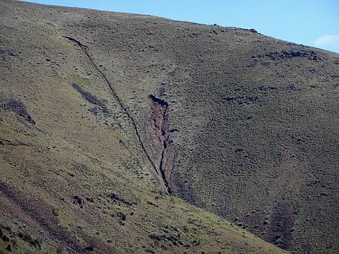 This slide traveled a mile down to Waterworks Canyon and left a debris field. 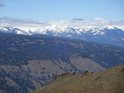 Rainier stayed hidden. 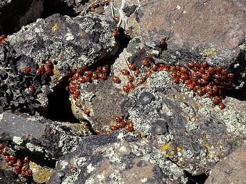 Ladybugs. 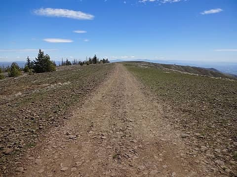 Nearing Naches Benchmark, 4924.' 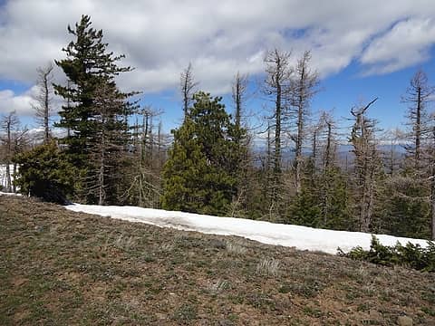 Pines, Douglas Fir and Western Larches on the north side of Cleman 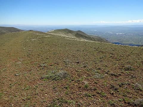 The ridge down. 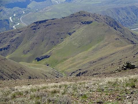 Point 3582 from across Meystre Canyon. A trail comes up to the low saddle on the right from Waterworks Canyon for a loop dropping back down to the parking area after going over the top.  It's about time I saw one of these. 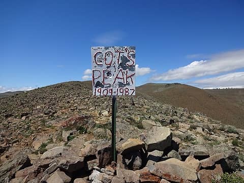 "Cot's Peak" aka Point 4375. 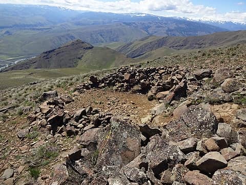 Bivy spot/lounge area at Cot's Peak. 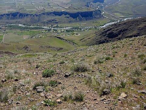 A steep trail goes all the way down to the feeding station from here. 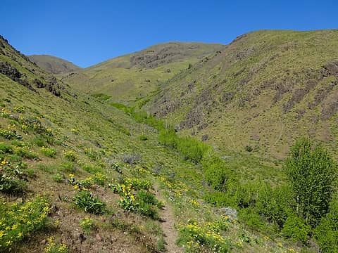 Looking back at Meystre Canyon after crossing the creek.  Feeding station ahead. 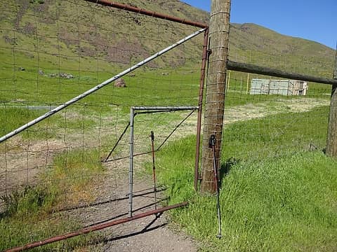 The gate is locked but a human sized door is open. 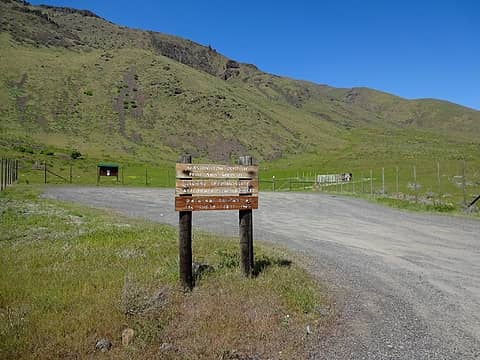 Now I'll walk a mile back to the Waterworks Canyon Trailhead on the road to close the loop. 10ish miles and 3500' gain.
|
| Back to top |
  
|
|
wildernessed
viewbagger

Joined: 31 Oct 2004
Posts: 9275 | TRs | Pics
Location: Wenatchee |
 Nice. Is it feasible to come up the North or South side and drop down the other side as a car to car thruhike ? Weird year we saw a good sized lizard early April at around 4k' in between snow patches on Entiat Ridge. Nice. Is it feasible to come up the North or South side and drop down the other side as a car to car thruhike ? Weird year we saw a good sized lizard early April at around 4k' in between snow patches on Entiat Ridge.
Living in the Anthropocene
Living in the Anthropocene
|
| Back to top |
|
|
RichP
Member
Joined: 13 Jul 2006
Posts: 5637 | TRs | Pics
Location: here |
|
RichP
Member
|
Thu May 04, 2017 6:42 am |
|
|
| wildernessed wrote: | | Is it feasible to come up the North or South side and drop down the other side as a car to car thruhike ? |
Totally feasible. One could walk up Hardy Canyon or Big Burn and drop down via one of the ridges or canyons on the south or vice versa.
|
| Back to top |
|
|
Brushbuffalo
Member

Joined: 17 Sep 2015
Posts: 1887 | TRs | Pics
Location: there earlier, here now, somewhere later... Bellingham in between |
Looks like a perfect day. You are becoming an authority on Cleman Mountain!
Who knows anything about Cot of "Cot's Peak"? Maybe a former local who roamed there?
Interesting.
Passing rocks and trees like they were standing still
Passing rocks and trees like they were standing still
|
| Back to top |
|
|
|
|


