| Previous :: Next Topic |
| Author |
Message |
Dick B
Member


Joined: 06 Jun 2013
Posts: 345 | TRs | Pics
Location: Redmond, Or |
|
Dick B
Member
|
 Tue Aug 29, 2023 1:40 pm |
|
|
I thought I would probe folk's thoughts and hopefully have them share any information they may have about the Cascade Crest Trail system through Washington before the Pacific Crest Trail was designated in 1968. What sections of the old trail exist, and which were redesignated as PCT.
In my youth, I can faintly remember hiking what I assumed were sections of this original trail. I recall small diamond shaped trail markers nailed to trees. They were about 4 inches high, green on white enamel on metal. I believe a tree in the middle.
In the mid 60s I worked on a trail crew that relocated a section of the PCT from Surprise Lake, over Peiper Pass and down to the base of the talus slope above Glacier Lake. It bypassed the old section over Surprise Gap. I remember that there were other contracts let at that time with the purpose of improving or bypassing old sections of trail. I was told that any new portion constructed couldn't accede a 6% grade. I believe whoever surveyed our section, set his Abney hand level at 6% and proceeded to flag the p line. It went thru some pretty serious cliffs, and some switchbacks in order to make the pass. There were some pretty tight specs as to width of tread and width at certain heights so pack animals could safely pass. As I remember the tread had to be 18 or 24" wide(?), and when going thru the cliffs, a normal sized man had to stand in the middle of the trail, extend his arm out horizontally and not be able to touch anything. We improved an old existing trail from the pass down to where we hit the Surprise Gap trail. There was some serious drilling and shooting thru the cliffs and the rock slides before we were done.
 hikerbiker, runup, Riverside Laker, yukon222 hikerbiker, runup, Riverside Laker, yukon222
hikerbiker, runup, Riverside Laker, yukon222 |
| Back to top |
  
|
|
yorknl
Member
Joined: 04 Aug 2008
Posts: 136 | TRs | Pics
|
|
yorknl
Member
|
Thu Aug 31, 2023 12:27 pm |
|
|
This may not be accurate (it's the internet, after all) but I believe I've read that the direct trail from Deception Pass to Cathedral Pass - the section crossing the two challenging streams coming off Mt. Daniel - was new construction for the PCT. This bypasses what would have been the CCT down to Hyas Lake, the Cle Elum River road, and back up via Squaw Lake. I'd guess that the latter routes see far more usage than the direct trail between the two passes, which I thought was memorable solely for the creeks. There were surprisingly few views when I hiked that 10 years ago.
|
| Back to top |
|
|
JimK
Member

Joined: 07 Feb 2002
Posts: 5606 | TRs | Pics
Location: Ballard |
|
JimK
Member
|
Thu Aug 31, 2023 3:34 pm |
|
|
Here are two of your diamond-shaped markers with the tree in the middle. It was already the Pacific Crest Trail by then. They were located close to each other.
|
| Back to top |
|
|
zimmertr
TJ Zimmerman
Joined: 24 Jun 2018
Posts: 1228 | TRs | Pics
Location: Issaquah |
|
zimmertr
TJ Zimmerman
|
Thu Aug 31, 2023 4:39 pm |
|
|
| yorknl wrote: | | two challenging streams |
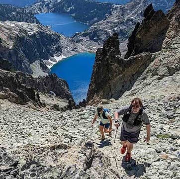
I think this is one of them from last August
| JimK wrote: | | diamond-shaped markers |
There's another one near Mirror Lake.
|
| Back to top |
|
|
Schroder
Member

Joined: 26 Oct 2007
Posts: 6722 | TRs | Pics
Location: on the beach |
|
Schroder
Member
|
Thu Aug 31, 2023 5:46 pm |
|
|
One of these days I'll scan this
Probably the greatest reroute near Seattle is north from Snoqualmie Pass. The CCT went over Red Pass to Goldmeyer, through Dutch Miller Gap and joined the now PCT at Waptus Lake.
At Glacier Peak, the CCT went down Milk Creek and back up the Suiattle River to join the PCT at Miner's Creek. I went on the Vista Creek trail when they were building it in 1967.
mossbackmax, day_hike_mike, JimK, hikerbiker, zimmertr
mossbackmax, day_hike_mike, JimK, hikerbiker, zimmertr |
| Back to top |
|
|
Riverside Laker
Member

Joined: 12 Jan 2004
Posts: 2819 | TRs | Pics
|
I had plans to hike the CCT last month from Snoqualmie to Stevens. Alas, smoke
I have the 1960s guidebook.
|
| Back to top |
|
|
Dick B
Member
Joined: 06 Jun 2013
Posts: 345 | TRs | Pics
Location: Redmond, Or |
|
Dick B
Member
|
Fri Sep 01, 2023 10:05 am |
|
|
| Schroder wrote: | | Probably the greatest reroute near Seattle is north from Snoqualmie Pass. The CCT went over Red Pass to Goldmeyer, through Dutch Miller Gap and joined the now PCT at Waptus Lake.
At Glacier Peak, the CCT went down Milk Creek and back up the Suiattle River to join the PCT at Miner's Creek. I went on the Vista Creek trail when they were building it in 1967. |
Construction on the Deception Lake to Glacier Lake reroute started in 65, and I think ended in 68. I joined the crew in 66 and also worked on it in 67. My future survey company partner and his retired FS ranger dad took the contract. By 68 I was trying to get our surveying business up and running. I believe another contract had been let that went from Stevens Pass and came down to intersect the Gap trail between Surprise and Glacier Lakes.
The 65 and 66 spike camps were near Deception Lake, and in 67 it was on a small stream at the north end of the reroute. I remember the stream cuz it kept our beer cold.
The trail signs are as I remember except, they seemed to in a little better shape. I didn't realize they were put up to mark the PCT and not the CCT. I have never understood why signs are always an invitation for some idiot to use it for target practice.
|
| Back to top |
|
|
Kim Brown
Member
Joined: 13 Jul 2009
Posts: 6900 | TRs | Pics
|
The Pacific Crest Trail was a concept many years before re-routing started and it became designated with that name. I have a 1950's map that shows the route as "Pacific Crest Trail." So I wonder if some of markers were CCC era after all.
I have an idea to hike the CCC with vintage gear; it's been an idea for over 20 years, so chances are it will remain one. I'm getting older and dealing with vintage gear - and the food eaten then - doesn't sound as fun as it did 20 years ago.
"..living on the east side of the Sierra world be ideal - except for harsher winters and the chance of apocalyptic fires burning the whole area."
Bosterson, NWHiker's marketing expert
Joseph
"..living on the east side of the Sierra world be ideal - except for harsher winters and the chance of apocalyptic fires burning the whole area."
Bosterson, NWHiker's marketing expert
Joseph
|
| Back to top |
|
|
Riverside Laker
Member
Joined: 12 Jan 2004
Posts: 2819 | TRs | Pics
|
This map of the CCT from Snoqualmie to Rainy was made from the guidebook "High Trails, a Guide to the Cascade Crest Trail" by Robert H. Wills, 1962. It mentions the Pacific Crest Trail was made from the Oregon Skyline Trail and Washington Cascade Crest Trail. There's more differences north of Rainy Pass I've not drawn yet.
Red: PCT, Blue: CCT. The dashed blue isn't a practical hike right now (Milk Creek trail). There's two lines at the south end, the horse route went via Snow Lake, and the hiker route over Red Pass.
mossbackmax
mossbackmax |
| Back to top |
|
|
Dick B
Member
Joined: 06 Jun 2013
Posts: 345 | TRs | Pics
Location: Redmond, Or |
|
Dick B
Member
|
Fri Sep 01, 2023 1:24 pm |
|
|
| Kim Brown wrote: | | The Pacific Crest Trail was a concept many years before re-routing started and it became designated with that name. I have a 1950's map that shows the route as "Pacific Crest Trail." So I wonder if some of markers were CCC era after all.
I have an idea to hike the CCC with vintage gear; it's been an idea for over 20 years, so chances are it will remain one. I'm getting older and dealing with vintage gear - and the food eaten then - doesn't sound as fun as it did 20 years ago. |
Kim. Glad to hear your take on the trail markers. I know I saw some when I was hiking in the 50s so the PCT lettering makes sense. Some sure do look old.
If I were to hike the old CCT with vintage gear (which I won't), it kind of depends how far you want to go back. I found that WWII was kind of a defining point as far as camping gear was concerned. Right after the war there was a lot of surplus stuff to be had. Since I could be classified as "vintage" here is what I would suggest. A trapper Nelson pack or a WW2 rucksack, no tent but perhaps a fly, probably nylon. Post WW2 might provide you with a pup tent, also known as a shelter half. It is pretty heavy canvas so it would probably require 2 people, one to carry each part of the shelter half. It is fastened together and holds 2 people. No other types of backpack tents were available that I know of hence we always slept in the open. For me, pre WW2 sleeping gear was a blanket carried tied up in a roll. Folded over at night, and slept on the bare ground. Post WW2, provided us with our first down filled sleeping bags, and air mattresses which were great if you could get them to hold air. Food would have to include at least one can of pork and beans. Eggs and some bacon, and some way to cook. Be prepared to cook everything over an open fire. Several 50s hikes included army C rations. I doubt there are any of those left. What ever we took it was pretty heavy as there were no freeze dried stuff then, or at least that I heard of. The only hiking boot that I remember were Redwings. but I think they came later.
Speaking of authenticity, reminds me of a book I read once about civil war reenactors. Those folks really take their tasks seriously as far as what the wear, what they take with them, even as to how they sleep. The author of the book decided to participate in one of the mock battles. All his gear was inspected down to what he had in his lunch, which was to be eaten on the "battlefield". They threw out an apple because it was a variety that had not been grown during the Civil War.
|
| Back to top |
|
|
reststep
Member
Joined: 17 Dec 2001
Posts: 4757 | TRs | Pics
|
|
reststep
Member
|
Fri Sep 01, 2023 1:57 pm |
|
|
"The mountains are calling and I must go." - John Muir
|
| Back to top |
|
|
Dick B
Member
Joined: 06 Jun 2013
Posts: 345 | TRs | Pics
Location: Redmond, Or |
|
Dick B
Member
|
Fri Sep 01, 2023 3:31 pm |
|
|
I remember the Currin-Green boot. My late business partner, college classmate and best friend always had a Rainer caulk (we called them cork) boot. One foot was slightly miss-shaped due to early polio and he had to have his boots custom made. Having corked boots, while beating the brush on the west side of Oregon, was a requirement. I always bought Buffalos as it was the only kind I could afford. Back in the early 60s I think they were around $35.00 a pair. With heavy use, they usually lasted about a year and a half. After I moved to the east side corked boots were no longer needed. I had a perfectly good pair kicking around the house but after time they disappeared. I'm sure they would bring big bucks on eBay today. I checked their listing and it looks like you can get a pair now for only around $600 or $700.
I also had a pair of Whites with vibram soles for hiking. They were a good boot.
runup
runup |
| Back to top |
|
|
Joseph
Joseph
Joined: 13 Jun 2018
Posts: 263 | TRs | Pics
Location: Seattle |
|
Joseph
Joseph
|
Sun Oct 22, 2023 8:29 pm |
|
|
| Kim Brown wrote: | | The Pacific Crest Trail was a concept many years before re-routing started and it became designated with that name. I have a 1950's map that shows the route as "Pacific Crest Trail." So I wonder if some of markers were CCC era after all.
I have an idea to hike the CCC with vintage gear; it's been an idea for over 20 years, so chances are it will remain one. I'm getting older and dealing with vintage gear - and the food eaten then - doesn't sound as fun as it did 20 years ago. |
I have a Trapper Nelson pack I can let you use, lol
runup
runup |
| Back to top |
|
|
RichP
Member

Joined: 13 Jul 2006
Posts: 5634 | TRs | Pics
Location: here |
|
RichP
Member
|
Tue Oct 24, 2023 6:10 am |
|
|
I hiked a couple of unnamed peaklets above the North Fork Little Naches between Pyramid Peak and Blowout Mtn this weekend and took some old sections of the trail which are still in decent shape. They really did try to stay on the crest and go over every bump originally. The reroute is below these sections now to avoid some of the elevation gain and loss.
|
| Back to top |
|
|
|
|


