| Previous :: Next Topic |
| Author |
Message |
rubywrangler
Member


Joined: 04 Aug 2015
Posts: 511 | TRs | Pics
|
I am slightly embarrassed to admit I had never laid eyes on Lyman lakes until now. Thank you weather gods for this opportunity  Day 1
The road to Phelps Creek trailhead seemed fine/better than the last time I was there (2018). I arrived to a nearly full TH at 2pm and spent some time mouse-proofing (ie hiding all food and paper items in cooler or other sealed containers), then got on the trail 2:30ish. After passing through Spider Meadow, I left the trail at the creek coming down from Genius and headed east. Following the description in an old TR by Rainie Too!, I followed the right fork when the creek branched, and then stayed on the left side of the right fork the rest of the way. The route climbs steeply ~2000' with a game trail to follow here and there and is completely brush free. At 6500 I hit a pretty bench full of larches. I climbed a little further and reached the more stark upper basin shortly before sunset. I was coming off of a weeklong cold and was totally spent. Ate dinner and crashed immediately.
Day 1
The road to Phelps Creek trailhead seemed fine/better than the last time I was there (2018). I arrived to a nearly full TH at 2pm and spent some time mouse-proofing (ie hiding all food and paper items in cooler or other sealed containers), then got on the trail 2:30ish. After passing through Spider Meadow, I left the trail at the creek coming down from Genius and headed east. Following the description in an old TR by Rainie Too!, I followed the right fork when the creek branched, and then stayed on the left side of the right fork the rest of the way. The route climbs steeply ~2000' with a game trail to follow here and there and is completely brush free. At 6500 I hit a pretty bench full of larches. I climbed a little further and reached the more stark upper basin shortly before sunset. I was coming off of a weeklong cold and was totally spent. Ate dinner and crashed immediately.
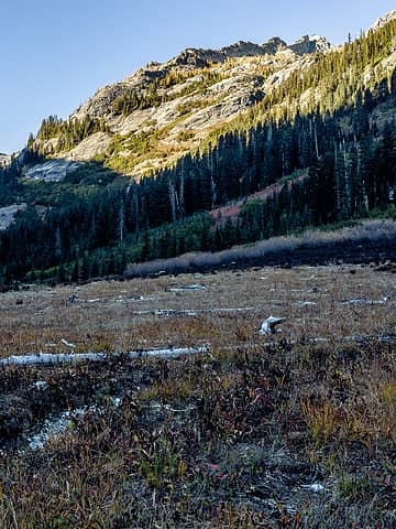 heading for those larches, roughly 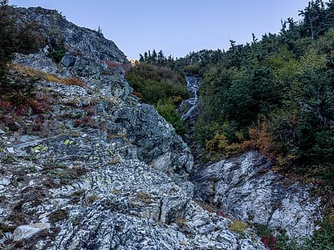 climbing to genius basin 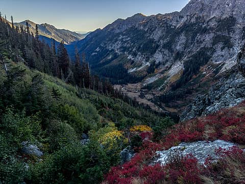 looking back to spider meadow 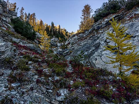 hello larches 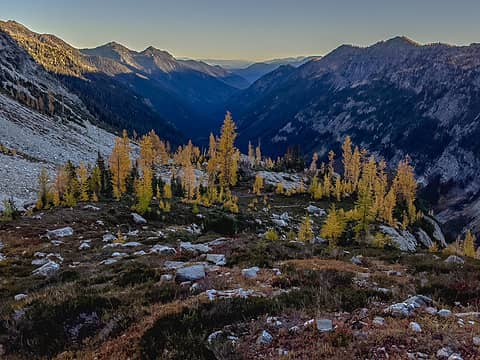 6500' bench 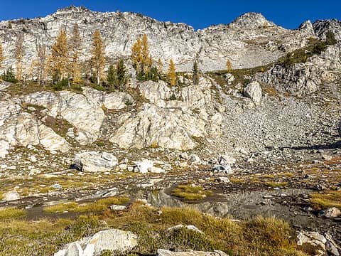 genius basin 6900' 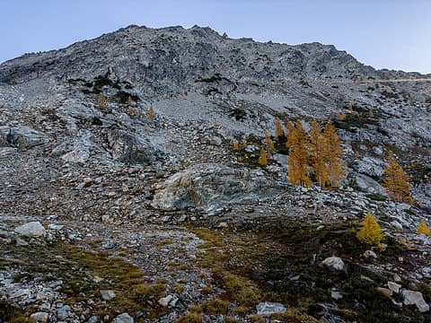 genius 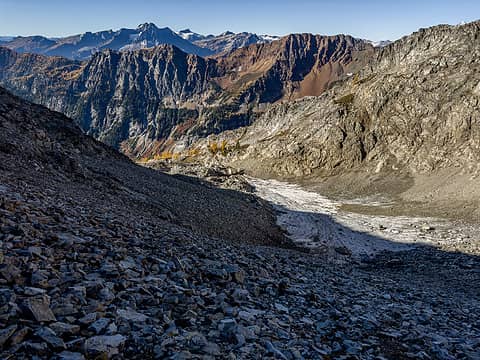 looking back 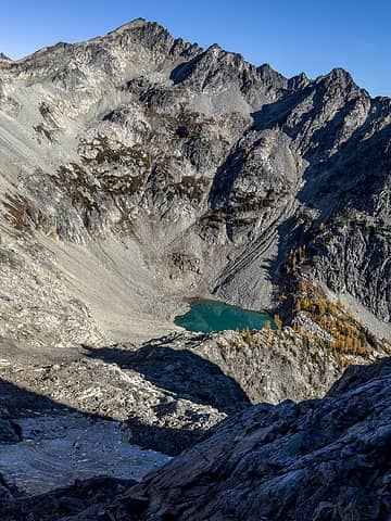 pretty tarn below greenwood 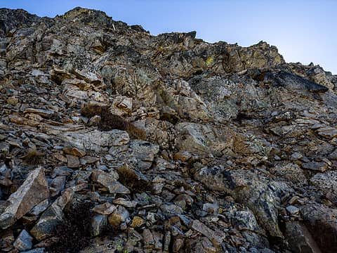 looking up genius north ridge scramble. beyond this, just a walk 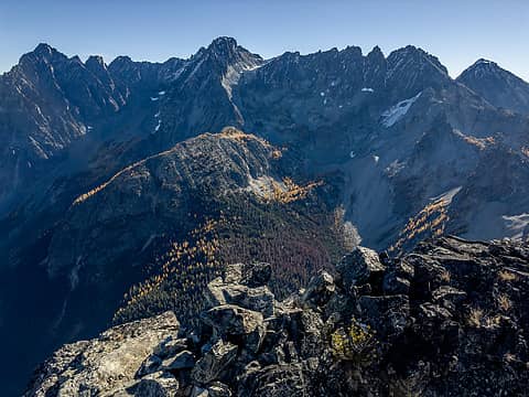 copper to maude 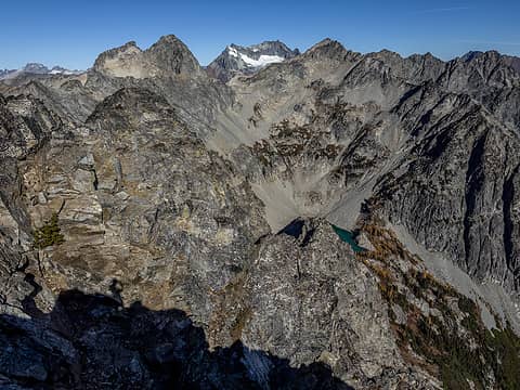 dumbbell bonanza greenwood 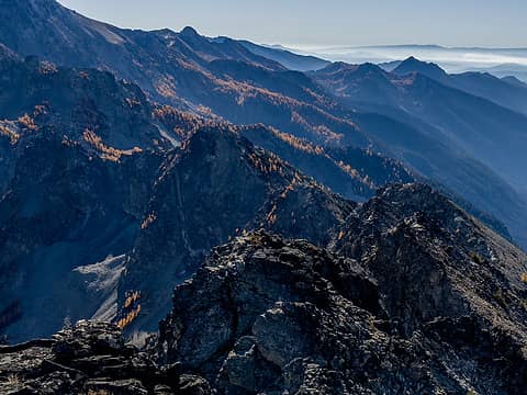 larches larches larches 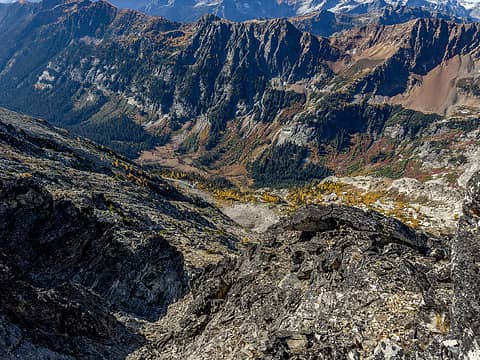 down to spider meadow 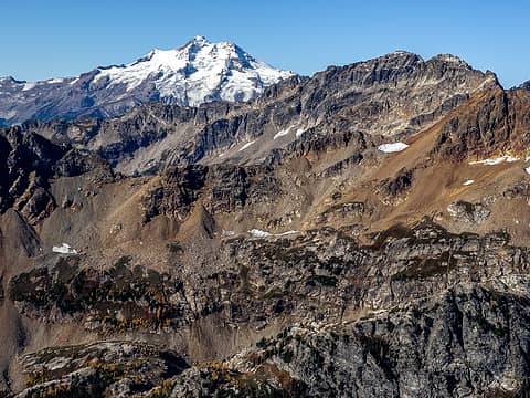 dakobed, fortress, chiwawa 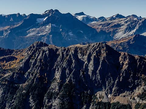 some of my favorite places 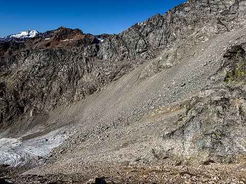 genius exit ledge ahead 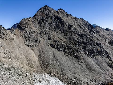 genius from top of ramp at 7400' 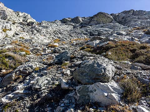 looking back descent route 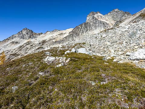 heather benches en route to dumbbell 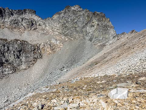 dumbbell 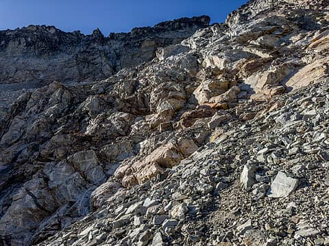 first cliff band passage 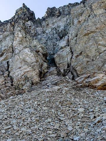 class 3 gully 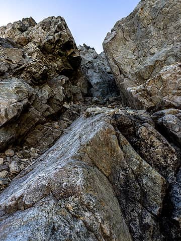 class 3 gully 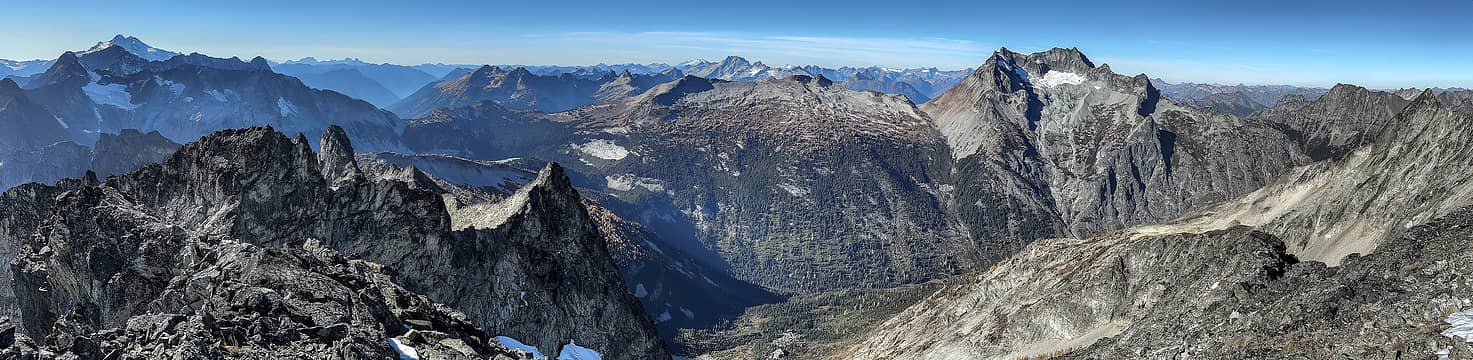 dumbbell summit pano 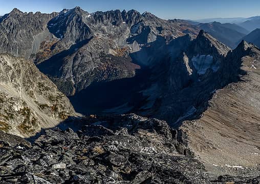 summit view south 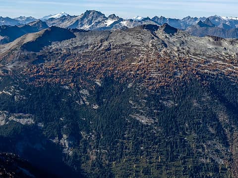 tomorrow's destination  I picked up the climbers path below the basin and took it down to ~7100, where I filled up with water before heading north on heather benches dotted with larches to the head of Phelps basin, where I camped, arriving just in time for sunset. Barely a trickle of water and very lumpy, but great views. Saw zero humans all day. I picked up the climbers path below the basin and took it down to ~7100, where I filled up with water before heading north on heather benches dotted with larches to the head of Phelps basin, where I camped, arriving just in time for sunset. Barely a trickle of water and very lumpy, but great views. Saw zero humans all day.
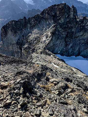 descending the summit block 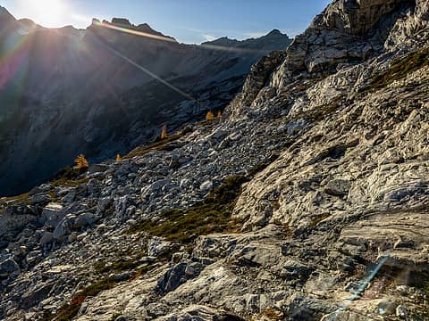 heading for heather benches again 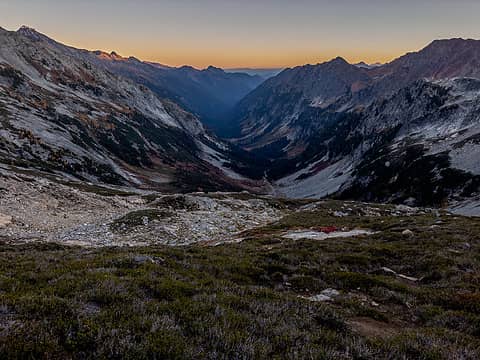 camp view 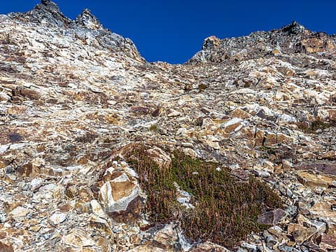 climb to the 7400' col 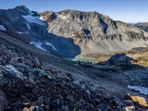 finally lyman lakes! 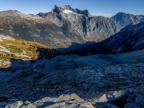 huge moraine and spectacular larch basin 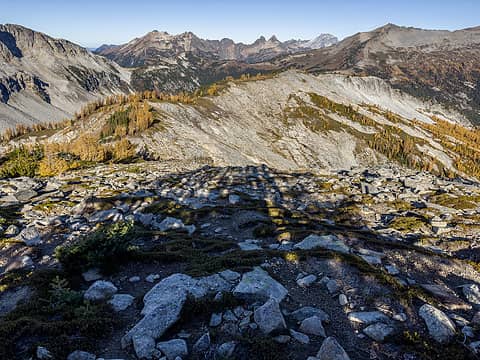 that ridge is calling me 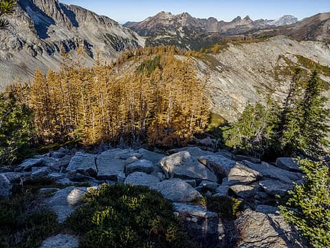 follow the yellow larch road 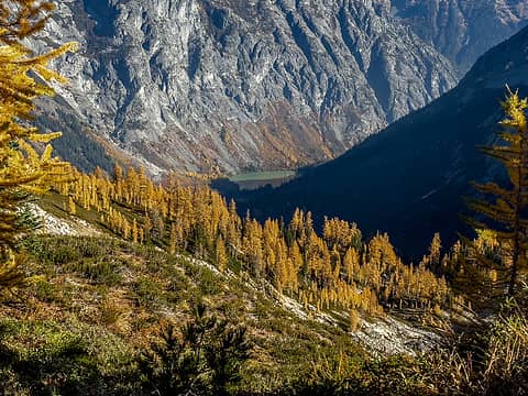 hart lake 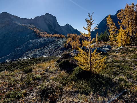 looking back 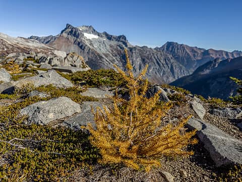 babylarch2 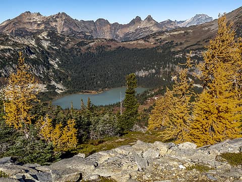 lower lyman 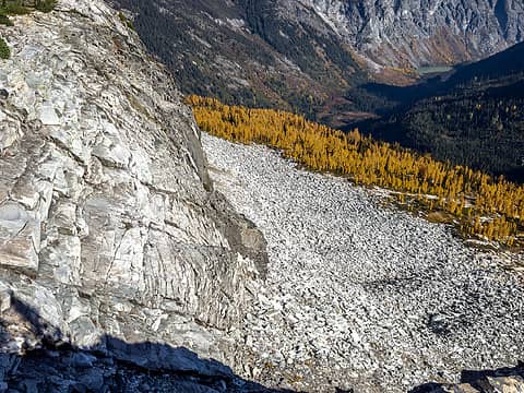 neat cliff 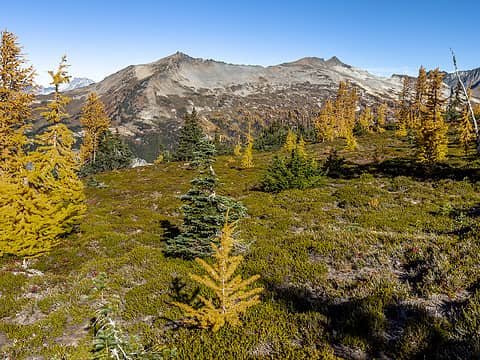 ridge views 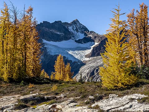 ridge views 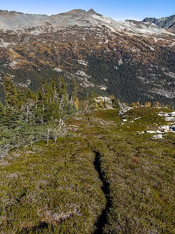 would be nice if that trail went all the way... 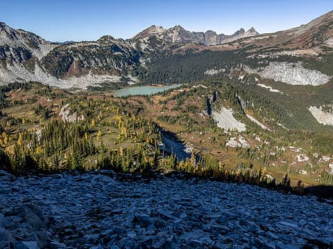 descending to lymans 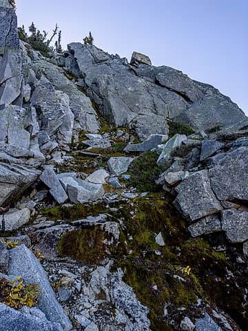 descent gully 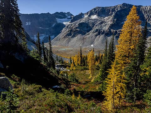 descending to lymans 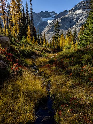 upper lyman basin larches 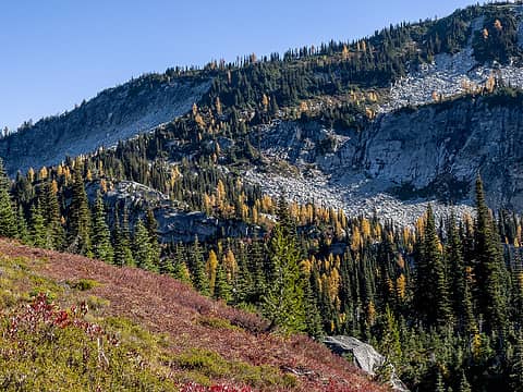 descent from ridge was at the left edge of the trees here. trail in there somewhere 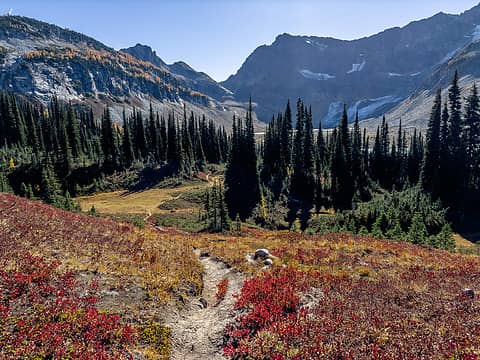 on the trail to lower lyman, looking back toward spider gap 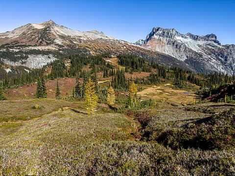 what a view 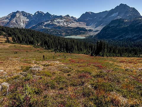 and this one too  I went down hard but it wasn't too painful so I shook it off and kept going. Somehow it didn't end up bothering me until yesterday (Monday). I guess it just needed some time to stiffen up. I went down hard but it wasn't too painful so I shook it off and kept going. Somehow it didn't end up bothering me until yesterday (Monday). I guess it just needed some time to stiffen up.  The heather transitioned to slabs as I climbed higher. Eventually I got on the ridge connecting Cloudy and North Star, west of North Star's false summit, and walked east until I came to a ~20 drop off that I couldn't descend. If only I had read Fletcher's TR before this moment, I would have known the ridge doesn't go! Oops. Summitpost doesnt mention this
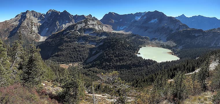 lymans from the trail to north star basin 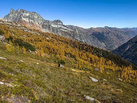 yesssss 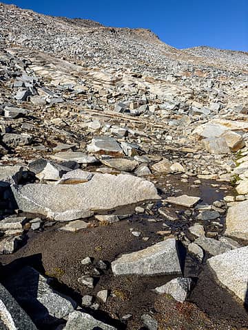 slabs > talus 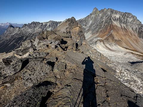 on the summit ridge, approaching dead end 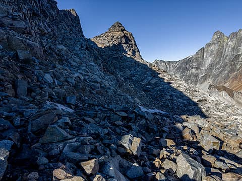 back on route, south side of the ridge 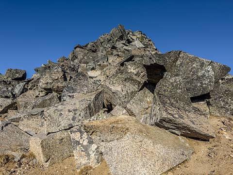 summit block, scramble straight up or walk around 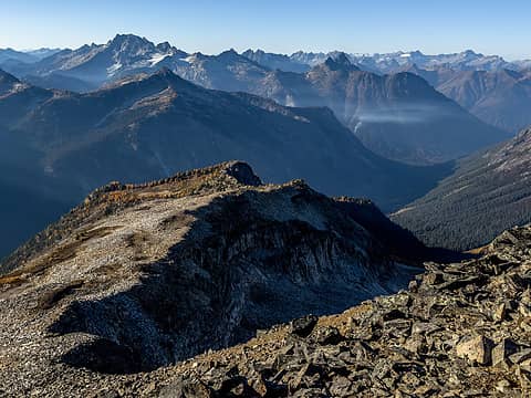 summit view north, smoke from dome peak fire or ?? 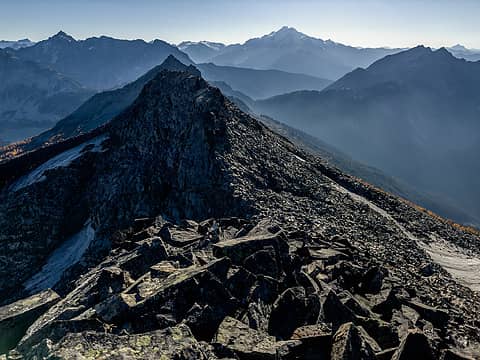 summit view west 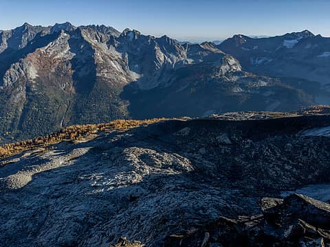 summit view south 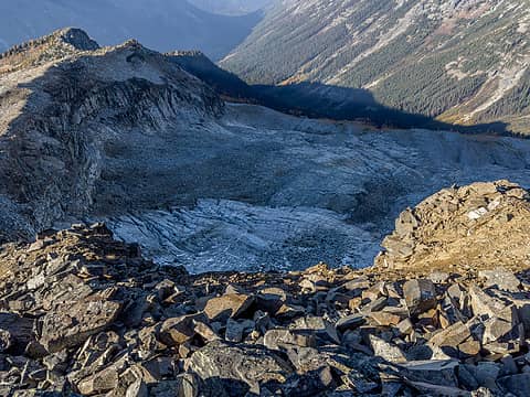 grant glacier 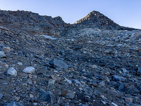 from near the bottom of the moraine 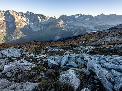 an easy stroll back to camp  Then back down to lower lyman. I took the trail on the west side of the lake this time, which is much more scenic than the normal trail. But eventually it dead ends and a sign directs to you rock or snow for the final ~150 climb to the middle lake. Crossing the outlet was very slippery and I ended up with 2 wet feet. I hopped on a trail that skirts the shore of the middle lake and eventually connected with the main trail leading up to Spider Gap. Then a leisurely lunch on larch knob, and back to the car at ~3:15. There were a handful of folks between Spider Gap and Spider Meadow, but zero people on the trail out until the last 1/4 mile when the Carne Mtn traffic kicked in. Must have been 100-150 cars up there. No sign of mice in my car! Then back down to lower lyman. I took the trail on the west side of the lake this time, which is much more scenic than the normal trail. But eventually it dead ends and a sign directs to you rock or snow for the final ~150 climb to the middle lake. Crossing the outlet was very slippery and I ended up with 2 wet feet. I hopped on a trail that skirts the shore of the middle lake and eventually connected with the main trail leading up to Spider Gap. Then a leisurely lunch on larch knob, and back to the car at ~3:15. There were a handful of folks between Spider Gap and Spider Meadow, but zero people on the trail out until the last 1/4 mile when the Carne Mtn traffic kicked in. Must have been 100-150 cars up there. No sign of mice in my car!
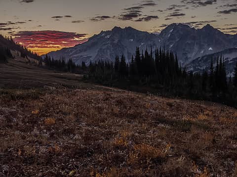 nice sunrise... over holden 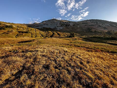 cloudy peak from camp 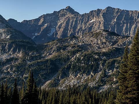 my nemesis 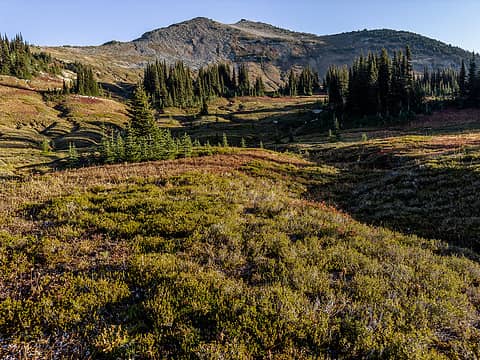 really awesome meadows here 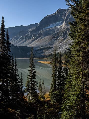 lower lyman from west trail 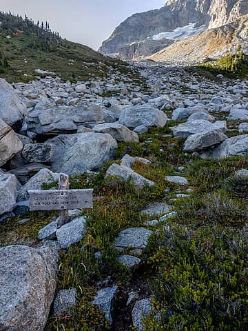 end of the trail 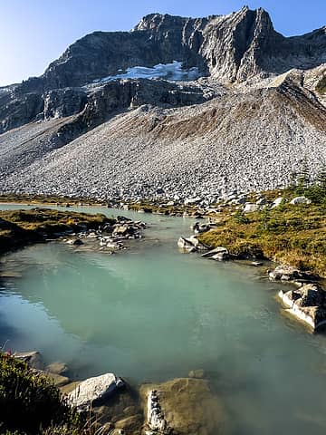 that color, wow 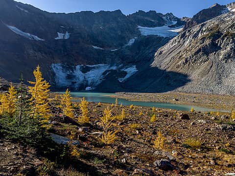 upper lyman + chiwawa 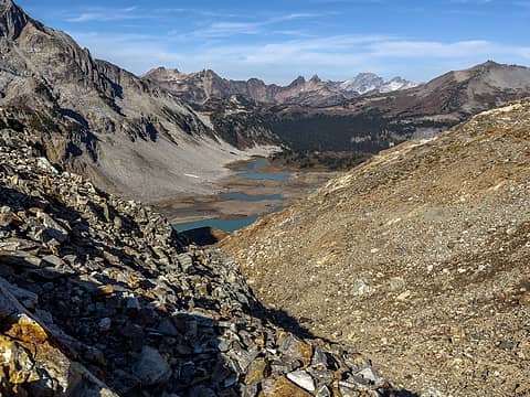 spider gap view 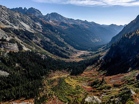 larch knob lunch spot view 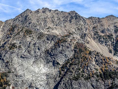 teeny genius summit 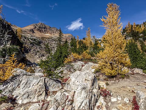 looking back to spider gap 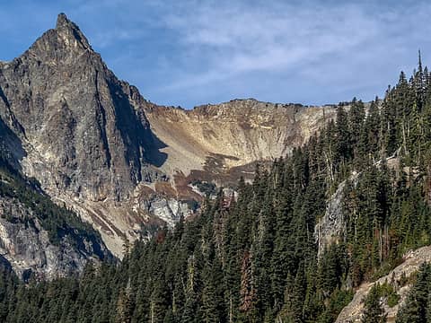 my phelps basin exit is the notch in the ridge right of the pinnacle
 RAW-dad, Nancyann, The Ghost of Bear 380, Kenji, Gimpilator, adam.rhoda1, Bramble_Scramble, Josh Journey, Kascadia, Get Out and Go, shelby147, fourteen410, Route Loser, neek, fffej50, Eric Gilbertson, reststep, NWtrax, Prosit, Bowregard, runup, kite, HitTheTrail, silence, raising3hikers, Now I Fly, RichP, John Mac, Tom RAW-dad, Nancyann, The Ghost of Bear 380, Kenji, Gimpilator, adam.rhoda1, Bramble_Scramble, Josh Journey, Kascadia, Get Out and Go, shelby147, fourteen410, Route Loser, neek, fffej50, Eric Gilbertson, reststep, NWtrax, Prosit, Bowregard, runup, kite, HitTheTrail, silence, raising3hikers, Now I Fly, RichP, John Mac, Tom  awilsondc, jaysway awilsondc, jaysway  SpookyKite89 SpookyKite89  geyer, KascadeFlat, zimmertr geyer, KascadeFlat, zimmertr
RAW-dad, Nancyann, The Ghost of Bear 380, Kenji, Gimpilator, adam.rhoda1, Bramble_Scramble, Josh Journey, Kascadia, Get Out and Go, shelby147, fourteen410, Route Loser, neek, fffej50, Eric Gilbertson, reststep, NWtrax, Prosit, Bowregard, runup, kite, HitTheTrail, silence, raising3hikers, Now I Fly, RichP, John Mac, Tom awilsondc, jaysway SpookyKite89 geyer, KascadeFlat, zimmertr |
| Back to top |
  
|
|
NWtrax
Member

Joined: 27 Apr 2008
Posts: 638 | TRs | Pics
|
|
NWtrax
Member
|
 Wed Oct 11, 2023 10:47 am |
|
|
Splendid!
rubywrangler
rubywrangler |
| Back to top |
|
|
Gimpilator
infinity/21M

Joined: 12 Oct 2006
Posts: 1684 | TRs | Pics
Location: Edmonds, WA |
Nice trip.  
|
| Back to top |
|
|
The Ghost of Bear 380
~SJ~
Joined: 15 Dec 2022
Posts: 19 | TRs | Pics
Location: In your IG feed |
OMG these photos are gorgeous! Cool trip!
rubywrangler
rubywrangler |
| Back to top |
|
|
Nancyann
Member
Joined: 28 Jul 2013
Posts: 2322 | TRs | Pics
Location: Sultan Basin |
|
Nancyann
Member
|
Sat Oct 14, 2023 8:09 pm |
|
|
Very cool adventure! Nice to see what the area looks like after the larches turn gold. Im amazed that the berry bushes held their color for so long, they were scarlet almost six weeks ago! We camped at the west end of Lower Lyman but didnt have time to walk up to the waterfall so its nice to see that its worth doing.
rubywrangler
rubywrangler |
| Back to top |
|
|
rubywrangler
Member
Joined: 04 Aug 2015
Posts: 511 | TRs | Pics
|
Happy birthday Nancyann!
Nancyann
Nancyann |
| Back to top |
|
|
|
|
You cannot post new topics in this forum
You cannot reply to topics in this forum
You cannot edit your posts in this forum
You cannot delete your posts in this forum
You cannot vote in polls in this forum
|
Disclosure: As an Amazon Associate NWHikers.net earns from qualifying purchases when you use our link(s). |


