Matt
Tea, Earl Grey, Hot


Joined: 30 Jan 2007
Posts: 4308 | TRs | Pics
Location: Shoreline |
|
Matt
Tea, Earl Grey, Hot
|
 Mon Nov 13, 2023 1:06 am |
|
|
October 19-20, 2023
Destination: Kettle Crest trail north from Sherman Pass to Copper Butte, with camp on Wapaloosie Mtn.
Summits: Columbia 6782, Jungle Hill 6544, Wapaloosie 7018, Copper Butte 7140, Scar 7040.
I've wanted to hike Kettle Crest for western larch season ever since I saw a mid-October photo of larches at Sherman just beginning to turn gold with a light cover of snow on the ground. Some friends were also interested this year, so I planned the trip. The reality turned out more mixed than the plan.
- New place to explore? Yes! Entirely new area for me.
- Friends available? Friends not available, so I went alone.
- Long drive? 5.5 hours from Seattle.
- Good weather window? First day was very sunny and warm.
- Western larches? Larches were early this year, but still colorful at lower elevations.
- Fresh snow for scenery and water? No snow
- Spring for water? Springs doubtful, so carried water for whole trip.
- Fun peak name? Yes, Wapaloosie.
- New summits? Yes, Columbia, Jungle Hill, Wapaloosie, Scar, Copper Butte
- Summit camp? Yes, Camped on summit of Wapaloosie
- New WAP2K peak? Yes, Copper Butte has 4740P, #107/144 for me.
- Worth going back for more? Yes, multiple other options for future trips!
Here are more of the details:
Getting there: I drove up Wednesday evening from Seattle and camped near the trailhead. From Tonasket eastward was all new to me, but it was already dark, so I couldn't enjoy the scenery. My headlights gave occasional glimpses of some colored trees, but increasing drifts of needles on the road were ominous foreshadowing for the larches.
Western Larches: These are Western Larches, so they grow at lower elevation mixed in with other forest. Usually they reach peak color around the third weekend of October, but this year was very early, so larches near the crest had lost most of their needles. Hiking along, they still gave a pleasant thrill when an occasional bright one would appear. And the hike below bare trees provided a meditation on the cycle of seasons, with the trees adjusting to survive the cold of winter and then grow their needles bright green then gold again for the next seasons.
Scenery: Most of the trail is in forest, but occasional openings give views along the way. Wapaloosie, Scar, and Copper have huge grassy meadows on their flanks, for wide views of the area. The lower surrounding hills were spangled with spatters and ribbons of larches still showing bright yellow amid the darker forests.
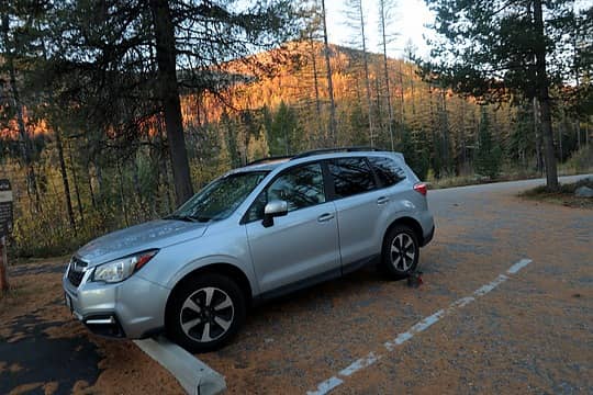 Sunrise where I car-camped in a parking lot covered with larch needles near Sherman Pass. 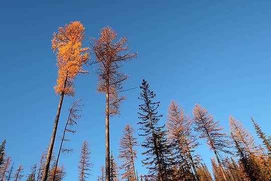 Mixed remnants of color above Sherman Pass. 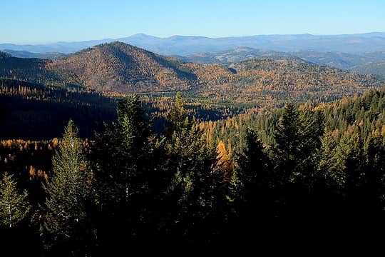 Brighter trees on the hills and valleys below. 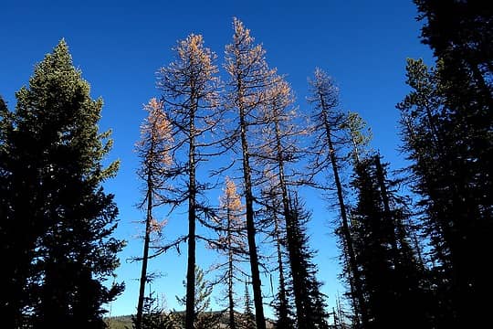 More transient fringes of gold overhead. 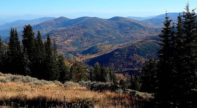 A very eastern WA view, grass & sage in the foreground, and western larches mixed in the forest below. 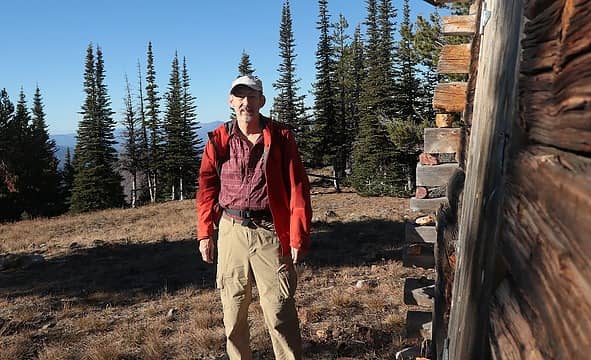 Standing by the lookout cabin on Columbia Mtn. 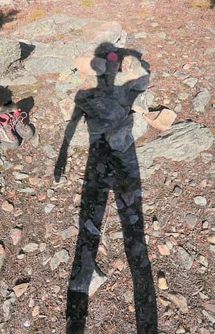 My shadow on the Jungle Hill summit cairn, with the cap of the register looking like I have a giant alien red eye. Maybe I'm a Borg  A trickle of water from the Wapaloosie spring. 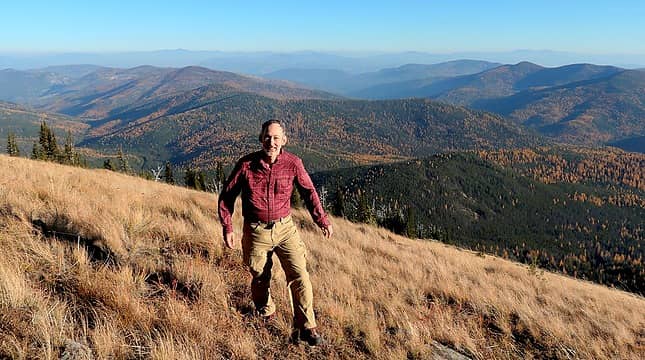 Wandering around the sunny afternoon meadows on Wapaloosie. 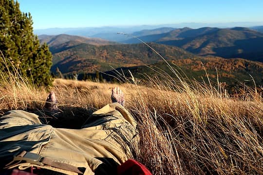 Reclining on the warm meadow, with golden larches viewed through golden grass. 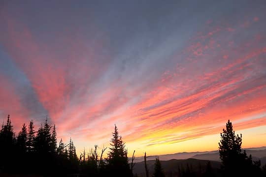 Sunrise lighting high clouds in the morning. 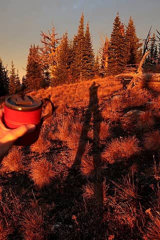 Morning tea and my shadow in the red morning light. 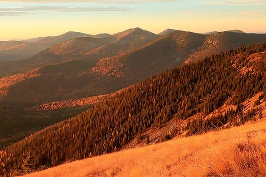 Golden light on the view back to Columbia Mtn. 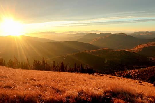 And the sun rises, spreading light across the rides, meadows, and trees. 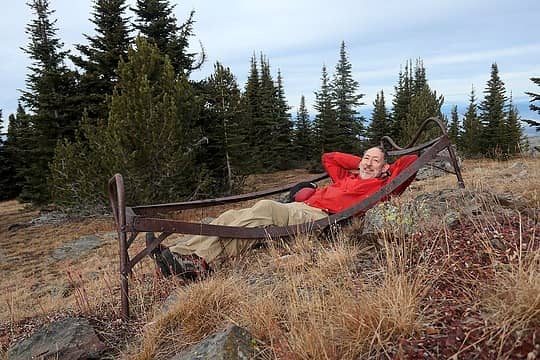 Reclining on the summit of Copper Butte. 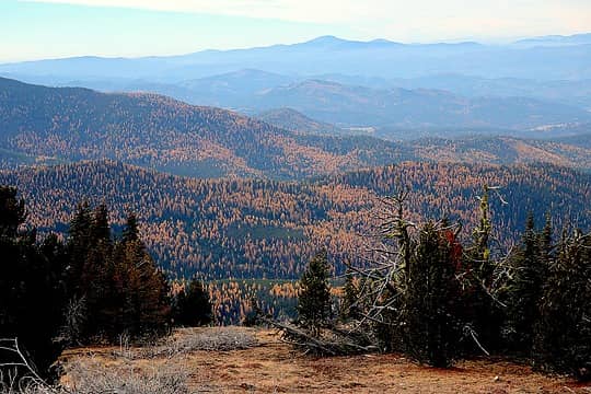 More larches westward from Copper Butte. 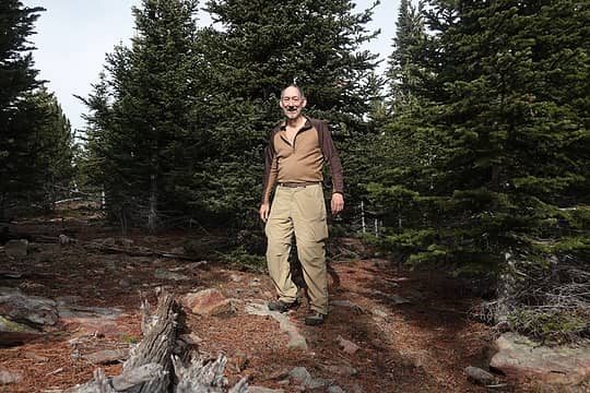 Overcast summit on Scar 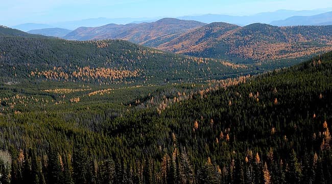 View up U.S. Creek from the side of Scar Mtn. 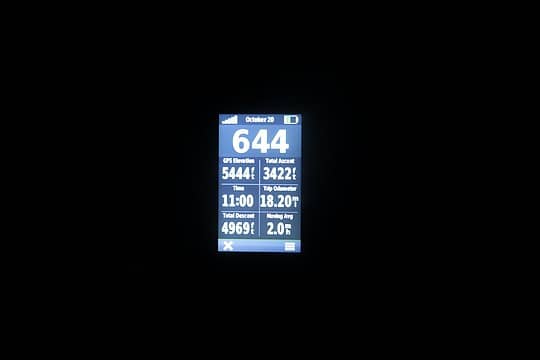 All dark back at the Sherman Pass trailhead. 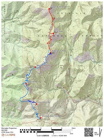 Kettle Crest GPS track.
As beacons mountains burned at evening. J.R.R. Tolkien
 raising3hikers, rubywrangler, contour5, RichP, Get Out and Go, NWtrax, Lindsay, geyer, glenoid, jaysway, jstern, silence, Waterman, Gimpilator raising3hikers, rubywrangler, contour5, RichP, Get Out and Go, NWtrax, Lindsay, geyer, glenoid, jaysway, jstern, silence, Waterman, Gimpilator
As beacons mountains burned at evening. J.R.R. Tolkien
raising3hikers, rubywrangler, contour5, RichP, Get Out and Go, NWtrax, Lindsay, geyer, glenoid, jaysway, jstern, silence, Waterman, Gimpilator
|


