| Previous :: Next Topic |
| Author |
Message |
b00
Member


Joined: 29 Sep 2003
Posts: 1145 | TRs | Pics
|
|
b00
Member
|
 Wed Aug 16, 2006 7:24 pm |
|
|
Buck mountain 8-12-06
Beautiful scenery, great weather, interesting people and lots of off-trail travel. What a great adventure!
This trip is more an exercise in route finding, than scrambling. although you must be experienced to be able to handle and enjoy it.
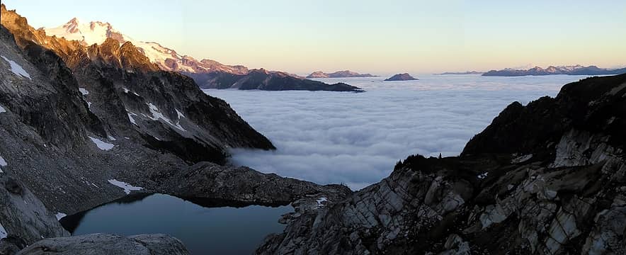 Panorama from high pass - buck mt 8-12-06 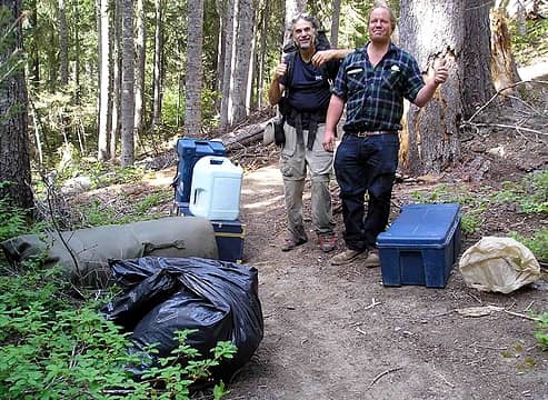 robert on the right 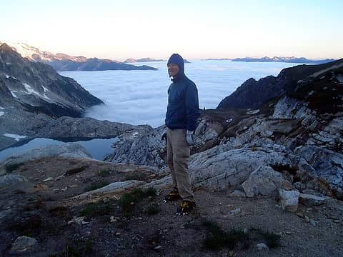 view from high pass - buck mt 8-12-06 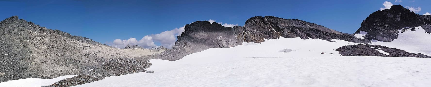 Panorama true summit right of center - buck mt 8-12-06 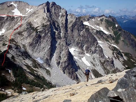 getting back from buck mountain 8-12-06  1 label - -true summit right of center  1 label panorama high pass afternoon  fence of larches
|
| Back to top |
  
|
|
Quark
Niece of Alvy Moore

Joined: 15 May 2003
Posts: 14152 | TRs | Pics
|
|
Quark
Niece of Alvy Moore
|
Wed Aug 16, 2006 7:36 pm |
|
|
Damn, that's wierd - Stefan met a gent up in N Cascades (Chelan area I think) several years ago doing that exact same thing as your Robert was doing.
He figured it was a meth lab relo project or something.
Could be just some guy setting up backcountry travelers to give 'em sumpin' to think about. That'd be funny as hell. I might start doing stuff like that, just for the hell of it.
"...Other than that, the post was more or less accurate."
Bernardo, NW Hikers' Bureau Chief of Reporting
"...Other than that, the post was more or less accurate."
Bernardo, NW Hikers' Bureau Chief of Reporting
|
| Back to top |
|
|
RayD
the griz ate my pass
Joined: 20 Aug 2005
Posts: 1763 | TRs | Pics
Location: Vacaville |
|
RayD
the griz ate my pass
|
Wed Aug 16, 2006 7:53 pm |
|
|
Robert says he has done this stretch before and was going to Bumping Lake this time. Go figure!
don't believe everything you think
don't believe everything you think
|
| Back to top |
|
|
Guiran
Member

Joined: 03 Mar 2004
Posts: 621 | TRs | Pics
Location: University of Washington |
|
Guiran
Member
|
Wed Aug 16, 2006 8:26 pm |
|
|
Great trip! Louis Creek Basin is a really neat place to camp if you come in from the Napeequa Valley side. Feels tremendously remote.
|
| Back to top |
|
|
Get Out and Go
Member

Joined: 13 Nov 2004
Posts: 2130 | TRs | Pics
Location: Leavenworth |
I met you with my friend as you two were coming out on Sunday morning (See my Trip Report for Buck, Pt 7529, and High Pass) and described your Buck accomplishment. I saw the Subaru with a flat tire and wondered who was going to find that pleasant surprise when they came out. Your last comment as we parted on the trail was that we were going to meet an interesting character up ahead. Yeah, we had an interesting conversation with Robert, to say the least. When we came out on Tuesday, he had made considerable progress, maybe 2 miles from the pass.
"These are the places you will find me hiding'...These are the places I will always go."
(Down in the Valley by The Head and The Heart)
"Sometimes you're happy. Sometimes you cry.
Half of me is ocean. Half of me is sky."
(Thanks, Tom Petty)
"These are the places you will find me hiding'...These are the places I will always go."
(Down in the Valley by The Head and The Heart)
"Sometimes you're happy. Sometimes you cry.
Half of me is ocean. Half of me is sky."
(Thanks, Tom Petty)
|
| Back to top |
|
|
Get Out and Go
Member
Joined: 13 Nov 2004
Posts: 2130 | TRs | Pics
Location: Leavenworth |
Glad to see the photographic evidence of Robert. Great pictures of the route out to Buck as well.
"These are the places you will find me hiding'...These are the places I will always go."
(Down in the Valley by The Head and The Heart)
"Sometimes you're happy. Sometimes you cry.
Half of me is ocean. Half of me is sky."
(Thanks, Tom Petty)
"These are the places you will find me hiding'...These are the places I will always go."
(Down in the Valley by The Head and The Heart)
"Sometimes you're happy. Sometimes you cry.
Half of me is ocean. Half of me is sky."
(Thanks, Tom Petty)
|
| Back to top |
|
|
Tazz
Member
Joined: 27 Apr 2005
Posts: 7902 | TRs | Pics
|
|
Tazz
Member
|
Thu Aug 17, 2006 6:55 pm |
|
|
great tr BOO. Thanks 
|
| Back to top |
|
|
JimK
Member

Joined: 07 Feb 2002
Posts: 5606 | TRs | Pics
Location: Ballard |
|
JimK
Member
|
Thu Aug 17, 2006 8:00 pm |
|
|
Here is Stefan's report of the guy with the suitcase and dufflel:
Bob?
Scroll down the page. This was a pretty interesting thread on its own.
|
| Back to top |
|
|
|
|
You cannot post new topics in this forum
You cannot reply to topics in this forum
You cannot edit your posts in this forum
You cannot delete your posts in this forum
You cannot vote in polls in this forum
|
Disclosure: As an Amazon Associate NWHikers.net earns from qualifying purchases when you use our link(s). |


