| Previous :: Next Topic |
| Author |
Message |
John Morrow
Member


Joined: 03 Apr 2007
Posts: 1526 | TRs | Pics
Location: Roslyn |
I picked up a great trail map by Earthwalk Press ($5.00) of the entire north and south sections of Capitol Reef N.P. at the Visitor Center. Its contours (80 ft.) are sufficient if one is not planning on elaborate canyoneering.
April 29: After leaving Bryce I crossed the famous Utah Hwy 12 through the amazing slickrock to the Escanlante-Grand Staricase National Monument.
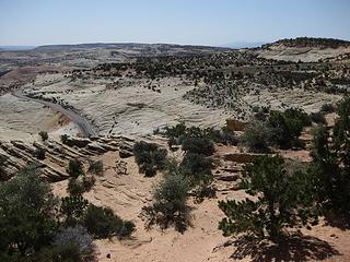 Highway 12 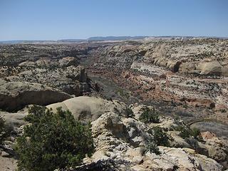 Escalante River 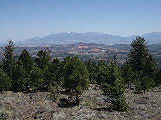 Viewpoint overlook of Capitol Reef 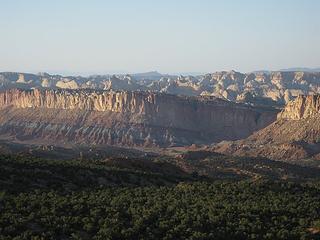 Layered formations 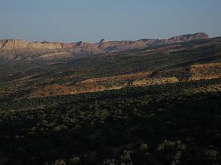 Old Wagon Rd Sunset 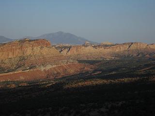 Henry Mts. Behind 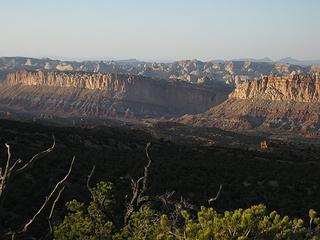 Navaho domes 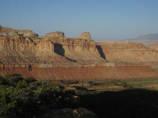 Golden Throne 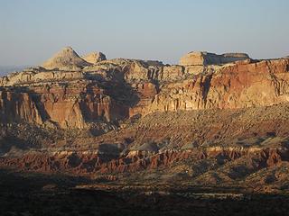 Lowered sun 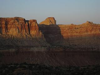 Sunlit Throne 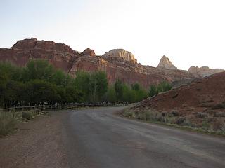 Campground 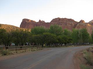 Sun rises over camp 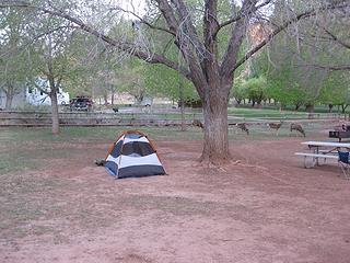 Camp morning 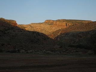 Fremont River gorge 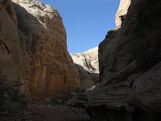 Grand Wash 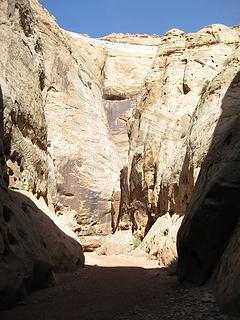 Grand Wash Narrows 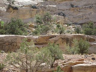 Bighorn ewe on ledge 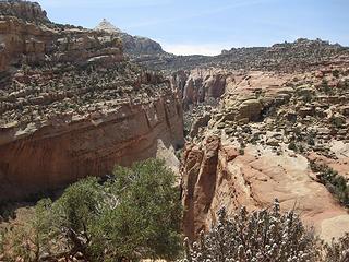 Shinob Canyon 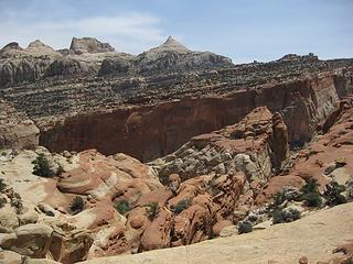 Fryingpan Trail 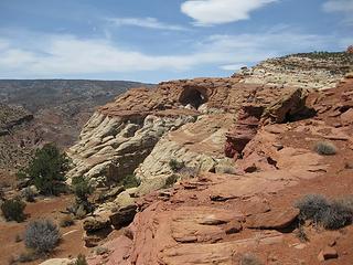 Cassidy Arch 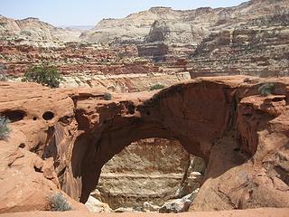 Capitol Reef National Park 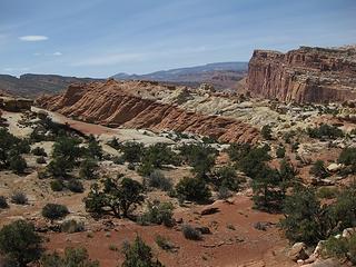 Distant Wingate Formation 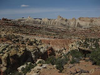 In the Kayenta ledges 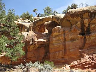 Capitol Reef National Park 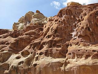 Cohab Canyon cheese 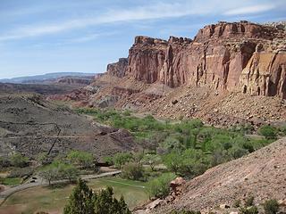 Descent to Fruita 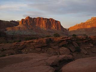 Glowing Wingate cliffs 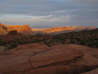 Glowing Reef 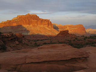 Utah_396 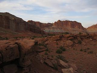 Panorama Point 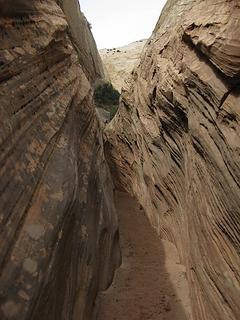 Sheets Gulch Narrows 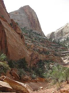 Sheets Gulch 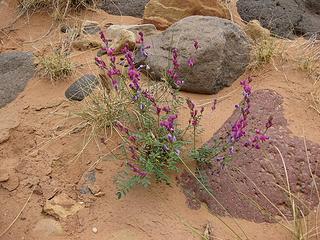 Vetch? 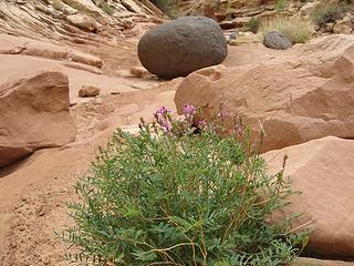 Basalt erratic 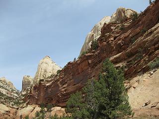 Navaho above Kayenta 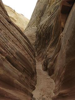 slot in Navaho stone 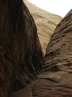 More slot 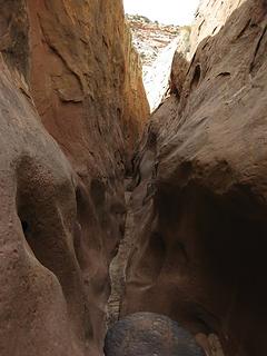 Sheets slot 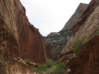 Sheets Gulch relief 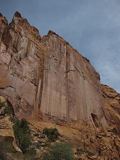 Towering Wingate 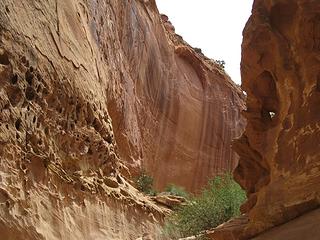 Wingate formation canyon twists 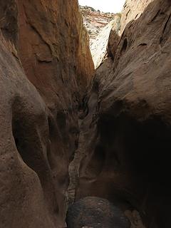 Sheets again Sheets Gulch Narrows 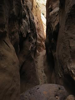 Sheets Gulch 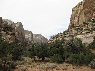 Mini sandstone Yosemite 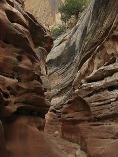 Sheets Gulch 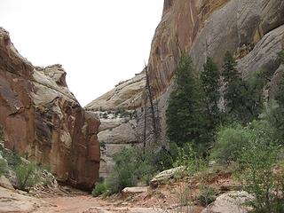 Nearing the Slots 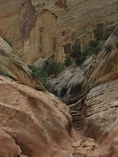 Deepening slots 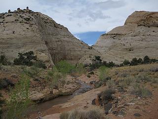 Domes above Pleasant Creek 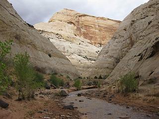 Pleasant Creek 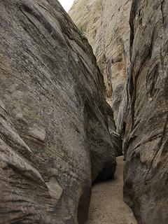 Pleasant Creek Canyon, Capitol Reef NP 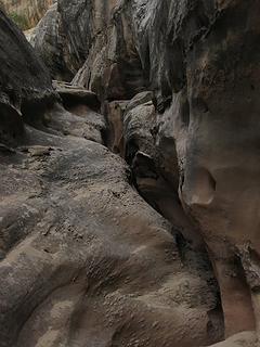 Pleasant Creek side slot 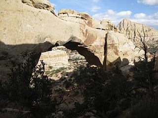 Hickman 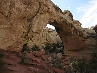 Capitol Reef National Park 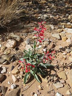 Common Flower 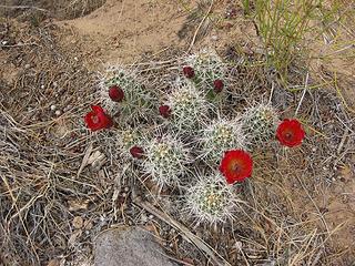 Cactus bloom 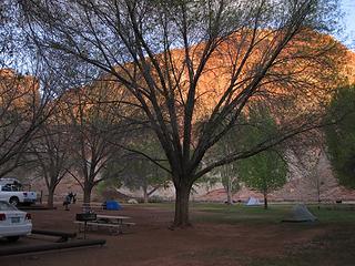 Last evening 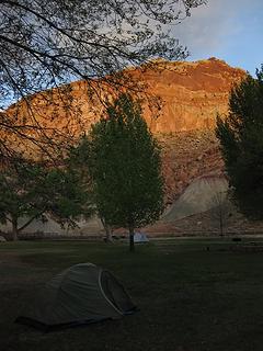 Almost bedtime ![Utah 487 [800x600]](https://cloud.nwhikers.net/3578250385_320x240.jpg) Utah 487 [800x600] ![Utah 497 [800x600]](https://cloud.nwhikers.net/3579055676_320x240.jpg) Utah 497 [800x600] ![Utah 496 [800x600]](https://cloud.nwhikers.net/3579055742_320x240.jpg) Utah 496 [800x600] ![Utah 501 [800x600]](https://cloud.nwhikers.net/3578250619_320x240.jpg) Utah 501 [800x600] ![Utah 478 [800x600]](https://cloud.nwhikers.net/3578250697_320x240.jpg) Utah 478 [800x600] ![Utah 477 [800x600]](https://cloud.nwhikers.net/3578250793_320x240.jpg) Utah 477 [800x600] ![Utah 479 [800x600]](https://cloud.nwhikers.net/3578250885_320x240.jpg) Utah 479 [800x600] ![Utah 488 [800x600]](https://cloud.nwhikers.net/3579056100_320x240.jpg) Utah 488 [800x600]
Tell me, what is it you plan to do with your one wild and precious life?-Mary Oliver
A nation that continues year after year to spend more money on military defense than on programs of social uplift is approaching spiritual doom.
― MLK Jr.
Tell me, what is it you plan to do with your one wild and precious life?-Mary Oliver
A nation that continues year after year to spend more money on military defense than on programs of social uplift is approaching spiritual doom.
― MLK Jr.
|
| Back to top |
  
|
|
Tazz
Member

Joined: 27 Apr 2005
Posts: 7902 | TRs | Pics
|
|
Tazz
Member
|
 Sat May 30, 2009 9:42 am |
|
|
One of my favorite parks down there. Not as heavily visited as the others and has some sweet gems to be found. I can't wait to get back in there. I hiked part of grand wash. nice through hike you did!
so much to do and no time to do it all...  thanks for sharing!
awesome pics!
thanks for sharing!
awesome pics!
|
| Back to top |
|
|
John Morrow
Member
Joined: 03 Apr 2007
Posts: 1526 | TRs | Pics
Location: Roslyn |
| tazz wrote: | | One of my favorite parks down there. Not as heavily visited as the others and has some sweet gems to be found. I can't wait to get back in there. I hiked part of grand wash. nice through hike you did!
so much to do and no time to do it all... :rolleyes: |
Ditto that<Tazz. I almost feel like my mountain time this summer is a way to kill time in the summer heat until I can get back to the Utah Desert! It affected me somehow.
J
Tell me, what is it you plan to do with your one wild and precious life?-Mary Oliver
A nation that continues year after year to spend more money on military defense than on programs of social uplift is approaching spiritual doom.
― MLK Jr.
Tell me, what is it you plan to do with your one wild and precious life?-Mary Oliver
A nation that continues year after year to spend more money on military defense than on programs of social uplift is approaching spiritual doom.
― MLK Jr.
|
| Back to top |
|
|
Dean
(aka CascadeHiker)

Joined: 02 Mar 2002
Posts: 1967 | TRs | Pics
Location: ex Kennewick, Wa & Lehi Utah |
|
Dean
(aka CascadeHiker)
|
Sun May 31, 2009 3:18 am |
|
|
Wonderful report John. Capitol Reef is a gem and you have really done a great job in showing it off.  I'm loving living in Utah as each week I get to see something new and wonderful. I've been to Fruita two times so far and will get back there later this summer for some more exploration. Thanks for all the eye candy. I'm loving living in Utah as each week I get to see something new and wonderful. I've been to Fruita two times so far and will get back there later this summer for some more exploration. Thanks for all the eye candy.
|
| Back to top |
|
|
Slim
This space for rent

Joined: 31 Aug 2004
Posts: 561 | TRs | Pics
Location: Falling off a turnip truck |
|
Slim
This space for rent
|
Sun May 31, 2009 9:12 pm |
|
|
Thanks for the report and photos. It must be getting HOT by now. Isn't that where Butch Cassidy used to hang out ? I've been down that way three times but could go every year and never get tired of it.
"Lean mean money-making-machines serving fiends"
"Lean mean money-making-machines serving fiends"
|
| Back to top |
|
|
Quark
Niece of Alvy Moore

Joined: 15 May 2003
Posts: 14152 | TRs | Pics
|
|
Quark
Niece of Alvy Moore
|
Sun May 31, 2009 10:36 pm |
|
|
John,
I love the erratic rock! How'd that get there - is there information on erratics in the area?
Your "vetch?" plant looks like a type of pea or perhaps locoweed...?
I'll try to look it up tomorrow unless someone else knows for sure.
"...Other than that, the post was more or less accurate."
Bernardo, NW Hikers' Bureau Chief of Reporting
"...Other than that, the post was more or less accurate."
Bernardo, NW Hikers' Bureau Chief of Reporting
|
| Back to top |
|
|
|
|
You cannot post new topics in this forum
You cannot reply to topics in this forum
You cannot edit your posts in this forum
You cannot delete your posts in this forum
You cannot vote in polls in this forum
|
Disclosure: As an Amazon Associate NWHikers.net earns from qualifying purchases when you use our link(s). |


![Utah 487 [800x600]](https://cloud.nwhikers.net/3578250385_081be94c54_o.jpg#800x600+https://farm4.staticflickr.com/3595/3578250385_081be94c54_o.jpg#800x600)
![Utah 497 [800x600]](https://cloud.nwhikers.net/3579055676_0cb5d3d5cb_o.jpg#800x600+https://farm3.staticflickr.com/2468/3579055676_0cb5d3d5cb_o.jpg#800x600)
![Utah 496 [800x600]](https://cloud.nwhikers.net/3579055742_bef0b929a4_o.jpg#800x600+https://farm4.staticflickr.com/3625/3579055742_bef0b929a4_o.jpg#800x600)
![Utah 501 [800x600]](https://cloud.nwhikers.net/3578250619_f987fcfb95_o.jpg#800x600+https://farm4.staticflickr.com/3302/3578250619_f987fcfb95_o.jpg#800x600)
![Utah 478 [800x600]](https://cloud.nwhikers.net/3578250697_99ff2a9f7d_o.jpg#800x600+https://farm4.staticflickr.com/3413/3578250697_99ff2a9f7d_o.jpg#800x600)
![Utah 477 [800x600]](https://cloud.nwhikers.net/3578250793_ed1f4e8bc7_o.jpg#800x600+https://farm4.staticflickr.com/3318/3578250793_ed1f4e8bc7_o.jpg#800x600)
![Utah 479 [800x600]](https://cloud.nwhikers.net/3578250885_c0a8991274_o.jpg#800x600+https://farm3.staticflickr.com/2450/3578250885_c0a8991274_o.jpg#800x600)
![Utah 488 [800x600]](https://cloud.nwhikers.net/3579056100_426ab2b1b7_o.jpg#800x600+https://farm3.staticflickr.com/2424/3579056100_426ab2b1b7_o.jpg#800x600)