| Previous :: Next Topic |
| Author |
Message |
Phil
Member


Joined: 02 Jul 2003
Posts: 2025 | TRs | Pics
Location: Shoreline, WA |
|
Phil
Member
|
 Mon Oct 04, 2010 8:27 am |
|
|
Spent a spectacular Saturday up in the Mt. Tom creek drainage that feeds into the Hoh river. This was a trip with Cye; part of an effort to find wreckage from the lost F-102 jet. My second such trip with Cye; he's tracked all over the Olympics and this drainage in particular this year. I was very fortunate to be partnered with him on this trip because he's been up there numerous times and he knows the ways. Route-finding on the envaginated slopes of the middle to upper Mt Tom creek drainage is anything but straight-forward.
My trip started with me racing and failing to catch a 7:45pm ferry out of Edmonds friday night. Missed it by 5 cars (that smarts). Ended up on the 8:20pm ferry, then driving towards the Hoh at 9pm. At this point I could have pulled over and fallen asleep instantly but I had 3+ hours driving to do. On the last legs of a stubborn cold so not looking forward to it. But I soldiered on, supported by a stack of Sonic Youth CDs I hadn't listened to in years. A frustrating pause for 10pm road construction before Seqium, a stop in PA for some fruit and water, finally pulling in to the Hoh parking lot around 12:30am, groggy and dizzy, yet too pumped to sleep well.
Still, up at 4:50am girding my loins with a tall mug of thick strong coffee. Here's my sleeping method and gear:
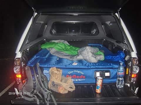 truckbed.JPG 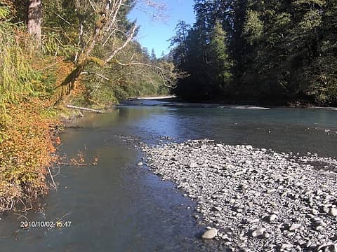 hoh.JPG 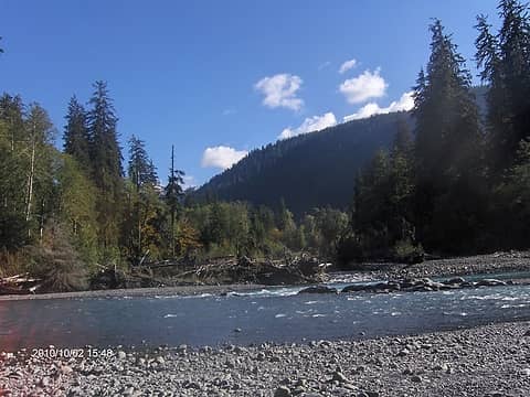 mt.tom.creek.mouth.JPG 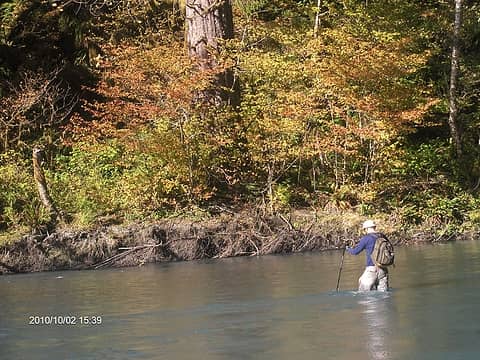 cye.crossing.JPG 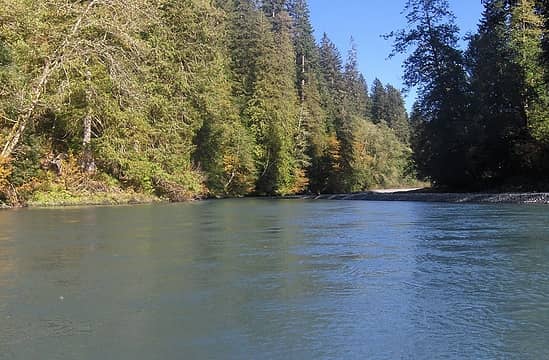 crossing.view.JPG 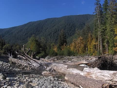 mt.tomcreek.basin.JPG 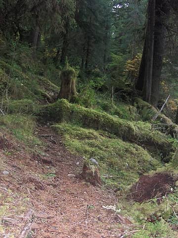 mt.tom.trail.JPG  smoking ferns.JPG 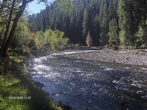 mt.tom.camp1.JPG 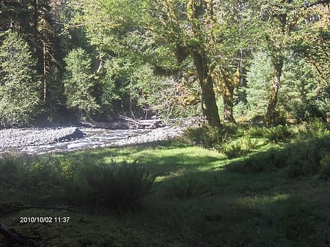 mt.tom.camp2.JPG 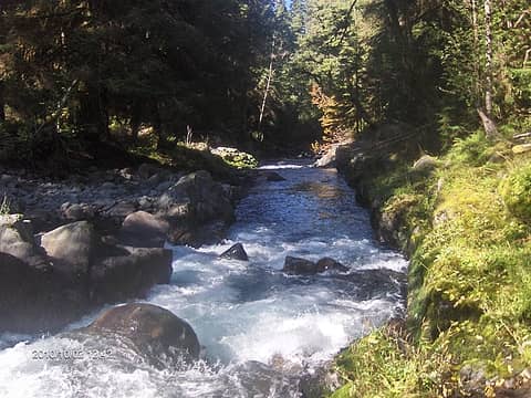 mt.tomcreek.canyon1.JPG  002.JPG
|
| Back to top |
  
|
|
Phil
Member
Joined: 02 Jul 2003
Posts: 2025 | TRs | Pics
Location: Shoreline, WA |
|
Phil
Member
|
Mon Oct 04, 2010 3:56 pm |
|
|
That's fascinating, Shack. That explains the breadth of that river mouth.... I really found it extraordinary. It defies the term 'creek' by a long shot.
I don't think Cye has been up much past the middle of the creek drainage .... but what you mention sounds like a good target for a future hike. I've heard that actually getting up to Mt. Tom from the drainage can be a frustrating endeavor. We had some glimpses of the slopes of Mt Tom and it appeared to be a massive series of steep gullies. Funny because the climbers guide makes it sound like a casual stroll up to the top. Ever done that route or know of those who have?
|
| Back to top |
|
|
Phil
Member
Joined: 02 Jul 2003
Posts: 2025 | TRs | Pics
Location: Shoreline, WA |
|
Phil
Member
|
Mon Oct 04, 2010 8:18 pm |
|
|
| Shacknasty Jim wrote: | | On one trip, I decided to backpack about 3 miles upvalley, camp and see about reaching the subalpine area north of Mount Tom the following day. As you saw firsthand, the going is slow. Crossing and recrossing the creek is tedious and gets frustrating near the head of the valley where the way forks. I climbed along the eastern drainage and took forever to break out onto a little rock and meadow table with a fairly large lake in the middle. |
Great stuff!  I think that lake is on the Custom Correct Olympus climber's map, pretty much just north of White Glacier, about 5000 feet, is that it? If so, wow, burly terrain man.
|
| Back to top |
|
|
Phil
Member
Joined: 02 Jul 2003
Posts: 2025 | TRs | Pics
Location: Shoreline, WA |
|
Phil
Member
|
Tue Oct 05, 2010 7:46 am |
|
|
Wow, I bet very very few people have been up to that lake and even fewer have ascended the cliffs at the headwaters of mt Tom creek. From what I've heard it's a lot easier to scale Olympus and head over to Mt Tom over the glaciers. If I ever find myself with a week or so I'll bug you about more route info for upper Mt Tom creek.
|
| Back to top |
|
|
Larry
Member

Joined: 22 Feb 2003
Posts: 1084 | TRs | Pics
Location: Kitsap |
|
Larry
Member
|
Tue Oct 05, 2010 8:39 pm |
|
|
Good going, Phil! A nice report.
Mount Tom, and the lakes north of the glacier, the locally named "Lakes of the Gods", are much easier via the White Glacier. On the west end of the Snow Dome, there is a steep gully leading down to the White Glacier - used a short rope for a handline, and left it there for coming back up. My partner and I took about half a dozen turns with the skis, but we couldn't ski the whole glacier due to whiteout conditions.
Glad you finally got to get up your Mount Tom Creek!
|
| Back to top |
|
|
bobbi
stillaGUAMish

Joined: 13 Jul 2006
Posts: 8012 | TRs | Pics
Location: olympics! |
|
bobbi
stillaGUAMish
|
Tue Oct 05, 2010 8:43 pm |
|
|
gnarly
bobbi ૐ
"Today is your day! Your mountain is waiting. So
get on your way!" - Oh, the Places Youll Go! By Dr. Seuss
bobbi ૐ
"Today is your day! Your mountain is waiting. So
get on your way!" - Oh, the Places Youll Go! By Dr. Seuss
|
| Back to top |
|
|
Phil
Member
Joined: 02 Jul 2003
Posts: 2025 | TRs | Pics
Location: Shoreline, WA |
|
Phil
Member
|
Wed Oct 06, 2010 7:53 am |
|
|
Thanks!
bcfc gnarly it was, but only because we elected to contour the slopes as part of our search. Much of the route along Mt Tom creek is on a flattish bench above the creek. Not bad at all. In fact Cye's 11 y.o. grandson went along with him this past Summer and got as far as we did!
Larry when it comes to gear and experience I am entirely ropeless  so unless the headwalls of Mt Tom creek can be scrambled to reach Lake of the Gods, that area will remain out of my reach. so unless the headwalls of Mt Tom creek can be scrambled to reach Lake of the Gods, that area will remain out of my reach.
|
| Back to top |
|
|
|
|
You cannot post new topics in this forum
You cannot reply to topics in this forum
You cannot edit your posts in this forum
You cannot delete your posts in this forum
You cannot vote in polls in this forum
|
Disclosure: As an Amazon Associate NWHikers.net earns from qualifying purchases when you use our link(s). |


