| Previous :: Next Topic |
| Author |
Message |
ragman and rodman
Member


Joined: 28 Apr 2005
Posts: 1219 | TRs | Pics
Location: http://rgervin.com/ |
Goat Island Mountain is a massive mountain that separates the Emmons and Fryingpan Glaciers in Mount Rainier National Park... and while she offers a gentle two mile west ridge approach to her summit, a person has to put in a lot of work to reach the west end of the mountain where the west ridge is most accessible. I had done the west ridge route two years earlier under perfect snow conditions... as snow still covered Fryingpan Creek and the lateral moraines west of Summerland... making for easy snow travel... a route that was ~13.5 miles roundtrip, gaining ~4000 feet of elevation.
After reading SAReno's recent trip report of accessing the summit via the east ridge we knew there was an elk trail that would take us most of the way to the summit... however, we still weren't sure where to leave the Wonderland Trail. The contour lines on our USGS topo map only showed forgiveness in one place on the east side of GIM, but we were looking for confirmation... so Snowdog contacted Ree... and Ree sent us a map that confirmed our thoughts on where to leave the Wonderland Trail and head up.
From the Fryingpan Creek parking area... hike the connector trail for .1 miles... turn right onto the Wonderland Trail and hike toward the White River Campground... hike the Wonderland Trail for 10 minutes (a half mile) and you will find the east ridge. The Wonderland Trail makes an obvious bend at this point... and while you can't see cars on the road 50 feet below, you can definitely hear them. Note that the elk trail is not obvious where you want to leave the main trail, but you will find it very quickly.
GIM's east ridge wasted no time in gaining elevation... as we followed the elk trail (which either stayed on the ridge or just left of it) to ~5800 feet... where we left the ridge and crossed a basin to another east-trending ridge that took us directly to the summit (7288').
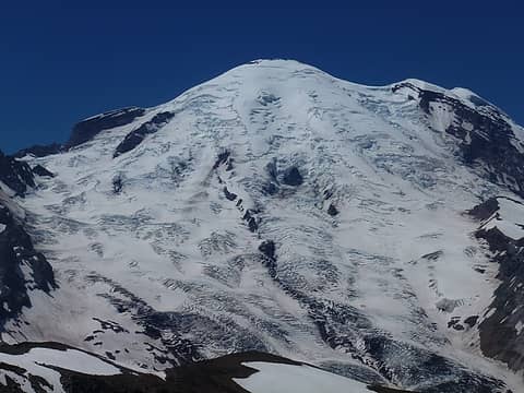
After spending an hour on the summit, we made the leisurely 2 mile stroll along GIM's west ridge... constantly being harassed by Mt. Rainier in our face... to the point where we left GIM's west ridge at ~6400 feet... made our way down to an interesting crossing of Fryingpan Creek... then a tedious hike over the lateral moraines to Summerland... where we found the Wonderland Trail that took us back to the car.
~11.5 miles roundtrip, gaining ~4200 feet of elevation.
Stunning views on this hike... everyone deserves to make the 2-mile ridge walk from the GIM summit to the west end of the mountain.
Good news... the footbridge just below Summerland has been repaired.
Maps and photos of our trip to Goat Island Mountain.
..
|
| Back to top |
  
|
|
tigermn
Member

Joined: 10 Jul 2007
Posts: 9242 | TRs | Pics
Location: There... |
|
tigermn
Member
|
 Thu Jul 11, 2013 1:40 pm |
|
|
That looks like a really cool trip. How bad was the bushwhacking (or was it), coming up the east ridge?
|
| Back to top |
|
|
silence
Member

Joined: 25 Apr 2005
Posts: 4420 | TRs | Pics
|
|
silence
Member
|
Thu Jul 11, 2013 2:16 pm |
|
|
sweet .. who knew? seriously I never thought about that approach ... and there's even a trail ..
PHOTOS
FILMS
Keep a good head and always carry a light bulb. Bob Dylan
PHOTOS
FILMS
Keep a good head and always carry a light bulb. Bob Dylan
|
| Back to top |
|
|
Snowdog
Member

Joined: 21 Jul 2006
Posts: 1028 | TRs | Pics
Location: on (& off) the beaten path |
|
Snowdog
Member
|
Thu Jul 11, 2013 2:43 pm |
|
|
After seeing earlier TR"s on this route, I pestered Ragman into giving it a go.  Finding the Elk trail was easy peesy. Those guys make more of a Freeway than a game trail. They do not, however, walk in single file, so there are numerous side trails that can pull you in different directions. At one point Ragman dubbed me "Elk Woman" or "One who walks with Elk" commenting on my uncanny ability to stay on the main trail. Did I mention it resembled an interstate highway???
  He was simply being kind. I acquired other, more colorful knicknames as the day wore on.
This route wastes no time gaining, and soon we popped out exactly where we wanted to be. We trended left, picked up the ridge to the high point, and voila- there we were! Now we had ample lunch break, and the anticipation of the looong ridge walk.
He was simply being kind. I acquired other, more colorful knicknames as the day wore on.
This route wastes no time gaining, and soon we popped out exactly where we wanted to be. We trended left, picked up the ridge to the high point, and voila- there we were! Now we had ample lunch break, and the anticipation of the looong ridge walk.
 Playing around w/ zoom 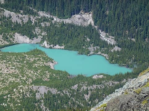 pretty little un-named lake 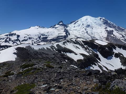 ridge one earns the walk of by climbing up the east side of GIP. 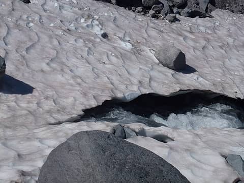 think light thoughts, and walk quickly 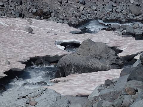 sketchy snow "bridges"......  going up when we wanted to be going down.
I said I was Hot,Tired and Cranky. They agreed. Another knickname acquired! (I'm guessing a few other knicknames crossed their minds too)
We emerged right at the Summerland shelter. I will always believe Barb simply wished to visit summerland since we were so close....probably planned it all along... going up when we wanted to be going down.
I said I was Hot,Tired and Cranky. They agreed. Another knickname acquired! (I'm guessing a few other knicknames crossed their minds too)
We emerged right at the Summerland shelter. I will always believe Barb simply wished to visit summerland since we were so close....probably planned it all along... 
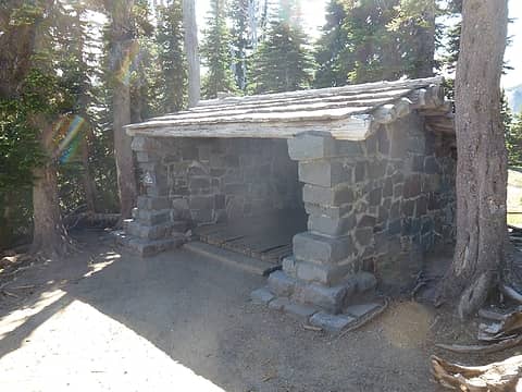 unplanned visit to Summerland
'we don't have time for a shortcut'
'we don't have time for a shortcut'
|
| Back to top |
|
|
ragman and rodman
Member
Joined: 28 Apr 2005
Posts: 1219 | TRs | Pics
Location: http://rgervin.com/ |
| tigermn wrote: | | How bad was the bushwhacking (or was it), coming up the east ridge? |
Not bad at all... those elk have really big butts.
Know that the absolute best time to do this loop is when there is still snow on the Wonderland Trail a half-mile to a mile below the footbridge crossing of Fryingpan Creek just below Summerland. That would pretty much guarantee that snow would still be covering the lateral moraines west of Summerland... making for ideal snow travel over that crap... not to mention an easy crossing of Fryingpan Creek up near the west end of GIM.
I would consider the east ridge route an excellent summer route... then maybe hike the west ridge from the summit a mile or so over to Point 7218... then trace your steps back to the summit and go back down the east ridge.
I would also recommend checking with the Park about the condition of the footbridge crossing of Fryingpan Creek below Summerland... just ask Opus and tribe about this... they got to wade across it on their earlier trip this year because the bridge was out... and IMO, Fryingpan Creek rates as a serious creek crossing.
--------------------------------------
| Snowdog wrote: | | I said I was Hot,Tired and Cranky. They agreed. Another knickname acquired! (I'm guessing a few other knicknames crossed their minds too) |
How does "Whines no more forever" work? Feel free to replace "whines" with your favorite word of choice...  --
--
|
| Back to top |
|
|
ree
Member

Joined: 29 Jun 2004
Posts: 4399 | TRs | Pics
|
|
ree
Member
|
Thu Jul 11, 2013 10:04 pm |
|
|
Glad it was fun. Hope the map helped some.
|
| Back to top |
|
|
Magellan
Brutally Handsome

Joined: 26 Jul 2006
Posts: 13117 | TRs | Pics
Location: Inexorable descent |
|
Magellan
Brutally Handsome
|
Thu Jul 11, 2013 10:50 pm |
|
|
I love it.  Thanks for the TR. This peak is definitely worth going back to. Thanks for the TR. This peak is definitely worth going back to.
|
| Back to top |
|
|
BarbE
Member

Joined: 28 Jul 2006
Posts: 1153 | TRs | Pics
|
|
BarbE
Member
|
Fri Jul 12, 2013 8:45 am |
|
|
| Snowdog wrote: | | I will always believe Barb simply wished to visit summerland since we were so close....probably planned it all along... |
Of course, I love Summerland, so why pass up a good thing with a perfectly nice trail  Just a few hundert extra feet at the end of a long day
  You always like a bit more conditioning.
BTW ree, the map helped a lot. The East Ridge worked great. We named it the "ree-route" You always like a bit more conditioning.
BTW ree, the map helped a lot. The East Ridge worked great. We named it the "ree-route"
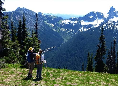 naming peaks 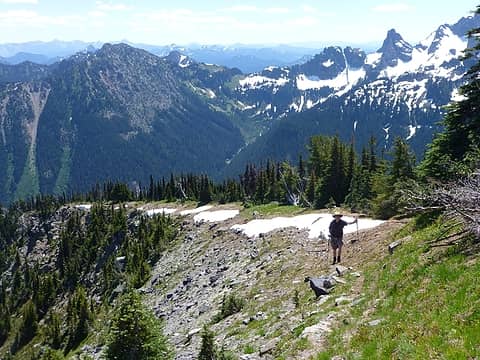 Ragman on the steep east ridge 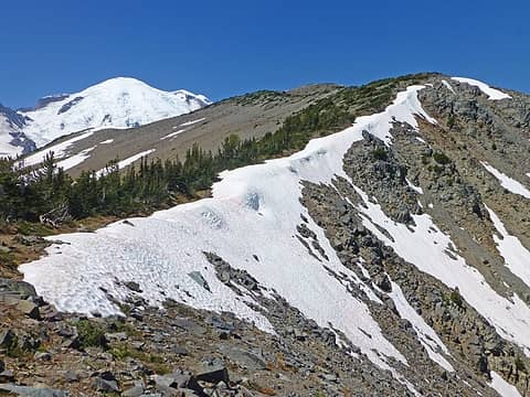 East ridge walk 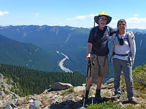 made it! 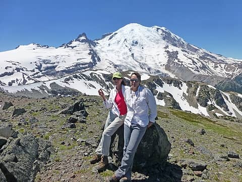 cool summit 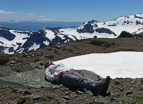 napping on the summit 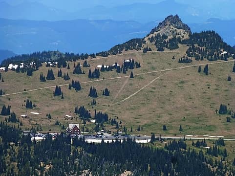 Sunrise Park from Goat Island summit 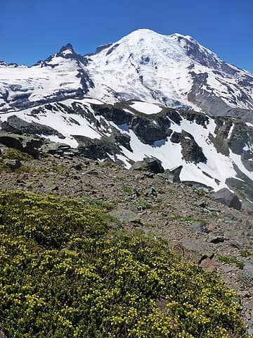 heather on Goat Island 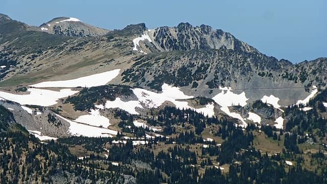 Sourdough Ridge trail 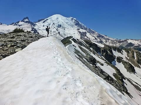 photographer at work 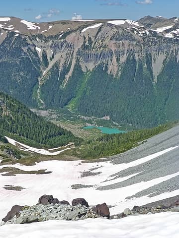 White River and tarn 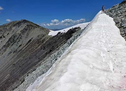 ridgewalk along Goat Island 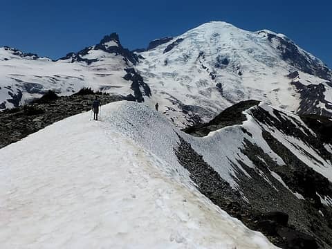 Goat Island 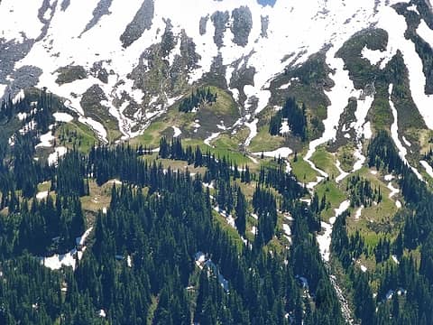 Summerland almost melted out 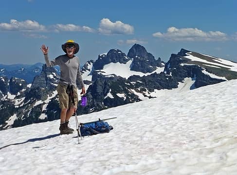 Ragman & the Cowlitz Chimneys 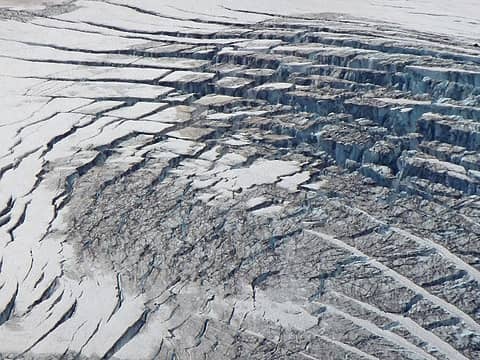 glacier pattern 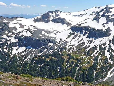 looking into Summerland and Panhandle gap 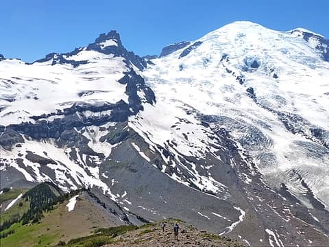 small hikers, big mountain 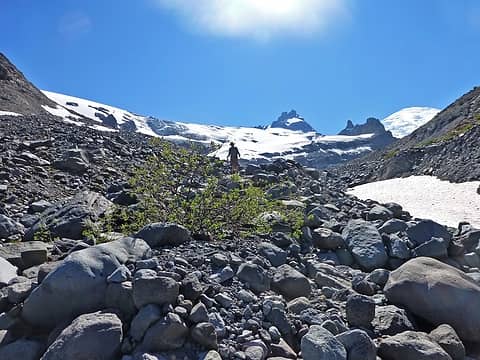 looking for a better way 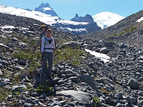 tough terrain  bushwhacking up to Summerland 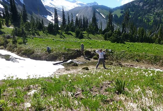 didn't think we'd be here 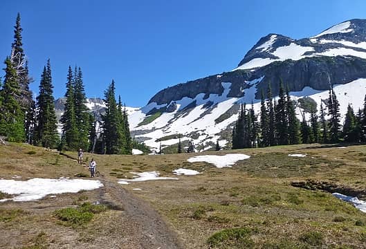 trail from Summerland 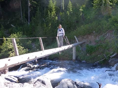 Fryingpan Creek bridge
|
| Back to top |
|
|
tigermn
Member
Joined: 10 Jul 2007
Posts: 9242 | TRs | Pics
Location: There... |
|
tigermn
Member
|
Fri Jul 12, 2013 9:20 am |
|
|
| BarbE wrote: | tough terrain |
Yea I'm thinking maybe east ridge out and back this summer.
|
| Back to top |
|
|
iron
Member

Joined: 10 Aug 2008
Posts: 6392 | TRs | Pics
Location: southeast kootenays |
|
iron
Member
|
Fri Jul 12, 2013 9:27 am |
|
|
that tarn looks pretty sweet!
|
| Back to top |
|
|
ragman and rodman
Member
Joined: 28 Apr 2005
Posts: 1219 | TRs | Pics
Location: http://rgervin.com/ |
| ree wrote: | | Hope the map helped some. |
Ree... your map gave us extreme confidence... which I suppose could be a bad thing...
|
| Back to top |
|
|
|
|


