| Previous :: Next Topic |
| Author |
Message |
williswall
poser


Joined: 30 Sep 2007
Posts: 1968 | TRs | Pics
Location: Redmond |
"Adventure is just bad planning" (Roald Amundsen)
Synopsis: As my vacation time comes to an end Cassie and I did a spur of the moment trip to Glacier Peak, only in that we had originally planned a circumnavigation but her prior foot and shoe issues precluded a trip of that length with no bail options if she ran into foot trouble. Therefore, we opted for a shorter loop trip, starting at Sloan Creek Campground and taking the North Fork Sauk trail to the Pilot Ridge trail, hitting the Blue Lake High Trail to the PCT. The plan then was to take trail 643 past the old Kennedy Hot Springs area and up onto Lost Creek Ridge trail and loop back to the road, eventually walking the 4 miles back to the vehicle on the road. This was about a 50 mile trip with 13,000' of elevation, planned for 3 days. If foot/shoe issues continued, we could always bail after White Pass by taking the N F Sauk trail back to the car for a shorter loop. The good news is that we finally found the right shoe for Cassie and foot issues were not a problem. The bad news is I made a classic mistake of not planning well. What issues could possible arise on a trip that involves all trail? Read the signs, turn left or right, no need for smaller scale maps or GPS.
Day 1. A 4:30 AM departure from home had us on the trail at 7 AM, not a bad start considering the travel time. The North Fork Sauk trail is in fine condition, and we soon reached the cut off for Pilot Ridge, where an easy log crossing was found a short distance up the trail. After grinding up the switchbacks the rest of the day was spent in alpine splendor, with far reaching views only blocked by a low hanging cloud deck. One of the things I enjoy about this kind of trip is total flexibility as to where we would camp. We spent considerable time at gorgeous Blue Lake, with Cassie checking her feet, soaking in the cool water and me taking photos and video. After a little confusion as to where the trail continued, we did the steepish slog up to the pass on the Blue Lake High Trail, meeting and chatting with a group of 6 or so people at the pass. They commented on my hat (of course) and our trail shoes (it's a trail, after all) and they proceeded down to Blue Lake as we headed toward the PCT junction and Indian Pass. However, on the way there we found a perfect spot to set up camp with open views for the height of the Perseids show. We went to bed early with alarms set for midnight to get up and enjoy the show and take some long exposures. However, as soon as the sun went down so did the dewpoint, and the rest of the evening and into the next morning we found ourselves in cloud with nary a star peeping out. Slightly disappointing as last year we watched the show from Upper Lena Lake, sipping hot chocolate with some neighbors during our marmot survey. We found it hard to get up in the continual soaking but managed to get on the trail around 8 AM, much later than our original plan.
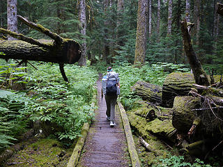 1. Starting out- N. Fork Sauk Trail 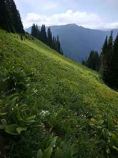 2. Pilot Ridge 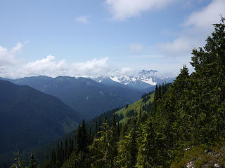 3. views from Pilot Ridge 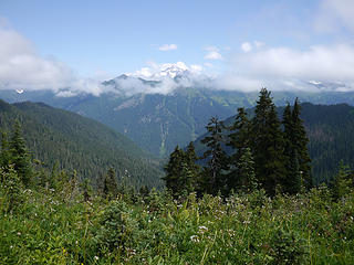 4. First views of Glacier Peak- Pilot Ridge 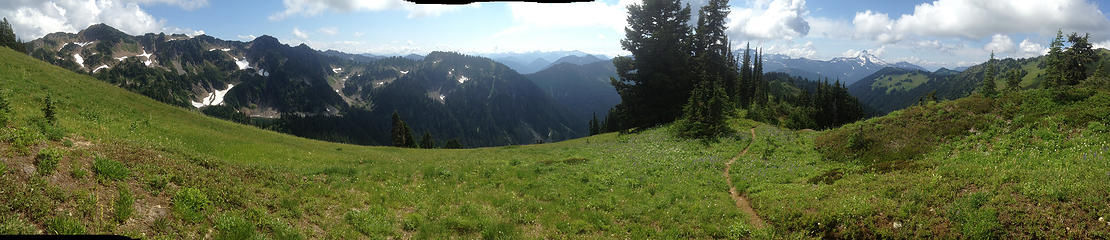 Pilot Ridge 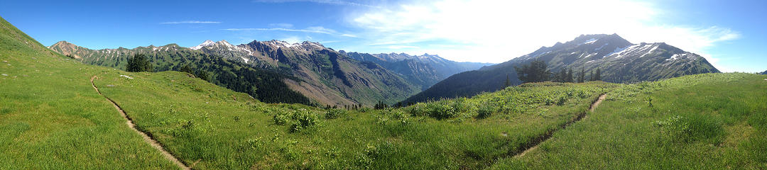 Pilot Ridge2 3. views from Pilot Ridge 4. First views of Glacier Peak- Pilot Ridge 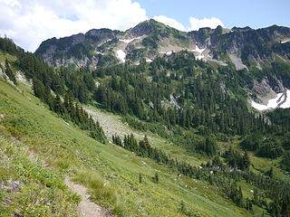 5. more Pilot Ridge views 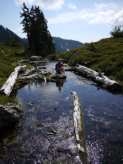 6. foot break at Blue Lake outlet 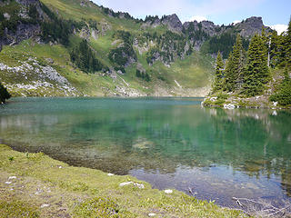 7. Blue Lake 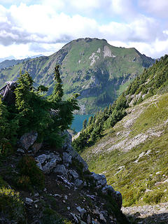 8. last views of Blue Lake 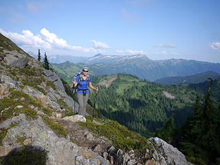 9. pass on Blue Lake High Trail 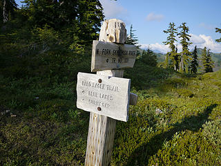 10. Dishpan Gap 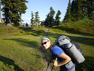 11. pole break at Dishpan Gap 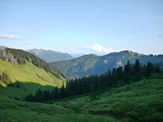 12. greenery near Meander Meadow 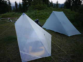 13. abodes- ZPacks Pocket Tarp and GG The One 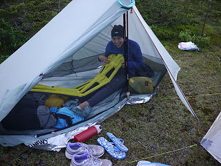 14. Cassie setting up shop in The One 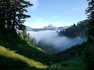 15. finally clearing near Indian Pass 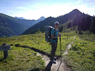 16. entering Glacier Peak Wilderness 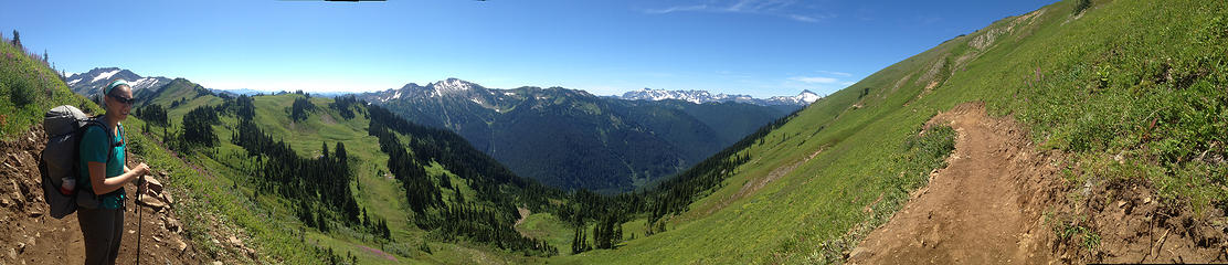 near White Pass 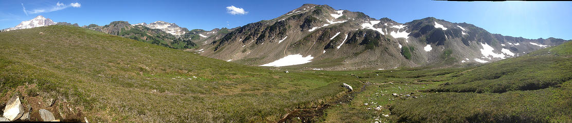 White Chuck Basin 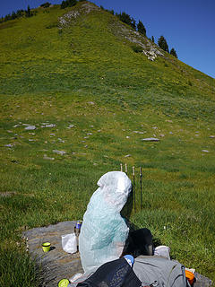 17. B4 lunch break 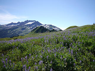 18. Lupine splendor 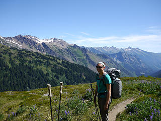 19. never ending alpine splendor 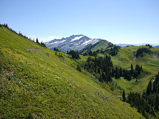 20. PCT- gorgeous 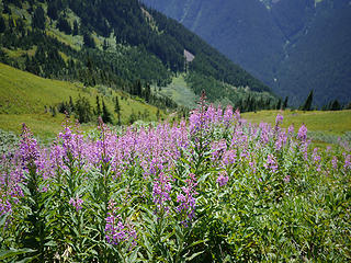 21. PCT views 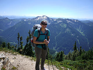 22. near Red Pass 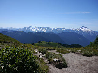 23. Monte Cristo from Red Pass 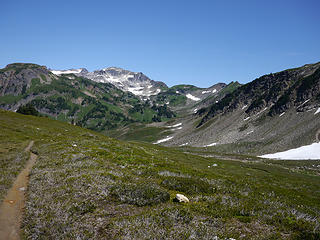 24. entering White Chuck basin 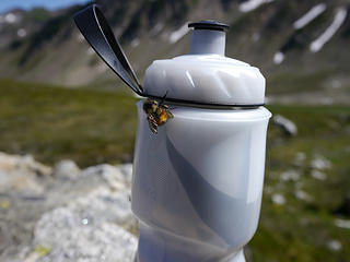 25. bottle buzz 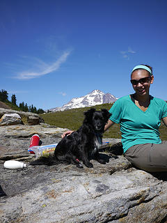 26. Cassie and black marmot 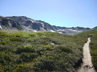 27. White Chuck Basin 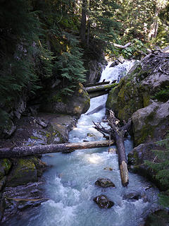 28. crossing White Chuck River 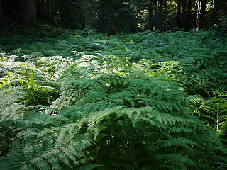 29. Ferndale 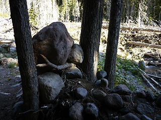 30. rock art 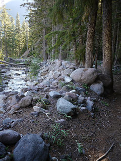 31. Sitkum creek 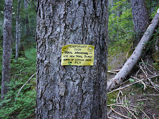 32. my first hint 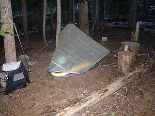 33. sleeping arrangement at Sitkum Creek 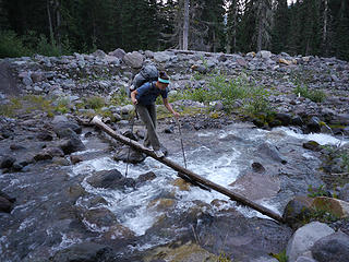 34. remember this log crossing?. 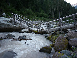 35. Kennedy Creek crossing 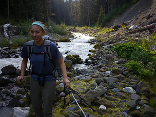 36. where is the trail? 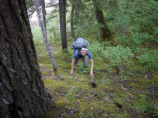 37. skirting washed out section of trail 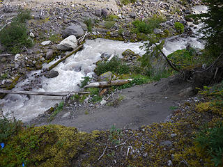 38. where trail used to be 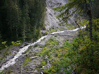 39. logs used to cross White Chuck 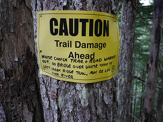 40. WTF 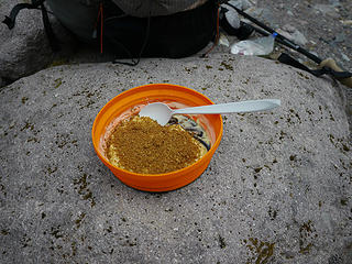 41. lemon cheesecake 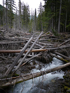 42. remnants of high flow 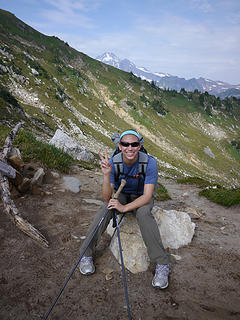 43. Red Pass number 2 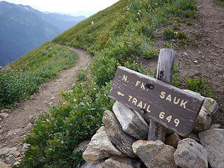 44. an actual sign! 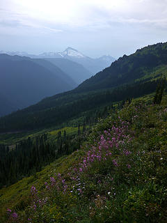 45. N F Sauk Trail 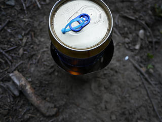 46. hot dinner with Suluk46 TEA system 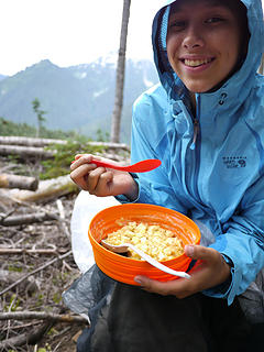 47. banana pudding top off
|
| Back to top |
  
|
|
Kim Brown
Member

Joined: 13 Jul 2009
Posts: 6900 | TRs | Pics
|
You probably already checked the map to see that Lost Creek Ridge is on the opposite side of the Whitechuck from Kennedy Ridge and the Whitechuck and Kennedy Ridge trails. It starts in the campground out of the bouldery mess, on the SW side of the Whitechuck, signed "Lake Byrne," if you can find the campground (it's a loggy mess) and then find the sign within it (the campground is sorta destroyed and the paths are faint, but once you find the Lk Byrne trail, you're good). But yeah, the landscape is freakishly different and if you've been there before the floods (and you have) it's actually even more disorienting than if you have no vision of what it was like then.
Signage wasn't poor before the floods; but since the area was wiped out, the signs that are there don't mean much. The damage is too big, and the area too wide and the trails undefined. I'm surprised there isn't flagging leading to the Lk Byrne trail.
"..living on the east side of the Sierra world be ideal - except for harsher winters and the chance of apocalyptic fires burning the whole area."
Bosterson, NWHiker's marketing expert
"..living on the east side of the Sierra world be ideal - except for harsher winters and the chance of apocalyptic fires burning the whole area."
Bosterson, NWHiker's marketing expert
|
| Back to top |
|
|
Kim Brown
Member
Joined: 13 Jul 2009
Posts: 6900 | TRs | Pics
|
But no matter, it looks like a great Trip anyway
"..living on the east side of the Sierra world be ideal - except for harsher winters and the chance of apocalyptic fires burning the whole area."
Bosterson, NWHiker's marketing expert
"..living on the east side of the Sierra world be ideal - except for harsher winters and the chance of apocalyptic fires burning the whole area."
Bosterson, NWHiker's marketing expert
|
| Back to top |
|
|
contour5
Member

Joined: 16 Jul 2003
Posts: 2963 | TRs | Pics
|
|
contour5
Member
|
 Thu Aug 15, 2013 5:22 pm |
|
|
You turned a great trip into an adventure! Very nice TR!
|
| Back to top |
|
|
RichardJ
Member

Joined: 23 Oct 2012
Posts: 275 | TRs | Pics
Location: Maple Valley |
|
RichardJ
Member
|
Thu Aug 15, 2013 6:31 pm |
|
|
Fantastic report and pics of one of my favorite areas. I love reading your's and Cassie's hikes because I have the same hiking relationship with my daughter. She is 22 years old now and still likes to hike with me even though I'm slowing down while she is getting faster. I understand how wonderful it is when a teenager wants to experience Washington's amazing outdoors with her dad.
|
| Back to top |
|
|
|
|
You cannot post new topics in this forum
You cannot reply to topics in this forum
You cannot edit your posts in this forum
You cannot delete your posts in this forum
You cannot vote in polls in this forum
|
Disclosure: As an Amazon Associate NWHikers.net earns from qualifying purchases when you use our link(s). |


