| Previous :: Next Topic |
| Author |
Message |
wildernessed
viewbagger


Joined: 31 Oct 2004
Posts: 9275 | TRs | Pics
Location: Wenatchee |
Access : Wolf Creek TH
Maps : GTM - Buttermilk Butte and Mazama, TOPO
Stats : 23.5 mi, 7900' r/t
Milton Mountain LO
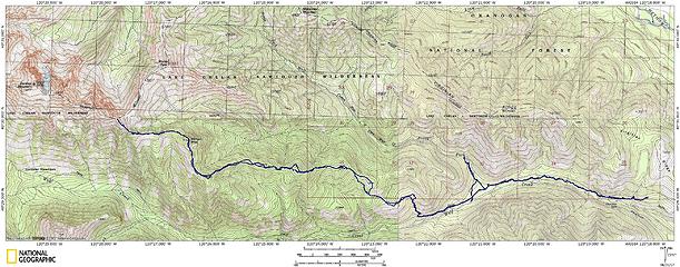 Milton 7152' - Gardner Ridge 7961' via Wolf Creek 
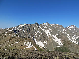
 Wolf Creek trail. 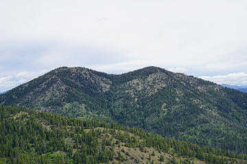 McKinney.  It wasn't all open park land there were sections of blowdown, thick vegetation, and loose rocky soil. 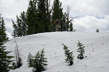 Steve walking the snow drift. 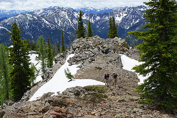 Steve and Rich approaching Milton's summit. 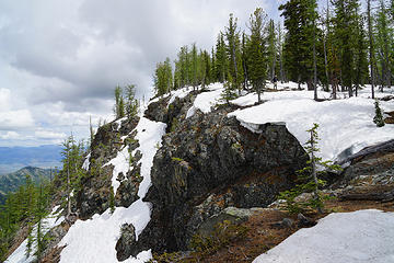 RichP on the ridge. 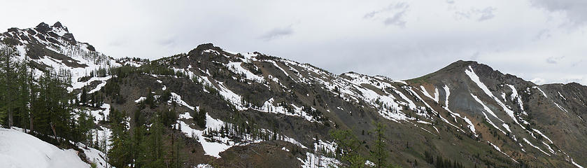 From the low saddle off Milton a view of the basin below Gardner Ridge and the ridge to Storey. 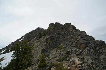 Easy scrambling up the South side of Gardner Ridge 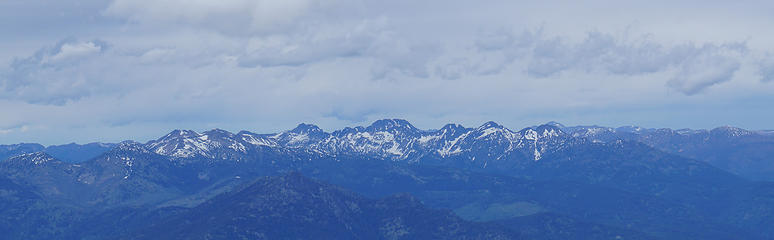 McLeod and Isabela Ridges. 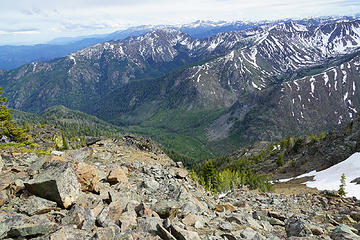 Looking down into Wolf Creek drainage. 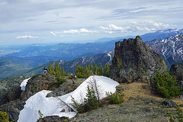 Getting the views ! 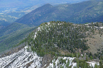 Milton 7152' and the ridge leading to Gardner Ridge. 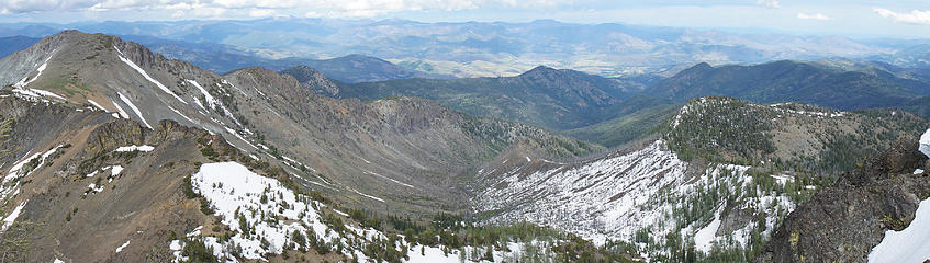 Drainage between Milton and Storey that empties into North Fork Wolf Creek. 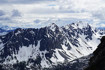 Gardner Meadows - East Abernathy - Abernathy - Abernathy Lake 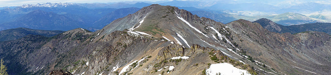 Storey from the South on Gardner Ridge. 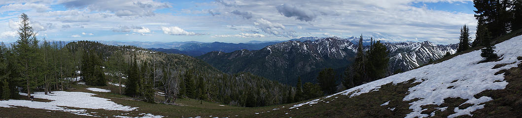 Some nice open slopes on the saddle between Gardner Ridge and Milton. 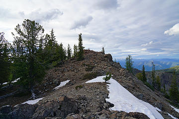 Milton summit ahead. 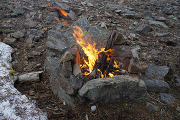 We made fire ! 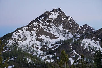 Part of the ridge to the 7961' point on the end of Gardner Ridge. 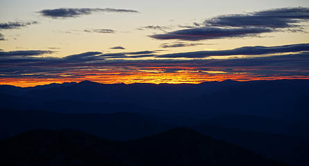 Coffee Time ! 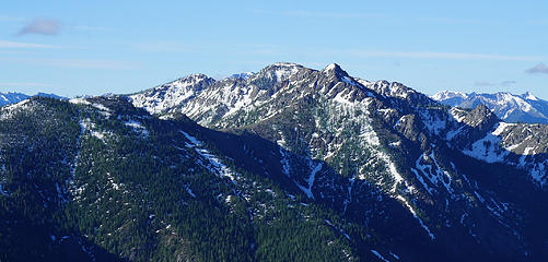 Little Bridge Creek Butte - Midnight Mountain
Living in the Anthropocene
Living in the Anthropocene
|
| Back to top |
  
|
|
RichP
Member

Joined: 13 Jul 2006
Posts: 5634 | TRs | Pics
Location: here |
|
RichP
Member
|
 Wed Jun 21, 2017 7:42 pm |
|
|
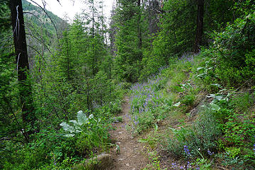
After a month in the flatlands of South Carolina this trip was a real butt kicker. I enjoyed our short exploration of the North Fork Wolf Creek trail which is shown on maps to start on the east side of the creek but in reality starts on the west side. You won't see any evidence of the trail from the main Wolf Ck Trail though, but it's there if you poke around. This is an old stock driveway and there is still evidence of that activity on this trail. We came across a functional gate that is a real masterwork and raises and lowers with the touch of a finger due to a counterbalanced rock. It must work as good now as the day it was built. I'd like to explore further up this drainage on some future trip.
The Milton Mtn Trail was also interesting and we followed the old communication wire for miles up to the old lookout site. The trail is actually in pretty decent shape where the tread still exists. The lookout was built in 1933 and sold for 1 dollar in 1951 when it was removed. I wonder if it's still around?
Great to get out with Rob and Steve again. Thanks for the invite.
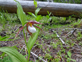 Mountain lady slipper. 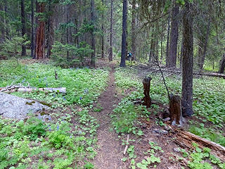 North Fork Wolf Creek Trail. 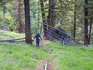 Old gate on North Fork Wolf Ck. Masterfully built and still works with a slight touch of the finger. 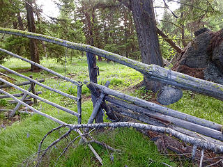 Counterweight on gate. 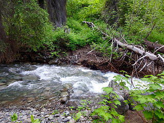 The trail crosses the North Fork Wolf Ck just after the gate. 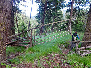 Another view of the gate on this historic stock driveway. The gate must be well over 50 years old. 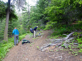 Junction of Wolf Ck Trail and Milton Mtn Trail at about the 4 mile mark. 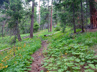 The Milton Mtn Trail still receives some horse traffic. 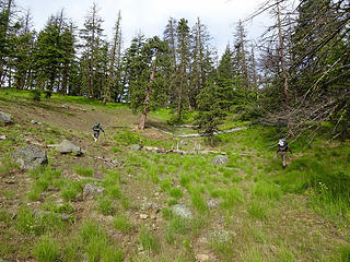 Higher up the Milton Mtn trail disappears but is mostly on open slopes. 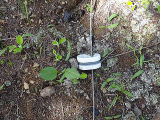 Wire from the lookout days still around. 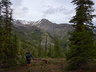 Storey Mtn. 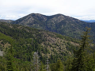 McKinney Mtn. 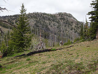 Below Milton Mtn. 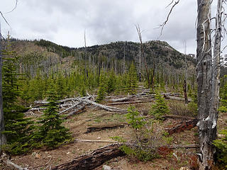 Burn below Milton. 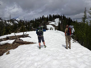 The summit ridge of Milton. 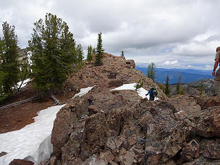 Milton Mtn Lookout site 7152.' 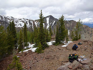 Summit of Milton. 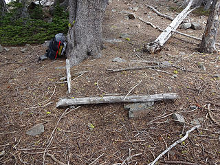 Outhouse base. 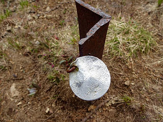 Range marker we found on the ridge dated 8/25/1966. 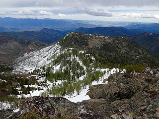 Milton Mtn from the ridge to Gardner Mtn. 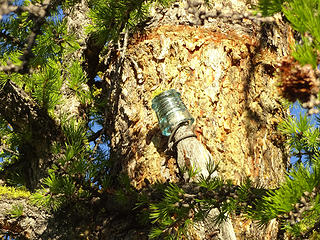 Old glass insulator on Milton, one of the few relics left. 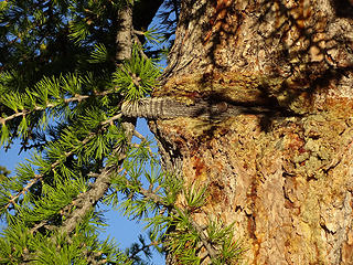 Post for glass insulator. 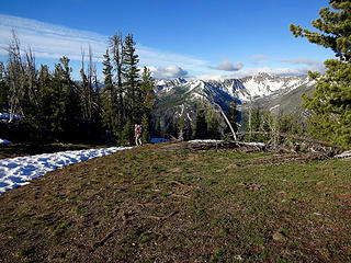 Headed down in the morning.
|
| Back to top |
|
|
Brushbuffalo
Member

Joined: 17 Sep 2015
Posts: 1887 | TRs | Pics
Location: there earlier, here now, somewhere later... Bellingham in between |
Good beta for a future trip to Milton LO site. Thanks, as we were just thinking about the se ridge as a logical place to find the old trail.
That gate is fascinating!
Passing rocks and trees like they were standing still
Passing rocks and trees like they were standing still
|
| Back to top |
|
|
wildernessed
viewbagger
Joined: 31 Oct 2004
Posts: 9275 | TRs | Pics
Location: Wenatchee |
We had quite an adventure out there between finding old trails, diverse terrain, the views, flowers, LO, and relics. I found a pic from Storey looking down the Ridge over to the point we were on taken in July. That stretch is doable but there is a lot of snow right now and the head two basins are holding quite a bit of melt water which is pooling in the snow.
 Gardner Ridge from Storey.
Living in the Anthropocene
Living in the Anthropocene
|
| Back to top |
|
|
fourteen410
Member

Joined: 23 May 2008
Posts: 2629 | TRs | Pics
|
Thanks for sharing. So much to explore in that area.
|
| Back to top |
|
|
HitTheTrail
Member

Joined: 30 Oct 2007
Posts: 5462 | TRs | Pics
Location: 509 |
I'll bet Steve the history guy loved that old gate. Looks like you guys covered a lot of ground and new ideas.
|
| Back to top |
|
|
wildernessed
viewbagger
Joined: 31 Oct 2004
Posts: 9275 | TRs | Pics
Location: Wenatchee |
| HitTheTrail wrote: | | I'll bet Steve the history guy loved that old gate. Looks like you guys covered a lot of ground and new ideas. |
Yeah Rich and Steve played with that gate for nearly an hour admiring the ingenuity of it, we got out to Milton which has been on his mind for quite awhile, and we solved the West Fork trail question. Those old trails are like black holes they suck you in. It starts with just checking it out and one thing leads to another.
Living in the Anthropocene
Living in the Anthropocene
|
| Back to top |
|
|
Brushbuffalo
Member
Joined: 17 Sep 2015
Posts: 1887 | TRs | Pics
Location: there earlier, here now, somewhere later... Bellingham in between |
| wildernessed wrote: | | Those old trails are like black holes they suck you in. It starts with just checking it out and one thing leads to another. |
Ain't it the truth?  It is fascinating how some trails that haven't had a bit of planned maintenance in half a hundred or longer ( think "Remmel Mountain") are still in better shape than some maintained trails. Finding old trails goes hand-in-hand ("foot-in-foot?") with the hobby of getting to former lookout sites.
Passing rocks and trees like they were standing still
Passing rocks and trees like they were standing still
|
| Back to top |
|
|
HitTheTrail
Member
Joined: 30 Oct 2007
Posts: 5462 | TRs | Pics
Location: 509 |
Here is a photo Steve took last year from his exploring during that trip we took up to Slate Lake. The old Dodd cutoff goes from the Slate Lake basin down into the south fork of Wolf Creek.
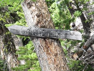 Dodd Cuttoff
|
| Back to top |
|
|
wildernessed
viewbagger
Joined: 31 Oct 2004
Posts: 9275 | TRs | Pics
Location: Wenatchee |
He calls all his discoveries treasures. 
Living in the Anthropocene
Living in the Anthropocene
|
| Back to top |
|
|
RichP
Member
Joined: 13 Jul 2006
Posts: 5634 | TRs | Pics
Location: here |
|
RichP
Member
|
Fri Jun 23, 2017 8:04 am |
|
|
As Steve remarked, none of these trails would be built today and there is hardly a ridge or drainage that didn't have one at some point in time. It's a reminder that recreation was not the purpose of them either. These were working trails to drive stock or to get to mines or someplace where roads didn't exist. Many of them may have started as old traces used by the original people that lived there for hunting and travel too. I love finding old trails and thinking about those that walked them in the past.
|
| Back to top |
|
|
Abert
Member

Joined: 02 Sep 2010
Posts: 588 | TRs | Pics
Location: Sequim |
|
Abert
Member
|
Thu Aug 08, 2019 9:52 am |
|
|
I followed the mapped trail route from Gardner Meadows yesterday up to Milton as a way to get to Storey Peak without having to make an additional trip after doing the Gardners. I can't say I found much unambiguous remnants of the trail but the route went well with not much brush or blowdowns.
Coming down the ridge from Milton after Point 6690 I took the mapped trail rather than your more direct route along the ridge. However messy your route was there in getting up to Milton mine had to be much worse. I was not happy when I could finally see what I had to get through to get back on the ridge. Trip photos
|
| Back to top |
|
|
wildernessed
viewbagger
Joined: 31 Oct 2004
Posts: 9275 | TRs | Pics
Location: Wenatchee |
👍🏻Good Stuff we systematically explored quite a bit of the area over the years the Virginian Ridge - McKinney Mountain - Wolf Creek Loop is a good early season backpack too we came in Sandy Butte from SR 20 to do Storey.
Living in the Anthropocene
Living in the Anthropocene
|
| Back to top |
|
|
|
|


