| Previous :: Next Topic |
| Author |
Message |
Matt
Tea, Earl Grey, Hot


Joined: 30 Jan 2007
Posts: 4308 | TRs | Pics
Location: Shoreline |
|
Matt
Tea, Earl Grey, Hot
|
 Sun Jul 29, 2018 4:24 pm |
|
|
Monday, July 9, Day 3: Drinnan Peak, Drinnan Lakes, Gwillim Lakes
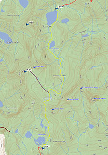
Itinerary
Cross Valhalla outlet and traverse boulder field westward to 6700 feet.
Side trip to Drinnan 8478 via southeast col.
Traverse northward to access Drinnan north ridge at 7000.
Follow ridge back southward to Drinnan north col at 7500.
Descend to lower Drinnan Lake 6640.
Take trail down to 6200 and up to Gwillim Lakes 7020.
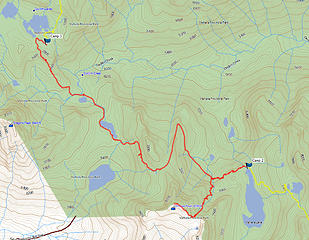 Day 3 Map 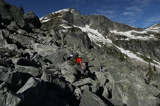 boulder field 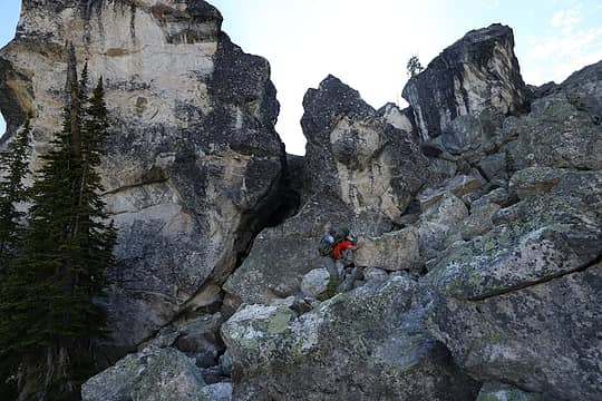 more boulder field 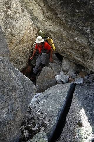 way too much boulder field 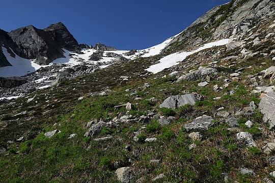 easy terrain up Drinnan couloir 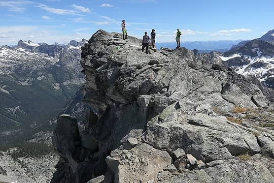 Drinnan's rather undercut summit 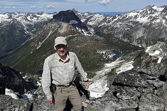 Me on Drinnan 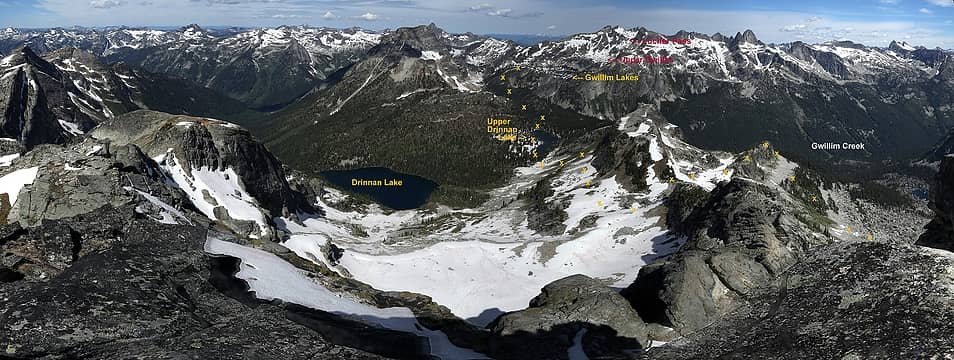 View north from Drinnan, our route ahead 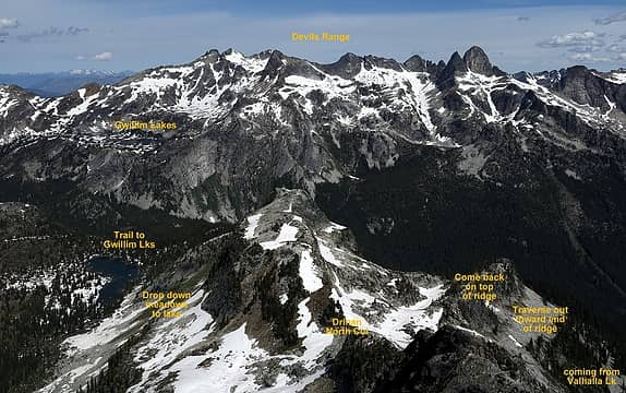 Another view of the route ahead 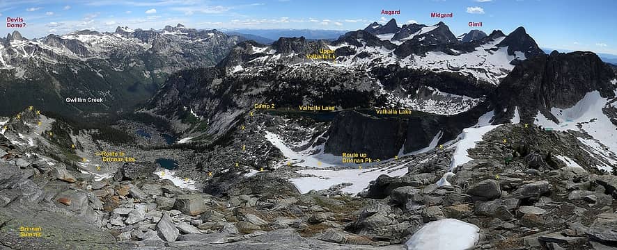 View southeast from Drinnan, our route behind 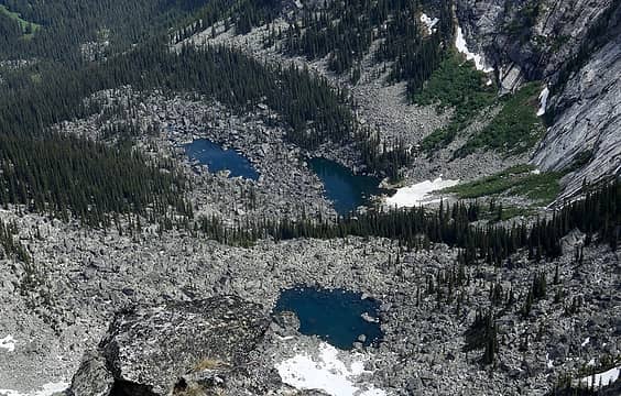 Boulder-field potholes below Valhalla Lake 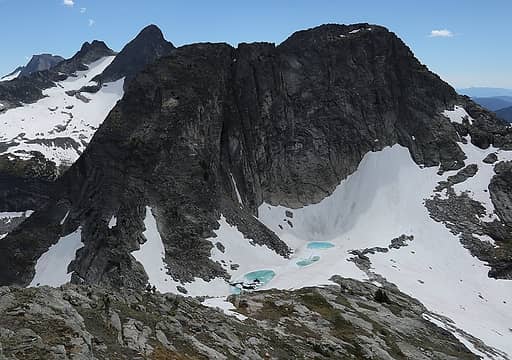 Going down Drinnan's east ridge more tarns everywhere 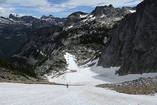 Easy snow down the couloir 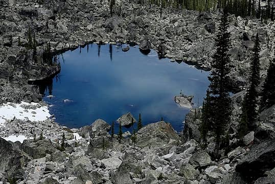 boulder tarn 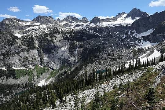 Looking back at the Valhalla waterfall from Drinnan's north ridge 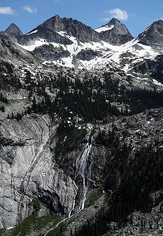 Valhalla waterfall with Asgard & Midgard up above 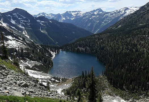 Drinnan Lake 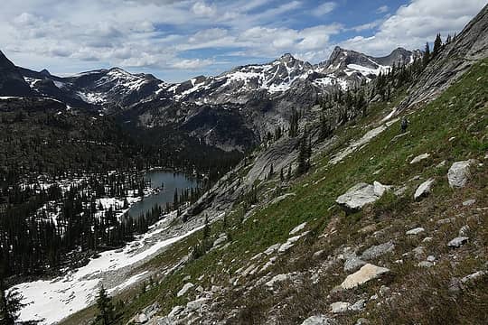 Traversing toward Upper Drinnan 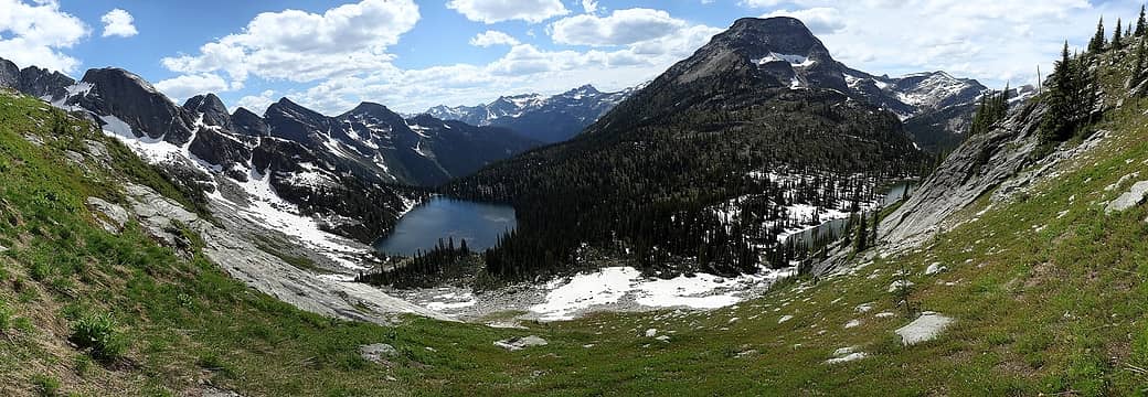 Dropping down meadow to Upper Drinnan (if you look close, you can see people near snow at bottom) 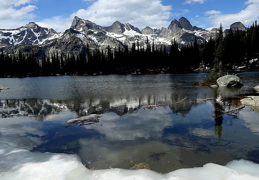 Upper Drinnan Lake with Devils Range 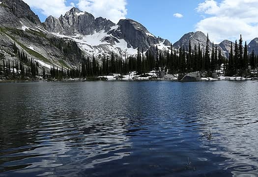 Upper Drinnan Lake with Drinnan Peak 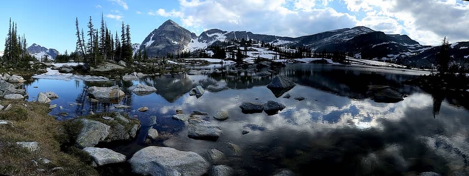 Gwillim Lake 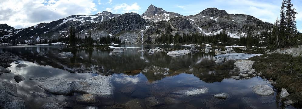 Gwillim Lake & Lucifer 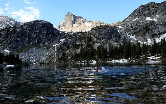 swimming in Gwillim Lake 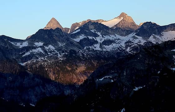 Sunset highlighting Asgard & Midgard 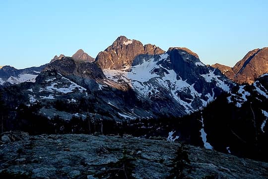 Alpenglow on Drinnan Peak
As beacons mountains burned at evening. J.R.R. Tolkien
As beacons mountains burned at evening. J.R.R. Tolkien
|
| Back to top |
  
|
|
Matt
Tea, Earl Grey, Hot
Joined: 30 Jan 2007
Posts: 4308 | TRs | Pics
Location: Shoreline |
|
Matt
Tea, Earl Grey, Hot
|
Thu Aug 02, 2018 12:06 am |
|
|
Tuesday, July 10, Day 4:
Forecast received from Yana on 6/8:
Tuesday rain in the forecast between 6 am and 6 pm, with the larger amount of rain between 6 am and noon.
Forecast received from Yana on 6/9:
Chance of precip up to 80% for tomorrow but no longer predicting thunderstorms, precip starting earlier, some increase in expected amounts of precip, still forecast to be dry after 6pm tomorrow.
[Play ominous foreshadowing music here.]
Itinerary
Ascend north halfway up Lucifer Pass. Wait in tent for 1:15 hours for rain to stop.
Ascend to Lucifer Pass 8400. Wait in tent for 5:15 hours for rain to stop.
Descend north to Rocky Lake 6920 and Hird Lake 6840.
 Day 4 Track (purple line is side trip cancelled due to rain) 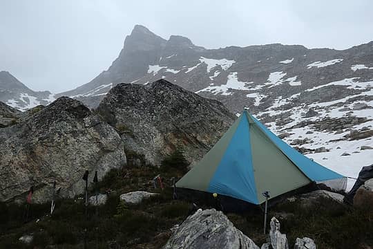 First rain stop (Lucifer Pass in background above). 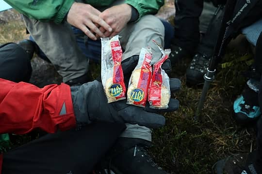 Eric sharing his daily packets of uneaten crackers. 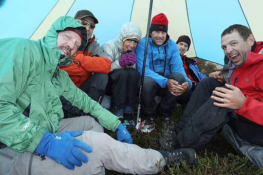 Hudding in the tent 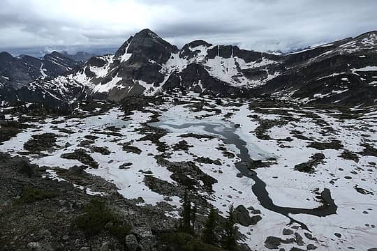 Hiking past Upper Gwillim Lakes 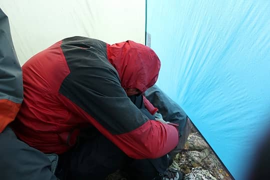 Cold and damp 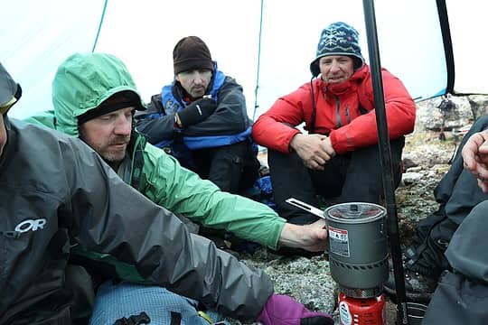 Hot stove 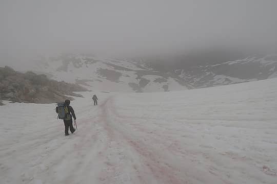 Hiking down from Lucifer Pass 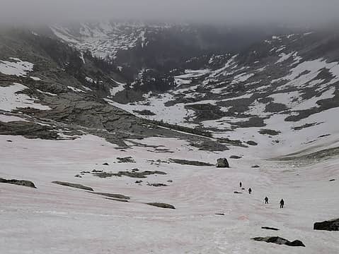 Continuing down. Rocky & Hird Lakes at upper left. Some cool water meadows at the bottom. 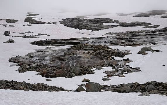 Stairstep slab waterfalls 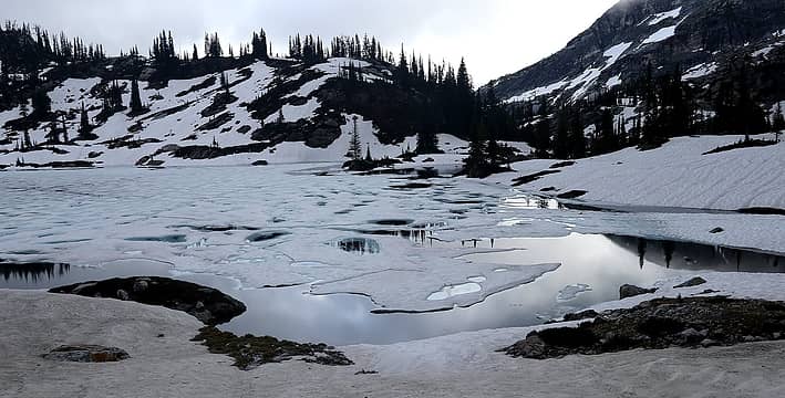 Silvery Rocky Lake 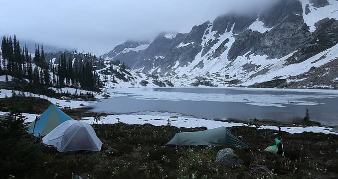 Hird Lake camp 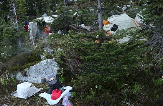 Yard sale drying out gear at Hird Lake
As beacons mountains burned at evening. J.R.R. Tolkien
As beacons mountains burned at evening. J.R.R. Tolkien
|
| Back to top |
|
|
silence
Member

Joined: 25 Apr 2005
Posts: 4420 | TRs | Pics
|
|
silence
Member
|
Thu Aug 02, 2018 6:53 am |
|
|
PHOTOS
FILMS
Keep a good head and always carry a light bulb. Bob Dylan
|
| Back to top |
|
|
b00
Member

Joined: 29 Sep 2003
Posts: 1145 | TRs | Pics
|
|
b00
Member
|
Wed Jul 24, 2019 8:29 pm |
|
|
better late than never? :>)
|
| Back to top |
|
|
|
|
You cannot post new topics in this forum
You cannot reply to topics in this forum
You cannot edit your posts in this forum
You cannot delete your posts in this forum
You cannot vote in polls in this forum
|
Disclosure: As an Amazon Associate NWHikers.net earns from qualifying purchases when you use our link(s). |


