| Previous :: Next Topic |
| Author |
Message |
Alden Ryno
Member

Joined: 04 Jun 2019
Posts: 150 | TRs | Pics
Location: Issaquah, WA |
Grand Valley Ridges Moose/McCartney/Cameron/Claywood/Sentinel/Wellesley/Pt 6759
EDIT: I guess dates would be helpful to some... August 13th to 15th, 2022.
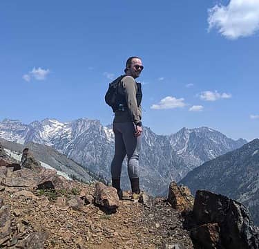
 sunset to Olympus day 1 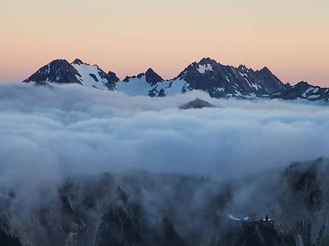 sunset to Anderson day 1 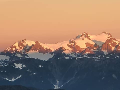 sunrise to Olympus day 2 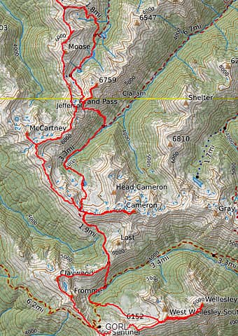 the route taken 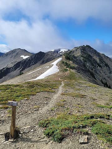 turnoff from Grand Valley Trail to "defunct" Lilian Ridge Way Trail 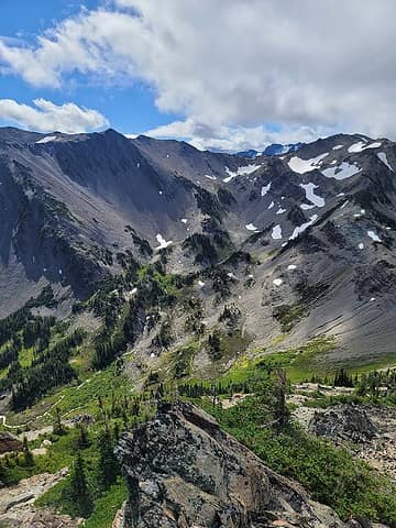 looking to Grand Pass. Ribbon of trail winds its way through 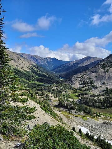 looking down Grand Valley 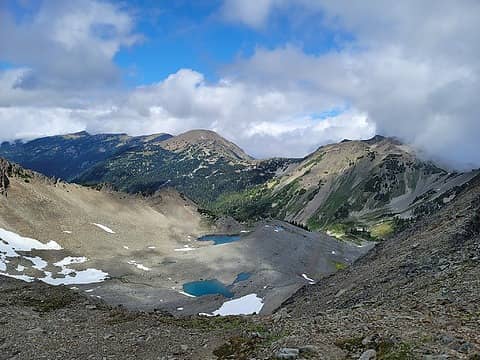 terrain in Lilian "Glacier" Basin. Easier travel than the ridge. 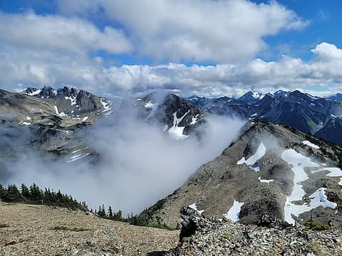 ridge to Mount Cameron (left rear area). Much was spent on the ridge proper, but traversed below most points along ridge. 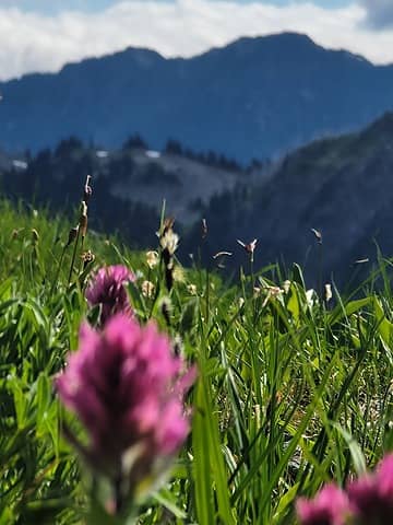 bountiful flowers on this trip 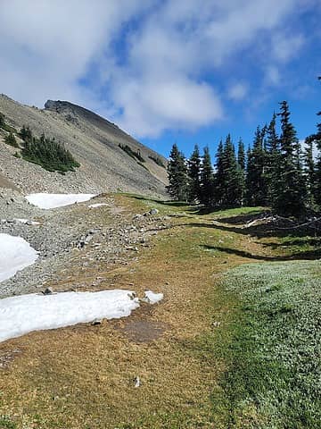 not uncommon terrain while traversing. so many spots for remote camps. 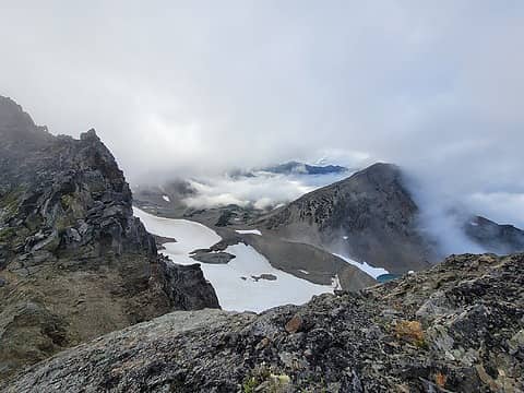 past the first false summit of Cameron, looking back to Cameron Basin with Cameron Head on the right 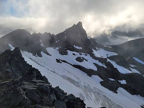 looking back at the alleged proper summit of Cameron from near the second summit (farther along the ridge). 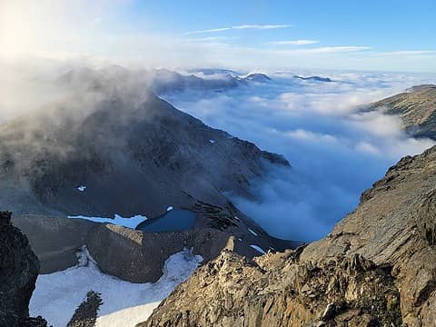 I wonder what it's like under those clouds... 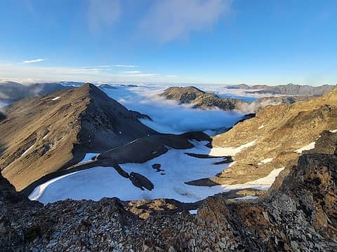 clouds settling and clearing as I get nearer camp  minute long video getting back to camp 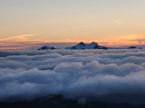 excuse me while I flood this TR with pretty pictures that have no route details 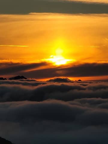 sunset of Bogachiel/far northern Bailey range 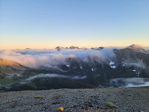 Lost Bain and Anderson Massif beyond 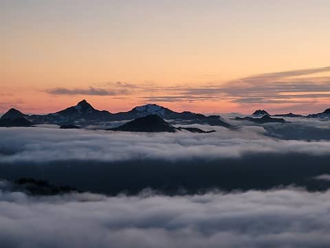 Meany and Queets 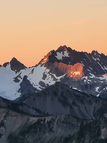 sun risin' 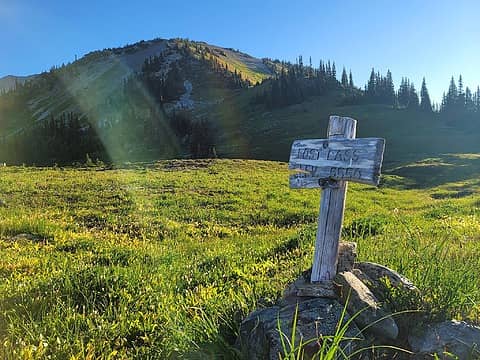 Lost Pass 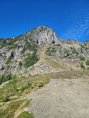 looking at a subsummit of Claywood on the ridge. up the dirt patch to the base of the cliffs, then traverse hard right under the cliffs on obvious terrain (when you're there) 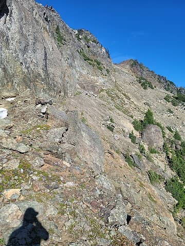 traverse where subtle lower terrain meets more vertical upper terrain, natural fold in the terrain 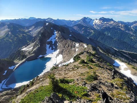 summit of Claywood, looking to Fromme and Sentinel 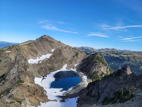 summit of Fromme, looking to claywood 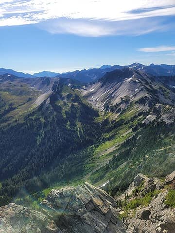 not the easiest to see but I crossed the choss slopes with runnels under Sentinel here. I crossed the snow patches (and loaded up with coolant) 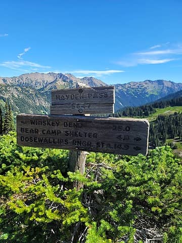 Hayden Pass between Fromme and Sentinel ![From Sentinel to Wellesley along the ridge, Deception [i:7214077a77]et al.[/i:7214077a77] beyond. I wondered, and still do, if the ridge directly off of Sentinel would go. Likely more tedious than simply dropping a few hundred vert and crossing the snow and talus slopes](https://cloud.nwhikers.net/eef7a9864cf947dcc9435071a5c4c0b2_480x360.jpg) From Sentinel to Wellesley along the ridge, Deception et al. beyond. I wondered, and still do, if the ridge directly off of Sentinel would go. Likely more tedious than simply dropping a few hundred vert and crossing the snow and talus slopes 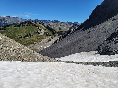 gentle snow and talus slopes directly beneath Sentinel. Much more shallow than they appeared head-on and on the maps 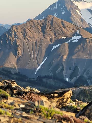 the slopes from near camp 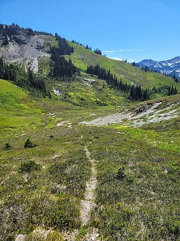 use-trail to nowhere from the pass east of Sentinel 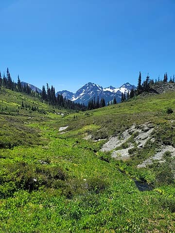 mmhmm 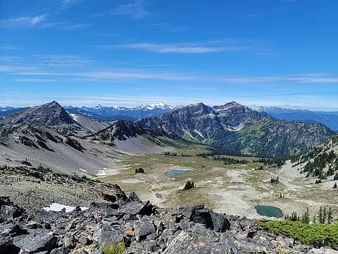 aptly named Thousand Acre Meadow 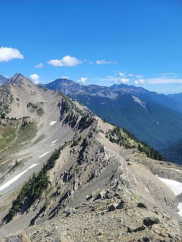 ridge proper goes but just drop down to the right here and take it easy 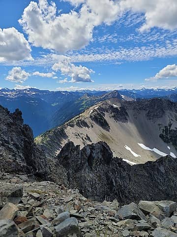 Wellesley summit, Sentinel is far away... ![[b:7214077a77]easy terrain off the ridge but along the ridge to Wellesley.[/b:7214077a77] this can be taken to about halfway to/from West Wellesley and Wellesley main.](https://cloud.nwhikers.net/cff10b5723a111d02f326e694bf381e0_360x480.jpg) easy terrain off the ridge but along the ridge to Wellesley. this can be taken to about halfway to/from West Wellesley and Wellesley main. 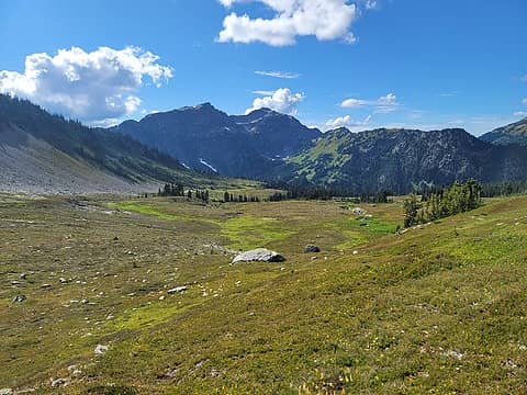 flat basin is flat 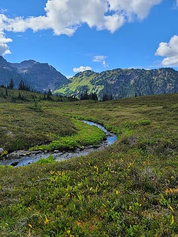 pretty basin is pretty 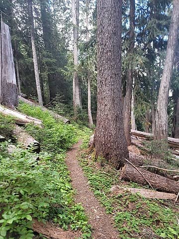 thirty miles into this trip and I'm finally in a bonafide forest 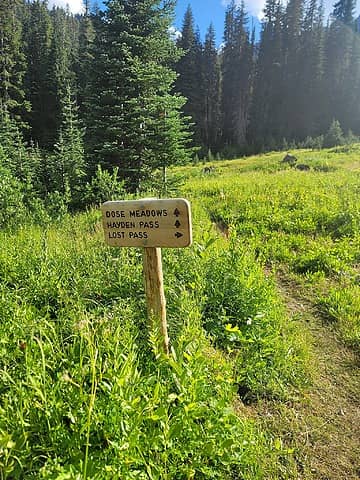 time to leave the forest, after 2 miles (maybe) 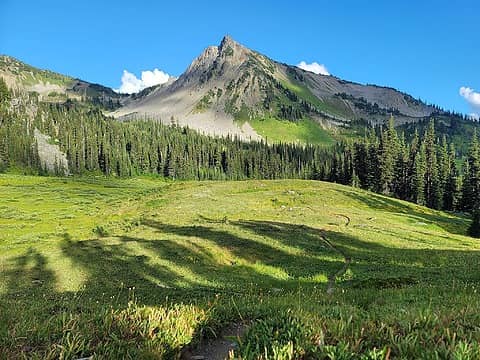 Lost Peak with singletrack ribbon 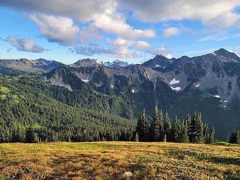 back to pretty pictures without route significance 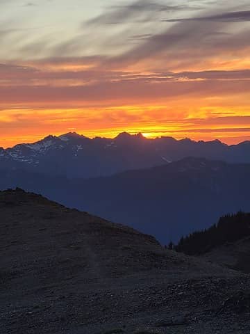 reward for a day of hard effort done well 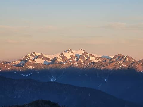 top o' the mornin' to ya! 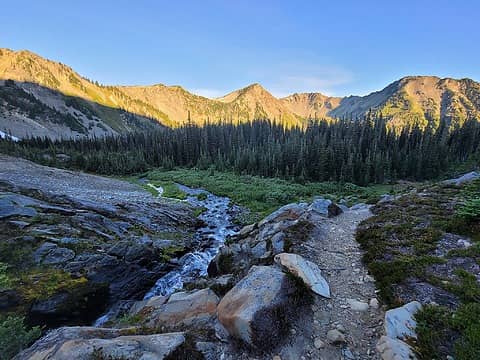 the trail through Cameron Basin is wonderful 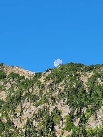 big moon was bright both nights 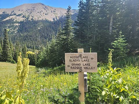 the last turnoff and the last sustained climb 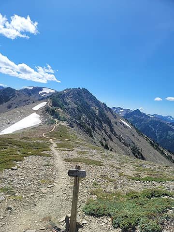 at last, back to my diversion point 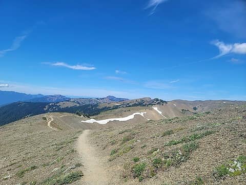 this way to the car 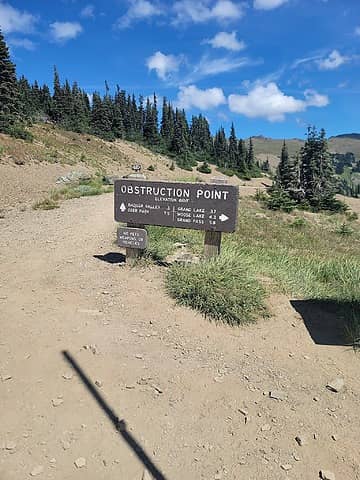 back at the TH
 half fast, Cam, olderthanIusedtobe, brewermd, zimmertr, RAW-dad, IanB, reststep, Hesman, Abert, Waterman half fast, Cam, olderthanIusedtobe, brewermd, zimmertr, RAW-dad, IanB, reststep, Hesman, Abert, Waterman  rubywrangler, jaysway, meck rubywrangler, jaysway, meck  silence silence  awilsondc awilsondc
half fast, Cam, olderthanIusedtobe, brewermd, zimmertr, RAW-dad, IanB, reststep, Hesman, Abert, Waterman rubywrangler, jaysway, meck silence awilsondc |
| Back to top |
  
|
|
meck
Member

Joined: 31 Dec 2010
Posts: 920 | TRs | Pics
|
|
meck
Member
|
 Sat Aug 27, 2022 5:01 pm |
|
|
Fantastic trip, and thank you for posting the photos of some of those slopes! Aside from the heat, looks like you visited at just the right time. I almost got to Wellesley, but decided to swim in 1000 acre meadows instead (it was so hot out there when I visited a few years back). Thanks for including the photos from Sentinel over to Wellesley, I've got to go back. Also, I really appreciate the photo around the north-east edge of Claywood. I'd sat staring at that route around the edge for about 40 minutes one evening debating if I should go there (from about the same location your photo was taken), before turning around and going back along that ridge to Lost Basin (I'd visited it from Hayden Pass along the same route you exited from).
Lot's of great terrain for exploring out there!
*Just say NO to Rent-Seeking, don't give up the concept of "ownership"*
*Just say NO to Rent-Seeking, don't give up the concept of "ownership"*
|
| Back to top |
|
|
jaysway
Member

Joined: 16 Jul 2020
Posts: 348 | TRs | Pics
|
|
jaysway
Member
|
Sat Aug 27, 2022 5:40 pm |
|
|
It seems like you had a great trip and were able to string together some real highlights!
| Alden Ryno wrote: | Lost Bain and Anderson Massif beyond |
What a gorgeous scene, the cloud/inversion layer at sunset is the stuff that dreams are made of.
| Alden Ryno wrote: | summit of Claywood, looking to Fromme and Sentinel |
Great shot, this might be the place I'm most excited to visit in the Olympics some day!
| Alden Ryno wrote: | aptly named Thousand Acre Meadow |
I can almost picture a glacier filling this whole basin many decades ago (or longer). Visiting 1K meadow is also high on my list.
|
| Back to top |
|
|
silence
Member

Joined: 25 Apr 2005
Posts: 4420 | TRs | Pics
|
|
silence
Member
|
Sun Aug 28, 2022 6:24 am |
|
|
Great traverse and wonderful photos ... thanks for posting!
PHOTOS
FILMS
Keep a good head and always carry a light bulb. Bob Dylan
PHOTOS
FILMS
Keep a good head and always carry a light bulb. Bob Dylan
|
| Back to top |
|
|
RAW-dad
Member

Joined: 07 Jul 2017
Posts: 119 | TRs | Pics
Location: Oregon |
|
RAW-dad
Member
|
Sun Aug 28, 2022 7:13 am |
|
|
Nice intro to the Olympics! You'll find many more worthy routes.
|
| Back to top |
|
|
zimmertr
TJ Zimmerman
Joined: 24 Jun 2018
Posts: 1228 | TRs | Pics
Location: Issaquah |
|
zimmertr
TJ Zimmerman
|
Sun Aug 28, 2022 9:17 am |
|
|
Love the photos of Claywood Lake and the Lillian Glacier Basin. Lots of places I've also dreamed of going too.
With respect to chafting, have you ever tried chamois buttr? I used to get it on my lower back on big days and it helps a lot. And doesn't seem to stop working when you sweat like body glide does. I normally just apply it liberally before going out on a big day, but for overnight trips you can buy small packets as well. For example: https://www.amazon.com/Chamois-Buttr-Original-9mL-Packets/dp/B00CUK5ITQ
|
| Back to top |
|
|
Alden Ryno
Member
Joined: 04 Jun 2019
Posts: 150 | TRs | Pics
Location: Issaquah, WA |
I haven't tried that stuff, though I've used other products with success... I simply forgot EVERYTHING that I normally use (Squirrel's Nut Butter, Body Glide, baby wipes) other than carmex. That whole carmex tube got used to prevent below waist chaff instead of chapped lips.
I should have added that I eventually made it to the car with no chaff!
|
| Back to top |
|
|
coldrain108
Thundering Herd

Joined: 05 Aug 2010
Posts: 1858 | TRs | Pics
Location: somewhere over the rainbow |
| jaysway wrote: | | What a gorgeous scene, the cloud/inversion layer at sunset is the stuff that dreams are made of. |
from 1k acre meadow, Sentinel is the sharp point.
This trip covered in 2 days what I did in 2 separate 4 day trips. I came up the Dose on one and over Grand for another.
Since I have no expectations of forgiveness, I don't do it in the first place. That loop hole needs to be closed to everyone.
jaysway
Since I have no expectations of forgiveness, I don't do it in the first place. That loop hole needs to be closed to everyone.
jaysway
|
| Back to top |
|
|
|
|
You cannot post new topics in this forum
You cannot reply to topics in this forum
You cannot edit your posts in this forum
You cannot delete your posts in this forum
You cannot vote in polls in this forum
|
Disclosure: As an Amazon Associate NWHikers.net earns from qualifying purchases when you use our link(s). |


![From Sentinel to Wellesley along the ridge, Deception [i:7214077a77]et al.[/i:7214077a77] beyond. I wondered, and still do, if the ridge directly off of Sentinel would go. Likely more tedious than simply dropping a few hundred vert and crossing the snow and talus slopes](https://cloud.nwhikers.net/eef7a9864cf947dcc9435071a5c4c0b2_r.jpg#2048x1536+https://lh3.googleusercontent.com/9kqh90VccI_NJi-tDOGURWVuksjKYLhoQgpOWQx_Q29cy-6rgfRV3h_67C9CF2EaagVeZ0s529LKmehOJWK5Y8dGMDP9jKulRZZGm4IPIZCZLiTZ3VdXdIMEKZCpJPKnqSRkkmfUnNM=s0#4000x3000)


![[b:7214077a77]easy terrain off the ridge but along the ridge to Wellesley.[/b:7214077a77] this can be taken to about halfway to/from West Wellesley and Wellesley main.](https://cloud.nwhikers.net/cff10b5723a111d02f326e694bf381e0_r.jpg#1536x2048+https://lh3.googleusercontent.com/3imRNedszYJ6HVq5UyXDF3MSwmfnvH5nZ9gPYSmaRL7eAbTOyd-KCSEiqt9j9u_0f51eseksnEvnSY8Ny7vAof6TAn14Wp2RpG4YCjRT_V72m34m1m45YTMy-ObjqrsixJvUVzTSBlA=s0#3000x4000)


