| Previous :: Next Topic |
| Author |
Message |
Gimpilator
infinity/21M


Joined: 12 Oct 2006
Posts: 1684 | TRs | Pics
Location: Edmonds, WA |
Intro
I planned a roadtrip revolving around meeting with various people here and there in the desert at different times. First I would join John Stolk and Grant Meyers, later I would join Greg Slayden and Dave Covill. As with many of these trips, almost nothing went as we planned. In fact, everything from the second day until I met with Greg and Dave was completely improvised last-minute, with no prior research.
5-10
Seaman Peak - 8606'
I started my trip with Seaman, which is always a good way to start. The route goes north up a talus gully and then turns west onto a ridge with nice mature Pondersoa.
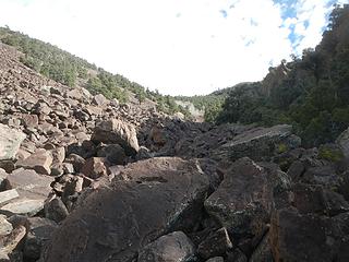 talus gully 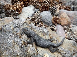 dinosaur 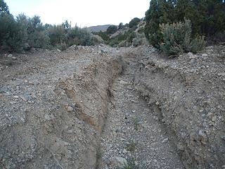 washed out road trough 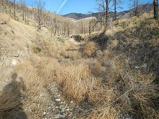 tumbleweed drifts 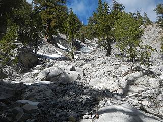 steep gully 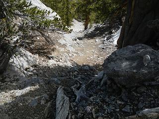 chossy 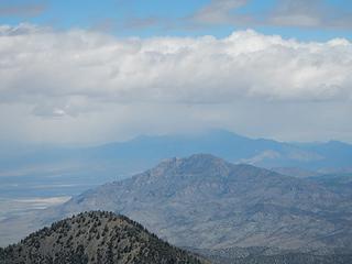 snowing on Currant 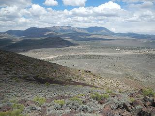 Signal 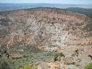 Hells Hole 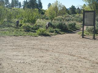 trailhead deer 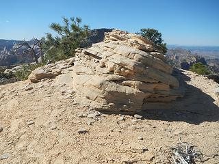 summit 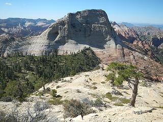 North Guardian 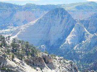 Rams Peak 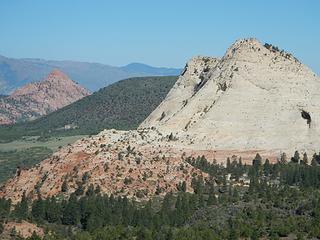 Red Butte and Pine Valley Peak 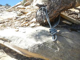 rap sling 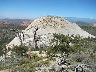 West Northgate from East 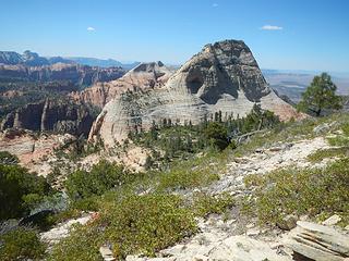 The Guardian Angels 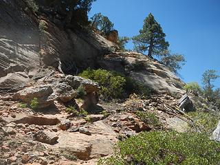 ramp 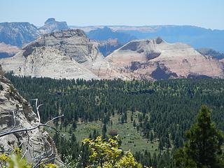 Guardian Angels 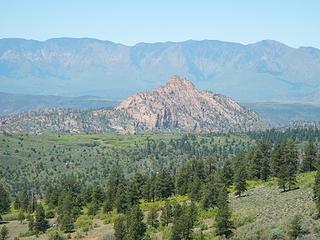 Red Butte 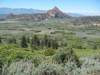 Red Butte 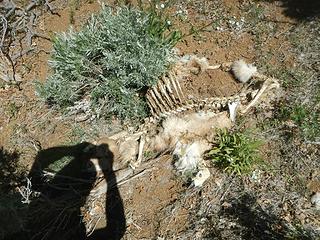 a lion kill 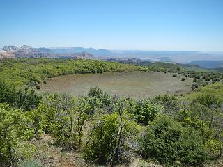 caldera  sketch 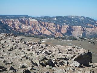 Cedar Breaks over there 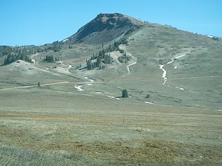 Brian Head 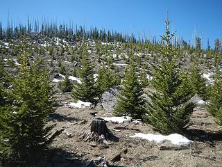 Navajo 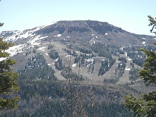 Brian Head
|
| Back to top |
  
|
|
Gimpilator
infinity/21M
Joined: 12 Oct 2006
Posts: 1684 | TRs | Pics
Location: Edmonds, WA |
Frisco Peak 9660'
I drove to 8160 feet over some very rough and loose rock. It was probably foolish to take the Subaru that far. I hiked the rest of the way which was mostly better than what I drove up.
May 17
Wah Wah Mountain 9393'
The next bunch of peaks are remote. The approach road was good however. I awoke in the morning to find a tick crawling on my pillow inside my tent.  Wah Wah is off-trail through trees and brush. I hiked up a south ridge and then the main southeast ridge, watching for ticks on my legs. Thankfully none.
Wah Benchmark 9383'
This northern summit a half mile away is supposedly 10 feet lower than the main peak. Too close to know for certain. It also has a register.
Indian Peak 9790'
The drive to this one is the crux. Fortunately the road was recently graded. The route goes up a north fence line. As suggested, I followed the fence the entire way. It was very steep and loose in places with brush and some fallen logs. Not a pleasant route, but good views.
May 18
Highland Peak 9395'
Around this time I got word from John and Grant that they were planning on Worthington/Hyko/Highland soon, so I drove over there hoping to run into them. Theres no cell signal in that part of Nevada, so I knew that my chances of finding them were not good. I drove to the top of Highland.
Hyko Benchmark 7950'
Very highly recommend this peak. It has some of the best summit views of any peak Ive done in southern Nevada to date. Furthermore, the route is interesting and less than straight-forward. I parked at 6160 feet and followed the old road briefly before ascending northwest onto an east ridge.
I scrambled through some minor cliffs only to discover that my camera case was mysterious empty. Where was my camera? I went almost all the was back to the bottom and then came back up the exact same way and found my camera where it had fallen out. My poor camera has tumbled down gullies in WA and the view screen was broken in CA this last January. Im still shooting everything without being able to see, just hoping that some turn out.
When I came to the upper plateau, I noticed chips of flint scattered all over the place. It was obvious that before modern times, American Natives used to wait here and craft tools. They knew that animals from the plateau would pass this exact spot on the way down to Twin Springs below.
I continued north into a maze of granitic formations. I thought I could find an easy direct way to the summit, but I was wrong. When I finally came to the summit, I was pleased to face a steep short scramble. This is an excellent peak.
Wah Wah is off-trail through trees and brush. I hiked up a south ridge and then the main southeast ridge, watching for ticks on my legs. Thankfully none.
Wah Benchmark 9383'
This northern summit a half mile away is supposedly 10 feet lower than the main peak. Too close to know for certain. It also has a register.
Indian Peak 9790'
The drive to this one is the crux. Fortunately the road was recently graded. The route goes up a north fence line. As suggested, I followed the fence the entire way. It was very steep and loose in places with brush and some fallen logs. Not a pleasant route, but good views.
May 18
Highland Peak 9395'
Around this time I got word from John and Grant that they were planning on Worthington/Hyko/Highland soon, so I drove over there hoping to run into them. Theres no cell signal in that part of Nevada, so I knew that my chances of finding them were not good. I drove to the top of Highland.
Hyko Benchmark 7950'
Very highly recommend this peak. It has some of the best summit views of any peak Ive done in southern Nevada to date. Furthermore, the route is interesting and less than straight-forward. I parked at 6160 feet and followed the old road briefly before ascending northwest onto an east ridge.
I scrambled through some minor cliffs only to discover that my camera case was mysterious empty. Where was my camera? I went almost all the was back to the bottom and then came back up the exact same way and found my camera where it had fallen out. My poor camera has tumbled down gullies in WA and the view screen was broken in CA this last January. Im still shooting everything without being able to see, just hoping that some turn out.
When I came to the upper plateau, I noticed chips of flint scattered all over the place. It was obvious that before modern times, American Natives used to wait here and craft tools. They knew that animals from the plateau would pass this exact spot on the way down to Twin Springs below.
I continued north into a maze of granitic formations. I thought I could find an easy direct way to the summit, but I was wrong. When I finally came to the summit, I was pleased to face a steep short scramble. This is an excellent peak.
 USGS tripod 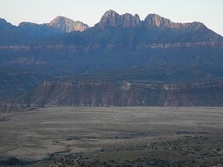 Smithsonian 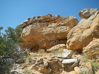 summit block 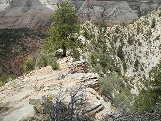 back down the knife ridge 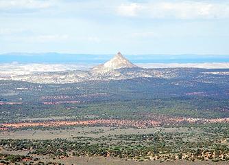 Mollies Nipple 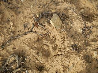 meow
|
| Back to top |
|
|
Gimpilator
infinity/21M
Joined: 12 Oct 2006
Posts: 1684 | TRs | Pics
Location: Edmonds, WA |
May 21
Mollies Nipple 7271'
I drove deeper into the Escalante. The roads became pure soft sand. I was alone and one small error in my driving would make for a lot of trouble. To add to my anxiety, I was supposed to meet Dave and Greg at the Grand Canyon later in the afternoon. What would they think if I didnt show up? This is the most challenging sand road I have ever driven and if you are thinking about this peak, I would give a word of caution. By providence I parked 100 yards before an impasse and hiked the remaining ~2 miles to the peak.
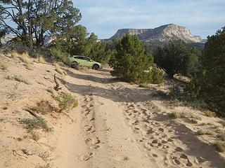 parked 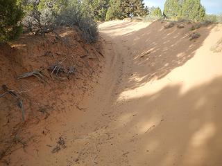 right before this 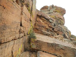 ledges 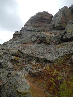 final bit 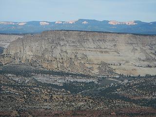 part of Bryce Canyon visible 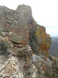 looking back  don't bust the crust 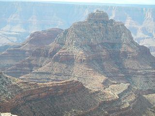 Vishnu 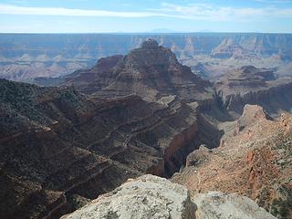 Vishnu 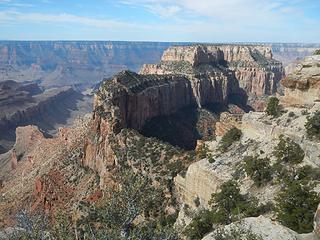 Wotans Throne 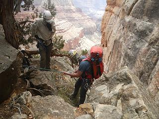 top of the big rappel, Coconino 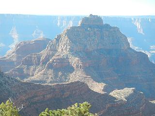 elusive Vishnu 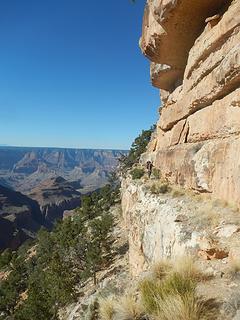 Dave on a ledge 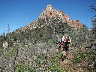 prow 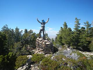 Saddle summit cairn 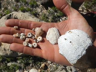 fossils 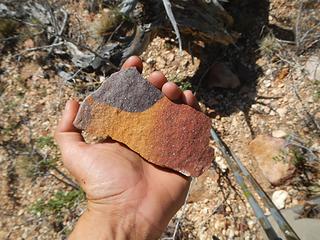 tri-colored sandstone 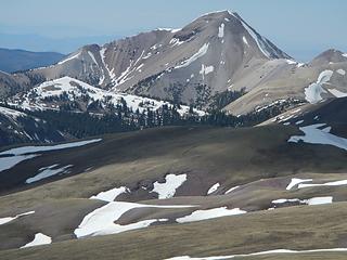 Baldy 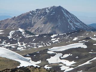 Belknap 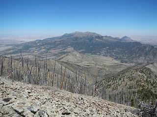 Ellen from Pennell 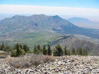 Hillers 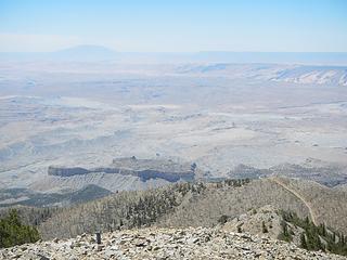 Navajo
|
| Back to top |
|
|
Jake Robinson
Member

Joined: 02 Aug 2016
Posts: 521 | TRs | Pics
|
Beautiful shots of Zion! I love how colorful the rock is there. Your experience on Vishnu Temple sounds a bit intense, I'm glad you all made it out unscathed.
|
| Back to top |
|
|
GaliWalker
Have camera will use

Joined: 10 Dec 2007
Posts: 4931 | TRs | Pics
Location: Pittsburgh |
|
GaliWalker
Have camera will use
|
 Sat Jun 02, 2018 12:21 pm |
|
|
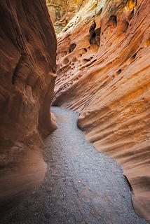
Wow, great report(s)! Little Wildhorse Canyon in particular looks spectacular!
| Gimpilator wrote: | | Id like to thank GaliWalker for her report about this place, without which I never would have known. Its crowded and you have to pay now to enter, however I found that everyone was deterred by the second ladder with is missing multiple rungs and has a waterfall going over it. Somewhat dangerous. |
I was surprised to see Kanarra Creek photos and you're welcome! That second ladder looks quite a bit worse now, and it was sketchy even when I did it.  PS. I'm a guy.
|
| Back to top |
|
|
chandlerhaberlack
chandler haberlack

Joined: 29 May 2018
Posts: 26 | TRs | Pics
Location: Monroe |
Love the canyon shots. What a great write up.
|
| Back to top |
|
|
Brushbuffalo
Member

Joined: 17 Sep 2015
Posts: 1887 | TRs | Pics
Location: there earlier, here now, somewhere later... Bellingham in between |
| Gimpilator wrote: | | Probably very few people realize the volcanic history of Zion. |
That statement also applies to not only Zion but other assorted areas in Utah, Nevada, SE Oregon, Eastern California, Northern Arizona, even New Mexico. Volcanoes are scattered in clusters all over the Great Basin.
Fun to see you branch out from peakbagging to explore some fantastic canyons and mesas, Adam.
Passing rocks and trees like they were standing still
Passing rocks and trees like they were standing still
|
| Back to top |
|
|
Matt Lemke
High on the Outdoors

Joined: 15 Jul 2010
Posts: 2052 | TRs | Pics
Location: Grand Junction |
|
Matt Lemke
High on the Outdoors
|
Sat Jun 02, 2018 10:52 pm |
|
|
Escalante is also one of my favorite areas. Red breaks slot canyon is a very special one, as is the nearby cosmic ashtray.
Pennel and Ellen are also really sweet views. I could still spend years in Utah despite the time I've already spent there! Nice trip
|
| Back to top |
|
|
OutOfOffice
Member

Joined: 02 Jun 2015
Posts: 91 | TRs | Pics
Location: Seattle |
I was just down in the Grand Canyon myself. Need to plan more trips to Escalante. Some mind blowing terrain in there
|
| Back to top |
|
|
joker
seeker

Joined: 12 Aug 2006
Posts: 7953 | TRs | Pics
Location: state of confusion |
|
joker
seeker
|
Tue Jun 05, 2018 2:25 pm |
|
|
Wow - quite a walkabout! You hit some cool spots.
| GaliWalker wrote: | | Little Wildhorse Canyon in particular looks spectacular! |
IT's very pretty and very accessible and very well known now. The area around it is cool - looks like there is a lot of exploration potential in the San Rafel Swell...
 Little-Wildhorse-Canyon 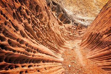 Little-Wildhorse-Canyon-2
|
| Back to top |
|
|
Gimpilator
infinity/21M
Joined: 12 Oct 2006
Posts: 1684 | TRs | Pics
Location: Edmonds, WA |
| GaliWalker wrote: | | PS. I'm a guy. |
Deep apologies for the ignorant assumption. I feel like I've been told that before. Anyhow, thanks again for your report. It shaped the direction my trip took.
| Matt Lemke wrote: | | Red breaks slot canyon is a very special one, as is the nearby cosmic ashtray. |
Thanks for the recommendation Matt. I know you have a ton of experience down there. I'll bookmark these two for the future.
| joker wrote: | Little-Wildhorse-Canyon-2 |
I'm glad you got a better shot of this spot than I did. It totally reminded me of the corrupted corridors in the Alien movies and the HR Giger museum in Austria.
|
| Back to top |
|
|
chemicalman
chemicalman
Joined: 04 Jan 2018
Posts: 2 | TRs | Pics
Location: Escondido |
Great report. You did a plethora of peaks! I could feel your foreboding on the canyon trip as I read about it. Glad everyone got out safely. I have been wanting to get out to Utah for a few days and will try to hit some of the prominence ones this summer. Thanks for the report!
|
| Back to top |
|
|
Homey360
Member
Joined: 10 Aug 2016
Posts: 18 | TRs | Pics
Location: Issaquah, WA |
|
Homey360
Member
|
Thu Jun 21, 2018 9:51 pm |
|
|
Super cool report. Definitely, some places I need to visit. Thanks.
"for everyone needs beauty as well as bread, places to play in and pray in where Nature may heal and cheer and give strength to body and soul alike."
"for everyone needs beauty as well as bread, places to play in and pray in where Nature may heal and cheer and give strength to body and soul alike."
|
| Back to top |
|
|
|
|
You cannot post new topics in this forum
You cannot reply to topics in this forum
You cannot edit your posts in this forum
You cannot delete your posts in this forum
You cannot vote in polls in this forum
|
Disclosure: As an Amazon Associate NWHikers.net earns from qualifying purchases when you use our link(s). |


