| Previous :: Next Topic |
| Author |
Message |
Matt
Tea, Earl Grey, Hot


Joined: 30 Jan 2007
Posts: 4308 | TRs | Pics
Location: Shoreline |
|
Matt
Tea, Earl Grey, Hot
|
 Sun Jun 03, 2018 11:48 pm |
|
|
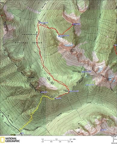
Dates: May 26-28
Destination: Holliway Mtn via Swamp Creek, Methow Pass, Methow River & Nugget Lakes
Party: Matt, Carla (Dicey)
Short Version
Day 1: Ascended Swamp Creek to 7700 feet on Hardy, then back down to a fine view camp at 7000 feet above Methow Pass.
Day 2: Visit Holliway by descending PCT down the Methow River to 4600 feet, then back up via Nugget Lakes to Holliway's summit. A long round trip, but a great view of Golden Horn's steep north side.
Day 3: After enjoying one more night at our high camp, reluctantly hike back down to the car.
 Holliway GPS Track 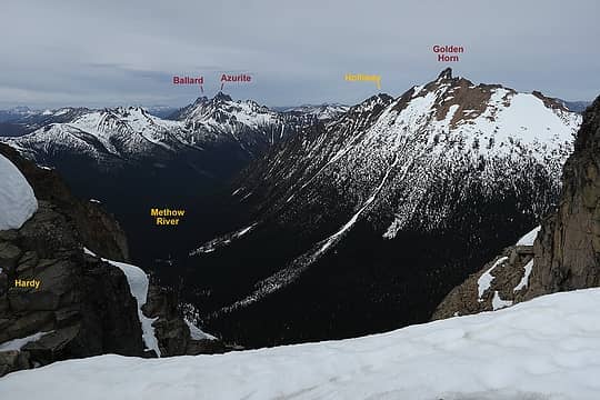 Holliway viewed from Hardy 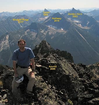 Holliway viewed from Azurite in 2008, about the only location where you clearly see Holliway in relation to its neighbors, and see the steep north faces of Holliway and Golden Horn 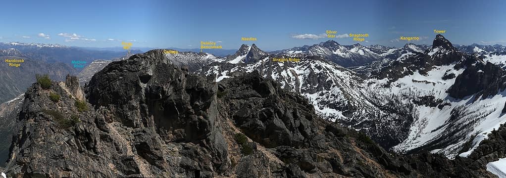 Holliway summit view looking east 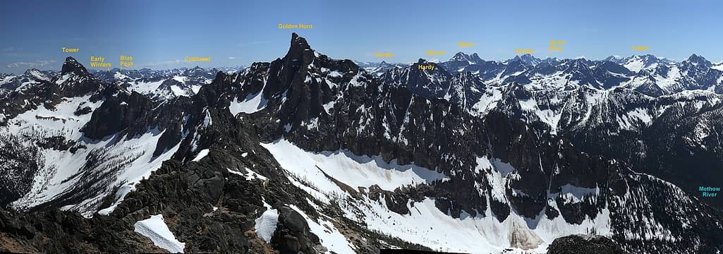 Holliway summit view looking south 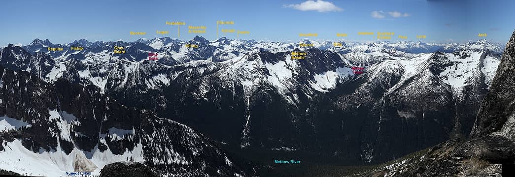 Holliway summit view looking west 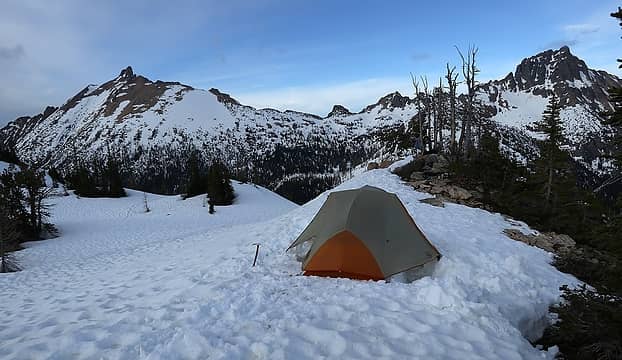 Golden Horn & Tower from camp 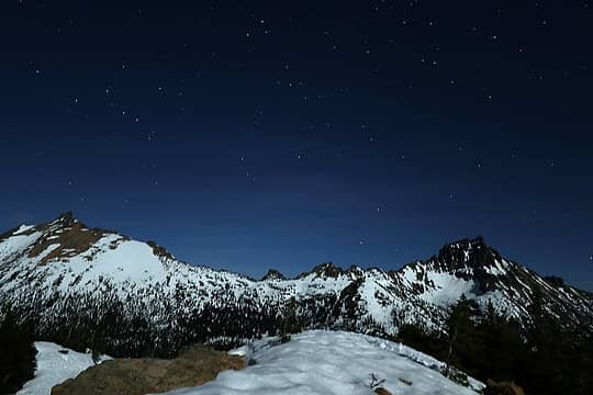 Golden Horn & Tower by moonlight 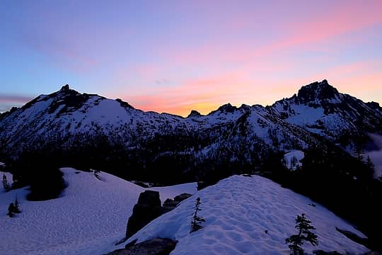 Golden Horn & Tower at sunrise 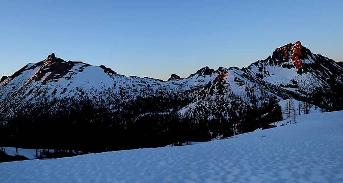 Golden Horn & Tower at sunset 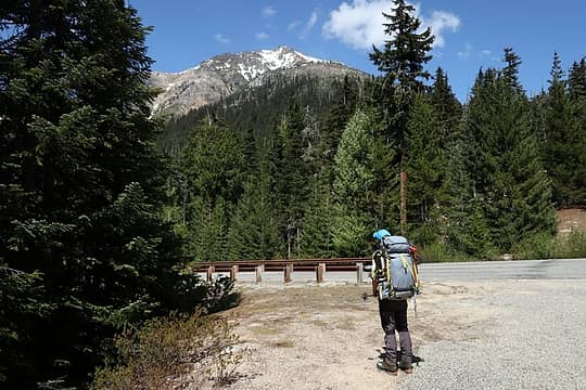 Looking up Hardy from the parking lot 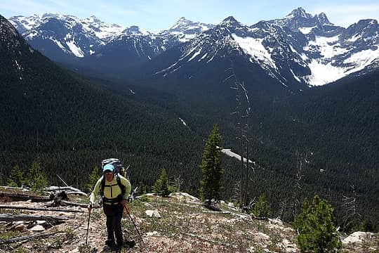 Carla ascending through the burn, with the parking area still visible below 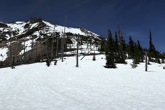 Looking up the shoulder of Hardy 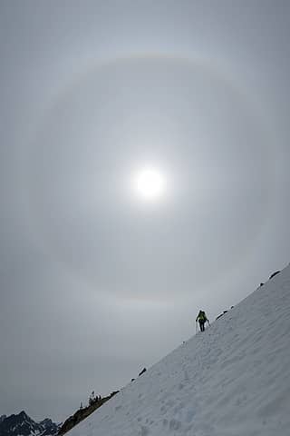 Turning the corner to descend 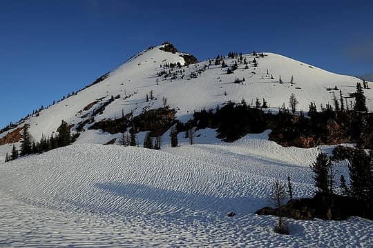 The slope we descended from Hardy to camp (taken later in the evening) 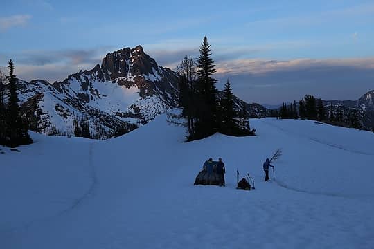 Surprise visitors, with their destination in the background. 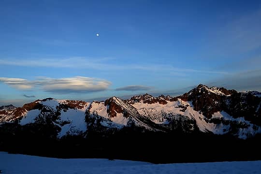 Golden light on Cutthroat & Porcupine, 9:23pm 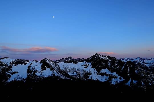 Afterglow above Cutthroat & Porcupine, 9:47pm 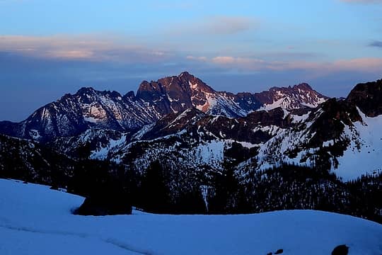 Alpenglow on Silver Star 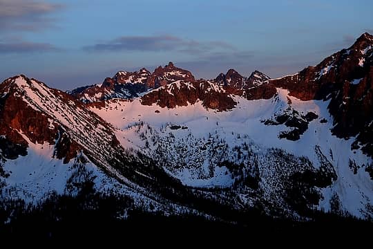 Alpenglow on Cutthroat 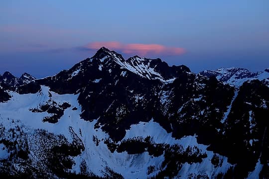 Last red cloud above Black Peak 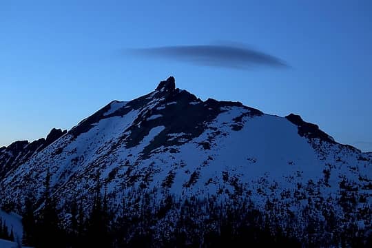 Last gray cloud above Golden Horn 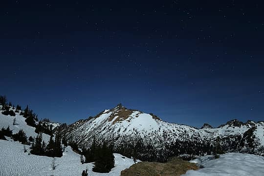 Moonlit Golden Horn 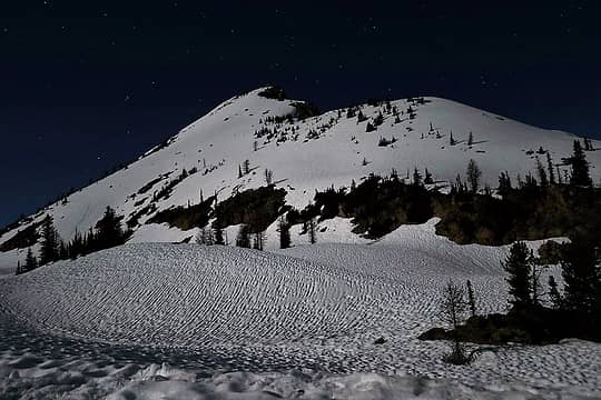 Moonlit Hardy 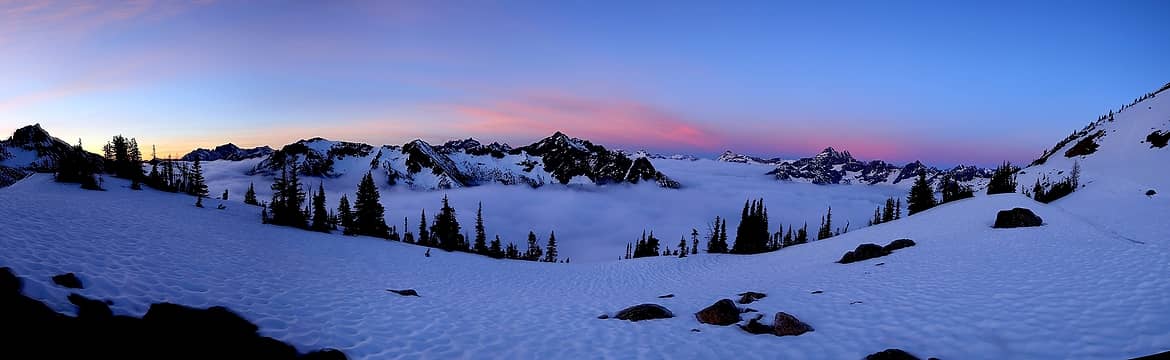 Colors above and clouds below 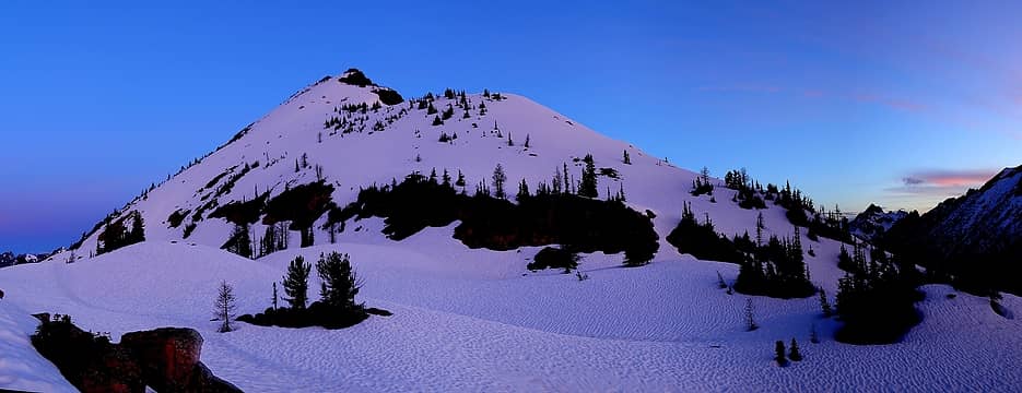 Hardy 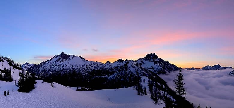 Golden Horn & Tower 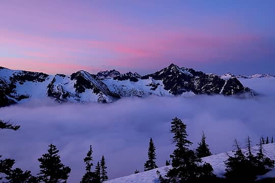 Cutthroat & Porcupine 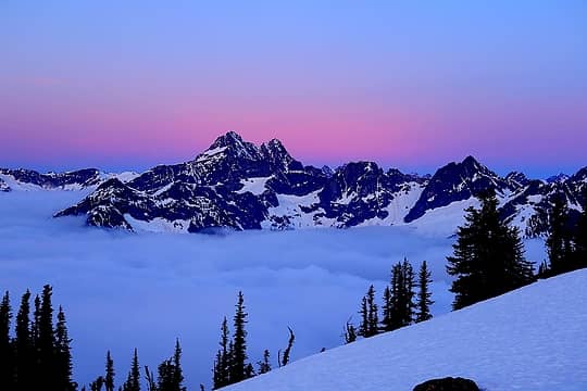 Black Peak before dawn 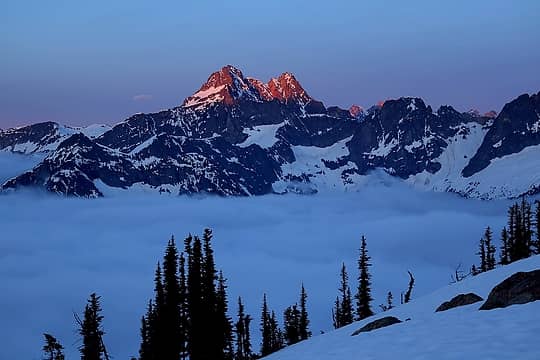 Black Peak alpenglow 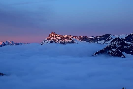 Corteo alpenglow 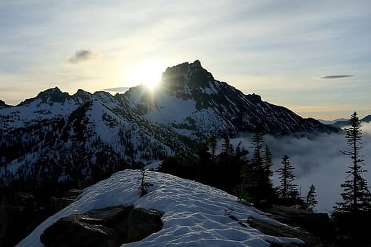 Sunrise burning through the corner of Tower. 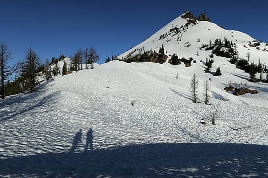 Heading out from camp 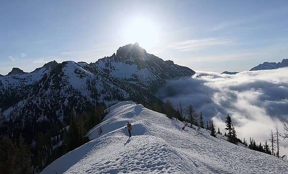 Walking into the light 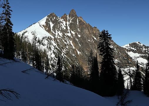 Steep side of Hardy 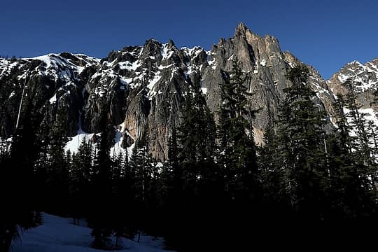 More steepness of Hardy 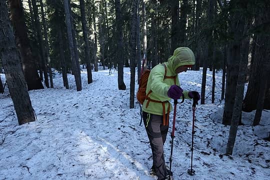 Walking along the snow-covered PCT 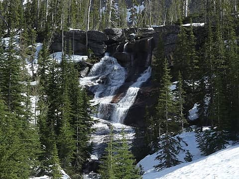 Slab waterfall below Nugget Lakes 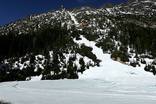 Route up the Holliway gully 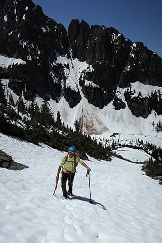 Carla ascending (good thing we didn't need to use that other gully in the background) 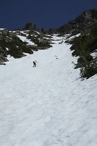 uphill 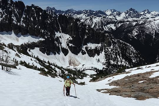 further up 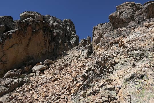 summit is atop the outcrop on the left 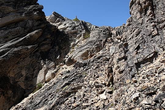 Last corner onto easier terrain at the top  Me near the summit 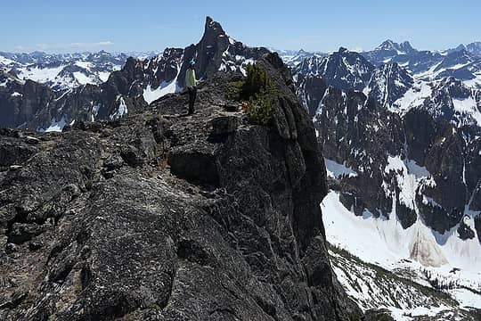 Carla on the break area 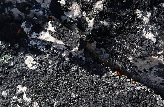 ladybug proof of summit 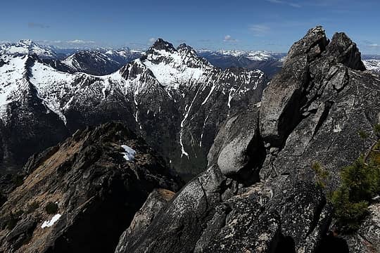 Holliway summit cairn, with Azurite & Ballard 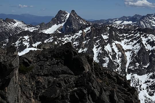 The Needles, looking much less pointy from this angle 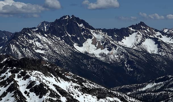 Silver Star & Snagtooth Ridge 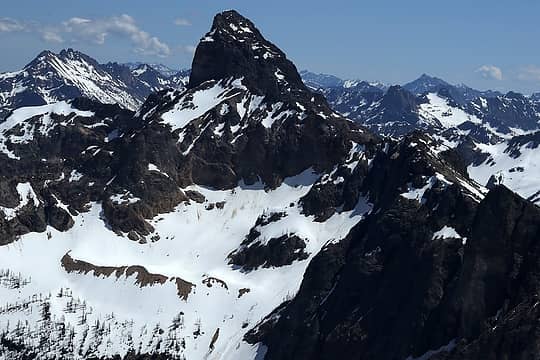 Tower 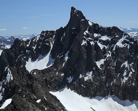 Golden Horn 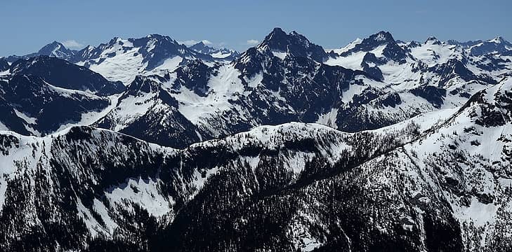 Logan, Easy Pass, & Ragged Ridge 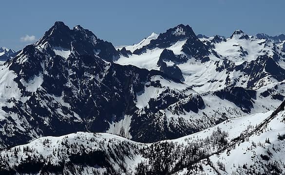 Ragged Ridge 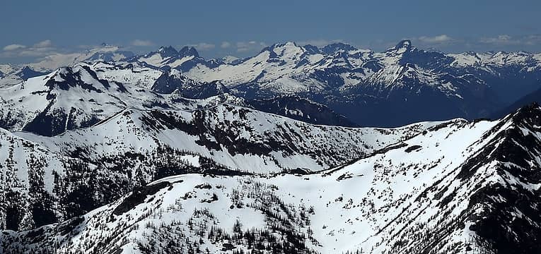 Picket Range 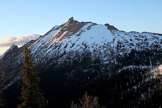 South side of Golden Horn (from Methow Pass camp) 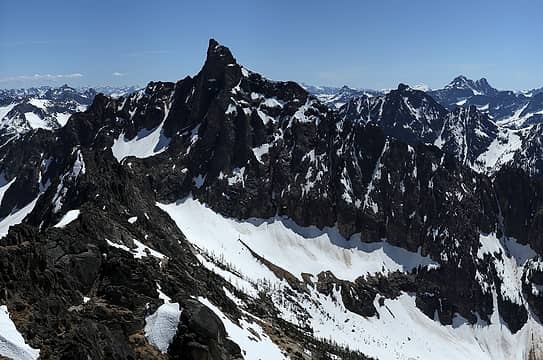 North side of Golden Horn (from Holliway) 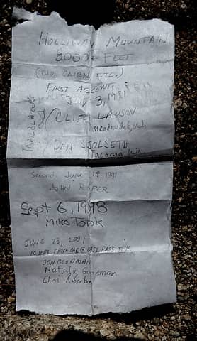 old register, page 1 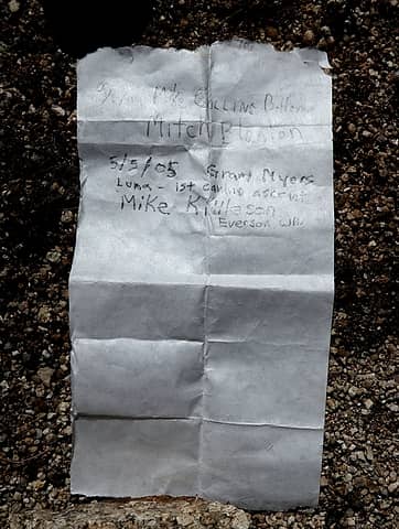 old register, page 2 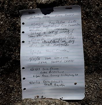 new register 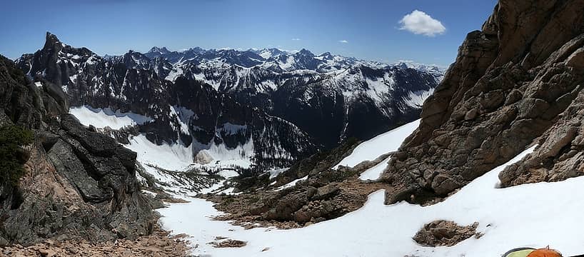 the route back down (with a piece of Carla in the corner) 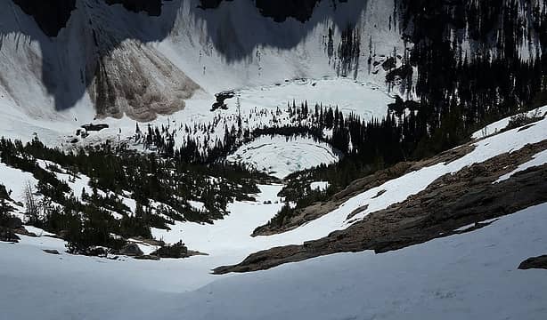 Shadows descending toward Nugget Lakes (I like the upside-down tree shadows) 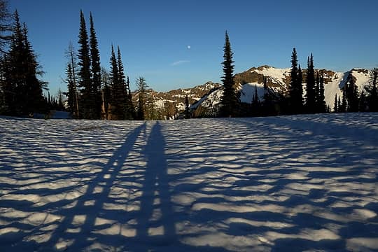 Shadows back at Methow Pass for the moonrise and sunset 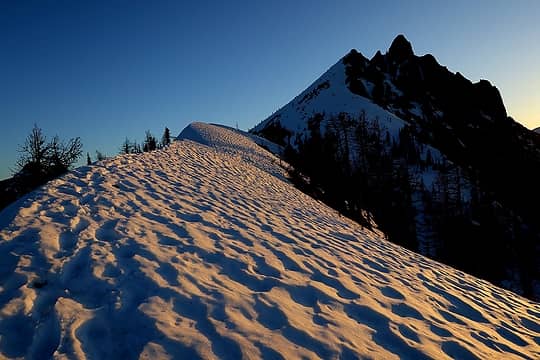 Hiking up toward Hardy 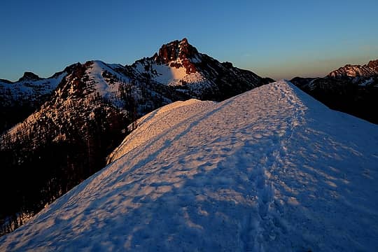 Looking back toward Tower 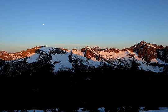 A bit of alpenglow over Porcupine 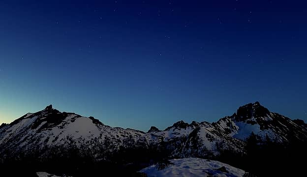 Stars coming out over Golden Horn and Tower 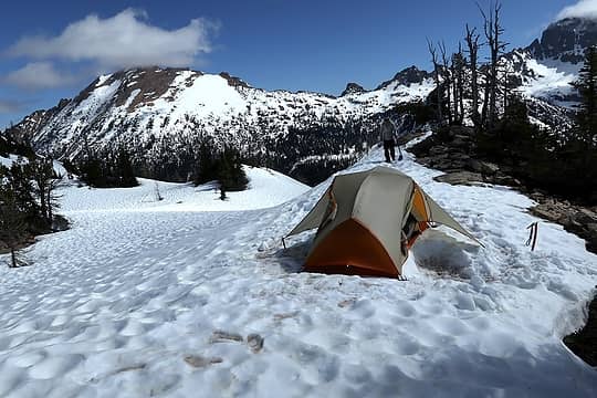 My tent spreading its wings to fly away. 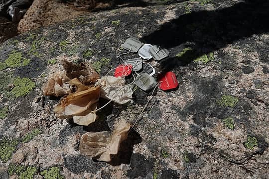 Weekend tea bag collection, 6 for me, 2 for Carla 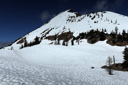 You can see the skiers about to turn the corner just below the x mark. 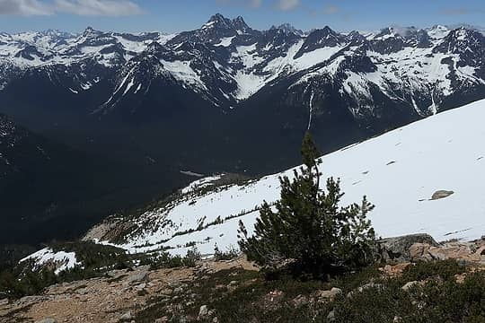 Heading back downslope, with the burn and the parking area visible 3500 feet below. 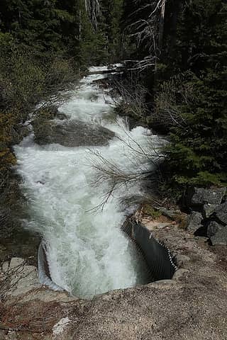 This passage under the highway does not seem safe for pedestrians.
As beacons mountains burned at evening. J.R.R. Tolkien
As beacons mountains burned at evening. J.R.R. Tolkien
|
| Back to top |
  
|
|
RichP
Member

Joined: 13 Jul 2006
Posts: 5634 | TRs | Pics
Location: here |
|
RichP
Member
|
Mon Jun 04, 2018 7:33 am |
|
|
Fantastic trip and report, Matt and Dicey. Those 14-hour days seem to stick in the mind for a long time.  
|
| Back to top |
|
|
Stefan
Member

Joined: 17 Dec 2001
Posts: 5093 | TRs | Pics
|
|
Stefan
Member
|
Mon Jun 04, 2018 9:32 am |
|
|
Always wonderful on the pictures!
|
| Back to top |
|
|
iron
Member

Joined: 10 Aug 2008
Posts: 6392 | TRs | Pics
Location: southeast kootenays |
|
iron
Member
|
Mon Jun 04, 2018 9:54 am |
|
|
|
| Back to top |
|
|
raising3hikers
Member

Joined: 21 Sep 2007
Posts: 2344 | TRs | Pics
Location: Edmonds, Wa |
| Stefan wrote: | | Always wonderful on the pictures! |
I agree
|
| Back to top |
|
|
chandlerhaberlack
chandler haberlack

Joined: 29 May 2018
Posts: 26 | TRs | Pics
Location: Monroe |
strong effort and great report. that looked like a lot of fun!
|
| Back to top |
|
|
GaliWalker
Have camera will use

Joined: 10 Dec 2007
Posts: 4931 | TRs | Pics
Location: Pittsburgh |
|
GaliWalker
Have camera will use
|
Tue Jun 05, 2018 10:38 am |
|
|
| Matt wrote: | Turning the corner to descend Black Peak alpenglow |
Spectacular! 
|
| Back to top |
|
|
BarbE
Member

Joined: 28 Jul 2006
Posts: 1153 | TRs | Pics
|
|
BarbE
Member
|
Tue Jun 05, 2018 12:53 pm |
|
|
Outstanding mountain scenery and photos!
|
| Back to top |
|
|
Distel32
Member
Joined: 03 Jun 2014
Posts: 961 | TRs | Pics
Location: Edmonds, WA |
|
Distel32
Member
|
Tue Jun 05, 2018 1:45 pm |
|
|
|
| Back to top |
|
|
Brushbuffalo
Member

Joined: 17 Sep 2015
Posts: 1887 | TRs | Pics
Location: there earlier, here now, somewhere later... Bellingham in between |
| Matt wrote: | Turning the corner to descend |
I suppose you were like me in seeing this late Saturday halo and thought " oh oh, here comes an unpredicted weather change."
Turned out to be just a stray spell of cirrostratus producing that halo. False alarm.  We were not far away on East Crater.
Passing rocks and trees like they were standing still
Passing rocks and trees like they were standing still
|
| Back to top |
|
|
wildernessed
viewbagger

Joined: 31 Oct 2004
Posts: 9275 | TRs | Pics
Location: Wenatchee |
Living in the Anthropocene
Living in the Anthropocene
|
| Back to top |
|
|
mbravenboer
Member
Joined: 20 Oct 2013
Posts: 1422 | TRs | Pics
Location: Seattle |
Spectacular!
I've been reading up on the east-side lately for sunny options, but the various unknown creek crossings are a bit discouraging. This looks like a nice one without creek complications .
|
| Back to top |
|
|
|
|
You cannot post new topics in this forum
You cannot reply to topics in this forum
You cannot edit your posts in this forum
You cannot delete your posts in this forum
You cannot vote in polls in this forum
|
Disclosure: As an Amazon Associate NWHikers.net earns from qualifying purchases when you use our link(s). |


