| Previous :: Next Topic |
| Author |
Message |
Redwic
Unlisted Free Agent


Joined: 23 Feb 2009
Posts: 3292 | TRs | Pics
Location: Going to the Prom(inence) |
|
Redwic
Unlisted Free Agent
|
 Sat Jul 07, 2018 7:30 pm |
|
|
With time off from work for several days, I looked at several multi-day peakbagging possibilities and decided on Daemon Peak located in the western side of Pasayten Wilderness. Daemon Peak is the unofficial name most recognized for a seldom climbed mountain located northeast of Devils Pass. The peak has 7514 elevation with 2194 clean prominence, good enough to be the 112th-most prominent peak in Washington. With presumed favorable weather and route conditions, as well as the same summit objective, Paul M. joined me for this adventure.
We left the Canyon Creek TH (1900) by 9:00 AM. Knowing that we had all day to get to our intended camp, we took our time to enjoy the weather and scenery. After two creek crossings, we started heading up the heavily switchbacked Jackita Ridge Trail. Within two miles, we passed an official Pasayten Wilderness sign. Within four miles, we took a break at a small stream marking the trail junction with the Crater Mountain Trail (5250). Soon, we were walking through McMillan Park, a mostly forested trek that contained some nice meadows and peek-a-boo views of nearby hills and peaks.
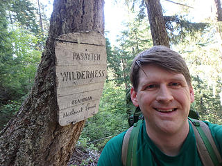 Nice wilderness area (& sign) 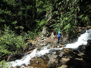 Crossing a stream... 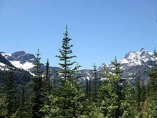 Early peek-a-boo views 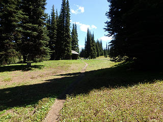 Approaching Devils Park Shelter... 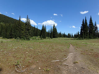 Crossing Devils Park 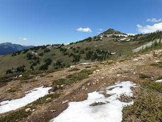 Hiking to the the trail highpoint... 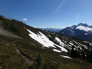 Looking back from trail highpoint... 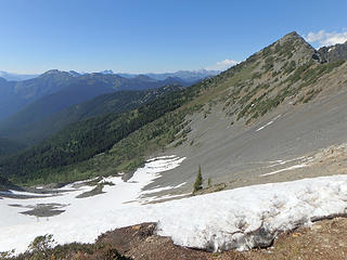 Snowy gully ahead... 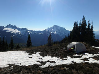 Crater & Jack from camp 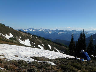 Paul enjoys the campsite views!  Summit day begins! 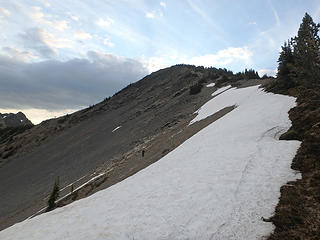 Paul, beyond the snow crux 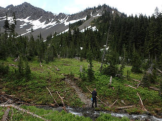 At Middle Fork Devils Creek 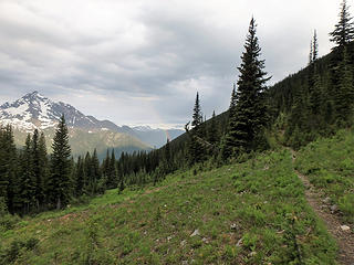 Rainbow near Jack Mountain 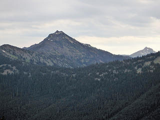 First view of Deamon Peak 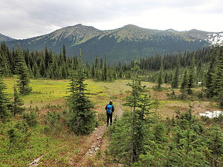 Entering a nice flowery meadow 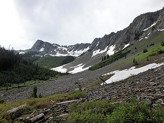 North Fork Devils Creek valley 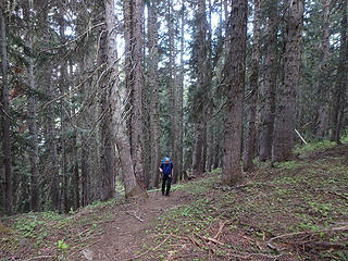 Steep forest trail beyond creek 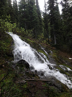 Nice small waterfall 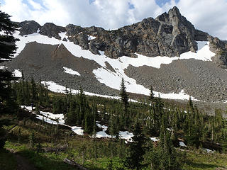 Paul, with Jackita Ridge 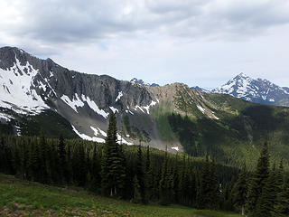 We just went over that ridge! 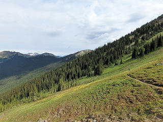 Heading to Devils Pass... 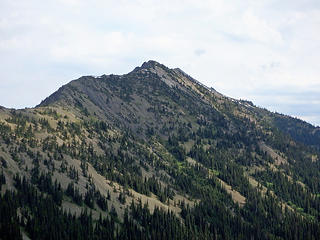 Great view of Daemon Peak 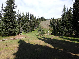 Devils Pass 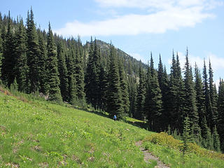 Heading east... 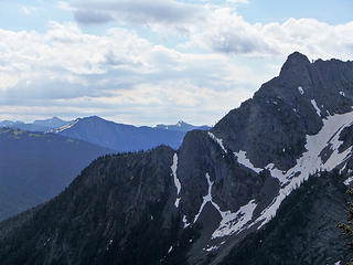 "Slate Peak, in the distance!" 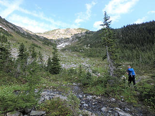 Heading up meadow gully... 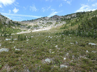 Further up meadow gully... 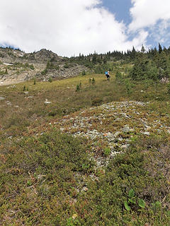 The meadow steepens! 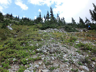 The meadow steepens more! 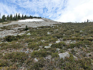 At the south ridge crest... 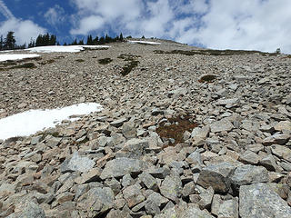 High ridge talus 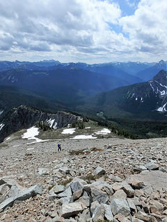 Looking back at Paul on ridge 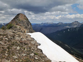 On the summit ridge  The final summit hill (Class 2) 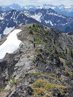 Looking at Paul on summit ridge 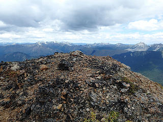 Daemon Peak summit 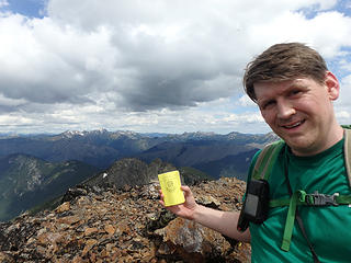 Daemon Peak summit register 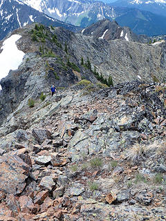 Paul, nearing the summit... 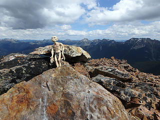 "My precious!" 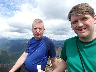 Team summit photo 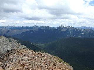 Great views! (This is looking east) 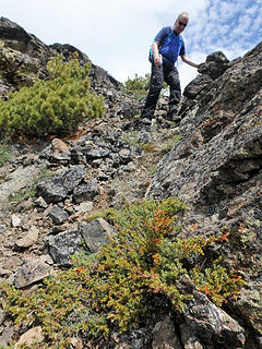 "Crux" section of summit hill 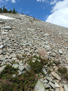 Paul, descending steep talus 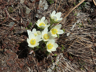 Nice flower cluster! 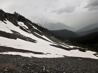 Storm moving in fast! 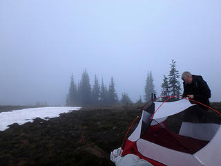 The next morning (no views!) 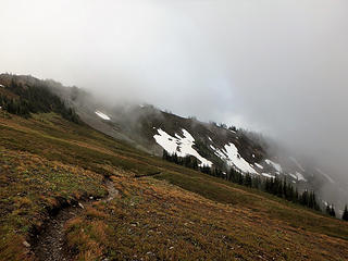 Leave before next storm...
60 pounds lighter but not 60 points brighter.
60 pounds lighter but not 60 points brighter.
|
| Back to top |
  
|
|
Paul M
Member

Joined: 15 Jul 2008
Posts: 371 | TRs | Pics
|
|
Paul M
Member
|
Sat Jul 07, 2018 7:40 pm |
|
|
Thx for suggesting this great trip Craig. The views were outstanding as the pictures show and the terrain varied and beautiful. I especially liked the fact there was still snow in places as we never really had an issue with water anywhere on the trip.
It was good to get this P2K peak also, given the weather window we had Friday. It sure rained hard all that night!
ps. I have to tell you that I may not be able to share a tent, trail or even Wilderness Area with you again if you insist on taking that hideous Lasagna With Meat Sauce Frozen dinner again......... if you catch my drift  Some of my pictures follow:
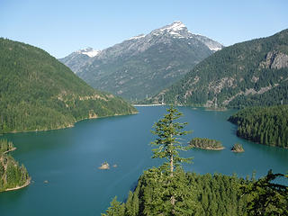 Diablo Lake and Davis Peak 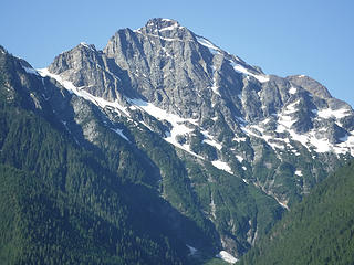 Colonial Peak 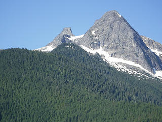 Pyramid Peak and Paul Bunyans Stump 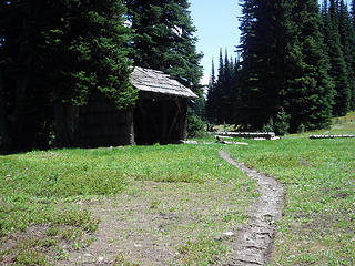 Devils Park Shelter 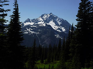 Jack Mountain from Devils Park 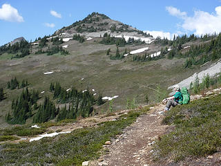 Nearing our ridge camp on Jakita Ridge 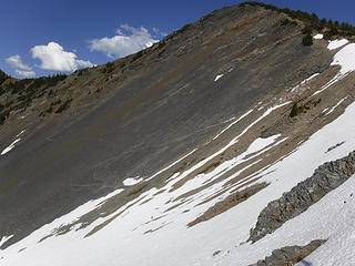 Snow descent at ridge camp 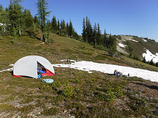 Ridge camp at 6700 ft 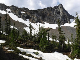 Trail below Anacortes Crossing 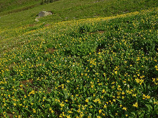 Sea of flowers 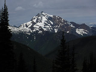 Ever Present Jack Mountain from Jakita Ridge Trail 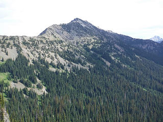 Daemon Peak from Devils Pass 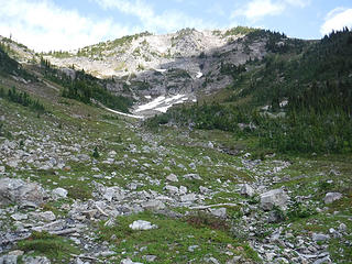 South basin below Daemon Peak 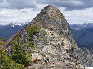 Summit scramble 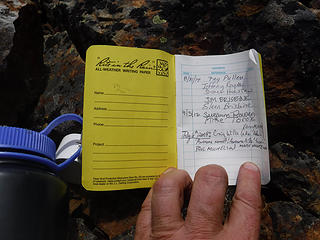 Dameon Peak register 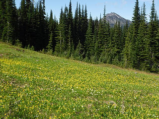 Some final views of Daemon Peak on hack back to camp 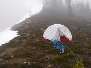 Packing up after an all night rain 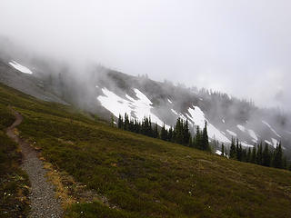 Morning hike out 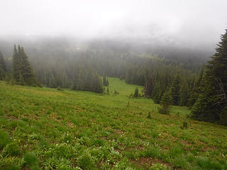 Descending back down to Devils Park in the mist
|
| Back to top |
|
|
Redwic
Unlisted Free Agent
Joined: 23 Feb 2009
Posts: 3292 | TRs | Pics
Location: Going to the Prom(inence) |
|
Redwic
Unlisted Free Agent
|
Sat Jul 07, 2018 7:42 pm |
|
|
| Paul M wrote: | | if you catch my drift |
You certainly caught mine! 
| Paul M wrote: | Summit scramble |
Nice photo! At first, I did not notice me in the center of it. This photo gives great perspective for size of the summit hill.
60 pounds lighter but not 60 points brighter.
60 pounds lighter but not 60 points brighter.
|
| Back to top |
|
|
RichP
Member

Joined: 13 Jul 2006
Posts: 5634 | TRs | Pics
Location: here |
|
RichP
Member
|
Sun Jul 08, 2018 7:52 am |
|
|
Nice remote summit. I like it. 
|
| Back to top |
|
|
Brushbuffalo
Member

Joined: 17 Sep 2015
Posts: 1887 | TRs | Pics
Location: there earlier, here now, somewhere later... Bellingham in between |
Passing rocks and trees like they were standing still
|
| Back to top |
|
|
Redwic
Unlisted Free Agent
Joined: 23 Feb 2009
Posts: 3292 | TRs | Pics
Location: Going to the Prom(inence) |
|
Redwic
Unlisted Free Agent
|
Mon Jul 09, 2018 4:42 pm |
|
|
| Brushbuffalo wrote: | | Had the trees across the first few miles of trail been cut yet, Craig? |
No. It would not take much effort to cut those downed trees, either. And they are primarily within the first two miles, not far in the wilderness area.
60 pounds lighter but not 60 points brighter.
60 pounds lighter but not 60 points brighter.
|
| Back to top |
|
|
Brushbuffalo
Member
Joined: 17 Sep 2015
Posts: 1887 | TRs | Pics
Location: there earlier, here now, somewhere later... Bellingham in between |
When we hiked out on May 30 the WTA crew was just starting the sawing. When asked I informed them that nearly all of downed trees were outside the wilderness boundary. I learned that WTA doesn't use chain saws, apparently ever.
Interesting.
Passing rocks and trees like they were standing still
Passing rocks and trees like they were standing still
|
| Back to top |
|
|
|
|
You cannot post new topics in this forum
You cannot reply to topics in this forum
You cannot edit your posts in this forum
You cannot delete your posts in this forum
You cannot vote in polls in this forum
|
Disclosure: As an Amazon Associate NWHikers.net earns from qualifying purchases when you use our link(s). |


