| Previous :: Next Topic |
| Author |
Message |
Gimpilator
infinity/21M


Joined: 12 Oct 2006
Posts: 1688 | TRs | Pics
Location: Edmonds, WA |
What sort of person goes to the Caribbean and doesnt set foot on a beach? This was a 6 day trip with 3 travel days and 3 hiking days. I began in Jamaica.
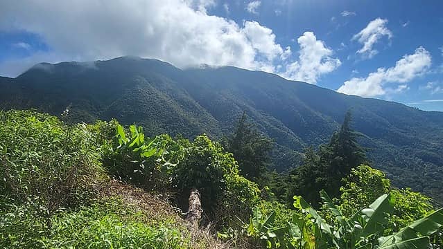
10-29
Blue Mountain Peak 7402
The highest peak in Jamaica is famous for growing what is widely accepted as the best coffee in the world. The coffee is expensive and most people in the states have never tasted it. I hired a local company, Tropical Trips Jamaica, to take care of all the logistics for me. (Cheryl +1-809-974-0036)
The road to the trailhead is very rough and not recommended for rental vehicles. I started the hike at 5am with a local guide. He slowed me down, but was interesting to talk to and I enjoyed the conversation for the first hour. He wouldnt let me lead until after the sun came up, for safety.
There was a little bit of rain near the top, but not bad. Sort of warm, even at elevation. For the 2nd hour I took the lead and the guide started to fall behind. There are two summits, with a lower bump in between. Its a nice trail, pleasantly constructed and easy on the feet.
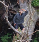
 Blue 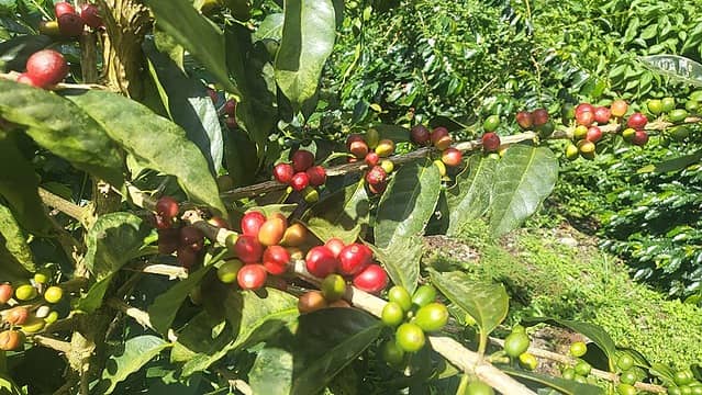 coffee 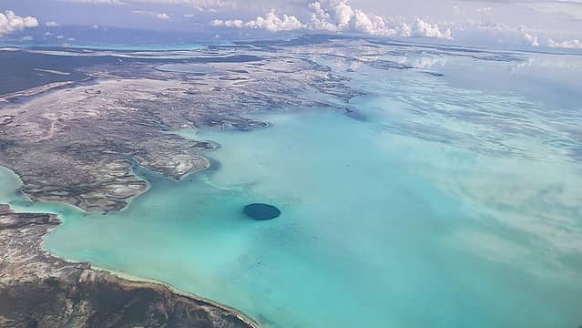 The Middle Caicos Blue Hole is likely the widest ocean hole on earth (seen during flight)  paella in Boca Chica including 2 lobsters  I found my happy place 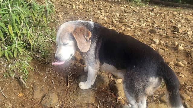 Perro Loco 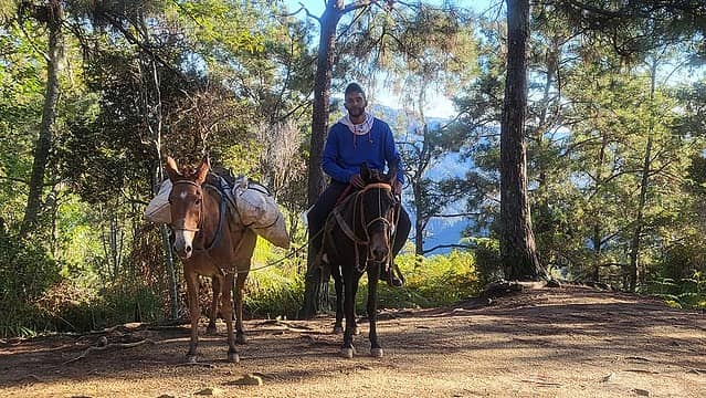 Luis  Yaque summit 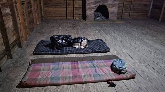 spartan accommodations 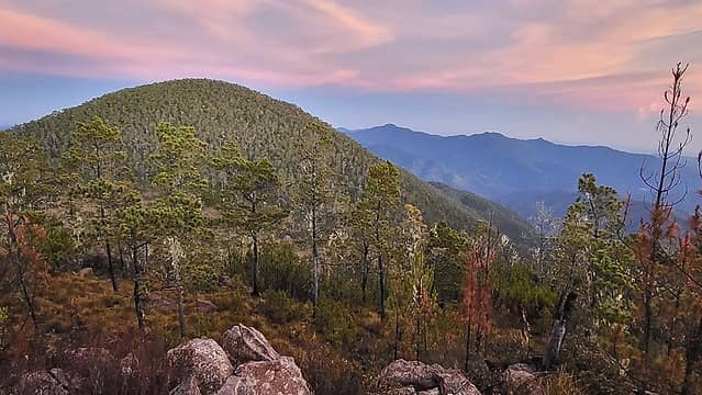 Pelona 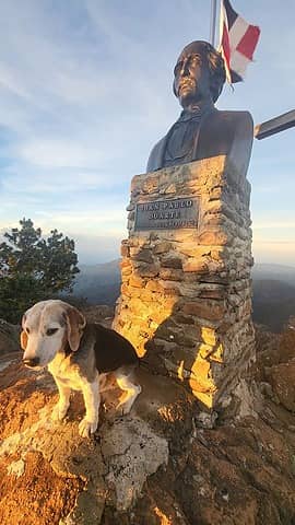 Perro Loco 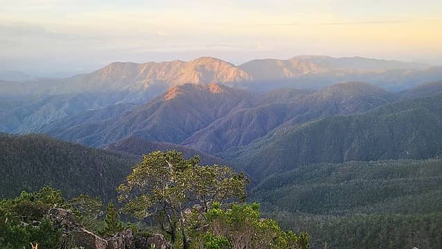 a view towards Haiti 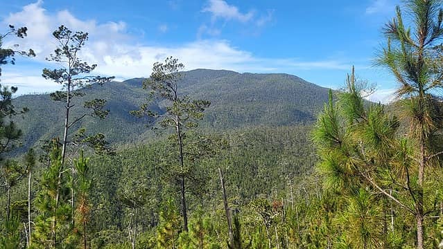 Duarte
Summitpost | YouTube | Peakbagger
 tekewin, geyer, SeanSullivan86, kite, Eric Hansen, zimmertr, Now I Fly, awilsondc, reststep, RichP, rubywrangler tekewin, geyer, SeanSullivan86, kite, Eric Hansen, zimmertr, Now I Fly, awilsondc, reststep, RichP, rubywrangler
Summitpost | YouTube | Peakbagger
tekewin, geyer, SeanSullivan86, kite, Eric Hansen, zimmertr, Now I Fly, awilsondc, reststep, RichP, rubywrangler
|
| Back to top |
  
|
|
raising3hikers
Member

Joined: 21 Sep 2007
Posts: 2345 | TRs | Pics
Location: Edmonds, Wa |
Good stuff, Adam. Congrats on the new record of 2000m prominent pks in a year
|
| Back to top |
|
|
awilsondc
Member

Joined: 03 Apr 2016
Posts: 1328 | TRs | Pics
|
International peak bagging sure seems complicated! Nice trip though, and congrats on the record... That's pretty crazy, especially considering that WA only has 4 such peaks! Well done! 
|
| Back to top |
|
|
Route Loser
Member
Joined: 24 Jul 2012
Posts: 199 | TRs | Pics
Location: Whidbey Island |
You have really been getting around to some nice places.
I'd take the Mount Agung coffee over the Blue Mountain myself.
|
| Back to top |
|
|
Stefan
Member

Joined: 17 Dec 2001
Posts: 5095 | TRs | Pics
|
|
Stefan
Member
|
 Mon Nov 06, 2023 10:05 am |
|
|
|
| Back to top |
|
|
crock
Member
Joined: 14 Aug 2004
Posts: 103 | TRs | Pics
Location: Newcastle |
|
crock
Member
|
Mon Nov 06, 2023 3:07 pm |
|
|
Gimpilator - From the village of La Cienaga de Manaba, there's a sign saying 426.2 km (28.7 miles), 2380m (7,810') round trip to Pico Duarte https://peakbaggerblobs.blob.core.windows.net/pbphoto/p2303L.jpg. According to Caltopo, it looks like the distance is 25.8 mile and 10,170' of vertical. Your suggested shortcut might cut off 1.4 miles and 60'.
For someone in reasonable shape, is it feasible to do Pico Duarte in a day going solo? I did the 31.2 miles 6,800' Loowit Trail this summer and 30.0 miles 7,320' White Pass to Walupt Lake last summer (throwing in a little sidetrip up Old Snowy Mtn). However, those trails were probably in better shape and faster. Plus there's more oxygen at Old Snowy's 7,900' summit and the 4,900' high point on the Loowit Trail than there is at 10,000' on Pico Duarte.
|
| Back to top |
|
|
Gimpilator
infinity/21M
Joined: 12 Oct 2006
Posts: 1688 | TRs | Pics
Location: Edmonds, WA |
Thanks Eric, Aaron and Stefan!
| Route Loser wrote: | | I'd take the Mount Agung coffee over the Blue Mountain myself. |
Yeah the Blue is good, but not my favorite. I actually prefer Yirgacheffe from Ethiopia, which I roast myself in a frying pan.
| crock wrote: | | For someone in reasonable shape, is it feasible to do Pico Duarte in a day going solo? I did the 31.2 miles 6,800' Loowit Trail this summer and 30.0 miles 7,320' White Pass to Walupt Lake last summer (throwing in a little sidetrip up Old Snowy Mtn). However, those trails were probably in better shape and faster. |
Yes, I think it would be possible. It might require a bit of at-night travel. Also the resident ranger at La Comparticion has a couple stray dogs he feeds. They were not very prone to barking when I was there, however if you are attempting the ascent without official permission, then you might exercise special care in this area. I would suggest staying far left (downhill side).
It's a long way to travel there and therefore a lot on the line, so I can't totally endorse tressbagging this peak, but if someone wanted to try it, that would be the best info I can offer. Also, if you were unlucky enough to run into a guided group, hypothetically the leaders of that group might want to check your wrist for a certain permit band...
|
| Back to top |
|
|
Route Loser
Member
Joined: 24 Jul 2012
Posts: 199 | TRs | Pics
Location: Whidbey Island |
| Gimpilator wrote: | | I actually prefer Yirgacheffe from Ethiopia, which I roast myself in a frying pan. |
Hand-roasted, I like it; very traditional. I enjoy roasting a few fruit bombs at home myself.
I bet you could pick up a few peaks in the Bale Mountains to further the coffee and climbing tour.
Looks like you were in Bali at the beginning of the harvest season. It's fascinating to see all of the small family farm producers wet-hulling at roadside in a few plastic tubs and setting the coffee out for a truck to come round and collect.
|
| Back to top |
|
|
Sky Hiker
Member
Joined: 03 Feb 2007
Posts: 1475 | TRs | Pics
Location: outside |
Interesting pictures and area.
Gimpilator
Gimpilator |
| Back to top |
|
|
|
|
You cannot post new topics in this forum
You cannot reply to topics in this forum
You cannot edit your posts in this forum
You cannot delete your posts in this forum
You cannot vote in polls in this forum
|
Disclosure: As an Amazon Associate NWHikers.net earns from qualifying purchases when you use our link(s). |


