Forum Index > Trip Reports > Mount Catherine [Dec 20, 2023]
 Reply to topic
Previous :: Next Topic
Author Message
jsb
Member
Member


Joined: 05 May 2023
Posts: 22 | TRs | Pics
Location: Seattle, WA, USA
jsb
Member
PostFri Dec 22, 2023 7:05 am 
Third times a charm. Back in February, I made two solo attempts to summit Mount Catherine via its west ridge. On my first attempt, I made it up onto the ridge, but was unable to find the summit trail and turned around due to a combination of time, weather, and fatigue. On my second attempt, I tried to squeeze the summit push into a half day, but simply couldn't cover ground fast enough along the Nordic Pass trail and turned around at Windy Pass. This past Wednesday, we had some great weather in the central Cascades, so I convinced my dad and cousin to head back up to Snoqualmie Pass to take another crack at Catherine. We left the Silver Fir parking lot on snowshoes right around 8:30am. Without fresh snow in over a week, the trail along Hyak Creek was compacted and icy. I almost wish I brought earplugs to drown out the deafening steps over crusty snow. We made it up to Hyak Lake in about an hour, and continued along the east edge of the lake - what the map shows as the Nordic Pass trail. We connected into FS 9070 at (47.39092, -121.42270), hiked along the nordic trails for a bit, then left the ski trail system to get back onto the Nordic Pass trail at (47.38714, -121.42759). This next section turned out to be the slowest / most frustrating bit of the day. We definitely weren't on an established trail, had no trail markers to follow, and ended up zig-zagging around for about a half hour until we were back on the trail.
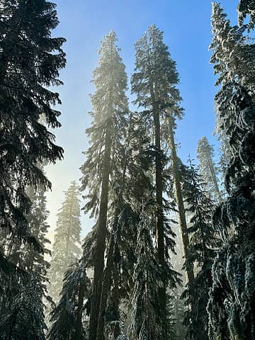
bluebird day in the woods
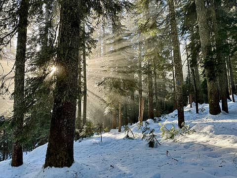
rays of light shining through in the meadow northwest of mount catherine
Once we were back on the Nordic Pass trail, we were able to follow the highway of blue diamond trail makers nailed high on the trees. It took us about an hour to make it to the SNOTEL station at Windy Pass. (Fun fact that I learned on the drive home - these stations don't use satellite comms. Instead, they bounce VHF radio signals off a band of ionized meteors up in space. Wild.)
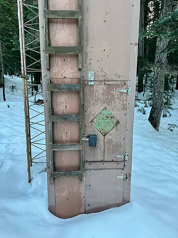
snotel station at windy pass
At this point, it's all about finding the easiest, lowest-angle path to get up onto the west ridge of Mount Catherine and onto the summer trail. I pulled up some old TRs and GPS tracks from peakbagger and resolved to traverse right along the King/Kittitas county line. If you're able to overlay slope angle / shading, there is a pretty clear break in the angle as you move southeast to gain the ridge. Once we were on the ridge line, it was smooth sailing. Looked as though there were a few parties up there within the last few weeks, but hard to tell with the limited amount of new snow. The summit views were outstanding - especially with the inversion layer sitting over Keechelus Lake to the east. With warm temps and no wind, we spent close to an hour up there enjoying the scenery and boiling a couple batches of water - one for hot chocolate and one for some bone broth that had been sitting in my trail snacks bag for way too long.
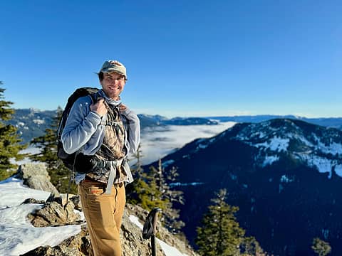
cousin on the summit
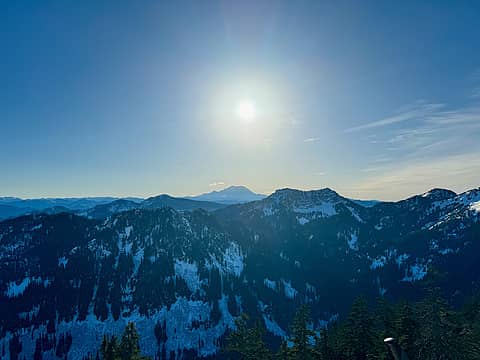
rainier
rainier
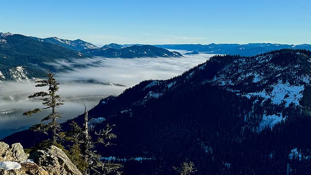
inversion layer over keechelus lake
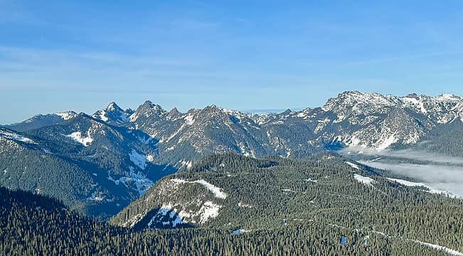
the alpine lakes wilderness peaks surround alpental
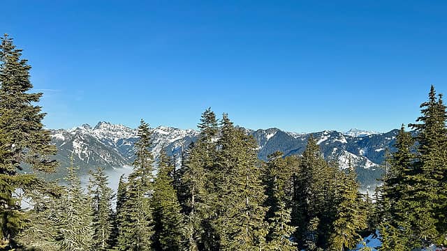
alpine lakes wilderness looking northeast (including stuart off in the distance)
We left the summit at 2pm, narrowly avoided disaster when my dad took a face first fall on the steep off-trail downhill between the ridge and Windy Pass. Given the fact that we were running out of daylight, we took a slightly different route to connect back into the nordic trails at (47.38710, -121.43458). From there, we slogged along the ski trails, including Outback of Summit Central, all the way back to the Silver Fir parking lot. Sad to see how rough the ski hill is this late in the season.
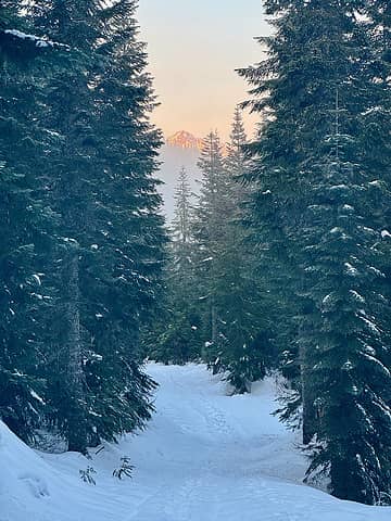
alpenglow while hiking down along the ski trails
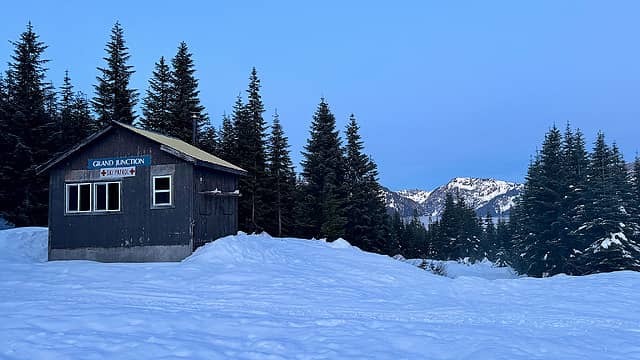
grand junction warming hut at the end of the day
All in all - a great adventure in the woods with the family! ----------- first attempt: https://www.gaiagps.com/datasummary/track/01eb0cac39f82a6f02d9e2d0efc56ff9 second attempt: https://www.gaiagps.com/datasummary/track/6f76638b4ea3c6ef5c238bd7cc8f68e8 this trip: https://www.gaiagps.com/datasummary/track/e66ffd550305798f59f9dfecf84bca34

Fedor, Comma, IanB, some names, day_hike_mike, KascadeFlat, NWtrax, RichP, John Mac, Now I Fly, awilsondc
Back to top Reply to topic Reply with quote Send private message
   All times are GMT - 8 Hours
 Reply to topic
Forum Index > Trip Reports > Mount Catherine [Dec 20, 2023]
  Happy Birthday MFreeman!
Jump to:   
Search this topic:

You cannot post new topics in this forum
You cannot reply to topics in this forum
You cannot edit your posts in this forum
You cannot delete your posts in this forum
You cannot vote in polls in this forum