| Previous :: Next Topic |
| Author |
Message |
Matt
Tea, Earl Grey, Hot


Joined: 30 Jan 2007
Posts: 4308 | TRs | Pics
Location: Shoreline |
|
Matt
Tea, Earl Grey, Hot
|
 Sun Feb 24, 2008 2:48 pm |
|
|
I thought this trip would be a fairly straightforward travel up through trees and logging roads, but not much of a view on the relatively low summit (3824 feet). Wrong on both counts!
The hike up gave us an experience of all the ways that forest can obstruct or benefit travel, especially when its been logged:
- terrible slash in the clearcuts unpredictable deep postholing.
- pesky downed junk on side slopes getting away from the clearcuts slippery treading over and under the trunks.
- nice tall straight young trees on the higher slopes easy marching uphill.
- thick crowded small snowy trees below the crest winding and pushing through crowded branches showering us with snow.
- gorgeous tall trees crowning the crest brought almost to a standstill to admire and photograph them.
But the summit is positioned at the junction of two drainages with great views in several directions:
- west along the Stillaguamish to all of the Whitehorse area peaks
- and along the Sauk north way up into the North Cascades south down to the Mountain Loop peaks.
A week ago, Justus followed the south ridge to the summit, using logging roads at the base and cutting the switchbacks where needed. In hindsight, that seems the best route and its basically the route we followed down. Unfortunately, foresight was not so wise, and we took a different route up.
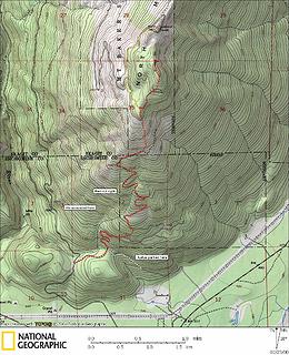 North Mountain Trip Map 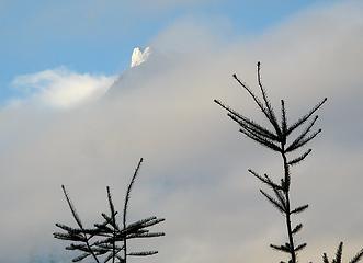 First Tip of Whitehorse 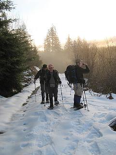 Walking the road at sunrise 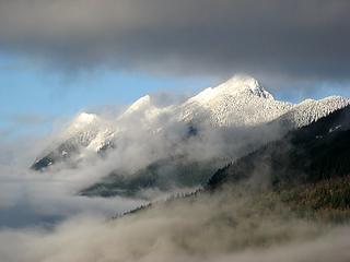 Higgins among the clouds  Jumbo among the clouds 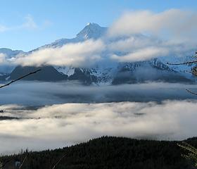 Whitehorse above the clouds 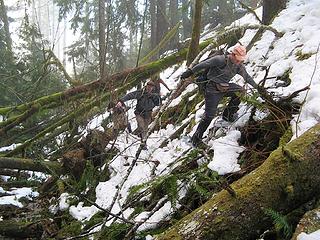 Evil Trees for hiking 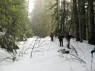 On the road again 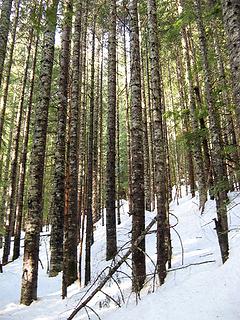 Good Trees for hiking 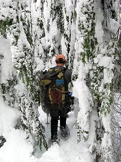 Bad Trees for hiking 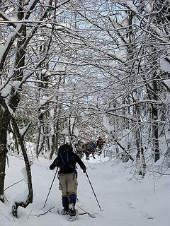 On the road for the third time 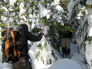 Dense trees near the crest 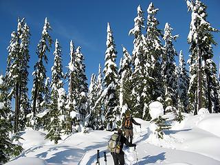 Arriving at big beautiful open trees 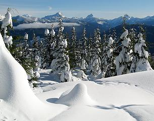 Glacier, Whitechuck, Pugh, Bedal/Sloan 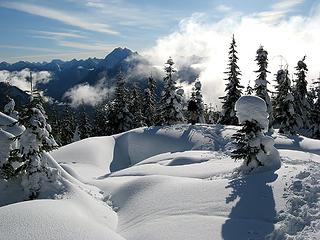 Jumbo Revealed, Whitehorse Hiding 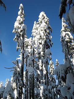 Tall Snowy Trees 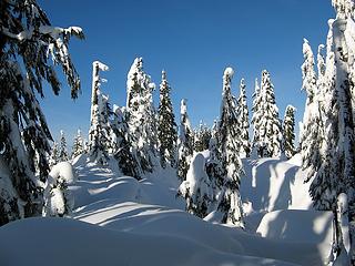 Fairytale Forest 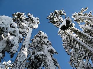 Snow-plastered Giants 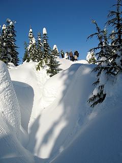 Arriving at the summit, past deeply trenched outcrops 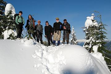 Summit group: Suzanne, Lynn, Mike, Lori, Richard 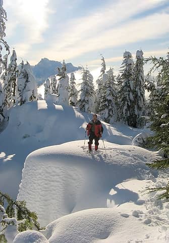 Matt near the summit, with Whitehorse 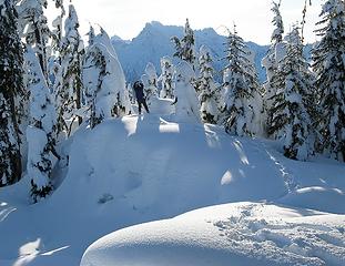 Mike getting a photo of Whitehorse 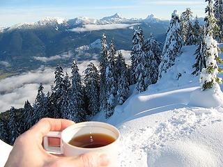 Summit teas with Sauk Valley, Whitechuck, etc. 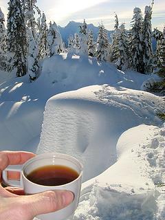 Summit tea with summit blocks & Whitehorse 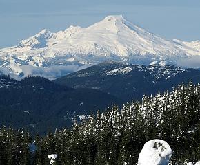 Baker 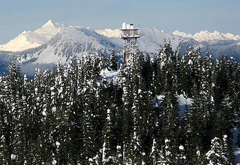 Lookout & Shuksan 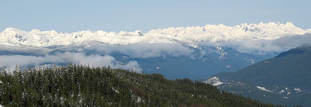 Lots of Pickets 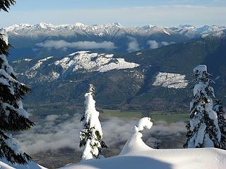 Sauk Valley 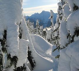 Whitehorse through the branches 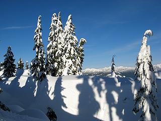 Sentinels & Shadows 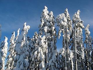 Tall sugar-plum trees 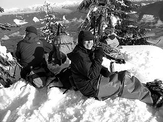 Relaxing on the summit 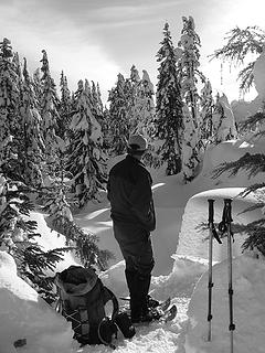 Considering the route to the lookout 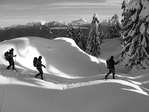 Leaving the summit 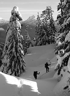 Heading down 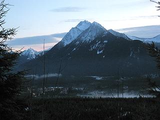 Lights of Darrington 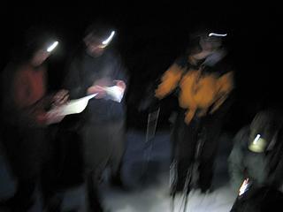 Nighttime Navigation
As beacons mountains burned at evening. J.R.R. Tolkien
As beacons mountains burned at evening. J.R.R. Tolkien
|
| Back to top |
  
|
|
wildernessed
viewbagger

Joined: 31 Oct 2004
Posts: 9275 | TRs | Pics
Location: Wenatchee |
Good Stuff ! 
Living in the Anthropocene
Living in the Anthropocene
|
| Back to top |
|
|
Justus S.
Member

Joined: 17 Nov 2004
Posts: 1298 | TRs | Pics
Location: WA |
Very cool Matt, thanks for the TR. It is very nice to see pictures of what it looks like on a nice day.  I think the summit area is quite interesting. Decsending in the dark on this one is something I was glad not to have had to do. Looks like you guys had a good trip though. I think the summit area is quite interesting. Decsending in the dark on this one is something I was glad not to have had to do. Looks like you guys had a good trip though.
|
| Back to top |
|
|
Sabahsboy
Member

Joined: 18 Jul 2006
Posts: 2484 | TRs | Pics
Location: SW Sno County |
Terrific! The description relates an exhausting tale of ascent; the photos describe rough route and sublime summit. Many thanks to all for executing such a spectacular snow hike and extracting beautiful images to share.
|
| Back to top |
|
|
Hiker Mama
Member

Joined: 25 Jun 2006
Posts: 3451 | TRs | Pics
Location: Lynnwood |
Wow!!!  That looks fabulous. Thanks for the wonderful pictures and the interesting writeup. That looks fabulous. Thanks for the wonderful pictures and the interesting writeup.
|
| Back to top |
|
|
Matt
Tea, Earl Grey, Hot
Joined: 30 Jan 2007
Posts: 4308 | TRs | Pics
Location: Shoreline |
|
Matt
Tea, Earl Grey, Hot
|
Wed Feb 27, 2008 11:24 pm |
|
|
Apparently some people in the group want to get rid of me, or maybe they just get tired of me asking them to take photos. Observe:
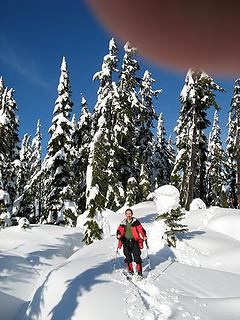 Giant hiker's thumb ready to smash Matt 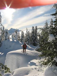 Giant hiker's hand ready to smash Matt
As beacons mountains burned at evening. J.R.R. Tolkien
As beacons mountains burned at evening. J.R.R. Tolkien
|
| Back to top |
|
|
Suzanne
Member
Joined: 18 Feb 2008
Posts: 6 | TRs | Pics
|
|
Suzanne
Member
|
Thu Feb 28, 2008 12:10 am |
|
|
ahh geez, matt, i am as bad a photographer as i feared....sorry to ruin such a nice shot!
|
| Back to top |
|
|
peltoms
Member

Joined: 13 Jul 2006
Posts: 1760 | TRs | Pics
Location: Worcester MA |
|
peltoms
Member
|
Thu Feb 28, 2008 5:47 am |
|
|
That fairytale forest is great. What about a transcript of the conversation around the map-GPS by headlamp?
|
| Back to top |
|
|
EastKing
Surfing and Hiking

Joined: 28 Mar 2007
Posts: 2082 | TRs | Pics
Location: 77 miles from Seattle! |
|
EastKing
Surfing and Hiking
|
Sun Mar 02, 2008 2:28 am North Mtn
|
|
|
Fabulous Pics!!!!!
YouTube | SummitPost
Saw the depths of despair. Now I am salvaging what time I have left on Earth.
YouTube | SummitPost
Saw the depths of despair. Now I am salvaging what time I have left on Earth.
|
| Back to top |
|
|
|
|
You cannot post new topics in this forum
You cannot reply to topics in this forum
You cannot edit your posts in this forum
You cannot delete your posts in this forum
You cannot vote in polls in this forum
|
Disclosure: As an Amazon Associate NWHikers.net earns from qualifying purchases when you use our link(s). |


