| Previous :: Next Topic |
| Author |
Message |
The Angry Hiker
SAR Blacklistee


Joined: 13 Jun 2008
Posts: 2890 | TRs | Pics
Location: Kentwila |
The great thing about decommissioned logging roads is that they're relatively easy and inexpensive to turn into hiking trails.
Why? BECAUSE THEY'RE TRAILS ALREADY!!!
You simply close the road to vehicles, put up a sign at the trailhead, and you've got yourself another I-90 poop receptacle.
Case in point:
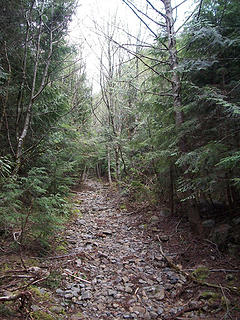 Dirty Harry's Peak 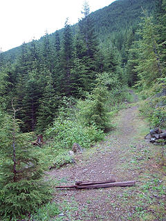 Mt. Washington 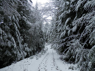 Teneriffe 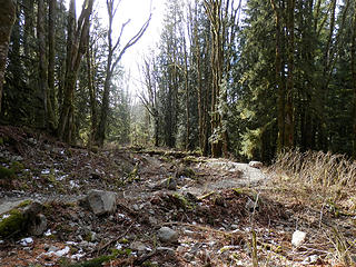 NICE 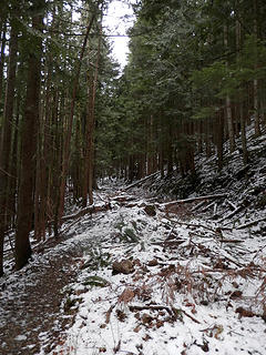 JOB 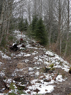 Is this really necessary? 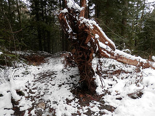 Very Natural 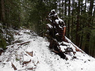 Yeah, that's convincing 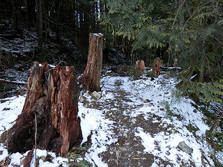 Stump slalom 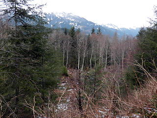 Phoney Baloney View 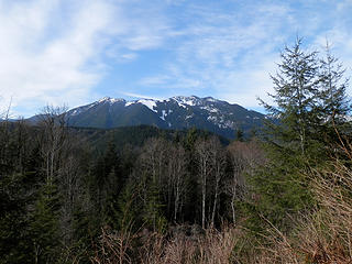 Phony Baloney View 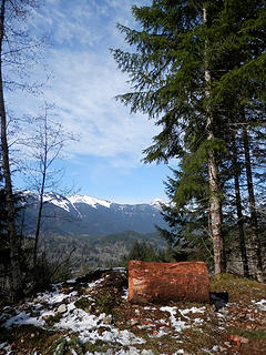 Another Phoney Bloney View 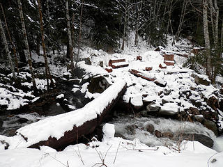 Idiotic Bridge 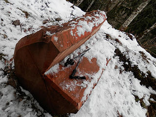 Patio Furniture 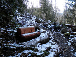 Patio Furniture on Granite Lakes Trail 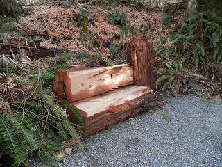 Patio Furniture on Granite Lakes Trail 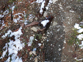 Driftwood brought in from Alki Beach 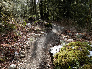 Carefully placed mossy rocks 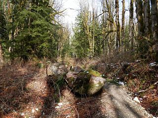 Strategically placed boulders 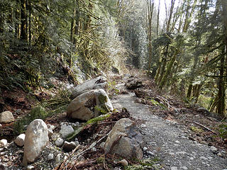 Strategically placed boulders 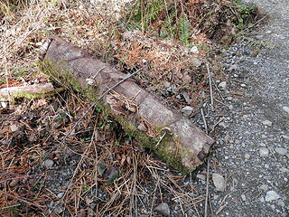 Thomas Kincade called...he wants his strategically placed mushroom log back! 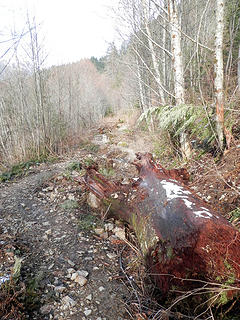 Oh, I guess I'll just go around this log that somehow magically found its way here 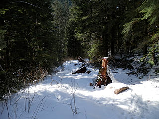 Granite Lakes 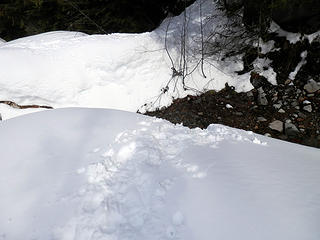 Granite Lakes 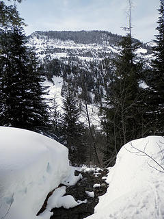 Granite Lakes 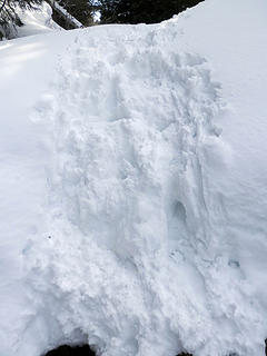 Granite Lakes 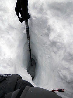 World Record Post-Hole  Please Mr. Angry Hiker!  Save me from these sh*tty trail improvements!  Granite Lakes Trail
|
| Back to top |
  
|
|
Foist
Sultan of Sweat

Joined: 08 May 2006
Posts: 3974 | TRs | Pics
Location: Back! |
|
Foist
Sultan of Sweat
|
 Wed Mar 27, 2013 6:41 pm |
|
|
  What a totally ridiculous waste. What a totally ridiculous waste.
|
| Back to top |
|
|
patrickb87
hello internet

Joined: 07 Feb 2013
Posts: 75 | TRs | Pics
Location: Tacoma |
|
patrickb87
hello internet
|
Wed Mar 27, 2013 6:56 pm |
|
|
I think I've seen this on another trail.. Seems like a lot of effort that could have/should have been redirected to a trail revival or something.
its more interesting to watch nature run its course
|
| Back to top |
|
|
cascadeclimber
Member

Joined: 04 Sep 2006
Posts: 1427 | TRs | Pics
|
You are trying to get me all cranked out of shape again. It won't work. This time. But don't let that stop you from trying again soon.
|
| Back to top |
|
|
Malachai Constant
Member

Joined: 13 Jan 2002
Posts: 16105 | TRs | Pics
Location: Back Again Like A Bad Penny |
Whats more is that a few years ago the road extended to within 1/4 of a mile from the summit of Mailbox (national junk depository) until it was restored to an unholy (actually quite holey) condition by scraping off the outside edge and pushing it down into the lower switchback after trashing the old road they are now building a new short gauge road (called a "trail") to the same place how do you like my Joycian sentence 
"You do not laugh when you look at the mountains, or when you look at the sea." Lafcadio Hearn
"You do not laugh when you look at the mountains, or when you look at the sea." Lafcadio Hearn
|
| Back to top |
|
|
flatsqwerl
Member

Joined: 23 Feb 2010
Posts: 1055 | TRs | Pics
Location: tacoma |
life is so hard for you.. 
|
| Back to top |
|
|
Sadie's Driver
Sadie's Driver

Joined: 24 Apr 2006
Posts: 1763 | TRs | Pics
Location: Welcome Pass |
Four-paw buddy lets me tag along!
|
| Back to top |
|
|
BaNosser
Member

Joined: 04 Dec 2009
Posts: 198 | TRs | Pics
|
|
BaNosser
Member
|
Wed Mar 27, 2013 9:32 pm |
|
|
Government work... imagine that...
|
| Back to top |
|
|
tigermn
Member

Joined: 10 Jul 2007
Posts: 9242 | TRs | Pics
Location: There... |
|
tigermn
Member
|
Wed Mar 27, 2013 9:47 pm |
|
|
How far up to you have to get to hit snow? I was contemplating this one. Did you start from the road off of Middle Fork or take the short cut further up?
Yea the last time I did this hike you could have (and I saw one) a mountain bike or at least pushed it up and coasted down. Not so much now it appears.
|
| Back to top |
|
|
Kat
Turtle Hiker
Joined: 05 Oct 2003
Posts: 2560 | TRs | Pics
|
|
Kat
Turtle Hiker
|
Thu Mar 28, 2013 4:13 am |
|
|
Hilarious and yet oh-so-true AH. This used to be a pleasant multi-use trail/road, I've used my feet, bicycle, skis, and snowshoes on this trail - now, it's a mess for anything except hiking and as you humorously pointed out they've screwed that up too making it pointlessly meanderingly longer.
Weirdly enough, some folks have posted they like this re-deconstruction of junk 'n stumps, go figure.
|
| Back to top |
|
|
tigermn
Member
Joined: 10 Jul 2007
Posts: 9242 | TRs | Pics
Location: There... |
|
tigermn
Member
|
Thu Mar 28, 2013 6:00 am |
|
|
Yea that road/trail was long enough without forcing one to now zig zag. It's not like it was super steep or anything.
Are bikes even allowed anymore? Although I never tried it before, the road was perfectly suited for this and would make a longer trip more attractive if you could use a bike to get down/saving tons of time.
|
| Back to top |
|
|
moonspots
Happy Curmudgeon

Joined: 03 Feb 2007
Posts: 2456 | TRs | Pics
Location: North Dakota |
|
moonspots
Happy Curmudgeon
|
Thu Mar 28, 2013 7:38 am |
|
|
| The Angry Hiker wrote: | | Unfortunately, the folks in charge of decommissioning the Granite Creek Road couldn't leave well enough alone. |
Do you suppose that's because they're mostly "cubicle gophers", and don't know anything about the natural world they're been put in charge of?
I wonder who one might contact to voice an official complaint regarding the above?
At first glance (and again, after a second look), it looks a bit idiotic to me. I easily recognize "government idiotic" as I still work for the guv'ment... but not for long.
"Out, OUT you demons of Stupidity"! - St Dogbert, patron Saint of Technology
"Out, OUT you demons of Stupidity"! - St Dogbert, patron Saint of Technology
|
| Back to top |
|
|
The Angry Hiker
SAR Blacklistee
Joined: 13 Jun 2008
Posts: 2890 | TRs | Pics
Location: Kentwila |
| tigermn wrote: | | How far up to you have to get to hit snow? I was contemplating this one. Did you start from the road off of Middle Fork or take the short cut further up?
Yea the last time I did this hike you could have (and I saw one) a mountain bike or at least pushed it up and coasted down. Not so much now it appears. |
The snow kicks in a mile or two up, but not in significant amounts until just after the bridge. I put on snowshoes at the second fork, the one where the park bench is supposed to be (but is probably buried at the moment).
I started from the Middle Fork road. I didn't know there was a short cut, but that might explain why there were more people than cars on the trail that day.
The irony is that while they're busy turning a perfectly fine trail on Mailbox into a road, they're over here turning a road into a crummy trail.
|
| Back to top |
|
|
tigermn
Member
Joined: 10 Jul 2007
Posts: 9242 | TRs | Pics
Location: There... |
|
tigermn
Member
|
Thu Mar 28, 2013 10:44 am |
|
|
| The Angry Hiker wrote: | | I started from the Middle Fork road. I didn't know there was a short cut, but that might explain why there were more people than cars on the trail that day. |
Yea if you drive another 2 miles up the pothole fest there is a lesser known trail that basically turns 2.7 miles into around a mile. It comes out at the place where the "road" take a hard right. Maybe 1/2 a mile before the now destroyed bridge. I suspect snow might make it hard to see where the trail comes out/up and meets the road. I've never actually tried the short cut trail but I've seen reports on here of others that have. Can make destinations beyond Grante Lakes less of a slog.
Maybe they are "decommissioning" the road for the people that complain about road walks?!? Why they couldn't have just left it alone I don't know. Like other old road/trails around, they slowly close up some but with use still retain a path (with a little clearing now and then as with any trail) to be very hike-able.
Just think of it as your discover pass at work. 
|
| Back to top |
|
|
puzzlr
Mid Fork Rocks

Joined: 13 Feb 2007
Posts: 7221 | TRs | Pics
Location: Stuck in the middle |
|
puzzlr
Mid Fork Rocks
|
Thu Mar 28, 2013 11:45 am |
|
|
AH - like a rare old scotch, you take some getting used to, but worth it for the laughs.
| tigermn wrote: | | Why they couldn't have just left it alone I don't know |
I think it was because the DNR is subject to state laws that forest roads must be maintained to control sediment. Conversion to a trail was a better option for recreation than complete decommissioning. Think of the complaining if that happened!
I'll count myself as one that thinks the new trail is an improvement on the road, except that I did enjoy coasting down the old road on a bike. Give it ten years and it will look a lot better. Bikes are still allowed on this trail, but I'm not sure how easy it would be to negotiate on two wheels.
One boring factual comment -- the old bridge was not concrete. It was a rotting log stringer bridge that was held in place with cables to upstream trees and threatening to wash out in the next big Granite Creek flood event.
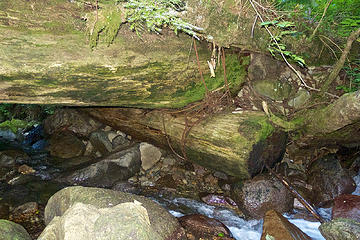 cable attachment 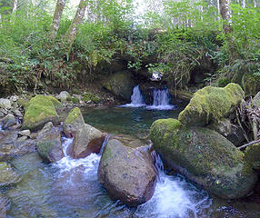 pretty from below
|
| Back to top |
|
|
|
|


 Consider this an "enhancement" to your outdoor experience!


