| Previous :: Next Topic |
| Author |
Message |
tigermn
Member


Joined: 10 Jul 2007
Posts: 9242 | TRs | Pics
Location: There... |
|
tigermn
Member
|
 Thu May 15, 2008 9:59 pm |
|
|
For a change of pace decided to pack up the mountain bike and drive to Cedar Falls and ride up the Iron Horse trail as far as the snow would let me.
What a beautiful day in contrast to yesterdays drizzle.
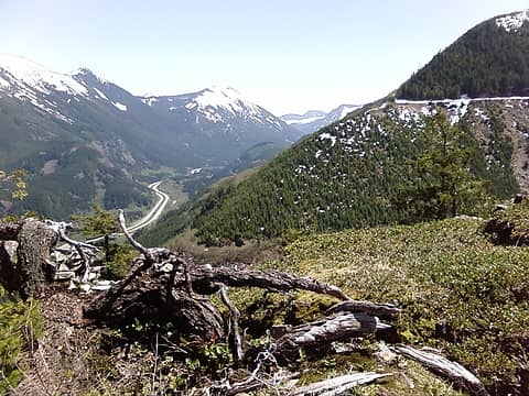
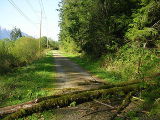 Lone blowdown Iron Horse trail just east of Cedar Butte trail junction. 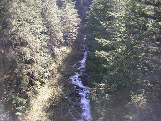 Iron Horse views. 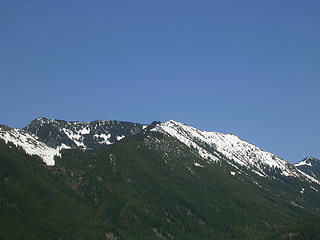 Iron Horse views. 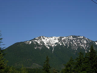 View north from first tressle. 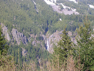 Falls just past Garcia across I-90. 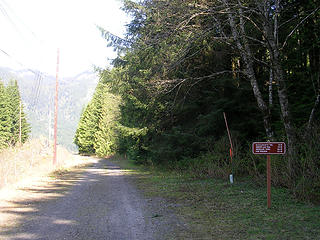 Mileage sign just past Garcia road. 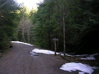 McClellan Butte west access point. Snow starting. 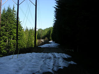 Another snow starting shot east of McClellan Butte east access point.
|
| Back to top |
  
|
|
whitebark
Member
Joined: 08 Jul 2005
Posts: 1864 | TRs | Pics
Location: Seattle |
Indeed the snow has melted a lot in the past few weeks. Just missed you on the Iron Horse today. I was working on the not-so-sekrit trail that starts between Change and Hall Creeks. Hall Point at 2600 feet is now reachable without crossing much snow.
 Hall Point 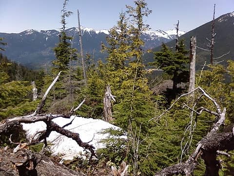 Hall Point 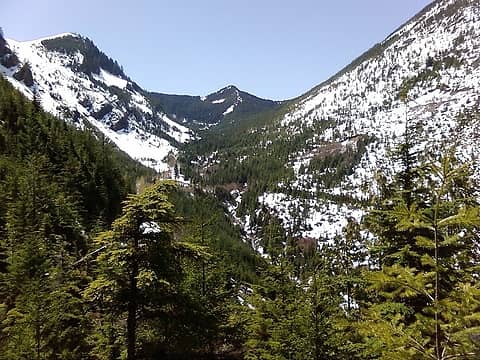 Change Ck May 16th 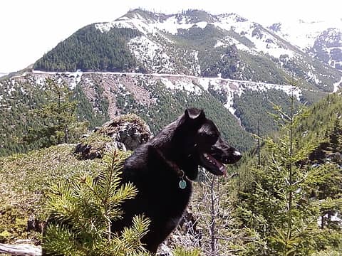 Lex at Hall Point  Lex
|
| Back to top |
|
|
tigermn
Member
Joined: 10 Jul 2007
Posts: 9242 | TRs | Pics
Location: There... |
|
tigermn
Member
|
Thu May 15, 2008 11:51 pm |
|
|
Where does this trail start from and how far does it go?
|
| Back to top |
|
|
whitebark
Member
Joined: 08 Jul 2005
Posts: 1864 | TRs | Pics
Location: Seattle |
|
| Back to top |
|
|
Grizzy
Yellow Cedar Hugger

Joined: 16 Jul 2006
Posts: 1936 | TRs | Pics
Location: Switchbacks |
|
Grizzy
Yellow Cedar Hugger
|
Fri May 16, 2008 11:03 am |
|
|
Very cool whitebark, what is the elevation gain to mt Wa? or say the loop combined with the Mt Wa trail? Mileage/gain? Your web site link above is awesome!  you should add some more of those! you should add some more of those! 
All the birds have flown up and gone;
A lonely cloud floats leisurely by.
We never tire of looking at each other -
Only the mountain and I. ~Li Po~
All the birds have flown up and gone;
A lonely cloud floats leisurely by.
We never tire of looking at each other -
Only the mountain and I. ~Li Po~
|
| Back to top |
|
|
gone
Member

Joined: 08 Feb 2008
Posts: 1051 | TRs | Pics
|
|
gone
Member
|
Fri May 16, 2008 11:18 am |
|
|
bikejr: Thanks for the trail update! I was contemplating checking that out myself yesterday, but wanted something more on the west/south face of something in order to get maximum sun! Good to know the ride is now clear to McClellan.
whitebark: Thanks for the great trail info - I can't wait to try that myself as a loop with the Mt Washington Great Wall trail!
|
| Back to top |
|
|
tigermn
Member
Joined: 10 Jul 2007
Posts: 9242 | TRs | Pics
Location: There... |
|
tigermn
Member
|
Fri May 16, 2008 2:37 pm |
|
|
Funny you mention something with more sun.
There were pockets on the trail when I was riding where it felt like it was in the mid 40's. Brief spots, but no doubt spots that don't get any sun and the fact that I was riding instead of walking adds to the wind chill factor.
|
| Back to top |
|
|
tigermn
Member
Joined: 10 Jul 2007
Posts: 9242 | TRs | Pics
Location: There... |
|
tigermn
Member
|
Fri May 16, 2008 2:48 pm |
|
|
Great site. You know I noticed that "trail" before and wondered if it was anything. I think I might try this long route once the snow is gone and I make another Washington attempt.
|
| Back to top |
|
|
moosefish
I am the fish

Joined: 02 Jul 2004
Posts: 1209 | TRs | Pics
Location: monkey herder |
|
moosefish
I am the fish
|
Fri May 16, 2008 7:15 pm |
|
|
I've done a loop parked at Change Creek. The best part of the trail was from the parking spot up to the Iron Horse along Change Creek and then again from when you leave the Iron Horse until you jump on the old logging road and head up to the lake at the source of Change Creek. After that it's all roads again until you're coming down from Mt. Washington. (We didn't wind up at the summit. My buddy was more interested in coming down.
This was back in 2006 and it sounds like it's WAY better now. I've got to get back up there.
|
| Back to top |
|
|
whitebark
Member

Joined: 08 Jul 2005
Posts: 1864 | TRs | Pics
Location: Seattle |
| Grizzy wrote: | |
Very cool whitebark, what is the elevation gain to mt Wa? or say the loop combined with the Mt Wa trail? Mileage/gain? Your web site link above is awesome! you should add some more of those! |
I think the loop combining the change creek trail and standard mt wa trail comes out to be 11 miles with 3200' of gain. Glad you liked the web site...I created it to make explaining the whereabouts of the new trail a lot easier.
|
| Back to top |
|
|
|
|


