| Previous :: Next Topic |
| Author |
Message |
Schmidt Altitude
Whippet Entourage


Joined: 28 Mar 2007
Posts: 803 | TRs | Pics
Location: The Quah |
Dates: Friday, August 22 to Sunday, August 24
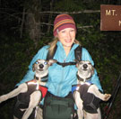
Crew: Yana, dicey, Schmidt Alti-Babe, Schmidt Alti-Dude (whippets stayed with Yet and Rufus - thanks for putting up with them  )
Summits (in the order we climbed them): Glee Peak 7160' (Point 7200+ in the Beckey Guide), West McMillan Spire 8000', The Roost 6705'
Lakes: Terror Lake
Total Elevation Gain: 13,394 feet
When dicey invited us on this trip, she promoted West McMillan Spire as the easiest of the Pickets to climb )
Summits (in the order we climbed them): Glee Peak 7160' (Point 7200+ in the Beckey Guide), West McMillan Spire 8000', The Roost 6705'
Lakes: Terror Lake
Total Elevation Gain: 13,394 feet
When dicey invited us on this trip, she promoted West McMillan Spire as the easiest of the Pickets to climb  . We are talking about the Pickets, right? That mass of impenetrable crags that we saw NE of us from our Bacon/Blum traverse last year? The mountain range with peaks named Fury, Terror, and the Chopping Block . We are talking about the Pickets, right? That mass of impenetrable crags that we saw NE of us from our Bacon/Blum traverse last year? The mountain range with peaks named Fury, Terror, and the Chopping Block  ! Isn't saying the easiest of the Pickets like saying the safest of the war zones or the mildest of the fiery habanera sauces? Still, we were eager to give the area a chance and willingly agreed.
Day 1: The hike in and Glee Peak
After Picking up Yana we all headed up I-5 north. The sunrise was so spectacular and distracting that we missed the Darrington exit and decided to drive through Mount Vernon instead. We made it the ranger station in Marblemount a little after it opened to find a line. We took turns using the last plumbed bathrooms we'd see for awhile as one of us saved our spot in line. In due time, we received our permit to camp two nights in the "Terror Basin Zone" ! Isn't saying the easiest of the Pickets like saying the safest of the war zones or the mildest of the fiery habanera sauces? Still, we were eager to give the area a chance and willingly agreed.
Day 1: The hike in and Glee Peak
After Picking up Yana we all headed up I-5 north. The sunrise was so spectacular and distracting that we missed the Darrington exit and decided to drive through Mount Vernon instead. We made it the ranger station in Marblemount a little after it opened to find a line. We took turns using the last plumbed bathrooms we'd see for awhile as one of us saved our spot in line. In due time, we received our permit to camp two nights in the "Terror Basin Zone"  . Dicey asked the ranger if the ravens (ca-caw! . Dicey asked the ranger if the ravens (ca-caw! ) were still attacking windshield wipers at the Goodell Creek campground ) were still attacking windshield wipers at the Goodell Creek campground  and he responded that their raven (ca-caw!) activity book didn't have any reports on such activity yet this year (apparently the ravens (ca-caw!) that live near the campground are know for destroying windshield wipers for fun when they get bored). and he responded that their raven (ca-caw!) activity book didn't have any reports on such activity yet this year (apparently the ravens (ca-caw!) that live near the campground are know for destroying windshield wipers for fun when they get bored).
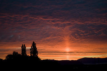 Sunrise from I-5 (Photo Alti-Babe)  ). ).
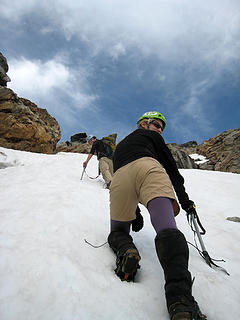
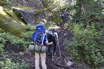
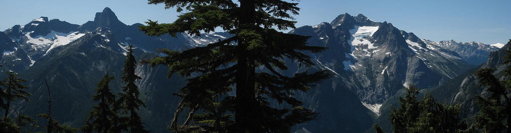
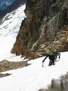
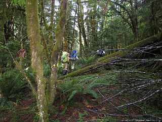 Up the soggy "trail" 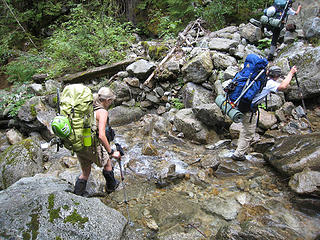 One of numerous creek crossings  Those darn ravens can't dampen her spirits! 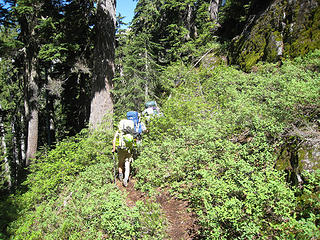 Sure, it gets sunny for the steep part! 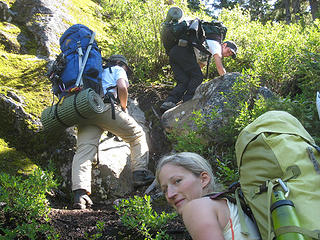 Where the vegetation is more than just pretty 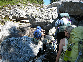 Boulder negotiations 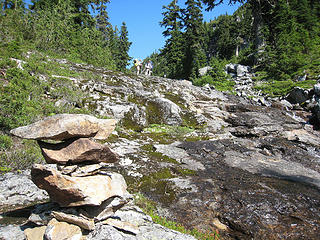 Head upstream at the large cairn 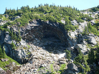 The amphitheater 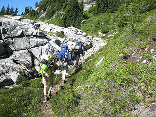 The powder puff pixies leaving Dude behind 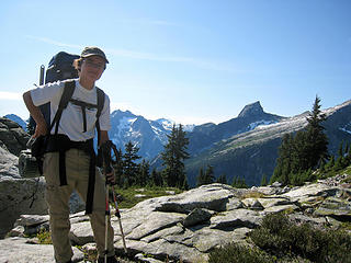 Yana and the Chopping Block 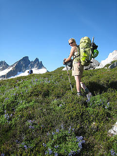 A Babe in her natural environment 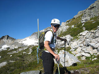 Dicey's ready for her fill of Glee! 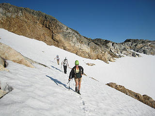 Snow traverse to Glee 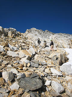 Scrambling up to Glee 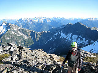 Babe on Glee (Davis and Roost behind) 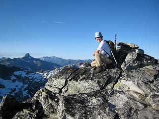 Yana on Glee (with Luna) 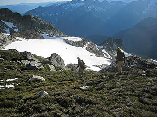 Time to head back and make dinner 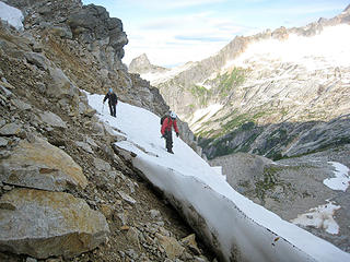 Yana and Dicey look for a way down from the pass 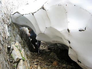 Babe takes the moat tunnel 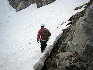 Back onto the snow 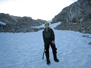 Descending into the Terror Basin 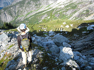 Fun with shadows 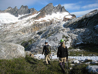 Traversing the Terror Basin towards the southern Pickets 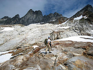 Slab walking  We've ran out of rock - it's glacier time!  Glacier Babe  Scrambling up loose slabs  The crawl method 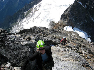 We've left the glacier far behind  ca-caw! ). ca-caw! ).
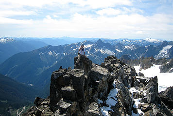 Yana, you take a picture of me on the summit as I take a picture of you 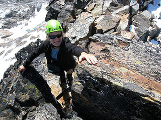 Touching the top 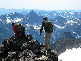 Dicey and Yana at the end of the world 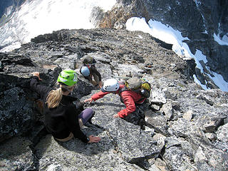 Nobody said we had to climb down too! 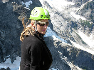 Can you please turn off the wind machine? 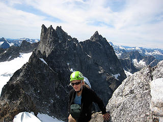 Babe in front of Inspiration, Pyramid, Degenhardt and Terror  ) and Dude eventually said screw it and glissaded even though he had shorts on. We made it back to slabs and then descended back down to Terror Creek. ) and Dude eventually said screw it and glissaded even though he had shorts on. We made it back to slabs and then descended back down to Terror Creek.
 Downclimbing steep snow 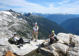 Taking a rest back on the rocks 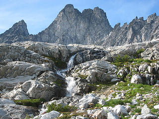 Waterfall under Inspiration Peak 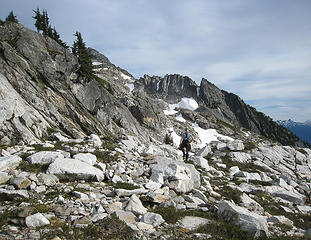 How did camp get so far away? 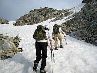 More steep snow 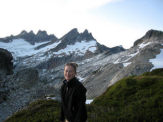 Babe at camp after climbing the West McMillan Spire 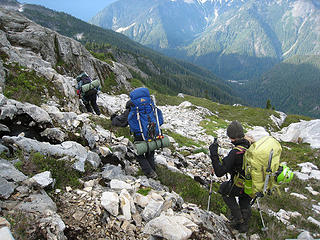 Down to the trail 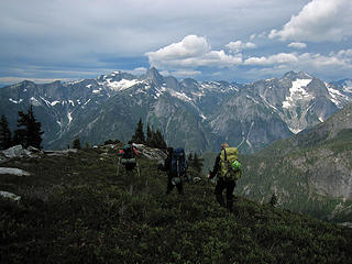 Some bad weather may be heading our way  . We made the top about 1:30 from where we left our packs. On the summit we ate the last of our food and tried to stay warm despite the freezing wind. . We made the top about 1:30 from where we left our packs. On the summit we ate the last of our food and tried to stay warm despite the freezing wind.
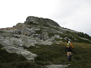 Below the summit of The Roost 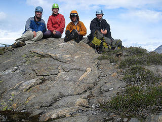 Roost summit shot  This is what we think of the weather! :P 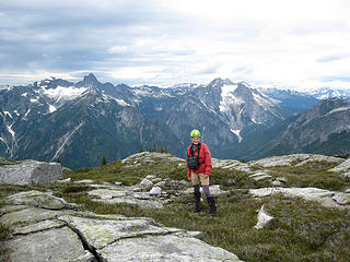 Babe with Triumph and Despair behind 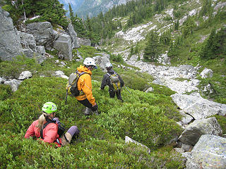 Down the slippery heather 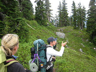 Dicey says goodbye to "Happy Land" 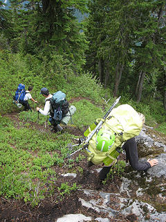 The steep part begins again 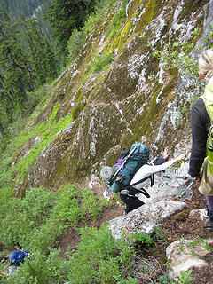 Veggie belays are good! 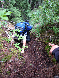 Babe directs Yana to the best hand holds 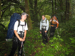 The soggy puff pixies 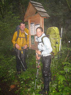 A very wet trailhead shot 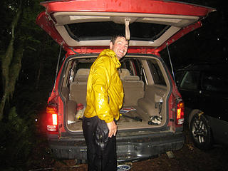 Yeah, no more hiking in the rain!
"Forest 101: These big wood stick things are called trees. The big rocks are called mountains, and the little rocks are their babies." Elliott from Open Season
"Forest 101: These big wood stick things are called trees. The big rocks are called mountains, and the little rocks are their babies." Elliott from Open Season
|
| Back to top |
  
|
|
Schmidt Alti-Babe
The Ice Queen
Joined: 11 Mar 2008
Posts: 606 | TRs | Pics
Location: Buried by backlogged pictures |
DAY 1:
 The vegetated gully ahead 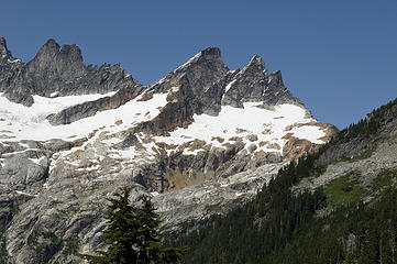 Zooming in on the McMillan Spires 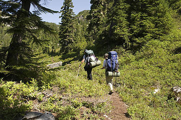 Entering "Happy Land" 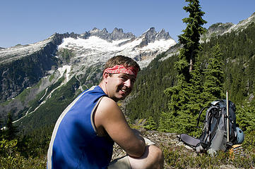 Dude chills during our lunch stop 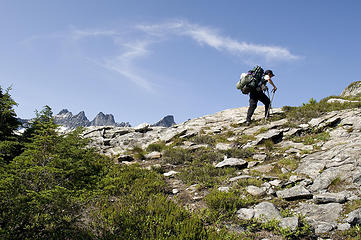 Dicey leads the way 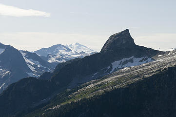 The Chopping Block with Blum and Baker behind  So close, yet so far 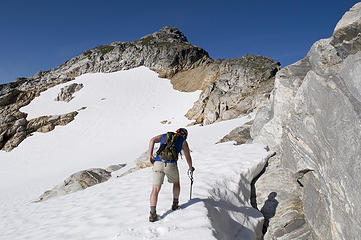 The summit of Glee Peak ahead 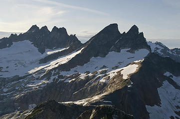 Degenhardt, Pyramid, Inspiration, and McMillan Spires from Glee Peak 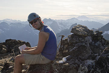 Dude tries to sign the wet register 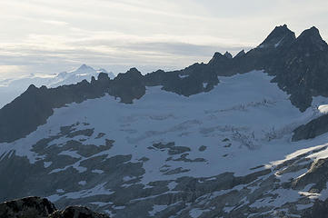 The Terror Glacier from Glee Peak 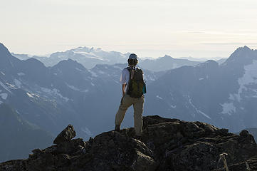 Yana checks out the views 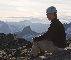 Yana on Glee 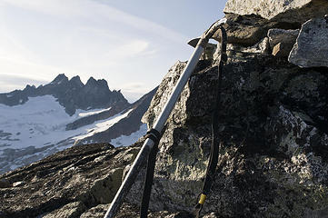 The ice axe yearns to be on the Terror Glacier 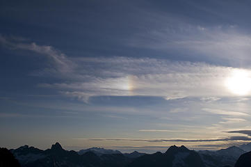 Sundog 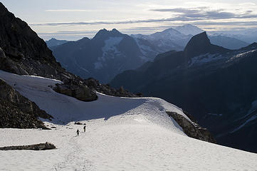 Yana and Dicey race ahead 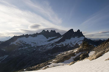 The clouds point the way to our goal 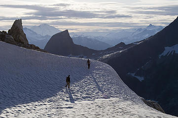 Almost back to camp 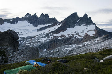 Rest up, we have a big day tomorrow 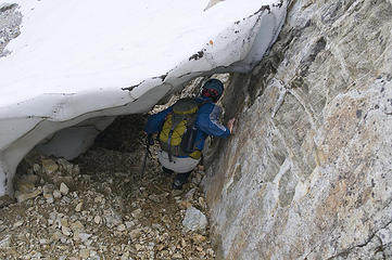 Dude leads the way down the moat 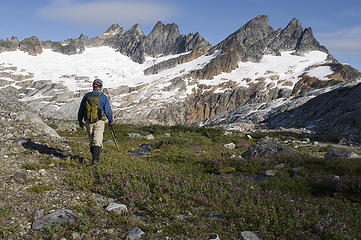 Dude checks out the views from the Terror Basin 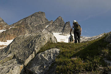 The McMillan Spires look a little closer 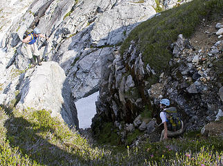 Ca-caw! 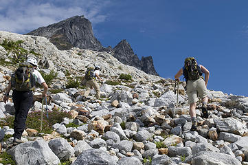 It's all up from here on out! 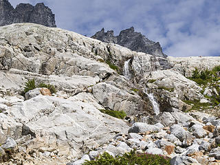 Water falling through the slabs 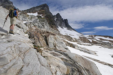 Dude scouts the route 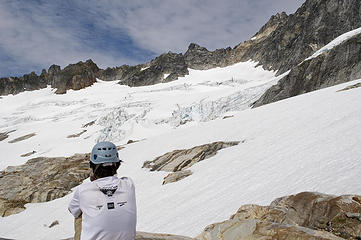 Yana ponders the Terror Glacier 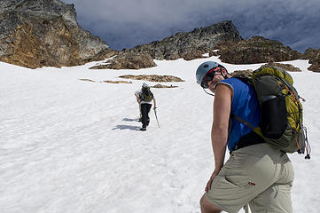 Glacier climbing 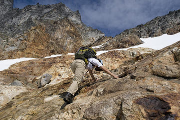 On the rock island to put on crampons 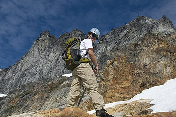 Yana's in control! 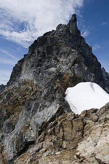 Inpiration Peak from the Inpiration-McMillan Col 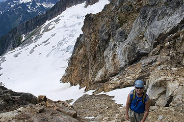 Dude on the choss covered slabs 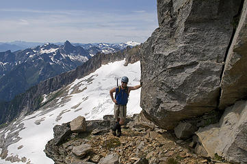 Dude easily holds the world at bay 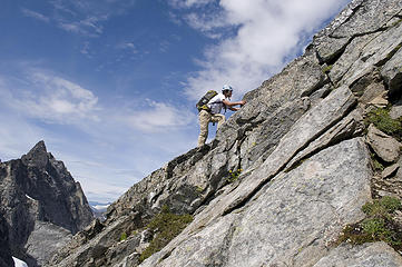 Yana climbing the West McMillan Spire 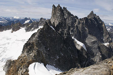 Inspiration, Pyramid, Degenhardt, and Terror from West McMillan Spire 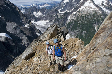 Dude and Yana on the way up West McMillan Spire 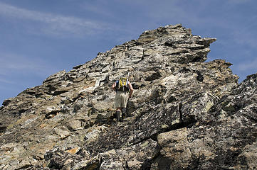 The mountain's starting to get narrow at the top 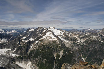 Mount Fury from West McMillan Spire 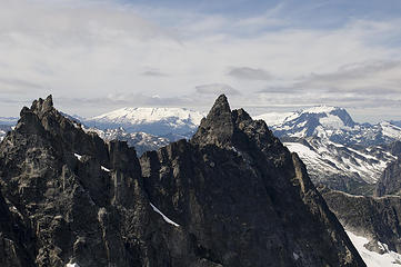 Baker and Shuksan from West McMillan Spire 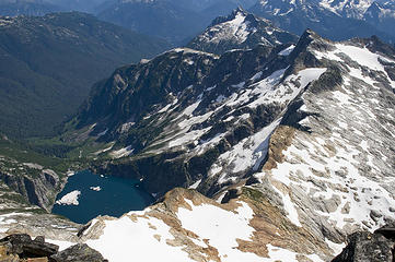 Azure Lake observed from West McMillan Spire 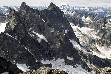 Degenhardt and Terror 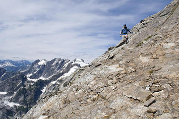 Down the slab of McMillan 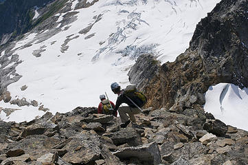 Down the loose stuff 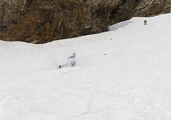 Dude glissading down the Terror Glacier 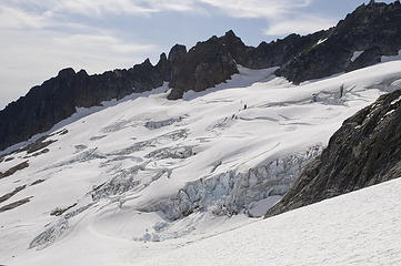 Terror Glacier 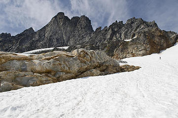 Mount Inspiration looms above us 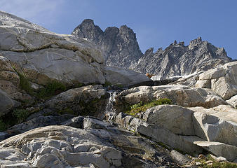 Waterfall in the slabs 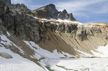 The lake below the Spires 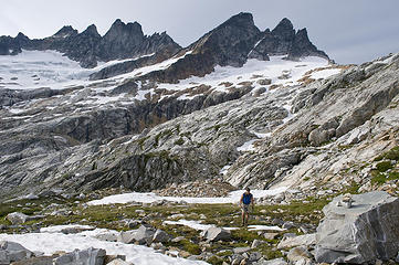 Recrossing the Terror Basin 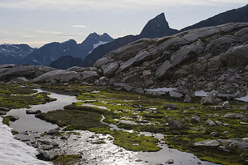 Terror Basin views 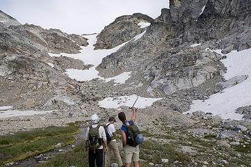 Trust me, I know a shortcut 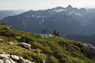 We're back at camp!! 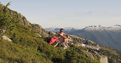 Dude tries to even out his tan 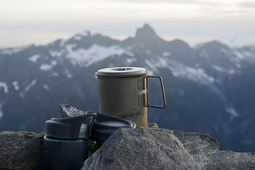 Camp views 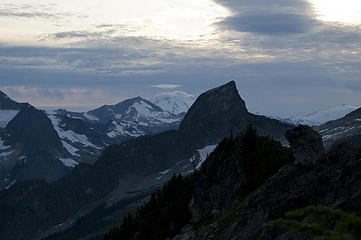 Cloudy skies off to the west 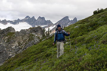 Dude leaving the Spires behind 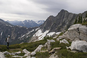 Dicey at Glee-Roost col 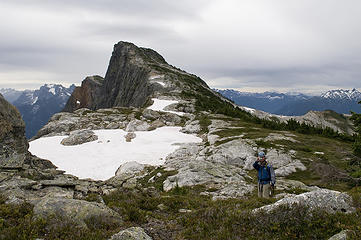 Dude turns to take a picture as he leads the way to the Roost 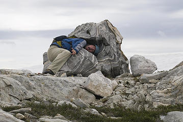 Oh no, Dude's being eaten by the rocks! 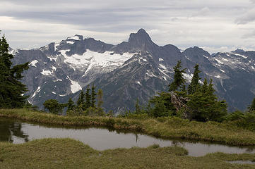 Triumph from Roost Ridge 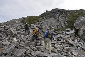 Just below the Roost summit 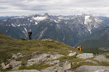 Yana and Dicey arrive at the Roost 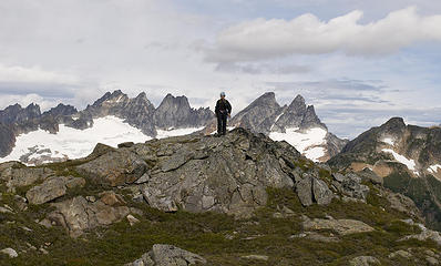 Yana checks out the views 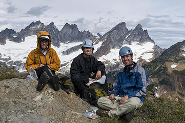 Eating the last of our supplies 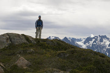 Dude on the summit of The Roost 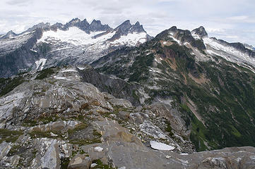 Striped rocks on Roost Ridge 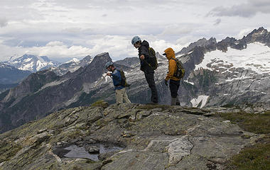 Have fun with the wind 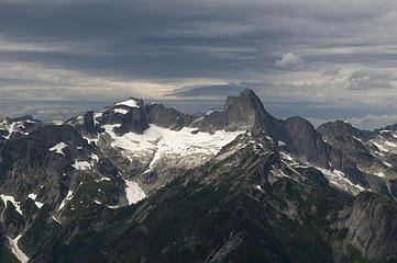 Triumph Peak under increasingly cloudy skies 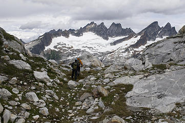 Yana and Dicey lead the way back to our packs 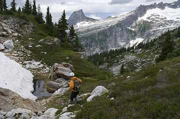 Descending off the Roost 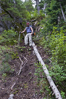 Dude conquers the offending log!
|
| Back to top |
|
|
Schmidt Alti-Dude
4th class poster

Joined: 06 Jul 2007
Posts: 1361 | TRs | Pics
Location: Looking for Adventure 201! |
And now for the panoramic perspective:
Day 1
 Triumph and Despair on the way up 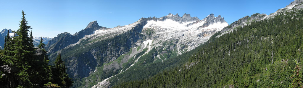 Views from lunch rock 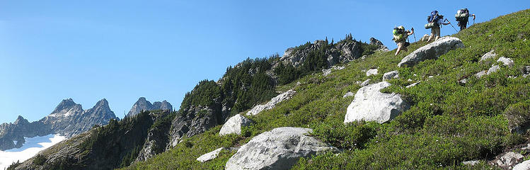 Almost to camp 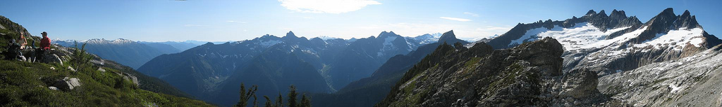 Views from camp 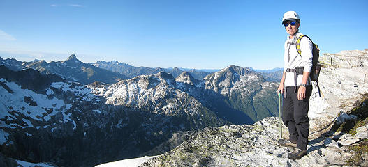 Dicey on Glee 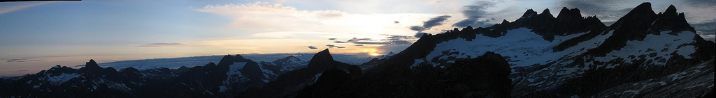 Sunset views from camp 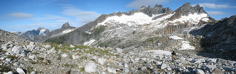 Crossing the Terror Basin 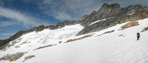 On the Terror Glacier 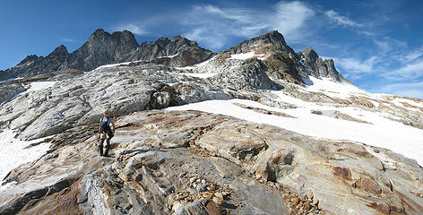 Babe on the melted ice cream slabs 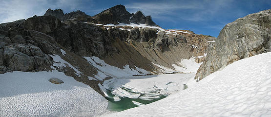 Terror Lake under the McMillan Spires 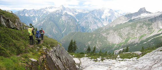 Hiking out 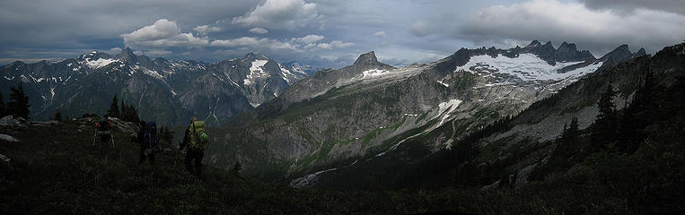 Hiking out under cloudy skies 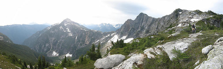 Davis Peak and The Roost from the col 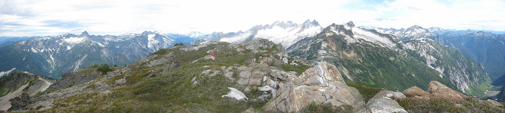 Views west and north from the summit of the Roost 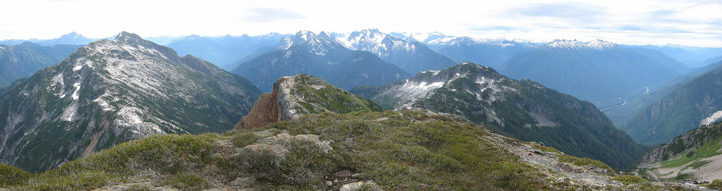 Views east and south from the summit of the Roost
Anything stated by me in no way reflects the attitudes or opinions of my wife
Anything stated by me in no way reflects the attitudes or opinions of my wife
|
| Back to top |
|
|
peltoms
Member

Joined: 13 Jul 2006
Posts: 1760 | TRs | Pics
Location: Worcester MA |
|
peltoms
Member
|
 Sat Aug 30, 2008 4:47 am |
|
|
Mama mia there you go again, glad you did not meet your waterloo.  Great effort obviously you tudes are in fine late season form. The slabs are gorgeous, what should the lake below the spires be named? Great effort obviously you tudes are in fine late season form. The slabs are gorgeous, what should the lake below the spires be named?
|
| Back to top |
|
|
then
Member
Joined: 27 Jan 2008
Posts: 84 | TRs | Pics
|
|
then
Member
|
Sat Aug 30, 2008 7:24 am |
|
|
Great Pictures! Last weekend I was sitting above Berdeen lake looking across the valley at Triump and Despair wondering what was on the other side, should have know it would be crawling with northwest hikers! We only had to gain 4200' to get to happy land on our side. Good job and Awsome report guys! I'm definanty going to use your trip report as a referance for next year. 
|
| Back to top |
|
|
pimaCanyon
Member

Joined: 13 Jul 2007
Posts: 1304 | TRs | Pics
Location: at the bottom of the map |
You dudes and babes sure know how to have a good time! Great report, amazing scenery, awesome pix! Oh, and way to maximize the weather window, getting the hard work done before the rain started.
So the crows left your wipers alone so you could use them on the long, wet drive home?
It's never too late to have a happy childhood
It's never too late to have a happy childhood
|
| Back to top |
|
|
Yana
Hater

Joined: 04 Jun 2004
Posts: 4212 | TRs | Pics
Location: Out Hating |
|
Yana
Hater
|
Sat Aug 30, 2008 8:35 am |
|
|
I can't believe we had almost 8000' of elevation loss the last day.
Oh, and incidentally - the windshield wipers did NOT get eaten by ravens (CA-CAAAAAW), which was rather fortunate as it was pouring rain all the way back to Seattle.
What a great trip. Dicey sure knows how to pick 'em!
Here are some of my pics.
 Descending the snow finger 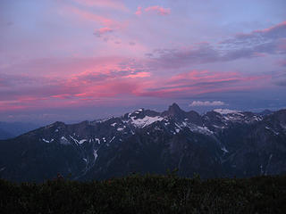 Storm's a brewing 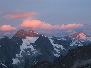 Morning light on Despair and Blum 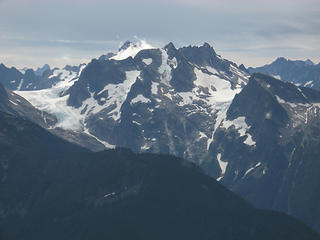 More cloud things 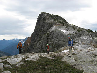 Departing the Roost 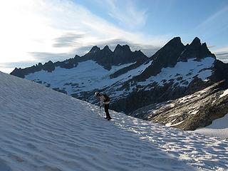 pause to pose 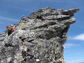 climbing near the edge 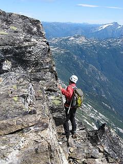 climbing nearer the edge  west, east, and little mac spires
PLAY SAFE! SKI ONLY IN CLOCKWISE DIRECTION! LET'S ALL HAVE FUN TOGETHER!
PLAY SAFE! SKI ONLY IN CLOCKWISE DIRECTION! LET'S ALL HAVE FUN TOGETHER!
|
| Back to top |
|
|
AttemPT
Member

Joined: 30 Jul 2007
Posts: 35 | TRs | Pics
Location: Wenatchee, WA |
|
AttemPT
Member
|
Sat Aug 30, 2008 8:47 am |
|
|
Love the picture banquet. Thanks
|
| Back to top |
|
|
huron
Member

Joined: 13 Sep 2004
Posts: 1039 | TRs | Pics
|
|
huron
Member
|
Sat Aug 30, 2008 8:59 am |
|
|
What an adventure!
|
| Back to top |
|
|
Guiran
Member
Joined: 03 Mar 2004
Posts: 621 | TRs | Pics
Location: University of Washington |
|
Guiran
Member
|
Sat Aug 30, 2008 9:19 am |
|
|
Great trip! That area is one of my favorites.
Glad to see your wiper blades fared better than ours did a few years ago. We returned (very tired) to find the wipers torn off and the car covered in raven poo (ca-caw).
|
| Back to top |
|
|
DIYSteve
seeking hygge

Joined: 06 Mar 2007
Posts: 12655 | TRs | Pics
Location: here now |
|
DIYSteve
seeking hygge
|
Sat Aug 30, 2008 9:23 am |
|
|
|
| Back to top |
|
|
Movenhike
\m/..mmmmetal\m/
Joined: 16 Apr 2007
Posts: 642 | TRs | Pics
Location: Leavenworth, WA |
|
Movenhike
\m/..mmmmetal\m/
|
Sat Aug 30, 2008 10:05 am |
|
|
The rock outcropping in Yana's 3rd to last picture "climbing near the edge"
bears a striking resemblance to a raven's head and beak (ca-caw!) 
"Make it your Friend" -John Bull
"Make it your Friend" -John Bull
|
| Back to top |
|
|
MikeBeebe
Seeking the Ur
Joined: 05 Aug 2008
Posts: 279 | TRs | Pics
Location: Seattle, Washington |
|
MikeBeebe
Seeking the Ur
|
Sat Aug 30, 2008 11:39 am |
|
|
A++++++ trip report, would read again!
Also, are you sure those are Ravens and not Crows? I didn't think we had Ravens in Washington.
|
| Back to top |
|
|
goats gone wild
Mr. Goat

Joined: 19 Aug 2007
Posts: 2524 | TRs | Pics
Location: Vampireville |
.....leaving me wanting to return over and over in what ever capacity that may be, even if one day my knees are too old and I can only see the mountains from my porch.
Jason Hummel
|
| Back to top |
|
|
ActionBetty
Im a dirty hippie!

Joined: 06 Jul 2003
Posts: 4807 | TRs | Pics
Location: kennewick, wa |
|
ActionBetty
Im a dirty hippie!
|
Sat Aug 30, 2008 12:07 pm |
|
|
climbing near the edge  Nice job
"If you're not living good, you gotta travel wide"...Bob Marley
"If you're not living good, you gotta travel wide"...Bob Marley
|
| Back to top |
|
|
|
|
You cannot post new topics in this forum
You cannot reply to topics in this forum
You cannot edit your posts in this forum
You cannot delete your posts in this forum
You cannot vote in polls in this forum
|
Disclosure: As an Amazon Associate NWHikers.net earns from qualifying purchases when you use our link(s). |


