| Previous :: Next Topic |
| Author |
Message |
iron
Member


Joined: 10 Aug 2008
Posts: 6392 | TRs | Pics
Location: southeast kootenays |
|
iron
Member
|
 Sun Jul 24, 2011 3:23 am |
|
|
what do you do when your summers 3 week trip is cancelled? plan another of course. it helps when the weather cooperates though...
after solid days of prepping food, making caches, and stashing stuff throughout the cascades, hotpantz and i were ready to head off.
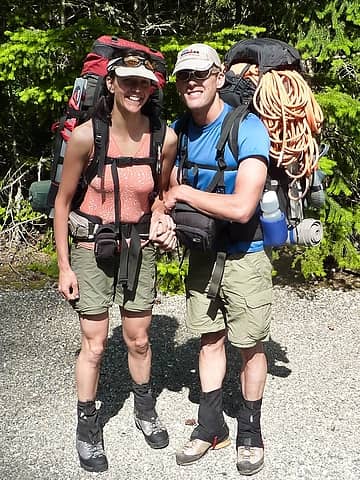 startin' off 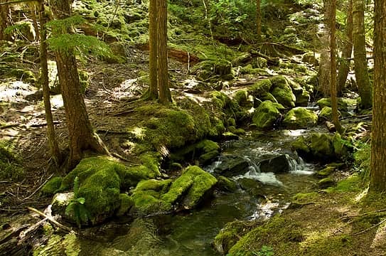 pyramid lake creek 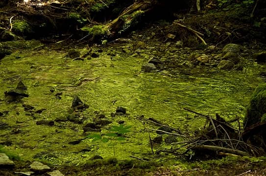 reflective green coat 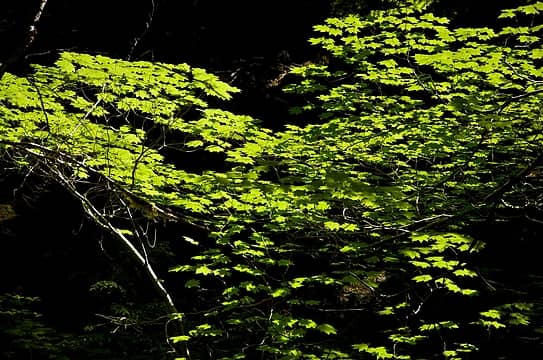 bright among dark 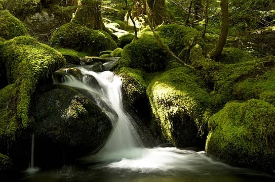 inviting pool 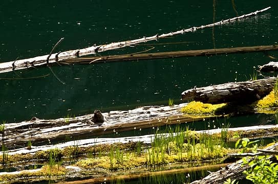 marsh forming in pyramid lake 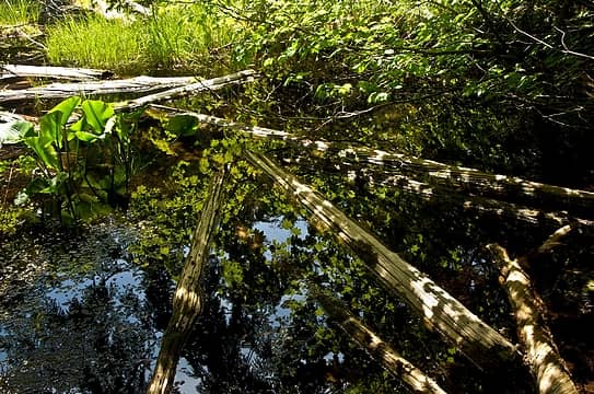 feeling skunky 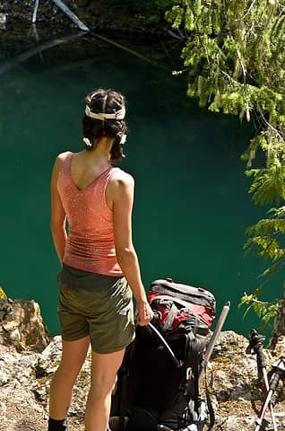 contemplating a jump 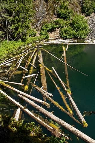 lots of balancing opportunities 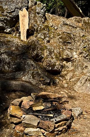 welcome 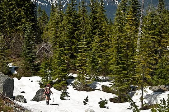 heading up the ridge 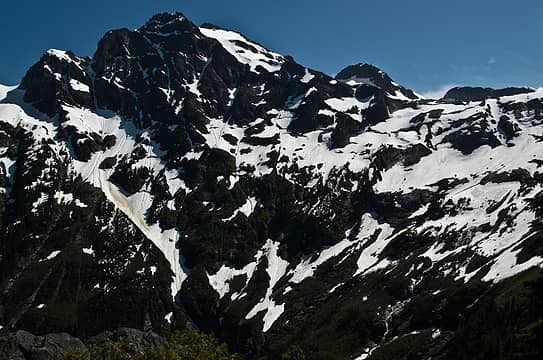 colonial 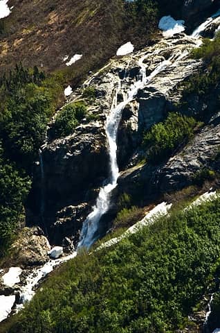 monster waterfall of colonial creek 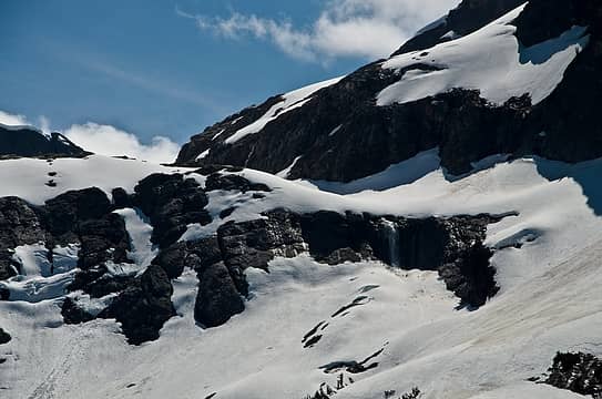 start of colonial creek 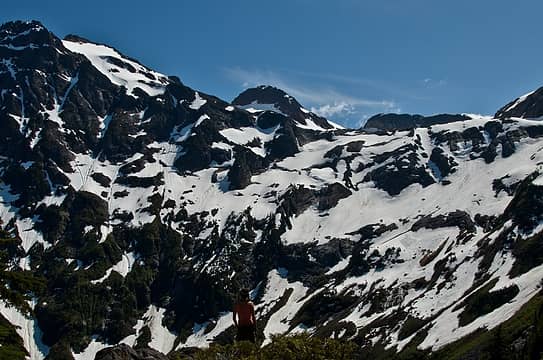 enjoying views 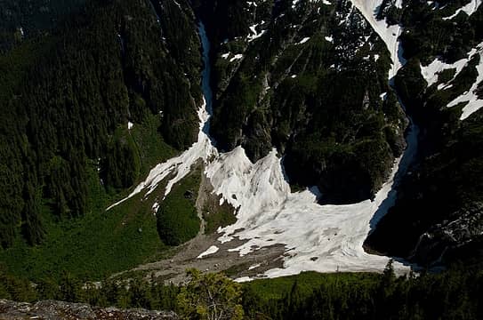 little snow in the colonial creek valley remains 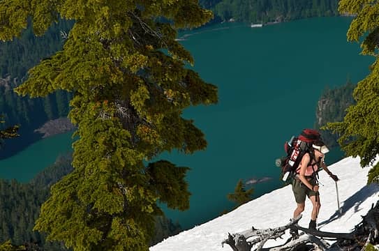 just above the waterline 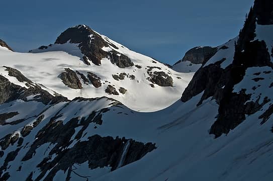 the traverse to colonial creek basin 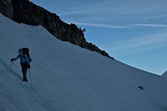 no sweat 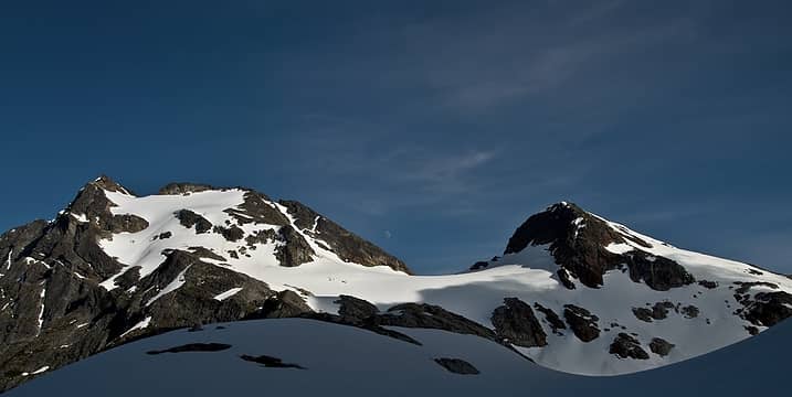 colonial and neve 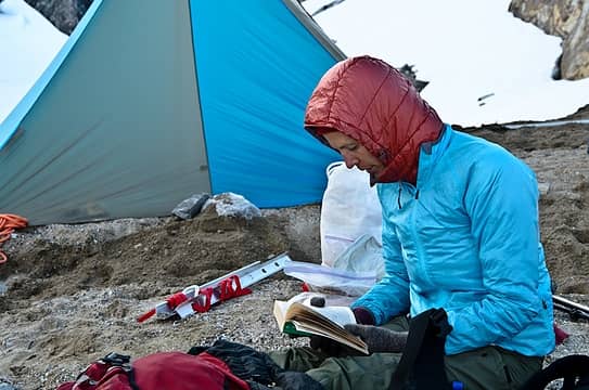 starting lord of the rings - fellowship of the ring 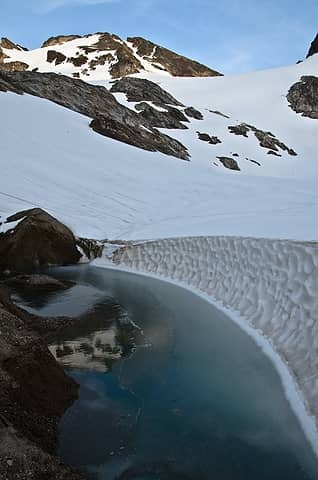 our water source 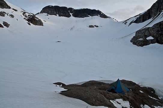 ice island 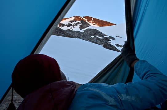 goodnight sun 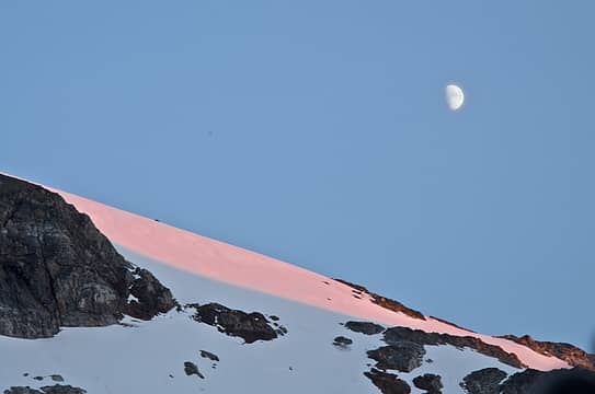 and moon  camp 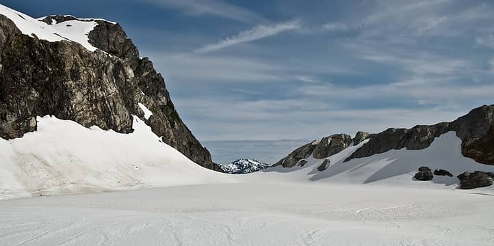 colonial glacier "lake" and outlet 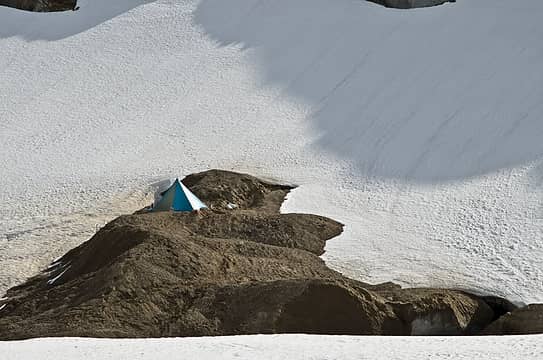 stay there little tent 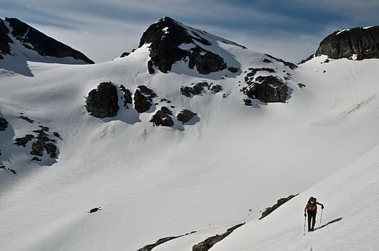 heading up to pyramid 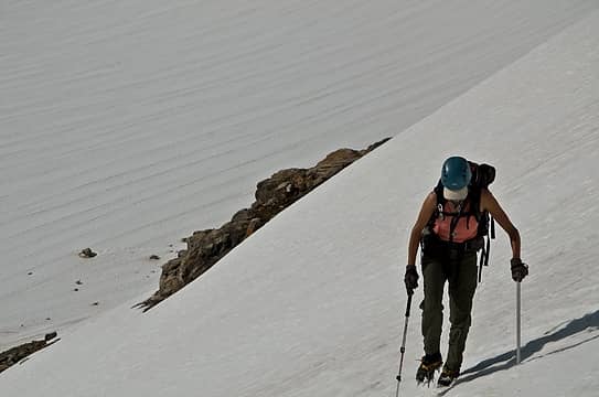 steepening 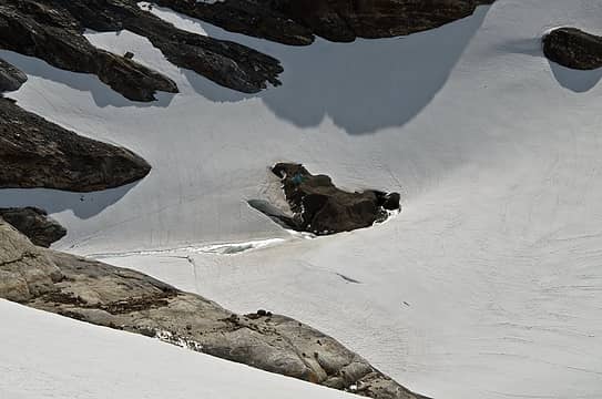 not much open yet 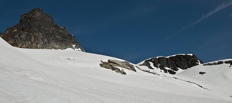 pinnacle and pyramid 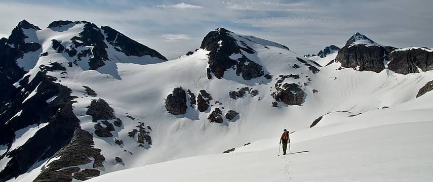 lots of snow to play in 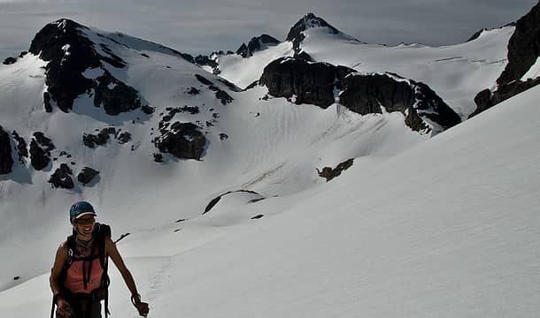 all smiles 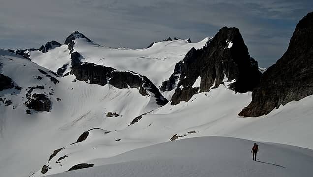 snowfield looking far away 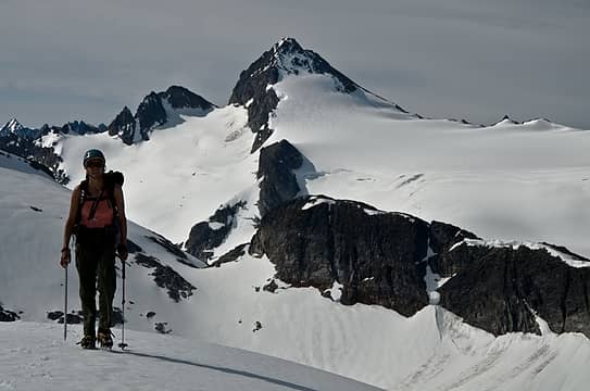 but now it looks close 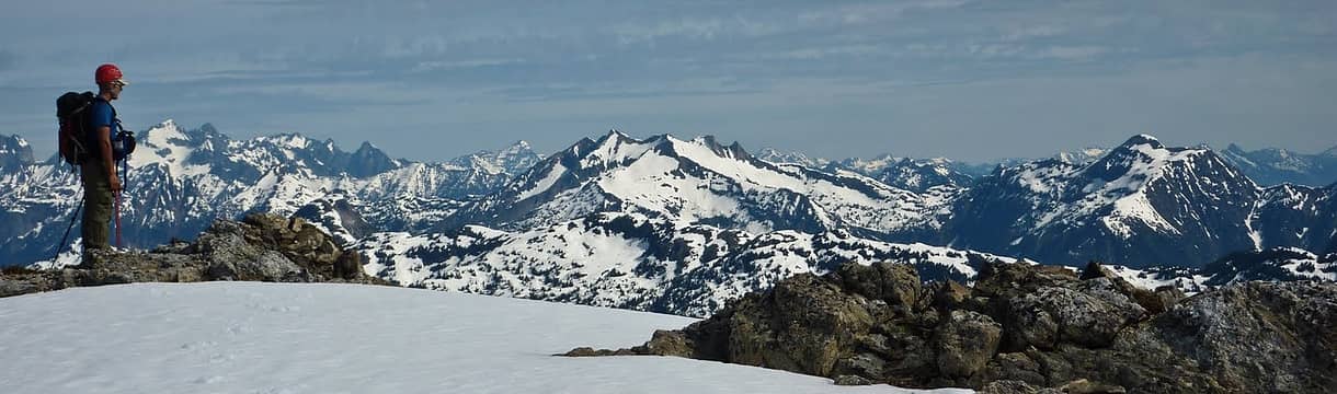 atop pyramid 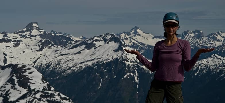 what, no register? 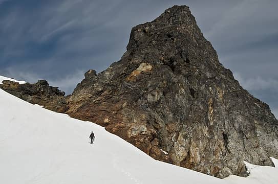 coming down from a weak pinnacle attempt 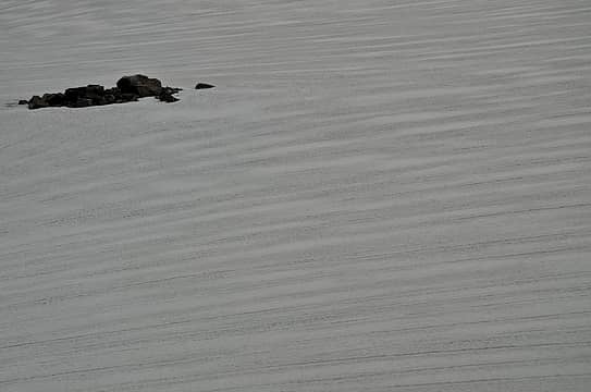 streaks 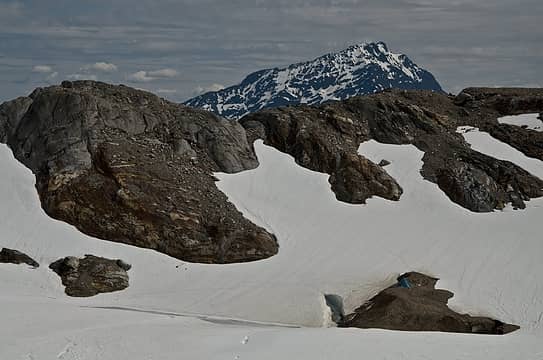 jack 'n tent 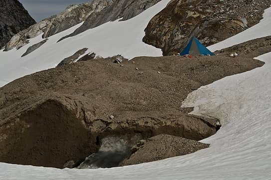 a little ice with your sand? 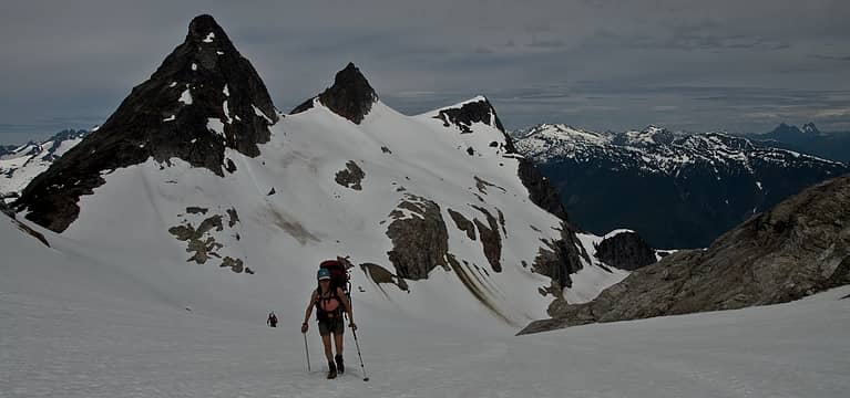 heading up to saddle 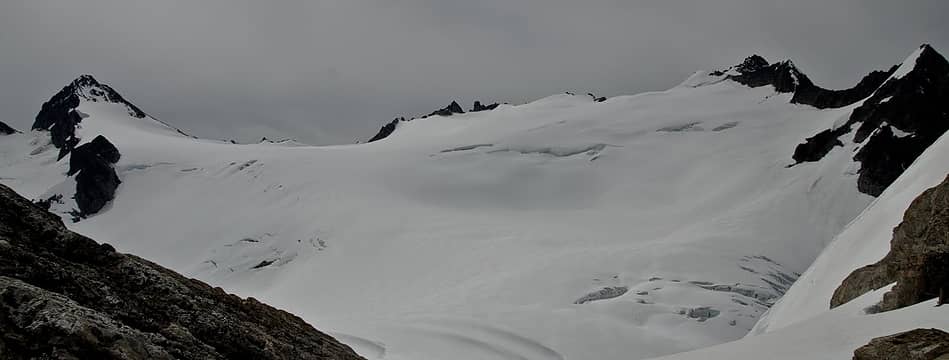 bigtime snow! 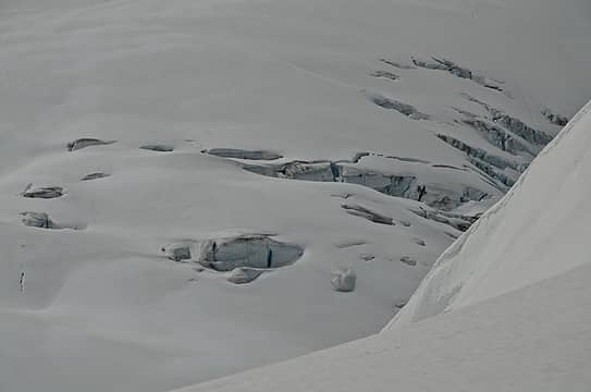 gaping 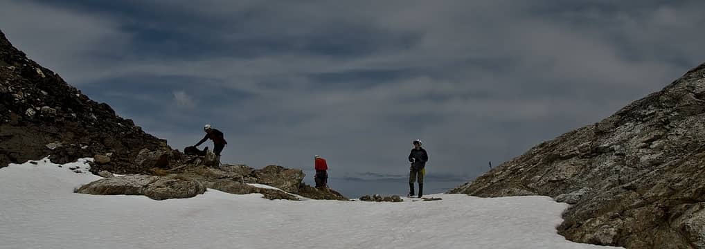 portland group 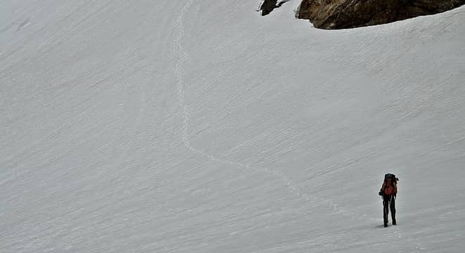 coming down from saddle 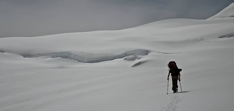 long and elegant 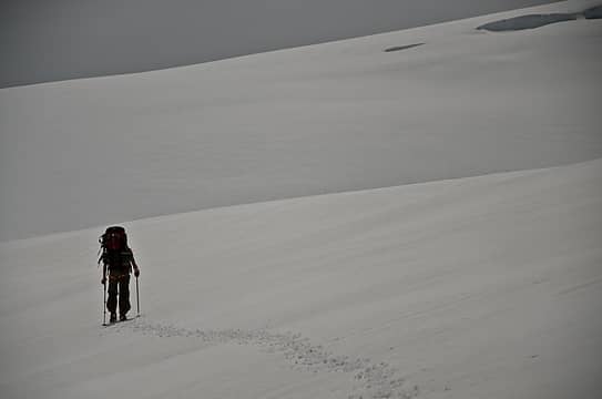 feeling small 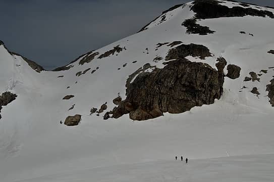 a look back at the saddle 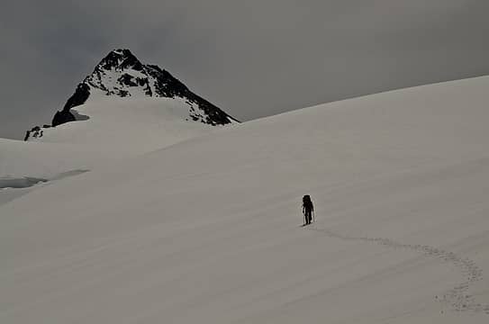 nearing snowfield 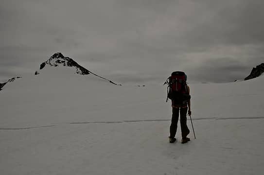 crevasse 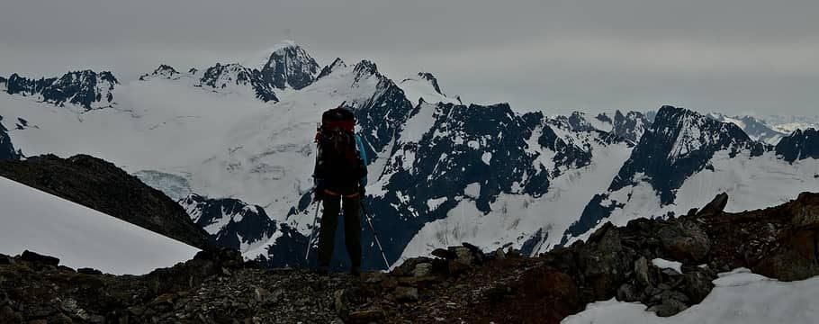 looking beyond to our next goal 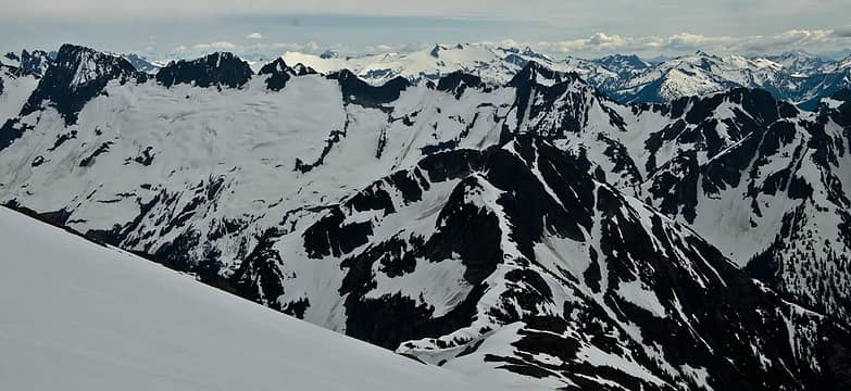 isolation peak 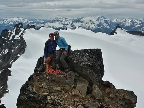 at the summit 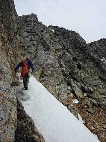 dropping in from notch to snowfield's final scramble 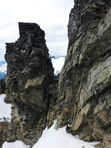 the notch from summit side 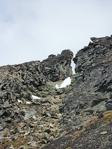 the notch from the approach side 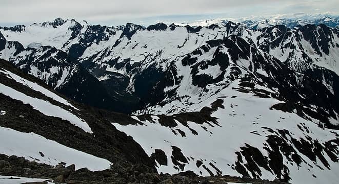 ridge leading to isolation 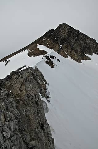 ridge the beta said to take 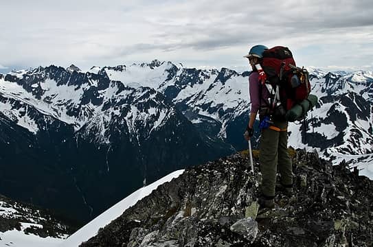 looking down said ridge 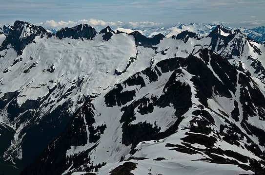 backbone ridge 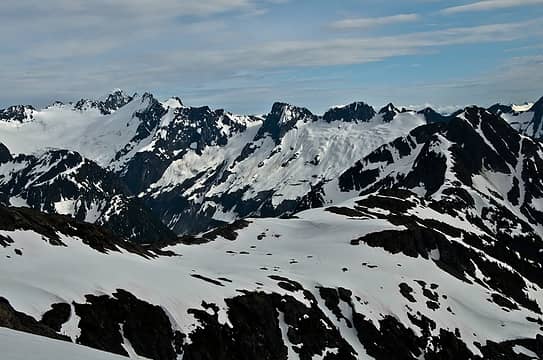 icecap peaks through isolation 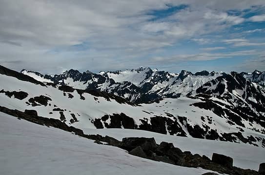 and more 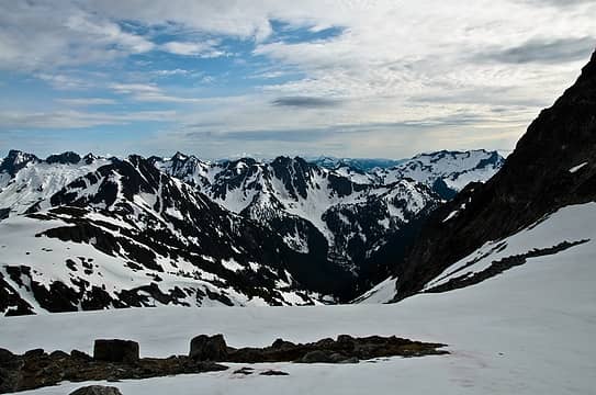 isolation through the devils 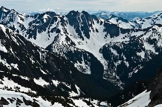 great relief  . we wrapped around some exposed rocks, topped off on water, and traversed around EL6800. with some steep spots, travel was slow, though on skis or a board, this would be easier as would many places on this traverse.
soon enough, we reached the S ridge of snowfield around EL6600 and walked down a gentle slope to a great ridge tarn and campsite (not established). the views and feeling here were truly alpine. i loved every second we were there. the roar of mcallister creek and the views of the N faces of the icecap peaks were breathtaking. . we wrapped around some exposed rocks, topped off on water, and traversed around EL6800. with some steep spots, travel was slow, though on skis or a board, this would be easier as would many places on this traverse.
soon enough, we reached the S ridge of snowfield around EL6600 and walked down a gentle slope to a great ridge tarn and campsite (not established). the views and feeling here were truly alpine. i loved every second we were there. the roar of mcallister creek and the views of the N faces of the icecap peaks were breathtaking.
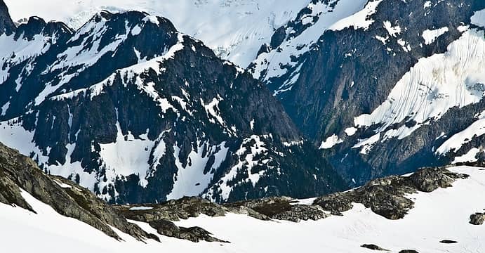 spying the tarn 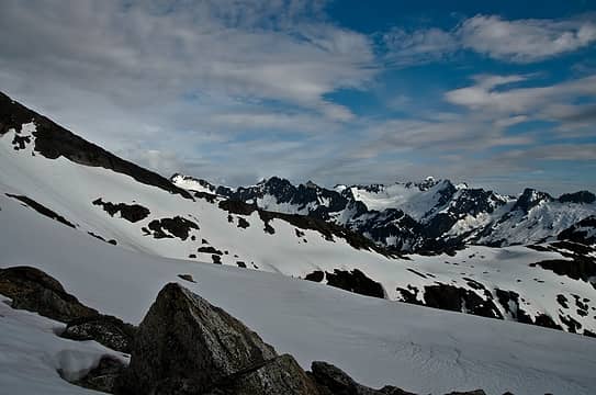 now down low with easy access to isolation's N ridge 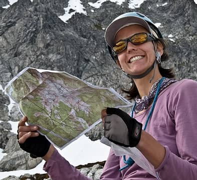 checkin' the map 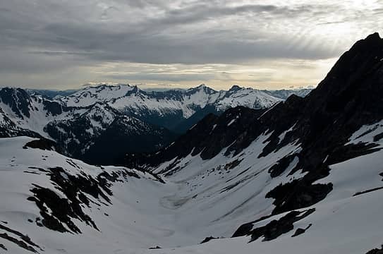 the devils and still frozen tarns 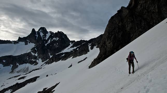 traversing to isolation's N ridge 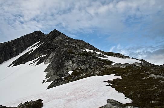 now on the ridge, looking back at the beta route 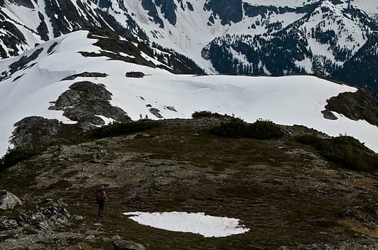 ah, so many choices  let's go here please!  small trees, big peaks  who's got shorts?  fading light 1 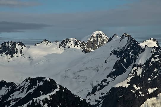 fading light 2 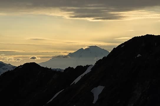 baker looking good 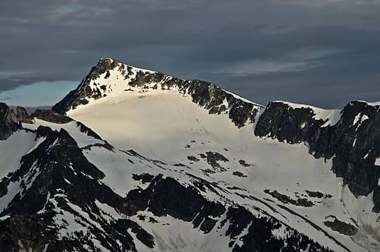 climb me! 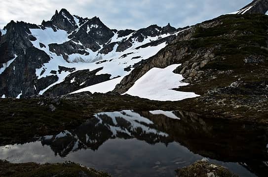 such a nice spot 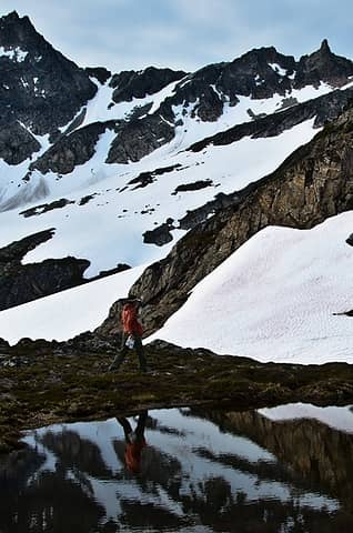 reflecting on nature 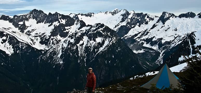 hooray! 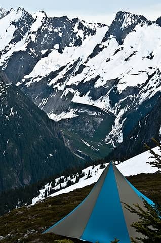 shiny new tent 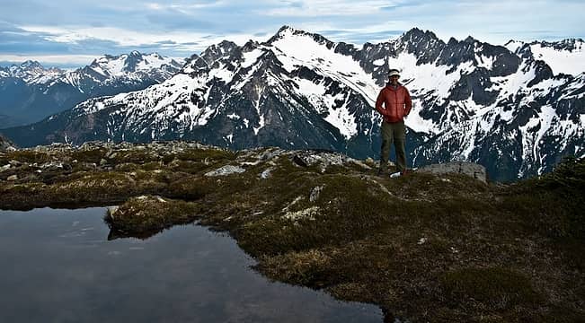 ready? 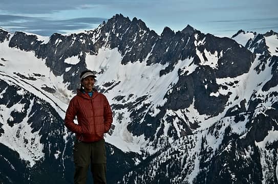 so small 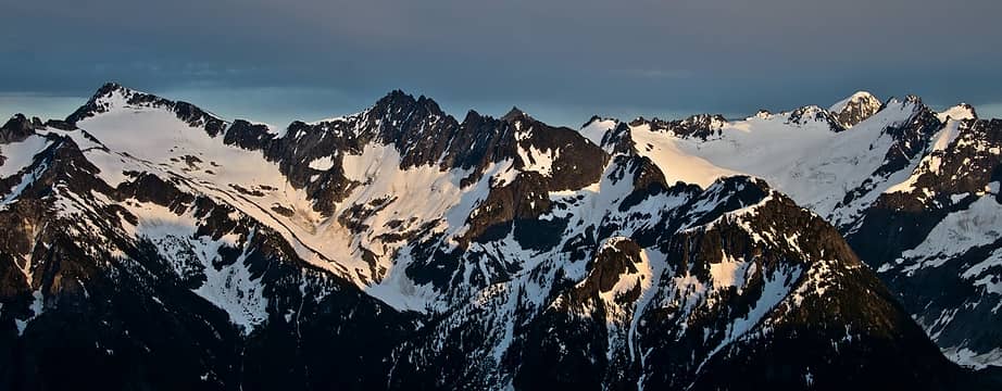 can't wait! 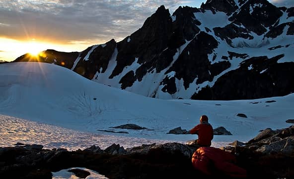 waiting for dinner to cook 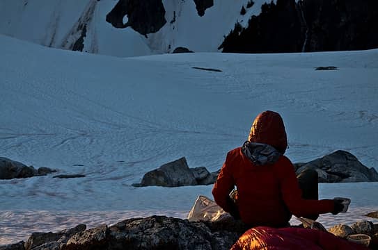 golden light 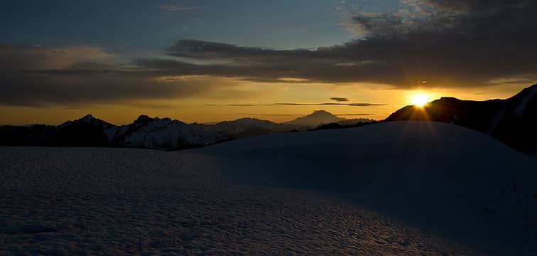 bye bye sun 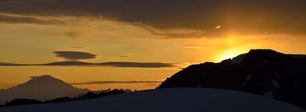 vertical beam 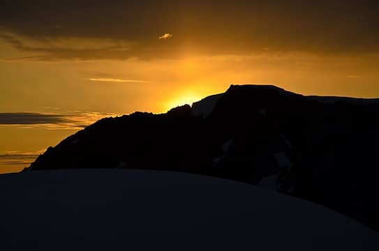 now an explosion 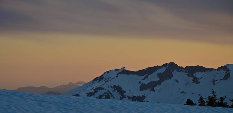 hazy hues 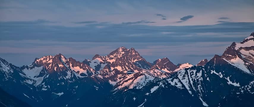 alpenglow 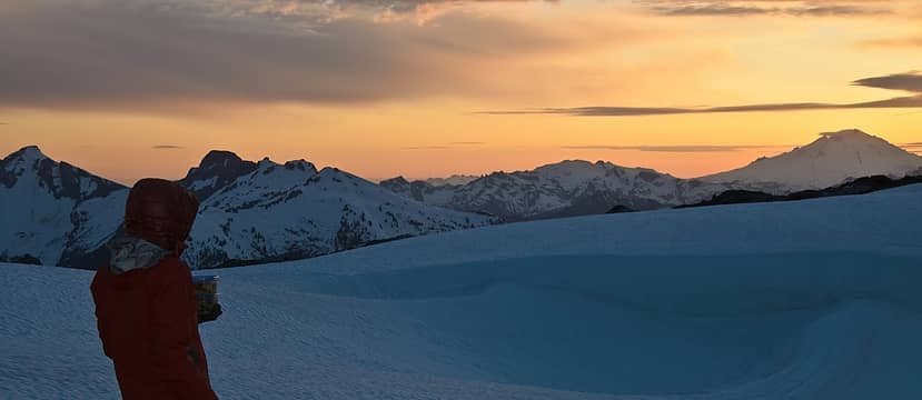 wow 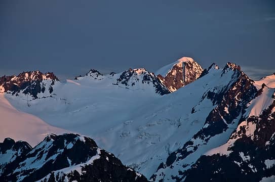 more wow 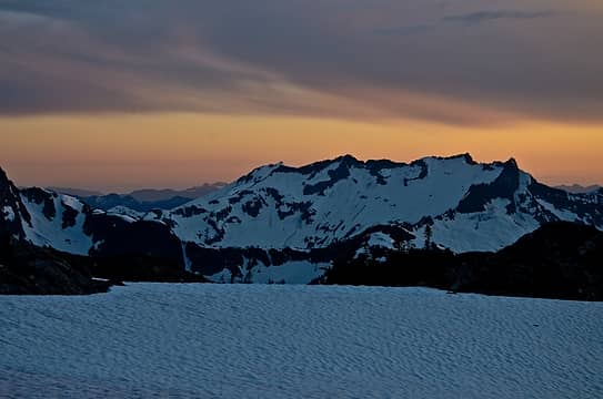 and more 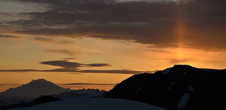 beaming 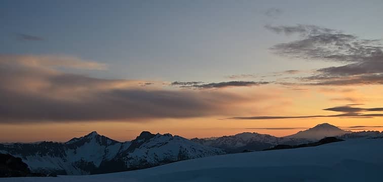 too 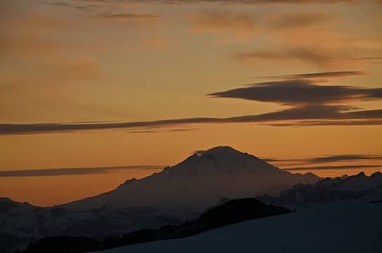 many 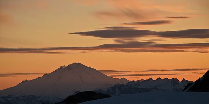 sunset 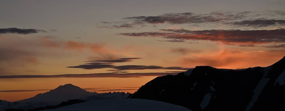 pics 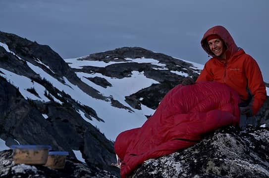 warm + food  pano near camp  cascade river road peaks  good morning tarn 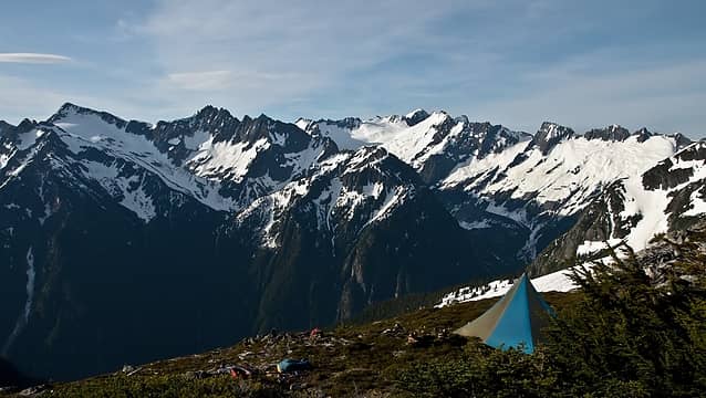 morning! 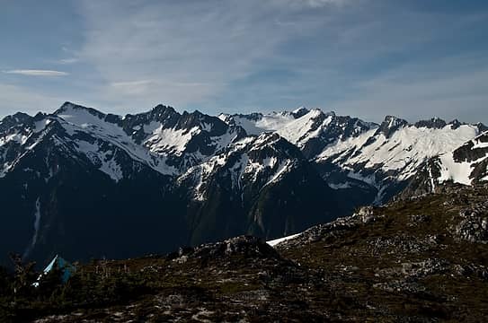 an okay setting to wake to 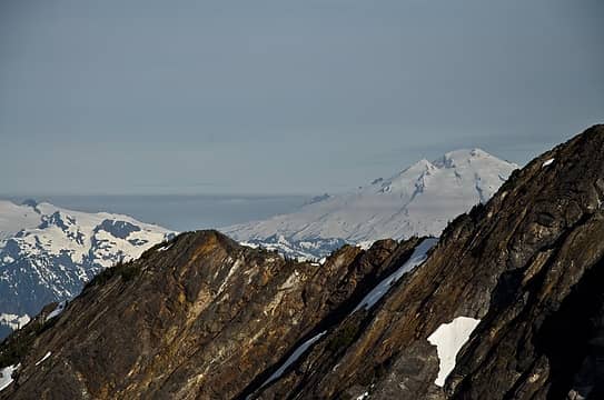 hmm, what's that 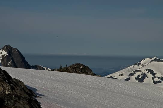 it's over there too 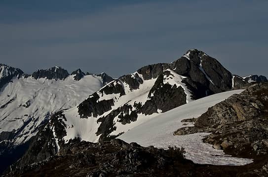 isolation lookin' mighty fine 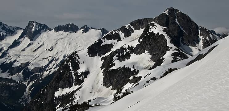 just follow the low snow 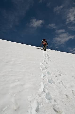 heading down 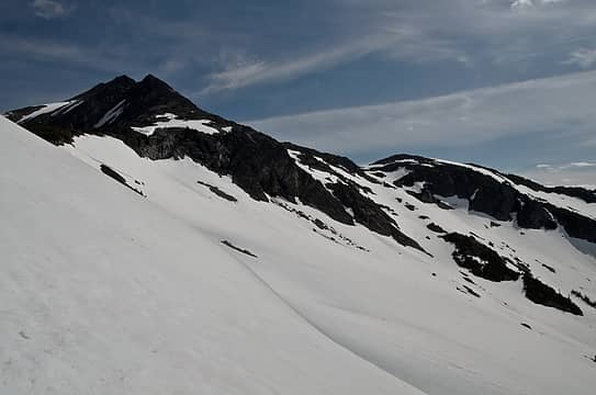 E side deproach options from snowfield 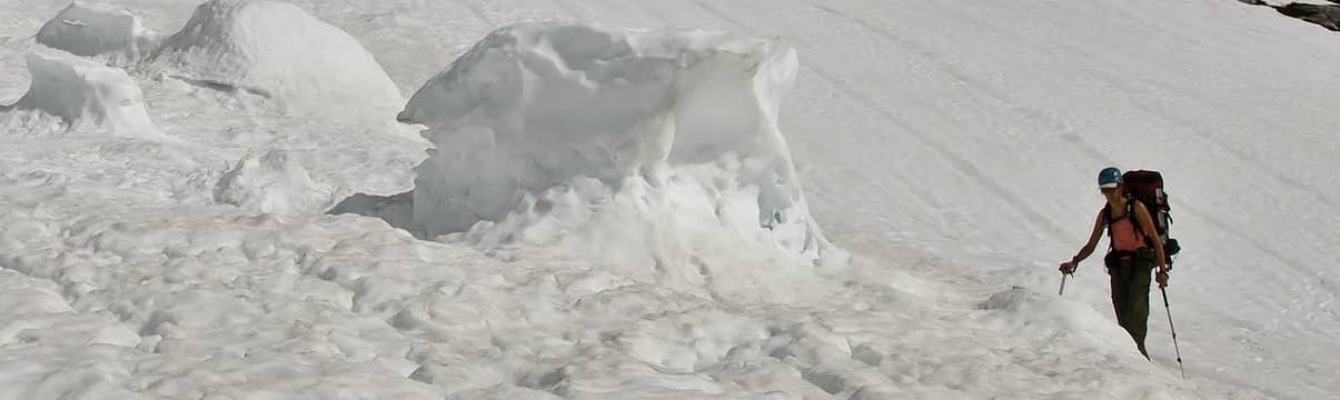 cornice chunk 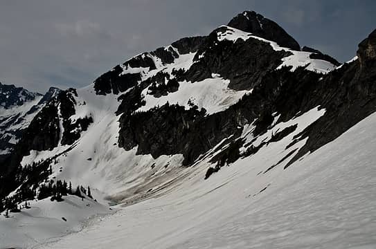 route becomes clear 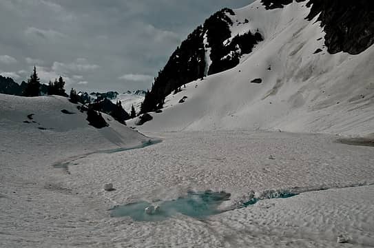 isolation tarn 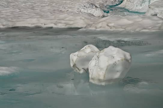 big snow balls 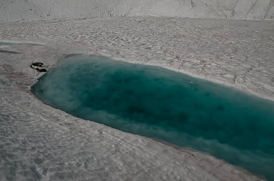 not as appealing as the tarn the night before 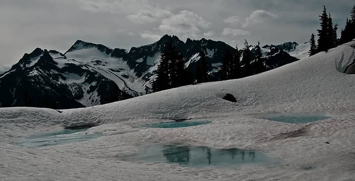 lakebagger's dream 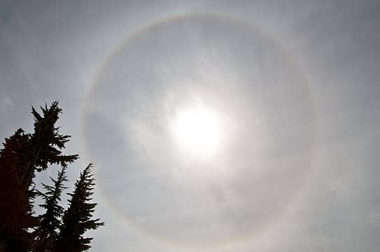 hmm 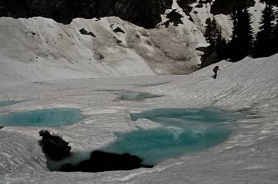 rounding the lake 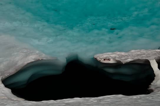 dive in and see what's under the snow! 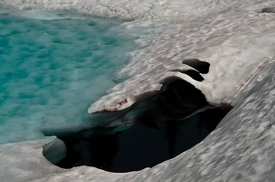 little bridge 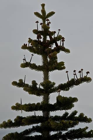 tree mushrooms 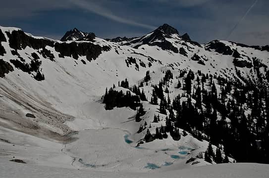 heading up isolation's ramp and looking down to tarn and back towards snowfield group 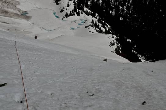 protecting a marginal runout 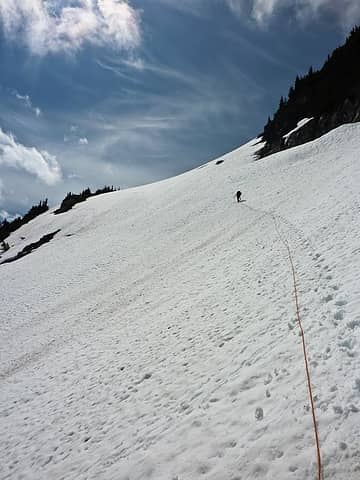 traversing up to isolation's shoulder 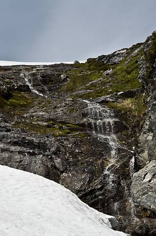 good spot to fill up 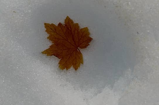 melting out 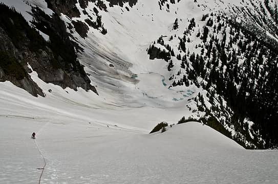 almost to ridge 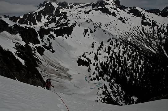 closer 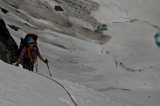 happy to be up this part 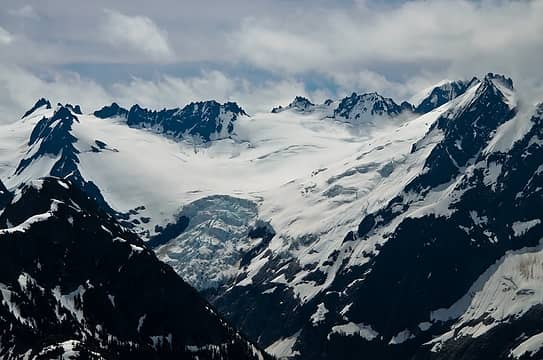 ice fall! 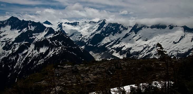 a bench off isolation 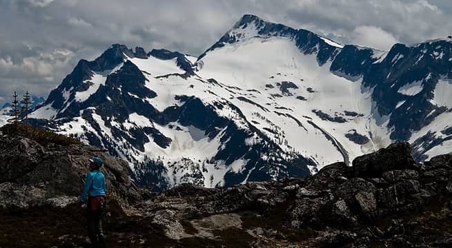 spying the route 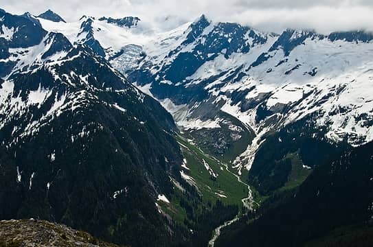 mcallister drainage 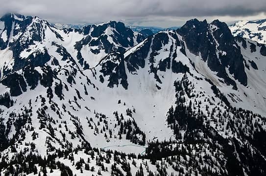 unhappy clouds, but man, what a sight 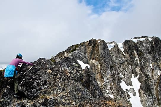 fun scrambling 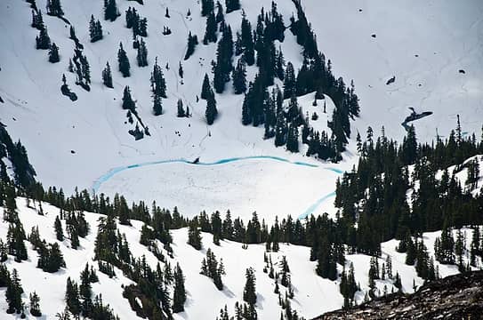 lake 5136 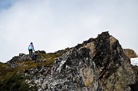 alpiney 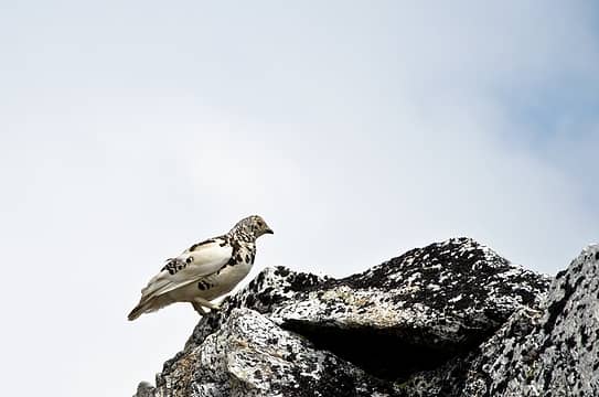 bird or rock, you decide 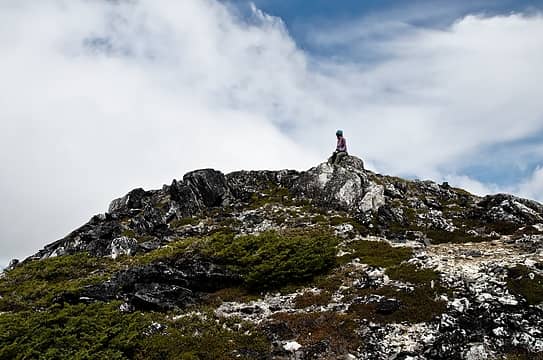 topped out on isolation 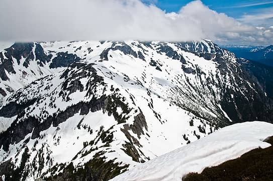 now, just have to get to that nice ridge below 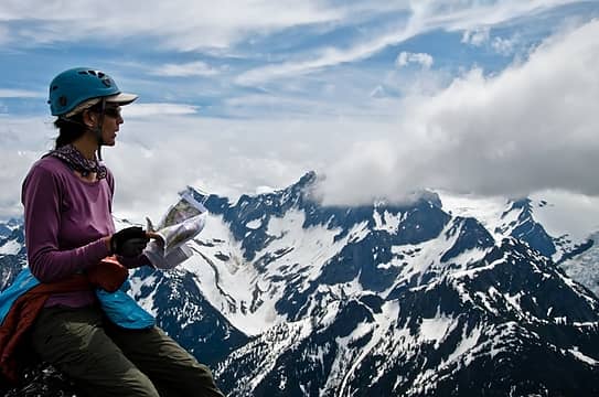 more map work 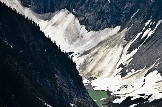 mcallister tarn (anyone want to visit this with me?) 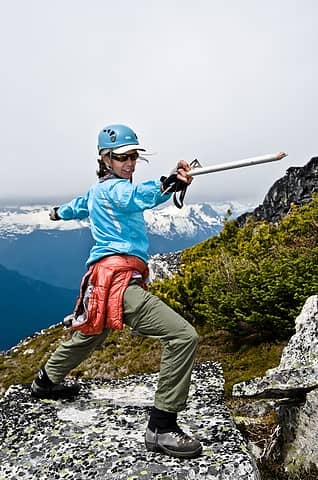 some high flying yoga 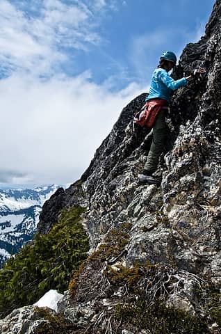 one cl3 step heading down 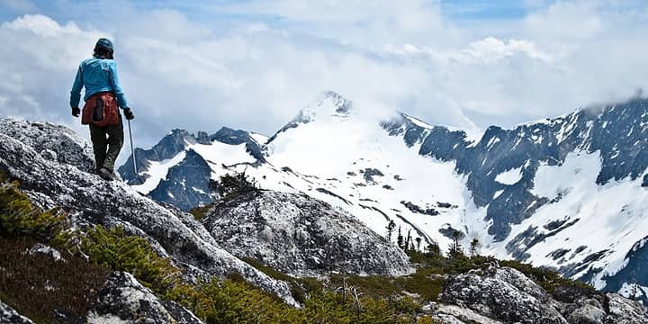 back to the packs 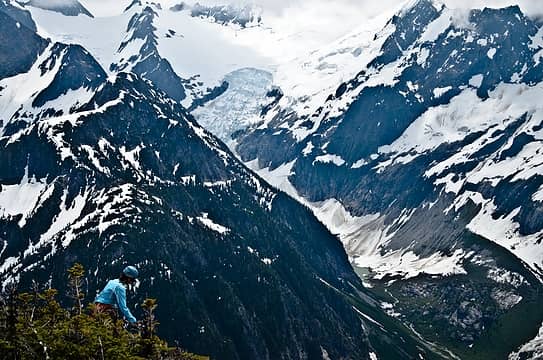 big terrain 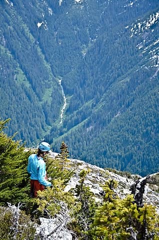 awesome drainage 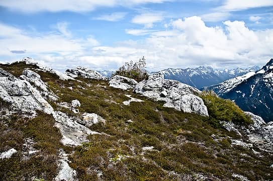 i loved this bench 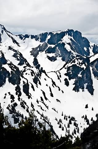 saddle 1 (S of lake 5136) and saddle 2 (N of the coccyx) 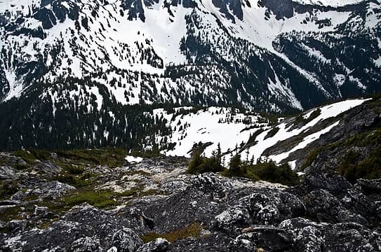 so close, but so far 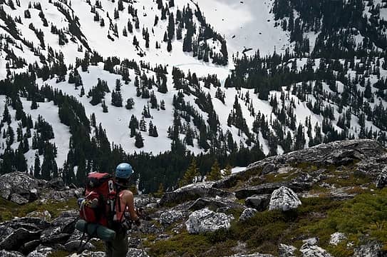 come here ridge 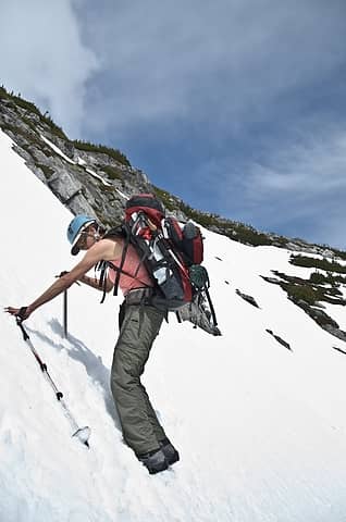 steeper than it looks 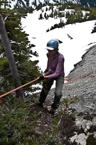 alright, time to rap 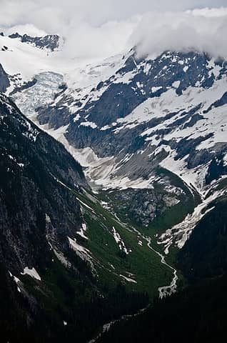 better views of the mcallister drainage 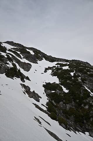 steep snow deproach to ridge  yikes! 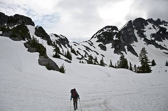 ahh, easier walkin' 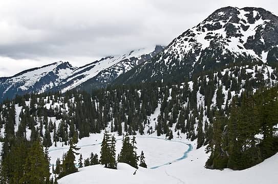 5136 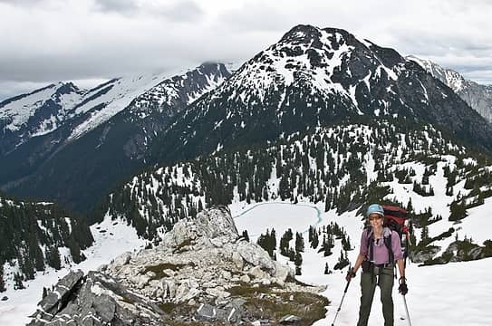 phew 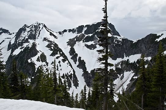 take the thread of snow up the gully to the next saddle 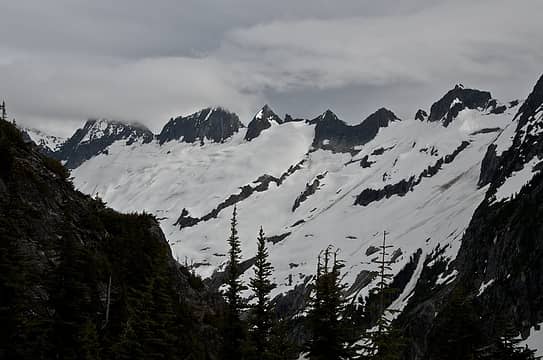 backbone ridge from N 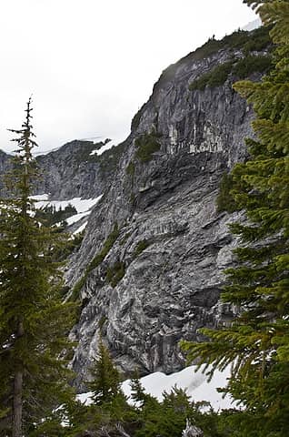 entering cold and strong basin opposite stout lake  follow the thin line of snow 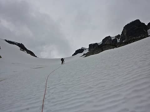 up the gully to our final camp 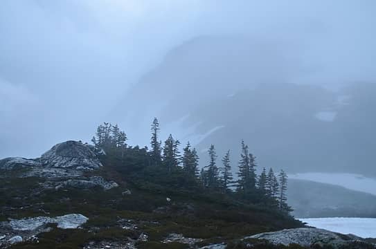 our view for most of the next 3+ days 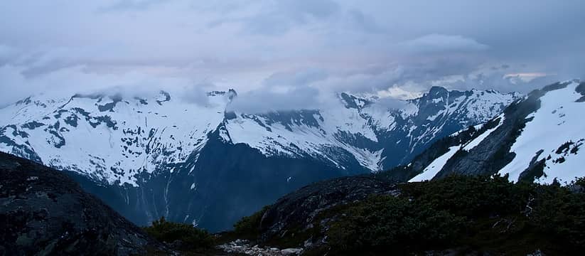 still hope, but not much 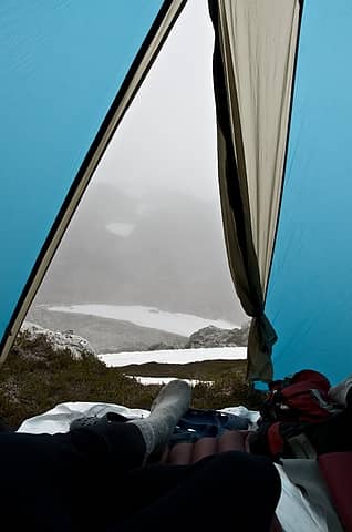 looking out the next day 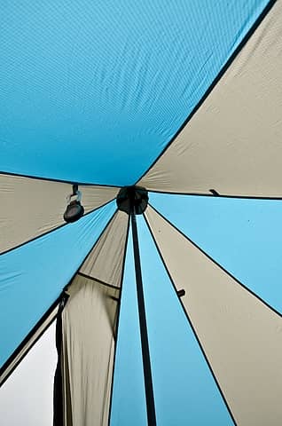 ooh, look at the top of the tent  only on page 76 at this point (would finish the 500+ pg book soon enough) 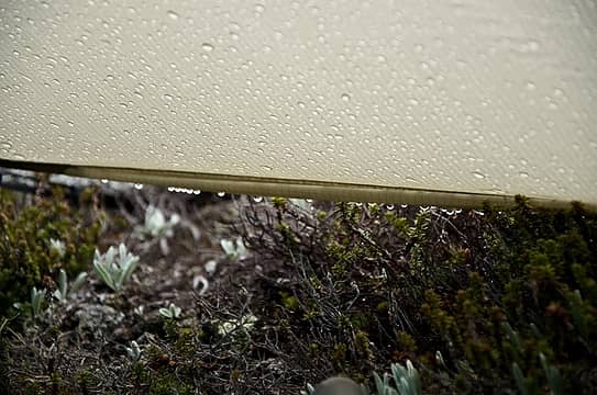 good spot to collect water 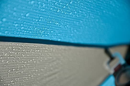 that shouldn't be on the inside  reflections of the clown tent 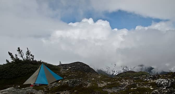 sucker hole 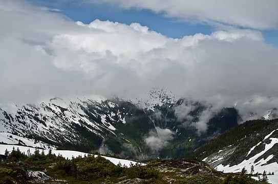 awesome drainage off the devils 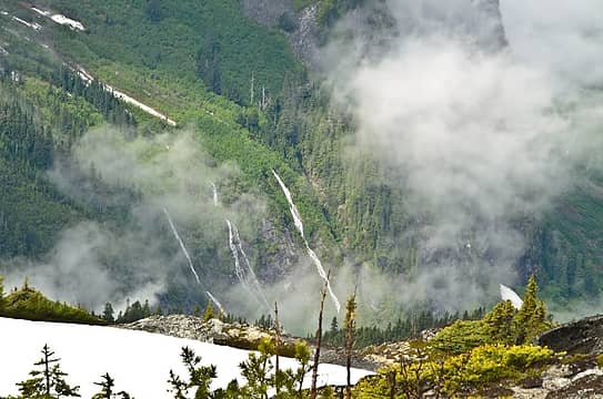 many waterfalls 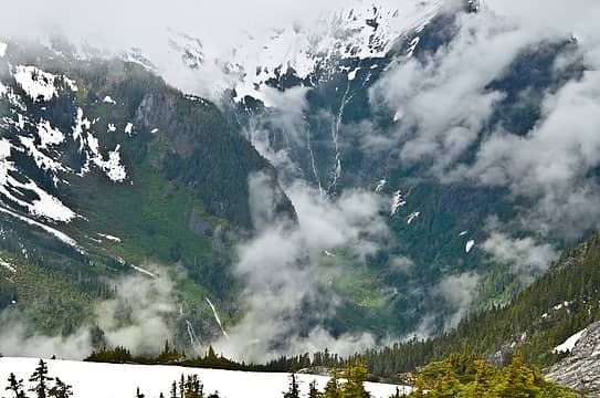 and more 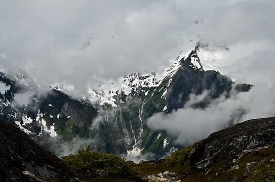 and one more (not much to photograph) 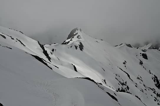 our would-be route ahead and around to backbone ridge 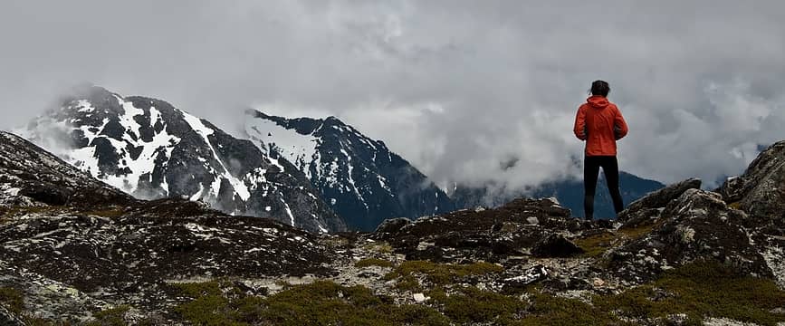 oh, what happened to the sun? 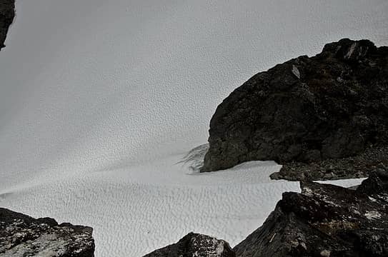 looking down the gully we came up to get to the final saddle/camp 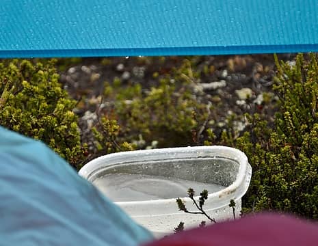 it's working! 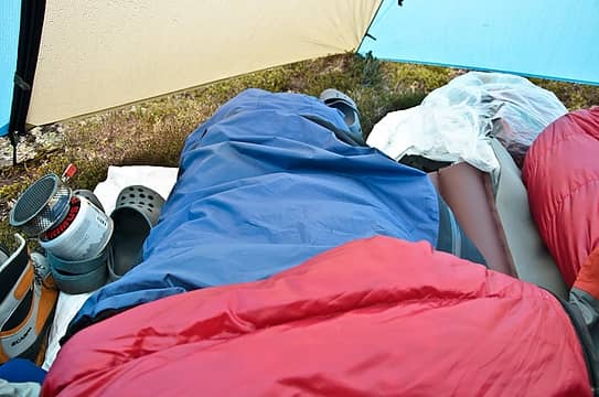 rain jacket = good foot bivy 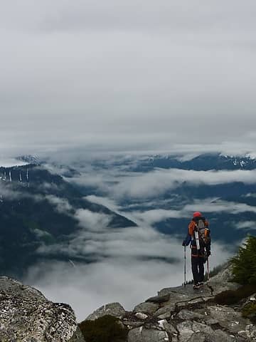 peering down into stout lake area 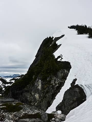 looking back at the ridge towards pt 6885  stout lake and basin 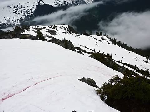 stout lake area 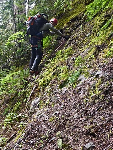 cramponing and picking my way up and out of the creek 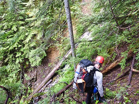 steep creek crossing 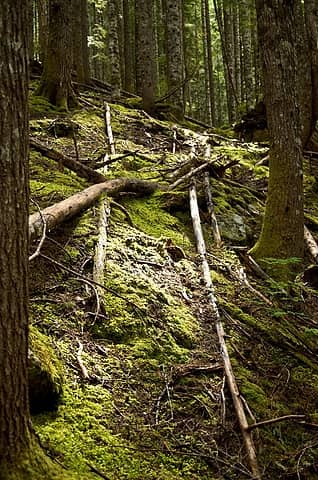 finally, in the forest and not so steep 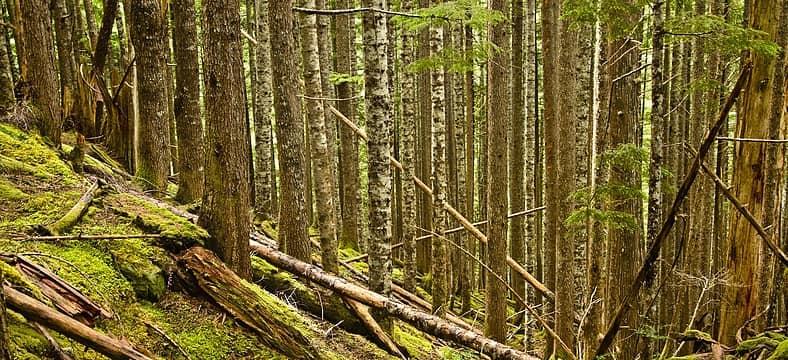 very green 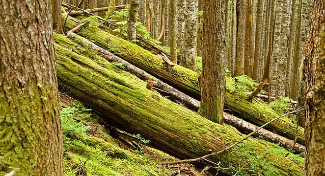 one goes up, one lies on hillside 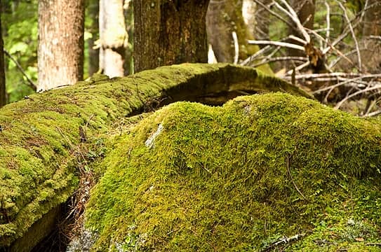 arced 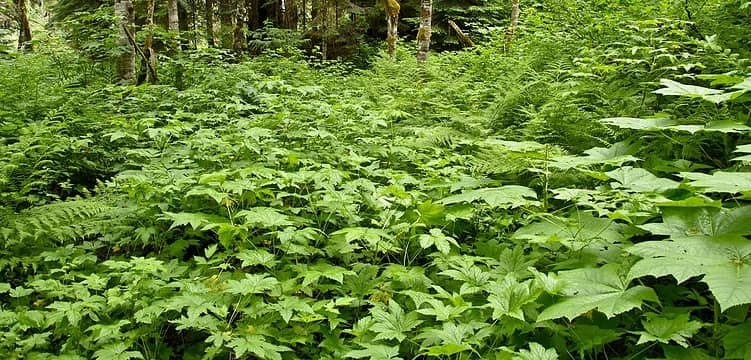 oh, this looks fun 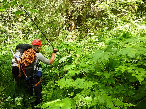 sometimes, you just gotta do it 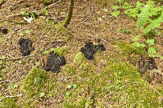 2nd time to cross these four 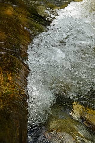 newhalem creek 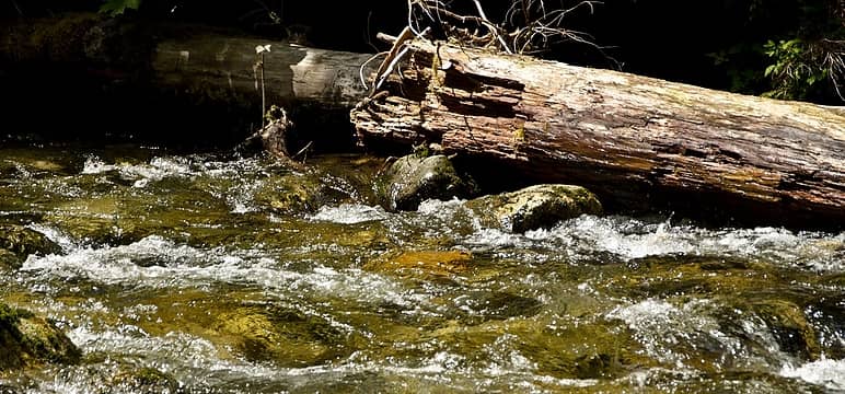 sun shining?!? 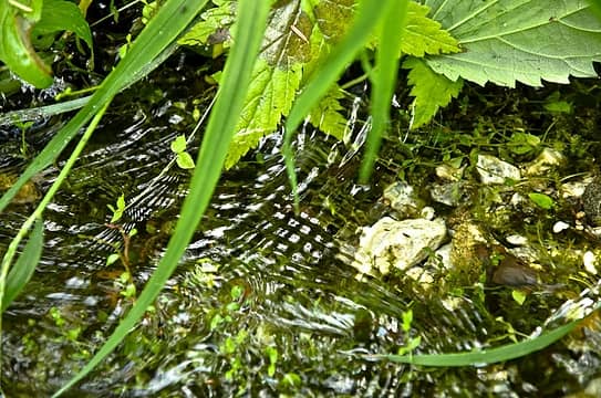 crossing patterns 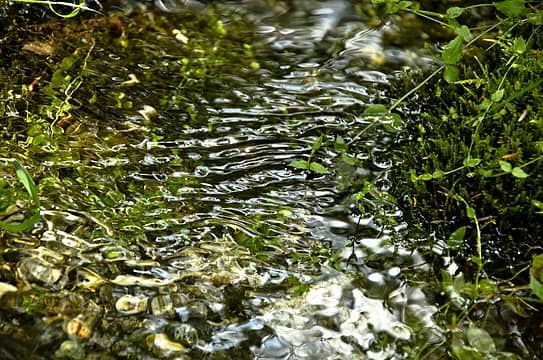 ripples 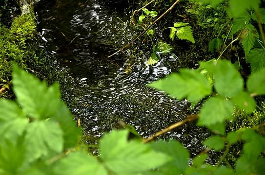 a little of everything 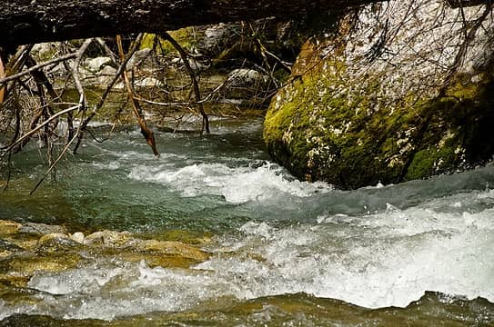 great color 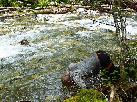 head dunking 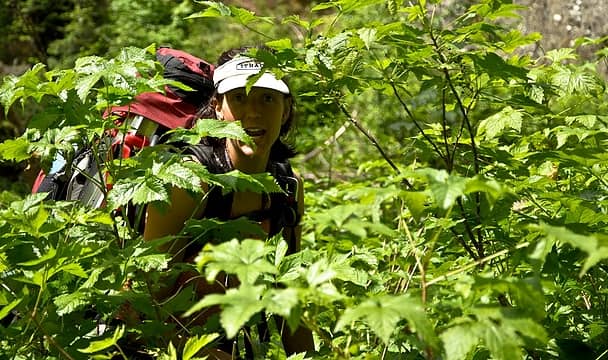 i love bushwacking 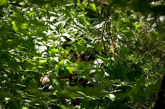 where'd she go? 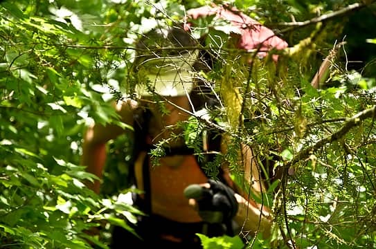 ah ha  muscles! 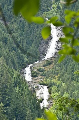 coming down from big devil 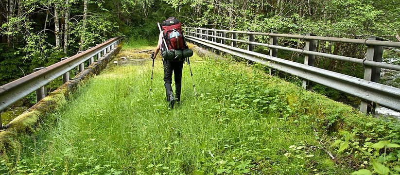 not many bridges like this (great camp spot!) 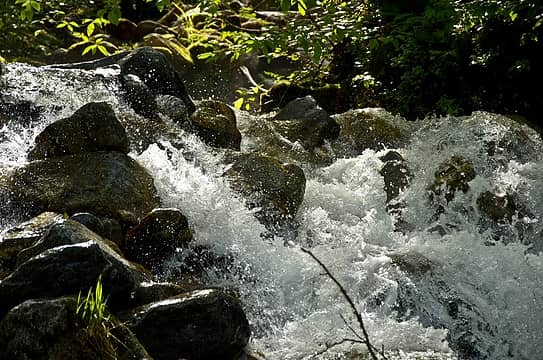 chaos 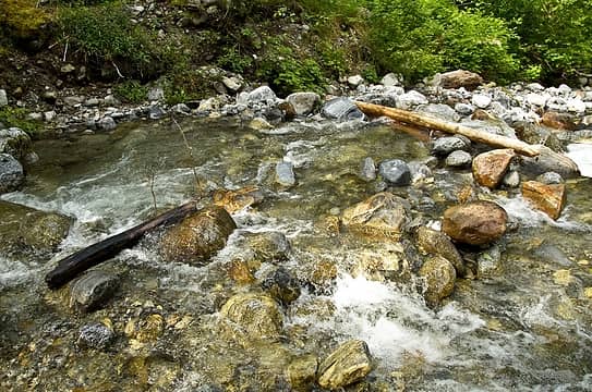 creek ford 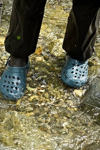 yay crocs 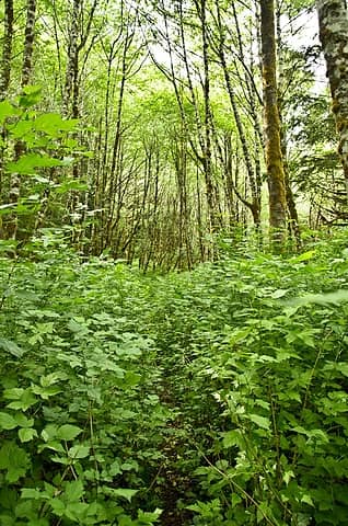 salmonberry stands 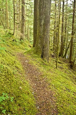 and suddenly good tread? 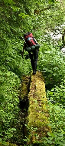 slick crossing 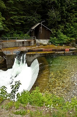 at gauging station 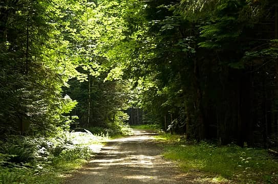 lonely road walk out
|
| Back to top |
  
|
|
cascadetraverser
Member

Joined: 16 Sep 2007
Posts: 1407 | TRs | Pics
|
Great trip and way to pull out when need be. Definately some challenging weather this July. Sounds like a cool trip you had planned. 22 days: on to the Ptarmigan and then the Glacier peak wilderness????
|
| Back to top |
|
|
Randy
Cube Rat

Joined: 18 Dec 2001
Posts: 2910 | TRs | Pics
Location: Near the Siamangs |
|
Randy
Cube Rat
|
Sun Jul 24, 2011 11:20 am |
|
|
great tr, mike! very cool that you guys get to do trips like this together.
|
| Back to top |
|
|
iron
Member
Joined: 10 Aug 2008
Posts: 6392 | TRs | Pics
Location: southeast kootenays |
|
iron
Member
|
Sun Jul 24, 2011 1:32 pm |
|
|
@CT: plan was: isolation traverse to inspiration to ptarmigan to buckindy with a bike ride back.
@randy: yes, i'm a lucky guy.
i just checked --- isolation was my 200th 400P peak. not too bad for ~3 years worth.
|
| Back to top |
|
|
Tom_Sjolseth
Born Yesterday

Joined: 30 May 2007
Posts: 2652 | TRs | Pics
Location: Right here. |
Nice report, too bad about the weather towards the end, but that's the N Cascades for you.
I just returned from a small foray into the area myself, details to come.
|
| Back to top |
|
|
GaliWalker
Have camera will use

Joined: 10 Dec 2007
Posts: 4931 | TRs | Pics
Location: Pittsburgh |
|
GaliWalker
Have camera will use
|
Sun Jul 24, 2011 4:36 pm |
|
|
Man you guys aren't human! Great for us mere mortals, to get to travel into such spectacular terrain.   What's great about your trips (as well as Matt's) is taking the time to share other, subtler parts of nature, such as the mossy trees and cleansing cascades. Elevates the quality of the report tremendously.
|
| Back to top |
|
|
Backpacker Joe
Blind Hiker

Joined: 16 Dec 2001
Posts: 23956 | TRs | Pics
Location: Cle Elum |
What are you talking about Gali. You're looking at Superman and Wonderwoman!
Coming to a theater near you.
First off I'm humbled by your thanks. Thank you for some wonderful reading. Secondly, krazie klimbers and their wonderful adventures. Really great work you two.
Mike, was my beta correct about that gauging station up at the end of that road on Newhalem creek? How would it be getting into Stout lake that way? Anything left of a/the trail at all? Topo shows a logging road coming within a half mile of Stout lakes outlet.
Thanks and again, great work.
Tom
"If destruction be our lot we must ourselves be its author and finisher. As a nation of freemen we must live through all time or die by suicide."
Abraham Lincoln
"If destruction be our lot we must ourselves be its author and finisher. As a nation of freemen we must live through all time or die by suicide."
Abraham Lincoln
|
| Back to top |
|
|
raising3hikers
Member

Joined: 21 Sep 2007
Posts: 2344 | TRs | Pics
Location: Edmonds, Wa |
You guys got a whole lot done in just a few days of actual hiking! Too bad about the weather but you had a few good days with some great pics. Your pic of the McAllister ice fall has me wanting to get a much closer look at it. Hopefully, you two will be able to do some more of those sections of your planned route if not the whole thing in the future. Thanks for the TR
|
| Back to top |
|
|
Hutch
Member
Joined: 18 Jun 2009
Posts: 638 | TRs | Pics
|
|
Hutch
Member
|
Sun Jul 24, 2011 8:44 pm |
|
|
Love that bird pic. Great report.
|
| Back to top |
|
|
Roald
Member

Joined: 06 Aug 2007
Posts: 367 | TRs | Pics
Location: Seattle |
|
Roald
Member
|
Sun Jul 24, 2011 10:56 pm |
|
|
Love the plan, and how you adjusted. Thanks for sharing, and congrats on such an adventure - even if it wasn't exactly the one you planned.
|
| Back to top |
|
|
iron
Member
Joined: 10 Aug 2008
Posts: 6392 | TRs | Pics
Location: southeast kootenays |
|
iron
Member
|
Mon Jul 25, 2011 8:13 am |
|
|
| Backpacker Joe wrote: | | Mike, was my beta correct about that gauging station up at the end of that road on Newhalem creek? How would it be getting into Stout lake that way? Anything left of a/the trail at all? Topo shows a logging road coming within a half mile of Stout lakes outlet. |
not sure i received/heard the beta on the gauging station approach route to the lake.
there was tread for sure following the lower road to the supposed campsite. easy enough to follow, but brushy for most of it. as for the upper road - we never saw it. might have been too far S to come across it. there was definitely no 10ft wide level portion of terrain as we came down to newhalem creek. and, as you know, following a road long-since used is often far more work than just going into the forest.
i believe the best approach to stout lake is what the ranger said as i listed earlier in the TR. from what we saw, all the terrain in there is steep, but nothing truly cliffs out (assuming you're not picking the steepest of steep routes). so, pick whatever route you want and just be flexible with where you go.
we never came across a fisherman's trail along the outlet. i might have pushed us too far N to start with b/c i didn't want to be sucked into that outlet since that did look steep and could have cliffed.
|
| Back to top |
|
|
BirdDog
Member
Joined: 09 Jan 2007
Posts: 1067 | TRs | Pics
Location: Seattle |
|
BirdDog
Member
|
Mon Jul 25, 2011 8:57 am |
|
|
you folks covered some ground! nice TR with great pics.
"There can be no greater issue than that of conservation in this country."
Teddy Roosevelt August 6, 1912
"There can be no greater issue than that of conservation in this country."
Teddy Roosevelt August 6, 1912
|
| Back to top |
|
|
Guiran
Member
Joined: 03 Mar 2004
Posts: 621 | TRs | Pics
Location: University of Washington |
|
Guiran
Member
|
Mon Jul 25, 2011 9:16 am |
|
|
Nice work! Better luck with the weather in ID.
|
| Back to top |
|
|
Rainie Too!
Member

Joined: 12 Dec 2008
Posts: 377 | TRs | Pics
|
Making memories!  You will have to share years to come! You will have to share years to come!
|
| Back to top |
|
|
Arete
Member

Joined: 29 Oct 2006
Posts: 137 | TRs | Pics
Location: Bothell, WA |
|
Arete
Member
|
Tue Jul 26, 2011 1:47 am |
|
|
|
| Back to top |
|
|
|
|
You cannot post new topics in this forum
You cannot reply to topics in this forum
You cannot edit your posts in this forum
You cannot delete your posts in this forum
You cannot vote in polls in this forum
|
Disclosure: As an Amazon Associate NWHikers.net earns from qualifying purchases when you use our link(s). |


